
Search for another town




Free U.S. delivery 7 to 10 days after you order
Lake City, Florida Map Art
A new map of Lake City, Florida, made in 2026 and printed to order on thick archival matte paper.
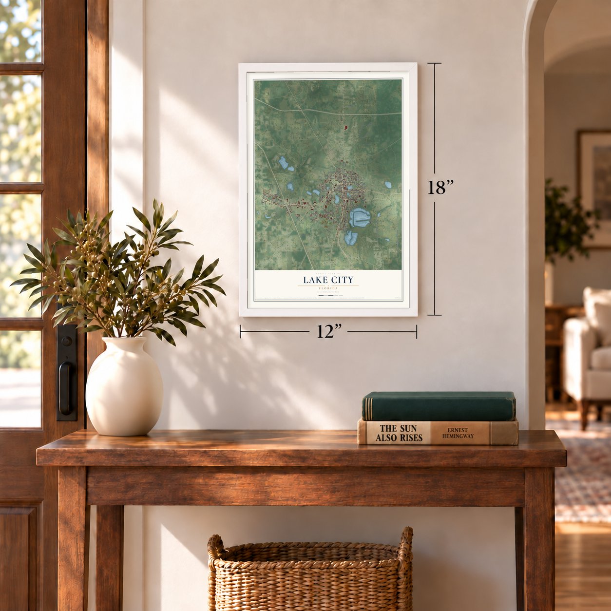
12" x 18" Archival Matte Print
A Map of Home. A Work of Art.
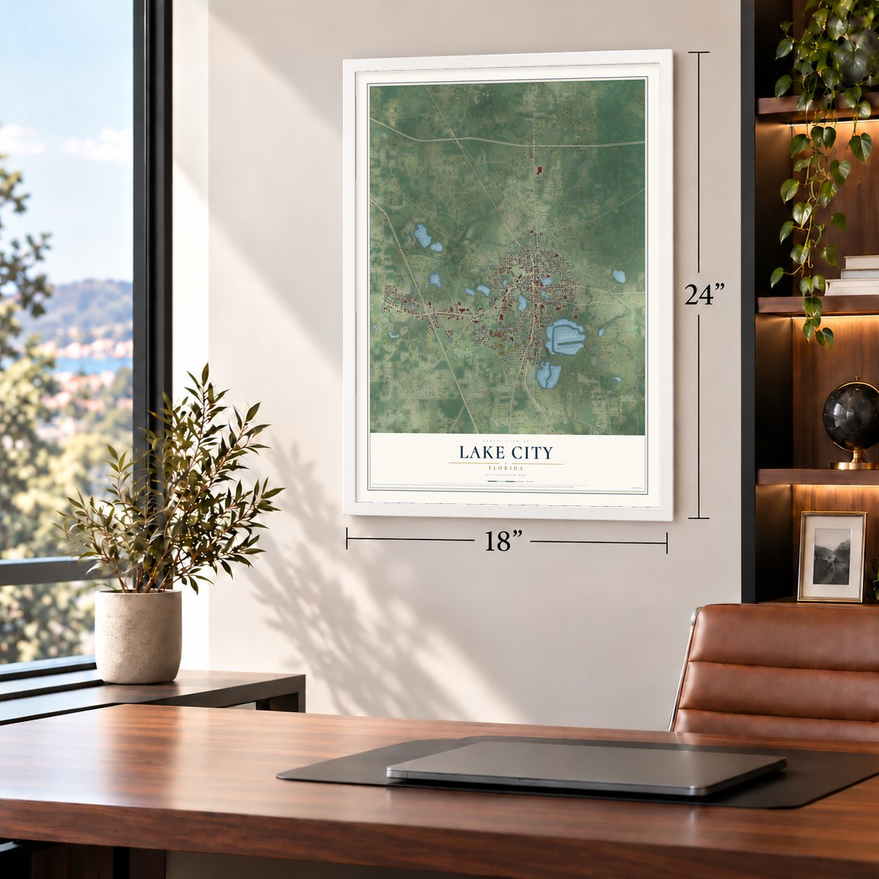
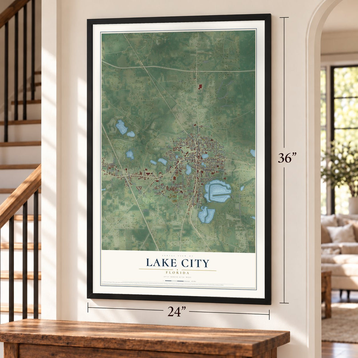
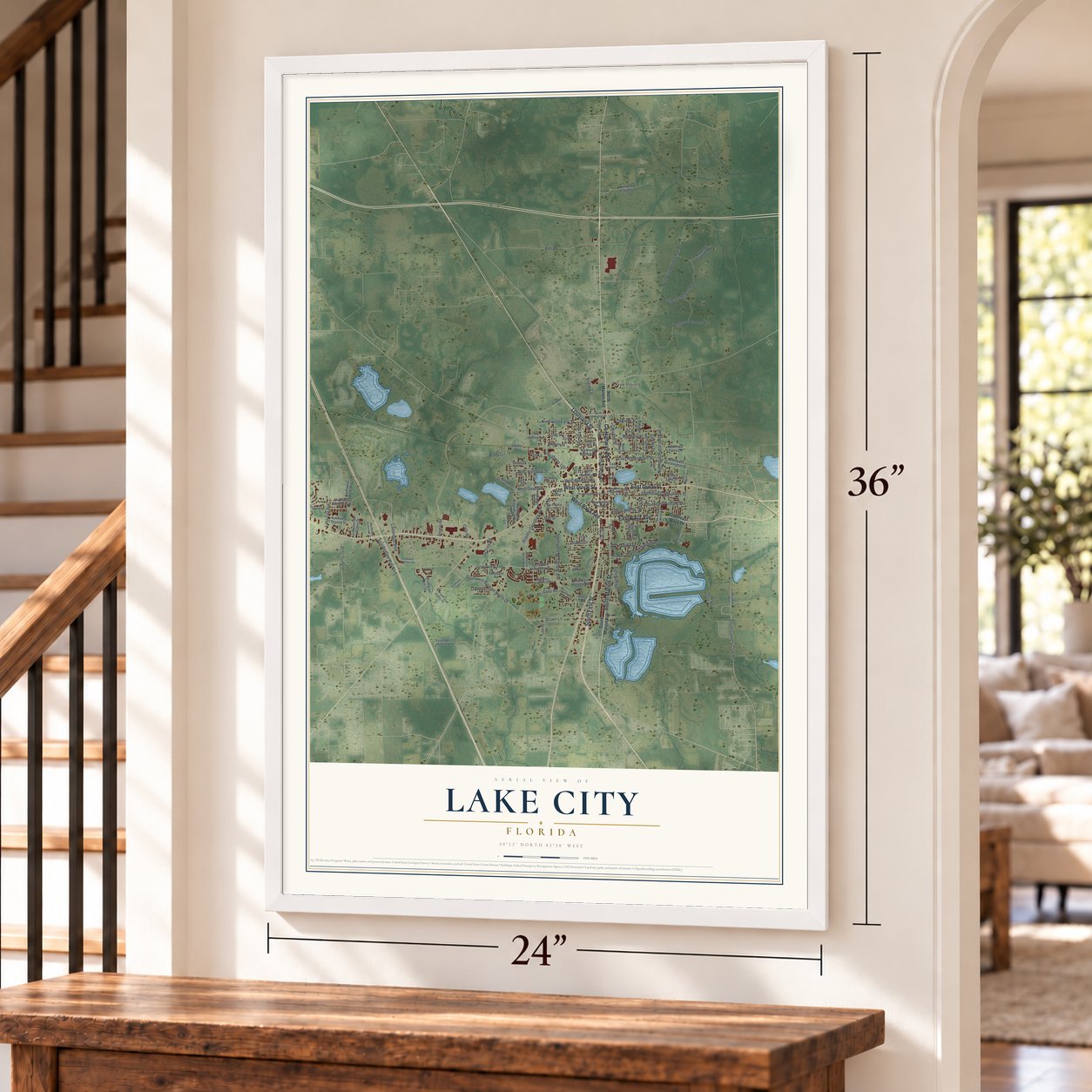
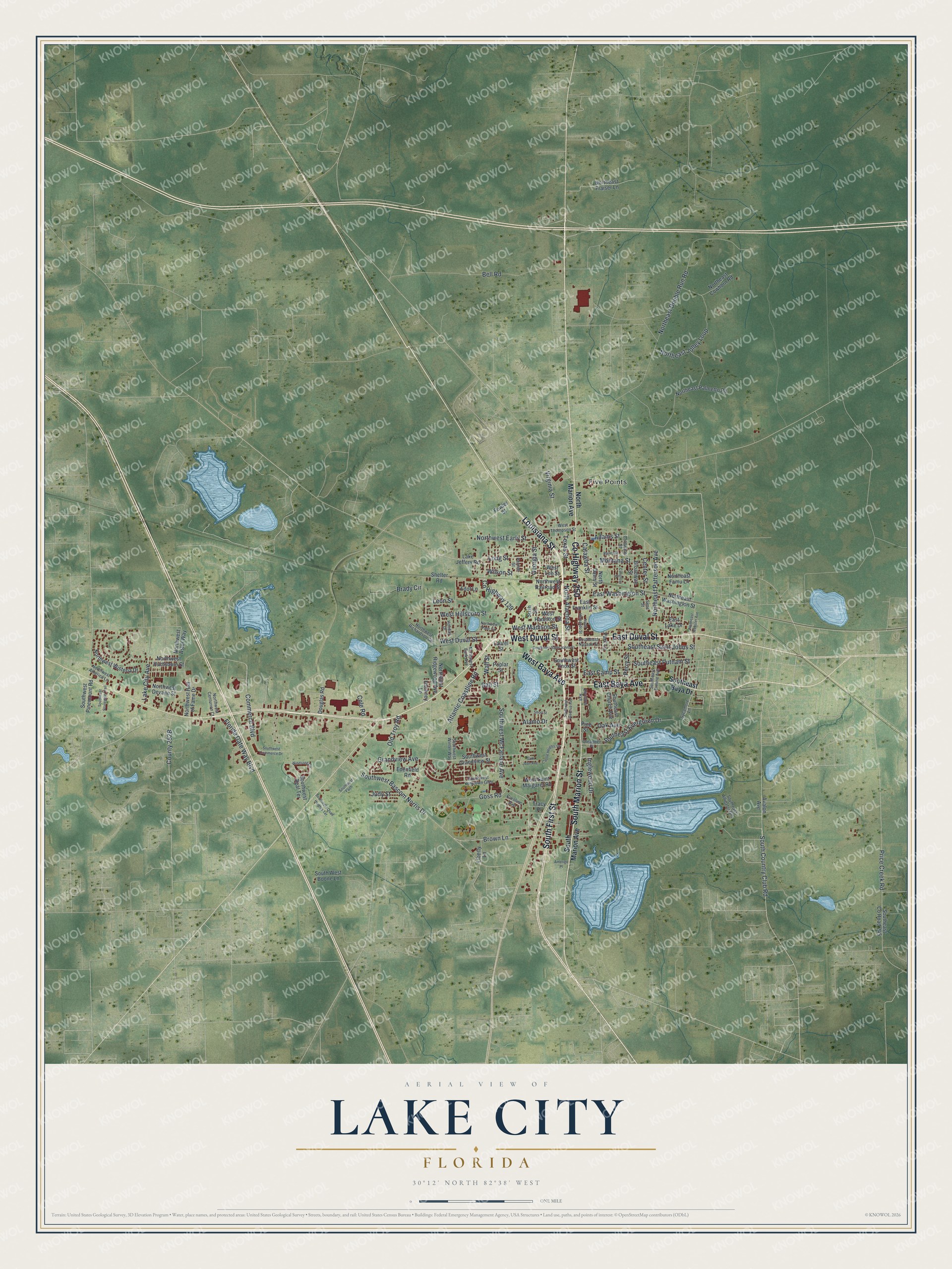
Explore Lake City, Florida from a whole new perspective. Created using aerial imagery and detailed geographic data, this map captures Lake City building by building, with labeled streets, familiar landmarks, and shaded topographical relief that highlights the natural contours of the landscape.
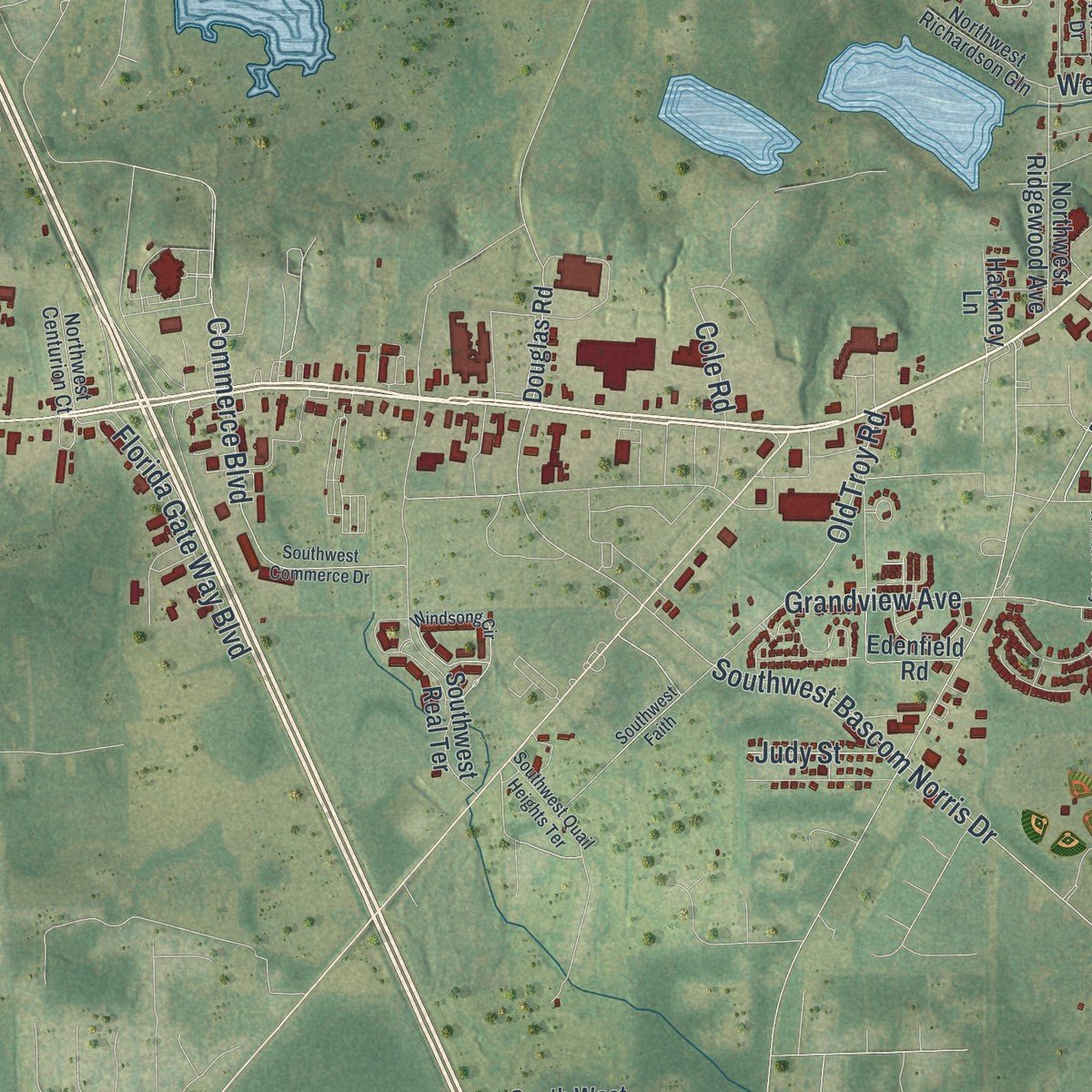
Combining modern data with the timeless character of a vintage atlas, this map is just as interesting up close as it is beautiful on the wall. Whether you grew up in Lake City, spent memorable years there, or call it home today, this unique map is a great way to celebrate a place that means something to you. Zoom in on the preview to look for your street, and then order a print to put your memories on the wall.
Three ways to hang it
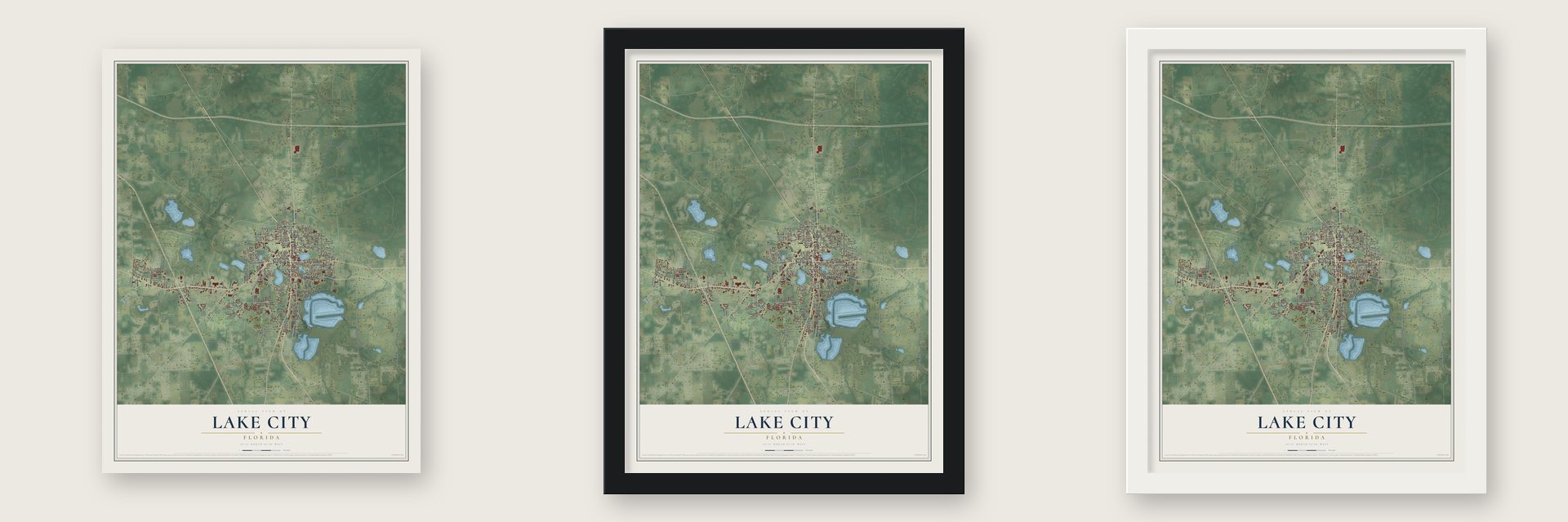
Unframed archival matte, a black wood frame or a white wood frame.
Up close
Geography Worth Displaying
This map was created using accurate cartographic data and authoritative geographic sources, including the U.S. Geological Survey (USGS) and FEMA. The map brings together terrain, waterways, roads, and building detail. The majority of the streets are labeled, houses are accurately depicted, and the topography is derived from government sources. Combining local data with carefully composed color and shading leads to this beautifully detailed Lake City artwork for your wall.
Rather than simply showing street outlines, we’ve included as many of the street names as we could reasonably fit on the map while keeping their names legible. Zoom in on the high resolution preview to see exactly what’s on the map. We truly set out to create a statement piece for anyone who loves Lake City. So whether it’s for you, or a gift for someone you love, we hope this map of Lake City brings back fond memories.
Explore the full map of Lake City, Florida and read about the local places it shows.
About Lake City, Florida
Lake City is a city of 12,329 people and the county seat of Columbia County, 60 miles west of Jacksonville. In the 1700s the Seminole town of Halapata Telofa, or Alligator Town, stood on this ground, and a US Army report of 1821 records it. Its best-known resident, Halpatter Tustenuggee, led Seminole warriors against removal in the Second Seminole War. American settlers started a village beside it called Alligator, and after the 1823 Treaty of Moultrie Creek the Seminole families moved south to the Peace River.
When Columbia County was carved from Duval and Alachua counties in 1832, Alligator became its seat. A railroad from Jacksonville arrived in November 1858 and brought trade and travelers, and in 1859 the town incorporated, chose M. Whit Smith as mayor and took the name Lake City. A local legend credits his wife, Martha Jane, who would not put up her lace curtains in a place called Alligator.
- The Battle of Olustee, 1864In February 1864 Union troops under Truman Seymour marched west from Jacksonville to cut Confederate supplies. On February 11 General Joseph Finnegan's men drove off a Union cavalry raid in Lake City, then moved about ten miles east to Olustee Station. There, on February 20, the armies fought the war's only major Florida battle. The Union lost 1,861 killed, wounded or missing, the Confederates 946, whose dead were buried in Lake City. A downtown memorial went up in 1928.
- Electric lights in 1891A fire in 1874 burned most of Lake City's wooden buildings, and the Lake City Reporter, the town's first newspaper, began that same year. The town rebuilt, and the Bigelow Building, finished in 1876, later became City Hall. In 1891 it was the first Florida city with electric lights run by a local power and light company.
- Hotel Blanche, 1902Lake City had become a busy railroad junction by the early 1900s, and the Hotel Blanche went up at 212 North Marion Street in 1902 to draw the tourists everyone expected. Until 1955 it was the main hotel and business center for the city and the county. Al Capone and Johnny Cash both stayed there, and its lobby holds what may be Florida's oldest elevator.
- A university that moved awayThe Florida Agricultural College opened here in 1884 as a land grant college and became a full university with 25 instructors in 1904. A year later the Buckman Act moved it to Gainesville to join the University of Florida. The city leased the campus to the Florida Baptist Convention, whose Columbia College closed in debt after ten years, and the land returned in 1919. It trained local troops in World War I, then became US Hospital No. 63.
- From air station to collegeNaval Air Station Lake City opened in 1942 on the Lake City Flying Club's field and trained Lockheed Ventura pilots until March 1946. Its buildings housed the Columbia Forestry School from 1947, and the city called itself the "Forestry Capitol of the World." Short of students and money, it became the University of Florida's Forest Ranger School in 1950. It became Lake City Junior College in 1962, Lake City Community College in 1970 and Florida Gateway College in 2010.
Find your street
Names on the Lake City map
Every name below is printed on this map. Look for your street, your school, the park where you played, or the pond down the road.
Places and landmarks1
- Five Points
Streets and roads131
- South First Street
- County Highway 250
- East Duval Street
- East Baya Avenue
- West Baya Avenue
- West Duval Street
- Louisiana Street
- South Marion Street
- Southwest Bascom Norris Drive
- Brown Lane
- Inglewood Drive
- East Washington Street
- South Country Club Road
- Southwest McFarlane Avenue
- Grandview Avenue
- Southeast Putnam Street
- County Highway 129
- Bali Street
- Perry Street
- Southeast Saint Johns Street
- Atlantic Coastline Road
- Virginia Street
- Price Creek Road
- Bell Road
- West Hillsboro Street
- Northeast Jolley Loop
- Old Troy Road
- Wilson Street
- Commerce Boulevard
- Northeast Double Run Road
Show all 131 streets
- Long Street
- Southeast Evergreen Drive
- West Madison Street
- East Camp Street
- Florida Gate Way Boulevard
- Northeast Patterson Avenue
- Alamo Drive
- Northwest Early Street
- Montana Street
- Center Street
- Adams Street
- North Alachua Street
- Lake City Avenue
- Texas Street
- Leon Street
- Georgia Street
- Goss Road
- Oak Avenue
- Catawba Street
- Judy Street
- Wall Street
- Brady Circle
- Cole Road
- South Marion Avenue
- North Marion Avenue
- Southeast Baya Drive
- West Saint Margaret Road
- Lake Jeffery Road
- Liberty Lane
- Park Lane
- East Franklin Street
- Northwest Astor Way
- East Lake Drive
- Southwest Knox Street
- Southeast County Road 245
- Northeast Palmetto Road
- Southwest Real Terrace
- Southeast Church Avenue
- Avalon Avenue
- Northwest Hall of Fame Drive
- Edenfield Road
- Southwest Grandview Street
- North Davis Street
- Fowler Street
- Northwest Wisteria Drive
- Northeast Washington Street
- Northwest Ridgewood Avenue
- Broadway Street
- Northwest Devane Street
- West Hamilton Street
- Northwest Railroad Street
- Northeast Cowhorn Road
- Northwest Huntsboro Street
- Southwest Pinemount Road
- Northeast Fraiser Lane
- Northeast Famu Lane
- Douglas Road
- South West Boone Lane
- Pine Street
- Sixth Street
- Poplar Street
- Fdot Lane
- Hackney Lane
- West Lee Street
- Laurel Street
- Tracy Place
- Shelter Road
- Oleander Place
- Caroline Avenue
- Southeast Nassau Street
- Southeast Alligator Gln
- Southeast Ermine Avenue
- Coldwater Street
- Sycamore Lane
- West Thompson Street
- Northwest Burk Avenue
- Southwest Yorktown Glen
- Northwest Richardson Gln
- Sims Street
- Northwest America Lane
- Northwest Centurion Court
- Southwest Winter Way
- Holiday Drive
- Division Avenue
- Parnell Street
- Southwest Alachua Avenue
- Castle Heights Drive
- Southwest Commerce Drive
- Windsong Circle
- Northwest Palm Circle
- Congress Street
- Southwest Saint Johns Street
- North Hernando Street
- Bailey Street
- Southwest Quail Heights Terrace
- Southwest Stonegate Trail
- Northeast Webster Avenue
- Southwest Faith
- Short Street
- San Juan Avenue
- Amerigo Place
Names are listed as they appear on the printed map. Zoom into the product photos to find them.
The art of mapping a place
How This Map Was Made
Real places. Remarkable detail. Discover the layers that turn geographic data into a map of home.

The view from above
Aerial imagery reveals the character of the land: woodland, open fields, and the patterns of a place.

The shape of the land
Elevation data brings hills, valleys, and subtle changes in the landscape into view.

The details of home
Roads, waterways, and building footprints come together to make the map feel unmistakably local.

Geography becomes art
Considered color, shading, and typography bring the layers together in a map made for your wall.


Process illustrated with Mendon, Massachusetts. Aerial imagery: USDA NAIP. Terrain: USGS 3D Elevation Program. Map details and finished artwork: KNOWOL.
The Details
About This Print
Choose an archival matte print, or a black or white Ayous wood frame. The archival matte print is unframed.
Select your size and finish above to see the matching product image and price.
Materials & Craftsmanship
A contemporary map with the character of a classic atlas, printed on archival matte paper. Optional frames are made from Ayous wood.
Your printed map does not include the watermark shown in the full-map preview.
Shipping & Delivery
Free shipping within the United States. Every print is made to order in the USA.
Buying a gift? Add a note in your cart and we'll include it. We never put prices in the package.
Prints ship within 2 to 3 business days. Allow 7 to 10 days total from ordering for delivery. Timing may vary during holidays or periods of high order volume.
Read our shipping policy.
Returns and damaged prints
Each print is made to order. Change-of-mind refunds are not available after production.
If your print arrives damaged, misprinted or incorrect, contact support@knowol.com within 30 days of receiving it. Include your order number, photos and a description of the issue.
Read our full refund and replacement policy. For questions about your order, email support@knowol.com.
Find your town
Looking for another city?
Find a map of home in our Florida collection, or any town in the country.
Nearby
Maps of towns near Lake City
Know someone from one of these towns? Their map makes a great gift.
 Five Points
, Florida
From $39.99See the map
 Watertown
, Florida
From $39.99See the map
 Columbia
, Florida
From $39.99See the map
More maps nearby: White Springs, Fort White, Lake Butler, Live Oak and Worthington Springs.