
Search for another town




Free U.S. delivery 7 to 10 days after you order
Lakewood, Washington Map Art
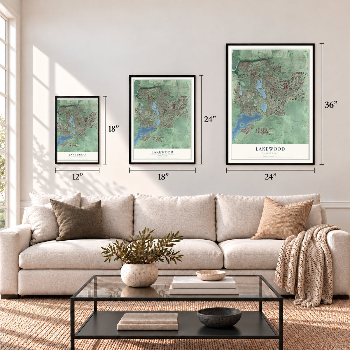
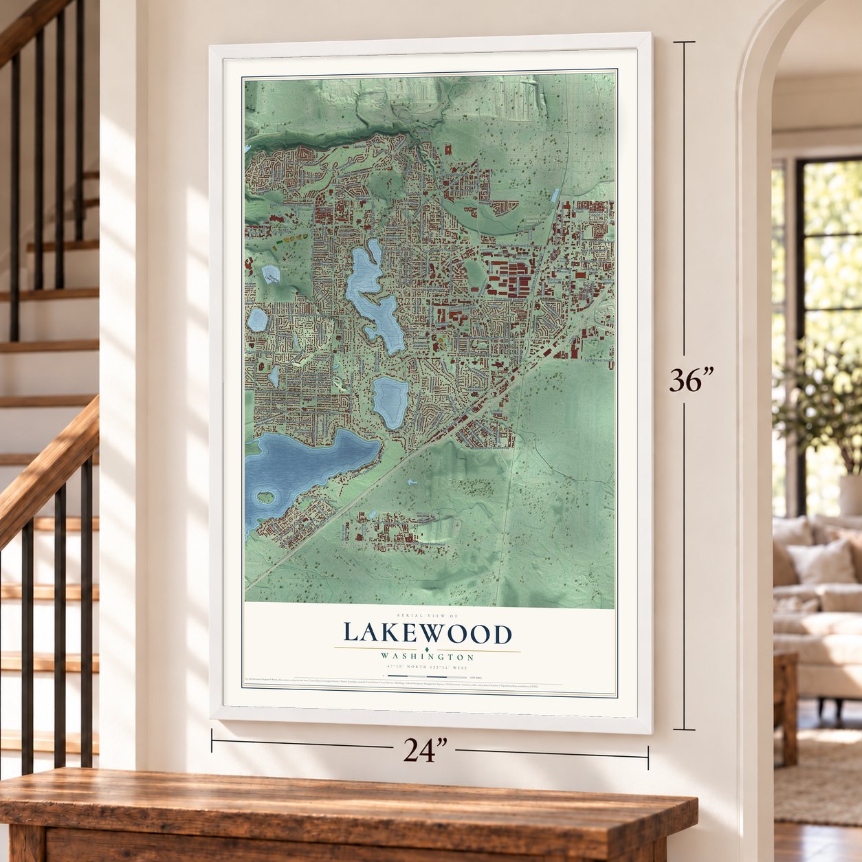
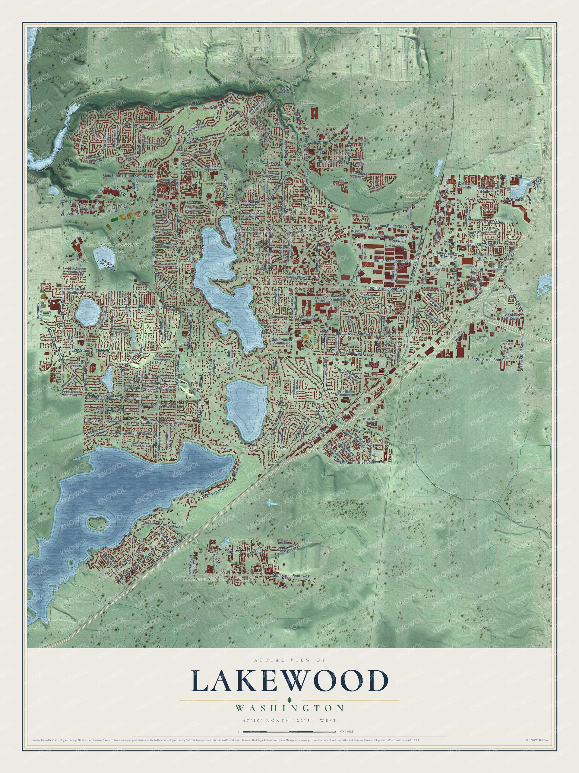
A new map of Lakewood, Washington, made in 2026 and printed to order on thick archival matte paper.
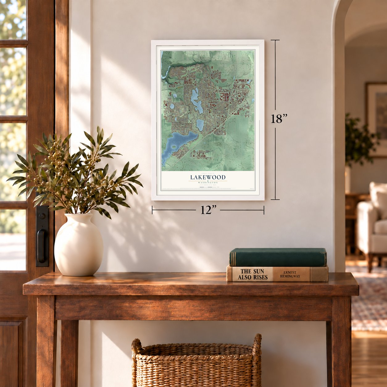
12" x 18" Archival Matte Print
A Map of Home. A Work of Art.
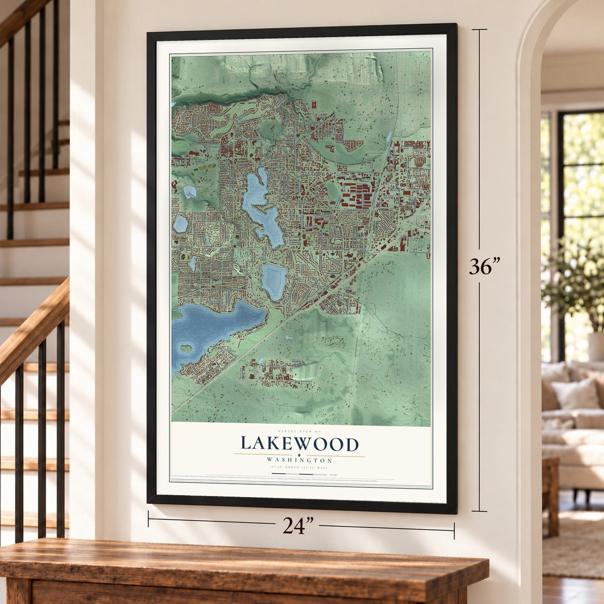
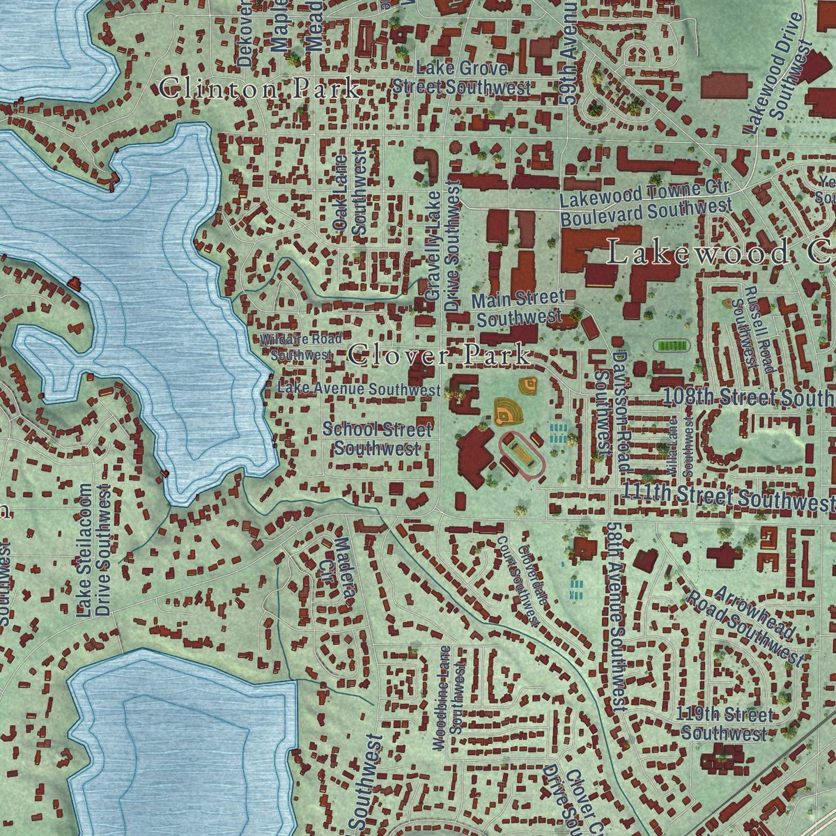
Explore Lakewood, Washington from a whole new perspective. Created using aerial imagery and detailed geographic data, this map captures Lakewood building by building, with labeled streets, familiar landmarks, and shaded topographical relief that highlights the natural contours of the landscape.
Combining modern data with the timeless character of a vintage atlas, this map is just as interesting up close as it is beautiful on the wall. Whether you grew up in Lakewood, spent memorable years there, or call it home today, this unique map is a great way to celebrate a place that means something to you. Zoom in on the preview to look for your street, and then order a print to put your memories on the wall.
Three ways to hang it
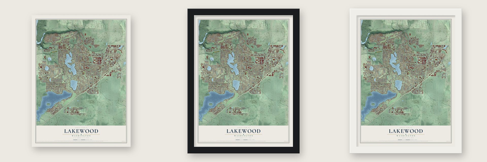
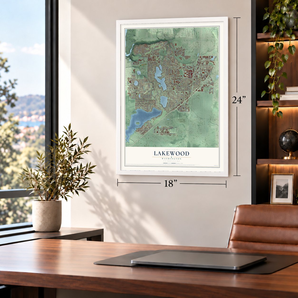
Unframed archival matte, a black wood frame or a white wood frame.
Up close
Geography Worth Displaying
This map was created using accurate cartographic data and authoritative geographic sources, including the U.S. Geological Survey and the Census Bureau. The map brings together terrain, waterways, roads, and building detail. The majority of the streets are labeled, houses are accurately depicted, and the topography is derived from government sources. Combining local data with carefully composed color and shading leads to this beautifully detailed Lakewood artwork for your wall.
Rather than simply showing street outlines, we’ve included as many of the street names as we could reasonably fit on the map while keeping their names legible. Zoom in on the high resolution preview to see exactly what’s on the map. We truly set out to create a statement piece for anyone who loves Lakewood. So whether it’s for you, or a gift for someone you love, we hope this map of Lakewood brings back fond memories.
Read the story behind this map of Lakewood, Washington from 2026.

About Lakewood, Washington
Lakewood is a city of 63,612 people in Pierce County, southwest of Tacoma and east of Steilacoom, the oldest town in the county. The city is named for its lakes. The biggest is American Lake, which covers 1,091 acres and has an average depth of 53 feet, and Gravelly Lake, Lake Louise, Waughop Lake and Lake Steilacoom also lie inside the city.
Before it became a city, the census of 1970 and 1980 called the area the Lakes District. Voters turned down cityhood three times, in 1971, 1990 and 1994. A fourth vote, held on March 14, 1995, for a smaller area, passed by 20 points. Lakewood became a city on February 28, 1996, the same day as Edgewood, and it was at once the second largest city in Pierce County.
- A name already takenA small community near Arlington, in Snohomish County, had used Lakewood for its post office since 1909. Once the new city formed, mail kept going to the wrong place, and each office had to forward letters to the other a day late. The Postal Service first suggested that the new city change its name. Instead, in 1998 it renamed the Snohomish County office North Lakewood, because that community was not incorporated.
- Started in a hobby shopThe community's first library opened in February 1947 inside a hobby shop at the Clover Park Shopping Center. It moved from building to building, once to a school basement, while the Friends of the Lakes District Library raised money. The Tenzler Foundation paid for a permanent home, and on August 1, 1963, the Flora B. Tenzler Memorial Library opened its doors. It grew in 1974 and took the name Lakewood Library in 1982.
- A general as first mayorWilliam Hardin Harrison, a U.S. Army general, was Lakewood's first mayor. The new city paid the Pierce County Sheriff's Office to police its streets from 1996, then started its own police department on November 1, 2004.
Find your street
Names on the Lakewood map
Every name below is printed on this map. Look for your street, your school, the park where you played, or the pond down the road.
Places and landmarks13
- Lakewood City Hall
- Monta Vista
- American Lake Garden Tract
- Tillicum
- Lakeview
- Fort Steilacoom Park
- Mountain View Memorial Park
- Clinton Park
- Clover Park
- Custer
- Interlaken
- Lake City
Show all 13 places
- Ponders Corner
Streets and roads210
- Lakewood Drive West
- Winona Street Southwest
- Branch Street
- Steilacoom Boulevard Southwest
- Bridgeport Way Southwest
- 112th Street Southwest
- 100th Street Southwest
- Pacific Highway Southwest
- Onyx Drive Southwest
- Zircon Drive Southwest
- Interlaaken Drive Southwest
- 47th Avenue Southwest
- South Tacoma Way
- Farwest Drive Southwest
- 108th Street Southwest
- Phillips Road Southwest
- 83rd Avenue Southwest
- Veterans Drive Southwest
- Meadow Road Southwest
- Lakeview Avenue Southwest
- 116th Street Southwest
- 59th Avenue Southwest
- 150th Street Southwest
- Washington Boulevard Southwest
- 104th Street Southwest
- 111th Street Southwest
- 95th Street Southwest
- Hipkins Road Southwest
- Nyanza Road Southwest
- 121st Street Southwest
Show all 210 streets
- 146th Street Southwest
- Military Road Southwest
- Bridgeport Way West
- Union Avenue Southwest
- 87th Avenue Southwest
- McChord Drive Southwest
- Butte Drive Southwest
- 32nd Avenue South
- Washington Avenue Southwest
- 84th Street South
- Grant Avenue Southwest
- Elwood Drive Southwest
- 75th Street West
- Country Club Drive Southwest
- Forest Avenue Southwest
- Circle Drive
- Wildwood Avenue Southwest
- 112th Street South
- Gold Course Road Southwest
- Custer Road Southwest
- 92nd Street South
- Fairlawn Drive Southwest
- 88th Street South
- Steele Street South
- Maple Avenue Southwest
- 90th Street South
- 78th Street West
- South 80th Street
- Idlewild Road Southwest
- 38th Avenue Southwest
- Sales Road South
- Cottage Row
- Evergreen Drive
- South Street
- Totem Drive
- Sentinel Drive
- Lake Louise Drive Southwest
- Lakewood Drive Southwest
- 97th Avenue Southwest
- Lakewood Towne Ctr Boulevard Southwest
- Murray Road Southwest
- Gravelly Lake Drive Southwest
- Lake Steilacoom Drive Southwest
- 34th Avenue South
- Angle Lane Southwest
- 81st Street Southwest
- 119th Street Southwest
- Lake City Boulevard Southwest
- Dekoven Drive Southwest
- 101st Street Southwest
- Whitman Avenue Southwest
- Waughop Lake Loop Road
- Lake Grove Street Southwest
- 26th Avenue South
- 82nd Street Southwest
- 79th Street West
- North Thorne Lane Southwest
- 80th Street Southwest
- 120th Street Southwest
- 88th Street Southwest
- Holden Road Southwest
- Addison Street Southwest
- 58th Avenue Southwest
- Edgewater Drive Southwest
- Kline Street Southwest
- Glenwood Avenue Southwest
- 94th Street Southwest
- 90th Avenue Southwest
- Turquoise Drive Southwest
- Topaz Drive Southwest
- Highland Avenue Southwest
- 96th Street South
- 86th Street Southwest
- Tower Road Southwest
- Sapphire Drive Southwest
- Kenwood Avenue Southwest
- John Dower Road Southwest
- Irene Avenue Southwest
- Chicago Avenue Southwest
- Freiday Street Southwest
- Northstar Way Southwest
- San Francisco Avenue Southwest
- North Lake Drive Southwest
- Oak Lane Southwest
- Durango Street Southwest
- John Dower Road West
- Glenwood Drive Southwest
- North Way Southwest
- 33rd Avenue Court South
- Clover Creek Drive Southwest
- Emerald Drive Southwest
- 45th Avenue Southwest
- Perimeter Street Southwest
- Arrowhead Road Southwest
- Agate Drive Southwest
- Ruby Drive Southwest
- Davisson Road Southwest
- 79th Street Southwest
- 65th Avenue West
- 96th Street Southwest
- Montrose Avenue Southwest
- Lakeholme Road Southwest
- 95th Avenue Southwest
- Settlers Street
- 104th Street Court South
- 107th Avenue Southwest
- Leschi Road Southwest
- Main Street Southwest
- Boston Avenue Southwest
- Madera Circle
- 94th Street South
- Tacoma Mall Boulevard
- Cedrona Street Southwest
- Front Street South
- Kids First Place
- 98th Street Southwest
- Rebecca Drive Southwest
- 83rd Street South
- School Street Southwest
- 82nd Street South
- Dalton Drive Southwest
- Rose Road Southwest
- 68th Avenue West
- 51st Avenue West
- Mount Tacoma Drive Southwest
- Custer Road West
- Waverly Drive Southwest
- Lexington Avenue Southwest
- Kendrick Street Southwest
- Dolly Madison Street Southwest
- Amber Drive Southwest
- Yew Lane Southwest
- 51st Avenue Southwest
- Woodbine Lane Southwest
- Redwood Drive Southwest
- Rainier Avenue Southwest
- Lake Avenue Southwest
- 92nd Stct Southwest
- Coral Drive Southwest
- Pine Street South
- Lake Street Southwest
- Proctor Street Southwest
- Russell Road Southwest
- 40th Avenue Southwest
- Masonic Road Southwest
- 123rd Street Southwest
- Flanagan Road West
- 109th Street Southwest
- Tyler Street Southwest
- Wildaire Road Southwest
- 93rd Street Southwest
- 77th Street West
- 83rd Street Southwest
- Wauna Street Southwest
- Nixon Avenue Southwest
- Sardonyx Drive Southwest
- 92nd Street Southwest
- 78th Street Southwest
- Spring Street Southwest
- Lake Steilacoom Point Road Southwest
- Sacramento Street Southwest
- 115th Street Southwest
- Cloverdale Court Southwest
- Villa Lane Southwest
- Terrace Road Southwest
- 52nd Avenue West
- West Shore Avenue Southwest
- Paine Street Southwest
- Silvertip Drive Southwest
- Motor Drive Southwest
- Loch Lane Southwest
- Garnet Lane Southwest
- 102nd Avenue Southwest
- Lochburn Lane Southwest
- Idlewood Drive Southwest
- North Street Southwest
- Filbert Street
- 62nd Avenue Court West
- Chapel Street South
- Eighth
Names are listed as they appear on the printed map. Zoom into the product photos to find them.
The art of mapping a place
How This Map Was Made
Real places. Remarkable detail. Discover the layers that turn geographic data into a map of home.

The view from above
Aerial imagery reveals the character of the land: woodland, open fields, and the patterns of a place.

The shape of the land
Elevation data brings hills, valleys, and subtle changes in the landscape into view.

The details of home
Roads, waterways, and building footprints come together to make the map feel unmistakably local.

Geography becomes art
Considered color, shading, and typography bring the layers together in a map made for your wall.


Process illustrated with Mendon, Massachusetts. Aerial imagery: USDA NAIP. Terrain: USGS 3D Elevation Program. Map details and finished artwork: KNOWOL.
The Details
About This Print
Choose an archival matte print, or a black or white Ayous wood frame. The archival matte print is unframed.
Select your size and finish above to see the matching product image and price.
Materials & Craftsmanship
A contemporary map with the character of a classic atlas, printed on archival matte paper. Optional frames are made from Ayous wood.
Your printed map does not include the watermark shown in the full-map preview.
Shipping & Delivery
Free shipping within the United States. Every print is made to order in the USA.
Buying a gift? Add a note in your cart and we'll include it. We never put prices in the package.
Prints ship within 2 to 3 business days. Allow 7 to 10 days total from ordering for delivery. Timing may vary during holidays or periods of high order volume.
Read our shipping policy.
Returns and damaged prints
Each print is made to order. Change-of-mind refunds are not available after production.
If your print arrives damaged, misprinted or incorrect, contact support@knowol.com within 30 days of receiving it. Include your order number, photos and a description of the issue.
Read our full refund and replacement policy. For questions about your order, email support@knowol.com.
Find your town
Looking for another city?
Find a map of home in our Washington collection, or any town in the country.
Nearby
Maps of towns near Lakewood
Know someone from one of these towns? Their map makes a great gift.
 McChord AFB
, Washington
From $39.99See the map
 Steilacoom
, Washington
From $39.99See the map
 University Place
, Washington
From $39.99See the map
More maps nearby: North Fort Lewis, Parkland, Fircrest, Ketron Island and Fort Lewis.