
Search for another town





Free U.S. delivery 7 to 10 days after you order
Steilacoom, Washington Map Art
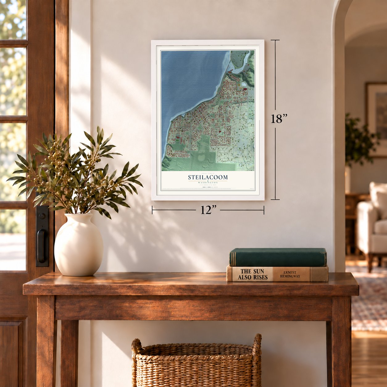
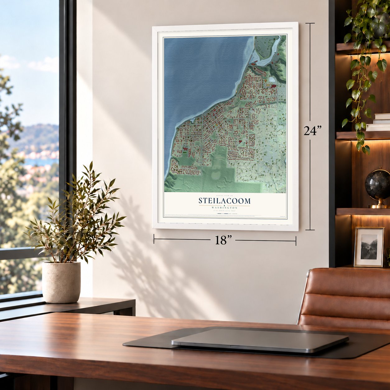
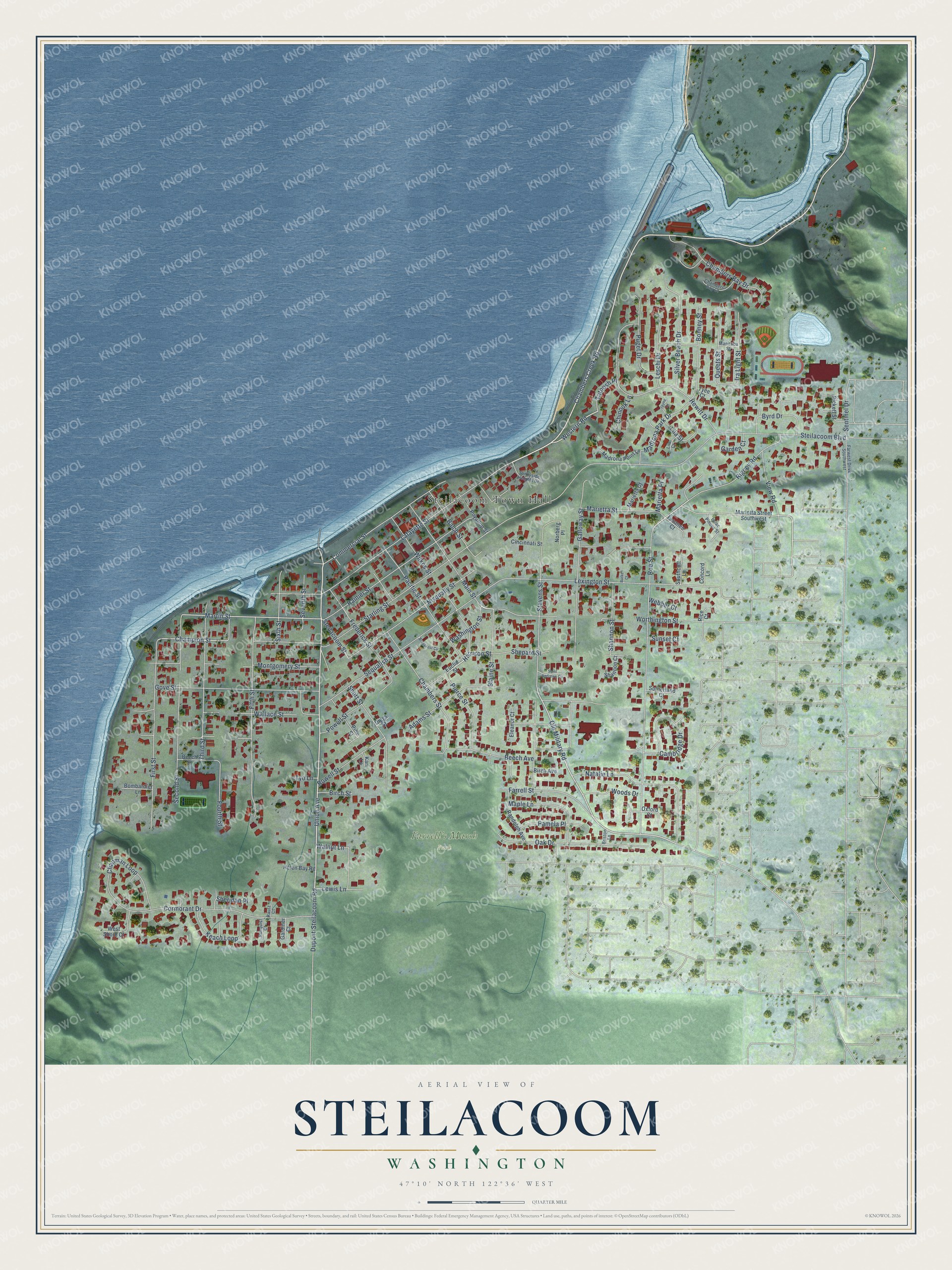
A new map of Steilacoom, Washington, made in 2026 and printed to order on thick archival matte paper.
12" x 18" Archival Matte Print
A Map of Home. A Work of Art.
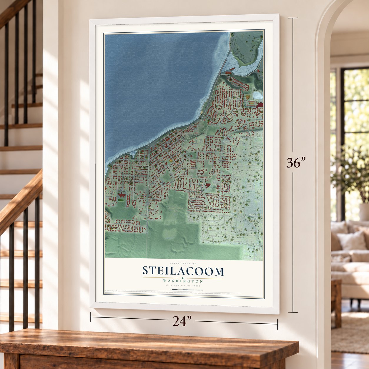
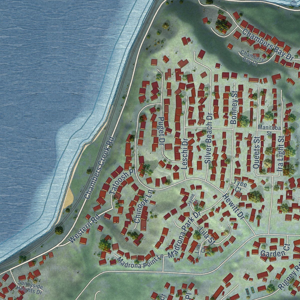
Explore Steilacoom, Washington from a whole new perspective. Created using aerial imagery and detailed geographic data, this map captures Steilacoom building by building, with labeled streets, familiar landmarks, and shaded topographical relief that highlights the natural contours of the landscape.
Combining modern data with the timeless character of a vintage atlas, this map is just as interesting up close as it is beautiful on the wall. Whether you grew up in Steilacoom, spent memorable years there, or call it home today, this unique map is a great way to celebrate a place that means something to you. Zoom in on the preview to look for your street, and then order a print to put your memories on the wall.
Three ways to hang it
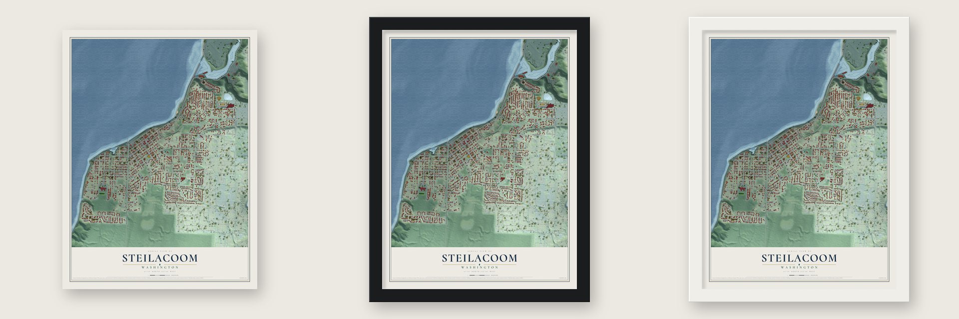
Unframed archival matte, a black wood frame or a white wood frame.
Up close
Geography Worth Displaying
This map was created using accurate cartographic data and authoritative geographic sources, including the U.S. Geological Survey and the Census Bureau. The map brings together terrain, waterways, roads, and building detail. The majority of the streets are labeled, houses are accurately depicted, and the topography is derived from government sources. Combining local data with carefully composed color and shading leads to this beautifully detailed Steilacoom artwork for your wall.
Rather than simply showing street outlines, we’ve included as many of the street names as we could reasonably fit on the map while keeping their names legible. Zoom in on the high resolution preview to see exactly what’s on the map. We truly set out to create a statement piece for anyone who loves Steilacoom. So whether it’s for you, or a gift for someone you love, we hope this map of Steilacoom brings back fond memories.
Read the story behind this map of Steilacoom, Washington from 2026.

About Steilacoom, Washington
Steilacoom is a town of 6,727 people in Pierce County, on Puget Sound across the water from Anderson and Ketron islands. Its shore and the prairies behind it are the ancestral home of the Steilacoom Tribe, whose largest village stood at nearby Chambers Creek. Lafayette Balch, a sea captain from Maine, came in 1851 meaning to build a store and a lumber mill at Olympia, but that town's founder, Edmund Sylvester, would not sell him lots at a fair price.
So Balch staked his own claim just south of Chambers Bay and named it Port Steilacoom, putting up a store of Maine lumber, a hotel and the first wharf in what is now Pierce County. That October John B. Chapman claimed the land next door for a rival town, Steilacoom City. The legislature of the new Washington Territory joined the two on April 22, 1854, making Steilacoom the territory's first incorporated town, and Union Street, the old line between them, became the main street. The town stayed important until the Northern Pacific Railway passed it by in 1873 and ended at Tacoma, which took the county seat in 1880.
“My home is at Shilacum Creek and there is where I want to live and die. I wish to tell the Governor that every Indian loves his Native land best. Every Indian loves his own people best”
- A judge jailed, a governor finedIn May 1856 Governor Isaac Stevens arrested Hudson's Bay men married to Native women, suspecting them of helping Leschi's forces. When Judge Edward Lander tried to hold court in Steilacoom, the militia arrested him and Stevens put Pierce County under martial law. Once released, Lander ordered the men freed, and Stevens had him jailed beside them. In the end Stevens let the prisoners go, Lander fined him $50, and the territorial senate and Congress both censured the governor.
- Leschi's first trialMany settlers wanted Leschi, the best known leader of the treaty wars, put to death. At his trial in Steilacoom late in 1856, his defenders argued he had fought as a combatant in a war and could not be charged with murder. Two jurors refused to convict, so the trial ended in a mistrial. A second trial at Olympia found him guilty, and on February 19, 1858, he was hanged close to Fort Steilacoom.
- The town's church bellAt Balch's urging, the Reverend John F. DeVore moved to Steilacoom in 1853. He put up a Methodist Episcopal church two stories tall, and the building doubled as the school and meeting hall. Its bell, ordered from the East, arrived with money still owed on it, so townspeople took up a collection. From then on the bell belonged to the town, ringing for emergencies and public meetings as well as for worship.
- A newspaper in 1855To promote his town, Balch bought a printing press in 1855. The first Puget Sound Courier, printed on May 19, 1855, counted seventy dwellings, six stores, three hotels, two blacksmith shops, two bowling alleys and a billiard saloon, with three sawmills close by and a new wharf where large ships could tie up whatever the tide.
- Nathaniel Orr's wagon shopNathaniel Orr arrived in Steilacoom in 1852 and built his first wagon shop in 1857. After his marriage to Emma Thompson in 1868, he turned the shop into their family home. The Nathaniel Orr House and Orchard joined the National Register in 1972.
Find your street
Names on the Steilacoom map
Every name below is printed on this map. Look for your street, your school, the park where you played, or the pond down the road.
Places and landmarks2
- Steilacoom Town Hall
- Farrell's Marsh Park
Streets and roads123
- Chambers Creek Road
- Union Avenue
- Harrison Street
- Old Military Road
- Rigney Road
- Champion Street
- Western Road
- Martin Street
- Steilacoom Boulevard
- Lafayette Street
- Roe Street
- Stevens Street
- Galloway Street
- Lexington Street
- Sequalish Street
- Rainier Street
- Starling Street
- Fifth Street
- Hewitt Drive
- First Street
- Second Street
- Natalie Lane
- Gove Street
- Cormorant Drive
- Nisqually Street
- Chambers Street
- Third Street
- Oak Drive
- Chapman Loop
- Commercial Street
Show all 123 streets
- Marietta Street
- Short Street
- Pacific Street
- Worthington Street
- Fourth Street
- Main Street
- Montgomery Street
- Ira Light Street
- Chambers Bay Drive
- Cambridge Drive
- Pierce Street
- Silver Beach Drive
- Frederick Street
- Wilkes Street
- Adams Street
- Farrell Street
- Wallace Street
- Seventh Street
- Bonney Street
- Puget Drive
- Maple Lane
- Shannon Street
- Madrona Park Drive
- Beech Avenue
- Blaine Street
- Keach Loop
- Walnut Lane
- Rowell Street
- Balch Street
- Shepard Street
- Byrd Drive
- Queets Street
- Sixth Street
- Washington Street
- Leschi Drive
- Pamela Place
- View Road
- Dupont-Steilacoom Road
- Woods Drive
- Lila Street
- Sentinel Drive
- Powell Street
- Lewis Lane
- Steilacoom Street
- Tatoosh Place
- Chinook Lane
- Garden Court
- Birch Street
- Webber Court
- Sheridan Place
- Sunset Court
- Marietta Place
- Tyo Lane
- Euclid Street
- Marietta Street Southwest
- Cincinnati Street
- Randolph Avenue
- Madrona Point Lane
- West Shore Court
- Puyallup Street
- Pickett Street
- Helen Bay Road
- Pine Street
- Sutherland Court
- Bombardier Lane
- Marietta Court
- Diggs Street
- Eleanor Court
- Shannon Court
- Tasanee Court
- Oxford Court
- Southcott Lane
- Concord Lane
- Beech Street
- Norberg Place
- Birch Avenue
- Gardiner Court
- Rice Court
- Kari Lane
- Tyee Court
- Manitoba Street
- Chambers Bay Court
- Sunnyside Heights Drive
- Isaac Pincus Street
- Farwest Drive Southwest
- Runquist Court
- Lila Court
- Briston Lane
- Kautz Court
- Saint Andrews Circle
- Braecrest Circle
- Jayne Court
- Burke Court
Names are listed as they appear on the printed map. Zoom into the product photos to find them.
The art of mapping a place
How This Map Was Made
Real places. Remarkable detail. Discover the layers that turn geographic data into a map of home.

The view from above
Aerial imagery reveals the character of the land: woodland, open fields, and the patterns of a place.

The shape of the land
Elevation data brings hills, valleys, and subtle changes in the landscape into view.

The details of home
Roads, waterways, and building footprints come together to make the map feel unmistakably local.

Geography becomes art
Considered color, shading, and typography bring the layers together in a map made for your wall.


Process illustrated with Mendon, Massachusetts. Aerial imagery: USDA NAIP. Terrain: USGS 3D Elevation Program. Map details and finished artwork: KNOWOL.
The Details
About This Print
Choose an archival matte print, or a black or white Ayous wood frame. The archival matte print is unframed.
Select your size and finish above to see the matching product image and price.
Materials & Craftsmanship
A contemporary map with the character of a classic atlas, printed on archival matte paper. Optional frames are made from Ayous wood.
Your printed map does not include the watermark shown in the full-map preview.
Shipping & Delivery
Free shipping within the United States. Every print is made to order in the USA.
Buying a gift? Add a note in your cart and we'll include it. We never put prices in the package.
Prints ship within 2 to 3 business days. Allow 7 to 10 days total from ordering for delivery. Timing may vary during holidays or periods of high order volume.
Read our shipping policy.
Returns and damaged prints
Each print is made to order. Change-of-mind refunds are not available after production.
If your print arrives damaged, misprinted or incorrect, contact support@knowol.com within 30 days of receiving it. Include your order number, photos and a description of the issue.
Read our full refund and replacement policy. For questions about your order, email support@knowol.com.
Find your town
Looking for another city?
Find a map of home in our Washington collection, or any town in the country.
Nearby
Maps of towns near Steilacoom
Know someone from one of these towns? Their map makes a great gift.
 Ketron Island
, Washington
From $39.99See the map
 Lakewood
, Washington
From $39.99See the map
 North Fort Lewis
, Washington
From $39.99See the map
More maps nearby: University Place, Anderson Island, DuPont, Fort Lewis and McChord AFB.