
Search for another town





Free U.S. delivery 7 to 10 days after you order
Lancaster, Ohio Map Art
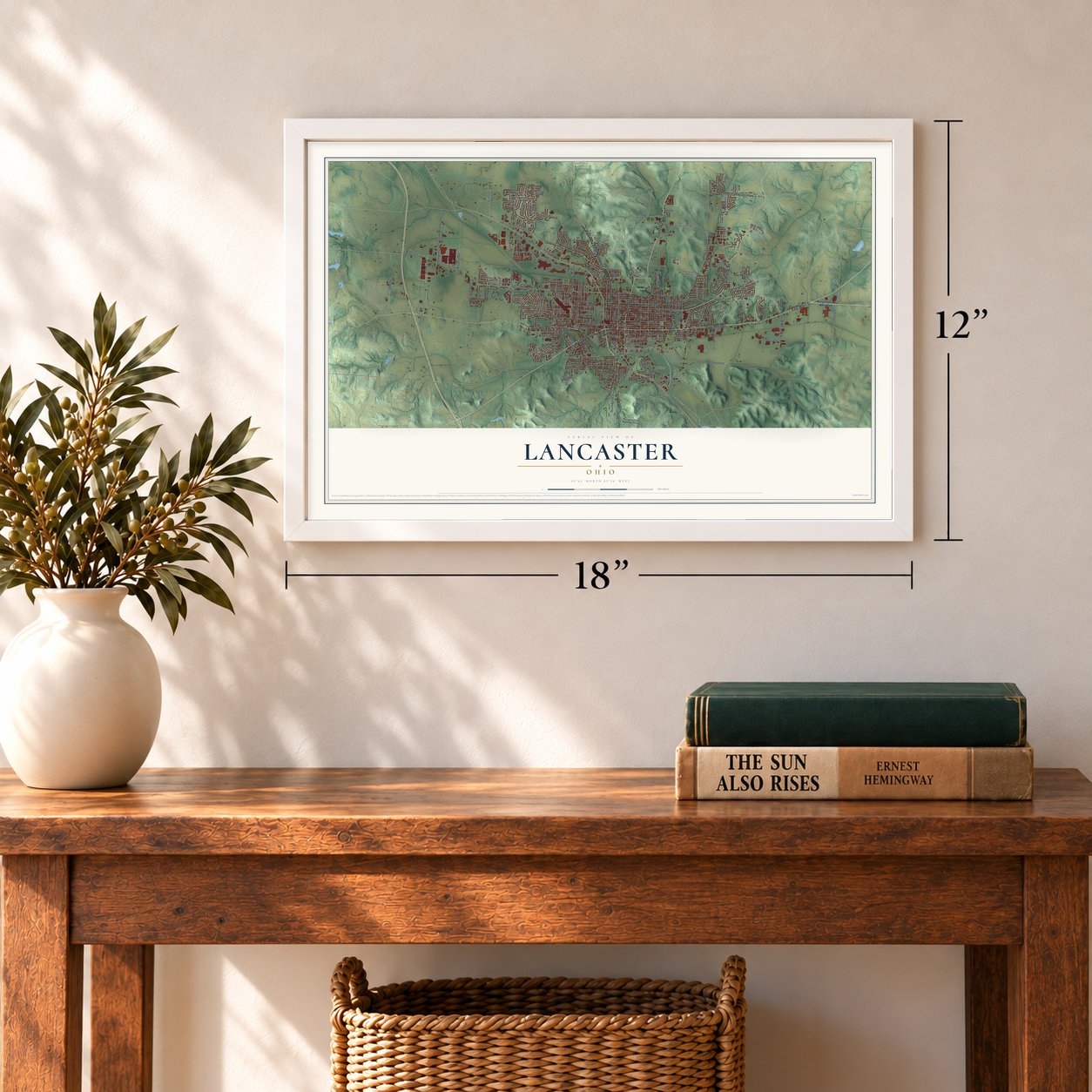
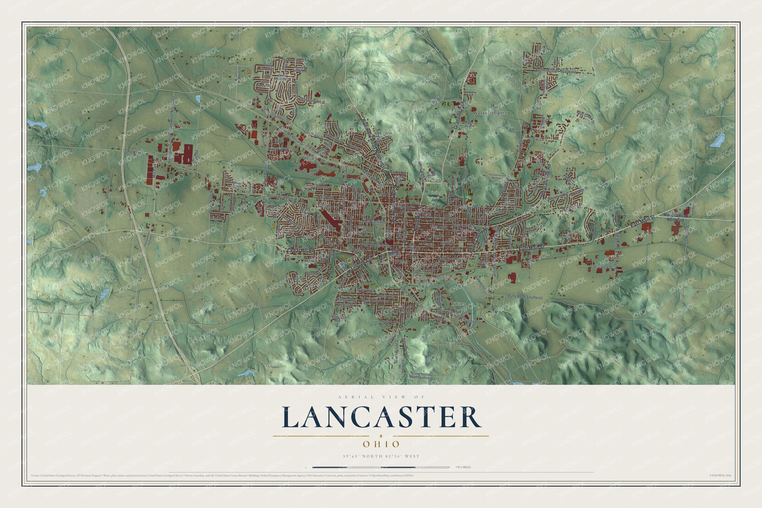
A new map of Lancaster, Ohio, made in 2026 and printed to order on thick archival matte paper.
12" x 18" Archival Matte Print
A Map of Home. A Work of Art.
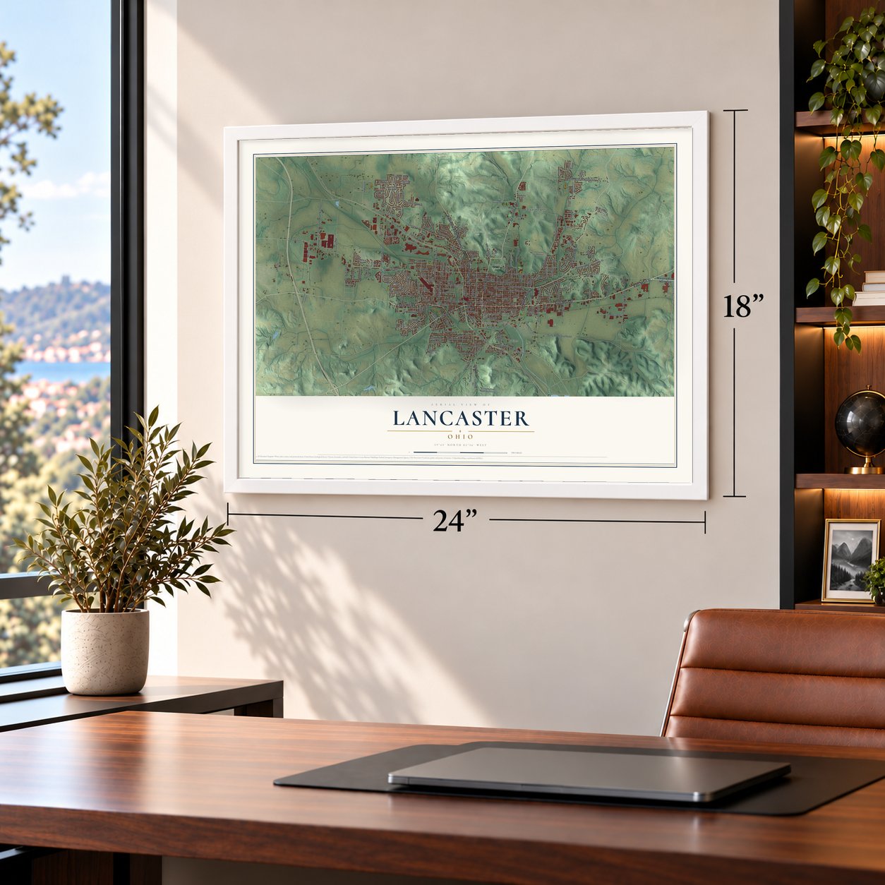
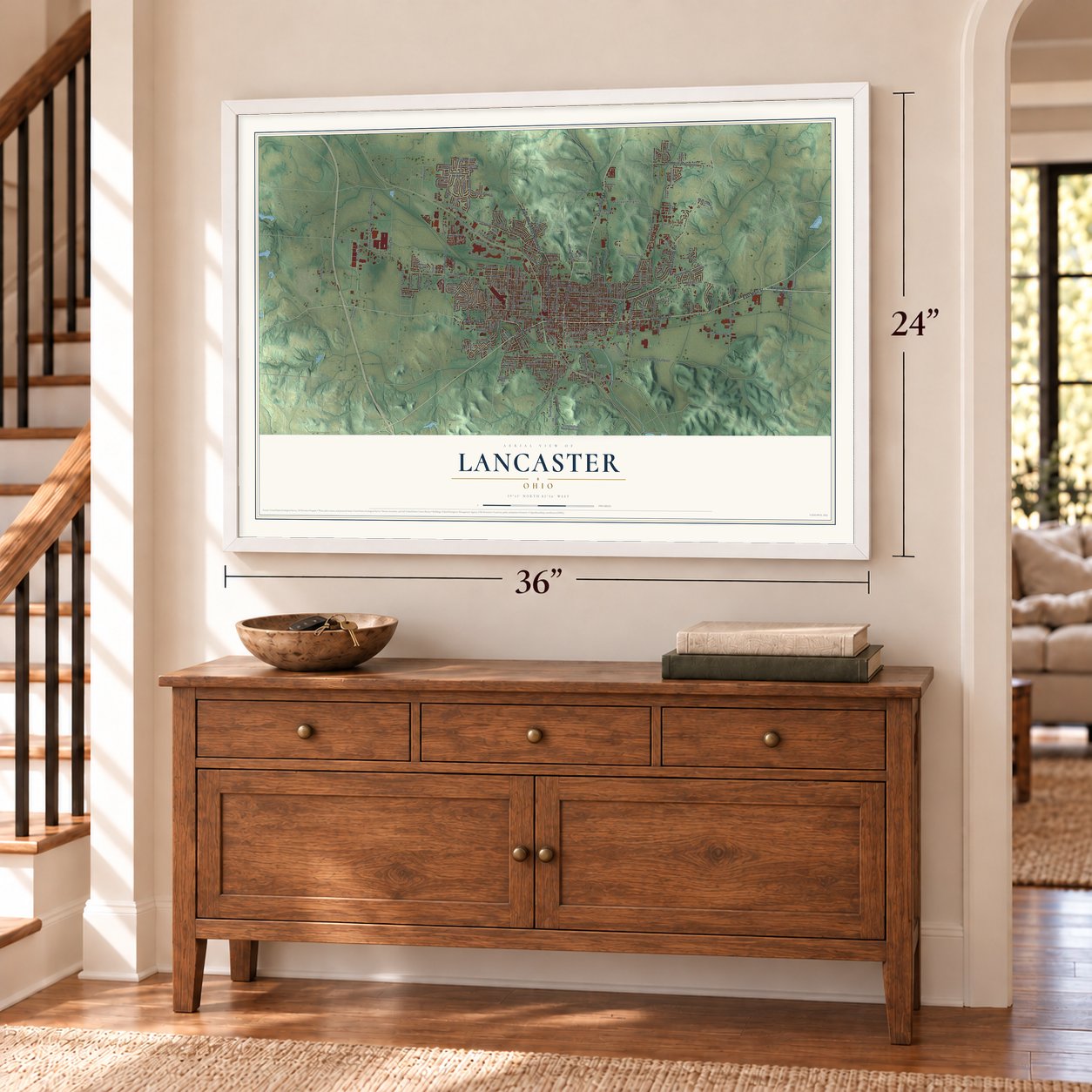
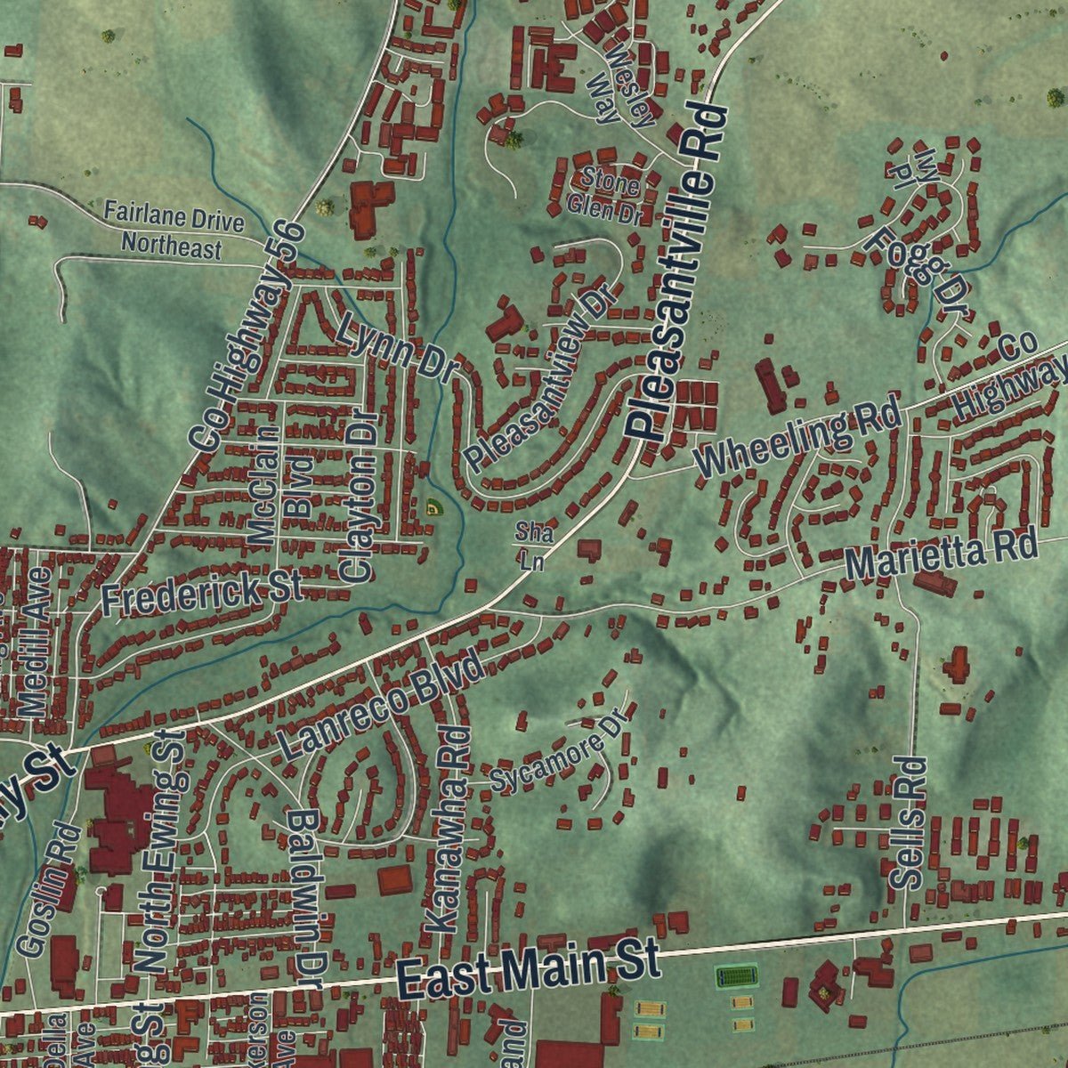
Explore Lancaster, Ohio from a whole new perspective. Created using aerial imagery and detailed geographic data, this map captures Lancaster building by building, with labeled streets, familiar landmarks, and shaded topographical relief that highlights the natural contours of the landscape.
Combining modern data with the timeless character of a vintage atlas, this map is just as interesting up close as it is beautiful on the wall. Whether you grew up in Lancaster, spent memorable years there, or call it home today, this unique map is a great way to celebrate a place that means something to you. Zoom in on the preview to look for your street, and then order a print to put your memories on the wall.
Three ways to hang it
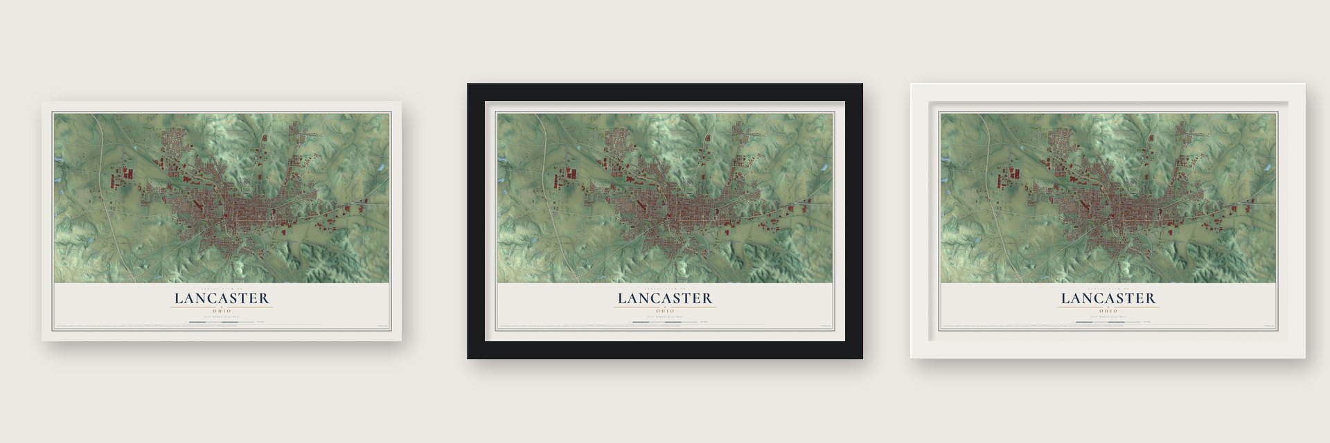
Unframed archival matte, a black wood frame or a white wood frame.
Up close
Geography Worth Displaying
This map was created using accurate cartographic data and authoritative geographic sources, including the U.S. Geological Survey and the Census Bureau. The map brings together terrain, waterways, roads, and building detail. The majority of the streets are labeled, houses are accurately depicted, and the topography is derived from government sources. Combining local data with carefully composed color and shading leads to this beautifully detailed Lancaster artwork for your wall.
Rather than simply showing street outlines, we’ve included as many of the street names as we could reasonably fit on the map while keeping their names legible. Zoom in on the high resolution preview to see exactly what’s on the map. We truly set out to create a statement piece for anyone who loves Lancaster. So whether it’s for you, or a gift for someone you love, we hope this map of Lancaster brings back fond memories.
Read the story behind this map of Lancaster, Ohio from 2026.

About Lancaster, Ohio
Lancaster is a city of 40,552 people and the seat of Fairfield County, near the Hocking River. In 1796 Ebenezer Zane, a Revolutionary War colonel, asked Congress for a contract to cut a trail across Ohio from Wheeling to Limestone, Kentucky, a route of 266 miles. Zane's Trace was finished by 1797, and Zane was paid in square-mile tracts where it crossed the Muskingum, Hocking and Scioto rivers.
Zane's sons divided the Hocking tract into lots, and the village was founded in 1800, three years before Ohio became a state. Zane gave some lots to tradesmen who promised to build cabins and work at their trades, and by the spring of 1801 the streets at the center of town were laid out much as they remained in 1877. Many settlers were Germans from Lancaster, Pennsylvania, so the place was called New Lancaster until the legislature shortened the name in 1805. Lancaster was incorporated in 1831.
- Canal boats from 1834The Lancaster Lateral Canal opened to traffic in 1834. It tied the town to the wider Ohio and Erie Canal system, which shipped oats, pork, lard, cheese and wool from the area to markets in the East. The city credits that canal trade with much of its early prosperity.
- Birthplace of the ShermansTwo brothers were born in a frame house built here in 1811: William Tecumseh Sherman, the Union general, and John Sherman, who went on to serve Ohio in the U.S. Senate and to lead both the State Department and the Treasury. The family enlarged the house in 1816 and added a brick front in 1870. The John Sherman Birthplace joined the National Register in 1966 and is now a museum of the general's life and Civil War relics.
- Rival papers, one nameThe Ohio Adler, founded around 1807, and the Ohio Gazette, founded in the 1830s, fought hard for readers. The Adler stood against slavery and for the Union, while many townspeople from the Upper South leaned toward the Confederacy. After glassmaker Anchor-Hocking bought the Gazette, the two papers merged in 1937 into the Lancaster Eagle-Gazette, the longest continuously running newspaper in Ohio.
- Designer of the 50-star flagRobert G. Heft of Lancaster designed the 50-star flag of the United States, which Congress adopted in 1960. A historical marker in Lancaster titled The Fifty Star Flag: A Symbol of America honors his flag.
- Ohio's last county fairThe Fairfield County Fair fills the second week of October every year, making it the 88th and final county fair on Ohio's calendar. Crowds come for truck, tractor and horse pulls, demolition derbies, horse races and concerts.
Find your street
Names on the Lancaster map
Every name below is printed on this map. Look for your street, your school, the park where you played, or the pond down the road.
Places and landmarks6
- Lancaster City Hall
- Whites
- Carpenters Addition
- Keller-Kirn Park
- Rising Park
- Wacker Heights
Streets and roads223
- East Main Street
- Cedar Hill Road
- North Cherry Street
- Granville Pike
- Pleasantville Road
- North High Street
- Lincoln Avenue
- North Columbus Street
- Baltimore Road Northwest
- North Memorial Drive
- South Memorial Drive
- West Sixth Avenue
- East Sixth Avenue
- North Broad Street
- West Fair Avenue
- South Broad Street
- Pierce Avenue
- Harrison West
- Mill Park Drive
- Zimmer Street
- Sheridan Drive
- North Pierce Avenue
- Washington Avenue
- Wheeling Road
- Schorr Way Drive
- Fair North
- Sugar Grove Road Southeast
- Duffy Road Southeast
- South Ewing Street
- West Wheeling Street
Show all 223 streets
- West Hubert Avenue
- Riverway Drive
- County Highway 51
- West Mulberry Street
- County Highway 56
- Canal
- East Fair Avenue
- Zane
- Marietta Road
- Carpenter
- East Allen Street
- Union Street
- East Chestnut Street
- Bank
- Autumn Drive
- Fifth North
- North
- Ety Road Northwest
- Lawrence Street
- King Street
- East Fifth Avenue
- Reese Avenue
- Rainbow Drive Northeast
- Vine
- Camp Ground Road Northwest
- Frederick Street
- Center
- Collins Road
- Spring Street
- Broad East 1
- Quarry Road Southeast
- Lynn Drive
- Sells Road
- Lanreco Boulevard
- Boving Road
- East Locust Street
- Eighth Avenue
- Slocum Street
- Tiki Lane
- Wacker Drive
- West Main Street
- Becks Knob Road
- Nolder Drive
- Commerce Street
- Edgewood Avenue
- Maud Avenue
- Trace Drive
- Kanawha Road
- Lewis Avenue
- Canal Street
- Barr Drive
- Baldwin Drive
- Elizabeth Drive
- Greencrest Way
- Long Bow Avenue
- North Ewing Street
- Bent Creek Drive
- Clayton Drive
- Hubert Avenue
- Fogg Drive
- Scott Drive
- Seville Street
- Park Street
- Marks Avenue
- Lendale Drive
- Third Street
- Witte Street
- Long Street
- Carl Drive
- Fay Avenue
- Rv Road
- Marietta Road Northeast
- Old Logan Road
- River Valley Circle South
- County Highway 35
- North Shoshone Drive
- Cedar West
- Green Meadow Drive
- Danbury Drive
- Whiley Road
- East Wheeling Street
- County Highway 37
- County Highway 43
- Arbor Valley Drive
- Lynwood Lane
- South Columbus Street
- South Maple Street
- Forest Rose Avenue
- Walnut South
- Allen North
- Lake North
- Stump Hollow Road Southeast
- Shasta Drive
- Arnold Avenue
- County Highway 45
- Lenwood Drive
- Pleasantview Drive
- Stone Run Court
- McClain Boulevard
- Little Brook Drive
- Goslin Road
- Independence Boulevard
- Boyd Street
- Whiley Avenue
- Brumfield Road
- Cloverdale Drive
- Cross Creek Avenue
- Cleveland Avenue
- Running Brook Avenue
- Peters Avenue
- Graceland Drive
- Linda Lane
- Mount Ida Avenue
- Bush Hill Drive
- Cemetery Road
- Ety Pointe Drive
- Coldspring Drive
- Ridgeway Avenue
- College Avenue
- Medill Avenue
- County Highway 40
- Hoffman Drive
- Miller Avenue
- Prairie Grass Avenue
- Ety Road
- Chartwell Street
- Highland Avenue
- Red Bud Lane
- Grove Avenue
- Carper Street
- Wilson Avenue
- Epic Way
- Hawk Street
- Thorn Hill Place
- Scenic Drive
- Arney Avenue
- Deer Run
- River Valley Circle North
- Marrose Drive
- East Mulberry Street
- West Fifth Avenue
- Garfield West
- Madison Avenue
- Pioneer
- West Seventh Avenue
- Goodwin Avenue
- West Walnut Street
- River Valley Boulevard
- County Highway 55
- Tecumseh Drive
- Shoshone Drive
- Wesley Way
- Sycamore Drive
- Della Avenue
- Harding Avenue
- Salt Lick Drive
- Seneca Drive
- Hubbard Drive
- Wittenberg Drive
- Creekside Drive
- Marvel Drive
- Kathryn Drive
- Fulkerson Avenue
- Nelson
- Gay Street
- Graf North
- Ivy Place
- Delmont Road Southwest
- Beacon Street
- Dean West
- Stringtown Road Northeast
- North Maple Street
- Coventry Circle
- Lambton Circle
- Fairlane Drive Northeast
- Stone Glen Drive
- Declaration Drive
- Snoke Hill Road Northeast
- Hardwood Avenue
- Sun Ridge Street
- Shawnee Drive
- Mound Street
- Tartan Place
- Scenic Valley
- Allen Street
- Knollwood Court
- Abigail Street
- Fairfield Avenue
- Little Pine Lane
- Kilt Court
- Plaza Way
- Olive Lane
- Sha Lane
Names are listed as they appear on the printed map. Zoom into the product photos to find them.
The art of mapping a place
How This Map Was Made
Real places. Remarkable detail. Discover the layers that turn geographic data into a map of home.

The view from above
Aerial imagery reveals the character of the land: woodland, open fields, and the patterns of a place.

The shape of the land
Elevation data brings hills, valleys, and subtle changes in the landscape into view.

The details of home
Roads, waterways, and building footprints come together to make the map feel unmistakably local.

Geography becomes art
Considered color, shading, and typography bring the layers together in a map made for your wall.


Process illustrated with Mendon, Massachusetts. Aerial imagery: USDA NAIP. Terrain: USGS 3D Elevation Program. Map details and finished artwork: KNOWOL.
The Details
About This Print
Choose an archival matte print, or a black or white Ayous wood frame. The archival matte print is unframed.
Select your size and finish above to see the matching product image and price.
Materials & Craftsmanship
A contemporary map with the character of a classic atlas, printed on archival matte paper. Optional frames are made from Ayous wood.
Your printed map does not include the watermark shown in the full-map preview.
Shipping & Delivery
Free shipping within the United States. Every print is made to order in the USA.
Buying a gift? Add a note in your cart and we'll include it. We never put prices in the package.
Prints ship within 2 to 3 business days. Allow 7 to 10 days total from ordering for delivery. Timing may vary during holidays or periods of high order volume.
Read our shipping policy.
Returns and damaged prints
Each print is made to order. Change-of-mind refunds are not available after production.
If your print arrives damaged, misprinted or incorrect, contact support@knowol.com within 30 days of receiving it. Include your order number, photos and a description of the issue.
Read our full refund and replacement policy. For questions about your order, email support@knowol.com.
Find your town
Looking for another city?
Find a map of home in our Ohio collection, or any town in the country.
Nearby
Maps of towns near Lancaster
Know someone from one of these towns? Their map makes a great gift.
 Hamburg
, Ohio
From $39.99See the map
 Sugar Grove
, Ohio
From $39.99See the map
 Pleasantville
, Ohio
From $39.99See the map
More maps nearby: Carroll, Baltimore, Thurston, West Rushville and Hide-A-Way Hills.