
Search for another town

Free U.S. delivery 7 to 10 days after you order
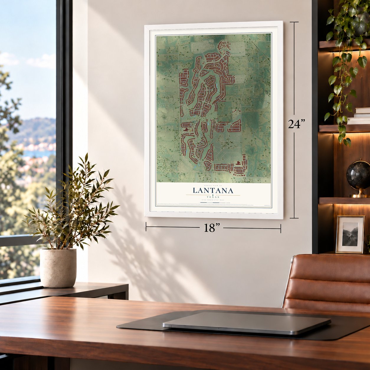
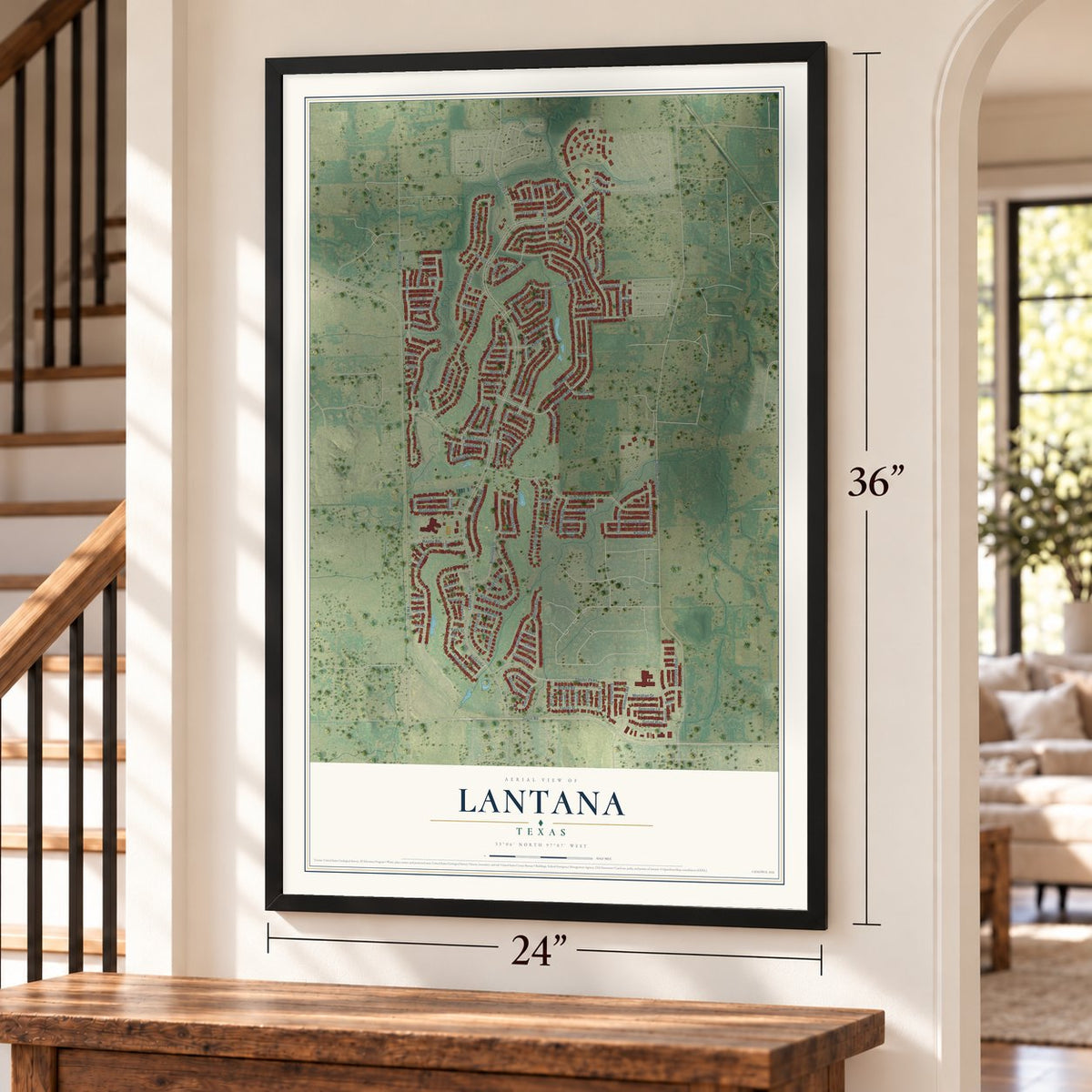
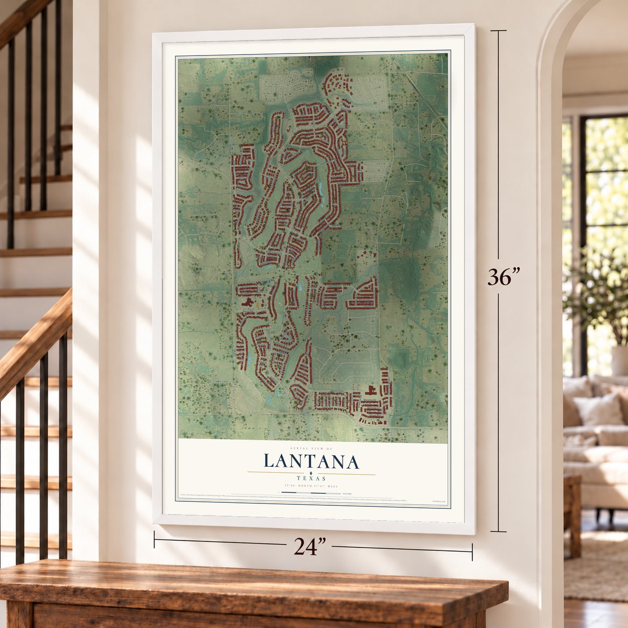
Lantana, Texas Map Art
Building by building, with labeled streets and shaded relief.
12" x 18" Archival Matte Print
A Map of Home. A Work of Art.
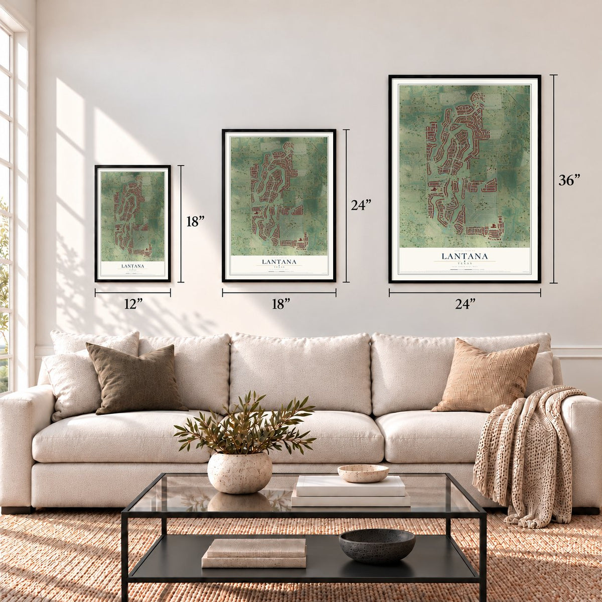
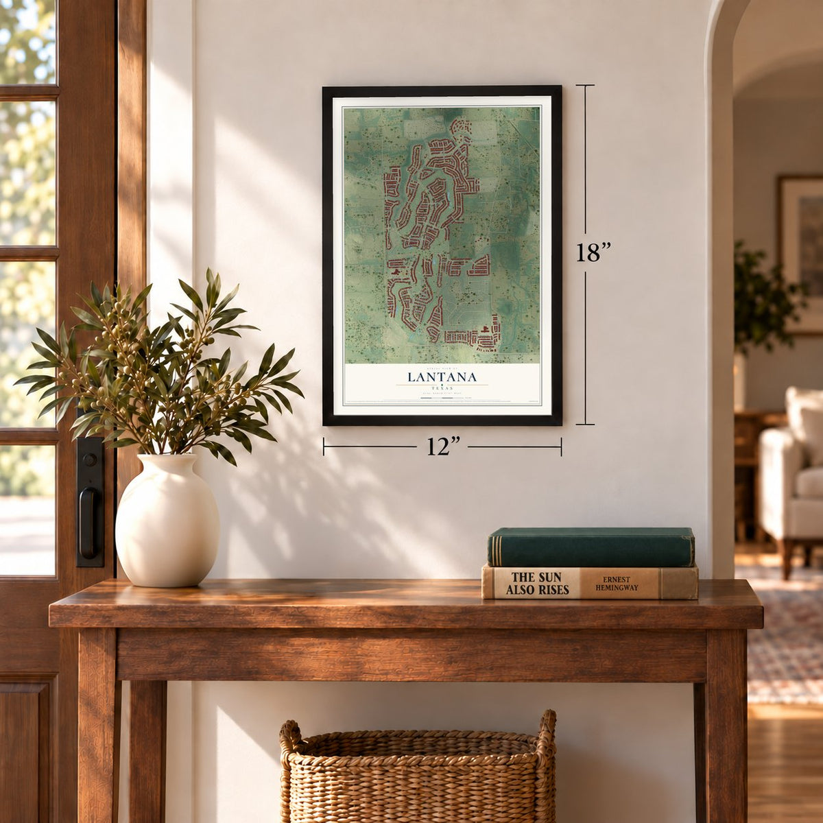
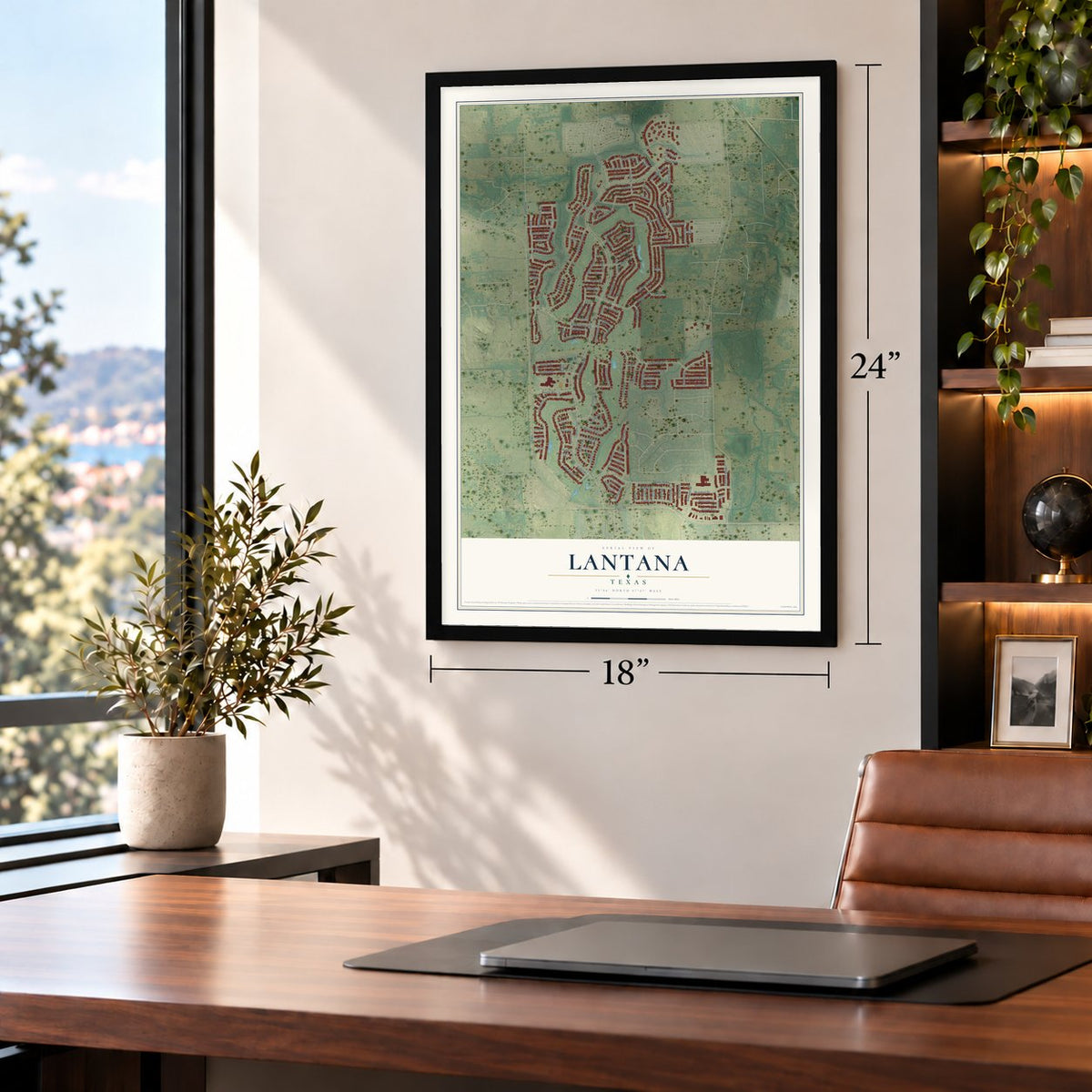
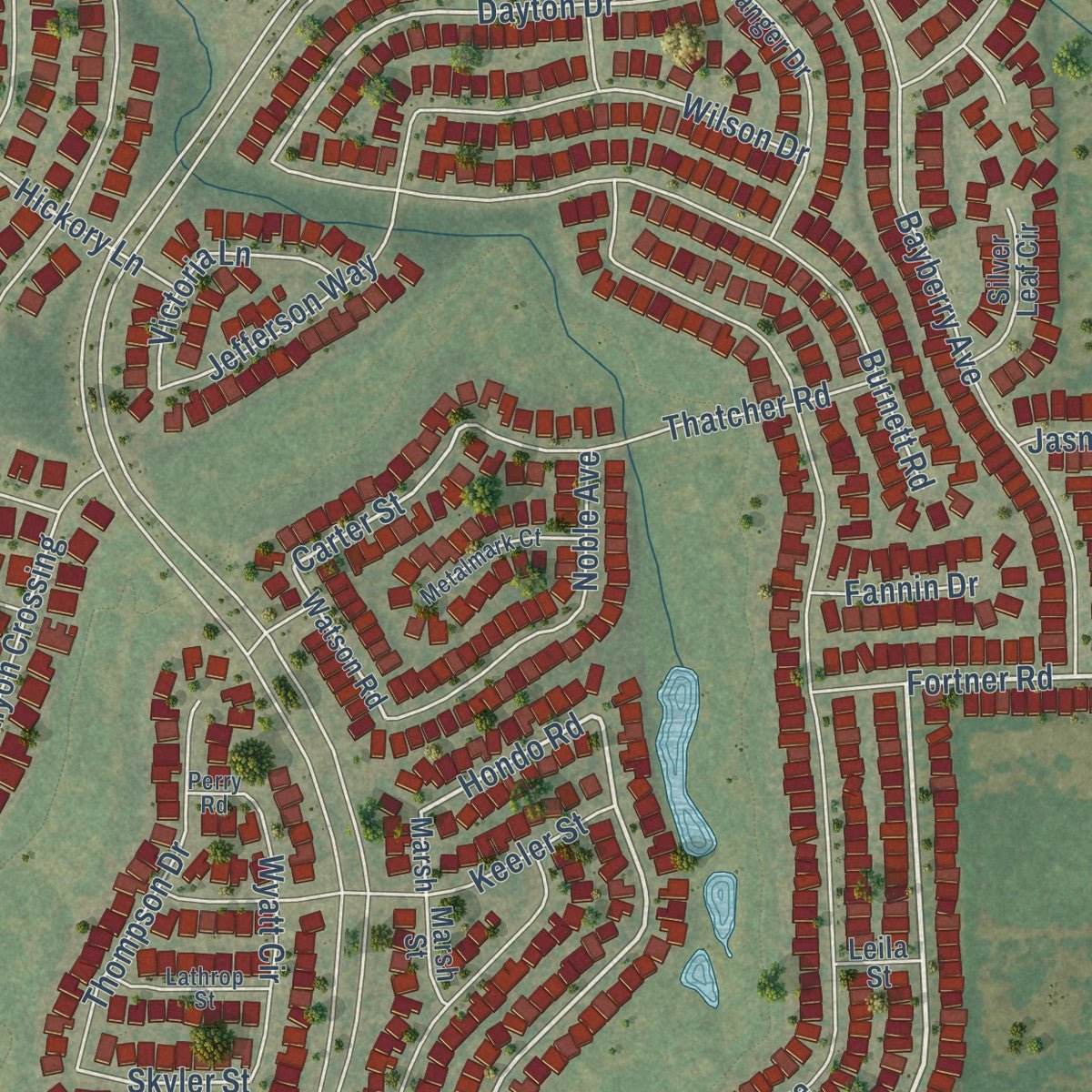
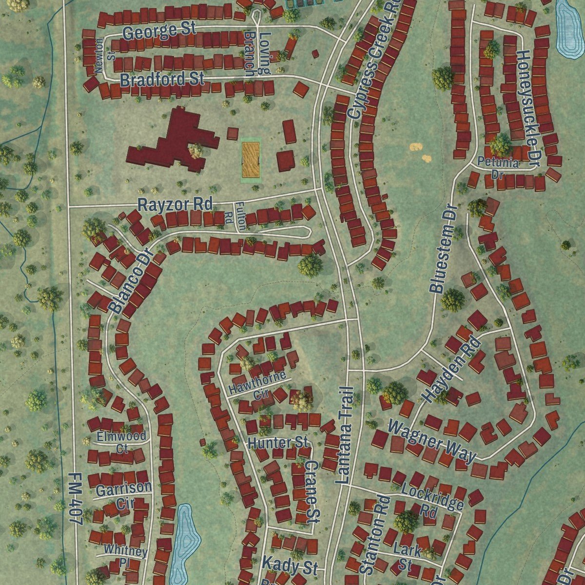
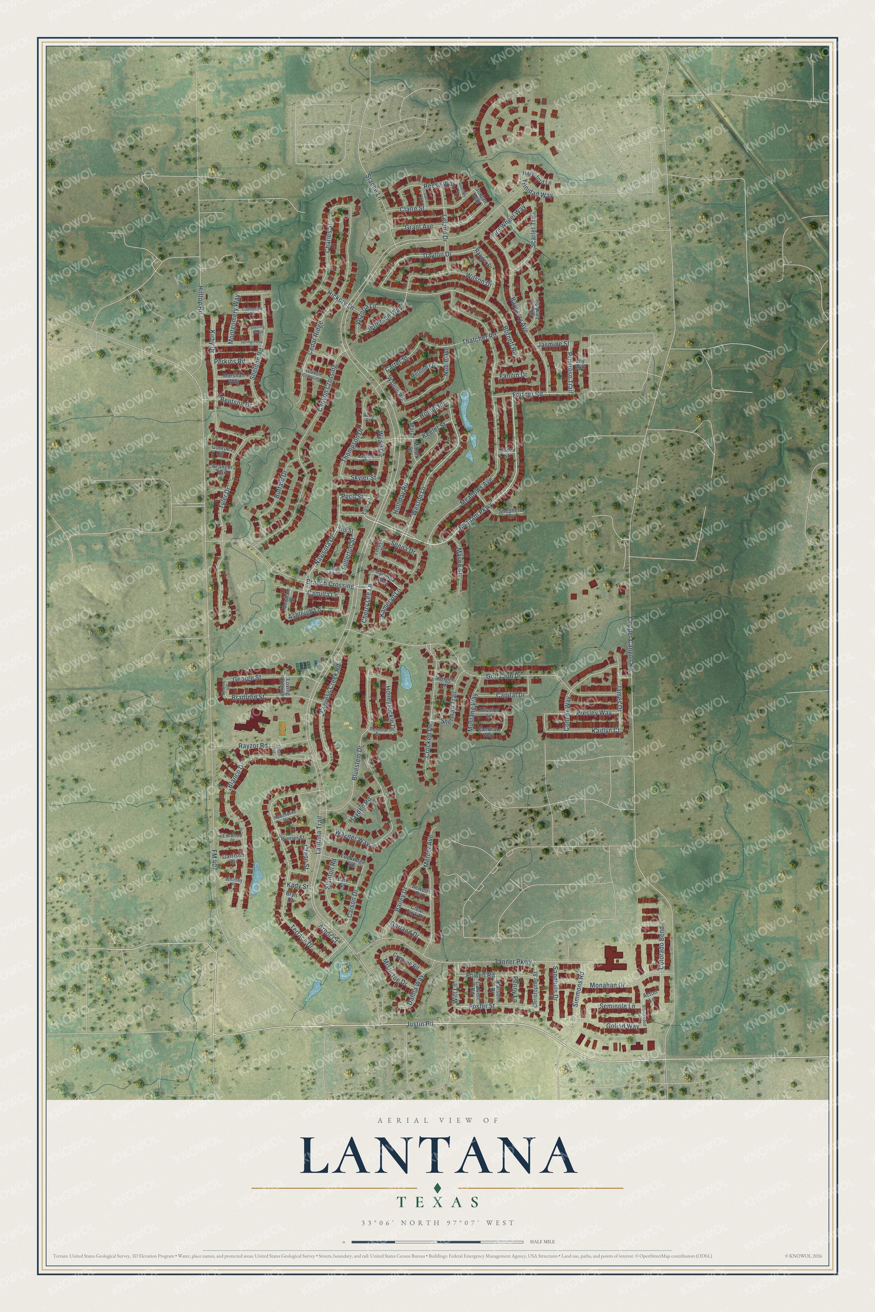
Explore Lantana, Texas from a whole new perspective. Created using aerial imagery and detailed geographic data, this map captures Lantana building by building, with labeled streets, familiar landmarks, and shaded topographical relief that highlights the natural contours of the landscape.
Combining modern data with the timeless character of a vintage atlas, this map is just as interesting up close as it is beautiful on the wall. Whether you grew up in Lantana, spent memorable years there, or call it home today, this unique map is a great way to celebrate a place that means something to you. Zoom in on the preview to look for your street, and then order a print to put your memories on the wall.
Three ways to hang it
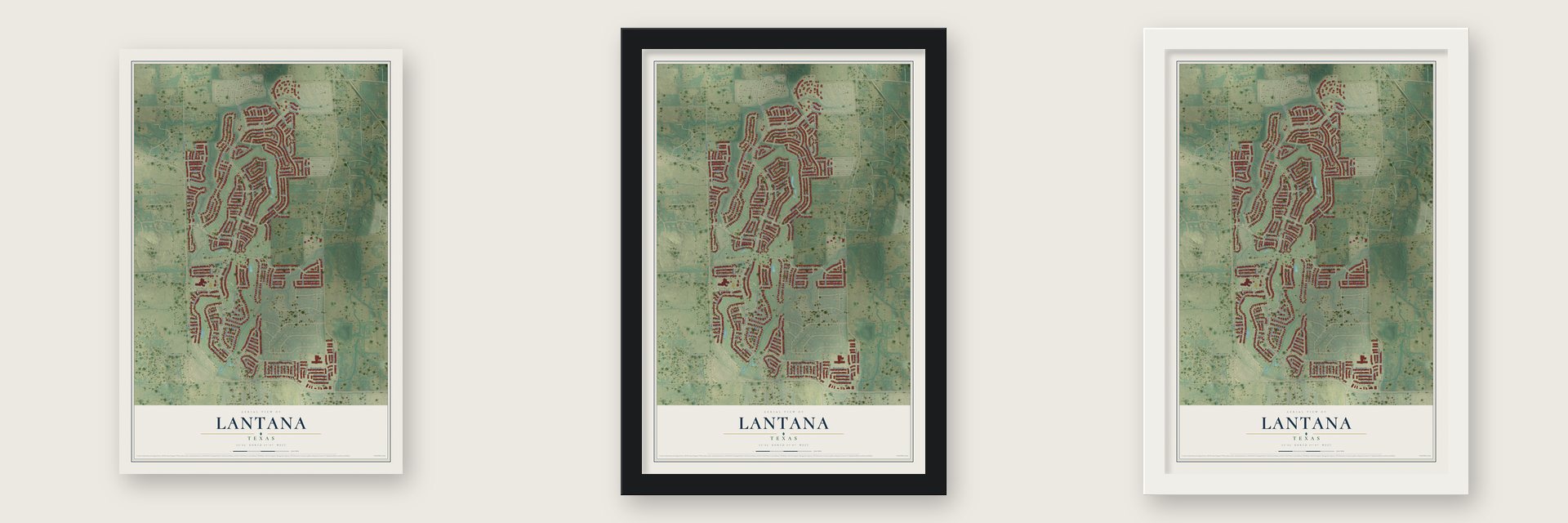
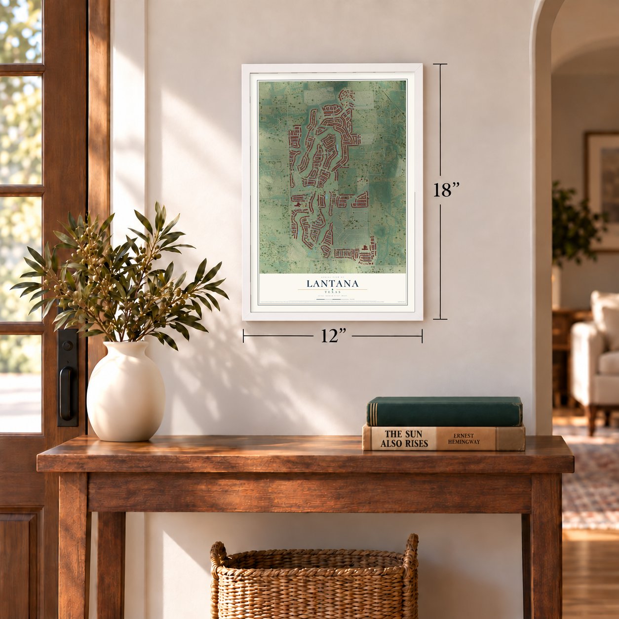
Unframed archival matte, a black wood frame or a white wood frame.
Up close
Geography Worth Displaying
This map was created using accurate cartographic data and authoritative geographic sources, including the U.S. Geological Survey and the Census Bureau. The map brings together terrain, waterways, roads, and building detail. The majority of the streets are labeled, houses are accurately depicted, and the topography is derived from government sources. Combining local data with carefully composed color and shading leads to this beautifully detailed Lantana artwork for your wall.
Rather than simply showing street outlines, we’ve included as many of the street names as we could reasonably fit on the map while keeping their names legible. Zoom in on the high resolution preview to see exactly what’s on the map. We truly set out to create a statement piece for anyone who loves Lantana. So whether it’s for you, or a gift for someone you love, we hope this map of Lantana brings back fond memories.

Find your street
Names on the Lantana map
Every name below is printed on this map. Look for your street, your school, the park where you played, or the pond down the road.
Streets and roads147
- Bonham Parkway
- Navisota Drive
- Peco Street
- Fortner Road
- FM 407
- Weston Lane
- Hondo Road
- Justin Road
- Primrose Trail
- Foster Street
- Witt Lane
- Ashleigh Lane
- Terrace Drive
- Dayton Drive
- Bradford Street
- Carter Street
- Fullerton Street
- Crane Street
- Branch Crossing
- Kaitlyn Court
- Skyler Street
- Lantana Trail
- Copper Canyon Road
- Meadows Avenue
- Golf Club Drive
- Tanner Parkway
- Blanco Drive
- Canyon Crossing
- Tyler Drive
- Cedar Ridge
Show all 147 streets
- Bayberry Avenue
- Burnett Road
- Bluestem Drive
- Wagner Way
- Kirby Drive
- Crockett Drive
- Mercer Avenue
- Cypress Creek Road
- Monahan Drive
- Charles Street
- Sheldon Road
- Grant Avenue
- Wilson Drive
- Keeler Street
- Holliday Road
- Conner Way
- Rayzor Road
- Buffalo Drive
- George Street
- Claire Street
- Colorado Bend
- Bailey Drive
- Leland Drive
- Thatcher Road
- Simmons Road
- Montgomery Way
- Thompson Drive
- Noble Avenue
- Powell Road
- Sandhills Drive
- Stacee Lane
- Hilltop Road
- Scarlet Trail
- Presley Way
- James Drive
- Capital Drive
- Stanton Road
- Honeysuckle Drive
- Goliad Way
- Jefferson Way
- Seminole Lane
- Camilla Lane
- Carson Drive
- Dahlia Way
- Wyatt Circle
- Victoria Lane
- Reese Way
- Mason Street
- Hayden Road
- Bentson Drive
- Sherman Trail
- Mustang Way
- Fire Wheel Way
- Cherry Lee Lane
- Hickory Lane
- Mistletoe Drive
- Perkins Road
- Trinidad Way
- Garland Drive
- Kameryn Lane
- Senna Drive
- Fannin Drive
- Arbor Court
- Jasmine Street
- Penny Lane
- Kady Street
- Marsh
- Central Way
- Watson Road
- Carolina Way
- Jordan Way
- Linden Street
- Ranger Drive
- Shepherd Court
- Lockridge Road
- Haverford Lane
- Crimson Road
- Christopher Street
- Marshall Way
- Silver Leaf Circle
- Mission Lane
- Clear Fork Drive
- Loving Branch
- Calvert Road
- Parson Drive
- Lark Street
- Newham Street
- Hunter Street
- Sewell Drive
- Marsh Street
- Conroe Circle
- Garrison Circle
- Ranger Lane
- Granger Circle
- Acton Lane
- Leila Street
- Iris Street
- Lily Way
- Bryn Court
- Elena Drive
- Metalmark Court
- Lathrop Street
- Griffin Street
- Walker Crossing
- Catherine Lane
- Petunia Drive
- Hawthorne Circle
- Elmwood Court
- Whitney Place
- Perry Road
- Newton Street
- Springcreek Drive
- Brownwood Avenue
- Sterling Ridge
- Gavin Road
- Geoffrey Drive
- Fulton Road
Names are listed as they appear on the printed map. Zoom into the product photos to find them.
About Lantana, Texas
Lantana is a census-designated place of 10,785 people in Denton County, about 8 miles south of Denton. It's a planned community that Republic Property Group began developing in 1999 on land bought from the Rayzor family, whose property was known as Rayzor Ranch. The company broke ground on March 16, 2000, and the first families arrived on July 31, 2001.
The first two neighborhoods to go up were Larkspur and Sandlin. Forestar Group had been an equity partner with Republic from the start, and in the first quarter of 2014 it bought out the rest of the partnership. Forestar then carried on the last stages of building the community, which covers 1,780 acres.
- Built around a golf courseJay Morrish designed the 18-hole golf course at the center of Lantana, and the community's homes were laid out around it. Lantana Golf Club became semi-private in October 2003. A 7,500 square-foot addition to its clubhouse was finished in October 2004, and the club went fully private in early 2009.
- The first school in 2002Eugenia Porter Rayzor Elementary was the first school built in the community, and it opened in August 2002. Annie Blanton Elementary and Tom Harpool Middle School followed in August 2008, and Dorothy Adkins Elementary opened in August 2014. All four belong to Denton ISD.
- Community of the Year, four timesThe Dallas Homebuilders Association gave Lantana its People's Choice honor for Community of the Year at the McSAM Awards in 2004, 2006, 2011 and 2012. Neighbors gather for outdoor music in the parks, chili cook-offs, festivals and picnics.
Keep exploring Texas
Lantana is one of 2,049 Texas towns we've mapped. Every dot on the map is a print of its own.
The search covers every state, Texas first.
Near Lantana
Order 2 or more town maps and save 10%. Shown in the size and finish you picked above, so they hang as a set.
- Copper Canyon 12" x 18" / Archival Matte Print $39.99
- Bartonville 12" x 18" / Archival Matte Print $39.99
- Double Oak 12" x 18" / Archival Matte Print $39.99

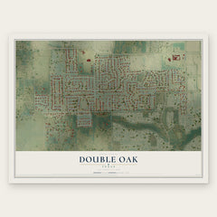
More maps nearby: Highland Village, Argyle, Flower Mound, Corinth and Hickory Creek.
The art of mapping a place
How This Map Was Made
Real places. Remarkable detail. Discover the layers that turn geographic data into a map of home.

The view from above
Aerial imagery reveals the character of the land: woodland, open fields, and the patterns of a place.

The shape of the land
Elevation data brings hills, valleys, and subtle changes in the landscape into view.

The details of home
Roads, waterways, and building footprints come together to make the map feel unmistakably local.

Geography becomes art
Considered color, shading, and typography bring the layers together in a map made for your wall.


Process illustrated with Mendon, Massachusetts. Aerial imagery: USDA NAIP. Terrain: USGS 3D Elevation Program. Map details and finished artwork: KNOWOL.
The Details
About This Print
Choose an archival matte print, or a black or white Ayous wood frame. The archival matte print is unframed.
Select your size and finish above to see the matching product image and price.
Materials & Craftsmanship
A contemporary map with the character of a classic atlas, printed on archival matte paper. Optional frames are made from Ayous wood.
Your printed map does not include the watermark shown in the full-map preview.
Shipping & Delivery
Free shipping within the United States. Every print is made to order in the USA.
Buying a gift? Add a note in your cart and we'll include it. We never put prices in the package.
Prints ship within 2 to 3 business days. Allow 7 to 10 days total from ordering for delivery. Timing may vary during holidays or periods of high order volume.
Read our shipping policy.
Returns and damaged prints
Each print is made to order. Change-of-mind refunds are not available after production.
If your print arrives damaged, misprinted or incorrect, contact support@knowol.com within 30 days of receiving it. Include your order number, photos and a description of the issue.
Read our full refund and replacement policy. For questions about your order, email support@knowol.com.