
Search for another town




Free U.S. delivery 7 to 10 days after you order
Lebanon, Tennessee Map Art
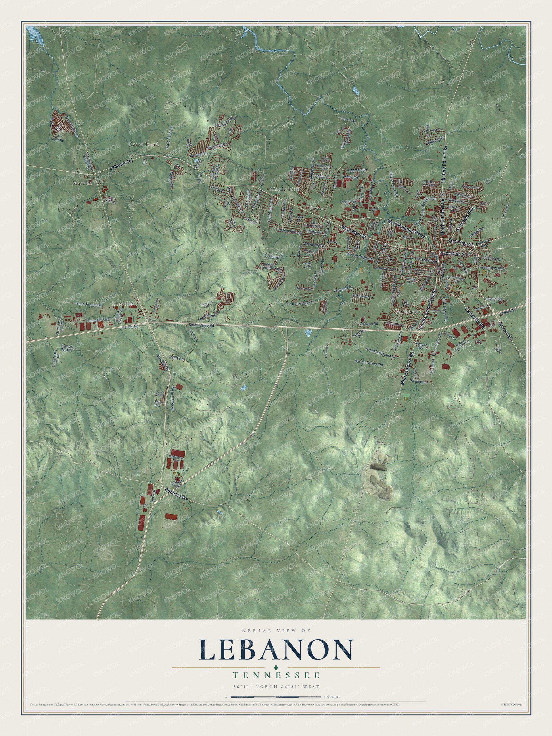
A new map of Lebanon, Tennessee, made in 2026 and printed to order on thick archival matte paper.
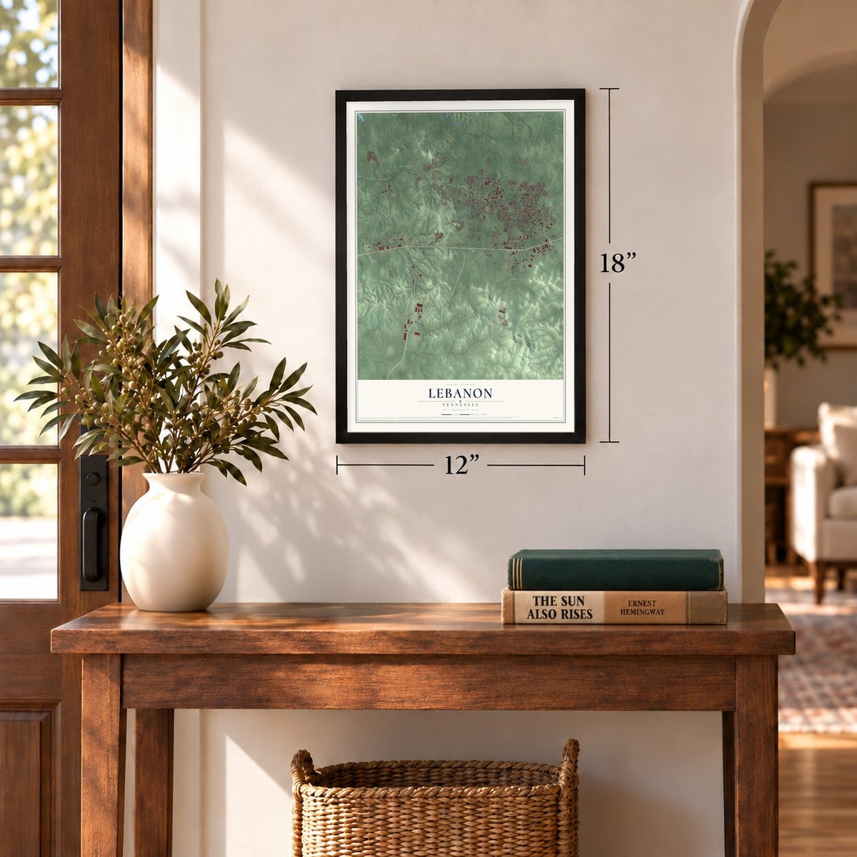
12" x 18" Archival Matte Print
A Map of Home. A Work of Art.
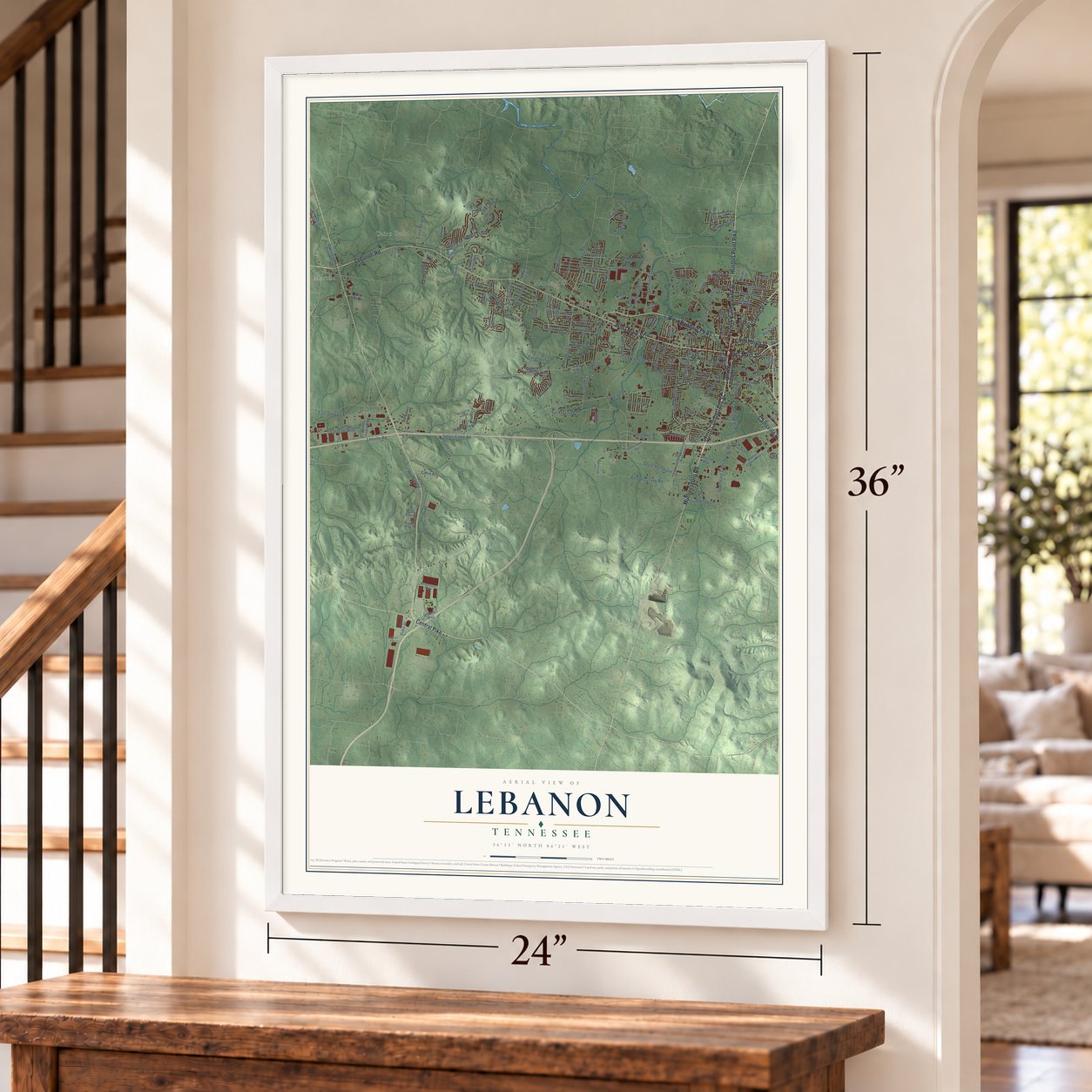
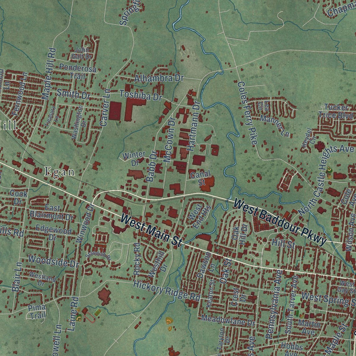
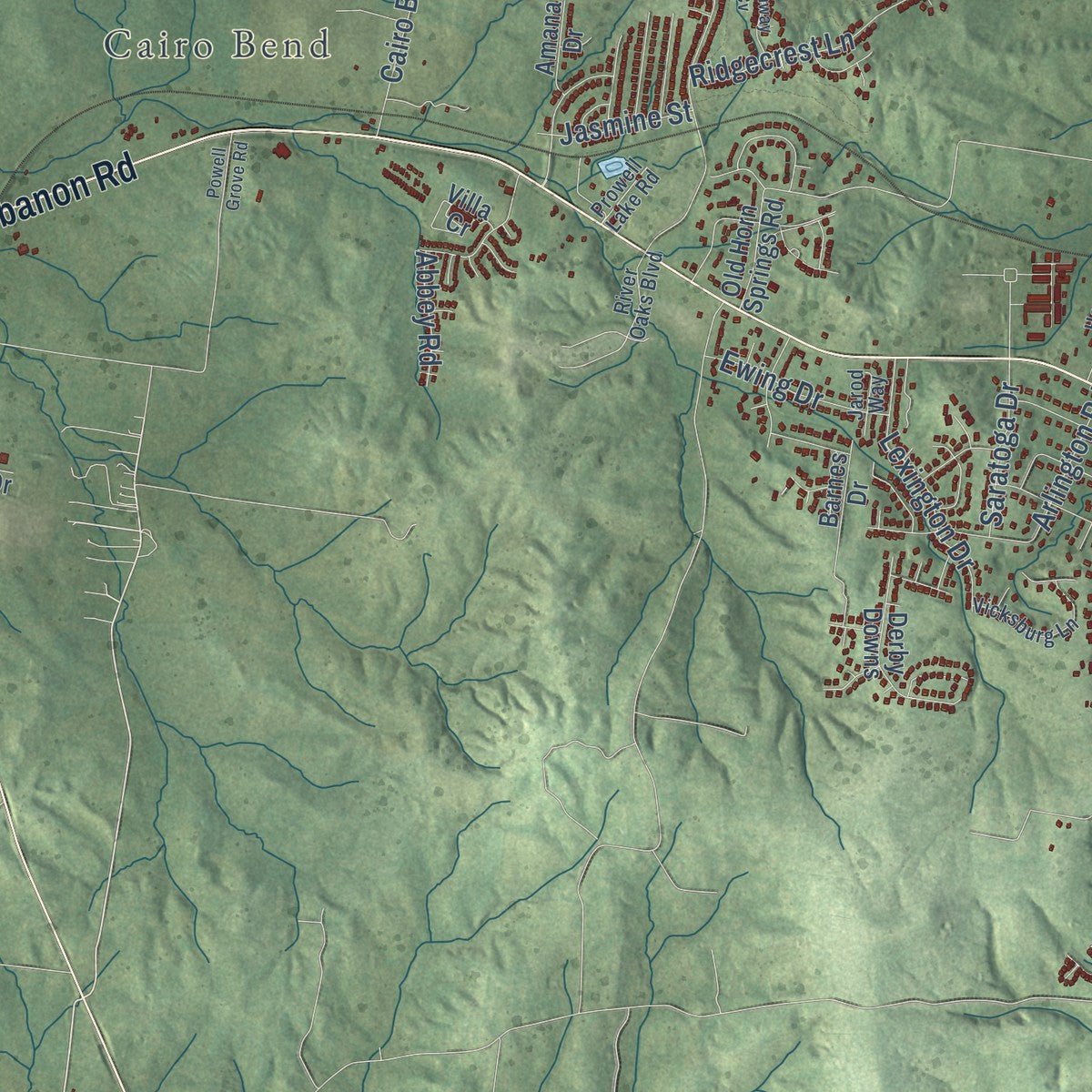
Explore Lebanon, Tennessee from a whole new perspective. Created using aerial imagery and detailed geographic data, this map captures Lebanon building by building, with labeled streets, familiar landmarks, and shaded topographical relief that highlights the natural contours of the landscape.
Combining modern data with the timeless character of a vintage atlas, this map is just as interesting up close as it is beautiful on the wall. Whether you grew up in Lebanon, spent memorable years there, or call it home today, this unique map is a great way to celebrate a place that means something to you. Zoom in on the preview to look for your street, and then order a print to put your memories on the wall.
Three ways to hang it
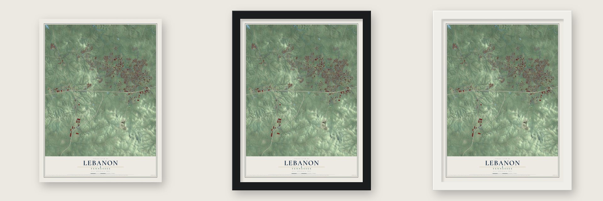
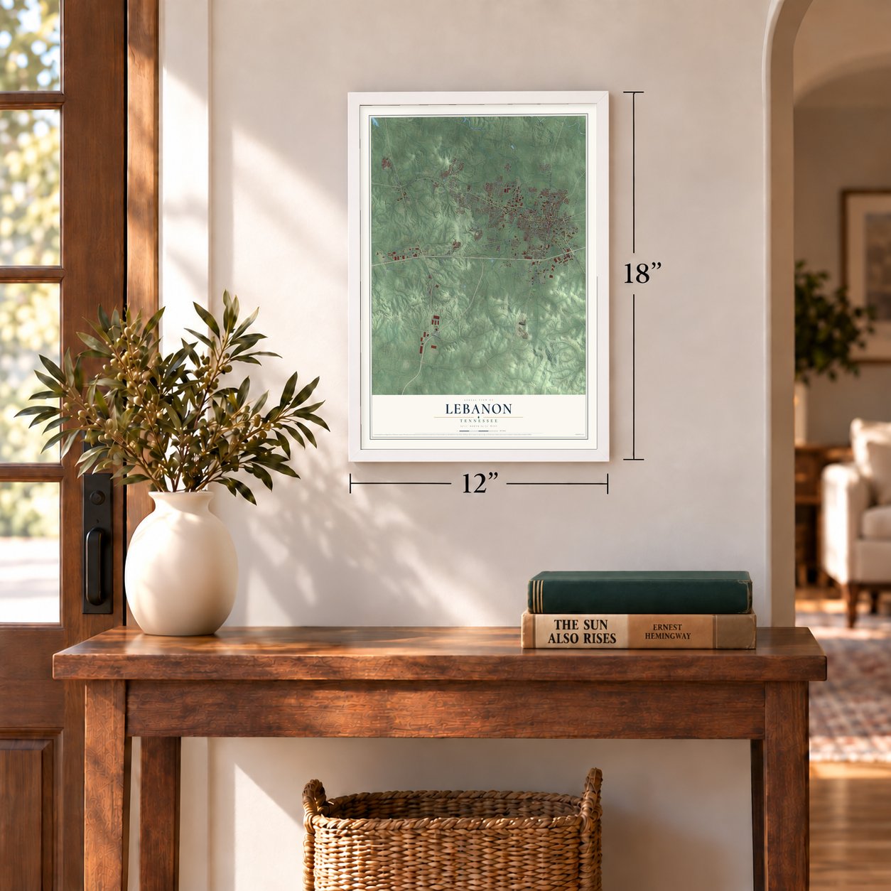
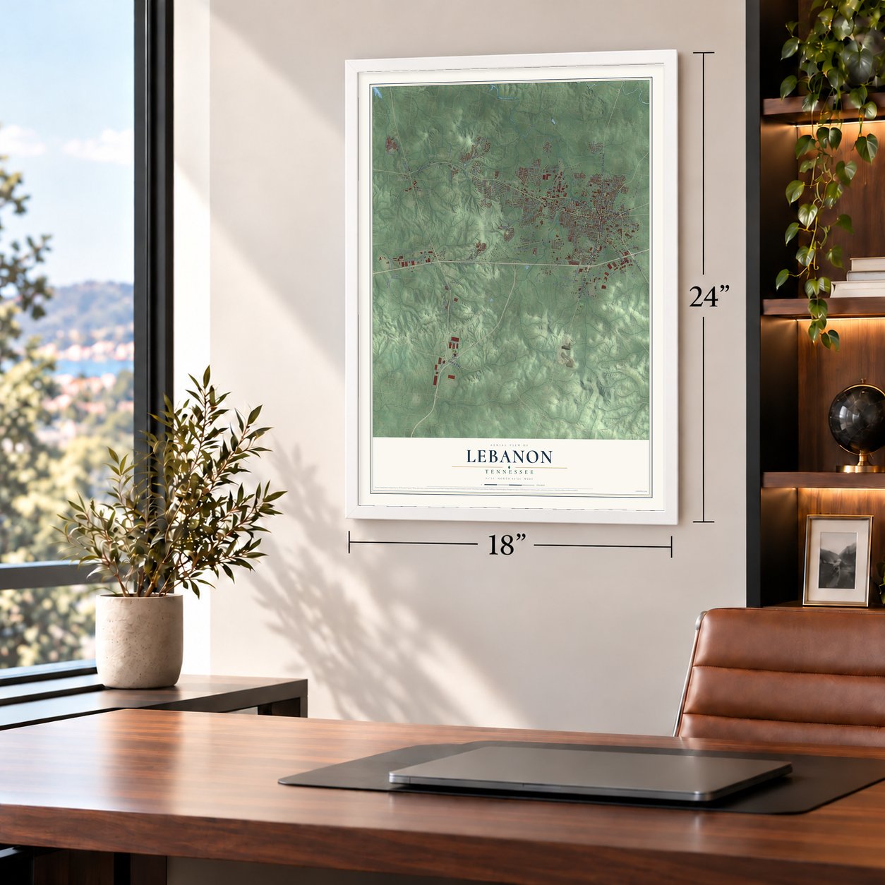
Unframed archival matte, a black wood frame or a white wood frame.
Up close
Geography Worth Displaying
This map was created using accurate cartographic data and authoritative geographic sources, including the U.S. Geological Survey and the Census Bureau. The map brings together terrain, waterways, roads, and building detail. The majority of the streets are labeled, houses are accurately depicted, and the topography is derived from government sources. Combining local data with carefully composed color and shading leads to this beautifully detailed Lebanon artwork for your wall.
Rather than simply showing street outlines, we’ve included as many of the street names as we could reasonably fit on the map while keeping their names legible. Zoom in on the high resolution preview to see exactly what’s on the map. We truly set out to create a statement piece for anyone who loves Lebanon. So whether it’s for you, or a gift for someone you love, we hope this map of Lebanon brings back fond memories.
Read the story behind this map of Lebanon, Tennessee from 2026.

About Lebanon, Tennessee
Lebanon is a city of 38,431 people and the seat of Wilson County, about 25 miles east of downtown Nashville. In 1801 the town was picked to be the seat of the county, mostly because of a large spring on the ground that became the public square, and that spring still flows today. The town took its name from the cedars of Lebanon in the Bible, and locals have long called it Cedar City for the cedars that grow thick around it.
Trains first reached Lebanon in 1871, when the Tennessee & Pacific Railroad opened a line to Nashville. That railroad is long gone, and the last of the original passenger trains pulled out of town in 1935. Passenger service came back in 2006 with the Music City Star commuter line to Nashville, now called the WeGo Star, and Lebanon sits at its eastern end.
- Cumberland University, 1842Cumberland University opened in Lebanon in 1842. More than eighty of its graduates went on to serve as representatives and senators, among them Albert Gore Sr. and Thomas Gore. Cordell Hull studied there too, and he later won the Nobel Peace Prize and led the State Department as its secretary from March 1933 until November 1944. The school's Memorial Hall joined the National Register in 1977.
- Cracker Barrel's hometownDan Evins started Cracker Barrel here in 1969, and the restaurant chain still keeps its corporate headquarters in Lebanon.
Find your street
Names on the Lebanon map
Every name below is printed on this map. Look for your street, your school, the park where you played, or the pond down the road.
Places and landmarks6
- Martha
- Cairo Bend
- Egan
- Forktown
- Leeville
- Maple Hill
Streets and roads183
- East Main Street
- South Cumberland Street
- West Main Street
- East High Street
- Murfreesboro Road
- West Baddour Parkway
- North Cumberland Street
- Lebanon Road
- Central Pike
- Hunters Point Pike
- Cainsville Road
- Hartsville Pike
- Leeville Pike
- East Division Street
- Park Avenue
- Lei Lani Drive
- South Hartmann Drive
- Franklin Road
- Hartmann Drive
- Hickory Ridge Road
- Safari Camp Road
- Tuckers Gap Road
- Eastgate Boulevard
- Coles Ferry Pike
- South Maple Street
- North Castle Heights Avenue
- Southeast Tater Peeler Road
- Carver Lane
- Five Oaks Boulevard
- Tennessee Boulevard
Show all 183 streets
- Bethlehem Road
- Castle Heights Avenue
- Bartons Creek Road
- West Spring Street
- Maple Hill Road
- Babb Drive
- Meandering Drive
- Blair Lane
- Woodside Drive
- Woodall Road
- Ridgecrest Lane
- Callis Road
- Foxglove Circle
- Cairo Bend Road
- Leeville Road
- Stumpy Lane
- Arlington Road
- Crowell Lane
- Tater Peeler Road
- Owl Drive
- Rome Pike
- Callis Lane
- Lealand Lane
- Indian Hills Road
- Lexington Drive
- Alhambra Drive
- McCown Drive
- Springfield Drive
- Oakdale Drive
- Genesco Parkway
- Chapman Drive
- Pennsylvania Avenue
- Toshiba Drive
- Hill Street
- Lake Street
- Rock Castle Drive
- Duke Drive
- Bluebird Road
- Ewing Drive
- Smith Drive
- Saratoga Drive
- Peyton Road
- Phelan Drive
- Gulf Avenue
- Jasmine Street
- Geers Drive
- Laine Road
- Oak Street
- Abbey Road
- Sparta Pike
- South College Street
- Martha Leeville Road
- Beard Avenue
- Old Horn Springs Road
- Tucker Trice Boulevard
- Winwood Drive
- Barnes Drive
- South Posey Hill Road
- West End Heights
- Winter Drive
- South Tarver Avenue
- Knoxville Avenue
- Eastland Avenue
- Martin Avenue
- Dawson Lane
- Princeton Drive
- Briarhill Road
- Derby Downs
- Old Laguardo Road West
- Wildcat Way
- Rocky Road
- Meadowlane Drive
- Edgewood Drive
- North Posey Hill Road
- Oak Hill Drive
- Lovers Lane
- Hobbs Avenue
- Slaters Drive
- Briskin Lane
- Fernwood Lane
- Ponderosa Trail
- Sullivan Bend Road
- Quita Circle
- Weatherly Drive
- East Blairmont Drive
- Manner Lane
- Somerset Drive
- Geri's Way
- Brook Trail
- Trusty Lane
- Westhill Drive
- Cook Drive
- Villa Cr
- Interstate Drive
- Wilson Avenue
- Bluefield Lane
- Old Stone Road
- Hickory Point Drive
- Bus Park Drive
- Briarcliff Drive
- Amana Drive
- Alligood Way
- June Drive
- Crest Drive
- Canal Street
- Maize Lane
- Pima Trail
- Nina Circle
- Cole Avenue
- Knox Crst
- Carthage Highway
- Maddox Simpson Parkway
- Old Murfreesboro Road West
- Bridgestone Parkway
- Keaton Street
- Westland Drive
- River Oaks Boulevard
- Vicksburg Lane
- Washington Drive
- Prowell Lake Road
- John Galt Drive
- Horn Springs Road
- Stonehenge Drive
- Hill Lake Drive
- West Gay Street
- Taryton Drive
- Elkins Drive
- Heydel Circle
- Sunny View Drive
- Jarod Way
- Arctic Drive
- Lea Circle
- Hartmann Plantation Circle
- Whispering Oaks Drive
- Village Circle
- Powell Grove Road
- Treasury Lane
- Southside Park Drive
- Woodmont Avenue
- Legends Drive
- Farmington Drive
- Standish Drive
- Reed Street
- Cloverhill Lane
- Harding Drive
- Glenway Cv
- Old Shannon Road
- Melanie Drive
- Sara Circle
- Levitron Drive
- Kyle Circle
- Glenn Circle
- Hart Lane
Names are listed as they appear on the printed map. Zoom into the product photos to find them.
The art of mapping a place
How This Map Was Made
Real places. Remarkable detail. Discover the layers that turn geographic data into a map of home.

The view from above
Aerial imagery reveals the character of the land: woodland, open fields, and the patterns of a place.

The shape of the land
Elevation data brings hills, valleys, and subtle changes in the landscape into view.

The details of home
Roads, waterways, and building footprints come together to make the map feel unmistakably local.

Geography becomes art
Considered color, shading, and typography bring the layers together in a map made for your wall.


Process illustrated with Mendon, Massachusetts. Aerial imagery: USDA NAIP. Terrain: USGS 3D Elevation Program. Map details and finished artwork: KNOWOL.
The Details
About This Print
Choose an archival matte print, or a black or white Ayous wood frame. The archival matte print is unframed.
Select your size and finish above to see the matching product image and price.
Materials & Craftsmanship
A contemporary map with the character of a classic atlas, printed on archival matte paper. Optional frames are made from Ayous wood.
Your printed map does not include the watermark shown in the full-map preview.
Shipping & Delivery
Free shipping within the United States. Every print is made to order in the USA.
Buying a gift? Add a note in your cart and we'll include it. We never put prices in the package.
Prints ship within 2 to 3 business days. Allow 7 to 10 days total from ordering for delivery. Timing may vary during holidays or periods of high order volume.
Read our shipping policy.
Returns and damaged prints
Each print is made to order. Change-of-mind refunds are not available after production.
If your print arrives damaged, misprinted or incorrect, contact support@knowol.com within 30 days of receiving it. Include your order number, photos and a description of the issue.
Read our full refund and replacement policy. For questions about your order, email support@knowol.com.
Find your town
Looking for another city?
Find a map of home in our Tennessee collection, or any town in the country.
Nearby
Maps of towns near Lebanon
Know someone from one of these towns? Their map makes a great gift.
 Gladeville
, Tennessee
From $39.99See the map
 Mount Juliet
, Tennessee
From $39.99See the map
 Tuckers Crossroads
, Tennessee
From $39.99See the map
More maps nearby: Rural Hill, Norene, Green Hill, Watertown and Castalian Springs.