
Search for another town



Free U.S. delivery 7 to 10 days after you order
Lewiston, Maine Map Art
Building by building, with labeled streets and shaded relief.
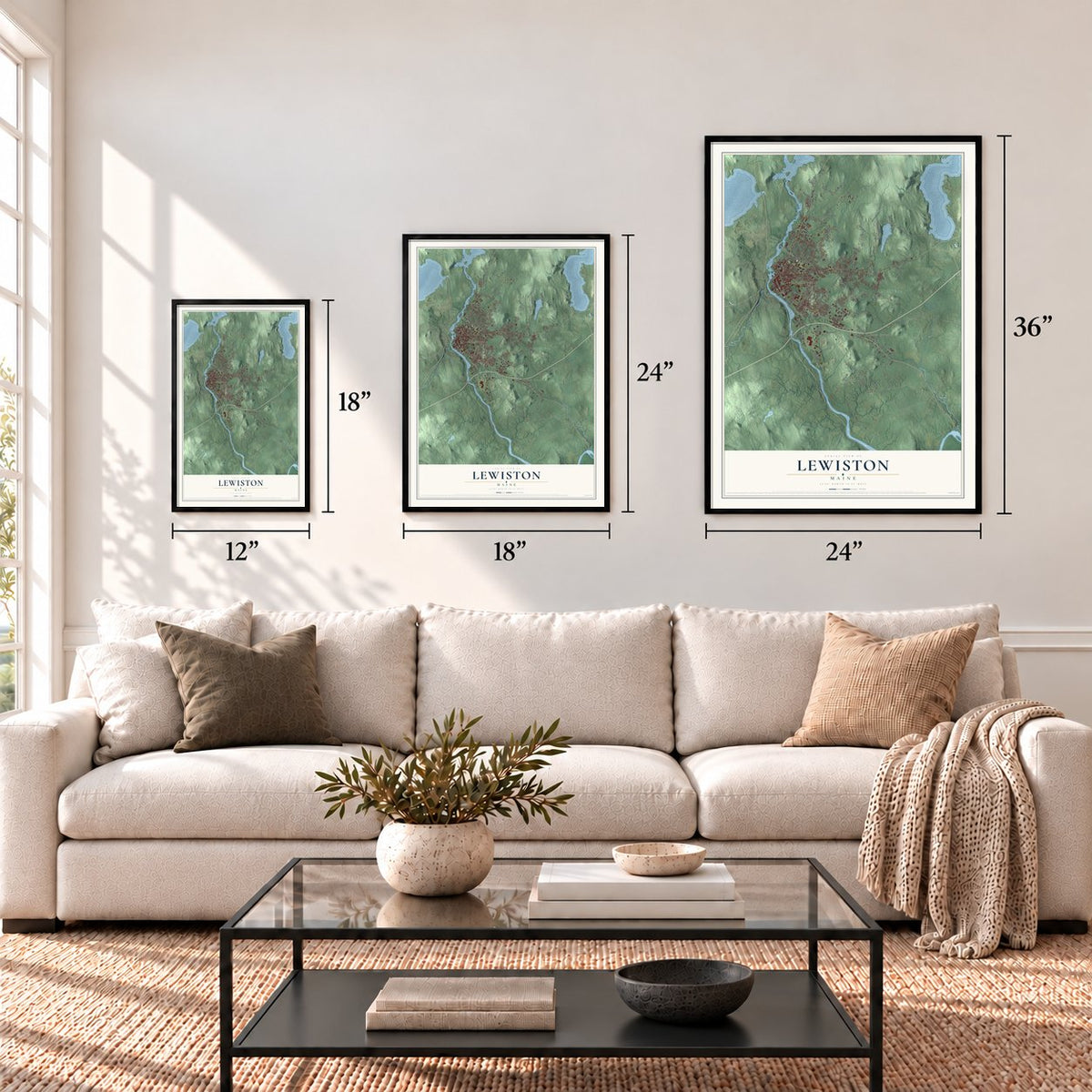
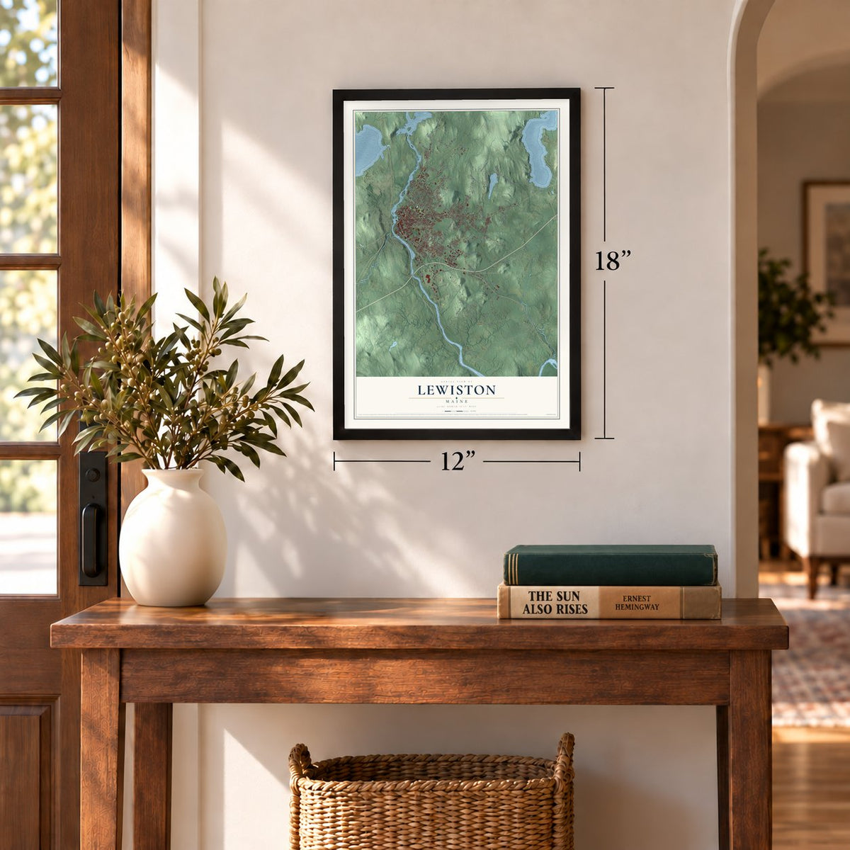
12" x 18" Archival Matte Print
A Map of Home. A Work of Art.
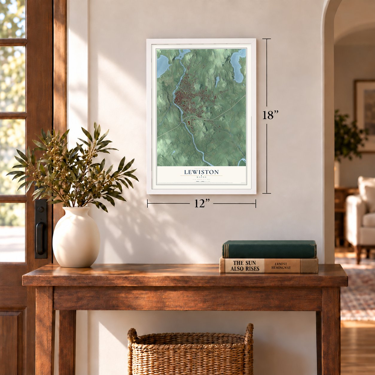
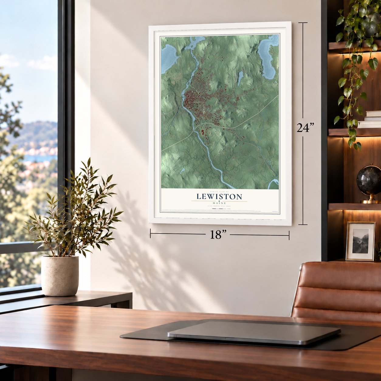
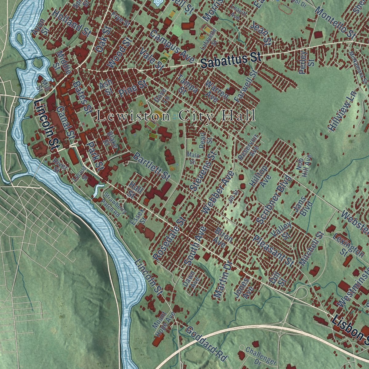
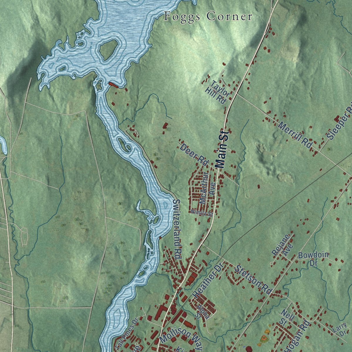
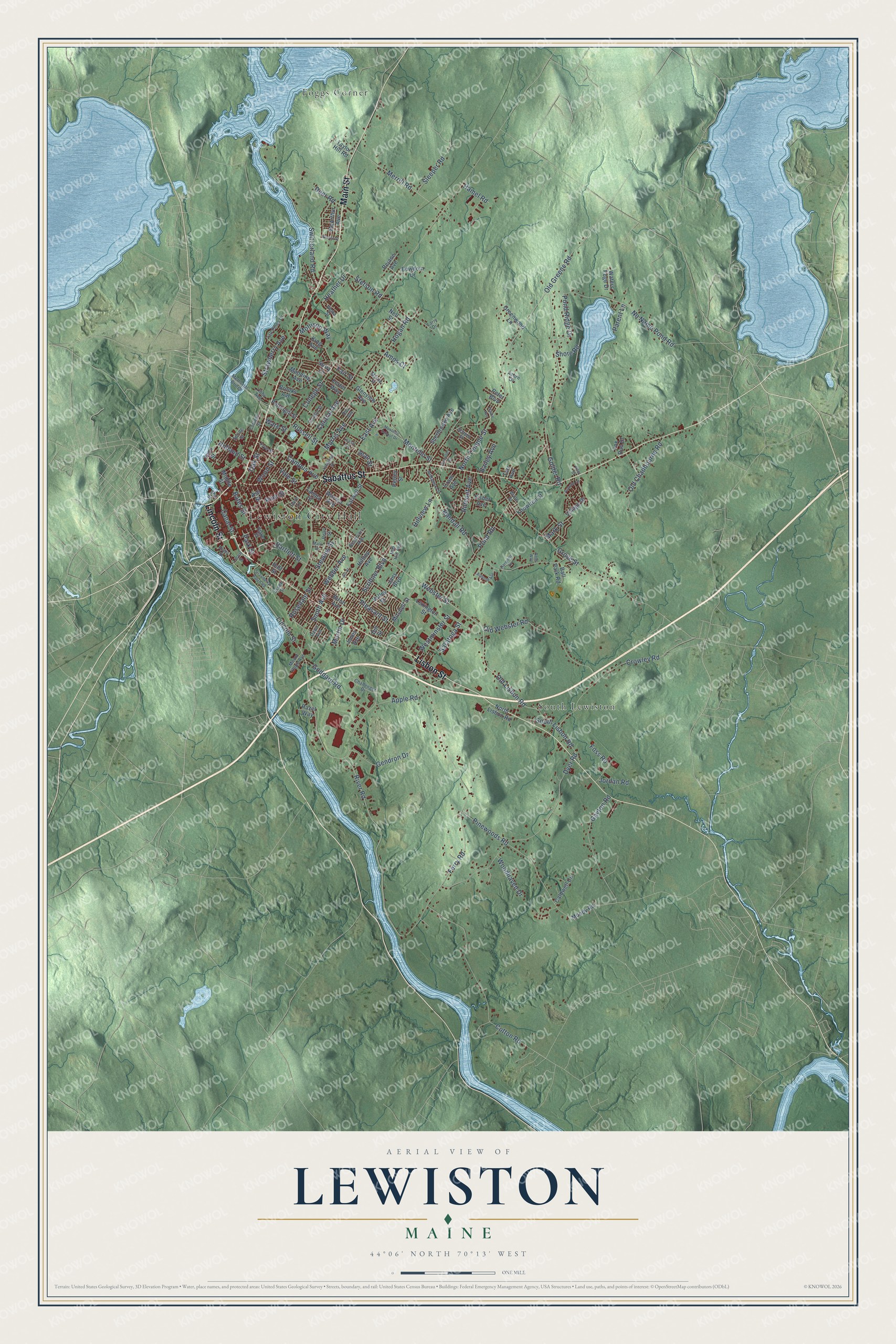
Explore Lewiston, Maine from a whole new perspective. Created using aerial imagery and detailed geographic data, this map captures Lewiston building by building, with labeled streets, familiar landmarks, and shaded topographical relief that highlights the natural contours of the landscape.
Combining modern data with the timeless character of a vintage atlas, this map is just as interesting up close as it is beautiful on the wall. Whether you grew up in Lewiston, spent memorable years there, or call it home today, this unique map is a great way to celebrate a place that means something to you. Zoom in on the preview to look for your street, and then order a print to put your memories on the wall.
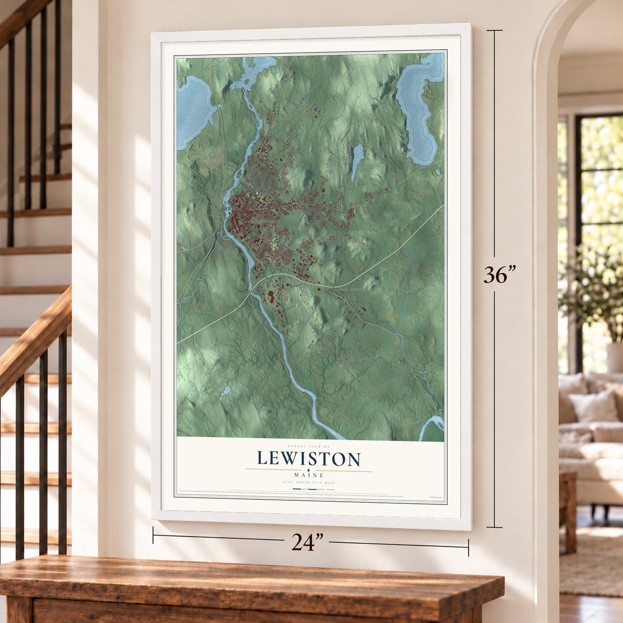
Three ways to hang it
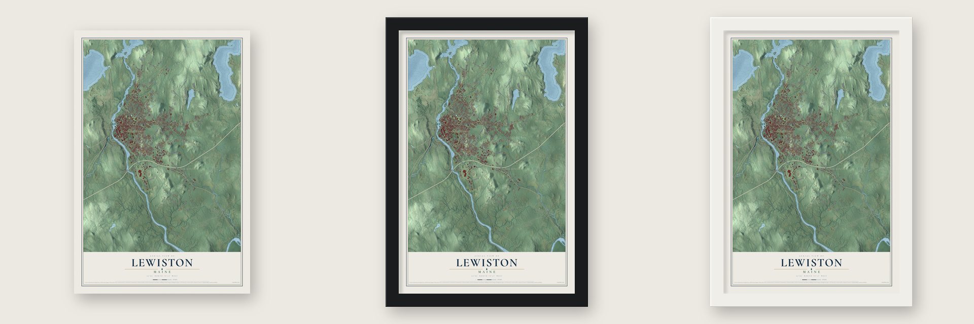
Unframed archival matte, a black wood frame or a white wood frame.
Up close
Geography Worth Displaying
This map was created using accurate cartographic data and authoritative geographic sources, including the U.S. Geological Survey (USGS) and FEMA. The map brings together terrain, waterways, roads, and building detail. The majority of the streets are labeled, houses are accurately depicted, and the topography is derived from government sources. Combining local data with carefully composed color and shading leads to this beautifully detailed Lewiston artwork for your wall.
Rather than simply showing street outlines, we’ve included as many of the street names as we could reasonably fit on the map while keeping their names legible. Zoom in on the high resolution preview to see exactly what’s on the map. We truly set out to create a statement piece for anyone who loves Lewiston. So whether it’s for you, or a gift for someone you love, we hope this map of Lewiston brings back fond memories.
Explore the full map of Lewiston, Maine and read about the local places it shows.

Find your street
Names on the Lewiston map
Every name below is printed on this map. Look for your street, your school, the park where you played, or the pond down the road.
Places and landmarks3
- Lewiston City Hall
- Foggs Corner
- South Lewiston
Streets and roads159
- Lincoln Street
- Lisbon Street
- Sabattus Street
- Main Street
- River Road
- Webster Street
- Old Lisbon Road
- Old Greene Road
- Merrill Road
- College Street
- Pond Road
- Ferry Road
- East Avenue
- Grove Street
- Randall Road
- Dyer Road
- Cotton Road
- Montello Street
- Pinewoods Road
- No Name Pond Road
- Central Avenue
- Pleasant Street
- Old Webster Road
- Stetson Road
- Russell Street
- Crowley Road
- Webber Avenue
- Switzerland Road
- Old Chadbourne Road
- Bartlett Street
Show all 159 streets
- Pine Street
- Gayton Road
- Goddard Road
- South Lisbon Road
- Bates Street
- Strawberry Avenue
- South Avenue
- Hogan Road
- Scribner Boulevard
- Rideout Avenue
- Park Street
- Gendron Drive
- Heather Drive
- Campus Avenue
- Oak Street
- Pond Ridge Drive
- North Temple Street
- Holland Street
- Apple Road
- Westminster Street
- Sleeper Road
- Shore Road
- Woodhaven Drive
- Mollison Way
- Rosedale Street
- Golder Road
- Foss Road
- Canal Street
- Fair Street
- Hillview Lane
- Stevens Street
- Martin Drive
- Wood Street
- Amos Court
- Vale Street
- Deer Road
- Saratoga Street
- Parent Lane
- Mark Street
- Hamel Road
- Morris Avenue
- Bailey Avenue
- Jordan Road
- Jean Street
- Ware Street
- Jans Boulevard
- Ash Street
- Farwell Street
- Village Drive
- Sherbrooke Avenue
- Pettingill Street
- Lexington Street
- Mitchell Street
- Greenwood Lane
- Warren Avenue
- Glenview Avenue
- Manning Avenue
- Tampa Street
- McArthur Avenue
- North Lisbon Road
- Caldwell Circle
- Waters Edge Drive
- Rejane Avenue
- Middle Street
- Knowlton Street
- Biron Avenue
- Fisher Avenue
- King Avenue
- Bowdoin Drive
- Moody Road
- Brooks Avenue
- Fortin Way
- Hilltop Avenue
- Avon Street
- Razel Way
- Valley Street
- Ball Park Road
- Dill Street
- Taylor Hill Road
- Nell Street
- Peter Boulevard
- Jones Avenue
- Fox Run Drive
- Perley Street
- Cram Avenue
- Surry Lane
- Tarr Avenue
- Hall Street
- Blake Street
- Tall Pines Drive
- Memorial Bridge
- Spring Street
- Cottage Street
- Challenger Drive
- Mill Street
- School Street
- Googin Street
- Reservoir Avenue
- Alpha Street
- Nob Hill Avenue
- Pearl Street
- Mount Hope Avenue
- Libby Avenue
- Frye Street
- River Street
- Dawn Avenue
- Acorn Drive
- Myrtle Street
- Essex Street
- Rita Avenue
- Larry Drive
- Brule Street
- Dove Lane
- Montello School Drive
- Autumn Lane
- Strawberry Patch Road
- McNamara Street
- Lafayette Street
- Garcelon Street
- Almond Avenue
- Leavitt Avenue
- Jill Street
- Locust Street
- Nimitz Street
- Harmony Lane
- Elaine Avenue
- Malo Street
- Bobs Way
- Riley Street
Names are listed as they appear on the printed map. Zoom into the product photos to find them.
About Lewiston, Maine
Lewiston is a city of 37,121 people in Androscoggin County, on the Androscoggin River. The Androscoggin, an Abenaki people, lived here first, but war with colonists and disease drove them north to New France, and by 1680 they were gone from Maine. On January 28, 1768, Moses Little and Jonathan Bagley of the Pejepscot Proprietors received a grant for this land, on the condition that fifty families settle it before June 1, 1774. They called it Lewistown. Paul Hildreth arrived as the first settler in the fall of 1770, and the town was incorporated in 1795.
For decades it was a farm town, but the falls on the river held power for industry. Local men formed the Androscoggin Falls Dam, Lock & Canal Company in 1836, and Boston investors bought in. One of them, Alexander De Witt, persuaded the industrialist Benjamin Bates to back the work. In the spring of 1850 about 400 Irish laborers, recruited around Boston by contractor Patrick O'Donnell, came to dig the canals, and the Bates Mill was finished in 1852. It stayed Maine's largest employer for three decades, and Lewiston grew from 1,801 people in 1840 to 21,701 in 1890, becoming a city in 1863.
- The patches and Little CanadaMany of the Irish canal diggers also built the Androscoggin & Kennebec Railroad, and their families lived in shanty neighborhoods known as patches. By 1854 one in four Lewiston residents was Irish, more than anywhere else in Maine. French Canadian millworkers began arriving in 1861 and settled downtown in Little Canada, which still speaks French. Le Messager, a French-language paper, started printing here in 1880.
- Bates College, opened 1855Minister and statesman Oren Burbank Cheney came from Parsonsfield to start a college, and Lewiston residents petitioned the legislature for the Maine State Seminary, which opened in 1855. It taught working people, women and Black students when other schools shut them out, and it was New England's first coeducational college. The year after Lewiston became a city, the school took the name Bates College in honor of Benjamin Bates.
- Saints Peter and PaulAt the start of the twentieth century, city leaders set out to build a cathedral that would draw the Roman Catholic Diocese of Portland to Lewiston. Builders broke ground on the Church of Saints Peter and Paul in 1905 and did not finish until 1938, paying for it mostly with thousands of small gifts from local people. It is the largest Catholic church in Maine and the state's only basilica.
- The Kora TempleThe Kora Shrine was organized in 1891 and first met in a Masonic temple on Lisbon Street. Between 1908 and 1910 its members built the Kora Temple on Sabattus Street, which became the largest home of any fraternal group in Maine.
- Ali and Liston in 1965Muhammad Ali beat Sonny Liston in a disputed fight in Miami Beach in February 1964, and the World Boxing Council called for a rematch right away. The heavyweight title bout was held in Lewiston in May 1965. Sixty years later the city unveiled a statue of Ali to mark the fight.
Keep exploring Maine
Lewiston is one of 536 Maine towns we've mapped. Every dot on the map is a print of its own.
The search covers every state, Maine first.
Near Lewiston
Order 2 or more town maps and save 10%. Shown in the size and finish you picked above, so they hang as a set.
- Auburn 12" x 18" / Archival Matte Print $39.99
- Sabattus 12" x 18" / Archival Matte Print $39.99
- Lisbon 12" x 18" / Archival Matte Print $39.99

More maps nearby: Wales, Greene, Lisbon Falls, Minot and Durham.
The art of mapping a place
How This Map Was Made
Real places. Remarkable detail. Discover the layers that turn geographic data into a map of home.

The view from above
Aerial imagery reveals the character of the land: woodland, open fields, and the patterns of a place.

The shape of the land
Elevation data brings hills, valleys, and subtle changes in the landscape into view.

The details of home
Roads, waterways, and building footprints come together to make the map feel unmistakably local.

Geography becomes art
Considered color, shading, and typography bring the layers together in a map made for your wall.


Process illustrated with Mendon, Massachusetts. Aerial imagery: USDA NAIP. Terrain: USGS 3D Elevation Program. Map details and finished artwork: KNOWOL.
The Details
About This Print
Choose an archival matte print, or a black or white Ayous wood frame. The archival matte print is unframed.
Select your size and finish above to see the matching product image and price.
Materials & Craftsmanship
A contemporary map with the character of a classic atlas, printed on archival matte paper. Optional frames are made from Ayous wood.
Your printed map does not include the watermark shown in the full-map preview.
Shipping & Delivery
Free shipping within the United States. Every print is made to order in the USA.
Buying a gift? Add a note in your cart and we'll include it. We never put prices in the package.
Prints ship within 2 to 3 business days. Allow 7 to 10 days total from ordering for delivery. Timing may vary during holidays or periods of high order volume.
Read our shipping policy.
Returns and damaged prints
Each print is made to order. Change-of-mind refunds are not available after production.
If your print arrives damaged, misprinted or incorrect, contact support@knowol.com within 30 days of receiving it. Include your order number, photos and a description of the issue.
Read our full refund and replacement policy. For questions about your order, email support@knowol.com.