
Search for another town





Free U.S. delivery 7 to 10 days after you order
Longmont, Colorado Map Art
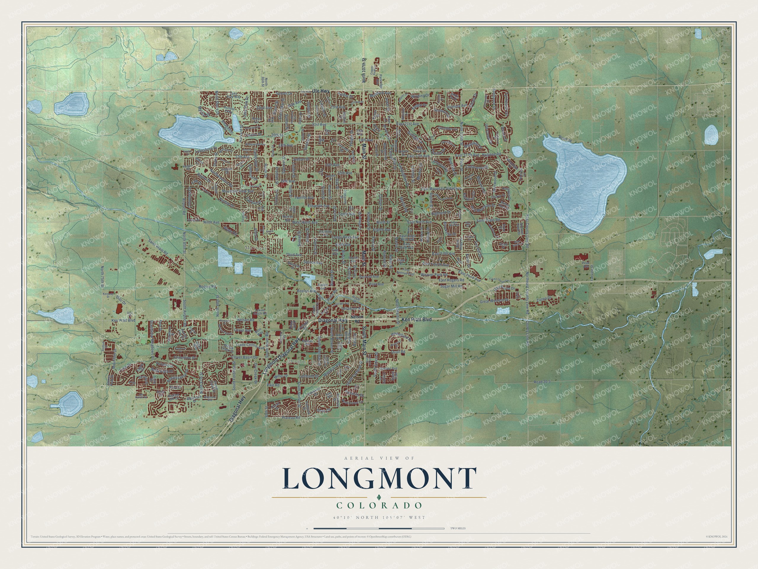
A new map of Longmont, Colorado, made in 2026 and printed to order on thick archival matte paper.
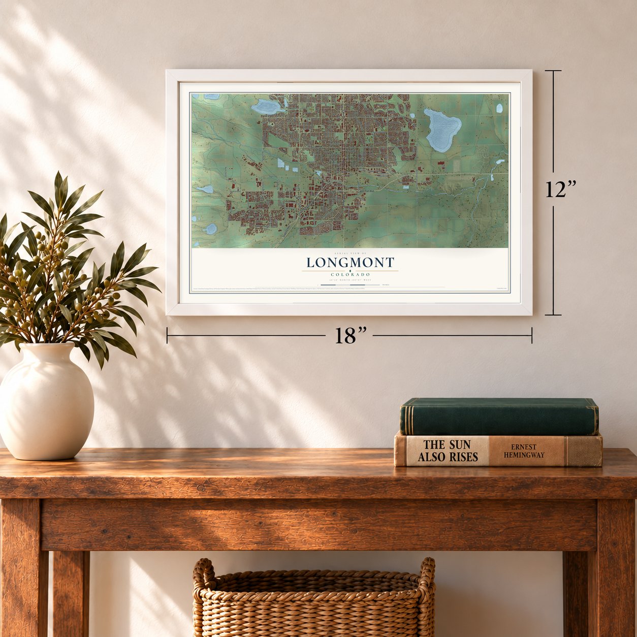
12" x 18" Archival Matte Print
A Map of Home. A Work of Art.
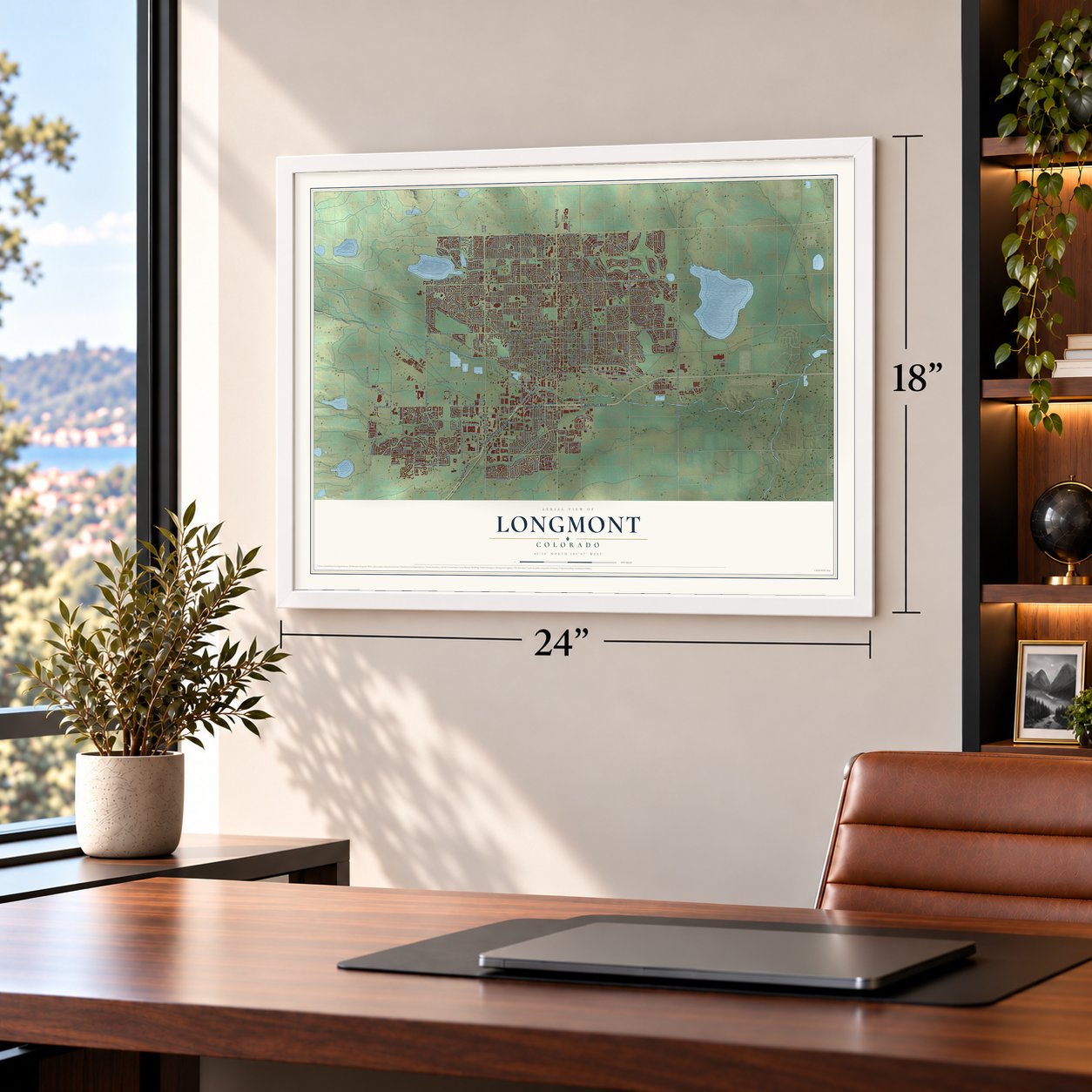
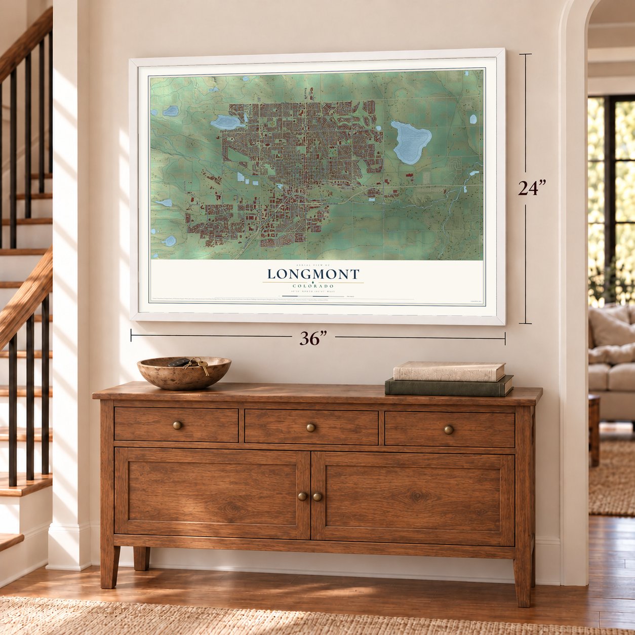
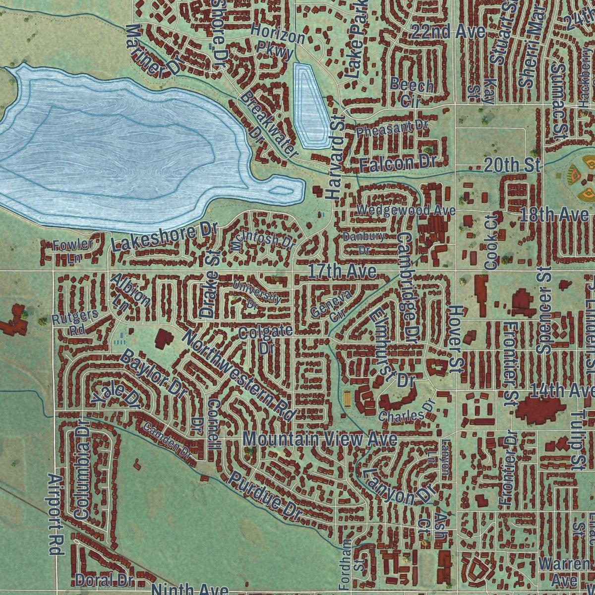
Explore Longmont, Colorado from a whole new perspective. Created using aerial imagery and detailed geographic data, this map captures Longmont building by building, with labeled streets, familiar landmarks, and shaded topographical relief that highlights the natural contours of the landscape.
Combining modern data with the timeless character of a vintage atlas, this map is just as interesting up close as it is beautiful on the wall. Whether you grew up in Longmont, spent memorable years there, or call it home today, this unique map is a great way to celebrate a place that means something to you. Zoom in on the preview to look for your street, and then order a print to put your memories on the wall.
Three ways to hang it
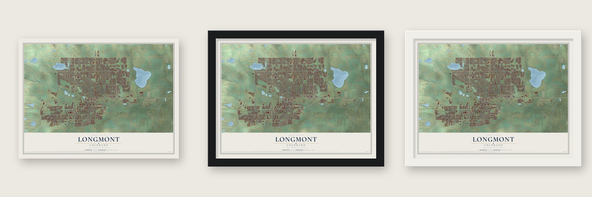
Unframed archival matte, a black wood frame or a white wood frame.
Up close
Geography Worth Displaying
This map was created using accurate cartographic data and authoritative geographic sources, including the U.S. Geological Survey and the Census Bureau. The map brings together terrain, waterways, roads, and building detail. The majority of the streets are labeled, houses are accurately depicted, and the topography is derived from government sources. Combining local data with carefully composed color and shading leads to this beautifully detailed Longmont artwork for your wall.
Rather than simply showing street outlines, we’ve included as many of the street names as we could reasonably fit on the map while keeping their names legible. Zoom in on the high resolution preview to see exactly what’s on the map. We truly set out to create a statement piece for anyone who loves Longmont. So whether it’s for you, or a gift for someone you love, we hope this map of Longmont brings back fond memories.
Read the story behind this map of Longmont, Colorado from 2026.
About Longmont, Colorado
Longmont is a city of 98,885 people in Boulder County, with its eastern edge reaching into Weld County. It takes its name from Longs Peak, the mountain in clear view of town, joined to mont, the French word for mountain. In 1871 a group from Chicago founded it as the Chicago-Colorado Colony, with Robert Collyer as president, and used money from selling memberships to buy the land.
The colony was the first planned town in Boulder County, and its streets were laid out in a grid covering one square mile. A post office opened on April 14, 1873, and farming took off after the Colorado Central Railroad built its line north from Boulder in 1877. Longmont was incorporated as a town on November 15, 1885.
- Colorado's first library, 1871Elizabeth Rowell Thompson started Colorado's first library here in 1871, but within about a year its 300 books were lost. A single-story Carnegie library opened in 1913 and served until August 7, 1972, when about 22,000 books had crowded it. A week later, the new library built next door opened. The Longmont Carnegie Library joined the National Register in 1992.
- The Klan voted out in 1927In a 1925 election the Ku Klux Klan won control of the City Council. Klan members paraded on Main Street in their robes, and the council started building Chimney Rock Dam above Lyons. Voters removed them in the 1927 election, and the Klan's hold faded. The dam was given up as impractical, and its foundations can still be seen in the St. Vrain River.
- Firefighters since 1879Longmont's firefighters trace their history to a company formed in 1879, known as the W. A. Buckingham Hook & Ladder Company, and the department took its present form in 1908. Station 1, built in 1907, housed the department until 1971 and joined the National Register as the Longmont Fire Department in 1985.
- Turkey hot dogs from Main StreetIn 1950 Longmont Foods built a large plant on southern Main Street, where trucks unloaded live turkeys. Its turkey products, including turkey hot dogs, sold across the country. Butterball later bought the company, and the plant closed in 2011.
Find your street
Names on the Longmont map
Every name below is printed on this map. Look for your street, your school, the park where you played, or the pond down the road.
Places and landmarks2
- Dominion
- Marnett
Streets and roads338
- Diagonal Highway
- Longmont Diagonal Highway
- Ken Pratt Boulevard
- Ute Highway
- Main Street
- South Main Street
- Pike Road
- Airport Road
- Deerwood Drive
- Renaissance Drive
- Sundance Drive
- Northwestern Road
- East 21st Avenue
- 21st Avenue
- Lakeshore Drive
- East 17th Avenue
- 14th Avenue
- 17th Avenue
- North 85th Street
- Emery Street
- Rogers Road
- First Avenue
- Ninth Street
- West Ninth Avenue
- East Ninth Avenue
- Hygiene Road
- South Coffman Street
- Plateau Road
- Road 20.5
- Allen Drive
Show all 338 streets
- Mumford Avenue
- Mountain View Avenue
- East County Line Road
- Northeast County Line Road
- Hover Street
- Ninth Avenue
- Nelson Road
- Alpine Street
- Gay Street
- North 119th Street
- Collyer Street
- Pace Street
- Clover Basin Drive
- Francis Street
- Third Avenue
- East Third Avenue
- 15th Avenue
- Lashley Street
- Lincoln Street
- 95th Street
- South Hover Road
- Bowen Street
- Atwood Street
- Longs Peak Avenue
- North 75th Street
- Sunset Street
- South Sunset Street
- Kimbark Street
- Eleventh Avenue
- Spencer Street
- Pratt Street
- Terry Street
- Grant Street
- East Mountain View Avenue
- Harvard Street
- Boston Avenue
- Sumner Street
- Vivian Street
- Bross Street
- 23rd Avenue
- Dry Creek Drive
- South Fordham Street
- Sixth Avenue
- Baker Street
- Coffman Street
- Tulip Street
- Judson Street
- Road 28
- South Martin Street
- Tenth Avenue
- Winding Drive
- 19th Avenue
- Martin Street
- East Fourth Avenue
- Cedarwood Drive
- East Fifth Avenue
- Olympia Avenue
- East Rogers Road
- Quail Road
- South Bowen Street
- Twelfth Avenue
- Great Western Drive
- South Emery Street
- Eighth Avenue
- South Airport Road
- Whitehall Drive
- Bella Vista Drive
- Fox Hill Drive
- 24th Avenue
- Saint Vrain Road
- Missouri Avenue
- County Line Road
- 16th Avenue
- Hilltop Drive
- 18th Avenue
- Sugar Mill Road
- Linden Street
- Purdue Drive
- North Shore Drive
- Stuart Street
- Sumac Street
- South Sherman Street
- Price Road
- Frontier Street
- Second Avenue
- Tyrrhenian Circle
- Lefthand Drive
- Columbia Drive
- Spruce Avenue
- Delaware Avenue
- Red Mountain Drive
- Baylor Drive
- North 87th Street
- Venice Street
- Zlaten Drive
- Sherri Mar Street
- Red Oak Drive
- Mountain Drive
- Weaver Park Road
- Cambridge Drive
- Sunset Drive
- Sunlight Drive
- Grandview Meadows Drive
- Yeager Drive
- Wheatfield Drive
- Ute Creek Drive
- Monarch Drive
- 22nd Avenue
- East 17 Th Avenue
- Fall River Circle
- Onyx Circle
- Centennial Drive
- Lamplighter Drive
- Falcon Drive
- Judson Drive
- Trade Centre Avenue
- North 89th Street
- Turin Drive
- Martin Road
- Lake Park Drive
- Aspen Street
- Wade Road
- Disc Drive
- Parker Drive
- Florentine Drive
- Steppe Drive
- Calais Drive
- Iron Horse Drive
- Meeker Drive
- Kane Drive
- Jewel Street
- Highland Drive
- Brookside Drive
- Lanyon Drive
- Drake Street
- Elmhurst Drive
- Mariner Drive
- Miller Drive
- Tenacity Drive
- Preston Drive
- Ceran Avenue
- 20th Street
- Karsh Drive
- Yale Drive
- North 107th Street
- Heather Hill Circle
- Maplewood Drive
- South Pratt Parkway
- Button Rock Drive
- Fourth Avenue
- Fifth Avenue
- Glenarbor Circle
- Quebec Avenue
- Neon Forest Circle
- East Longs Peak Avenue
- Meadow Street
- Corey Street
- Lake Park Way
- Creekside Drive
- Clover Creek Drive
- Santa Fe Drive
- Red Cloud Road
- Summer Hawk Drive
- Duchess Drive
- Warren Avenue
- Rider Ridge Drive
- Kansas Avenue
- Iowa Avenue
- South Francis Street
- Prairie Fire Circle
- Kay Street
- Horizon Parkway
- First Avenue East
- Amethyst Drive
- Portofino Drive
- Cornell Drive
- Parkridge Avenue
- Cinnamon Street
- Harlequin Drive
- Whistler Drive
- Eagan Circle
- Beech Circle
- Meeker Street
- Dorothy Drive
- Pintail Drive
- Antero Drive
- Squires Court
- American Road
- Moonlight Drive
- Alaska Avenue
- 20th Avenue
- Sandpoint Drive
- Sicily Circle
- Breakwater Drive
- Dexter Drive
- Meadow Drive
- Stones Peak Drive
- Bent Way
- Daley Drive
- Princess Drive
- Parkview Drive
- East Sixth Avenue
- Wasach Drive
- Frontier Drive
- Colgate Drive
- Fairview Street
- Korte Parkway
- Carolina Avenue
- Snowberry Street
- North 95th Street
- Estes Lane
- Celestial Lane
- Glenneyre Drive
- Sicily Drive
- Willow Creek Drive
- Aspen Trail
- Chukar Drive
- Lykins Gulch Road
- Country Lane
- Alder Way
- Frontage Road
- Reed Place
- Forbes Place
- Donovan Drive
- Doral Drive
- Riley Drive
- Emery Drive
- Albion Lane
- Lilac Street
- Peck Drive
- Cook Court
- Logan Street
- Royal Street
- Vireo Court
- Orion Place
- Carr Drive
- Peak Avenue
- Ash Court
- Fowler Lane
- Sugar Mill Avenue
- Juniper Street
- Independence Drive
- Fordham Street
- Tyrrhenian Drive
- Peppler Drive
- Hackberry Circle
- Lochmore Drive
- Clarendon Drive
- Wedgewood Avenue
- South Lincoln Street
- Windflower Drive
- Charles Drive
- South Gay Drive
- Nelson Park Drive
- Geneva Circle
- Bountiful Drive
- Kennedy Drive
- Pheasant Drive
- Pasque Drive
- Sherman Drive
- Redbud Circle
- Colorado Avenue
- McIntosh Drive
- Alta Street
- Crisman Drive
- Hays Circle
- River Road
- Old Ranch Road
- Bluestem Avenue
- James Street
- Rutgers Road
- Henry Court
- Rees Court
- Carter Lane
- Tucson Court
- Copper Peak Lane
- Ruby Way
- Disc Place
- Sherman Street
- Twin Peaks Mall
- Elliott Street
- Widgeon Drive
- Hawthorne Circle
- Danbury Drive
- South Kimbark Street
- Flemming Drive
- Staghorn Drive
- Fox Hill Country Club
- Sunrise Drive
- Mount Sneffels Street
- Bluegrass Drive
- University Drive
- Crawford Circle
- James Circle
- White Feather Drive
- Camden Drive
- Ashcroft Drive
- Retreat Circle
- Morgan Road
- Woodside Road
- Gay Circle
- Kristy Court
- Fox Street
- Skyline Lane
- Ashford Drive
- Lanyon Lane
- Riviera Place
- Elk Place
Names are listed as they appear on the printed map. Zoom into the product photos to find them.
The art of mapping a place
How This Map Was Made
Real places. Remarkable detail. Discover the layers that turn geographic data into a map of home.

The view from above
Aerial imagery reveals the character of the land: woodland, open fields, and the patterns of a place.

The shape of the land
Elevation data brings hills, valleys, and subtle changes in the landscape into view.

The details of home
Roads, waterways, and building footprints come together to make the map feel unmistakably local.

Geography becomes art
Considered color, shading, and typography bring the layers together in a map made for your wall.


Process illustrated with Mendon, Massachusetts. Aerial imagery: USDA NAIP. Terrain: USGS 3D Elevation Program. Map details and finished artwork: KNOWOL.
The Details
About This Print
Choose an archival matte print, or a black or white Ayous wood frame. The archival matte print is unframed.
Select your size and finish above to see the matching product image and price.
Materials & Craftsmanship
A contemporary map with the character of a classic atlas, printed on archival matte paper. Optional frames are made from Ayous wood.
Your printed map does not include the watermark shown in the full-map preview.
Shipping & Delivery
Free shipping within the United States. Every print is made to order in the USA.
Buying a gift? Add a note in your cart and we'll include it. We never put prices in the package.
Prints ship within 2 to 3 business days. Allow 7 to 10 days total from ordering for delivery. Timing may vary during holidays or periods of high order volume.
Read our shipping policy.
Returns and damaged prints
Each print is made to order. Change-of-mind refunds are not available after production.
If your print arrives damaged, misprinted or incorrect, contact support@knowol.com within 30 days of receiving it. Include your order number, photos and a description of the issue.
Read our full refund and replacement policy. For questions about your order, email support@knowol.com.
Find your town
Looking for another city?
Find a map of home in our Colorado collection, or any town in the country.
Nearby
Maps of towns near Longmont
Know someone from one of these towns? Their map makes a great gift.
 Niwot
Niwot, Colorado
From $39.99See the map
 Mead
Mead, Colorado
From $39.99See the map
 Frederick
, Colorado
From $39.99See the map
More maps nearby: Firestone, Leyner, Gunbarrel, Erie and Lyons.