
Search for another town





Free U.S. delivery 7 to 10 days after you order
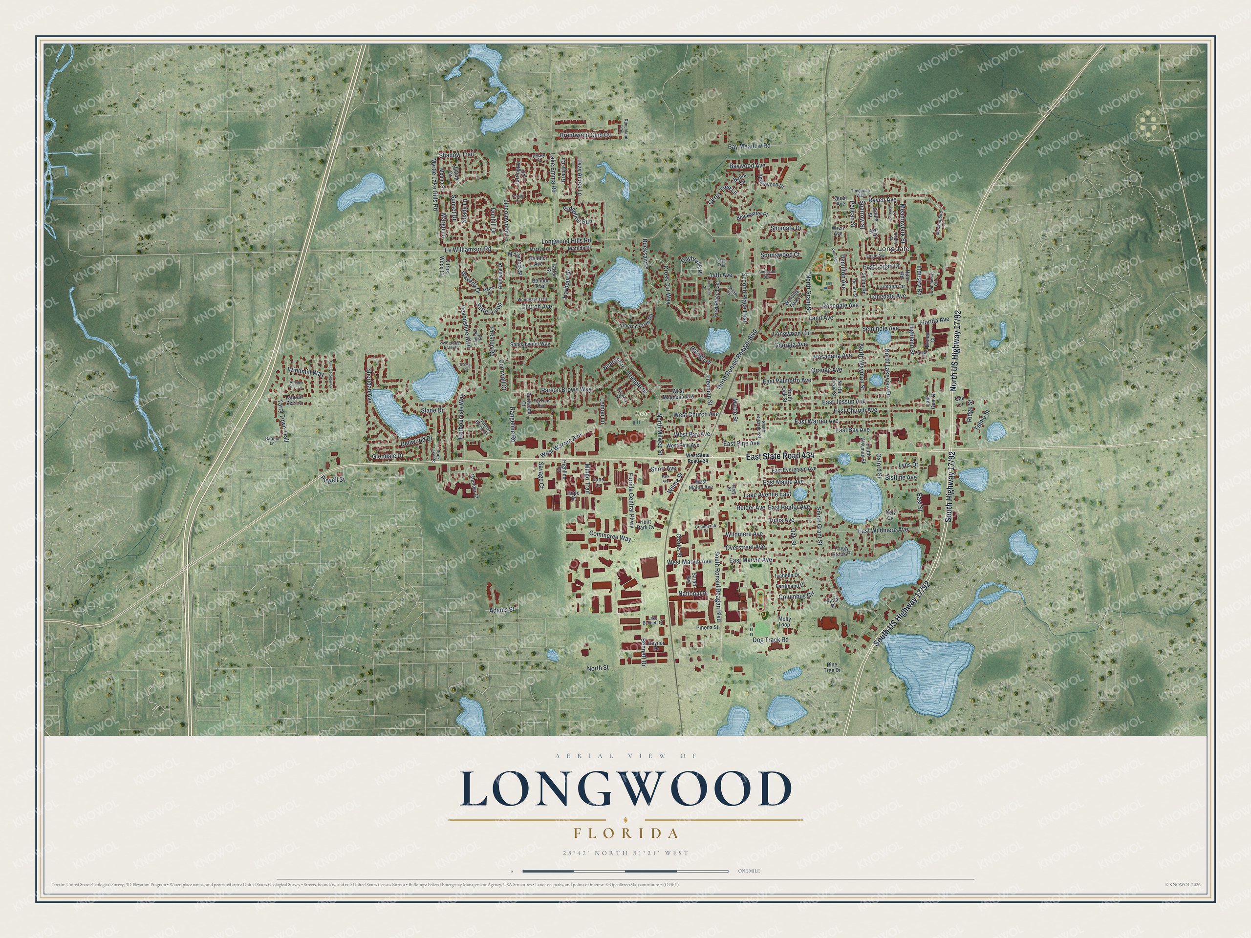
Longwood, Florida Map Art
Building by building, with labeled streets and shaded relief.
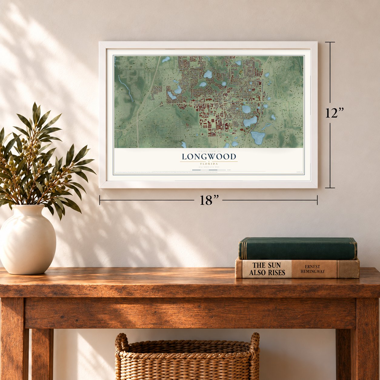
12" x 18" Archival Matte Print
A Map of Home. A Work of Art.
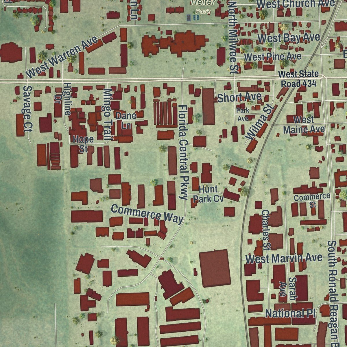
Explore Longwood, Florida from a whole new perspective. Created using aerial imagery and detailed geographic data, this map captures Longwood building by building, with labeled streets, familiar landmarks, and shaded topographical relief that highlights the natural contours of the landscape.
Combining modern data with the timeless character of a vintage atlas, this map is just as interesting up close as it is beautiful on the wall. Whether you grew up in Longwood, spent memorable years there, or call it home today, this unique map is a great way to celebrate a place that means something to you. Zoom in on the preview to look for your street, and then order a print to put your memories on the wall.
Three ways to hang it
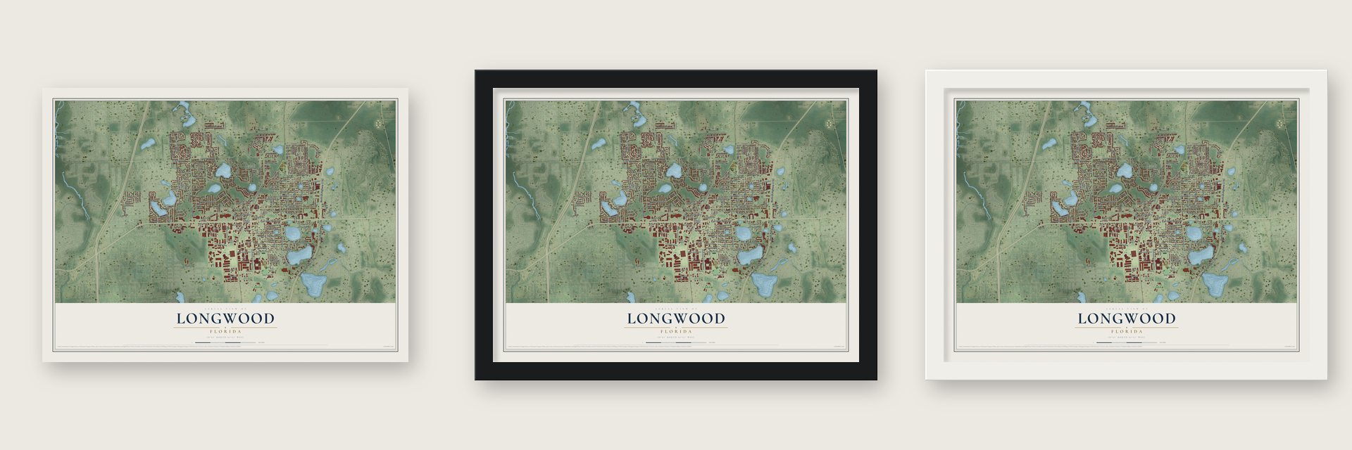
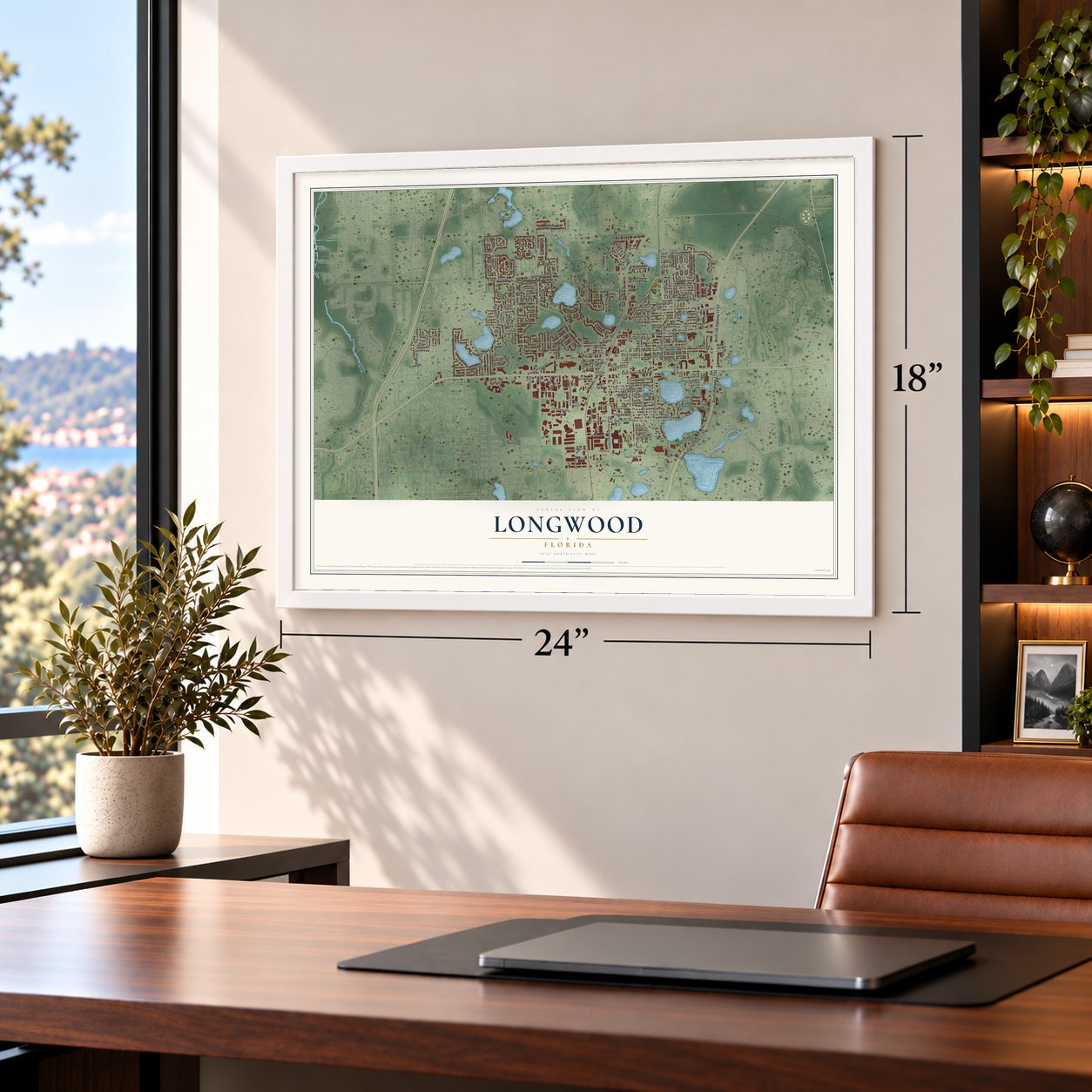
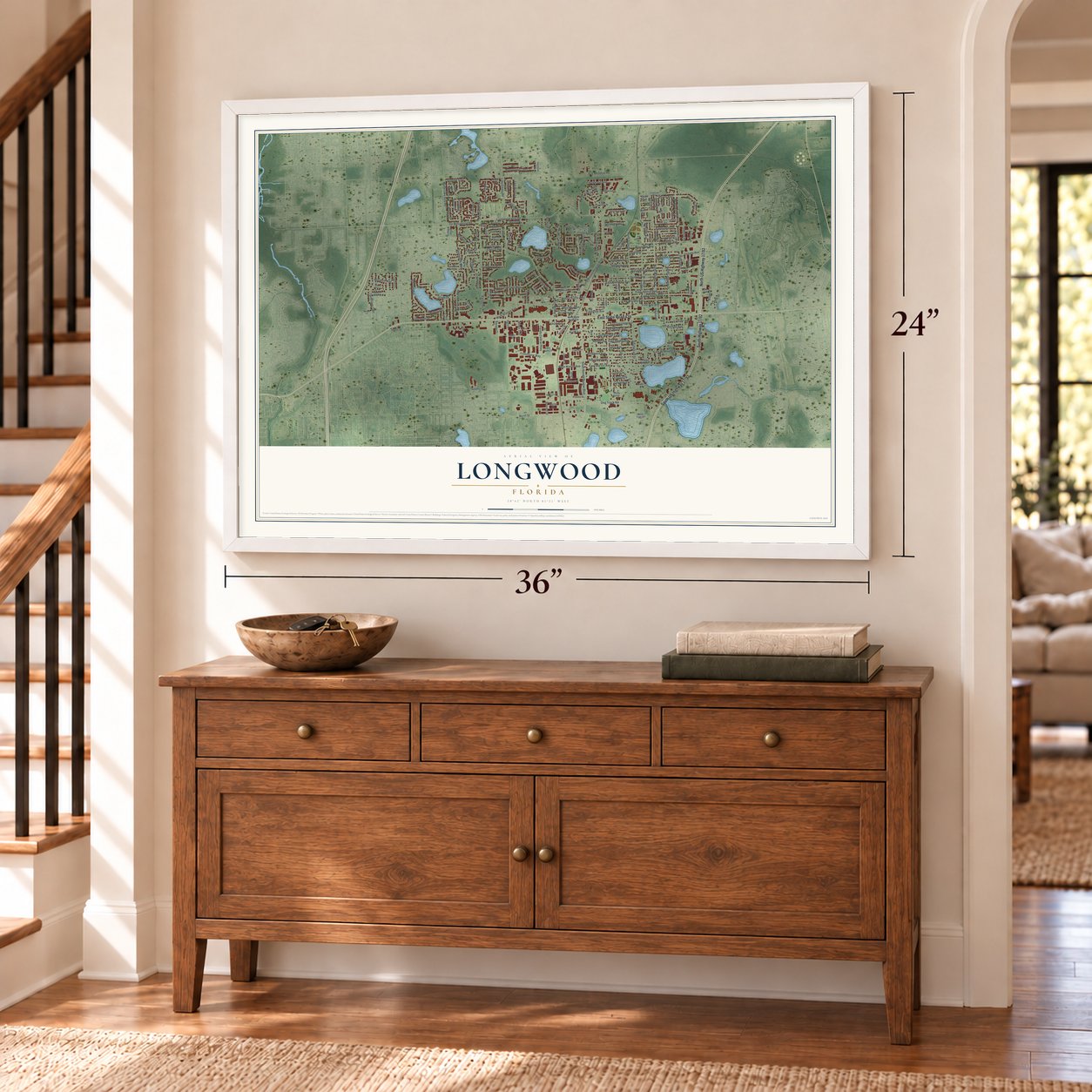
Unframed archival matte, a black wood frame or a white wood frame.
Up close
Geography Worth Displaying
This map was created using accurate cartographic data and authoritative geographic sources, including the U.S. Geological Survey (USGS) and FEMA. The map brings together terrain, waterways, roads, and building detail. The majority of the streets are labeled, houses are accurately depicted, and the topography is derived from government sources. Combining local data with carefully composed color and shading leads to this beautifully detailed Longwood artwork for your wall.
Rather than simply showing street outlines, we’ve included as many of the street names as we could reasonably fit on the map while keeping their names legible. Zoom in on the high resolution preview to see exactly what’s on the map. We truly set out to create a statement piece for anyone who loves Longwood. So whether it’s for you, or a gift for someone you love, we hope this map of Longwood brings back fond memories.
Explore the full map of Longwood, Florida and read about the local places it shows.

Find your street
Names on the Longwood map
Every name below is printed on this map. Look for your street, your school, the park where you played, or the pond down the road.
Places and landmarks2
- Longdale
- Reiter Park
Streets and roads197
- East State Road 434
- Raven Avenue
- Ee Williamson Road
- Sparrow Street
- Meadowlark Street
- West Church Avenue
- North Milwee Street
- North Ronald Reagan Boulevard
- South Grant Street
- East Church Avenue
- South Ronald Reagan Boulevard
- North Grant Street
- Orange Avenue
- Rangeline Road
- Longwood Hills Road
- East Wildmere Avenue
- West Warren Avenue
- Sheridan Avenue
- East Warren Avenue
- Georgia Avenue
- Florida Central Parkway
- East Bay Avenue
- Bennett Drive
- Church Avenue
- Dog Track Road
- East Palmetto Avenue
- Columbus Circle
- North Street
- Harbour Drive
- Slade Drive
Show all 197 streets
- Sunset Drive
- Wildmere Avenue
- Longdale Avenue
- Pasadena Avenue
- East Jessup Avenue
- Lazy Acres Lane
- Bucksaw Place
- Lake Emma Road
- North Wayman Street
- Overstreet Avenue
- East Maine Avenue
- Second Place East
- Land Avenue
- East Marvin Avenue
- Rosedale Avenue
- Seminole Avenue
- Myrtle Lake Hills Road
- Freeman Street
- Devonshire Boulevard
- Parson Brown Way
- North Lakeview Drive
- Harbour Isle Way
- Bay Meadow Road
- Longwood Circle
- Dunhill Drive
- Tarry Town Trail
- East Reider Avenue
- Wilma Street
- Oxford Street
- East Logan Drive
- Lincolnwood Lane
- Lake Avenue East
- East Street
- Tullis Avenue
- Brentwood Club Cv
- Highland Street
- East Pine Avenue
- Citrus Tree Lane
- Ridgeline Run
- Baywood Avenue
- Preston Road
- Cross Cut Way
- Dellwood Drive
- Shadow Trail
- Margo Lane
- Shomate Drive
- Sutter Loop
- West Marvin Avenue
- Talmo Street
- Ridge Street
- Waverly Drive
- West Bay Avenue
- 14th Avenue
- Daybreak Place
- Oak Street
- Powell Street
- Florida Avenue
- Hamilton Avenue
- Commerce Way
- Short Avenue
- Windmill Way
- Springwood Court
- Industry Road
- Bearss Circle
- National Place
- Balogh Place
- Bistline Avenue
- Lyns Drive
- Glendale Drive
- Savage Court
- Pelican Street
- Mingo Trail
- Temple Drive
- Adams Street
- Cornwall Court
- Reider Avenue
- Myrtle Street
- Shady Lane
- Lemon Lane
- Tartan Street
- Sandalwood Way
- Tiberon Cove Road
- Grange Circle
- East Evergreen Avenue
- Torrington Circle
- North Credo Street
- Islander Court
- Lormann Circle
- Alameda Drive
- Burlwood Court
- Winding Oak Lane
- West Magnolia Avenue
- South Wayman Street
- Bahia Circle
- Foggy Brook Place
- Charles Street
- First Place East
- Matilda Place
- North Oak Street
- Applewood Drive
- West Pine Avenue
- Molly Loop
- Mound Street
- Ferdinand Drive
- Hope Street
- McClintock Street
- Heather Avenue
- Blackwater Place
- Oak Lane
- Wren Avenue
- Selma Road
- West Maine Avenue
- Hunt Road
- Hilltop Drive
- Bonnie Trail
- Lake Gem Drive
- Tappan Zee Lane
- Isabella Drive
- Citrus Wood Court
- Bomar Court
- Highline Drive
- Oriole Street
- Sarah Avenue
- Pineda Street
- Poyner Drive
- Hunt Park Cv
- Quail Avenue
- Dane Lane
- Pine Tree Drive
- Jay Street
- Ketz Cv
- Pinta Place
- Eagle Avenue
- South Oleander Street
- Autumn Brook Circle
- Rock Lake Road
- Chelsea Road
- Woodgate Trail
- Valencia Court
- Commerce Circle
- Sweetbriar Branch
- Garden Lane
- Timocuan Way
- Canary Street
- Fig Tree Run
- Mockingbird Lane
- Robin Court
- Maraval Court
- Lake Bennett Court
- Commerce Street
- Marin Drive
- Ranchland Trail
- Reams Street
- Bryan Court
- Hillary Court
- Hardy Street
- West State Road 434
- Thames Circle
- Twelfth Avenue
- Sleepy Hollow Cv
- Norfolk Court
- Eagle Trail
- Corporate Way
- Lommler Street
- Park Avenue
- Bear Boulevard
- Wooden Shoe Lane
Names are listed as they appear on the printed map. Zoom into the product photos to find them.
About Longwood, Florida
Longwood is a city of 15,087 people in Seminole County, in the Orlando metropolitan area. Lumber drove its early growth. Peter Demens, born Pyotr Dementyev in Russia in 1850, reached the United States in 1881 and invested in a Longwood sawmill and a construction company. By 1885 he was supplying crossties to the Orange Belt Railway, a narrow-gauge line.
The railroad fell behind on its debts, so Demens took over its charter and kept laying track toward Tampa Bay. On June 8, 1888, the first train pulled into the last stop on the line, in southern Pinellas County. Demens called that stop St. Petersburg, for the Russian city where he had lived for half of his youth.
- The Longwood Hotel, 1885The Longwood Hotel went up in 1885, during the sawmill and railroad years, and was also known as the St. George Hotel. It was first built on Old Dixie Highway. The building was later moved, and it now stands at 300 North Ronald Reagan Boulevard.
- A 3,500-year-old cypressIn 1927 State Senator Moses Overstreet gave Seminole County a giant bald cypress and the land around it for a park, and the tree was named the Senator in his honor. It was estimated at about 3,500 years old when fire destroyed it in 2012.
- Lady Liberty still standsA second cypress, 40 feet away and at least 2,000 years old, still stands. Two fifth graders at Geneva Elementary named it Lady Liberty in a 2005 contest, because one branch looks like the statue's raised arm.
- Air bases and a grass runwayWorld War II brought military families to Longwood, which lay between Naval Air Station Sanford in the north and the Orlando Army Air Base in the south. In 1959 the city was a square about a mile wide with just over 1,000 residents. Private planes used Longwood Slade Airport, a grass strip on the west side, in the 1950s and 1960s.
- A film set in 1965Universal filmed Johnny Tiger in Longwood in 1965, using the city as a made-up south Florida town beside a Seminole reservation. The movie came out in 1966 and starred Robert Taylor, Geraldine Brooks and Chad Everett.
Keep exploring Florida
Longwood is one of 1,067 Florida towns we've mapped. Every dot on the map is a print of its own.
The search covers every state, Florida first.
Near Longwood
Order 2 or more town maps and save 10%. Shown in the size and finish you picked above, so they hang as a set.
- Casselberry 12" x 18" / Archival Matte Print $39.99
- Fern Park 12" x 18" / Archival Matte Print $39.99
- Altamonte Springs 12" x 18" / Archival Matte Print $39.99


More maps nearby: Lake Mary, Wekiwa Springs, Winter Springs, Maitland and Heathrow.
The art of mapping a place
How This Map Was Made
Real places. Remarkable detail. Discover the layers that turn geographic data into a map of home.

The view from above
Aerial imagery reveals the character of the land: woodland, open fields, and the patterns of a place.

The shape of the land
Elevation data brings hills, valleys, and subtle changes in the landscape into view.

The details of home
Roads, waterways, and building footprints come together to make the map feel unmistakably local.

Geography becomes art
Considered color, shading, and typography bring the layers together in a map made for your wall.


Process illustrated with Mendon, Massachusetts. Aerial imagery: USDA NAIP. Terrain: USGS 3D Elevation Program. Map details and finished artwork: KNOWOL.
The Details
About This Print
Choose an archival matte print, or a black or white Ayous wood frame. The archival matte print is unframed.
Select your size and finish above to see the matching product image and price.
Materials & Craftsmanship
A contemporary map with the character of a classic atlas, printed on archival matte paper. Optional frames are made from Ayous wood.
Your printed map does not include the watermark shown in the full-map preview.
Shipping & Delivery
Free shipping within the United States. Every print is made to order in the USA.
Buying a gift? Add a note in your cart and we'll include it. We never put prices in the package.
Prints ship within 2 to 3 business days. Allow 7 to 10 days total from ordering for delivery. Timing may vary during holidays or periods of high order volume.
Read our shipping policy.
Returns and damaged prints
Each print is made to order. Change-of-mind refunds are not available after production.
If your print arrives damaged, misprinted or incorrect, contact support@knowol.com within 30 days of receiving it. Include your order number, photos and a description of the issue.
Read our full refund and replacement policy. For questions about your order, email support@knowol.com.