
Search for another town



Free U.S. delivery 7 to 10 days after you order
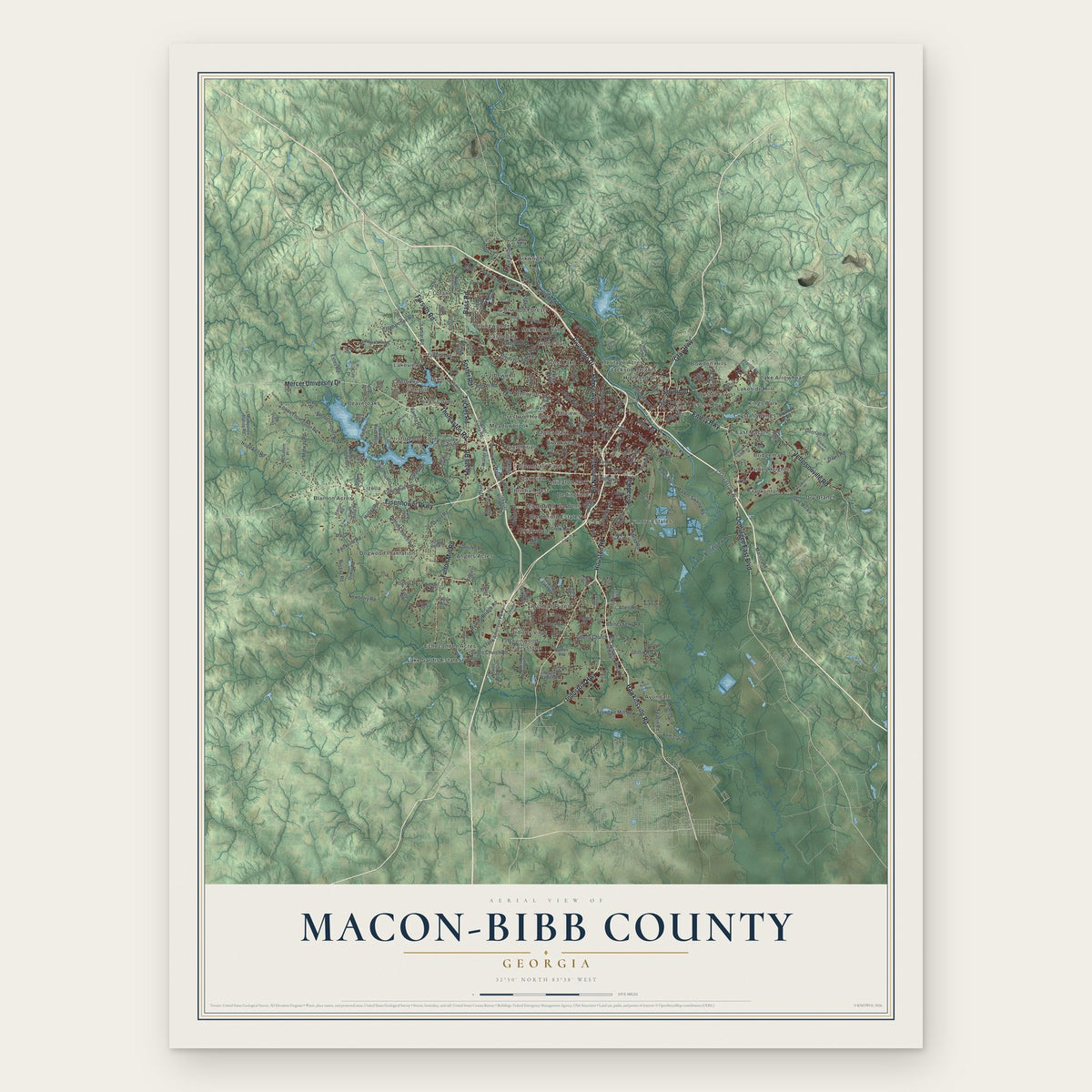
Macon-Bibb County, Georgia Map Art
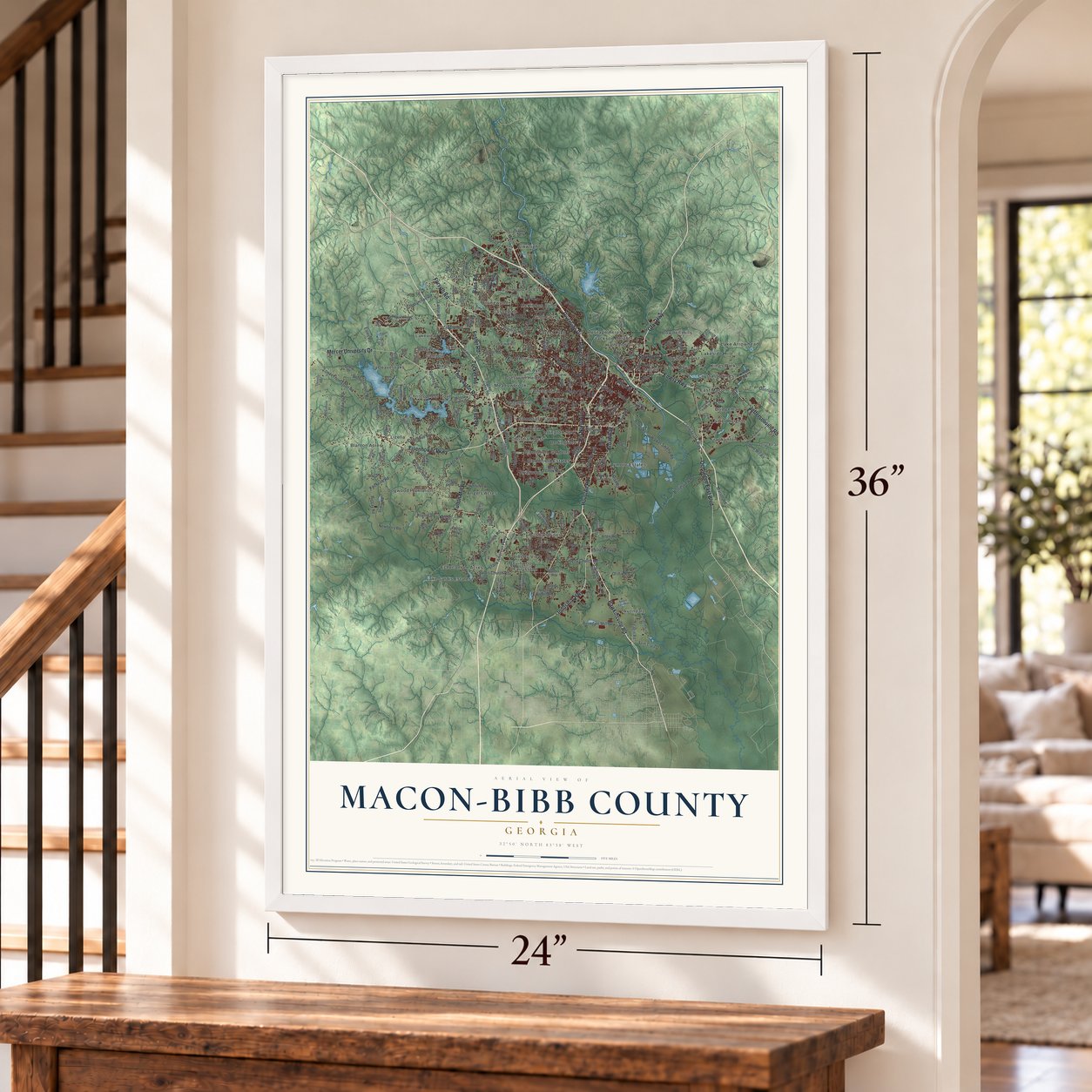
A new map of Macon-Bibb County, Georgia, made in 2026 and printed to order on thick archival matte paper.
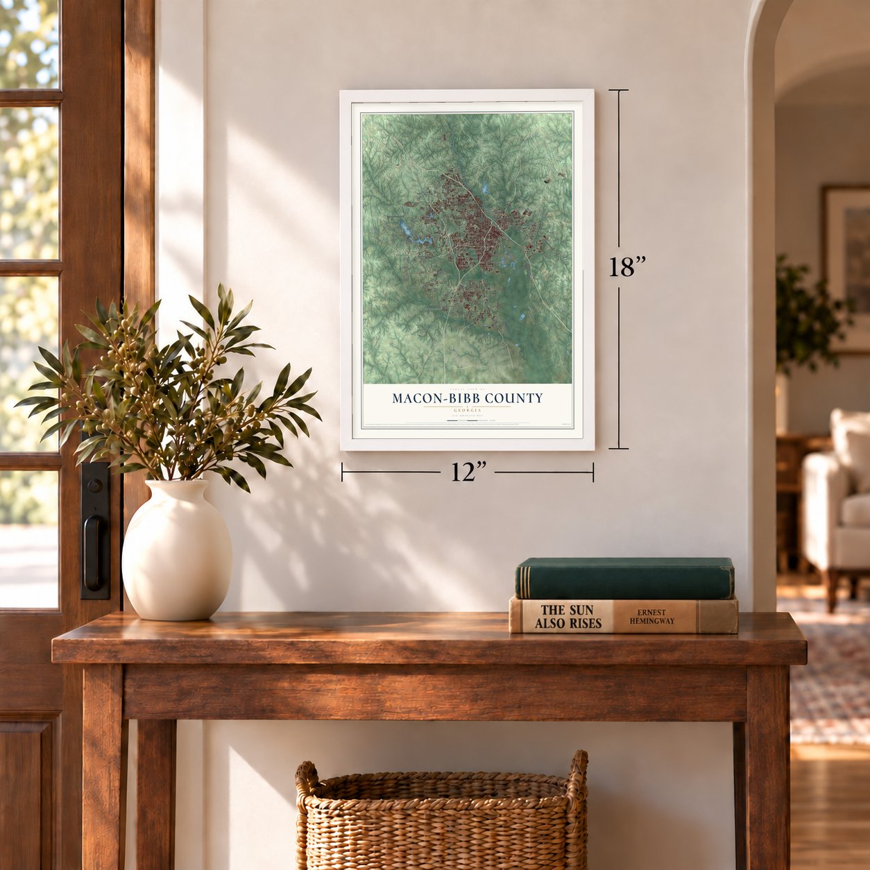
12" x 18" Archival Matte Print
A Map of Home. A Work of Art.
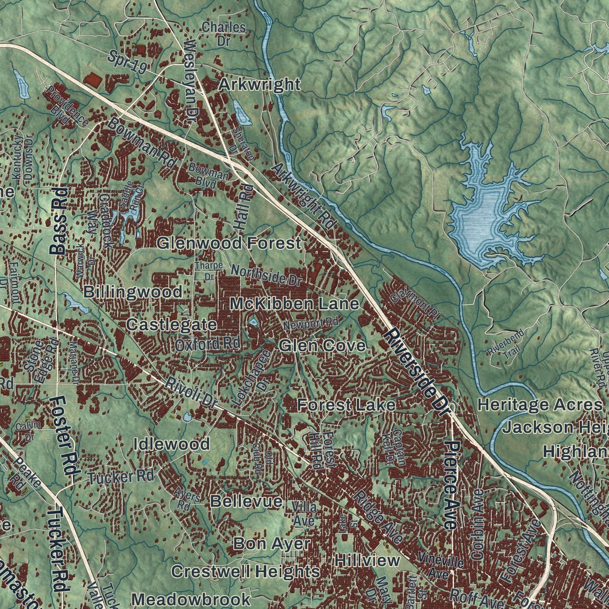
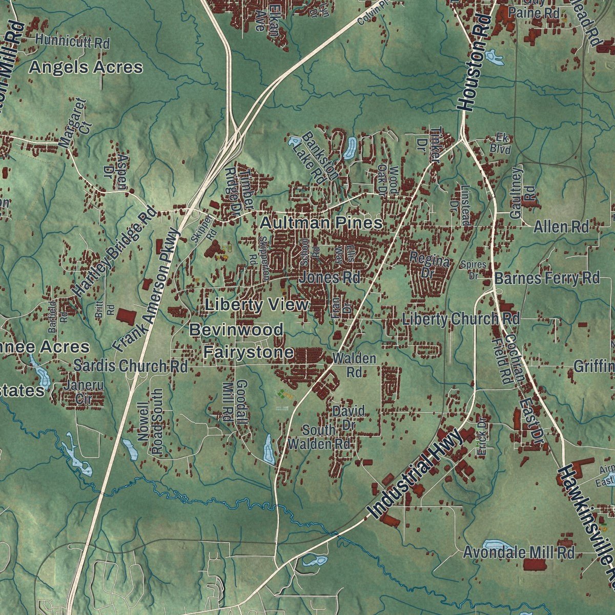
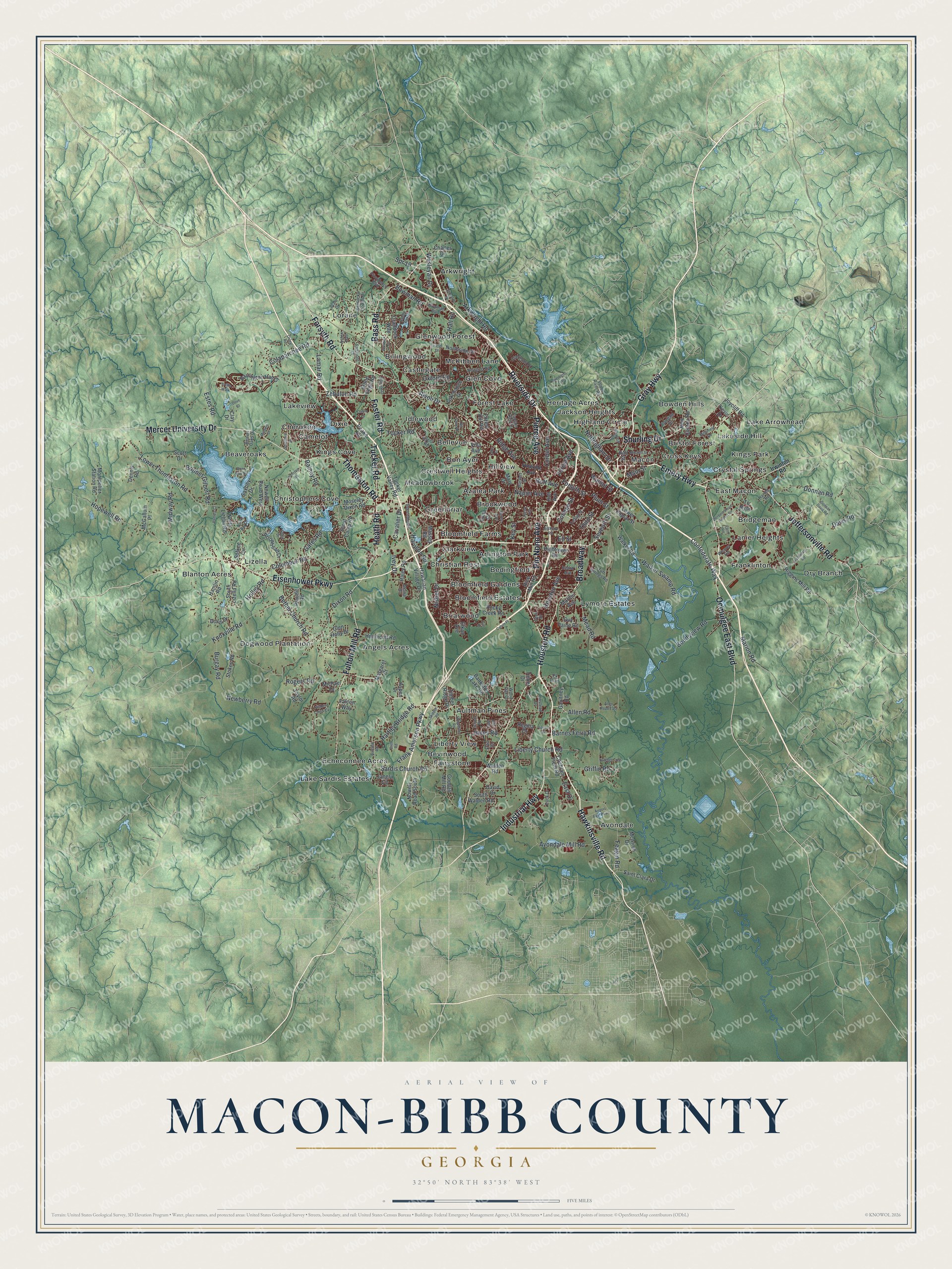
Explore Macon-Bibb County, Georgia from a whole new perspective. Created using aerial imagery and detailed geographic data, this map captures Macon-Bibb County building by building, with labeled streets, familiar landmarks, and shaded topographical relief that highlights the natural contours of the landscape.
Combining modern data with the timeless character of a vintage atlas, this map is just as interesting up close as it is beautiful on the wall. Whether you grew up in Macon-Bibb County, spent memorable years there, or call it home today, this unique map is a great way to celebrate a place that means something to you. Zoom in on the preview to look for your street, and then order a print to put your memories on the wall.
Three ways to hang it
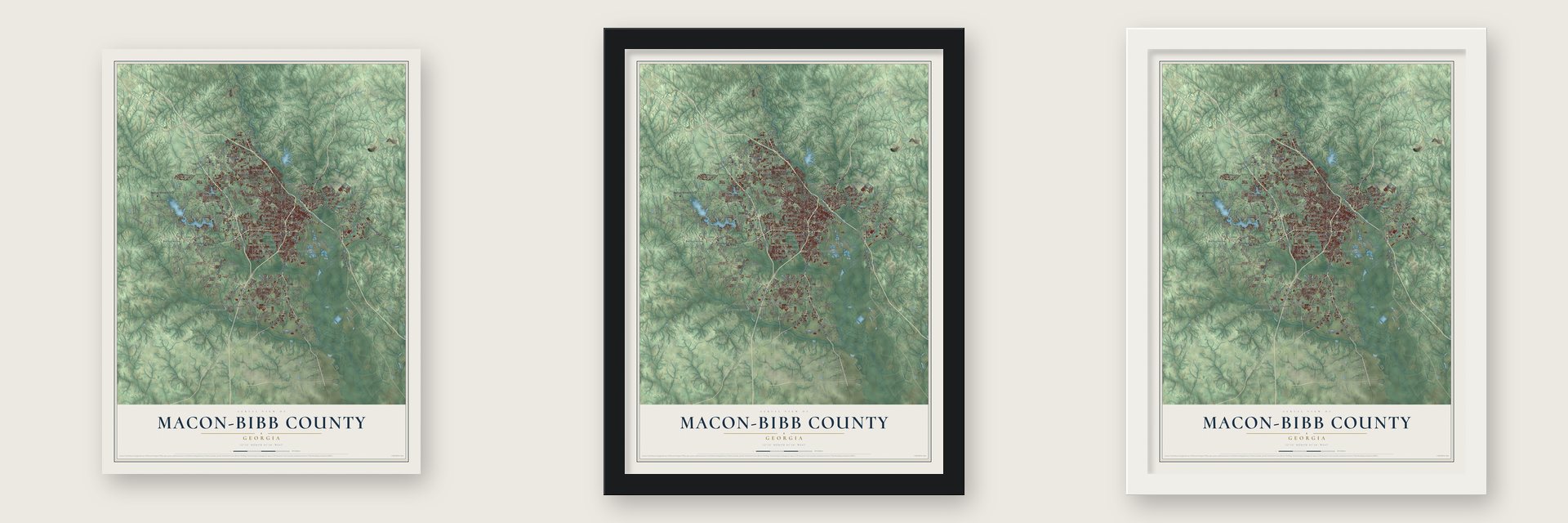
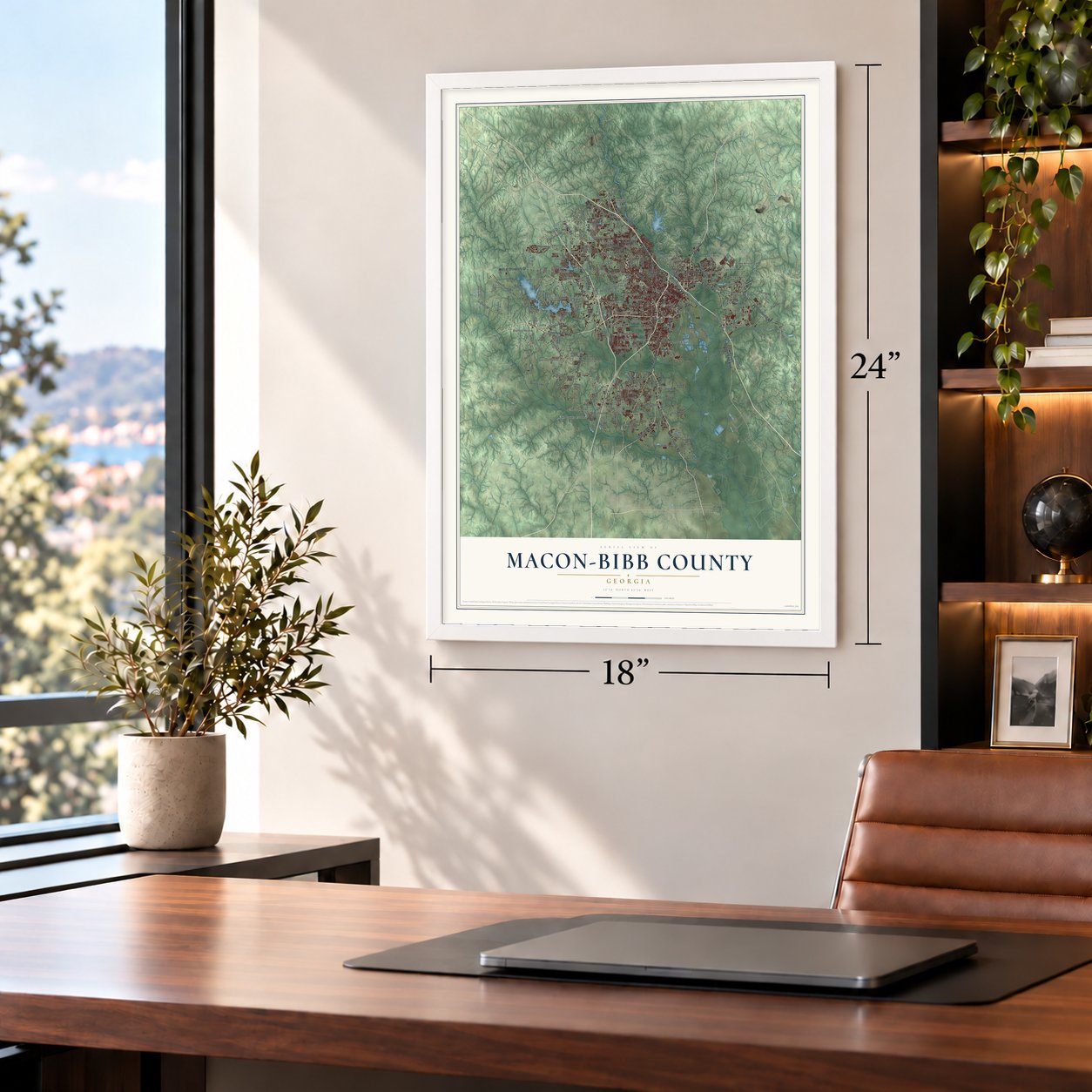
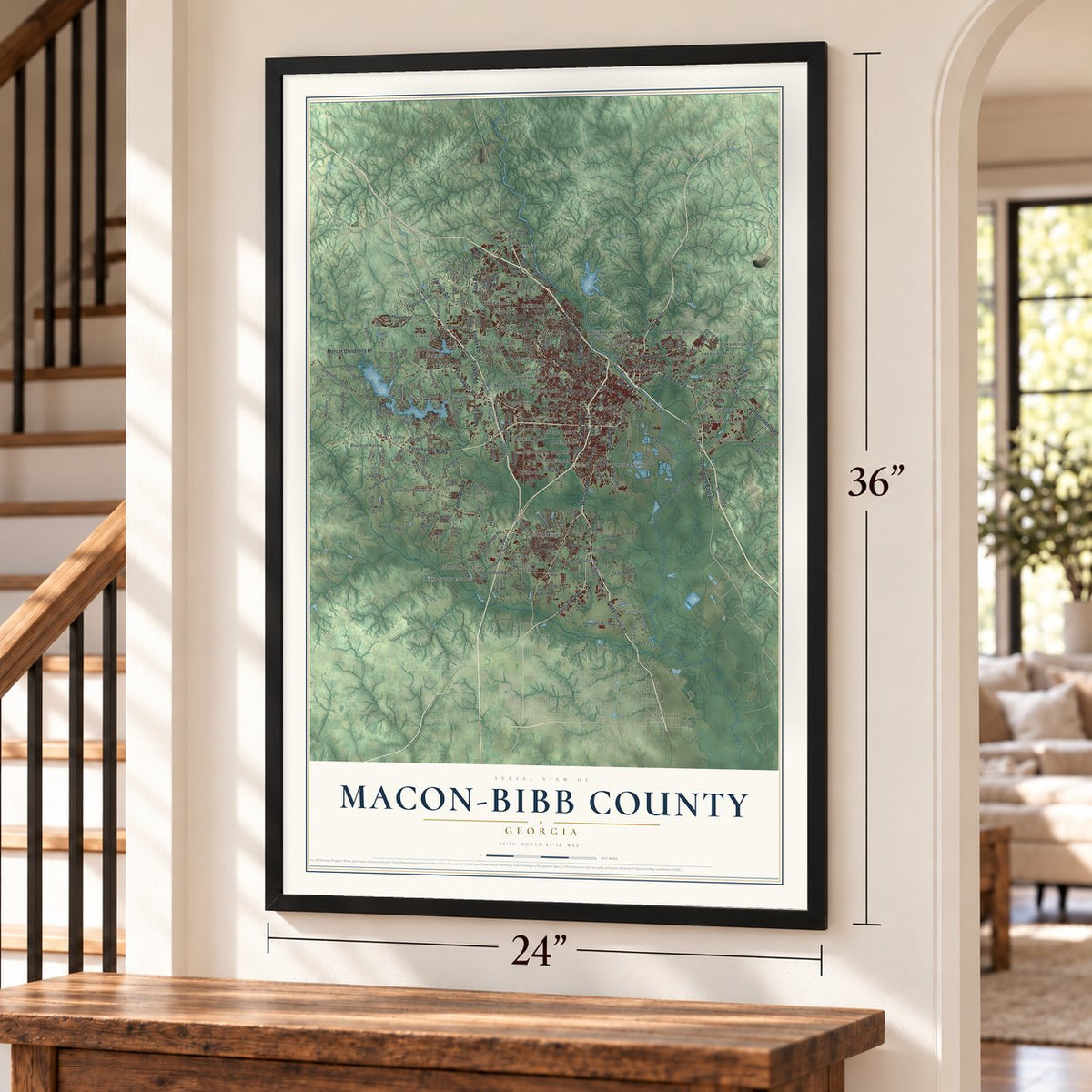
Unframed archival matte, a black wood frame or a white wood frame.
Up close
Geography Worth Displaying
This map was created using accurate cartographic data and authoritative geographic sources, including the U.S. Geological Survey (USGS) and FEMA. The map brings together terrain, waterways, roads, and building detail. The majority of the streets are labeled, houses are accurately depicted, and the topography is derived from government sources. Combining local data with carefully composed color and shading leads to this beautifully detailed Macon-Bibb County artwork for your wall.
Rather than simply showing street outlines, we’ve included as many of the street names as we could reasonably fit on the map while keeping their names legible. Zoom in on the high resolution preview to see exactly what’s on the map. We truly set out to create a statement piece for anyone who loves Macon-Bibb County. So whether it’s for you, or a gift for someone you love, we hope this map of Macon-Bibb County brings back fond memories.
Explore the full map of Macon-Bibb County, Georgia and read about the local places it shows.
Find your street
Names on the Macon-Bibb County map
Every name below is printed on this map. Look for your street, your school, the park where you played, or the pond down the road.
Places and landmarks60
- Angels Acres
- Arkwright
- Arlington Park
- Aultman Pines
- Avondale
- Azalea Park
- Beaveroaks
- Bedingfield
- Bellevue
- Bevinwood
- Billingwood
- Blanton Acres
Show all 60 places
- Bloomfield Estates
- Bloomfield Farms
- Bloomfield Gardens
- Bon Ayer
- Bowden Hills
- Briarwood
- Bridgeman
- Bristol Forest
- Brookwood
- Camelot
- Castlegate
- Cherokee
- Christian Rest
- Christophers Cove
- Clarkview
- Crestwell Heights
- Cross Keys
- Crystal Springs
- Dixie
- Dogwood Plantation
- Dry Branch
- East Macon
- Echeconnee Acres
- Fairystone
- Forest Lake
- Franklinton
- Glen Cove
- Glenwood Forest
- Greenbriar
- Heritage Acres
- Highland Circle
- Hillview
- Idlewood
- Jackson Heights
- Kings Cove
- Kings Park
- Lake Arrowhead
- Lake Sardis Estates
- Lakeside Hill
- Lakeview
- Lanier Heights
- Liberty View
- Lizella
- Lorane
- Lymore Estates
- Macon
- McKibben Lane
- Meadowbrook
Streets and roads223
- Pio Nono Avenue
- Gray Highway
- Industrial Highway
- Pierce Avenue
- Eisenhower Parkway
- Hawkinsville Road
- Mercer University Drive
- Riverside Drive
- Thomaston Road
- Ocmulgee East Boulevard
- Houston Road
- Forsyth Road
- Fulton Mill Road
- Emery Highway
- Jeffersonville Road
- Broadway
- Bass Road
- Shurling Drive
- Tucker Road
- Heath Road
- Foster Road
- Forsyth Street
- Plum Street
- Columbus Road
- Lower Thomaston Road
- Rivoli Drive
- Rogers Road
- Zebulon Road
- Knoxville Road
- Wesleyan Drive
Show all 223 streets
- Sardis Church Road
- Bonner Gilbert Road
- Napier Avenue
- Avondale Mill Road
- Houston Avenue
- Bethel Church Road
- Lamar Road
- Hartley Bridge Road
- Hopewell Road
- Dixon Road
- Arkwright Road
- Holley Road
- Feagin Road
- Allen Road
- Liberty Church Road
- Walnut Street
- Davis Road
- Barnes Ferry Road
- Jones Road
- Walker Swamp Road
- Donnan Road
- Bondsview Road
- Third Street
- College Street
- Newberry Road
- Frank Amerson Parkway
- Seventh Street
- Roff Avenue
- Midway Road
- Griffin Road
- Burgay Road
- Ridge Avenue
- Confederate Way
- Marion Road
- Colaparchee Road
- Mead Road
- Rainey Road
- Spr 19
- Cavalier Drive
- Corbin Avenue
- Nottingham Drive
- Estes Road
- Nisbet Drive
- East Drive
- Ell Street
- Forest Avenue
- Oxford Road
- Bowman Road
- Ivey Drive
- Harrison Road
- Gates Road
- Main Street
- Key Street
- Hall Road
- Riggins Mill Road
- Forest Hill Road
- Moseley Dixon Road
- Northside Drive
- Rocky Creek Road
- Walden Road
- Goodall Mill Road
- Nowell Road South
- South Lizella Road
- Peake Road
- Barrington Hall Drive
- Scout Camp Road
- Lower Poplar Street
- North Lizella Road
- Hamlin Road
- Guy Paine Road
- Edna Place
- South Walden Road
- Walker Road
- Joycliff Road
- Rice Mill Road
- McArrell Drive
- Hall Street
- New Clinton Road
- Montpelier Station Road
- To Rydc
- Arrowhead Drive
- Hawaiian Village Drive
- Saint Clara Drive
- Janeru Circle
- Hunnicutt Road
- Sofkee Circle
- Elkan Avenue
- Dennis Road
- Bankston Lake Road
- Lokchapee Drive
- Glen Holly Drive
- Cochran Field Road
- Marion Avenue
- Hightower Road
- Raley Road
- Tucker Valley Road
- Plaudit Road
- Stone Edge Road
- McCallum Place
- Stokes Road
- Nowell Road West
- Gaultney Road
- Massey Road
- Taylor Road
- Craddock Way
- Holt Avenue
- Margaret Court
- Charles Drive
- Timber Ridge Drive
- Regina Drive
- Doris Drive
- Michael Drive
- Mary Drive
- Falcon Way
- Aspen Drive
- Saxony Drive
- Scott Drive
- Clay Drive
- Tinker Drive
- Villa Avenue
- David Drive
- Kevin Drive
- Irwinton Road
- Upper River Road
- Ayers Road
- Kentucky Downs Drive
- Beaver Oaks Drive
- Weaver Road
- Clairmont Place
- Aston Hall
- Providence Boulevard
- Tuft Springs Road
- Interstate Drive
- Alandale Drive
- Captain Kell Drive
- Bartlett Street
- Newport Road
- Bowman Boulevard
- Fairmont Drive
- Harold Road
- Linstead Drive
- Telfair Street
- Ek Boulevard
- Alpine Drive
- Erick Drive
- Wood Oak Drive
- Heard Avenue
- Tech Drive
- Fran Drive
- Vineville Avenue
- Sheraton Drive
- Skipper Road
- Anthony Road
- Franklinton Road
- Johnson Road
- Briarcliff Road
- Millerfield Road
- Donnan Davis Road
- Hidden Creek Circle
- Burton Avenue
- Skipperton Road
- Old Club Road
- Southfork Drive
- Mitchell Street
- Airport East Parkway
- School Road
- Riverbend Trail
- Barfield Road
- Herbert Smart Airport Road
- Pansy Avenue
- Byars Drive
- Natchez Trce
- Britt Road
- Warwick Drive
- Oxley Road
- Marjane Drive
- Allen Road East
- Pamela Court
- Calvin Drive
- Ellis Way
- Deer Run Drive
- Colvin Place
- Tharpe Drive
- Spires Drive
- Masters Drive
- Saddle Run Court
- North Bay Drive
- Sanjo Drive
- Dove Court
- Trellis Walk
- Farm Road
- Lake Street
- Lyn Drive
Names are listed as they appear on the printed map. Zoom into the product photos to find them.
The art of mapping a place
How This Map Was Made
Real places. Remarkable detail. Discover the layers that turn geographic data into a map of home.

The view from above
Aerial imagery reveals the character of the land: woodland, open fields, and the patterns of a place.

The shape of the land
Elevation data brings hills, valleys, and subtle changes in the landscape into view.

The details of home
Roads, waterways, and building footprints come together to make the map feel unmistakably local.

Geography becomes art
Considered color, shading, and typography bring the layers together in a map made for your wall.


Process illustrated with Mendon, Massachusetts. Aerial imagery: USDA NAIP. Terrain: USGS 3D Elevation Program. Map details and finished artwork: KNOWOL.
The Details
About This Print
Choose an archival matte print, or a black or white Ayous wood frame. The archival matte print is unframed.
Select your size and finish above to see the matching product image and price.
Materials & Craftsmanship
A contemporary map with the character of a classic atlas, printed on archival matte paper. Optional frames are made from Ayous wood.
Your printed map does not include the watermark shown in the full-map preview.
Shipping & Delivery
Free shipping within the United States. Every print is made to order in the USA.
Buying a gift? Add a note in your cart and we'll include it. We never put prices in the package.
Prints ship within 2 to 3 business days. Allow 7 to 10 days total from ordering for delivery. Timing may vary during holidays or periods of high order volume.
Read our shipping policy.
Returns and damaged prints
Each print is made to order. Change-of-mind refunds are not available after production.
If your print arrives damaged, misprinted or incorrect, contact support@knowol.com within 30 days of receiving it. Include your order number, photos and a description of the issue.
Read our full refund and replacement policy. For questions about your order, email support@knowol.com.
Find your town
Looking for another city?
Find a map of home in our Georgia collection, or any town in the country.
Nearby
Maps of towns near Macon-Bibb County
Know someone from one of these towns? Their map makes a great gift.
 Bolingbroke
, Georgia
From $39.99See the map
 Byron
Byron, Georgia
From $39.99See the map
 Centerville
, Georgia
From $39.99See the map
More maps nearby: Quail Run, Warner Robins, Robins AFB, Gray and Smarr.