
Search for another town

Free U.S. delivery 7 to 10 days after you order
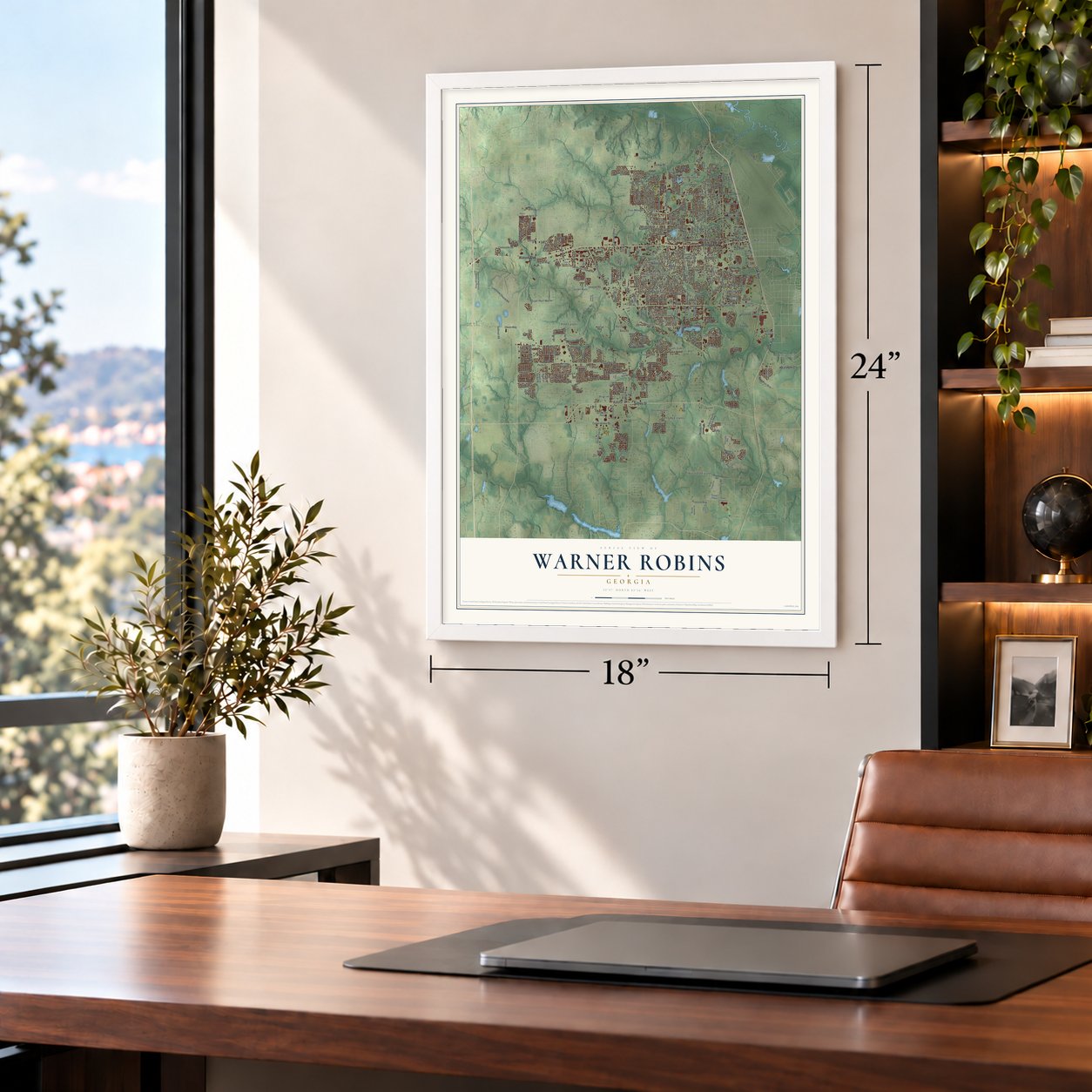
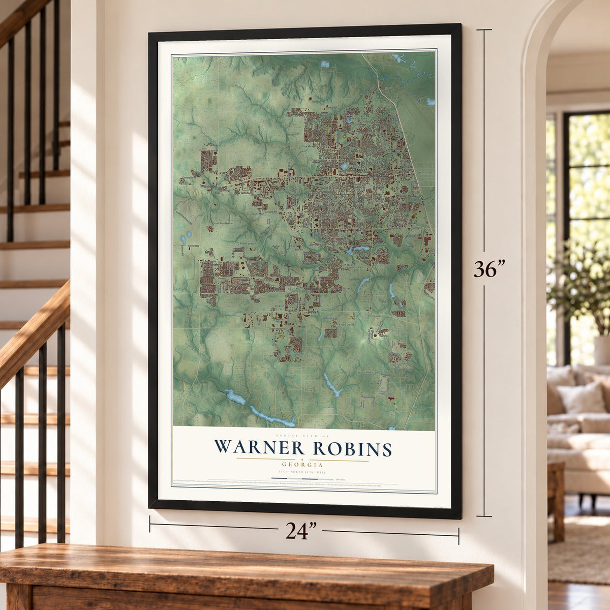
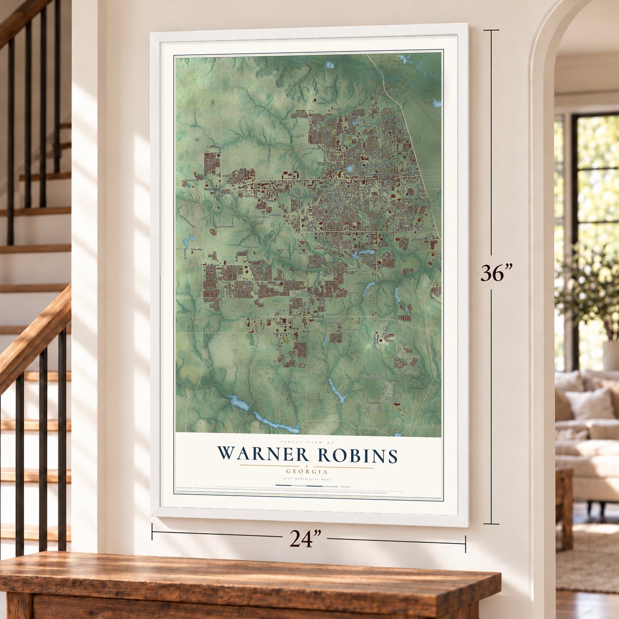
Warner Robins, Georgia Map Art
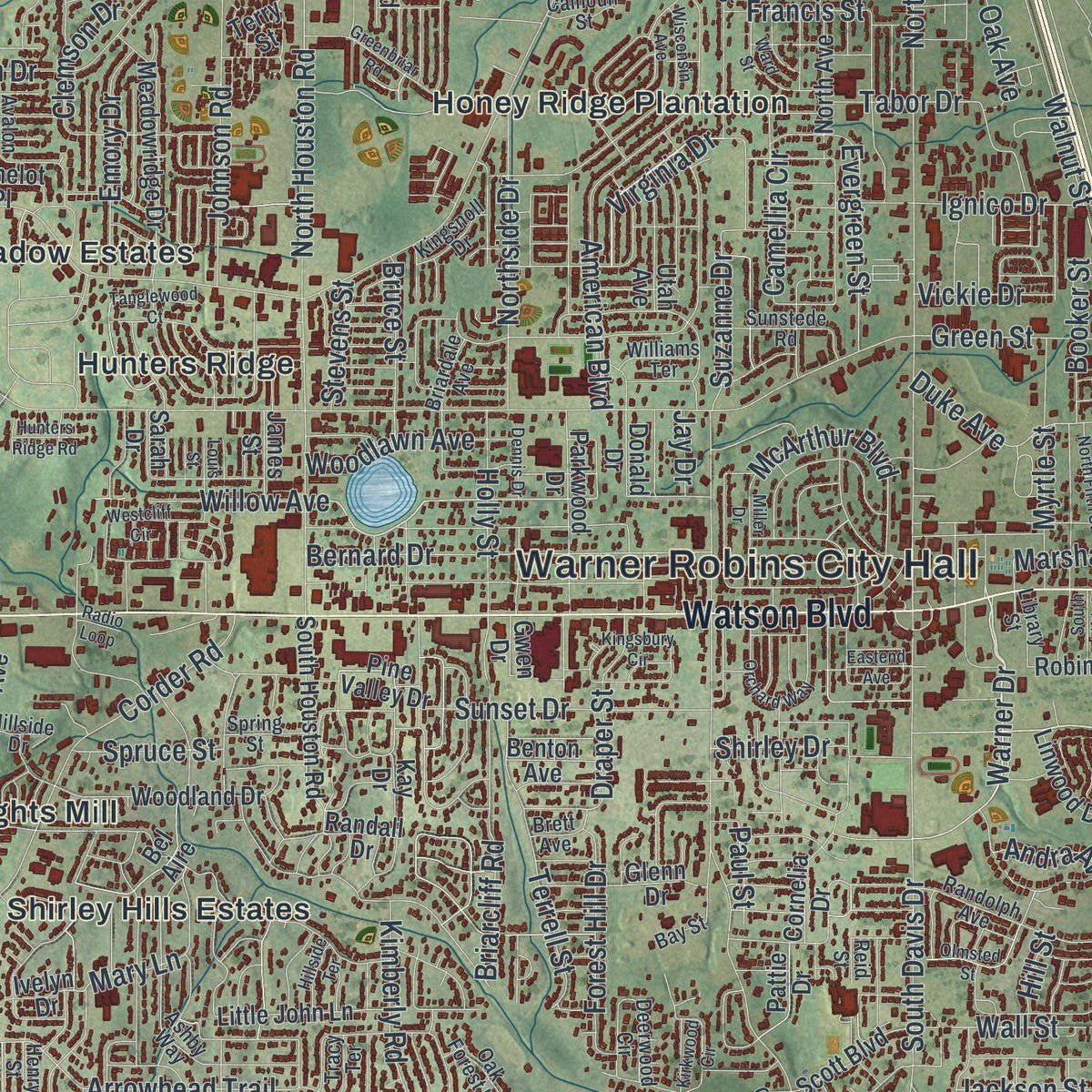
Building by building, with labeled streets and shaded relief.
12" x 18" Archival Matte Print
A Map of Home. A Work of Art.
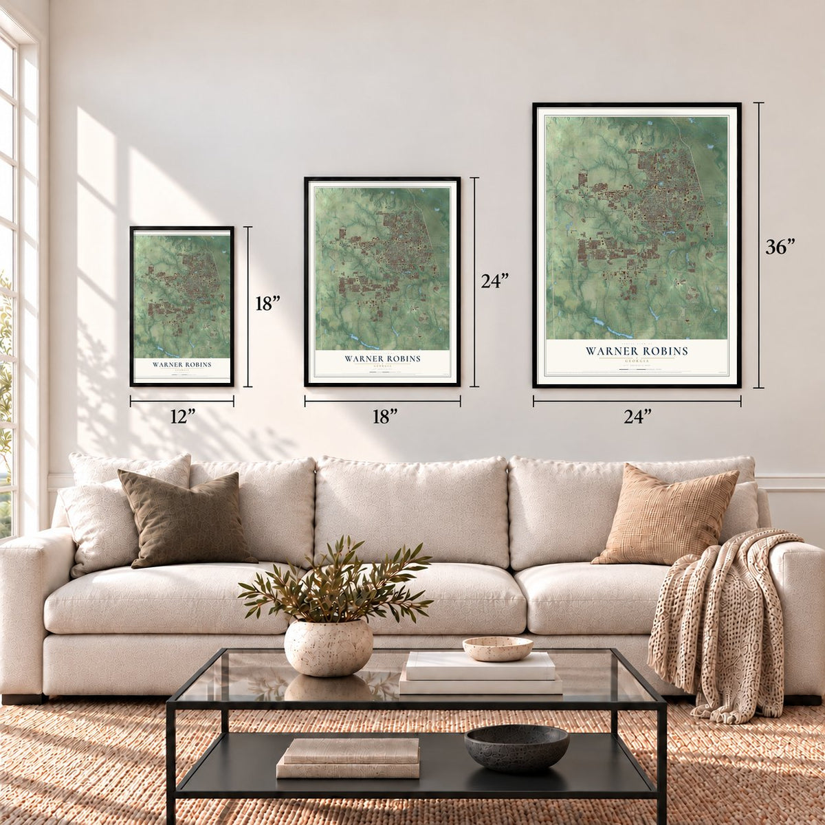
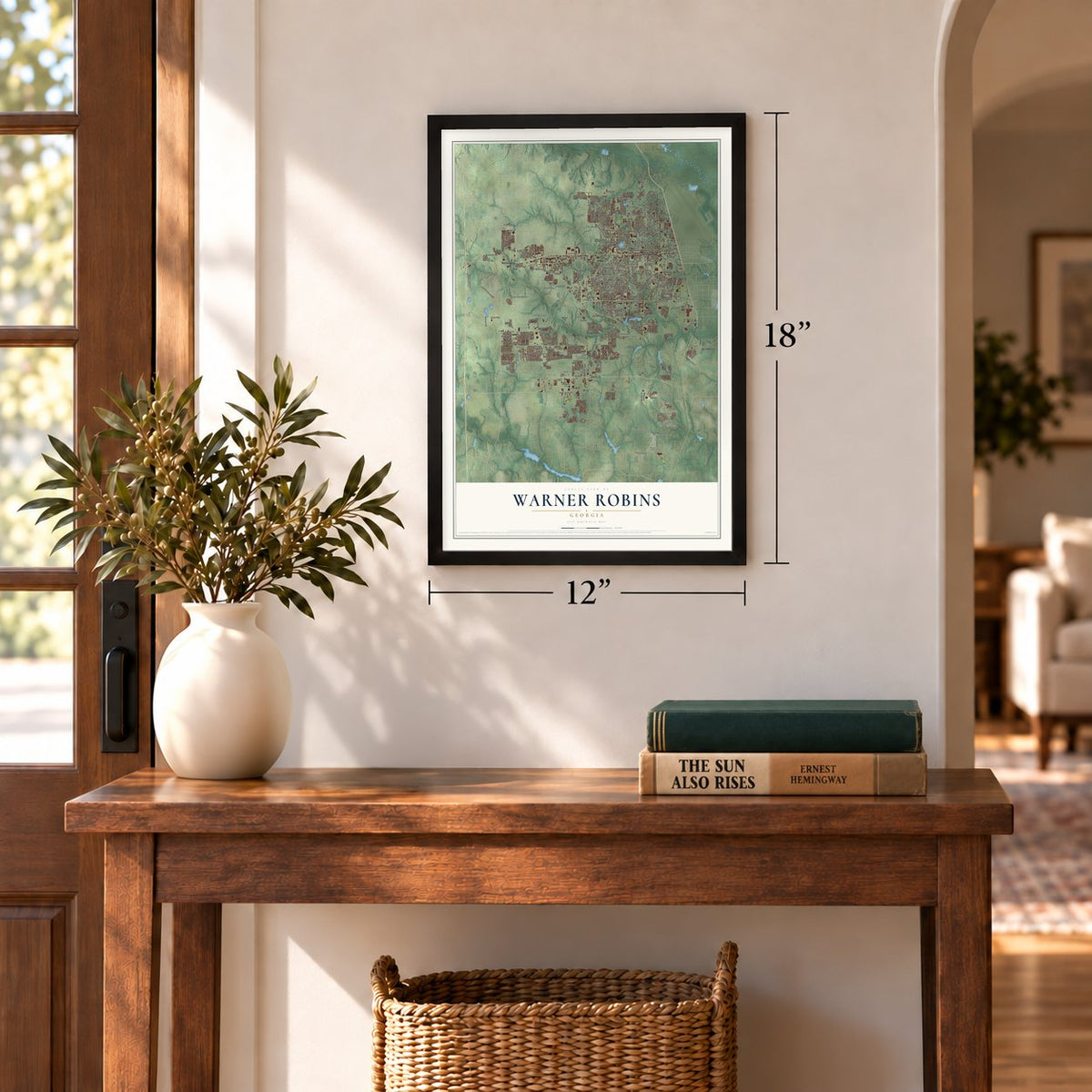
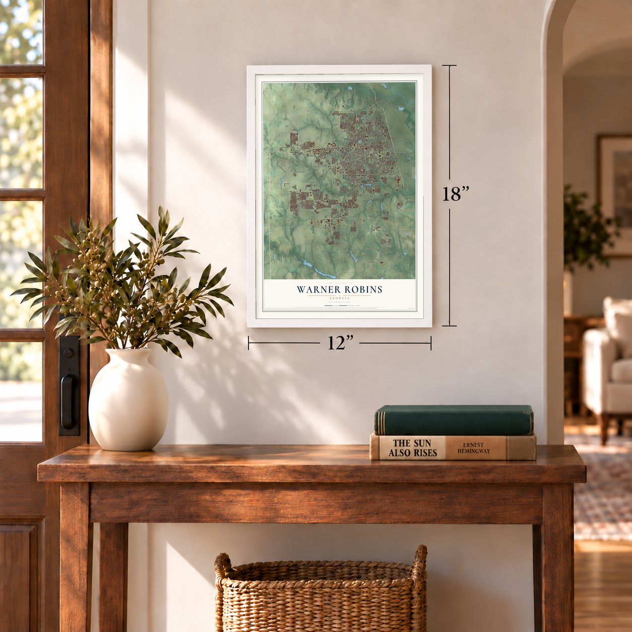
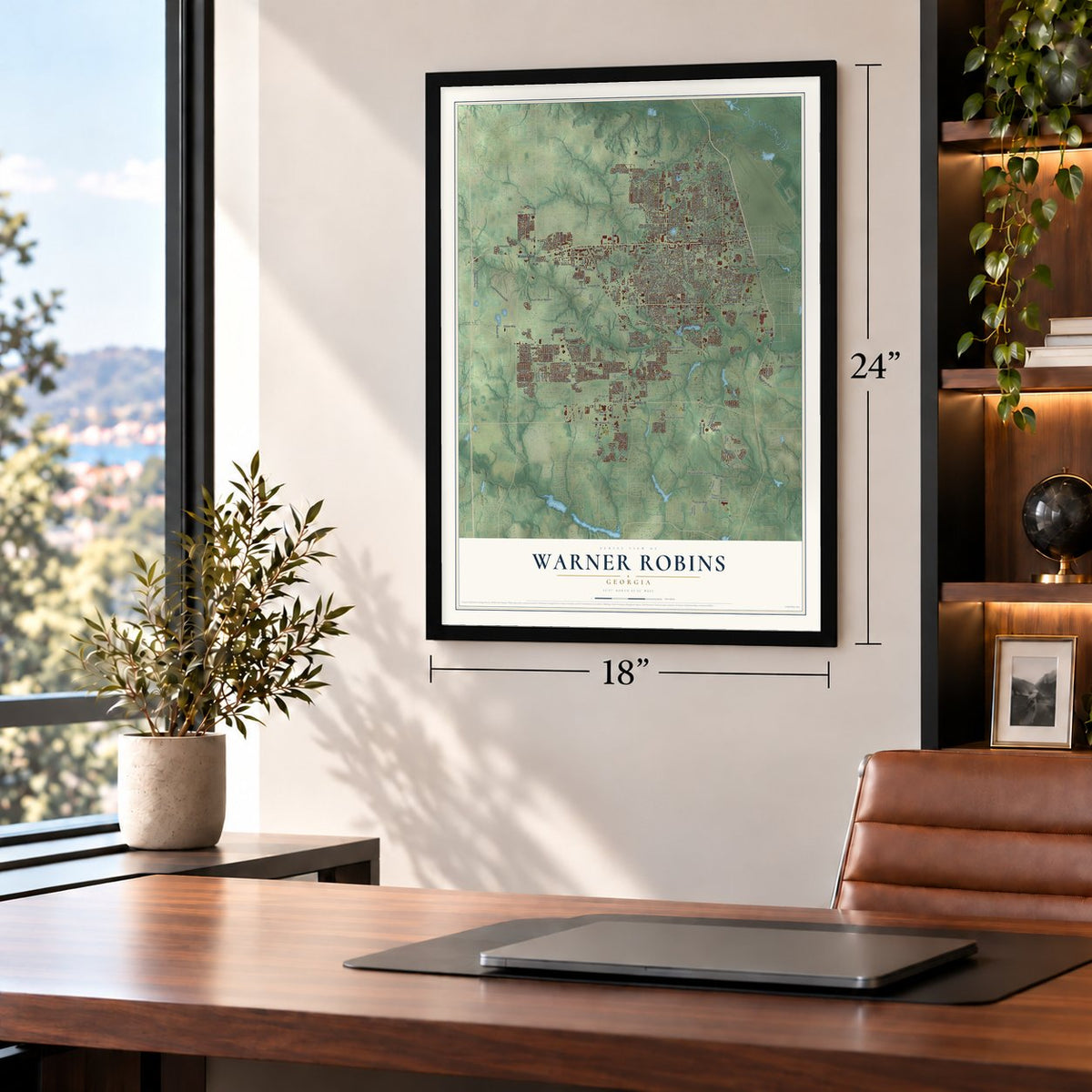
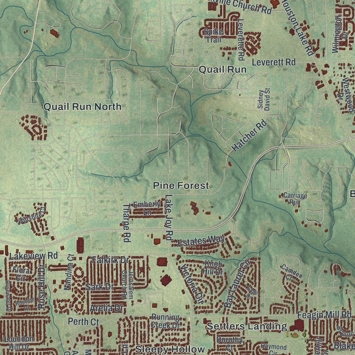
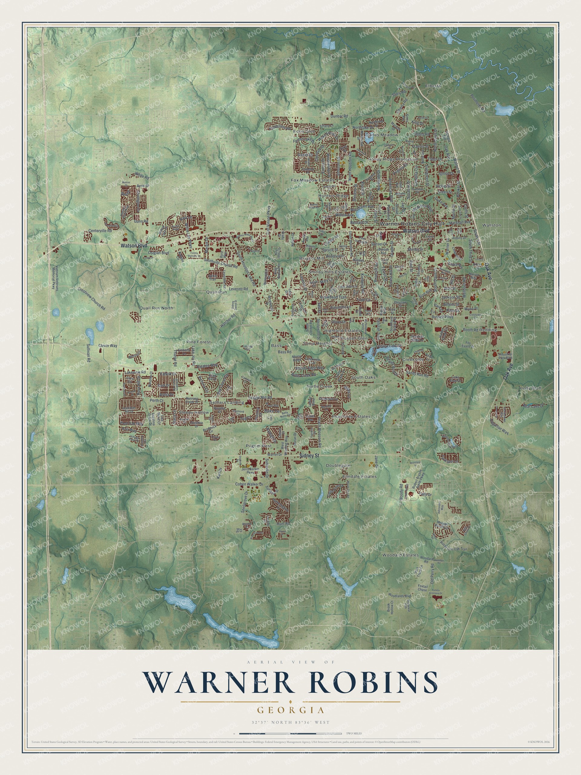
Explore Warner Robins, Georgia from a whole new perspective. Created using aerial imagery and detailed geographic data, this map captures Warner Robins building by building, with labeled streets, familiar landmarks, and shaded topographical relief that highlights the natural contours of the landscape.
Combining modern data with the timeless character of a vintage atlas, this map is just as interesting up close as it is beautiful on the wall. Whether you grew up in Warner Robins, spent memorable years there, or call it home today, this unique map is a great way to celebrate a place that means something to you. Zoom in on the preview to look for your street, and then order a print to put your memories on the wall.
Three ways to hang it
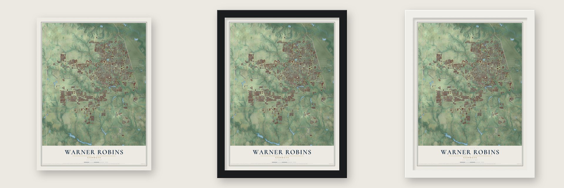
Unframed archival matte, a black wood frame or a white wood frame.
Up close
Geography Worth Displaying
This map was created using accurate cartographic data and authoritative geographic sources, including the U.S. Geological Survey (USGS) and FEMA. The map brings together terrain, waterways, roads, and building detail. The majority of the streets are labeled, houses are accurately depicted, and the topography is derived from government sources. Combining local data with carefully composed color and shading leads to this beautifully detailed Warner Robins artwork for your wall.
Rather than simply showing street outlines, we’ve included as many of the street names as we could reasonably fit on the map while keeping their names legible. Zoom in on the high resolution preview to see exactly what’s on the map. We truly set out to create a statement piece for anyone who loves Warner Robins. So whether it’s for you, or a gift for someone you love, we hope this map of Warner Robins brings back fond memories.
Explore the full map of Warner Robins, Georgia and read about the local places it shows.
Find your street
Names on the Warner Robins map
Every name below is printed on this map. Look for your street, your school, the park where you played, or the pond down the road.
Places and landmarks29
- Warner Robins City Hall
- Bass
- Creekside
- Danes Meadow
- Doublegate
- Echo Glen
- Elberta
- Elmdale Estates
- Fox Meadow Estates
- Highland Estates
- Holly Bluff
- Honey Ridge Plantation
Show all 29 places
- Hunters Ridge
- Peachtree Estates
- Pilgrim Rest
- Pine Forest
- Quail Run
- Quail Run North
- Redding
- Russell Glen
- Settlers Landing
- Shirley Hills Estates
- Sleepy Hollow
- Sonja Heights
- South Oaks
- Turtle Creek
- Wallston
- Woodard Estates
- Wrights Mill
Streets and roads330
- Oak Avenue
- Watson Boulevard
- Sidney Street
- Russell Parkway
- South 1 Street
- Corder Road
- White Road
- Virginia Drive
- South Houston Lake Road
- Willow Avenue
- Feagin Mill Road
- Moody Road
- Carl Vinson Parkway
- Elberta Road
- Green Street
- Lake Joy Road
- North Davis Drive
- Cohen Walker Drive
- North Houston Road
- Booth Road
- Old Perry Road
- Hatcher Road
- Lakeview Road
- Leverett Road
- Osigian Boulevard
- Crestview Church Road
- South Davis Drive
- Arrowhead Trail
- McArthur Boulevard
- Wellborn Road
Show all 330 streets
- Sandy Run Road
- Centerville Road
- Perimeter Road
- American Boulevard
- Bay Laurel Circle
- Gawin Drive
- Johnson Road
- Smithville Church Road
- Stacy Lane
- Post Oak Way
- Camellia Circle
- Bernard Drive
- Peach Blossom Road
- Todd Circle
- Johns Road
- Briarcliff Road
- Falkirk Drive
- Leisure Lake Drive
- Francis Street
- Mary Lane
- Fieldstone Road
- Sullivan Road
- Snellgrove Drive
- Forest Lake Drive
- Kimberly Road
- Dunbar Road
- Northside Drive
- Terrell Street
- Warner Drive
- Northlake Drive
- Gunn Road
- Edgarton Way
- Evergreen Street
- King Drive
- Sunset Drive
- Wake Forest Drive
- Clemson Drive
- South Third Street
- Tabor Drive
- Draper Street
- Sark Drive
- Willie Lee Parkway
- Rose Hill Drive
- Victoria Circle
- Duke Avenue
- Palomino Lane
- Erin Way
- Ignico Drive
- Myrtle Street
- Forest Hill Drive
- Walnut Street
- Woods Edge Way
- Emory Drive
- Arrie Drive
- Perth Court
- Woodlawn Avenue
- Raleigh Drive
- Tallulah Trail
- Clever Way
- Wall Street
- Estates Way
- Falls Drive
- Holly Street
- Beaver Run Drive
- Hunt Road
- Margie Drive
- Covington Cv
- Park Drive
- Park Lane
- Marshall Avenue
- Booker Street
- Sutherlin Drive
- Willis Creek Road
- Bear Lake Drive
- Larkspur Lane
- Paul Street
- Suzanne Drive
- Blake Terrace
- Athens Street
- Story Road
- Karl Drive
- Jackson Street
- Tug Court
- Tharpe Road
- Bruce Street
- Spruce Street
- Oliver Drive
- Andra Avenue
- Myles Lane
- Vickie Drive
- Self Street
- Stevens Street
- Laverne Drive
- Shirley Drive
- Palm Drive
- Arelia Drive
- Wynn Place
- Curtis Street
- Bass Road
- Jane Drive
- Burr Drive
- Jay Drive
- Hill Street
- Nelson Drive
- Vietnam Veterans Memorial Parkway
- Meadowridge Drive
- Robert Bryson Smith Parkway
- Loundon Hill Drive
- Leverette Road
- Morgan Ranch Circle
- King Richard Drive
- Springwood Drive
- Westwood Drive
- Tiffany Lane
- Pine Valley Drive
- Woodland Drive
- South Corder Road
- Hidden Creek Circle
- Haverhill Circle
- Burns Drive
- Woodlands Boulevard
- Cheshire Drive
- Broderick Circle
- Foy Evans Drive
- Castle Pines Drive
- Wilmington Drive
- Grand Avenue
- Rustic Live Oak Trail
- Marion Way
- Lattice Bend
- Robins Drive
- Industrial Park Boulevard
- South Houston Road
- Southland Station Drive
- Sutherlin Street
- Byrd Way
- Shannon Ridge Drive
- Knob Hill Drive
- West Wrasling Way
- Parkwood Drive
- Nandina Court
- Flora Circle
- Little John Lane
- Angelina Grace Drive
- Sarah Drive
- Jerry Barker Parkway
- Hummingbird Lane
- Bel Aire
- Links View Drive
- Willow Lake Drive
- Glenn Drive
- Turtle Creek Drive
- Creekview Trail
- Linwood Drive
- Pine Trace Lane
- Markwood Drive
- Chadwyck Lane
- Donald Drive
- North Avenue
- Dorothy Court
- Katelyn Circle
- Scott Boulevard
- Cornelia Drive
- Running Creek Drive
- Northfield Drive
- Utah Avenue
- Echo Lane
- Brady Drive
- Randall Drive
- Malachi Drive
- Spike Trail
- Gwen Drive
- Terry Street
- Emberly Lane
- Brook Hollow Court
- Georgia Avenue
- Pattie Drive
- Camelot Place
- Woodard Road
- Warren Drive
- Lisa Marie Court
- Moran Drive
- Ivelyn Drive
- Choctaw Street
- Austin Avenue
- Dixon Street
- James Street
- Ennis Avenue
- Benton Avenue
- Mossy Ridge
- Dental Drive
- Foxtail Chase
- Kay Drive
- Carver Court
- Marvin Boulevard
- Lake Drive
- Eric Drive
- Flint Street
- Sig Court
- Adirondac Way
- Robins West Parkway
- Bella Notte Circle
- Wilsons Creek Bend
- Ashby Way
- Wynfield Lane
- Lovorn Circle
- Keith Drive
- Madison Place Parkway
- Tracy Terrace
- Avondale Circle
- Norfolk Circle
- Randolph Avenue
- Madrid Street
- South Kimberly Road
- Avalon Drive
- Briardale Avenue
- Millside Drive
- Deerwood Circle
- Jerusalem Church Road
- Mount Zion Road
- Charlestown Way
- Ledford Way
- Randy Circle
- Bay Street
- Downing Circle
- Deven Court
- Oak Forest Lane
- Sunstede Road
- Bryson Way
- Wiltshire Court
- Bristleleaf Path
- Franklin Square
- George Circle
- Ridgedale Drive
- Weston Drive
- Reid Street
- Crestview Drive
- Sunnydale Drive
- Raymond Circle
- Villa Gloria Drive
- Kingsnoll Drive
- Library Street
- Williams Terrace
- King Arthur Drive
- Carriage Run
- Vinings Place Drive
- Spring Street
- Sidney David Street
- Camden Court
- Brett Avenue
- Calhoun Street
- Island Boulevard
- Henry Street
- Rigby Drive
- Park Avenue
- Lady Lane
- Liam Court
- Wisconsin Avenue
- Somerset Drive
- Knights Bridge
- Ward Street
- Westcliff Circle
- Kingsbury Circle
- Greenbriar Road
- Orchard Way
- Roseine Drive
- Stonebrook Circle
- Tommy Stalnaker Drive
- Tanglewood Court
- Pamela Greenway Drive
- Creekside Drive
- Rosewater Drive
- Kirkwood Circle
- Sonja Drive
- Olmsted Street
- Blue Ridge Lane
- Stoney Creek Drive
- North Fifth Street
- Radio Loop
- Miller Drive
- Plantation Road
- Wilson Road
- Dragstrip Road
- Thornton Drive
- Louis Street
- Sage Drive
- Brentfield Drive
- Solomon Road
- Eastend Avenue
- South Fifth Street
- Hunters Ridge Road
- Hillside Terrace
- Dennis Drive
- Lasso Drive
- Leroy Street
- Monroe Court
- Melody Lane
- Baxter Drive
- Patriot Way
- Fred Drive
Names are listed as they appear on the printed map. Zoom into the product photos to find them.
About Warner Robins, Georgia
Warner Robins is a city of 80,308 people in Houston and Peach Counties. Until 1942 it was Wellston, a thinly settled farm community with a railroad stop, a small sawmill and a grocery store, with peach orchards on some of the land around it. When the War Department planned an air depot for the Southeast, local leader Charles Bostic "Boss" Watson joined Macon officials in bidding for it. With help from U.S. Representative Carl Vinson, they won it in June 1941, when the government accepted their offer of 3,108 acres.
The depot opened in 1942 as Wellston Army Air Depot under Colonel Charles E. Thomas, who wanted to name it for his mentor, Gen. Augustine Warner Robins of the Army Air Corps. Regulations said a base had to carry the name of the nearest town, so Thomas talked Watson and the other leaders into renaming Wellston instead. The town became Warner Robins on September 1, 1942, and the base took the same name on October 14. Warner Robins incorporated as a town in 1943, then became a city in 1956.
- Tee-ball, invented in 1958Residents credit Claude Lewis, who directed the Warner Robins Recreation Department, with inventing tee-ball. The first game was played in March 1958 with 20 children. Lewis wrote the rules himself and mailed rule books to recreation departments across the country. In 2006 a field at the Warner Robins American Little League complex was dedicated to him as "the father of tee-ball."
- World champions in 2007In 2007 the Warner Robins American Little League took the Little League World Series. Its boys beat Tokyo Kitasuna of Japan 3-2 in the final when Dalton Carriker hit a walk-off homer in the last half of the sixth.
- Softball titles in 2009 and 2010The league's girls then won the 2009 Little League Softball World Series, beating Crawford, Texas, in the title game. That made Warner Robins American the only league with world titles in both baseball and softball. The girls repeated in 2010 over Burbank, California. In December 2008 Little League had chosen the city for its Southeast Region Headquarters, and regional play started here in 2010.
- The tornado of April 30, 1953An F4 tornado with winds above 200 mph cut across the city and into part of Robins Air Force Base. It killed 18 people and injured 300. A second tornado, an F2, damaged the northwest side of town the same day. More storms followed: an F1 on March 13, 1954, killed one person, and an F2 tornado family struck the northwest side again on April 5, 1957.
- The Museum of AviationBeside the base, the Museum of Aviation tells the story of military flight with aircraft, ground vehicles and exhibits on Operation Desert Storm and the Tuskegee Airmen. Among museums the Air Force sponsors, only one is larger, and it is Georgia's largest tourist attraction outside Atlanta.
Keep exploring Georgia
Warner Robins is one of 1,042 Georgia towns we've mapped. Every dot on the map is a print of its own.
The search covers every state, Georgia first.
Near Warner Robins
Order 2 or more town maps and save 10%. Shown in the size and finish you picked above, so they hang as a set.
- Quail Run 12" x 18" / Archival Matte Print $39.99
- Centerville 12" x 18" / Archival Matte Print $39.99
- Robins AFB 12" x 18" / Archival Matte Print $39.99
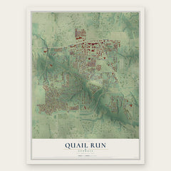
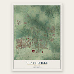
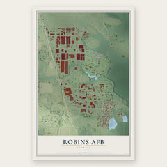
More maps nearby: Bonaire, Byron, Perry, Fort Valley and Macon-Bibb County.
The art of mapping a place
How This Map Was Made
Real places. Remarkable detail. Discover the layers that turn geographic data into a map of home.

The view from above
Aerial imagery reveals the character of the land: woodland, open fields, and the patterns of a place.

The shape of the land
Elevation data brings hills, valleys, and subtle changes in the landscape into view.

The details of home
Roads, waterways, and building footprints come together to make the map feel unmistakably local.

Geography becomes art
Considered color, shading, and typography bring the layers together in a map made for your wall.


Process illustrated with Mendon, Massachusetts. Aerial imagery: USDA NAIP. Terrain: USGS 3D Elevation Program. Map details and finished artwork: KNOWOL.
The Details
About This Print
Choose an archival matte print, or a black or white Ayous wood frame. The archival matte print is unframed.
Select your size and finish above to see the matching product image and price.
Materials & Craftsmanship
A contemporary map with the character of a classic atlas, printed on archival matte paper. Optional frames are made from Ayous wood.
Your printed map does not include the watermark shown in the full-map preview.
Shipping & Delivery
Free shipping within the United States. Every print is made to order in the USA.
Buying a gift? Add a note in your cart and we'll include it. We never put prices in the package.
Prints ship within 2 to 3 business days. Allow 7 to 10 days total from ordering for delivery. Timing may vary during holidays or periods of high order volume.
Read our shipping policy.
Returns and damaged prints
Each print is made to order. Change-of-mind refunds are not available after production.
If your print arrives damaged, misprinted or incorrect, contact support@knowol.com within 30 days of receiving it. Include your order number, photos and a description of the issue.
Read our full refund and replacement policy. For questions about your order, email support@knowol.com.