
Search for another town





Free U.S. delivery 7 to 10 days after you order
Marlboro, New Jersey Map Art
Building by building, with labeled streets and shaded relief.
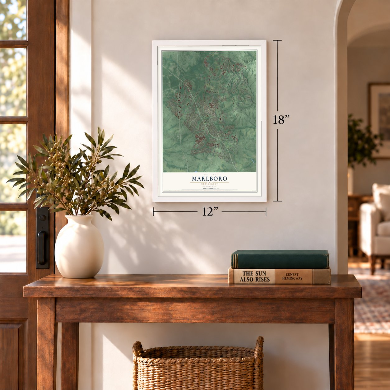
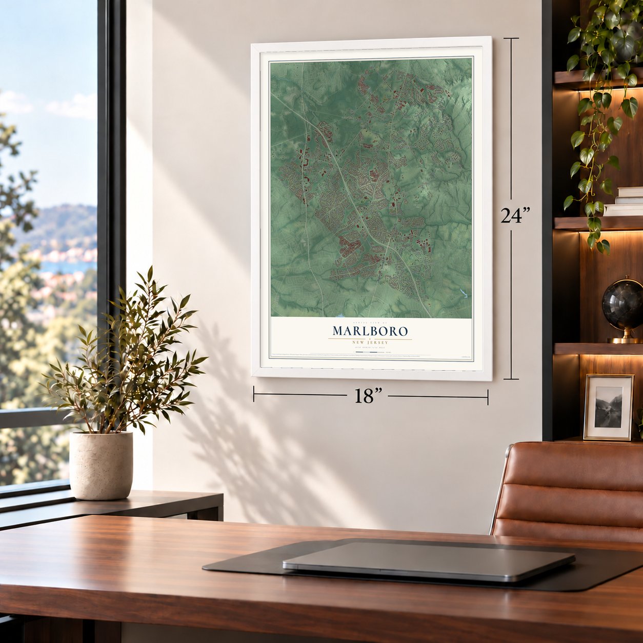
12" x 18" Archival Matte Print
A Map of Home. A Work of Art.
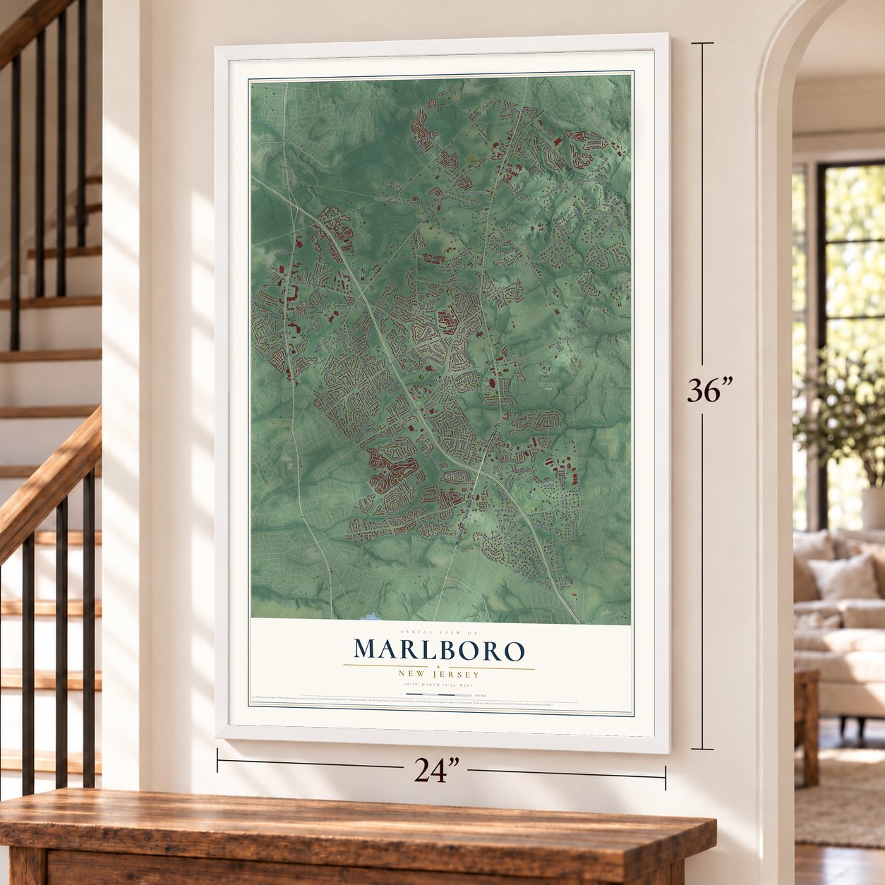
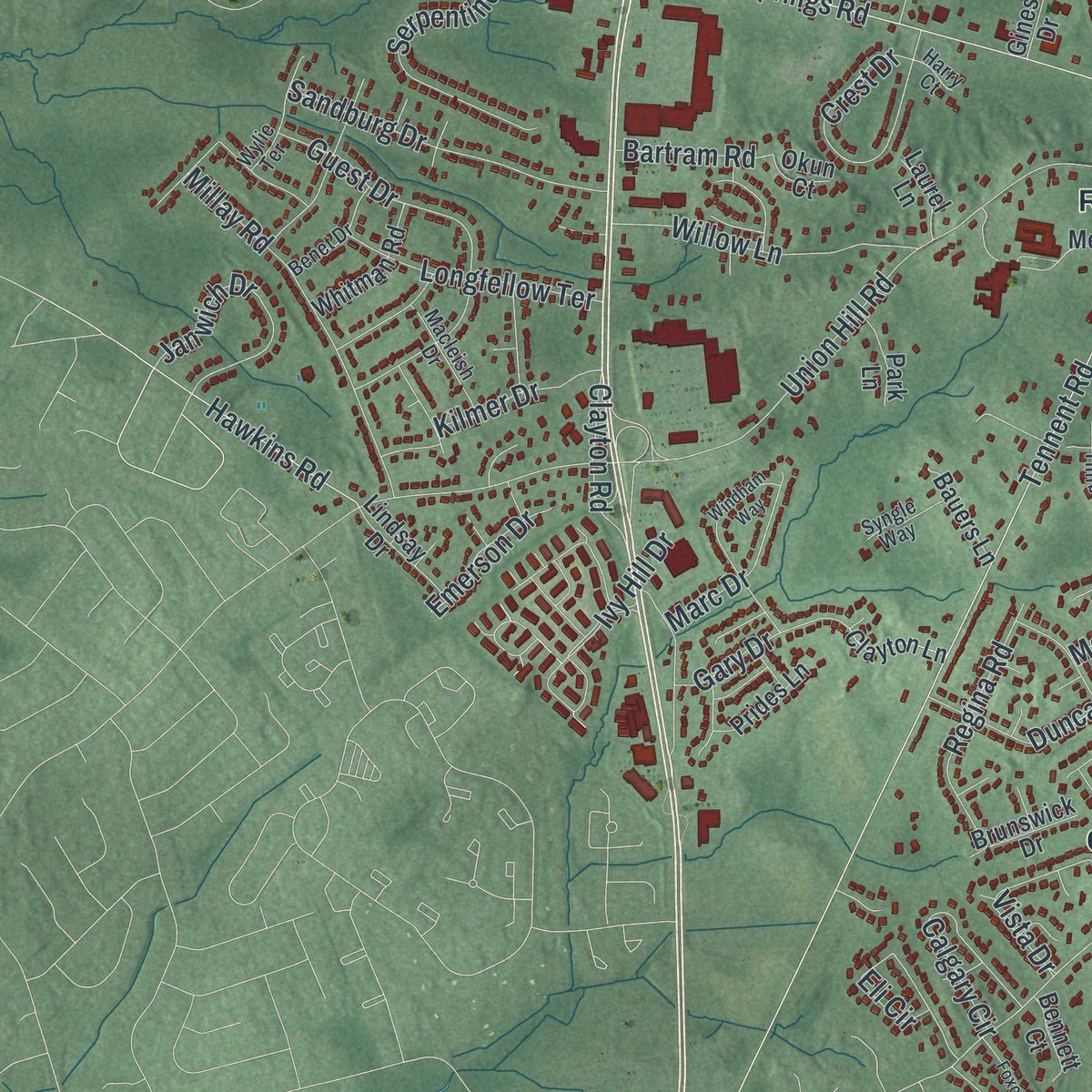
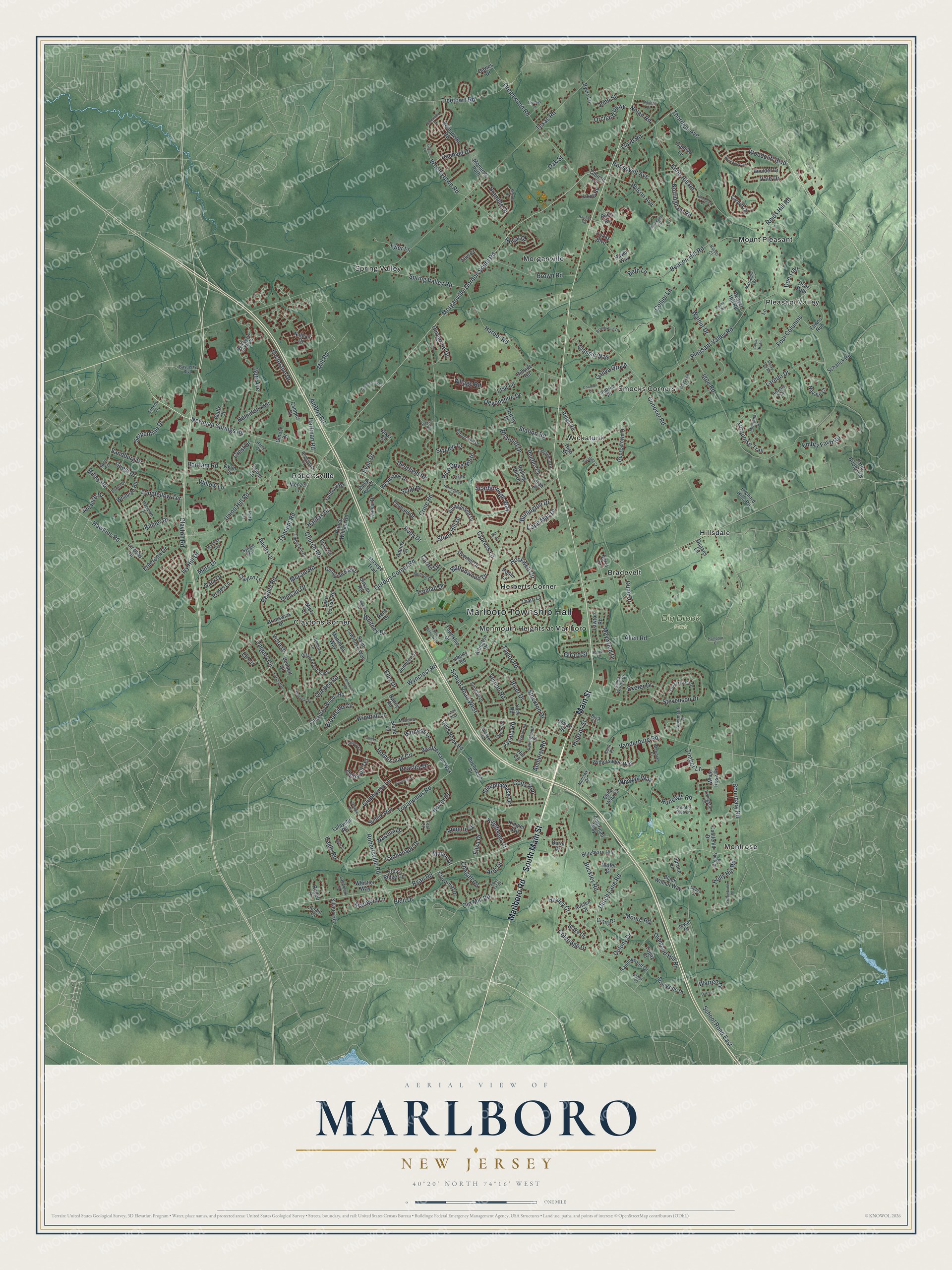
Explore Marlboro, New Jersey from a whole new perspective. Created using aerial imagery and detailed geographic data, this map captures Marlboro building by building, with labeled streets, familiar landmarks, and shaded topographical relief that highlights the natural contours of the landscape.
Combining modern data with the timeless character of a vintage atlas, this map is just as interesting up close as it is beautiful on the wall. Whether you grew up in Marlboro, spent memorable years there, or call it home today, this unique map is a great way to celebrate a place that means something to you. Zoom in on the preview to look for your street, and then order a print to put your memories on the wall.
Three ways to hang it
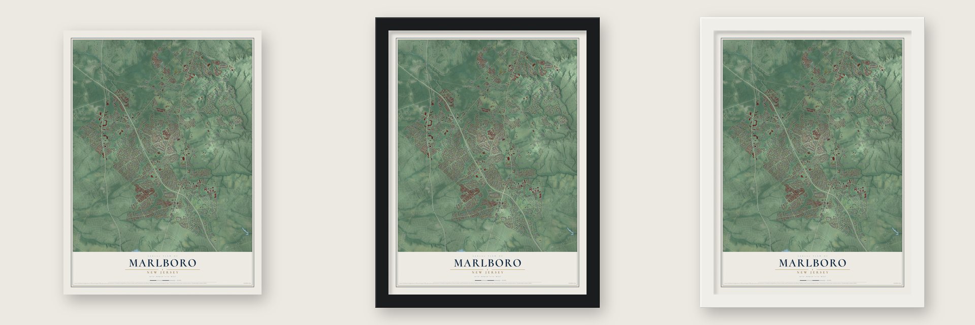
Unframed archival matte, a black wood frame or a white wood frame.
Up close
Geography Worth Displaying
This map was created using accurate cartographic data and authoritative geographic sources, including the U.S. Geological Survey (USGS) and FEMA. The map brings together terrain, waterways, roads, and building detail. The majority of the streets are labeled, houses are accurately depicted, and the topography is derived from government sources. Combining local data with carefully composed color and shading leads to this beautifully detailed Marlboro artwork for your wall.
Rather than simply showing street outlines, we’ve included as many of the street names as we could reasonably fit on the map while keeping their names legible. Zoom in on the high resolution preview to see exactly what’s on the map. We truly set out to create a statement piece for anyone who loves Marlboro. So whether it’s for you, or a gift for someone you love, we hope this map of Marlboro brings back fond memories.
Explore the full map of Marlboro, New Jersey and read about the local places it shows.

Find your street
Names on the Marlboro map
Every name below is printed on this map. Look for your street, your school, the park where you played, or the pond down the road.
Places and landmarks15
- Marlboro Township Hall
- Big Brook Park
- Bradevelt
- Claytons Corner
- Herberts Corner
- Hillsdale
- Monmouth Heights at Marlboro
- Montrose
- Morganville
- Mount Pleasant
- Pleasant Valley
- Robertsville
Show all 15 places
- Smocks Corners
- Spring Valley
- Wickatunk
Streets and roads341
- South Main Street
- Marlboro Road
- Main Street
- Ryan Road
- School Road West
- Spring Valley Road
- Newman Springs Road
- Tennent Road
- Pleasant Valley Road
- Morganville-Gordon South Road
- Texas Road
- School Road East
- Wyncrest Road
- Boundary Road
- Gordon Corner Road
- Conover Road
- Igoe Road
- Robertsville Road
- Topanemus Road
- Dutch Lane Road
- Union Hill Road
- Beacon Hill Road
- Stevenson Drive
- Nolan Road
- Crine Road
- Amboy Road
- Vanderburg Road
- Buckley Road
- Deerfield Road
- Greenwood Road
Show all 341 streets
- Harbor Road
- Enclosure Drive
- Church Road
- Reids Hill Road
- Station Road
- Steeplechase Drive
- Cannonade Drive
- Wooleytown Road
- Clubhouse Lane
- Coleridge Drive
- Woodcliff Boulevard
- Rockwell Circle
- Guest Drive
- Homestead Circle
- Timber Lane
- Rutledge Road
- Allen Road
- Four Columns
- Serpentine Drive
- Roosevelt Avenue
- Ticetown Road
- Millay Road
- Sandburg Drive
- Peasley Drive
- Brown Road
- Stony Hill Drive
- River Drive
- Scarborough Way
- Clayton Road
- Laredo Drive
- Heron Drive
- Embry Farm Road
- Burlington Drive
- Crest Drive
- Truman Drive
- Moore Road
- Knob Hill Road
- Willow Lane
- Lloyd Road
- Stockton Drive
- Village Road
- Gary Drive
- Diamond Hill Road
- Holly Hill Road
- Vista Drive
- Girard Street
- Eagle Road
- Collier Lane
- Caldwell Terrace
- Janwich Drive
- Old Mill Road
- Calgary Circle
- Manor Drive
- Annette Drive
- Regina Road
- Longfellow Terrace
- Elisa Drive
- Buttonwood Drive
- Nottingham Road
- Gallya Grove
- Cape May Drive
- Halifax Drive
- Wilson Avenue
- Duncan Drive
- Windfall Lane
- Maywood Drive
- Devonshire Drive
- Walnut Drive
- Rachael Drive
- Quebec Road
- Scott Drive
- Evan Drive
- Exeter Drive
- Mill Road
- Turquoise Trail
- Hamilton Avenue
- Marc Drive
- Hartman Road
- Classic Way
- Dunn Drive
- Brookside Circle
- Orchard Parkway
- Arie Drive
- Briarcliff Drive
- Rico Drive North
- Tyler Lane
- Amherst Road
- Pueblo Court
- Sinclair Court
- Whitney Drive
- Burr Avenue
- Hawkins Road
- Colts Run
- Kingfisher Court
- Vale Drive
- Ivy Hill Drive
- Ruby Drive
- Chagall Road
- Colony Drive
- Kilmer Drive
- Marigold Lane
- Harness Lane
- Bramble Drive
- Emerson Drive
- Huxley Court
- Thornton Avenue
- Peregrine Drive
- McCue Road
- Doe Trail
- Bartram Road
- Taylor Road
- Whipple Way
- Vernon Road
- Jacata Road
- Cypress Lane
- Hudson Street
- Lisa Lane
- Edie Drive
- John Street
- Nashua Drive
- Eli Circle
- Warren Drive
- Beth Lane
- Carter Drive
- Regal Drive
- Belil Drive
- Oak Street
- Campus Drive
- Lukas Boulevard
- Fawns Run
- Georgian Bay Drive
- Amagansett Drive
- Saint Lawrence Way
- Rolling Hill Drive
- Bernadette Road
- Navajo Court
- Sudbury Road
- Witherspoon Way
- Menzel Lane
- Farm Bridge Road
- Nathan Drive
- Jakob Road
- Castlehill Drive
- Prince William Road
- Canadian Woods Road
- Jennifer Court
- Stone Lane
- Suffolk Way
- Birchwood Drive
- Micki Drive
- Weathervane Way
- Overhill Drive
- Ridge Road
- Ardsly Place
- Westbrook Drive
- Township Drive
- Arlington Drive
- Georgetown Drive
- Imbrie Place
- Black Walnut Way
- Cross Ridge Circle
- Cloverleaf Drive
- High Street
- American Way
- Tharp Lane
- Masepe Trail
- Emerald Drive
- Lafayette Road
- Boulder Drive
- Sandalwood Drive
- Valesi Drive
- Colts Brook Road
- Blake Drive
- Sunnyside Drive
- Adams Street
- Blueberry Hill
- Ellis Court
- Whitman Road
- Potts Road
- Liberty Road
- Lawton Road
- Captiva Lane
- Manitoba Way
- Monarch Path
- Ryers Lane
- Lake Louise Road
- Lindsay Drive
- Spruce Lane
- Beaver Hill Road
- Whistler Way
- Schanck Road
- Orchard Hills Road
- Crine Lane
- Prides Lane
- Bella Vista Court
- Bauers Lane
- Brunswick Drive
- Clayton Lane
- Cardiff Drive
- York Road
- Rodeo Drive
- Silvers Road
- Bluffs Court
- Park Lane
- Oran Place
- Kinglet Avenue
- Deer Path
- Rene Drive
- Sussex Road
- White Rose Road
- Bennett Court
- Laurel Lane
- Haven Way
- Craig Drive
- Hobart Street
- Doral Drive
- Ginesi Drive
- Hill Circle
- Jewel Court
- Austen Court
- Netter Court
- Justin Court
- Egret Lane
- Church Lane
- Dugans Lane
- Hillside Terrace
- Topaz Court
- Nancy Road
- Okun Court
- Dawes Drive
- Deep Run Court
- Lane
- Rodin Lane
- Nikki Court
- Ottawa Road South
- Apache Trail
- Boulevard de Jardin
- Graversham Drive
- Marseille Terrace
- Collingwood Road
- Timber Hill Drive
- Cheyenne Drive
- Albermarle Drive
- Sorrel Drive
- Prescott Drive
- Country Club Lane
- Monroe Drive
- Meadow Lane
- Mohawk Drive
- Hemlock Lane
- Autumn Hill Drive
- Wylie Terrace
- Macleish Drive
- Montana Drive
- Angelique Court
- Benet Drive
- Buck Lane
- Owens Road
- Bayberry Boulevard
- Abbey Lane
- Meridian Place
- Syngle Way
- Livingston Court
- Bruce Road
- Landmark Lane
- James Worthy Court
- Serenity Place
- Peacock Lane
- Spencer Circle
- Clark Place
- Debra Court
- Stokes Lane
- Kaiser Court
- Harry Court
- Alder Court
- Teal Court
- Falson Lane
- Yellowbrook Road
- Samantha Drive
- Lotta Burke Way
- Windham Way
- Alberta Drive
- Hampton Court
- Freneau Drive
- Lakeview Drive
- Thomas Lane
- Saratoga Court
- Commercial Court
- Waterford Avenue
- Montreal Square
- Foxcroft Drive
- Memorial Road
- Brandywine Drive
- Hansom Lane
- Julian Way
- Hemingway Court
- Silver Leaf Drive
- Doree Road
- Newton Street
- Rocky Top Road
- Ingersoll Road
- Oak Lane
- Wembley Place
- Harrington Terrace
- Chardon Court
- Quail Court
- Harnley Road
- Pierson Road
- Sweet Court
- Corso Reale
- Kilt Court
Names are listed as they appear on the printed map. Zoom into the product photos to find them.
About Marlboro, New Jersey
Marlboro is a township in Monmouth County, and the 2020 census recorded 41,502 residents there. It was formally organized on February 17, 1848.
- 41,502 peopleThe United States census recorded this population in 2020.
- Formed in 1848It was formed on February 17, 1848.
Keep exploring New Jersey
Marlboro is one of 990 New Jersey towns we've mapped. Every dot on the map is a print of its own.
The search covers every state, New Jersey first.
Near Marlboro
Order 2 or more town maps and save 10%. Shown in the size and finish you picked above, so they hang as a set.
- Robertsville 12" x 18" / Archival Matte Print $39.99
- Morganville 12" x 18" / Archival Matte Print $39.99
- Lafayette Mills 12" x 18" / Archival Matte Print $39.99


More maps nearby: Brownville, Strathmore, East Freehold, Matawan and Holmdel.
The art of mapping a place
How This Map Was Made
Real places. Remarkable detail. Discover the layers that turn geographic data into a map of home.

The view from above
Aerial imagery reveals the character of the land: woodland, open fields, and the patterns of a place.

The shape of the land
Elevation data brings hills, valleys, and subtle changes in the landscape into view.

The details of home
Roads, waterways, and building footprints come together to make the map feel unmistakably local.

Geography becomes art
Considered color, shading, and typography bring the layers together in a map made for your wall.


Process illustrated with Mendon, Massachusetts. Aerial imagery: USDA NAIP. Terrain: USGS 3D Elevation Program. Map details and finished artwork: KNOWOL.
The Details
About This Print
Choose an archival matte print, or a black or white Ayous wood frame. The archival matte print is unframed.
Select your size and finish above to see the matching product image and price.
Materials & Craftsmanship
A contemporary map with the character of a classic atlas, printed on archival matte paper. Optional frames are made from Ayous wood.
Your printed map does not include the watermark shown in the full-map preview.
Shipping & Delivery
Free shipping within the United States. Every print is made to order in the USA.
Buying a gift? Add a note in your cart and we'll include it. We never put prices in the package.
Prints ship within 2 to 3 business days. Allow 7 to 10 days total from ordering for delivery. Timing may vary during holidays or periods of high order volume.
Read our shipping policy.
Returns and damaged prints
Each print is made to order. Change-of-mind refunds are not available after production.
If your print arrives damaged, misprinted or incorrect, contact support@knowol.com within 30 days of receiving it. Include your order number, photos and a description of the issue.
Read our full refund and replacement policy. For questions about your order, email support@knowol.com.