
Search for another town





Free U.S. delivery 7 to 10 days after you order
Mason, Ohio Map Art
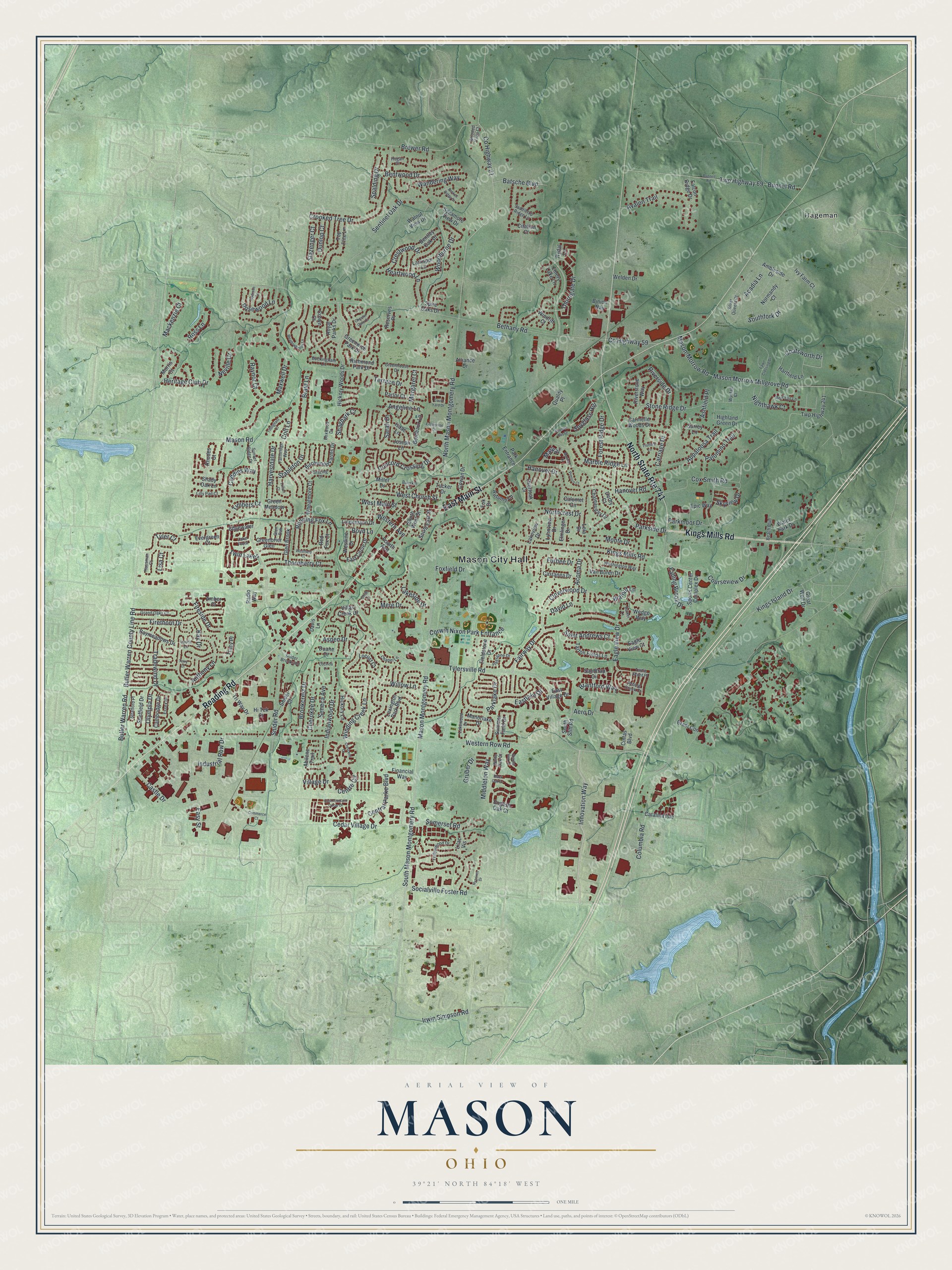
A new map of Mason, Ohio, made in 2026 and printed to order on thick archival matte paper.
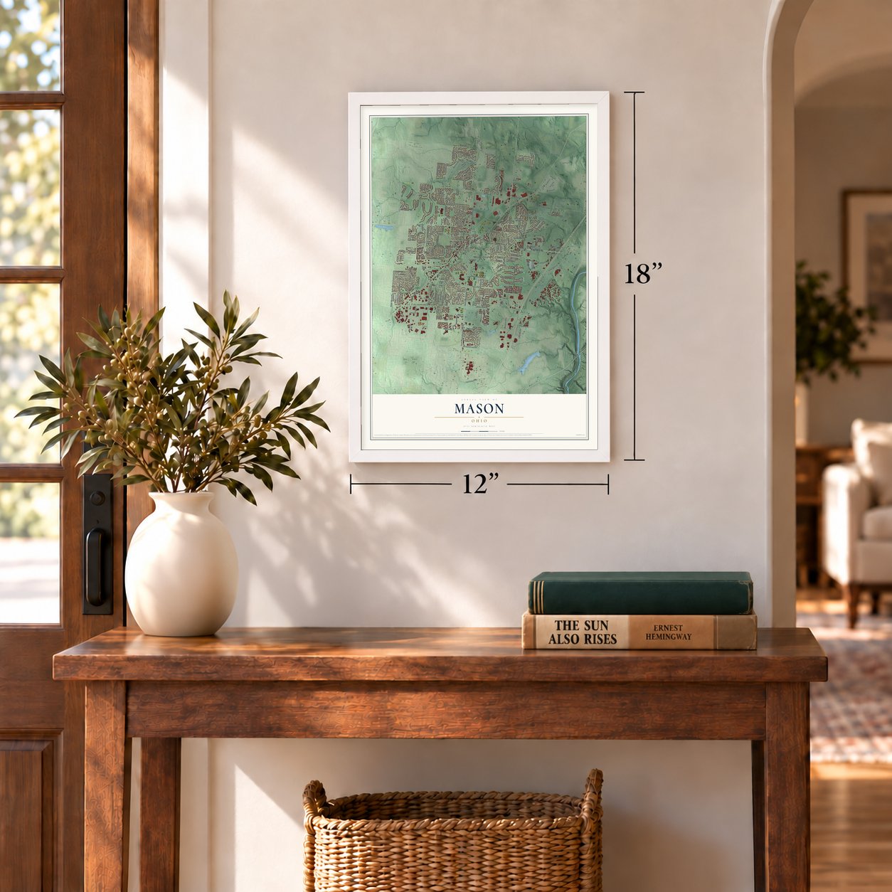
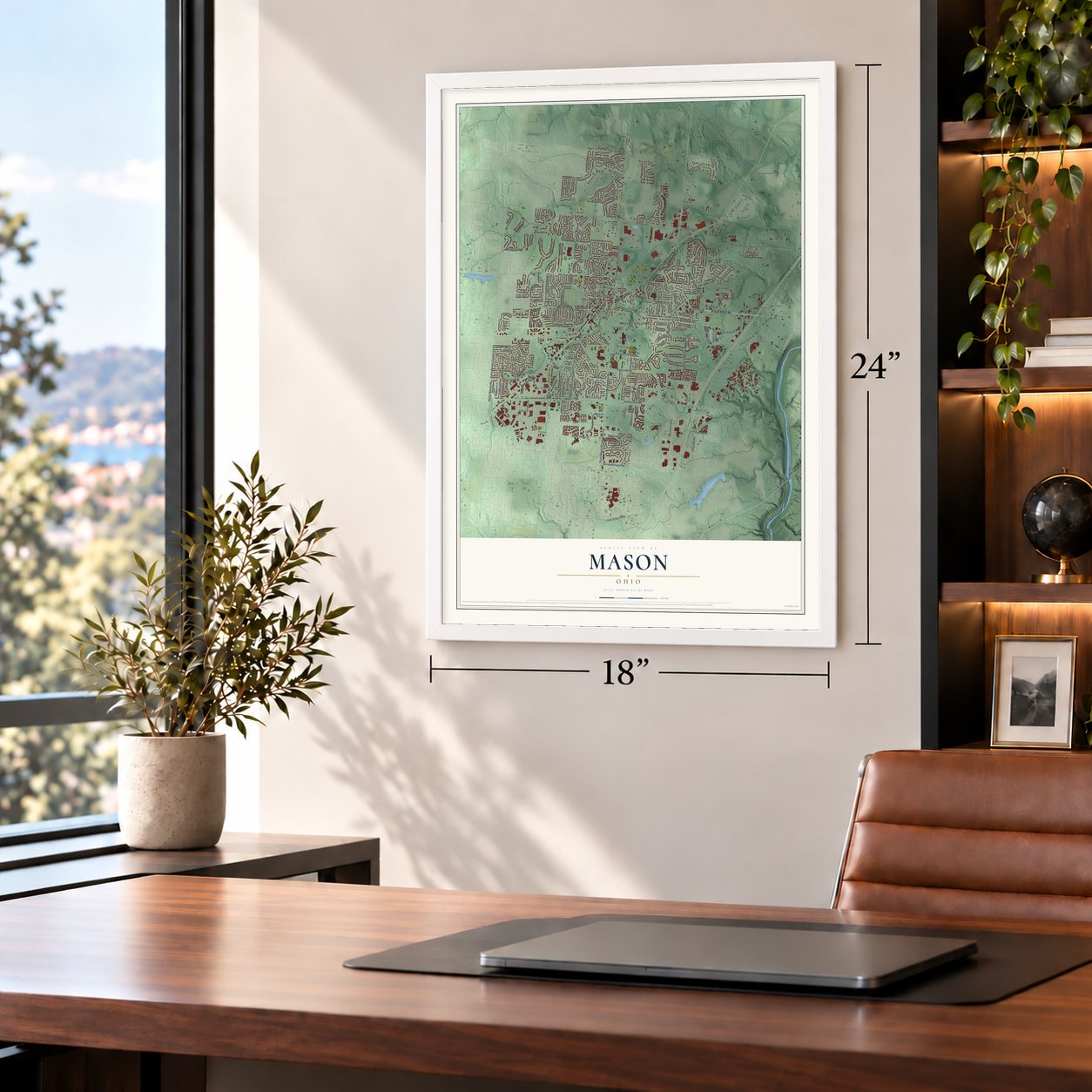
12" x 18" Archival Matte Print
A Map of Home. A Work of Art.
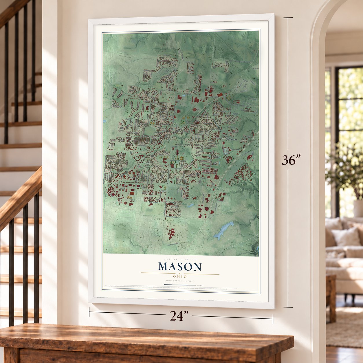
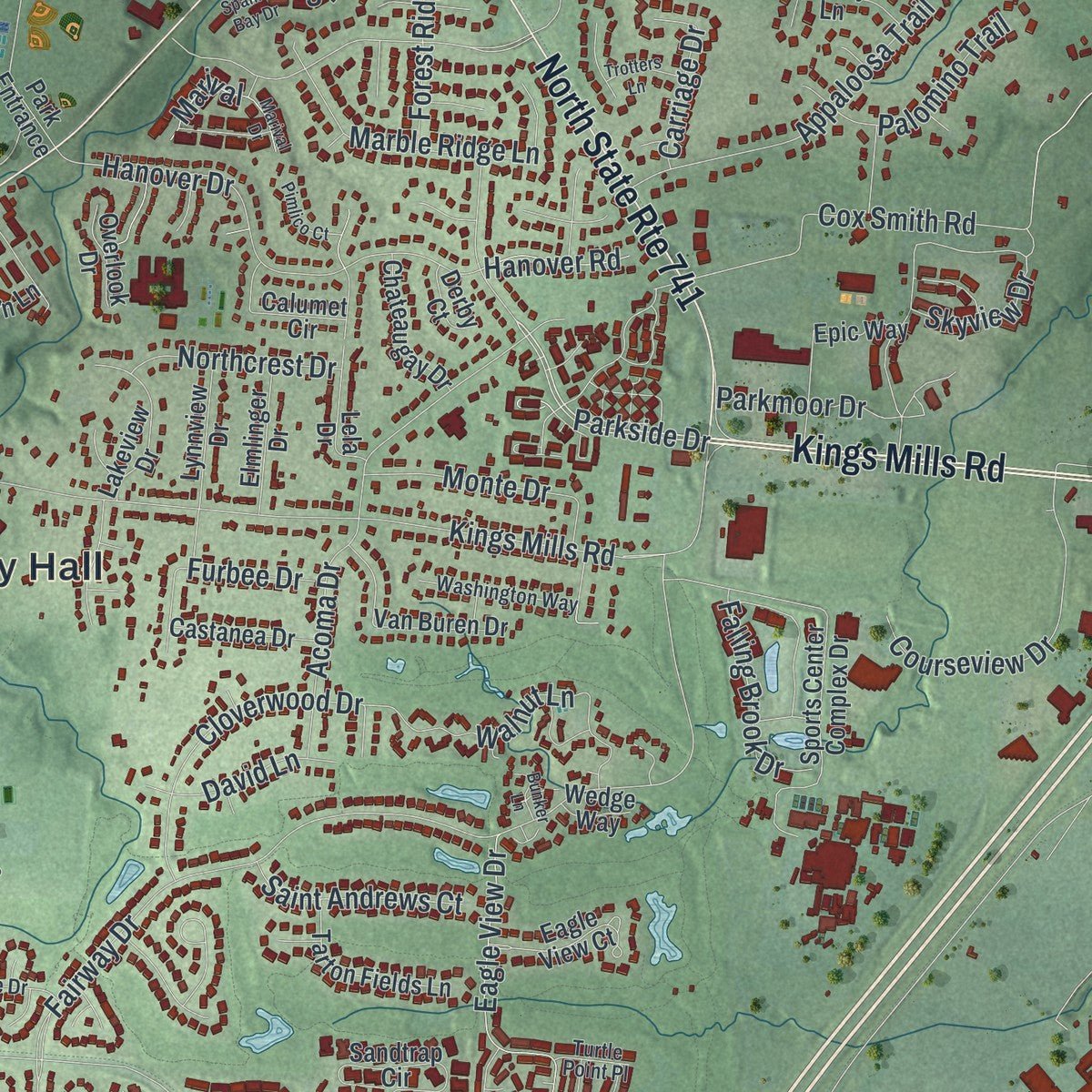
Explore Mason, Ohio from a whole new perspective. Created using aerial imagery and detailed geographic data, this map captures Mason building by building, with labeled streets, familiar landmarks, and shaded topographical relief that highlights the natural contours of the landscape.
Combining modern data with the timeless character of a vintage atlas, this map is just as interesting up close as it is beautiful on the wall. Whether you grew up in Mason, spent memorable years there, or call it home today, this unique map is a great way to celebrate a place that means something to you. Zoom in on the preview to look for your street, and then order a print to put your memories on the wall.
Three ways to hang it
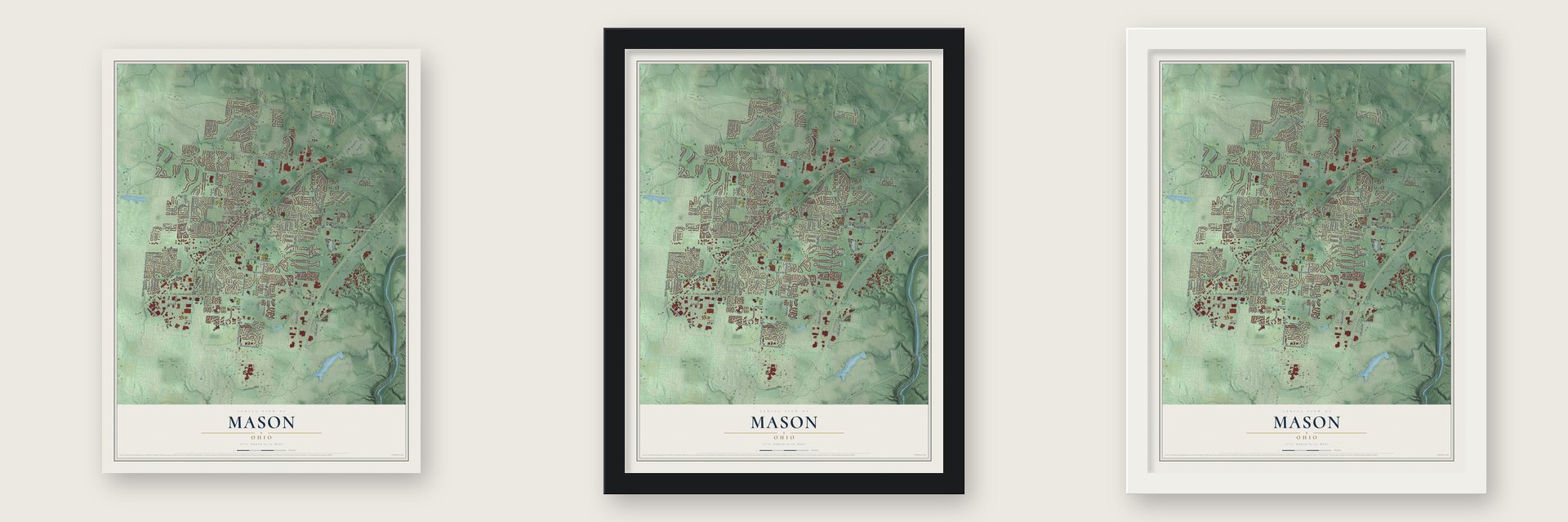
Unframed archival matte, a black wood frame or a white wood frame.
Up close
Geography Worth Displaying
This map was created using accurate cartographic data and authoritative geographic sources, including the U.S. Geological Survey and the Census Bureau. The map brings together terrain, waterways, roads, and building detail. The majority of the streets are labeled, houses are accurately depicted, and the topography is derived from government sources. Combining local data with carefully composed color and shading leads to this beautifully detailed Mason artwork for your wall.
Rather than simply showing street outlines, we’ve included as many of the street names as we could reasonably fit on the map while keeping their names legible. Zoom in on the high resolution preview to see exactly what’s on the map. We truly set out to create a statement piece for anyone who loves Mason. So whether it’s for you, or a gift for someone you love, we hope this map of Mason brings back fond memories.

About Mason, Ohio
Mason is a city of 34,792 people in southwestern Warren County, about 22 miles north of downtown Cincinnati. On June 1, 1803, William Mason, a veteran of the Revolutionary War, bought 640 acres at auction for $1,700. In 1815 he laid out 16 lots on the ground that is now downtown Mason and called the village Palmyra.
The post office listed the town as Kirkwood, perhaps by mistake, since its postmaster was a man named William Kirkwood. In 1835 a petition asked for the name to be fixed. Village leaders then learned that Ohio already had a Palmyra, so they named the town Mason instead. It stayed a small farming town for generations, and in 1970 it still had fewer than 5,700 residents.
“This proved bothersome for locals, as they could hear the broadcast through their bedsprings, downspouts, and fencing.”
- The Nation's StationIn 1928 Powell Crosley Jr.'s Cincinnati station WLW moved its transmitter to Tylersville Road, under an 831-foot tower. On May 2, 1934, Franklin D. Roosevelt switched on its 500,000-watt signal. It was ten times stronger than any other station's and could reach across the Atlantic.
- Cut back in 1939Rival stations complained of interference, so in 1939 the government cut WLW to 50,000 watts. The Crosley Corporation lost its Supreme Court appeal. WLW still broadcasts from Mason, on one of only seven Blaw-Knox diamond towers left.
- Main Street paved in 1923Paving Main Street in 1923 set off a celebration across town. Mason became a city the year after the 1970 count, and in February 1997 it left Deerfield Township by forming a paper township of its own, Mason Township.
- Neil Armstrong in 2003The first man on the Moon, Neil Armstrong, had served in the Korean War himself, and he was guest of honor at the dedication of the Mason Veterans Memorial on November 8, 2003. Beside an eternal flame, its 10 pillars stand for 10 major American conflicts, each one as tall as that war's casualties call for.
- Kings Island and the Cincinnati OpenMason is home to the Kings Island amusement park and to the Lindner Family Tennis Center, where the Cincinnati Open is played as one of the top nine tournaments on the ATP Tour. Cintas, a Fortune 500 company, keeps its headquarters here.
Find your street
Names on the Mason map
Every name below is printed on this map. Look for your street, your school, the park where you played, or the pond down the road.
Places and landmarks2
- Mason City Hall
- Hageman
Streets and roads288
- Reading Road
- North State Route 741
- Kings Mills Road
- East Main Street
- Parkside Drive
- Thorngate Drive
- Boyd Lane
- Tylersville Road
- Western Row Road
- Snider Road
- South Mason Montgomery Road
- Mason Montgomery Road
- Bethany Road
- Innovation Way
- Columbia Road
- North Mason Montgomery Road
- Mason Road
- Kings Island Drive
- Stone Ridge Drive
- Butler Warren County Line Road
- Butler Warren Road
- Cox Smith Road
- Fairway Drive
- Sentinel Oak Drive
- Cedar Village Drive
- Mason Morrow Millgrove Road
- Foxfield Drive
- Thornberry Court
- Maxwell Drive
- Crooked Tree Drive
Show all 288 streets
- Hanover Drive
- Socialville Foster Road
- Indianwood Drive
- Willow Lane
- County Highway 21
- Running Fox Lane
- Brewer Road
- Anthony Lane
- Terrace Drive
- Bunnel Road
- Twp Highway 69
- Corwin Nixon Park Entrance
- Central Parke Boulevard
- Castle Drive
- Avalon Trail
- Concord Crossing Drive
- Courseview Drive
- Mason-Morrow Road
- Sarah Drive
- Firethorn Drive
- Somerset Road
- Heritage Club Drive
- Marble Ridge Lane
- Riverside Drive
- Walnut Lane
- Appaloosa Trail
- Parklake Drive
- Bentwood Drive
- West Church Street
- Winding Creek Lane
- Village Drive
- Eagle View Drive
- Irwin Simpson Road
- Tradewind Drive
- Industrial Row Drive
- Brookcrest Drive
- Cloverwood Drive
- Chatsworth Drive
- Cherokee Drive
- Harvestdale Drive
- Heartwood Lane
- Spyglass Hill
- Acadia Lane
- Middleton Way
- Caddies Way
- Braid Lane
- Woodburne Drive
- Ross Lane
- Monte Drive
- Palomino Trail
- Crestwood Drive
- Acoma Drive
- Fireside Drive
- West Main Street
- Eastlake Drive
- Centre Circle
- Batsche Boulevard
- Angeline Lane
- Furbee Drive
- Margaret Court
- County Highway 59
- Falling Brook Drive
- Twin Lakes
- Western Avenue
- Olympia Drive
- Saint Andrews Court
- Northcrest Drive
- Stableton Drive
- Forest Ridge Drive
- Spalding Drive
- Rosewood Lane
- Wandering Way
- Aero Drive
- Lakeside Drive
- Marival
- Brantford Way
- David Lane
- Mackenzie Court
- Nighthawk Court
- Southfork Drive
- Raynor Court
- Parkmoor Drive
- Carriage Drive
- Seneca Avenue
- Tyler Court
- Aspen Drive
- Slazenger Court
- Ashfield Place
- Skyview Drive
- Timbers Court
- Mere Drive
- Shagbark Court
- Dunlop Court
- Hanover Road
- Gruber Drive
- Kay Drive
- Neville Court
- Easy Street
- Colt Lane
- Lisa Court
- Hickory Woods Drive
- Lexington Park Boulevard
- Sports Center Complex Drive
- Twp Highway 241
- Top Flite Lane
- Wheatmore Court
- Lakeview Drive
- Snider Court
- Tracy Place
- Highland Green Drive
- Birchwood Farms Drive
- Sandtrap Circle
- Ambleside Drive
- Eagle View Court
- South West Street
- Summer Field Drive
- English Oak Court
- Van Buren Drive
- Hartfield Lane
- Carmelle Woods Drive
- Epic Way
- Baymeadows Drive
- Tarton Fields Lane
- Cambridge Drive
- Amber Court
- Richmond Park Drive
- East Village Drive
- East Circle Drive
- Manorlake Drive
- Parlor Court
- Royal Parks Drive
- Park Entrance
- Great Wolf Drive
- Autumn Lane
- Green Meadow
- Chateaugay Drive
- Larkspur Lane
- Bordeaux Lane
- Riverstone Way
- Villas Creek Drive
- Lilac Vis
- Elmlinger Drive
- Glen Brook
- Castanea Drive
- Greenbrier Glen
- Lindemann Drive
- Lynnview Drive
- Cowan Drive
- Calumet Circle
- Tri Way Drive
- Surrey Lane
- Hickory Lane
- Morris Court
- Hi Tek Court
- Falcon Ridge Drive
- South East Street
- Bentley Oak Drive
- Fieldstone Drive
- Sheffield Drive
- Lela Drive
- Westline Drive
- Evergreen Court
- Isaac Lane
- Shady Oak Lane
- Tucker Drive
- Water Park Drive
- Catalina Isle
- Ivy Farm Court
- Financial Way
- Walnut View Drive
- Abilene Trail
- Sycamore View Drive
- Edgewater
- Emery Lake Lane
- Welden Drive
- Greenwich Park Drive
- Brant Con
- Normandy Court
- Joseph Lane
- Overlook Drive
- Citation Court
- Fox Drive
- Alliance Drive
- Locust Court
- Reserves Place
- Windrift Court
- Spire Oaks Drive
- Cintas Boulevard
- Red Fox Court
- South Stitt Road
- Radio Way
- Rhodes Court
- Crown Court
- Davis Lane
- Derby Court
- Binion Way
- Quality Place
- Duane Drive
- Fourth Avenue
- Miller Drive
- Wedge Way
- Rydal Lane
- Farmridge Way
- White Oak Court
- Yellowwood Drive
- Saddletop Ridge Lane
- Sunset Ridge Drive
- Greenhouse Drive
- Flagstone Drive
- Grand Oaks Court
- Washington Way
- Silver Queent Court
- Red Tail Lane
- Essex Drive
- Lakewood Drive
- Buckingham Lane
- Laura Lane
- Beach Boulevard
- Lilly Pad Court
- Stratford Place
- Grazing Court
- Boxwood Drive
- Chapel Lane
- Wooded Vista Court
- Snider Brookside
- Hassman Court
- Lake Front
- Pebble Creek Court
- Turtle Point Place
- Buerkle Drive
- Wynfall Court
- Glen Oak
- Hogan Court
- Meadowbrook Lane
- Bunnell Road
- East Fountain Circle Drive
- Spanish Bay Drive
- Fawn Crossing Drive
- Court Yard Drive
- Broken Ridge Drive
- Crescent Drive
- Marival Drive
- Black Oak Lane
- Tillinghast Court
- Ivygrove Lane
- Hyacinth Drive
- Enterprise Drive
- Lofton Court
- Commerce Court
- Scarlet Oak Court
- Pimlico Court
- Trotters Lane
- Chester Gate Court
- Westfield Court
- Cocinda Lane
- Bunker Lane
- Smith Court
- Terry Court
Names are listed as they appear on the printed map. Zoom into the product photos to find them.
The art of mapping a place
How This Map Was Made
Real places. Remarkable detail. Discover the layers that turn geographic data into a map of home.

The view from above
Aerial imagery reveals the character of the land: woodland, open fields, and the patterns of a place.

The shape of the land
Elevation data brings hills, valleys, and subtle changes in the landscape into view.

The details of home
Roads, waterways, and building footprints come together to make the map feel unmistakably local.

Geography becomes art
Considered color, shading, and typography bring the layers together in a map made for your wall.


Process illustrated with Mendon, Massachusetts. Aerial imagery: USDA NAIP. Terrain: USGS 3D Elevation Program. Map details and finished artwork: KNOWOL.
The Details
About This Print
Choose an archival matte print, or a black or white Ayous wood frame. The archival matte print is unframed.
Select your size and finish above to see the matching product image and price.
Materials & Craftsmanship
A contemporary map with the character of a classic atlas, printed on archival matte paper. Optional frames are made from Ayous wood.
Your printed map does not include the watermark shown in the full-map preview.
Shipping & Delivery
Free shipping within the United States. Every print is made to order in the USA.
Buying a gift? Add a note in your cart and we'll include it. We never put prices in the package.
Prints ship within 2 to 3 business days. Allow 7 to 10 days total from ordering for delivery. Timing may vary during holidays or periods of high order volume.
Read our shipping policy.
Returns and damaged prints
Each print is made to order. Change-of-mind refunds are not available after production.
If your print arrives damaged, misprinted or incorrect, contact support@knowol.com within 30 days of receiving it. Include your order number, photos and a description of the issue.
Read our full refund and replacement policy. For questions about your order, email support@knowol.com.
Find your town
Looking for another city?
Find a map of home in our Ohio collection, or any town in the country.
Nearby
Maps of towns near Mason
Know someone from one of these towns? Their map makes a great gift.
 Kings Mills
, Ohio
From $39.99See the map
 Landen
, Ohio
From $39.99See the map
 Four Bridges
, Ohio
From $39.99See the map
More maps nearby: South Lebanon, Wetherington, Loveland Park, Highpoint and Olde West Chester.