
Search for another town





Free U.S. delivery 7 to 10 days after you order
Mentor, Ohio Map Art
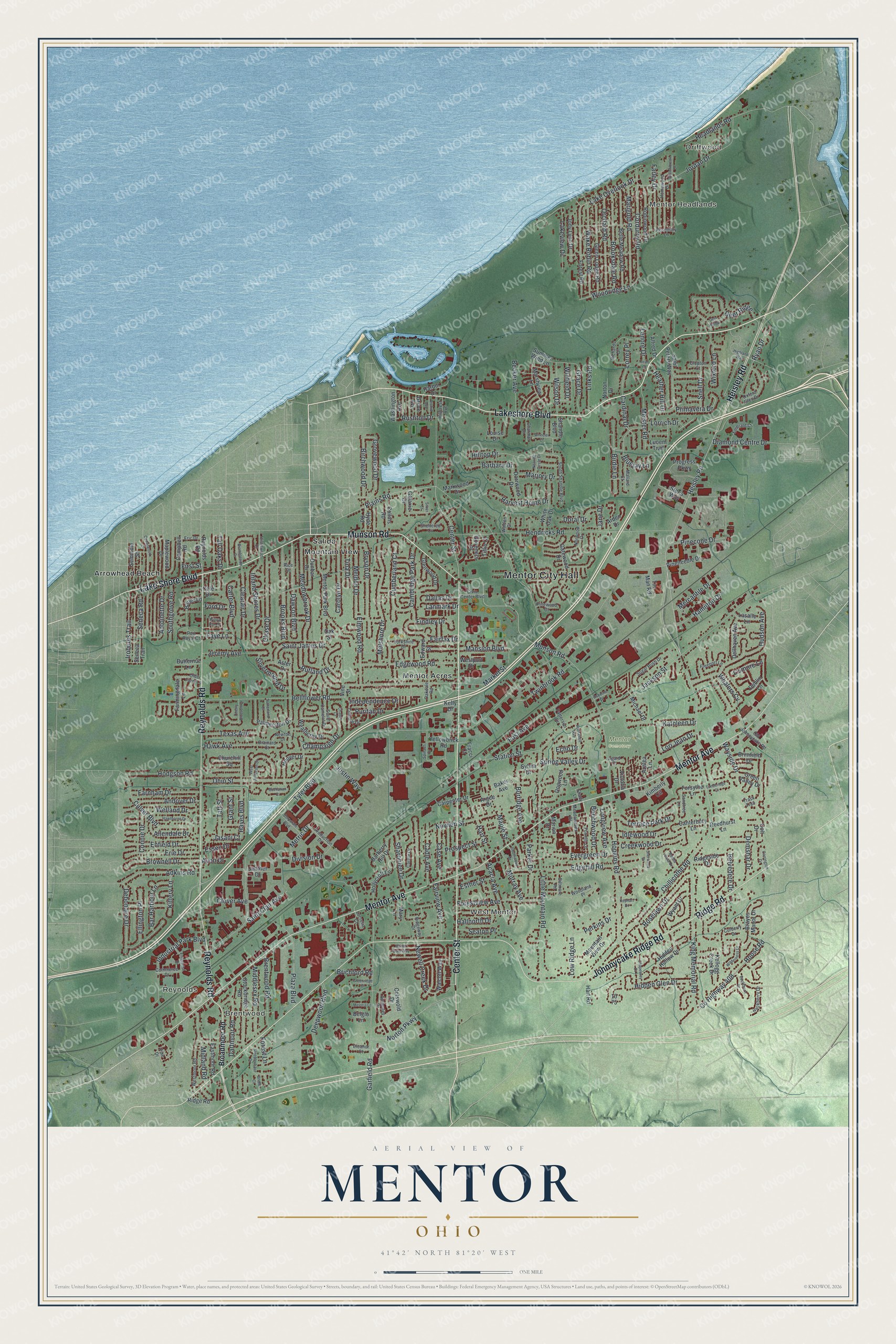
A new map of Mentor, Ohio, made in 2026 and printed to order on thick archival matte paper.
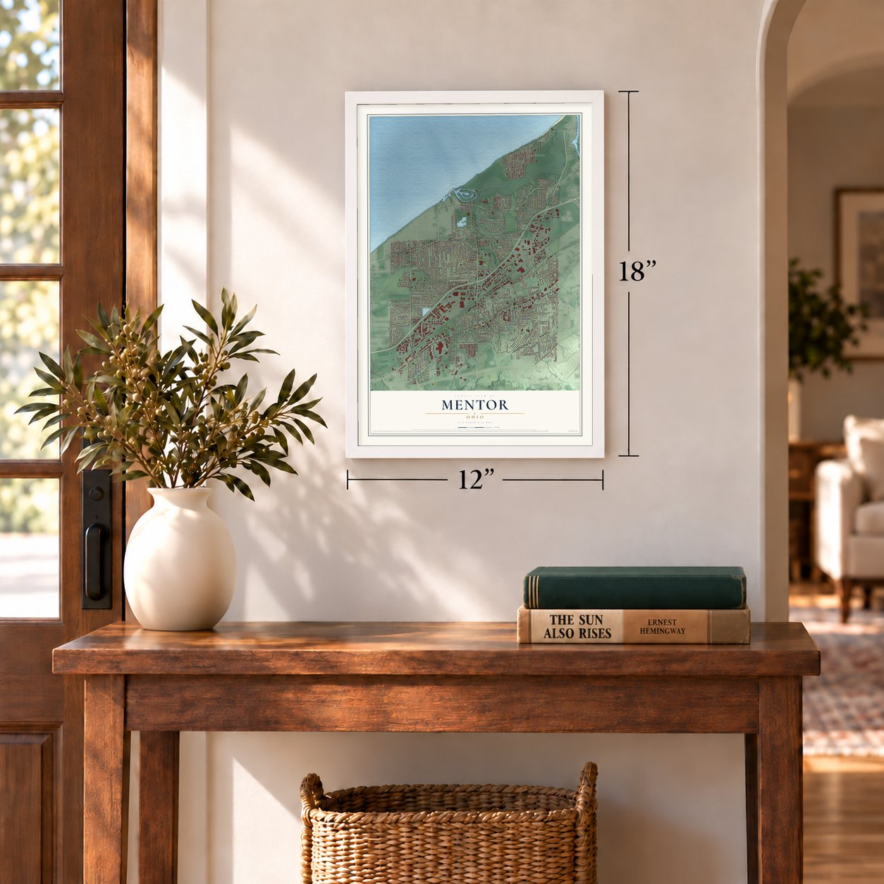
12" x 18" Archival Matte Print
A Map of Home. A Work of Art.
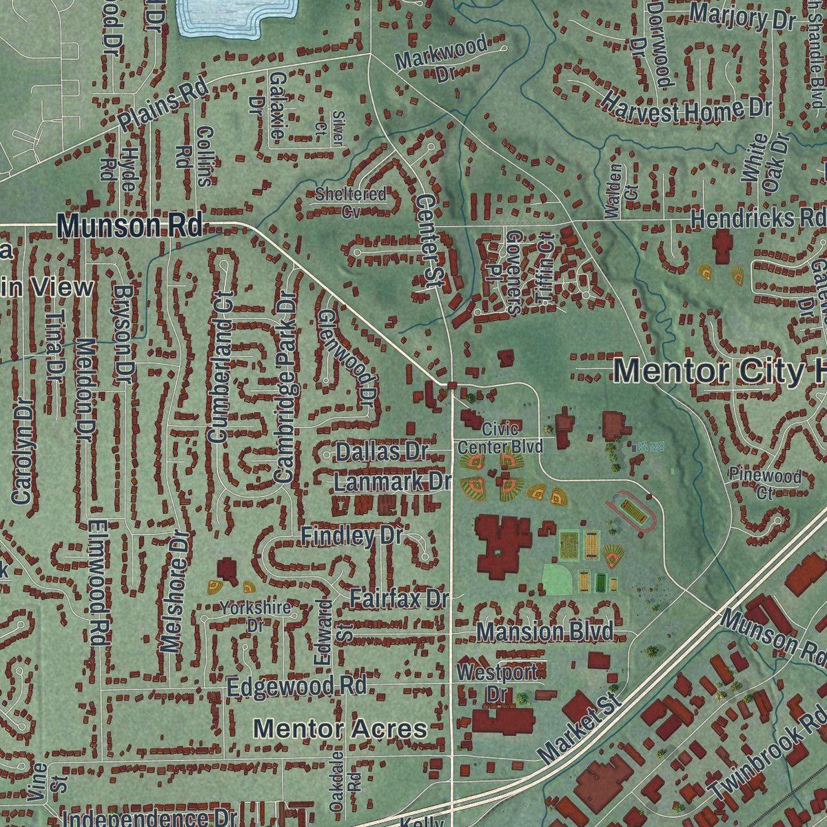
Explore Mentor, Ohio from a whole new perspective. Created using aerial imagery and detailed geographic data, this map captures Mentor building by building, with labeled streets, familiar landmarks, and shaded topographical relief that highlights the natural contours of the landscape.
Combining modern data with the timeless character of a vintage atlas, this map is just as interesting up close as it is beautiful on the wall. Whether you grew up in Mentor, spent memorable years there, or call it home today, this unique map is a great way to celebrate a place that means something to you. Zoom in on the preview to look for your street, and then order a print to put your memories on the wall.
Three ways to hang it
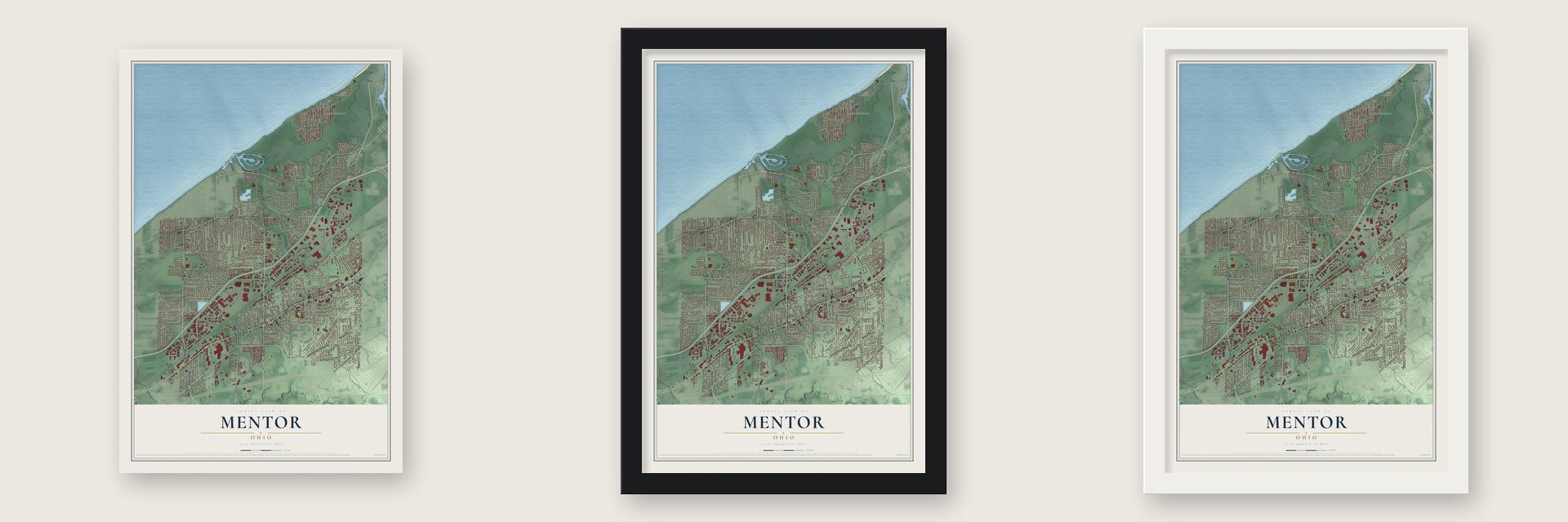
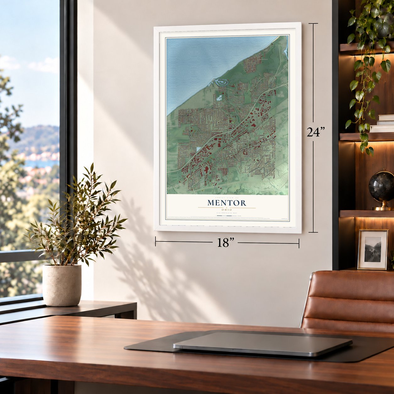
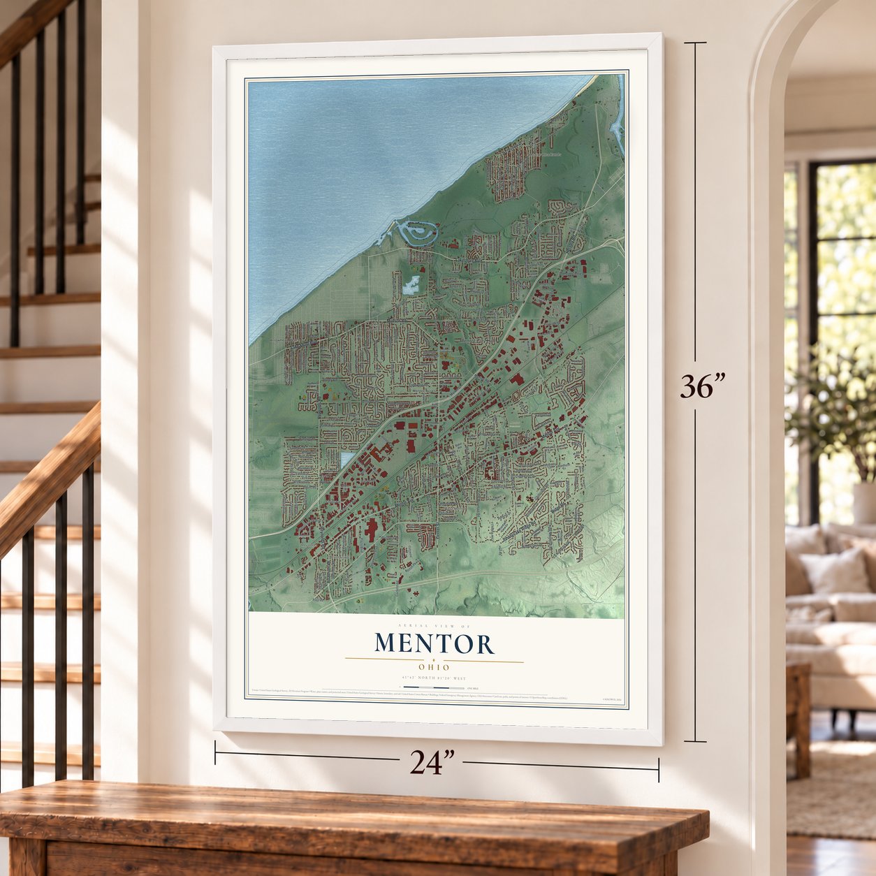
Unframed archival matte, a black wood frame or a white wood frame.
Up close
Geography Worth Displaying
This map was created using accurate cartographic data and authoritative geographic sources, including the U.S. Geological Survey and the Census Bureau. The map brings together terrain, waterways, roads, and building detail. The majority of the streets are labeled, houses are accurately depicted, and the topography is derived from government sources. Combining local data with carefully composed color and shading leads to this beautifully detailed Mentor artwork for your wall.
Rather than simply showing street outlines, we’ve included as many of the street names as we could reasonably fit on the map while keeping their names legible. Zoom in on the high resolution preview to see exactly what’s on the map. We truly set out to create a statement piece for anyone who loves Mentor. So whether it’s for you, or a gift for someone you love, we hope this map of Mentor brings back fond memories.

About Mentor, Ohio
Mentor is a city of 47,450 people in Lake County, the most populous city in the county, on the Lake Erie shore northeast of Cleveland. Charles Parker built its first settlement in 1797, the same year Connecticut Land Company surveyors settled the Headlands. The settlers named the place for Mentor, a figure from Greek legend, because Western Reserve families liked classical names, the same habit that gave nearby Solon, Euclid and Macedonia theirs. The community was formally established in 1855.
In 1876 James A. Garfield bought a home in Mentor. Four years later he ran for president from that house, and his 1880 race became the first successful front porch campaign for the White House. His home is now the James A. Garfield National Historic Site, and it joined the National Register in 1966.
- Rose Capital of the NationFrom the 1920s through the 1970s, upward of a dozen Mentor nurseries grew roughly five million rose plants a year, helped by the lake's mild weather, mixed soils and good water. Clevelanders came out to escape the smoky city. By the 1970s, rising land prices and new construction had eaten into the fields, and the Civic Center Complex now stands on a former huge rose field. A state marker at 8537 Mentor Avenue tells the story.
- Patent No. 10 for BlazeJoseph Kallay, one of Mentor's rose growers, bred a rose he called Blaze. In 1932 he received U.S. plant patent No. 10 for it. The city remembered its rose years in 1988 with the Commemorative Rose Garden, built to mark Mentor's 25th year as a city.
- Ohio's longest beachThe Mentor Headlands, in the northeast part of the city, were where the 1797 surveyors made their home. Today Headlands Beach State Park there is the longest public swimming beach in Ohio, and the Mentor Lagoons Nature Preserve nearby looks out over the Mentor Marsh and rare dune plants.
- A flag with six starsBrad Frost designed the city flag in 1988 for a contest held by Mentor Headlands. Its blue triangle stands for Ohio's hills and its stripes for roads and waterways. A northern cardinal, the official bird of both Ohio and Mentor, sits in a white circle, ringed by six stars for the 6 original townships, Mentor among them, surveyed in 1797.
- The Oliver family manorThe Oliver family built a manor house in Mentor in 1908. The city bought it in 1980 and turned it into the Wildwood Cultural Center, where the 34 acre estate now hosts weddings, programs and meetings and has hiking trails.
Find your street
Names on the Mentor map
Every name below is printed on this map. Look for your street, your school, the park where you played, or the pond down the road.
Places and landmarks11
- Mentor City Hall
- Driftwood
- Brentwood
- Reynolds
- Mentor Headlands
- West Mentor
- Mentor Cemetery
- Arrowhead Beach
- Mentor Acres
- Mountain View
- Salida
Streets and roads354
- Center Street
- Lakeshore Boulevard
- Munson Road
- Mentor Avenue
- Johnnycake Ridge Road
- Reynolds Road
- Heisley Road
- Lake Shore Boulevard
- Ridge Road
- Chillicothe Road
- Dawson Boulevard
- Norton Parkway
- Plains Road
- Brooks Boulevard
- Tyler Boulevard
- Hopkins Road
- Jackson Street
- Bellflower Road
- Hendricks Road
- Garfield Road
- Corduroy Road
- Headlands Road
- Little Mountain Road
- Plaza Boulevard
- King Memorial Road
- Deepwood Boulevard
- Ohio Street
- Melshore Drive
- Jordan Drive
- East Avenue
Show all 354 streets
- Deer Ridge
- Dartmoor Road
- Perkins Drive
- Market Street
- Meadowbrook Drive
- Culver Boulevard
- Brooksdale Road
- Marigold Road
- Industrial Park Boulevard
- Orchard Road
- Wake Robin Road
- Bryson Drive
- Edgewood Road
- County Highway 408
- Hoose Road
- Hart Street
- Inland Shores Drive
- Grovewood Drive
- Station Street
- Chase Drive
- Pinecone Drive
- Hilltop Drive
- Maple Street
- Primavera Drive
- Whalers Cv
- Cambridge Park Drive
- Adkins Road
- Meldon Drive
- Hayes Boulevard
- Andover Drive
- Carolyn Drive
- Twinbrook Road
- Hodgson Road
- Middlesex Road
- Murray Avenue
- Brownell Drive
- Evergreen Drive
- Edgehill Road
- Midland Road
- Brentwood Road
- Enfield Drive
- Clearair Drive
- Roselawn Drive
- Nowlen Street
- Fairfax Drive
- Erie Drive
- Lorrey Place
- Bluejay Lane
- Saint James Drive
- Seneca Road
- Hidden Glen Drive
- Cumberland Court
- Iroquois Trail
- Creekwood Drive
- Farnham Drive
- Birdie Lane
- Debonaire Drive
- Newell Creek Drive
- Lake Overlook Drive
- Champaign Drive
- Farley Drive
- Elmwood Road
- Independence Drive
- Woodridge Lane
- Jeremy Avenue
- Forestview Avenue
- Ellington Place
- Hamilton Drive
- Burridge Avenue
- Hudson Avenue
- Meister Road
- Antoinette Drive
- Cadle Avenue
- Bar Harbour Lane
- Carter Boulevard
- Southgrove Road
- Kathleen Drive
- Sharonlee Drive
- Beechwood Drive
- Lakeview Drive
- Terrace Park Drive
- Parker Drive
- Snell Drive
- Acacia Avenue
- Harvest Home Drive
- Birchwood Drive
- Welland Drive
- Links Road
- Fairview Avenue
- Tall Oaks Drive
- Case Avenue
- Texas Avenue
- Diamond Centre Drive
- Hawk Avenue
- Kittery Lane
- Cardinal Drive
- Mercantile Drive
- Becker Avenue
- Mansion Boulevard
- Silvermound Drive
- Wilson Drive
- Rutland Drive
- Grace Drive
- Idlewood Drive
- Connie Drive
- Barbara Drive
- Heather Hill Drive
- Demshar Drive
- Saint Clair Avenue
- Low Ridge Lane
- Puritan Drive
- Clover Avenue
- Marjory Drive
- Longview Avenue
- Rushton Drive
- Prospect Street
- Spring Valley Drive
- Findley Drive
- Doral Drive
- Belvedere Drive
- Ryan Drive
- Wayside Drive
- Taft Street
- Allendale Drive
- Division Drive
- Tina Drive
- Justin Way
- Lorrich Drive
- Dallas Drive
- Wixford Lane
- Seaton Place
- Metric Drive
- Lori Jean Drive
- Hallnorth Drive
- Essex Drive
- Brichford Road
- Lenore Drive
- Winfield Drive
- Esther Street
- Lanmark Drive
- Lismore Lane
- Grant Street
- Faye Lane
- Ford Drive
- Forest Lane
- Jasani Court
- Jane Drive
- Avon Drive
- Echo Drive
- First Street
- Broadmoor Road
- Mentor Park Boulevard
- Belle Meadow Road
- Forest Road
- Glenn Lodge Road
- Stockbridge Road
- Seneca Trail
- Gatewood Drive
- Dogwood Lane
- Weatherby Drive
- Kimberly Circle
- Marshview Lane
- Hollycroft Lane
- Green Valley Drive
- Mountain View Drive
- Brayes Manor Drive
- Saint Peters Way
- Kellogg Creek Drive
- Barberry Hill Drive
- Robinwood Drive
- Palmerston Drive
- White Oak Drive
- Reedhurst Lane
- Hidden Hollow Drive
- Seminole Street
- Pineneedle Drive
- Jody Lynn Drive
- Dorrwood Drive
- Maplewood Drive
- Wyant Drive
- Shandle Boulevard
- Dellhaven Avenue
- Alfred Drive
- Campbell Road
- Farmingdale Lane
- Harbor Drive
- Glenwood Drive
- Louise Drive
- Hoover Drive
- Ridgeside Drive
- Dunbar Drive
- Collins Road
- Canterbury Lane
- Markwood Drive
- Walcott Way
- Progress Parkway
- Eastmoor Road
- Brimfield Drive
- Washington Avenue
- Yellowbrick Road
- Carpenter Drive
- Lasalle Lane
- Arden Drive
- Tiffin Court
- Michael Drive
- Argee Drive
- Aster Drive
- Churchill Square
- Tin Man Road
- Hyde Road
- Butternut Lane
- Baker Avenue
- Westport Drive
- Edward Street
- Steris Way
- Victoria Drive
- Jenther Drive
- Colt Drive
- Bauer Lane
- Goveners Place
- Cotswold Drive
- Forsythe Lane
- Azalea Lane
- Mary Lane
- Grove Avenue
- Fracci Court
- Summer Wind Lane
- Luoem Trail
- Norton Drive
- Galaxie Drive
- Sylvia Drive
- Dublin Lane
- Hart Road
- Belglo Lane
- Marion Drive
- Cole Drive
- Kelly Drive
- Vine Street
- Oak Street
- Pine Drive
- Meadowlawn Drive
- Homewood Drive
- Norwood Drive
- Westmoor Road
- Foxmill Lane
- Civic Center Boulevard
- South Shandle Boulevard
- Oxford Glen Drive
- Amberley Drive
- Richards Drive
- Sugar Bush Drive
- Rosemary Lane
- Oakdale Road
- Charmar Drive
- Carole Drive
- Old Johnnycake Road
- Emerald Court
- South Camelot Drive
- Colonial Drive
- Curberry Drive
- Production Drive
- Olde Farm Lane
- Hackberry Drive
- Mallard Court
- Woodland Place
- Yorkshire Drive
- Brainard Court
- Commerce Drive
- Freeport Lane
- Clopton Court
- Port Royal Court
- Newton Drive
- Ridgeway Drive
- Patterson Drive
- Sandtree Lane
- Pinewood Court
- Sheltered Cv
- Hillcrest Avenue
- Biltmore Road
- Eric Drive
- Eleanor Court
- Lucretia Court
- Walden Court
- Trask Trail
- Agard Court
- Shady Lane
- Rice Drive
- Cedarwood Drive
- Willowbrook Drive
- Highland Way
- Manor Gate Way
- Steeplechase Drive
- Hawthorne Drive
- Brambleside Drive
- Roosevelt Avenue
- Chapelway Drive
- Sutherland Court
- West Jefferson Drive
- Spinach Drive
- Buchanan Court
- Sherwood Drive
- Wilderness Drive
- Corporate Boulevard
- Buckthorn Drive
- Southwood Drive
- Enterprise Drive
- Wheeler Court
- Cherry Blossom Drive
- Buena Vista Drive
- Orchid Avenue
- Thistlewood Drive
- Deer Hollow
- Nearing Circle Drive
- Timberidge Court
- Carrington Drive
- Greenridge Court
- Meloria Lane
- Chablis Court
- Osborne Drive
- Kephart Drive
- Leah Court
- Willow Run Drive
- Bridle Court
- Silver Court
Names are listed as they appear on the printed map. Zoom into the product photos to find them.
The art of mapping a place
How This Map Was Made
Real places. Remarkable detail. Discover the layers that turn geographic data into a map of home.

The view from above
Aerial imagery reveals the character of the land: woodland, open fields, and the patterns of a place.

The shape of the land
Elevation data brings hills, valleys, and subtle changes in the landscape into view.

The details of home
Roads, waterways, and building footprints come together to make the map feel unmistakably local.

Geography becomes art
Considered color, shading, and typography bring the layers together in a map made for your wall.


Process illustrated with Mendon, Massachusetts. Aerial imagery: USDA NAIP. Terrain: USGS 3D Elevation Program. Map details and finished artwork: KNOWOL.
The Details
About This Print
Choose an archival matte print, or a black or white Ayous wood frame. The archival matte print is unframed.
Select your size and finish above to see the matching product image and price.
Materials & Craftsmanship
A contemporary map with the character of a classic atlas, printed on archival matte paper. Optional frames are made from Ayous wood.
Your printed map does not include the watermark shown in the full-map preview.
Shipping & Delivery
Free shipping within the United States. Every print is made to order in the USA.
Buying a gift? Add a note in your cart and we'll include it. We never put prices in the package.
Prints ship within 2 to 3 business days. Allow 7 to 10 days total from ordering for delivery. Timing may vary during holidays or periods of high order volume.
Read our shipping policy.
Returns and damaged prints
Each print is made to order. Change-of-mind refunds are not available after production.
If your print arrives damaged, misprinted or incorrect, contact support@knowol.com within 30 days of receiving it. Include your order number, photos and a description of the issue.
Read our full refund and replacement policy. For questions about your order, email support@knowol.com.
Find your town
Looking for another city?
Find a map of home in our Ohio collection, or any town in the country.
Nearby
Maps of towns near Mentor
Know someone from one of these towns? Their map makes a great gift.
 Mentor-on-the-Lake
, Ohio
From $39.99See the map
 Kirtland Hills
, Ohio
From $39.99See the map
 Grand River
, Ohio
From $39.99See the map
More maps nearby: Painesville, Willoughby, Fairport Harbor, Eastlake and Timberlake.