


Search for another town





Free U.S. delivery 7 to 10 days after you order
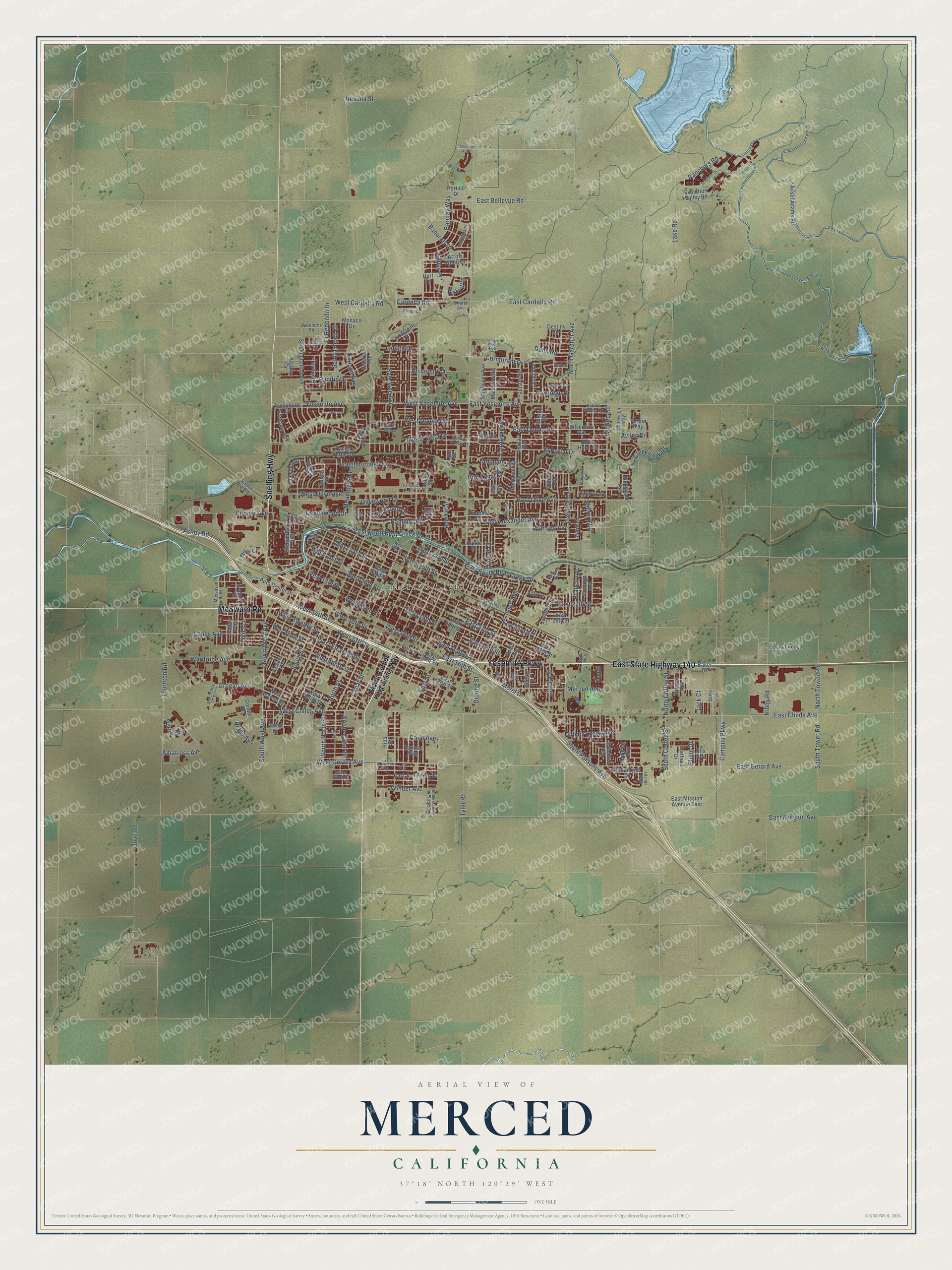
Merced, California Map Art
Building by building, with labeled streets and shaded relief.
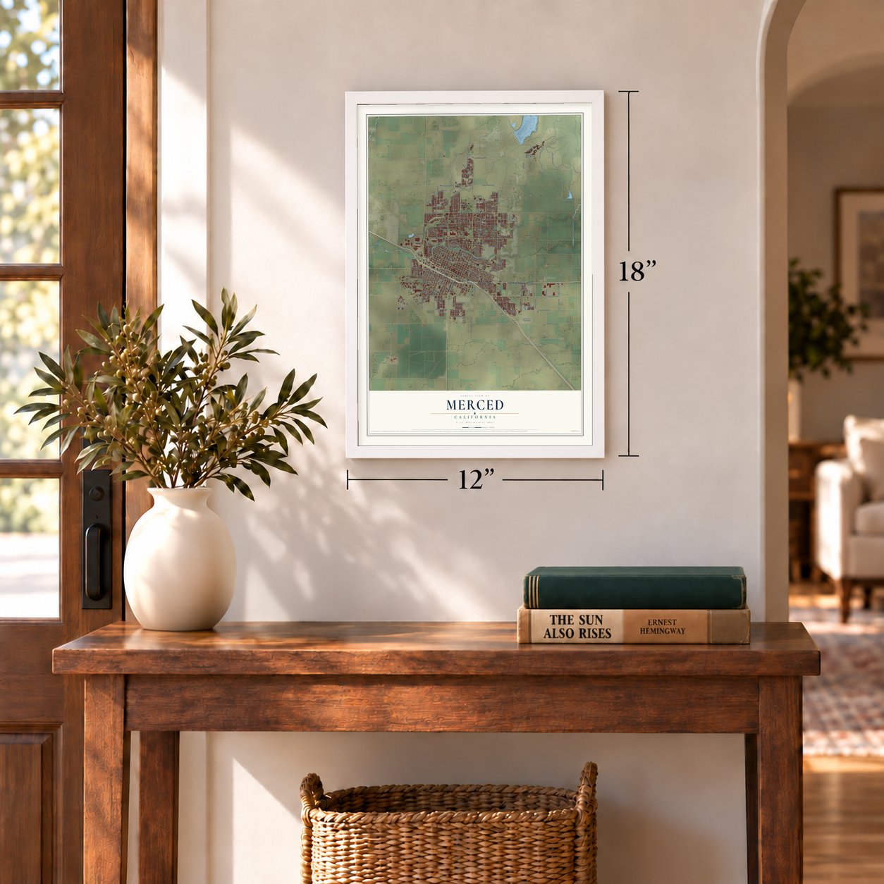
12" x 18" Archival Matte Print
A Map of Home. A Work of Art.
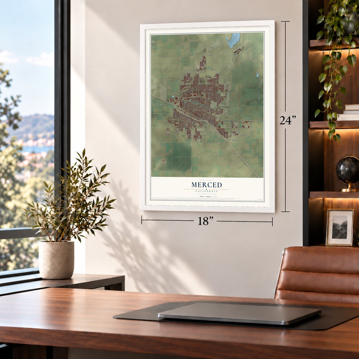
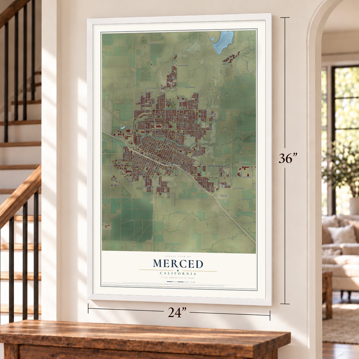
Explore Merced, California from a whole new perspective. Created using aerial imagery and detailed geographic data, this map captures Merced building by building, with labeled streets, familiar landmarks, and shaded topographical relief that highlights the natural contours of the landscape.
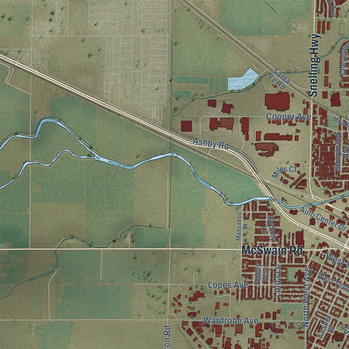
Combining modern data with the timeless character of a vintage atlas, this map is just as interesting up close as it is beautiful on the wall. Whether you grew up in Merced, spent memorable years there, or call it home today, this unique map is a great way to celebrate a place that means something to you. Zoom in on the preview to look for your street, and then order a print to put your memories on the wall.
Three ways to hang it
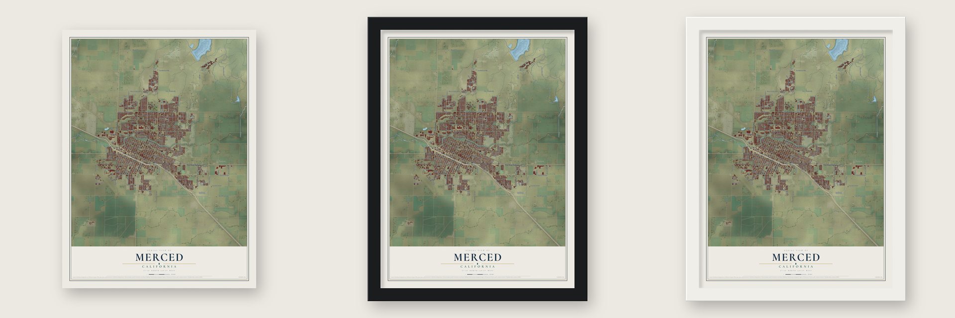
Unframed archival matte, a black wood frame or a white wood frame.
Up close
Geography Worth Displaying
This map was created using accurate cartographic data and authoritative geographic sources, including the U.S. Geological Survey and the Census Bureau. The map brings together terrain, waterways, roads, and building detail. The majority of the streets are labeled, houses are accurately depicted, and the topography is derived from government sources. Combining local data with carefully composed color and shading leads to this beautifully detailed Merced artwork for your wall.
Rather than simply showing street outlines, we’ve included as many of the street names as we could reasonably fit on the map while keeping their names legible. Zoom in on the high resolution preview to see exactly what’s on the map. We truly set out to create a statement piece for anyone who loves Merced. So whether it’s for you, or a gift for someone you love, we hope this map of Merced brings back fond memories.
Read the story behind this map of Merced, California from 2026.

Find your street
Names on the Merced map
Every name below is printed on this map. Look for your street, your school, the park where you played, or the pond down the road.
Places and landmarks2
- Merced Civic Center
- Kadota
Streets and roads233
- East State Highway 140
- McSwain Road
- Yosemite Parkway
- Snelling Highway
- West Childs Avenue
- North Gardner Avenue
- East Cardella Road
- Cardella Road
- South West Avenue
- North West Avenue
- West Gerard Avenue
- East Gerard Avenue
- West 16th Street
- Rambler Road
- East 16th Street
- West 13th Street
- Parsons Avenue
- West Yosemite Avenue
- Motel Drive
- Campus Parkway
- East Donna Drive
- University Drive
- East Childs Avenue
- East Bellevue Road
- West North Bear Creek Drive
- East Mission Avenue
- West Olive Avenue
- Canal Street
- Buena Vista Drive
- Thornton Road
Show all 233 streets
- South Street
- East Olive Avenue
- McKee Road
- North Street
- West Eleventh Street
- El Redondo Drive
- West Main Street
- West 23rd Street
- West 14th Street
- West 20th Street
- Loughborough Drive
- South Parsons Avenue
- West 25th Street
- West Twelfth Street
- El Portal Drive
- West 19th Street
- Merced Avenue
- East Alexander Avenue
- West 15th Street
- West 18th Street
- West 21st Street
- East 27th Street
- Lake Road
- Gove Road
- Brookdale Drive
- East 21st Street
- East 23rd Street
- Wardrobe Avenue
- West Donna Drive
- West Ninth Street
- South Coffee Street
- East Yosemite Avenue
- Lopes Avenue
- Cooper Avenue
- Grogan Avenue
- Olivewood Drive
- Bancroft Drive
- Glen Avenue
- Dinkey Creek Avenue
- East South Bear Creek Drive
- Cormorant Drive
- Columbia Avenue
- West Cardella Road
- Ranchers Road
- San Jose Avenue
- Creekview Drive
- Ashby Road
- Pacific Drive
- Yosemite Avenue
- Barclay Way
- Horizon Avenue
- Lehigh Drive
- Albatross Avenue
- Park Avenue
- South Tower Road
- Cordova Avenue
- Devonwood Drive
- East Main Street
- West 27th Street
- Green Street
- Dunn Road
- East Street
- Hansen Avenue
- South North Street
- South Canal Street
- Kibby Road
- North Tower Road
- Winder Avenue
- Branco Avenue
- Meadows Avenue
- East 19th Street
- Carol Avenue
- Sibley Place
- Northwood Drive
- North Coffee Street
- Tahoe Drive
- Saint Tropez Court
- Cone Avenue
- Partridge Drive
- Bedford Drive
- Delong Street
- Riggs Avenue
- Heron Way
- Nevada Street
- Alviso Drive
- Linda Lane
- Tyler Road
- Pluim Drive
- Aviles Drive
- Jack Court
- Martin Luther King Junior Way
- Ansel Adams Road
- Stonybrook Avenue
- East Mission Avenue East
- West 22nd Street
- East 22nd Street
- West Tenth Street
- East 20th Street
- East 26th Street
- Paulson Road
- Brimmer Road
- West Street
- Esplanade Drive
- San Augustine Avenue
- Andover Way
- West Fourth Street
- Baker Drive
- Sydney Lane
- Joerg Avenue
- Evolution Valley Road
- Austin Avenue
- Sandpiper Avenue
- East 13th Street
- Mansionette Drive
- Arrow Wood Drive
- Cherokee Avenue
- East San Pedro Street
- East 15th Street
- Cheyenne Drive
- Auto Center Drive
- Quail Avenue
- Vernal Avenue
- Union Avenue
- Silverado Avenue
- West Second Street
- Saratoga Avenue
- Sarasota Avenue
- Santa Fe Road
- Collins Drive
- Monaco Drive
- Paseo Verde Drive
- Jardin Way
- Ballantyne Drive
- Marie Lane
- Solstice Avenue
- Ironstone Drive
- Alpine Drive
- Carmen Way
- Bixby Way
- Wooddale Avenue
- Shirley Street
- Citadel Avenue
- Robin Hood Lane
- Emerald Drive
- Villa Drive
- Hart Drive
- Destiny Drive
- Argosy Drive
- Blix Avenue
- Colony Lane
- Portico Drive
- Sunset Drive
- Lesher Drive
- Condor Drive
- Miles Court
- Stuart Drive
- Centro
- Daffodil Drive
- Erie Avenue
- Emory Way
- Dublin Avenue
- Rios Street
- Line Drive
- Gail Court
- West El Portal Drive
- Shafer Avenue
- East Santa Fe Avenue
- Massasso Street
- Whitewater Way
- Macready Drive
- Paseo Verde Avenue
- Kimberly Avenue
- Rose Avenue
- Pettinotti Road
- La Mirada Drive
- Hutchinson Lane
- Favier Drive
- Cassis Drive
- Pebble Beach Drive
- Bismark Drive
- Madroan Avenue
- Santa Clara Court
- Mercy Avenue
- Sable Street
- Kelly Avenue
- Phelps Drive
- El Verano Way
- La Jolla Way
- West 26th Street
- Scholars Lane
- Oleander Avenue
- South Mather Road South
- Catalina Drive
- Fairfield Drive
- Pine Street
- Alfarata Boulevard
- Amy Street
- Hunters Drive
- Jenner Drive
- Farmland Avenue
- John Street
- Jackson Avenue
- June Court
Names are listed as they appear on the printed map. Zoom into the product photos to find them.
About Merced, California
Merced is the county seat of Merced County, a city of 86,333 people in the San Joaquin Valley. It takes its name from the nearby Merced River, and merced is the Spanish word for mercy. A post office opened here in 1870. On February 8, 1872, a company set up by the Central Pacific Railroad sold building lots at auction, and the town began.
The town was incorporated on April 1, 1889, and the County Courthouse, now a museum, dates from about that year. From 1907 to 1945 the Yosemite Valley Railroad ran out of Merced, and the city still calls itself the Gateway to Yosemite.
- The fairgrounds in 1942During World War II, Executive Order 9066 forced Japanese Americans from their West Coast homes. In 1942 the Merced County fairgrounds were turned into a temporary assembly center for 4,669 men, women and children, most of them from Merced County. They were held there between May 6 and September 15, and then sent to the Granada internment camp in Colorado.
- A new UC campus, 2005UC Merced, the 10th campus of the University of California, opened in late 2005 just northeast of the city limits. It was the first research university built in the United States in the 21st century, and its campus covers 1,026 acres.
- Castle Air Force BaseMerced's economy long depended on farming and on nearby Castle Air Force Base. The base wound down over three years and closed in September 1995. The site is now the Castle Airport Aviation and Development Center, and the Castle Air Museum is still there.
Keep exploring California
Merced is one of 1,990 California towns we've mapped. Every dot on the map is a print of its own.
The search covers every state, California first.
Near Merced
Order 2 or more town maps and save 10%. Shown in the size and finish you picked above, so they hang as a set.
- Bear Creek 12" x 18" / Archival Matte Print $39.99
- Franklin 12" x 18" / Archival Matte Print $39.99
- Tuttle 12" x 18" / Archival Matte Print $39.99


More maps nearby: McSwain, Atwater, Planada, Winton and Plainsburg.
The art of mapping a place
How This Map Was Made
Real places. Remarkable detail. Discover the layers that turn geographic data into a map of home.

The view from above
Aerial imagery reveals the character of the land: woodland, open fields, and the patterns of a place.

The shape of the land
Elevation data brings hills, valleys, and subtle changes in the landscape into view.

The details of home
Roads, waterways, and building footprints come together to make the map feel unmistakably local.

Geography becomes art
Considered color, shading, and typography bring the layers together in a map made for your wall.


Process illustrated with Mendon, Massachusetts. Aerial imagery: USDA NAIP. Terrain: USGS 3D Elevation Program. Map details and finished artwork: KNOWOL.
The Details
About This Print
Choose an archival matte print, or a black or white Ayous wood frame. The archival matte print is unframed.
Select your size and finish above to see the matching product image and price.
Materials & Craftsmanship
A contemporary map with the character of a classic atlas, printed on archival matte paper. Optional frames are made from Ayous wood.
Your printed map does not include the watermark shown in the full-map preview.
Shipping & Delivery
Free shipping within the United States. Every print is made to order in the USA.
Buying a gift? Add a note in your cart and we'll include it. We never put prices in the package.
Prints ship within 2 to 3 business days. Allow 7 to 10 days total from ordering for delivery. Timing may vary during holidays or periods of high order volume.
Read our shipping policy.
Returns and damaged prints
Each print is made to order. Change-of-mind refunds are not available after production.
If your print arrives damaged, misprinted or incorrect, contact support@knowol.com within 30 days of receiving it. Include your order number, photos and a description of the issue.
Read our full refund and replacement policy. For questions about your order, email support@knowol.com.