
Search for another town

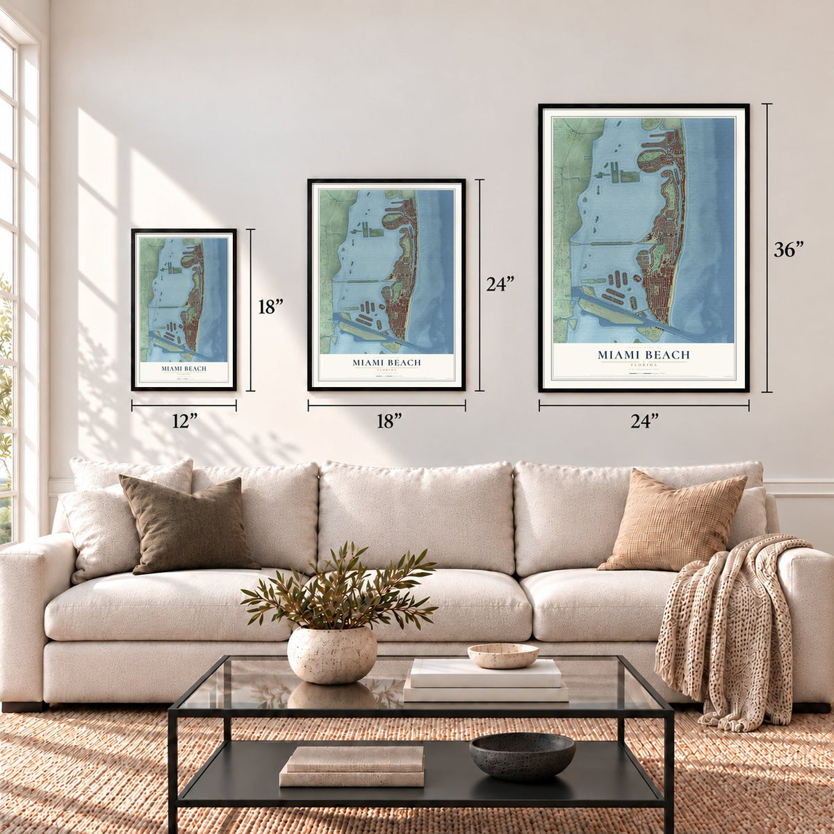

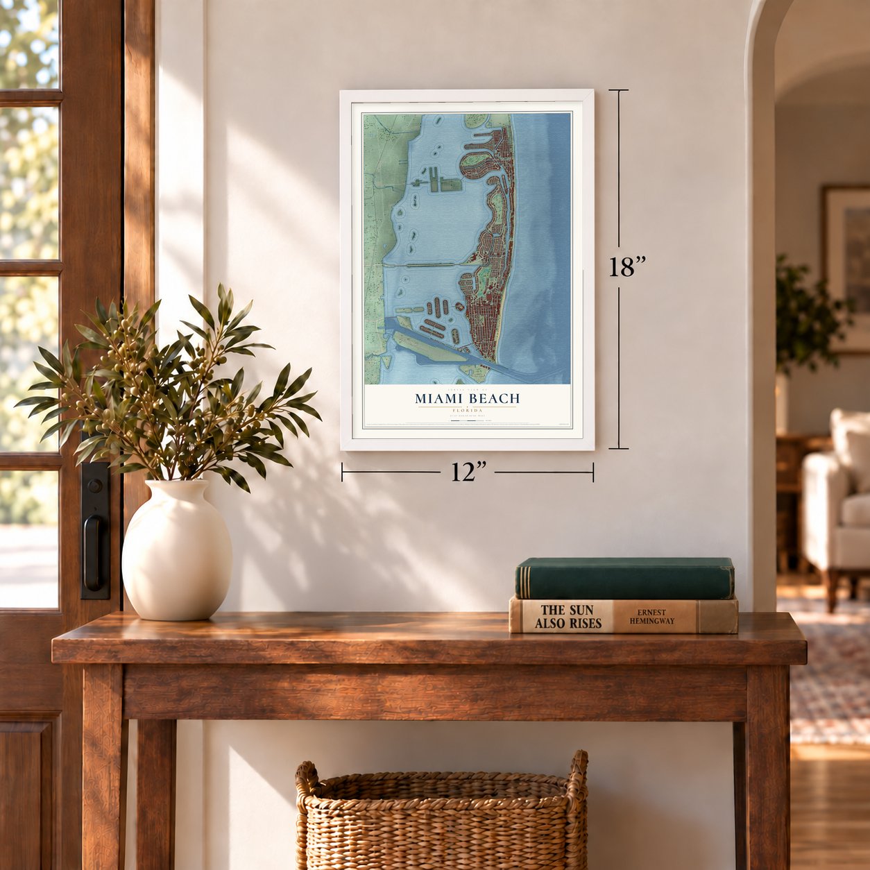
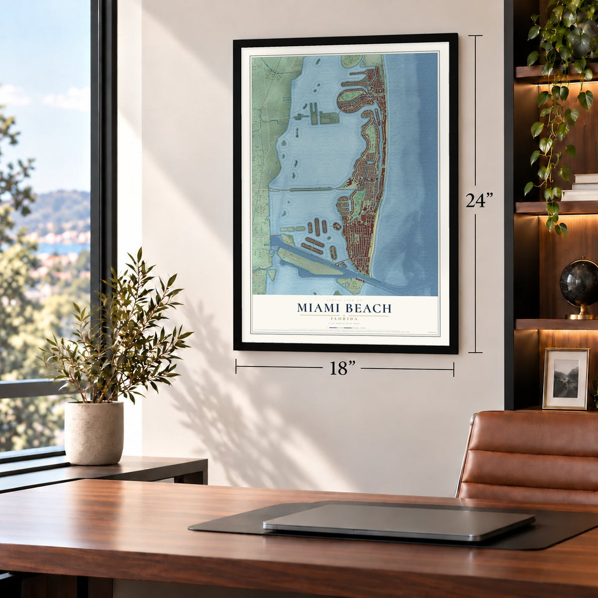
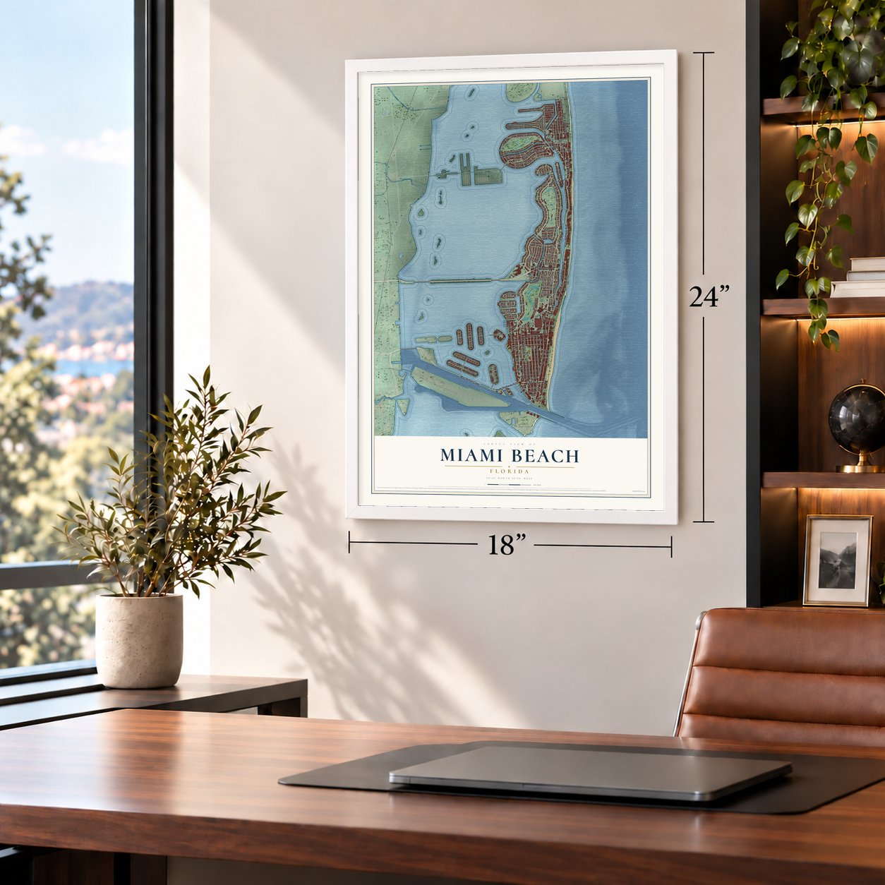


Free U.S. delivery 7 to 10 days after you order
Miami Beach, Florida Map Art
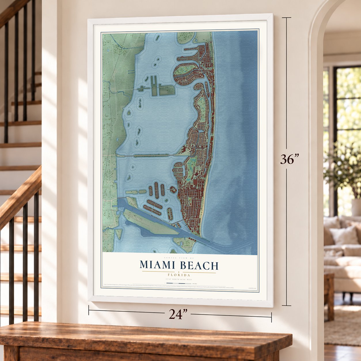
A new map of Miami Beach, Florida, made in 2026 and printed to order on thick archival matte paper.
12" x 18" Archival Matte Print
A Map of Home. A Work of Art.
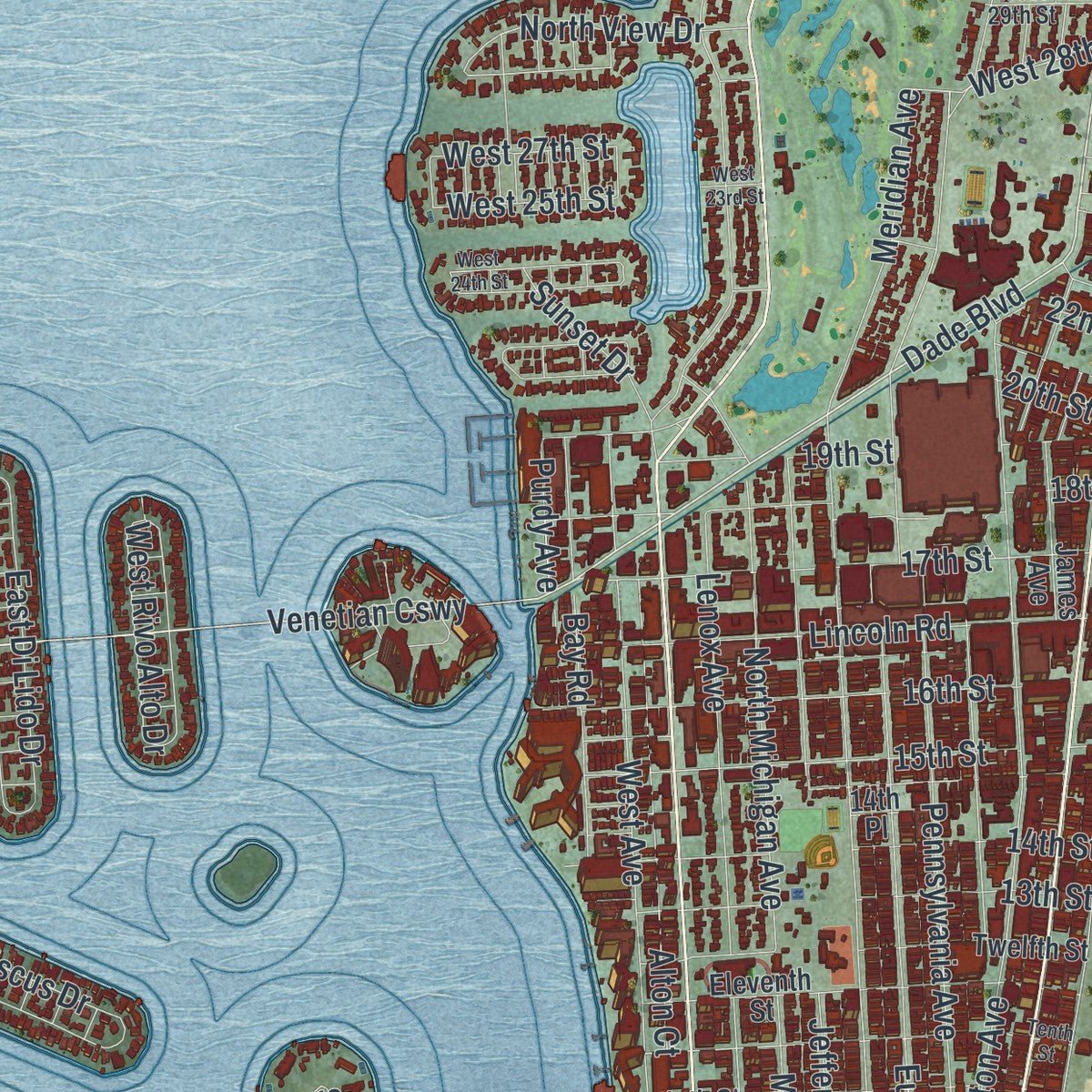
Explore Miami Beach, Florida from a whole new perspective. Created using aerial imagery and detailed geographic data, this map captures Miami Beach building by building, with labeled streets, familiar landmarks, and shaded topographical relief that highlights the natural contours of the landscape.
Combining modern data with the timeless character of a vintage atlas, this map is just as interesting up close as it is beautiful on the wall. Whether you grew up in Miami Beach, spent memorable years there, or call it home today, this unique map is a great way to celebrate a place that means something to you. Zoom in on the preview to look for your street, and then order a print to put your memories on the wall.

Three ways to hang it
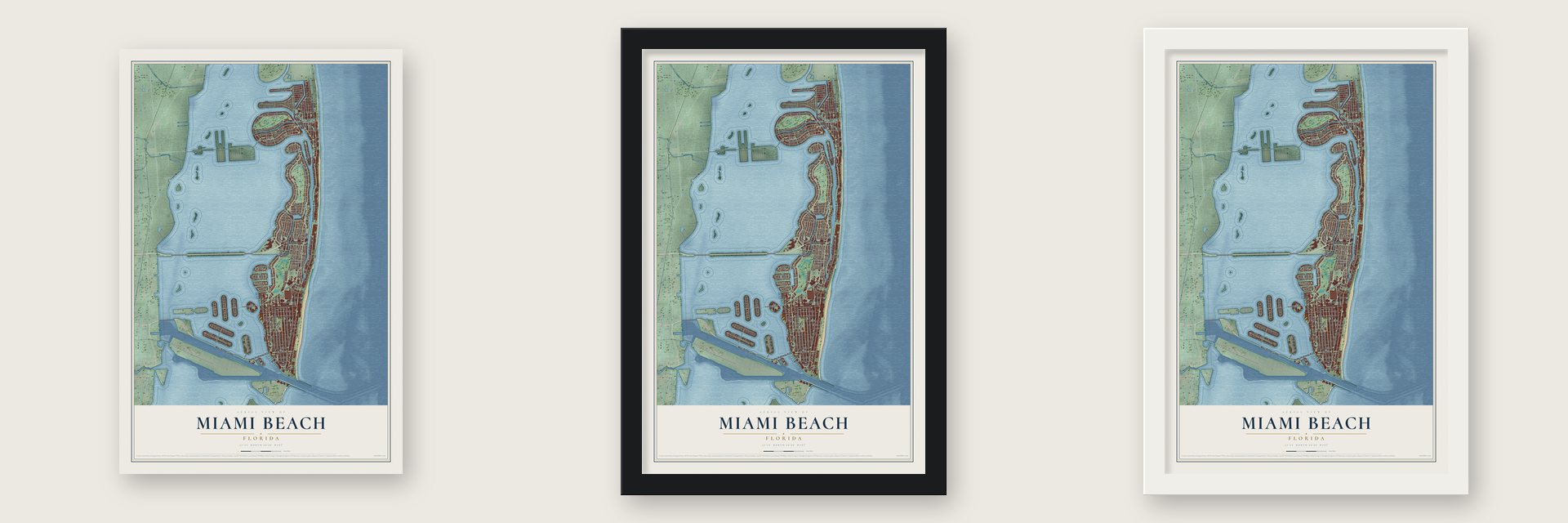
Unframed archival matte, a black wood frame or a white wood frame.
Up close
Geography Worth Displaying
This map was created using accurate cartographic data and authoritative geographic sources, including the U.S. Geological Survey (USGS) and FEMA. The map brings together terrain, waterways, roads, and building detail. The majority of the streets are labeled, houses are accurately depicted, and the topography is derived from government sources. Combining local data with carefully composed color and shading leads to this beautifully detailed Miami Beach artwork for your wall.
Rather than simply showing street outlines, we’ve included as many of the street names as we could reasonably fit on the map while keeping their names legible. Zoom in on the high resolution preview to see exactly what’s on the map. We truly set out to create a statement piece for anyone who loves Miami Beach. So whether it’s for you, or a gift for someone you love, we hope this map of Miami Beach brings back fond memories.
Explore the full map of Miami Beach, Florida and read about the local places it shows.

About Miami Beach, Florida
Miami Beach is a city of 82,890 people in Miami-Dade County, set on barrier islands between Biscayne Bay and the Atlantic. In 1870 Henry Lum and his son Charles paid 75 cents an acre for land on the empty shore. In 1876 the United States Life-Saving Service put up the Biscayne House of Refuge near 72nd Street to feed and shelter shipwrecked sailors. That station had fallen out of use by 1915, and the 1926 hurricane wrecked it for good.
In the 1880s John S. Collins, who farmed in Moorestown, New Jersey, and was a Quaker, put money into a coconut plantation here that failed. He bought out his partners and grew avocados instead. With loans from the Lummus brothers he started a wooden bridge 2.5 miles long to the mainland. When the money ran out, Carl G. Fisher paid to finish it in return for land, and the Collins Bridge opened on June 12, 1913, starting the island's first real estate boom. On March 26, 1915, the Town of Miami Beach received its charter, with John Newton Lummus as mayor, and it became a city in 1917.
“Print anything you want about Miami Beach; just make sure you get our name right.”
- Land dredged from the bayMuch of the interior was a mangrove jungle. In the 1920s Fisher and others dredged Biscayne Bay and piled up new ground: the Sunset Islands, Star, Palm and Hibiscus Islands, all but one of the Venetian Islands and much of Normandy Isle. The old sand bar of 1,600 acres grew to 2,800. In 1925 the Venetian Causeway, a chain of drawbridges, replaced Collins's wooden bridge.
- Where summer spends the winterFisher hired Steve Hannagan as his chief publicist in 1925. Hannagan opened the Miami Beach News Bureau and mailed thousands of photos of bathing beauties to columnists such as Walter Winchell and Ed Sullivan. His billboard in Times Square promised readers that it was always June in Miami Beach, and it called the city the place where summer spends the winter.
- A hospital of its ownIn the 1920s Fisher sold land only to gentiles, so Jewish residents had to live south of Fifth Street, and into the 1930s some hotels turned Jews away. Those barriers fell as the decade went on. During World War II, when no area hospital would give Jewish doctors staff privileges, the community built Mount Sinai Medical Center here. In 1980, 62 percent of the city's people were Jewish.
- Saving Art DecoSmall stucco hotels and rooming houses from the 1930s fill much of South Beach. Barbara Baer Capitman, a former interior designer, moved here in 1973 and in 1976 helped found the Miami Design Preservation League. Her group lobbied, held candlelight vigils and blocked bulldozers. Some buildings fell, but the district of 960 historic buildings joined the National Register in 1979. In 1996 a stretch of 10th Street was renamed Barbara Capitman Way.
Find your street
Names on the Miami Beach map
Every name below is printed on this map. Look for your street, your school, the park where you played, or the pond down the road.
Places and landmarks4
- Fisher Island
- Normandy Shores
- Atlantic Heights
- Isle of Normandy
Streets and roads127
- Alton Road
- Mac Arthur Causeway
- Fifth Street
- Indian Creek Drive
- Collins Avenue
- Normandy Drive
- West 41st Street
- 71st Street
- West 63rd Street
- North Bay Road
- Pine Tree Drive
- Lakeview Drive
- Dade Boulevard
- Venetian Causeway
- Biscayne Street
- North Shore Drive
- West 28th Street
- Biarritz Drive
- Purdy Avenue
- Washington Avenue
- Prairie Avenue
- Lagorce Drive
- West 51st Street
- North View Drive
- Meridian Avenue
- North Michigan Avenue
- Bay Drive
- Jefferson Avenue
- Harding Avenue
- West Avenue
Show all 127 streets
- Ocean Drive
- Euclid Avenue
- Lenox Avenue
- Byron Avenue
- Royal Palm Avenue
- Sheridan Avenue
- South Shore Drive
- Pennsylvania Avenue
- Lincoln Road
- Flamingo Drive
- Abbott Avenue
- Alton Court
- 17th Street
- 16th Street
- 14th Street
- Lagorce Circle
- 15th Street
- Palm Avenue
- Atlantic Way
- Sunset Drive
- Daytonia Road
- Cleveland Road
- Michigan Avenue
- Bay Road
- Star Island Drive
- 18th Street
- West 47th Street
- Nautilus Drive
- East Di Lido Drive
- North Hibiscus Drive
- Sixth Street
- 13th Street
- Carlyle Avenue
- Chase Avenue
- Hawthorne Avenue
- 20th Street
- Crespi Boulevard
- Calais Drive
- 19th Street
- Stillwater Drive
- 22nd Street
- 85th Street
- Allison Road
- Fountain Street
- West Rivo Alto Drive
- West 27th Street
- 83rd Street
- Second Street
- Third Street
- West 25th Street
- First Street
- Lenox Court
- Fisher Island Drive
- Fairway Drive
- Eleventh Street
- Ninth Street
- Twelfth Street
- 77th Street
- Post Avenue
- 73rd Street
- 75th Street
- 81st Street
- North Adams Avenue
- West San Marino Drive
- 69th Street
- North Coconut Lane
- James Avenue
- Noremac Avenue
- 72nd Street
- West 31st Street
- West 48th Street
- Bridge Road
- Wayne Avenue
- 30th Street
- 25th Street
- 14th Place
- 27th Street
- 87th Terrace
- 33rd Street
- Marseille Drive
- West 42nd Street
- Rue Granville
- West 49th Street
- West 30th Street
- West 56th Street
- West 29th Street
- 24th Street
- 26th Street
- Tenth Street
- Fourth Street
- West 23rd Street
- 79th Street
- 78th Street
- 21st Street
- West 24th Street
- North Chase Avenue
- Ray Street
Names are listed as they appear on the printed map. Zoom into the product photos to find them.
The art of mapping a place
How This Map Was Made
Real places. Remarkable detail. Discover the layers that turn geographic data into a map of home.

The view from above
Aerial imagery reveals the character of the land: woodland, open fields, and the patterns of a place.

The shape of the land
Elevation data brings hills, valleys, and subtle changes in the landscape into view.

The details of home
Roads, waterways, and building footprints come together to make the map feel unmistakably local.

Geography becomes art
Considered color, shading, and typography bring the layers together in a map made for your wall.


Process illustrated with Mendon, Massachusetts. Aerial imagery: USDA NAIP. Terrain: USGS 3D Elevation Program. Map details and finished artwork: KNOWOL.
The Details
About This Print
Choose an archival matte print, or a black or white Ayous wood frame. The archival matte print is unframed.
Select your size and finish above to see the matching product image and price.
Materials & Craftsmanship
A contemporary map with the character of a classic atlas, printed on archival matte paper. Optional frames are made from Ayous wood.
Your printed map does not include the watermark shown in the full-map preview.
Shipping & Delivery
Free shipping within the United States. Every print is made to order in the USA.
Buying a gift? Add a note in your cart and we'll include it. We never put prices in the package.
Prints ship within 2 to 3 business days. Allow 7 to 10 days total from ordering for delivery. Timing may vary during holidays or periods of high order volume.
Read our shipping policy.
Returns and damaged prints
Each print is made to order. Change-of-mind refunds are not available after production.
If your print arrives damaged, misprinted or incorrect, contact support@knowol.com within 30 days of receiving it. Include your order number, photos and a description of the issue.
Read our full refund and replacement policy. For questions about your order, email support@knowol.com.
Find your town
Looking for another city?
Find a map of home in our Florida collection, or any town in the country.
Nearby
Maps of towns near Miami Beach
Know someone from one of these towns? Their map makes a great gift.
 North Bay Village
, Florida
From $39.99See the map
 Fisher Island
, Florida
From $39.99See the map
 El Portal
, Florida
From $39.99See the map
More maps nearby: Miami Shores, Miami, Indian Creek, Surfside and Biscayne Park.