
Search for another town


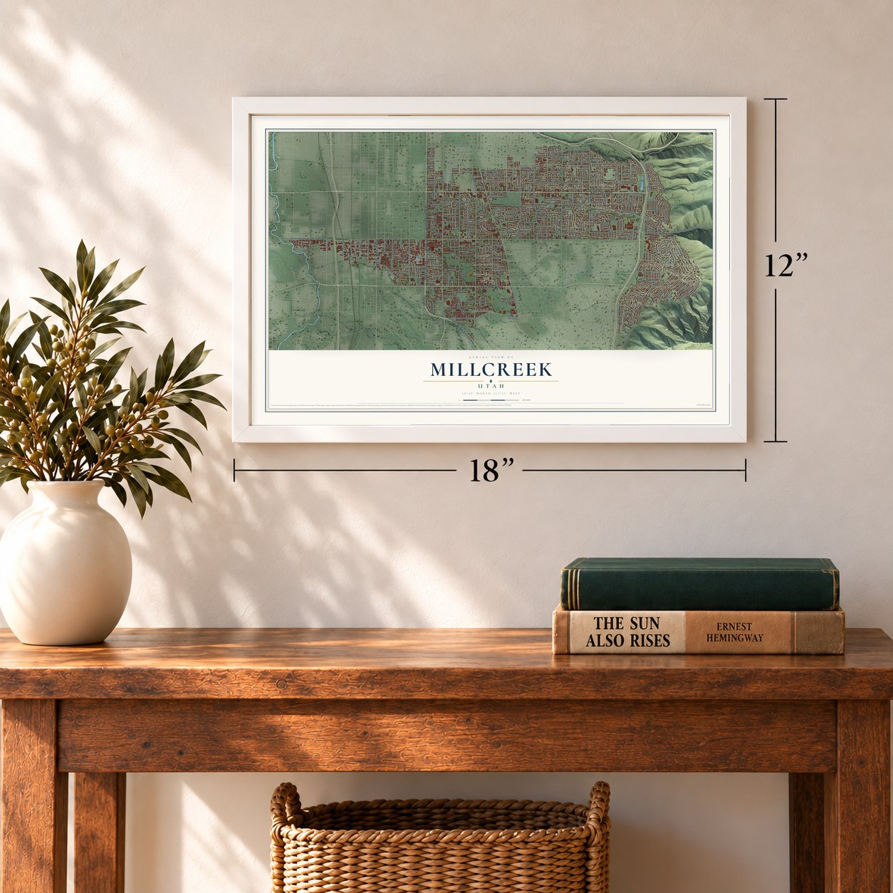

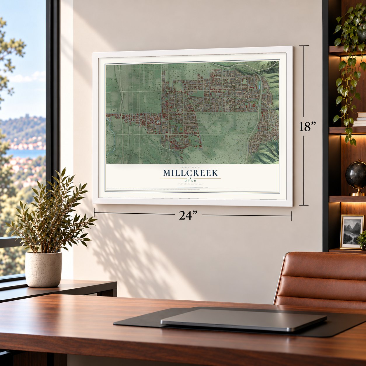

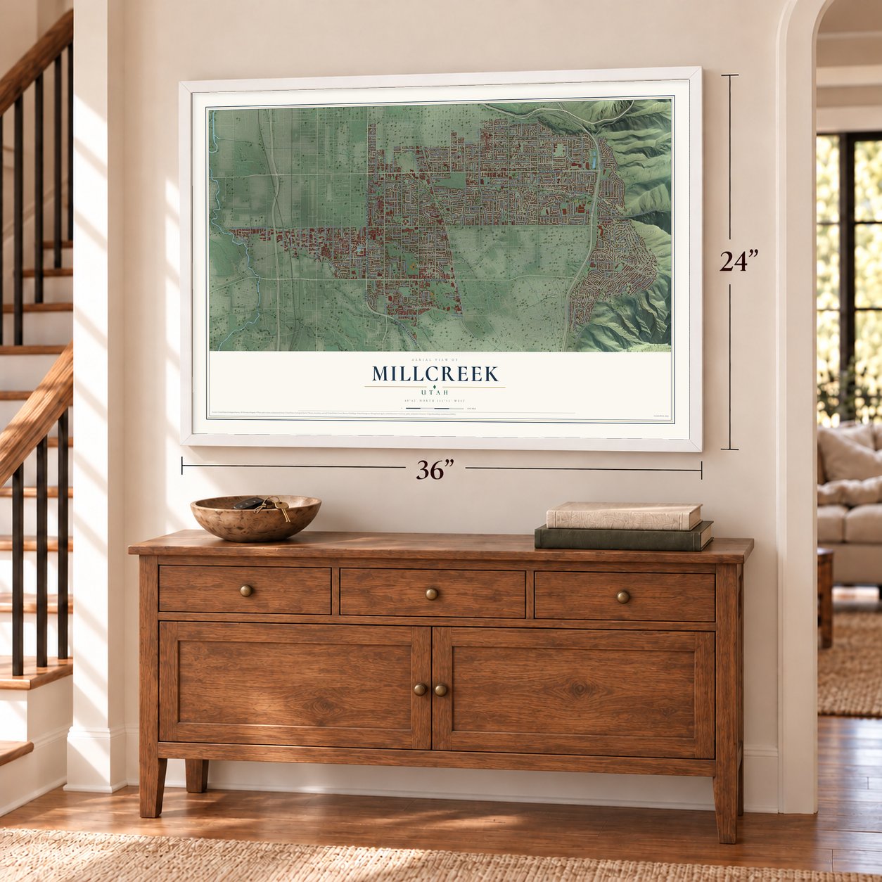

Free U.S. delivery 7 to 10 days after you order
Millcreek, Utah Map Art
A new map of Millcreek, Utah, made in 2026 and printed to order on thick archival matte paper.
12" x 18" Archival Matte Print
A Map of Home. A Work of Art.
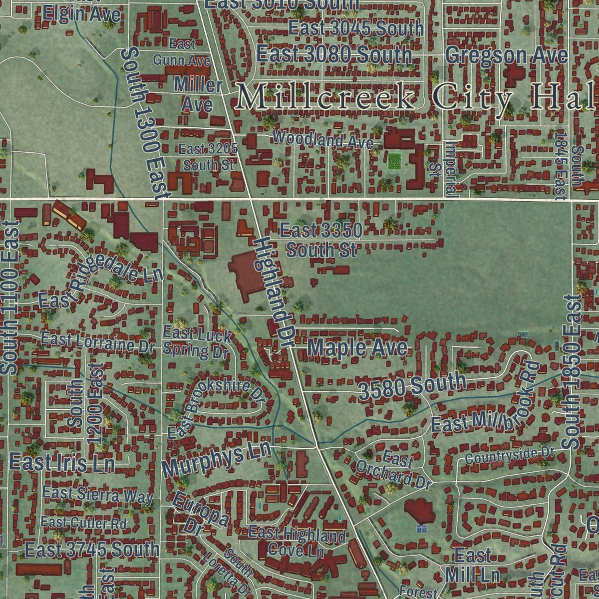
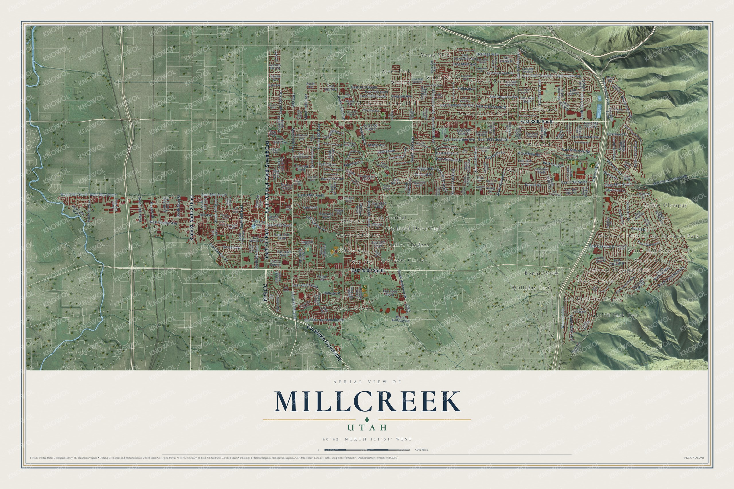
Explore Millcreek, Utah from a whole new perspective. Created using aerial imagery and detailed geographic data, this map captures Millcreek building by building, with labeled streets, familiar landmarks, and shaded topographical relief that highlights the natural contours of the landscape.
Combining modern data with the timeless character of a vintage atlas, this map is just as interesting up close as it is beautiful on the wall. Whether you grew up in Millcreek, spent memorable years there, or call it home today, this unique map is a great way to celebrate a place that means something to you. Zoom in on the preview to look for your street, and then order a print to put your memories on the wall.
Three ways to hang it
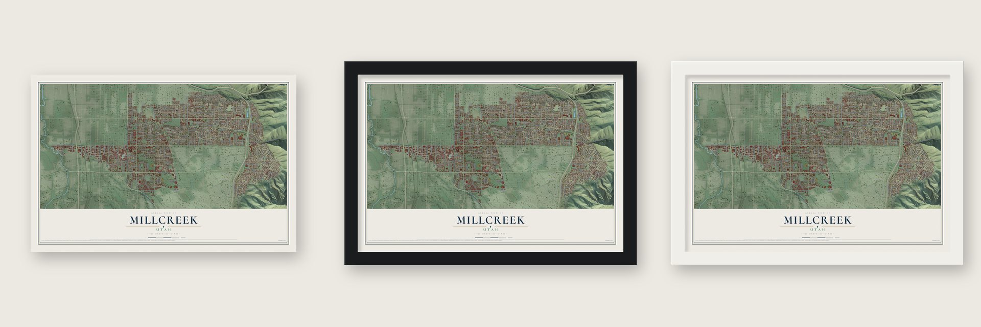
Unframed archival matte, a black wood frame or a white wood frame.
Up close
Geography Worth Displaying
This map was created using accurate cartographic data and authoritative geographic sources, including the U.S. Geological Survey and the Census Bureau. The map brings together terrain, waterways, roads, and building detail. The majority of the streets are labeled, houses are accurately depicted, and the topography is derived from government sources. Combining local data with carefully composed color and shading leads to this beautifully detailed Millcreek artwork for your wall.
Rather than simply showing street outlines, we’ve included as many of the street names as we could reasonably fit on the map while keeping their names legible. Zoom in on the high resolution preview to see exactly what’s on the map. We truly set out to create a statement piece for anyone who loves Millcreek. So whether it’s for you, or a gift for someone you love, we hope this map of Millcreek brings back fond memories.
Read the story behind this map of Millcreek, Utah from 2026.

About Millcreek, Utah
Millcreek is a city of 63,380 people in Salt Lake County. Its first pioneers arrived in the valley in the mid-1800s and settled around today's Canyon Rim and East Mill Creek. Among them, in 1848, was Mary Fielding Smith, the widow of Hyrum Smith, who came with her children, including Joseph F. Smith. Private irrigation companies brought water to their farms and orchards, and several mills ran along Mill Creek.
The area stayed mostly rural until after World War II, when new suburbs spread south past the Salt Lake City limits. The city did not annex them, so the neighborhoods grew without a government of their own. Salt Lake County formed Millcreek Township in 2002 to give residents more say over planning and to block annexation by neighbors. A 2012 vote to incorporate won only 40 percent, but a second vote passed on November 3, 2015. Millcreek officially became a city on the morning of December 28, 2016, with the change taking effect at 9:30.
- The inventor of headphonesNathaniel Baldwin, the man who invented headphones, was a Millcreek resident. His house joined the National Register in 1985.
- A downtown at 3300 SouthAfter incorporation, Millcreek planned a downtown around Highland Drive and 3300 South to give its scattered neighborhoods a center. Brickyard Plaza, a shopping center there, had belonged to Salt Lake City since 1979, and Millcreek tried to undo that annexation. The two cities settled it: Salt Lake City handed over land for a connected city center, and Millcreek dropped its claim to the plaza.
Find your street
Names on the Millcreek map
Every name below is printed on this map. Look for your street, your school, the park where you played, or the pond down the road.
Places and landmarks30
- Millcreek City Hall
- White Hill Estates
- Mount Olympus Park
- Mount Olympus Cove
- Mount Olympus
- Bonnie View
- Canyon Rim
- Carole Addition
- Donjean
- East Holladay Slopes
- East Millcreek
- Eddie Kay
Show all 30 places
- Ethel Gardens
- Fuller Gardens
- Highland Drive Park
- Holladay Circle
- Holladay East
- Maywood Hills
- Mount Olympus Hills
- Oakcliff Park
- Oakcliff Park Two
- Park Central
- Waymark
- Wells
- White Circle
- Willard
- Win Del
- Young Haven Circle
- Yuma View
- Zions Park
Streets and roads272
- East 3300 South
- South 700 East
- South 735 East
- South Seventh East
- Van Winkle Expressway
- East 4500 South
- North 20 East
- State Street
- 700 East
- East 3900 South
- South 900 East
- 900 East
- South 2000 East
- South 20th East
- South 800 East
- East 3800 South
- Virginia Way
- Highland Drive
- South Highland Drive
- East 3435 South Street
- South 900 East Street
- East Oakview Drive
- East 3760 South
- East 2070 South
- South 1300 East
- Wasatch Boulevard
- South 1100 East
- South 2300 East
- East Evergreen Avenue
- South 2700 East
Show all 272 streets
- East 3080 South
- East Murray Holladay Road
- South 1500 East
- East Lambourne Avenue
- Jupiter Drive
- East Gregson Avenue
- West 3900 South
- Adonis Drive
- Upland Drive
- South 1850 East
- South 500 East
- East Millcreek Road
- East 2920 South Street
- East Louise Avenue
- Eastwood Drive
- Siggard Drive
- South Zarahemla Drive
- South 1000 East
- East Gordon Lane
- East Craig Drive
- South Hillside Lane
- South 2900 East
- Gregson Avenue
- Mill Creek Canyon Road
- East 39th South
- South 3300 East
- West 4000 South
- South 3500 East
- East Atkin Avenue
- East Hillview Drive
- South Main Street
- East 3160 South Street
- 3580 South
- East Keller Lane
- West Central Avenue
- East 3010 South
- East Neffs Lane
- Millcreek Road
- South 2140 East
- Brookburn Road
- East 4580 South
- South 300 East
- South 300 West
- East Wilmott Drive
- Christine Street
- College Street
- South 615 East
- South Teton Drive
- Luetta Drive
- Doreen Avenue
- South 3205 East
- Murphys Lane
- East 4125 South
- Howick Street
- Hill Avenue
- Heritage Way
- Stillman Lane
- East Iris Lane
- Orchard Drive
- Maple Avenue
- Monza Drive
- South 3905 East
- East Del Verde Avenue
- East 4045 South
- South Eighth East
- East 4620 South
- South Hale Drive
- South 27th East
- Parkview Drive
- Murray Holladay Road
- South Honeycut Road
- East Millbrook Road
- South Fifth East
- East 4200 South
- South 3100 East
- East 3670 South
- East 3380 South Street
- South 1200 East
- South 1400 East
- East Claybourne Avenue
- Monte Verde Drive
- South Valley Street
- East 3745 South
- East 3665 South
- East Elgin Avenue
- Winder Lane
- Loren Von Drive
- East 3045 South
- South Grace Street
- East Lone Pine Drive
- East 2900 South Street
- East 3600 South
- South 2940 East
- South 805 East Street
- South Garden Drive
- South 1140 East
- East Ridgedale Lane
- South 2980 East
- East Elgin Drive
- South Old Farm Lane
- South West Temple Street
- East 4260 South
- East 4110 South
- East 3350 South Street
- South Wasatch Boulevard
- South 700 West
- South 3610 East
- Namba Way
- East 4345 South
- East Scott Avenue
- Achilles Drive
- East Malibu Drive
- Arnett Drive
- East 4270 South
- East Ruth Drive
- East Eastcliff Drive
- Thousand Oaks Circle
- East 3100 South
- West 4060 South
- South 785 East
- Cove Point Drive
- East 3325 South Street
- East Barbey Drive
- South Mathews Way
- East 3970 South
- South 905 East
- South 200 East
- South 1355 East
- East Del Mar Drive
- South 500 West
- Sagehill Drive
- South Pioneer Street
- South 765 East
- South 3185 East
- South 1935 East
- Europa Drive
- Noal Drive
- South 1215 East
- Celeste Way
- East Mill Lane
- Astro Way
- 300 East
- Lorraine Avenue
- East La Dore Drive
- South Birch Drive
- Miller Avenue
- South 1425 East
- South 2245 East
- Elgin Avenue
- Warr Road
- Garden Avenue
- Meadow Pine Court
- Lake Street
- Austin Avenue
- Range Road
- Pagos Avenue
- Delia Drive
- 1165 East
- Quail Point Road
- East Fortuna Drive
- South 945 East
- Imperial Street
- East 3400 South Street
- South 2235 East
- East 3780 South
- East Orchard Drive
- South Oakwood Street
- South Connor Street
- South Crestwood Drive
- South 1845 East
- Woodland Avenue
- East Millstream Lane
- East 2960 South Street
- East 4070 South
- Lakeview Drive
- East Lorraine Drive
- Arnette Drive
- East 2980 South Street
- East Brookshire Drive
- South 1940 East
- East 4140 South
- Santa Rosa Drive
- East Highland Cove Lane
- South Mile High Drive
- East Sierra Way
- East Fairclough Drive
- South 2475 East Street
- East Luck Spring Drive
- East 2880 South Street
- East 4700 South
- South 1830 East
- South 2400 East
- South 20th East Street
- Shady Lake Drive
- South Park Street
- East 2855 South Street
- East 2815 South
- Empire Avenue
- South 400 East
- East 3395 South Street
- 3720 South
- East 4280 South
- East 3000 South
- East 2935 South
- South Plateau Drive
- East 3220 South Street
- Cummings Road
- Park Hill Drive
- East 3510 South
- East Millcreek Dell Lane
- East Marie Avenue
- Yosemite Drive
- East 4055 South
- East Canyon View Drive
- East Millbrook Drive
- South Gary Road
- East 3740 South
- East 3930 South
- Countryside Drive
- South Loretta Drive
- East Vimont Avenue
- South 3175 East Street
- Tina Way
- East Cutler Road
- East Lost River Road
- East Gunn Avenue
- Arcata Road
- East 3155 South
- East 3205 South Street
- East Cruise Way
- South 2070 East
- East 3750 South
- Forest Hills Drive
- 4600 South
- Knudsen Street
- 3080 South
- 4015 South
- Grape Ivy Way
- 4115 South
- Alva Circle
- Milbert Drive
- 4020 South
Names are listed as they appear on the printed map. Zoom into the product photos to find them.
The art of mapping a place
How This Map Was Made
Real places. Remarkable detail. Discover the layers that turn geographic data into a map of home.

The view from above
Aerial imagery reveals the character of the land: woodland, open fields, and the patterns of a place.

The shape of the land
Elevation data brings hills, valleys, and subtle changes in the landscape into view.

The details of home
Roads, waterways, and building footprints come together to make the map feel unmistakably local.

Geography becomes art
Considered color, shading, and typography bring the layers together in a map made for your wall.


Process illustrated with Mendon, Massachusetts. Aerial imagery: USDA NAIP. Terrain: USGS 3D Elevation Program. Map details and finished artwork: KNOWOL.
The Details
About This Print
Choose an archival matte print, or a black or white Ayous wood frame. The archival matte print is unframed.
Select your size and finish above to see the matching product image and price.
Materials & Craftsmanship
A contemporary map with the character of a classic atlas, printed on archival matte paper. Optional frames are made from Ayous wood.
Your printed map does not include the watermark shown in the full-map preview.
Shipping & Delivery
Free shipping within the United States. Every print is made to order in the USA.
Buying a gift? Add a note in your cart and we'll include it. We never put prices in the package.
Prints ship within 2 to 3 business days. Allow 7 to 10 days total from ordering for delivery. Timing may vary during holidays or periods of high order volume.
Read our shipping policy.
Returns and damaged prints
Each print is made to order. Change-of-mind refunds are not available after production.
If your print arrives damaged, misprinted or incorrect, contact support@knowol.com within 30 days of receiving it. Include your order number, photos and a description of the issue.
Read our full refund and replacement policy. For questions about your order, email support@knowol.com.
Find your town
Looking for another city?
Find a map of home in our Utah collection, or any town in the country.
Nearby
Maps of towns near Millcreek
Know someone from one of these towns? Their map makes a great gift.
 Holladay
, Utah
From $39.99See the map
 South Salt Lake
, Utah
From $39.99See the map
 Murray
, Utah
From $39.99See the map
More maps nearby: Cottonwood Heights, Midvale, Taylorsville, Salt Lake City and Granite.