


Search for another town





Free U.S. delivery 7 to 10 days after you order
Milpitas, California Map Art
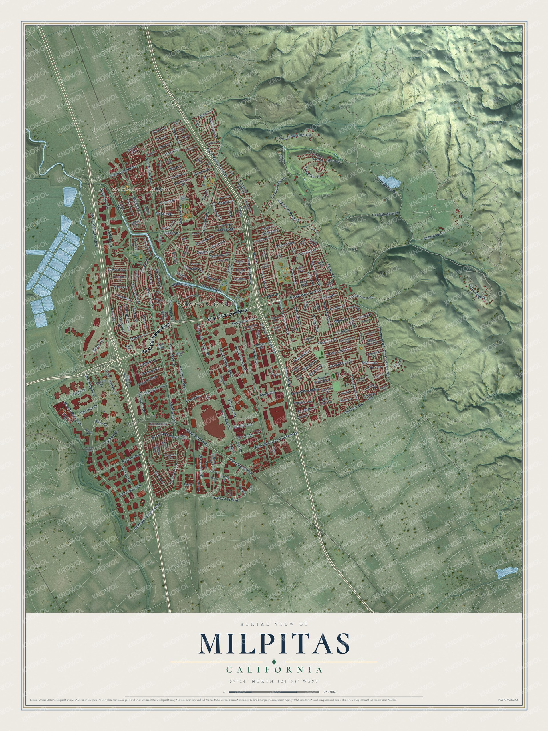
Building by building, with labeled streets and shaded relief.
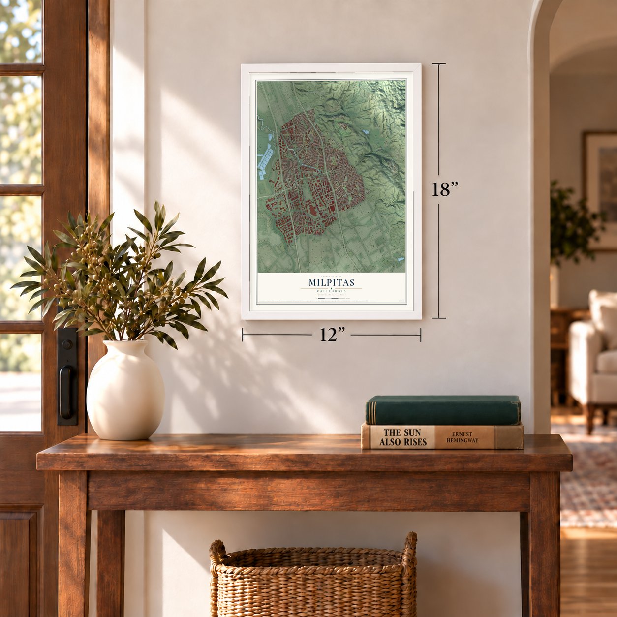
12" x 18" Archival Matte Print
A Map of Home. A Work of Art.
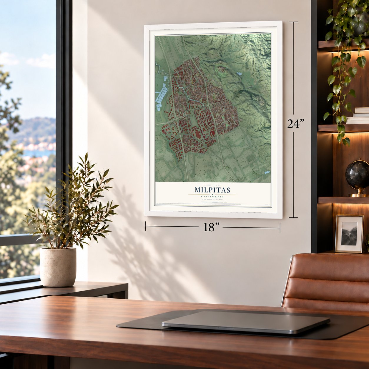
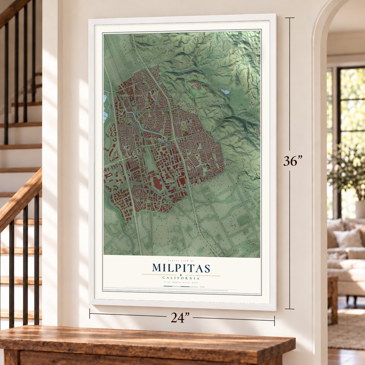
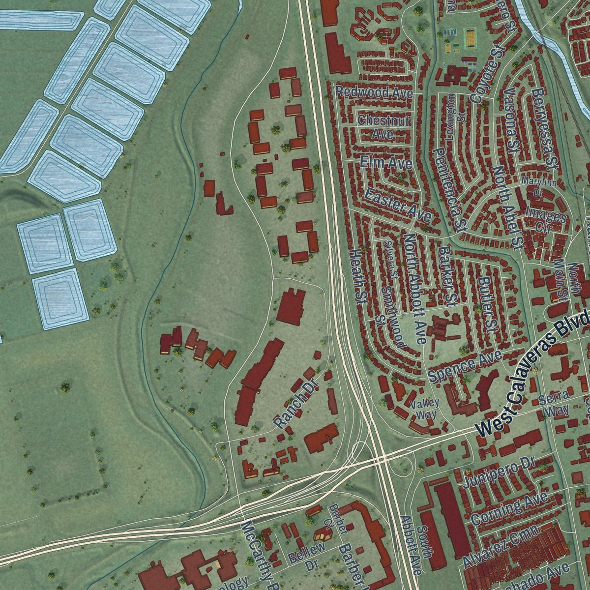
Explore Milpitas, California from a whole new perspective. Created using aerial imagery and detailed geographic data, this map captures Milpitas building by building, with labeled streets, familiar landmarks, and shaded topographical relief that highlights the natural contours of the landscape.
Combining modern data with the timeless character of a vintage atlas, this map is just as interesting up close as it is beautiful on the wall. Whether you grew up in Milpitas, spent memorable years there, or call it home today, this unique map is a great way to celebrate a place that means something to you. Zoom in on the preview to look for your street, and then order a print to put your memories on the wall.
Three ways to hang it
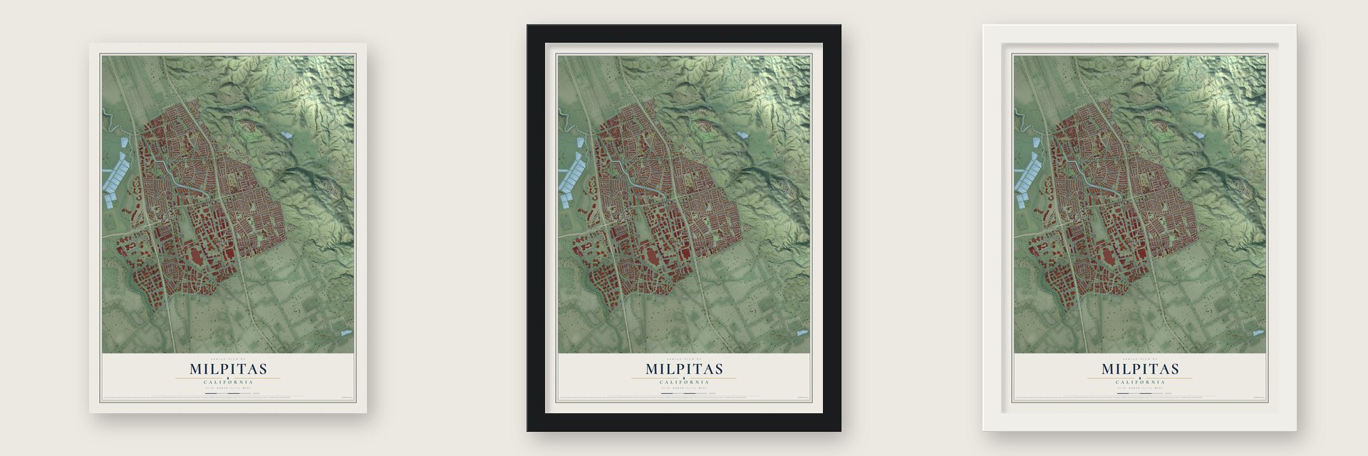
Unframed archival matte, a black wood frame or a white wood frame.
Up close
Geography Worth Displaying
This map was created using accurate cartographic data and authoritative geographic sources, including the U.S. Geological Survey and the Census Bureau. The map brings together terrain, waterways, roads, and building detail. The majority of the streets are labeled, houses are accurately depicted, and the topography is derived from government sources. Combining local data with carefully composed color and shading leads to this beautifully detailed Milpitas artwork for your wall.
Rather than simply showing street outlines, we’ve included as many of the street names as we could reasonably fit on the map while keeping their names legible. Zoom in on the high resolution preview to see exactly what’s on the map. We truly set out to create a statement piece for anyone who loves Milpitas. So whether it’s for you, or a gift for someone you love, we hope this map of Milpitas brings back fond memories.
Read the story behind this map of Milpitas, California from 2026.

Find your street
Names on the Milpitas map
Every name below is printed on this map. Look for your street, your school, the park where you played, or the pond down the road.
Places and landmarks2
- Milpitas City Hall
- Mobilodge of Milpitas
Streets and roads262
- East Calaveras Boulevard
- West Calaveras Boulevard
- South Park Victoria Drive
- Tasman Drive
- Great Mall Parkway
- East Capitol Avenue
- North Park Victoria Drive
- California Circle
- McCarthy Boulevard
- South Main Street
- Milmont Drive
- North McCarthy Boulevard
- Trade Zone Boulevard
- Dixon Landing Road
- McCandless Drive
- Railroad Avenue
- Amalfi Loop
- Montague Expressway
- Yosemite Drive
- Calaveras Road
- Barber Lane
- Vista Ridge Drive
- Jacklin Road
- North Hillview Drive
- Dempsey Road
- South Milpitas Boulevard
- Great Mall Drive
- Piedmont Road
- West Montague Expressway
- South Abel Street
Show all 262 streets
- Escuela Parkway
- North Abbott Avenue
- Downing Road
- Landess Avenue
- Arizona Avenue
- Evans Road
- Edsel Drive
- Old Piedmont Road
- Country Club Drive
- Ranch Drive
- Sinclair Frontage Road
- Heath Street
- Yellowstone Avenue
- Tramway Drive
- South Hillview Drive
- Fallen Leaf Drive
- Kennedy Drive
- Canton Drive
- Los Coches Street
- Hamilton Avenue
- North Abel Street
- Gibraltar Drive
- Starlite Drive
- Carnegie Drive
- Dixon Road
- South Temple Drive
- Coelho Street
- Conway Street
- Penitencia Street
- Hammond Way
- Calaveras Ridge Drive
- Sycamore Drive
- Murphy Ranch Road
- Alder Drive
- Erie Circle
- Mount Shasta Avenue
- Pso Refugio
- Old Calaveras Road
- North Temple Drive
- Singley Drive
- Ames Avenue
- Coyote Street
- Big Basin Drive
- Grand Teton Drive
- Acadia Avenue
- Thompson Street
- Roswell Drive
- Crater Lake Avenue
- Corning Avenue
- Corinthia Drive
- Columbus Drive
- West Capitol Avenue
- Lynn Avenue
- Tularcitos Drive
- Fanyon Street
- Skyline Drive
- Vasona Street
- Olympic Drive
- Lacey Drive
- Park Hill Drive
- Butler Street
- Berryessa Street
- Cottonwood Drive
- Edgewater Drive
- Machado Avenue
- Cuesta Drive
- Buckeye Drive
- Cll Oriente
- Stemel Way
- Alvarez Cmn
- Garden Street
- Russell Lane
- Junipero Drive
- Curtis Avenue
- Wellington Drive
- Midwick Drive
- Easter Avenue
- Spence Avenue
- San Disk Drive
- Burley Drive
- Vienna Drive
- Vista Way
- Wool Drive
- Chysis Road
- Wylie Drive
- Angus Drive
- Topaz Street
- Cadillac Court
- Curtner Drive
- Tiny Street
- Parvin Drive
- Elm Avenue
- Barker Street
- Jacklin Court
- Boyd Street
- Ayer Street
- Tice Drive
- Wilson Way
- Cll del Sol
- North Main Street
- North Milpitas Boulevard
- Calera Creek Heights Drive
- South Abbott Avenue
- Santa Rita Drive
- Washington Drive
- Smithwood Street
- Technology Drive
- Cameron Circle
- Falcato Drive
- Summerfield Drive
- Clear Lake Avenue
- Redwood Avenue
- Images Circle
- Serra Way
- Traughber Street
- Uridias Ranch Road
- Centre Pointe Drive
- Piper Drive
- Lee Way
- Glenview Drive
- Mesa Verde Drive
- Pebble Beach Court
- Cll Mesa Alta
- Perry Street
- Stardust Way
- Butano Drive
- Tahoe Drive
- Pacheco Drive
- Los Pinos Avenue
- Chewpon Avenue
- El Camino Higuera
- Bellew Drive
- Horcajo Circle
- Cuciz Lane
- Alcosta Drive
- Augusta Court
- Pescadero Street
- Stellar Way
- Mount Diablo Avenue
- Sonoma Drive
- Chestnut Avenue
- Daniel Court
- Nicklaus Avenue
- Wrigley Way
- Saratoga Drive
- Sudbury Drive
- Pinard Street
- Buskirk Street
- Oroville Road
- Bolton Drive
- Cestaric Drive
- Autrey Street
- Hanson Court
- Tarob Court
- Poppy Lane
- Cirolero Street
- Balboa Drive
- Hermina Street
- Lawton Drive
- Braly Avenue
- Taylor Drive
- View Drive
- Falcon Drive
- Ellis Avenue
- Sango Court
- Ede Lane
- Hilltop Court
- Shenandoah Avenue
- Platt Avenue
- Gerald Circle
- Lassen Avenue
- Kevenaire Drive
- Murphy Road
- Gingerwood Drive
- Lexington Street
- Prada Drive
- Minnis Circle
- Selwyn Drive
- London Drive
- South Gadsden Drive
- Silverlake Drive
- Yosemite Way
- Evergreen Way
- Canada Drive
- Strickroth Drive
- Gosser Street
- Diel Drive
- Gross Street
- Centria Lane
- Fieldcrest Drive
- Shirley Drive
- Freeland Drive
- Levin Street
- Sinnott Lane
- Nieves Street
- Gibraltar Court
- Park View Drive
- Barber Court
- Houret Drive
- Serpa Drive
- Valley Way
- Devon Place
- Dubois Street
- Towne Drive
- Merz Court
- Tasman Bridge
- Marylinn Drive
- Greenrock Road
- Sunnyhills Drive
- Greathouse Drive
- Silvera Street
- Donahe Drive
- Trento Loop
- Nestwood Way
- Bayview Park Drive
- Sepulveda Avenue
- Petersburg Drive
- Quince Lane
- Mattos Drive
- Gemma Drive
- Watson Court
- Simas Drive
- Bond Street
- Berylwood Lane
- Vegas Avenue
- Wild Rose Way
- Lundy Place
- Farmcrest Street
- Carlsbad Street
- Hillview Court
- Pepper Place
- Ann Place
Names are listed as they appear on the printed map. Zoom into the product photos to find them.
About Milpitas, California
Milpitas is a city of 80,273 people in Santa Clara County, at the northeastern corner of the Santa Clara Valley. Tamien people, part of the Ohlone, lived in villages here long before the Spanish came, and during the mission era the land lay on the route between Mission San José and Mission Santa Clara. In 1835 the ranchero José María Alviso received Rancho Milpitas, whose name means little cornfields, and he is counted as the town's founder.
Farm families of English, German and Irish descent arrived in the 1850s, and sharecroppers from the Azores followed in the 1870s and 1880s. Local legend holds that when a post office opened in Frederick Creighton's store in 1857, some wanted to call it Penitencia. Assistant postmaster Joseph Weller feared people would confuse that with penitentiary, so he proposed Milpitas instead. The farm town still had only about 800 people when it incorporated on January 26, 1954, to keep a fast-growing San Jose from absorbing it.
- The Alviso AdobeJosé María Alviso's adobe home and José Higuera's are the oldest buildings in Milpitas. The Alviso Adobe survives mostly as built, with a kitchen added by the Cuciz family, who bought it from the Gleasons in 1922. Until the city acquired it in 1995, it was California's oldest Mexican-era adobe still in use as a home. It joined the National Register in 1997, and the city is still restoring it.
- The Milpitas MinutemenSeven years after incorporation, San Jose tried to annex Milpitas. Residents formed the Milpitas Minutemen to fight it, and in the 1961 election a large majority of voters said no. The committee had cast San Jose as the British at Lexington, so the city put Daniel Chester French's Minuteman statue on its official seal.
- California's first black mayorBen F. Gross, a civil rights activist backed by the UAW, won a seat in 1961 as Milpitas's first black city councilman, and Look and Life magazines covered the election. In 1966 voters made him mayor, the first black mayor in California, and they reelected him in 1968.
- From Ford plant to Great MallBuilding the Ford assembly plant in 1955 set off decades of growth, as hayfields gave way to homes and industry. Milpitas had about 800 residents in 1950, and by 2000 the count had climbed to 62,698. The plant closed in 1984, and in 1994 the site reopened as the Great Mall of the Bay Area.
- Smith's Corner, 1895For more than a century, travelers on the old road between Oakland and San Jose stopped in Milpitas. John Smith built Smith's Corner in 1895 as a saloon selling beer and wine, and it served them for a hundred years before becoming a restaurant in 2001. The building still stands.
Keep exploring California
Milpitas is one of 1,990 California towns we've mapped. Every dot on the map is a print of its own.
The search covers every state, California first.
Near Milpitas
Order 2 or more town maps and save 10%. Shown in the size and finish you picked above, so they hang as a set.
- Berryessa 12" x 18" / Archival Matte Print $39.99
- Fremont 12" x 18" / Archival Matte Print $39.99
- Alviso 12" x 18" / Archival Matte Print $39.99


More maps nearby: East Foothills, Alum Rock, Little Portugal, Santa Clara and College Park.
The art of mapping a place
How This Map Was Made
Real places. Remarkable detail. Discover the layers that turn geographic data into a map of home.

The view from above
Aerial imagery reveals the character of the land: woodland, open fields, and the patterns of a place.

The shape of the land
Elevation data brings hills, valleys, and subtle changes in the landscape into view.

The details of home
Roads, waterways, and building footprints come together to make the map feel unmistakably local.

Geography becomes art
Considered color, shading, and typography bring the layers together in a map made for your wall.


Process illustrated with Mendon, Massachusetts. Aerial imagery: USDA NAIP. Terrain: USGS 3D Elevation Program. Map details and finished artwork: KNOWOL.
The Details
About This Print
Choose an archival matte print, or a black or white Ayous wood frame. The archival matte print is unframed.
Select your size and finish above to see the matching product image and price.
Materials & Craftsmanship
A contemporary map with the character of a classic atlas, printed on archival matte paper. Optional frames are made from Ayous wood.
Your printed map does not include the watermark shown in the full-map preview.
Shipping & Delivery
Free shipping within the United States. Every print is made to order in the USA.
Buying a gift? Add a note in your cart and we'll include it. We never put prices in the package.
Prints ship within 2 to 3 business days. Allow 7 to 10 days total from ordering for delivery. Timing may vary during holidays or periods of high order volume.
Read our shipping policy.
Returns and damaged prints
Each print is made to order. Change-of-mind refunds are not available after production.
If your print arrives damaged, misprinted or incorrect, contact support@knowol.com within 30 days of receiving it. Include your order number, photos and a description of the issue.
Read our full refund and replacement policy. For questions about your order, email support@knowol.com.