


Search for another town





Free U.S. delivery 7 to 10 days after you order
Fremont, California Map Art
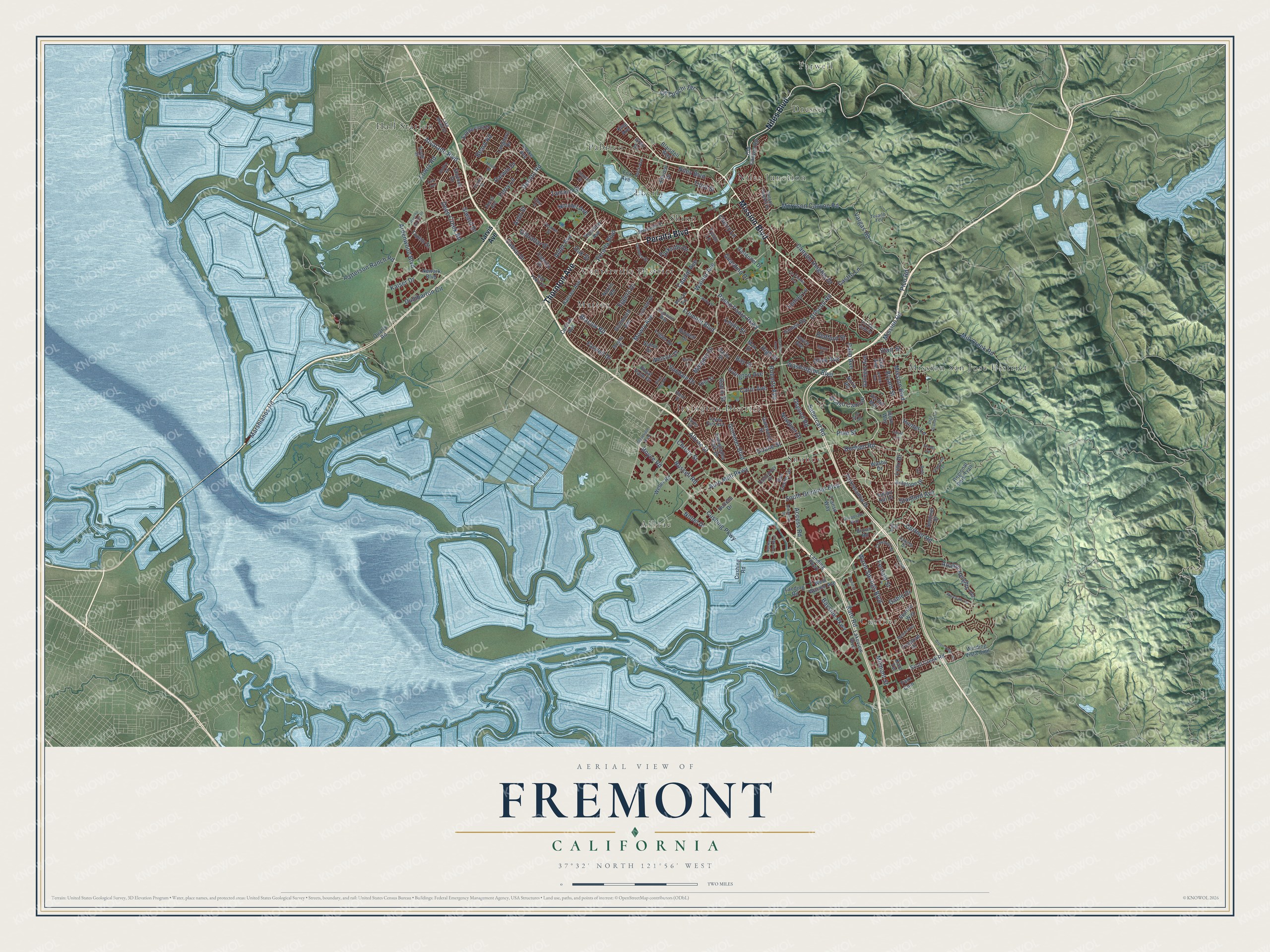
Building by building, with labeled streets and shaded relief.
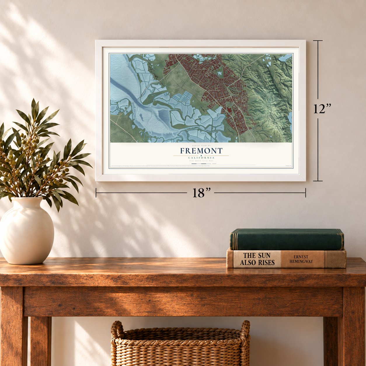
12" x 18" Archival Matte Print
A Map of Home. A Work of Art.
Explore Fremont, California from a whole new perspective. Created using aerial imagery and detailed geographic data, this map captures Fremont building by building, with labeled streets, familiar landmarks, and shaded topographical relief that highlights the natural contours of the landscape.
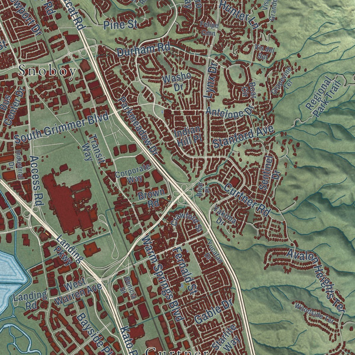
Combining modern data with the timeless character of a vintage atlas, this map is just as interesting up close as it is beautiful on the wall. Whether you grew up in Fremont, spent memorable years there, or call it home today, this unique map is a great way to celebrate a place that means something to you. Zoom in on the preview to look for your street, and then order a print to put your memories on the wall.
Three ways to hang it
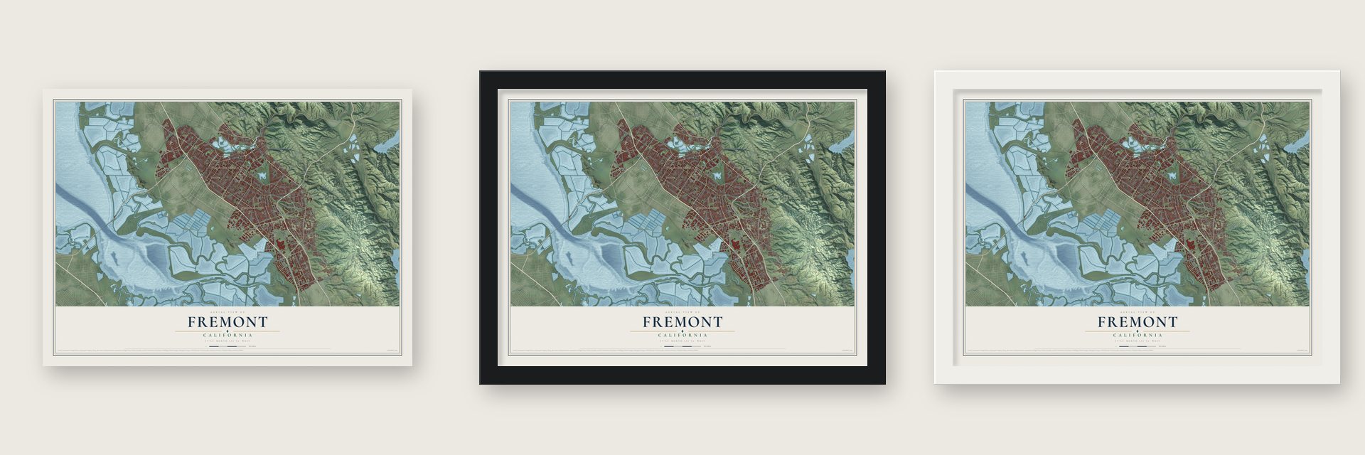
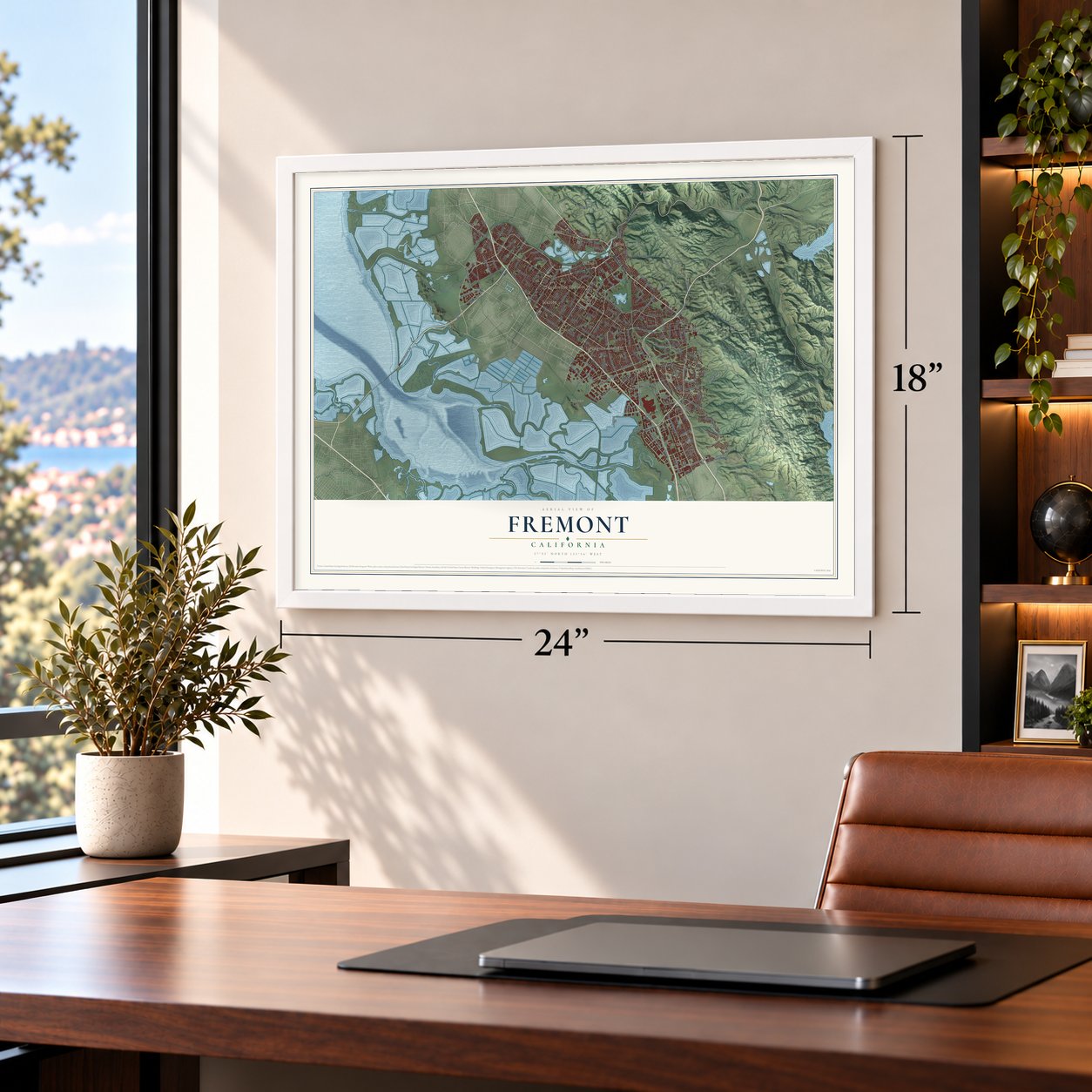
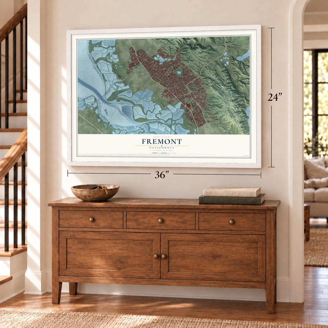
Unframed archival matte, a black wood frame or a white wood frame.
Up close
Geography Worth Displaying
This map was created using accurate cartographic data and authoritative geographic sources, including the U.S. Geological Survey and the Census Bureau. The map brings together terrain, waterways, roads, and building detail. The majority of the streets are labeled, houses are accurately depicted, and the topography is derived from government sources. Combining local data with carefully composed color and shading leads to this beautifully detailed Fremont artwork for your wall.
Rather than simply showing street outlines, we’ve included as many of the street names as we could reasonably fit on the map while keeping their names legible. Zoom in on the high resolution preview to see exactly what’s on the map. We truly set out to create a statement piece for anyone who loves Fremont. So whether it’s for you, or a gift for someone you love, we hope this map of Fremont brings back fond memories.
Read the story behind this map of Fremont, California from 2026.

Find your street
Names on the Fremont map
Every name below is printed on this map. Look for your street, your school, the park where you played, or the pond down the road.
Places and landmarks14
- Albrae
- Centerville District
- Curtner
- Dresser
- Eberly
- Farwell
- Hall Station
- Irvington District
- Mattos
- Mission San Jose District
- Niles Junction
- Pabrico
Show all 14 places
- Shinn
- Snoboy
Streets and roads200
- Niles Boulevard
- Peralta Boulevard
- Thornton Avenue
- Mission Boulevard
- Paseo Padre Parkway
- Fremont Boulevard
- Mowry Avenue
- Cushing Parkway
- Kato Road
- Alvarado Boulevard
- Avalon Heights Terrace
- Decoto Road
- Boyce Road
- Sundale Drive
- Blacow Road
- Warm Springs Boulevard
- South Grimmer Boulevard
- Auto Mall Parkway
- Grimmer Boulevard
- Walnut Avenue
- Mill Creek Road
- Washington Boulevard
- Farwell Drive
- Pine Street
- Marshlands Road
- Deep Creek Road
- Osgood Road
- Driscoll Road
- Nicolet Avenue
- Ardenwood Boulevard
Show all 200 streets
- Morrison Canyon Road
- Castro Lane
- Olive Avenue
- Christy Street
- Eggers Drive
- Durham Road
- Guardino Drive
- Patterson Ranch Road
- Canyon Heights Drive
- Vargas Road
- Albrae Street
- Tamayo Street
- Darwin Drive
- Milmont Street
- Lowry Road
- Kaiser Drive
- De Lucchi Terrace
- Access Road
- Boscell Road
- Dumbarton Circle
- Roberts Avenue
- Palm Avenue
- Curtner Road
- Alder Avenue
- Gibraltar Drive
- Sabercat Road
- Carol Avenue
- Bayside Parkway
- Margery Drive
- Hunter Lane
- Cabral Drive
- Leslie Street
- Fernald Street
- Ocaso Camino
- Siward Drive
- Robin Street
- Beard Road
- Lemos Lane
- Doane Street
- Starr Street
- High Street
- Stanford Avenue
- Capitol Avenue
- Parkside Drive
- Third Street
- Newport Drive
- Irvington Avenue
- Cherry Lane
- Bedford Street
- Bryant Street
- Gable Drive
- Mission Road
- Oak Street
- Nobel Drive
- Lynx Drive
- Nelson Street
- Bay Street
- Ferry Lane
- Pico Road
- Ardo Street
- Jarvis Avenue
- Cushing Road
- Scott Creek Road
- Landing Parkway
- Winding Vista Cmn
- Regional Park Trail
- Central Avenue
- Lakeview Boulevard
- Logan Drive
- Newark Boulevard
- Cabrillo Drive
- Old Canyon Road
- Parkmeadow Drive
- Landing Road
- Hansen Avenue
- Norris Road
- West Warren Avenue
- Everglades Park Drive
- Gallaudet Drive
- Bidwell Drive
- Fox Avenue
- Davis Street
- Gatewood Street
- Richmond Avenue
- Royal Palm Drive
- Hilo Street
- Bunche Drive
- Sanderling Drive
- Tupelo Street
- Bus Center Drive
- Sutter Drive
- Sentinel Drive
- Starlite Way
- Blaisdell Way
- Gallegos Avenue
- Quarry Road
- Antelope Drive
- Brown Road
- Ibero Way
- Gomes Road
- Hillview Drive
- Shylock Drive
- Joyce Avenue
- Weber Road
- Lorren Drive
- Langhorn Drive
- Vis del Mar
- Tonopah Drive
- Washo Drive
- Grau Drive
- Tyson Lane
- Locke Avenue
- Transit Way
- King Avenue
- Indian Hill Place
- Noria Road
- Max Drive
- Park Cmn
- Coit Avenue
- Kato Terrace
- San Pedro Drive
- Argonaut Way
- Omar Street
- Valpey Park Avenue
- Beacon Avenue
- Curtis Street
- Lake Mead Drive
- Riverwalk Drive
- Brophy Drive
- Technology Drive
- Tecado Terrace
- Perkins Street
- Corporate Way
- Boar Circle
- Crawford Street
- Camden Street
- Rock Avenue
- Sedge Street
- Yakima Drive
- Via San Gabriel
- Pecos Avenue
- Chaplin Drive
- Green Valley Road
- Stevenson Boulevard
- Liberty Street
- Las Palmas Avenue
- Milton Street
- Besco Drive
- Industrial Drive
- Vista Grande Terrace
- Farallon Cmn
- Woodside Terrace
- Grapevine Terrace
- Rancho del Sur Drive
- Mayten Way
- Sandra Road
- Mento Drive
- Northport Loop West
- Skye Road
- Jerome Avenue
- Silver Reef Drive
- Yucatan Drive
- Ariel Avenue
- Vis del Sol
- Benicia Street
- Ford Lane
- Gordon Street
- Felipe Cmn
- Eden Court
- Briar Place
Names are listed as they appear on the printed map. Zoom into the product photos to find them.
About Fremont, California
Fremont is a city of 230,504 people in Alameda County, in the East Bay. Its recorded history begins on June 6, 1797, when the Spanish priest Fermín de Lasuén founded Mission San José on the site of Oroysom, an Ohlone village. The mission grew to 1,887 people by 1831, but it lost its power after Mexico secularized the missions in 1834. Mission San Jose joined the National Register in 1971.
When the Gold Rush brought newcomers to California, a settlement named Mission San José took shape around the old church, and it had its own post office from 1850. Farmers there raised grapes, olives and nursery plants. In 1868 the Hayward earthquake knocked down buildings across the area and ruined the mission. On January 23, 1956, five towns, Niles, Irvington, Centerville, Warm Springs and Mission San José, joined to form one city, with Wally Pond chairing the incorporation committee. The new city took its name from John C. Frémont, who led an expedition through Mission Pass in 1846 to claim California for the United States.
- Chaplin's Tramp in NilesFrom 1912 to 1915, Niles was where California's film business got its start, at Essanay Studios. Charlie Chaplin made several movies around Niles, and the best known of them is The Tramp.
- Cold beer from a tentCenterville began in 1850, when George Lloyd set up a tent and sold cold beer to people riding the stagecoach. Capt. George Bond then opened a general store, and the settlement chose the name Centerville. Its post office opened in 1855 under the spelling Centreville and switched to Centerville in 1893. Centerville went on to become the leading town of Washington Township.
- California's biggest wineryIrvington's Palmdale Winery was the largest winery in California until the 1906 San Francisco earthquake destroyed it. Its ruins can still be seen near Five Corners, where Washington Boulevard meets Osgood.
- From GM to TeslaA General Motors assembly plant in South Fremont was long the town's largest employer. In the 1980s Toyota and General Motors ran it together as NUMMI, until the joint venture shut down in early 2010. In June 2010 Tesla Motors bought part of the plant for its main factory, which employed 25,000 people as of 2024.
- The first MacApple built its first Mac computer at a factory in Fremont, which kept making them until 1993. By 1999 about 750 high-tech companies had offices, headquarters or plants in the city, many of them in the Warm Springs District.
Keep exploring California
Fremont is one of 1,990 California towns we've mapped. Every dot on the map is a print of its own.
The search covers every state, California first.
Near Fremont
Order 2 or more town maps and save 10%. Shown in the size and finish you picked above, so they hang as a set.
- Alviso 12" x 18" / Archival Matte Print $39.99
- Newark 12" x 18" / Archival Matte Print $39.99
- Milpitas 12" x 18" / Archival Matte Print $39.99


More maps nearby: Sunol, Berryessa, Union City, Sunnyvale and Santa Clara.
The art of mapping a place
How This Map Was Made
Real places. Remarkable detail. Discover the layers that turn geographic data into a map of home.

The view from above
Aerial imagery reveals the character of the land: woodland, open fields, and the patterns of a place.

The shape of the land
Elevation data brings hills, valleys, and subtle changes in the landscape into view.

The details of home
Roads, waterways, and building footprints come together to make the map feel unmistakably local.

Geography becomes art
Considered color, shading, and typography bring the layers together in a map made for your wall.


Process illustrated with Mendon, Massachusetts. Aerial imagery: USDA NAIP. Terrain: USGS 3D Elevation Program. Map details and finished artwork: KNOWOL.
The Details
About This Print
Choose an archival matte print, or a black or white Ayous wood frame. The archival matte print is unframed.
Select your size and finish above to see the matching product image and price.
Materials & Craftsmanship
A contemporary map with the character of a classic atlas, printed on archival matte paper. Optional frames are made from Ayous wood.
Your printed map does not include the watermark shown in the full-map preview.
Shipping & Delivery
Free shipping within the United States. Every print is made to order in the USA.
Buying a gift? Add a note in your cart and we'll include it. We never put prices in the package.
Prints ship within 2 to 3 business days. Allow 7 to 10 days total from ordering for delivery. Timing may vary during holidays or periods of high order volume.
Read our shipping policy.
Returns and damaged prints
Each print is made to order. Change-of-mind refunds are not available after production.
If your print arrives damaged, misprinted or incorrect, contact support@knowol.com within 30 days of receiving it. Include your order number, photos and a description of the issue.
Read our full refund and replacement policy. For questions about your order, email support@knowol.com.