
Search for another town


Free U.S. delivery 7 to 10 days after you order
Newark, California Map Art
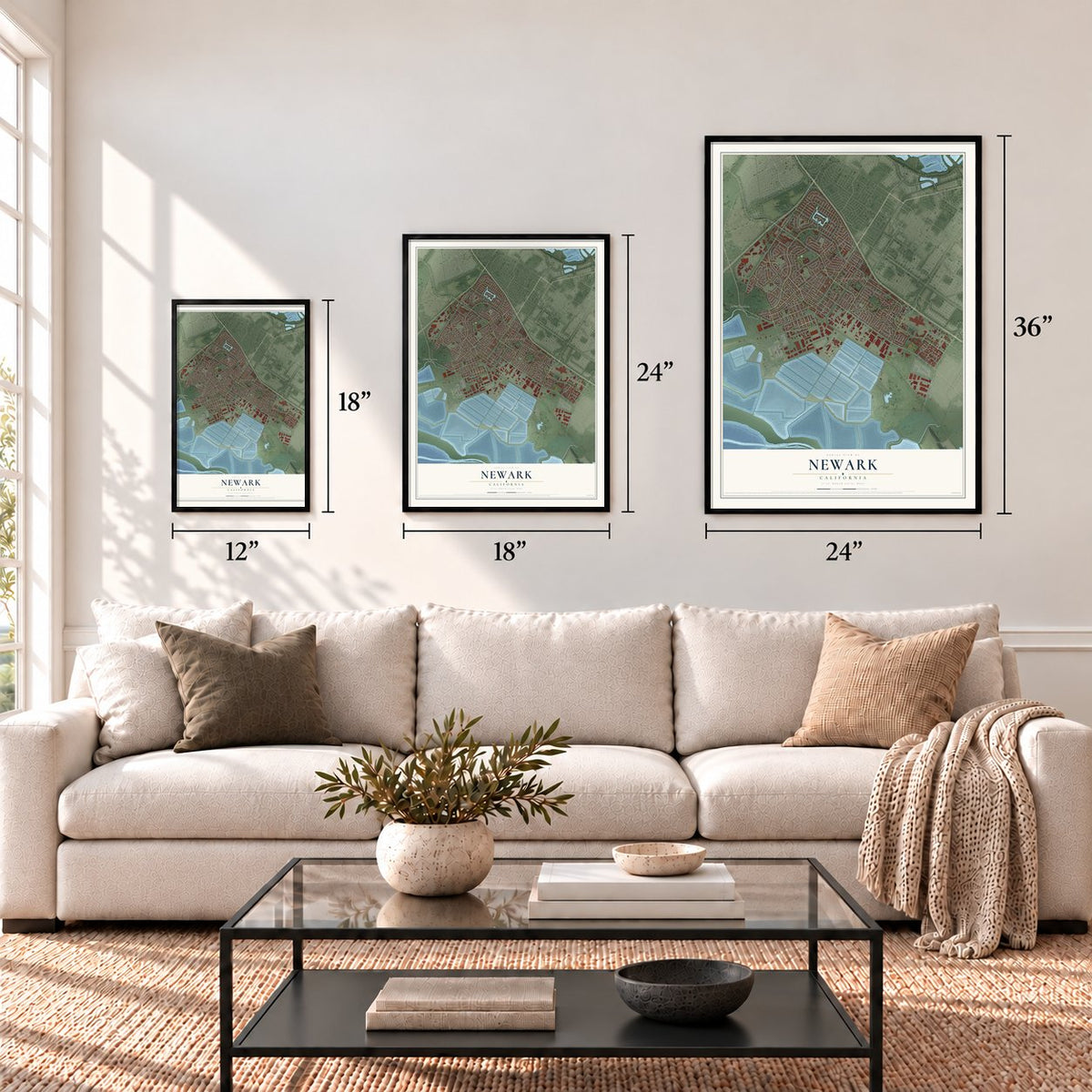
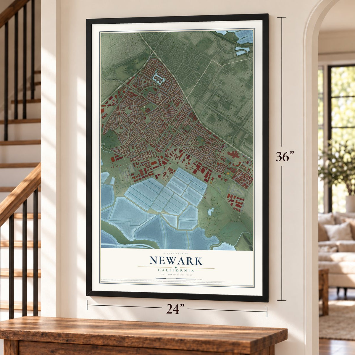
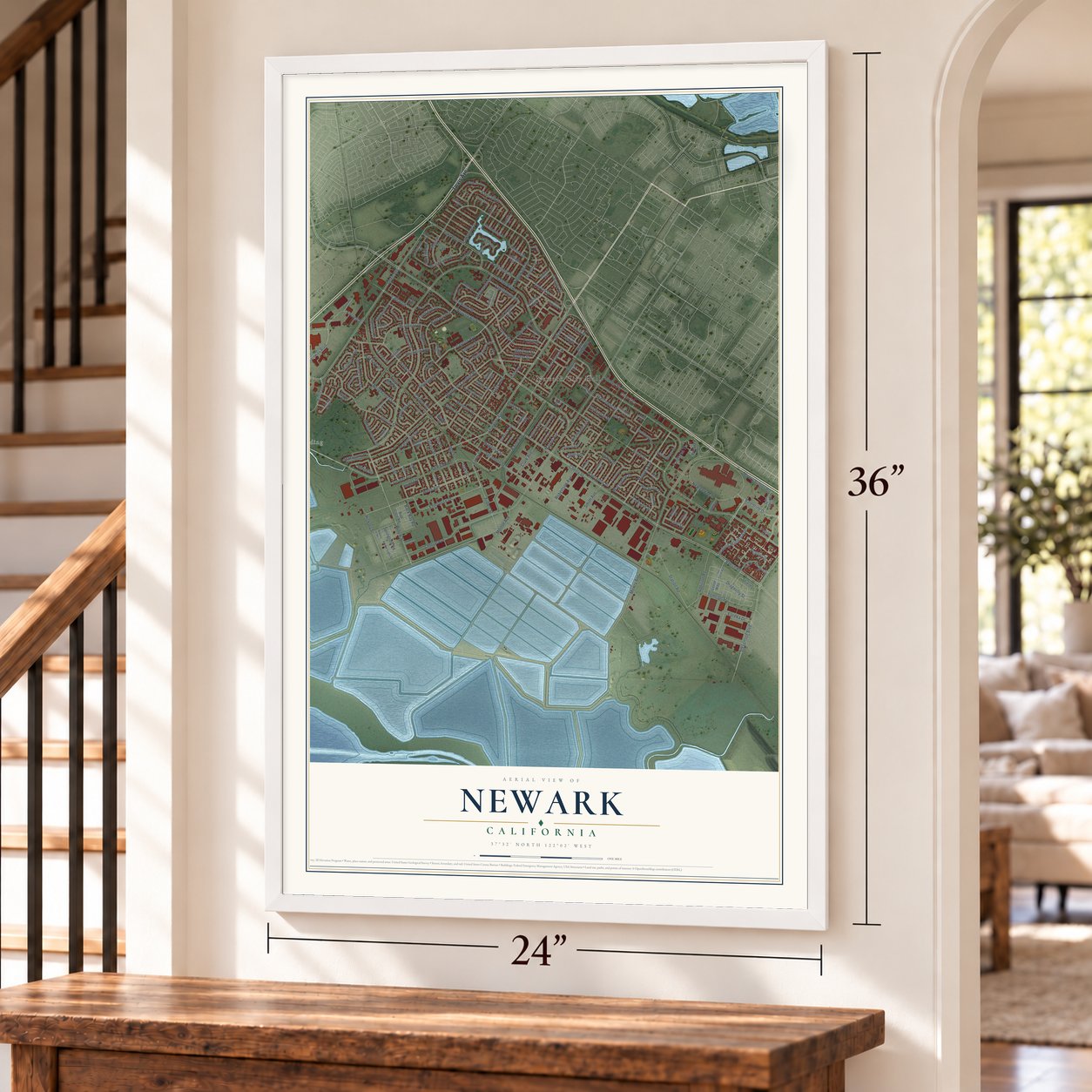
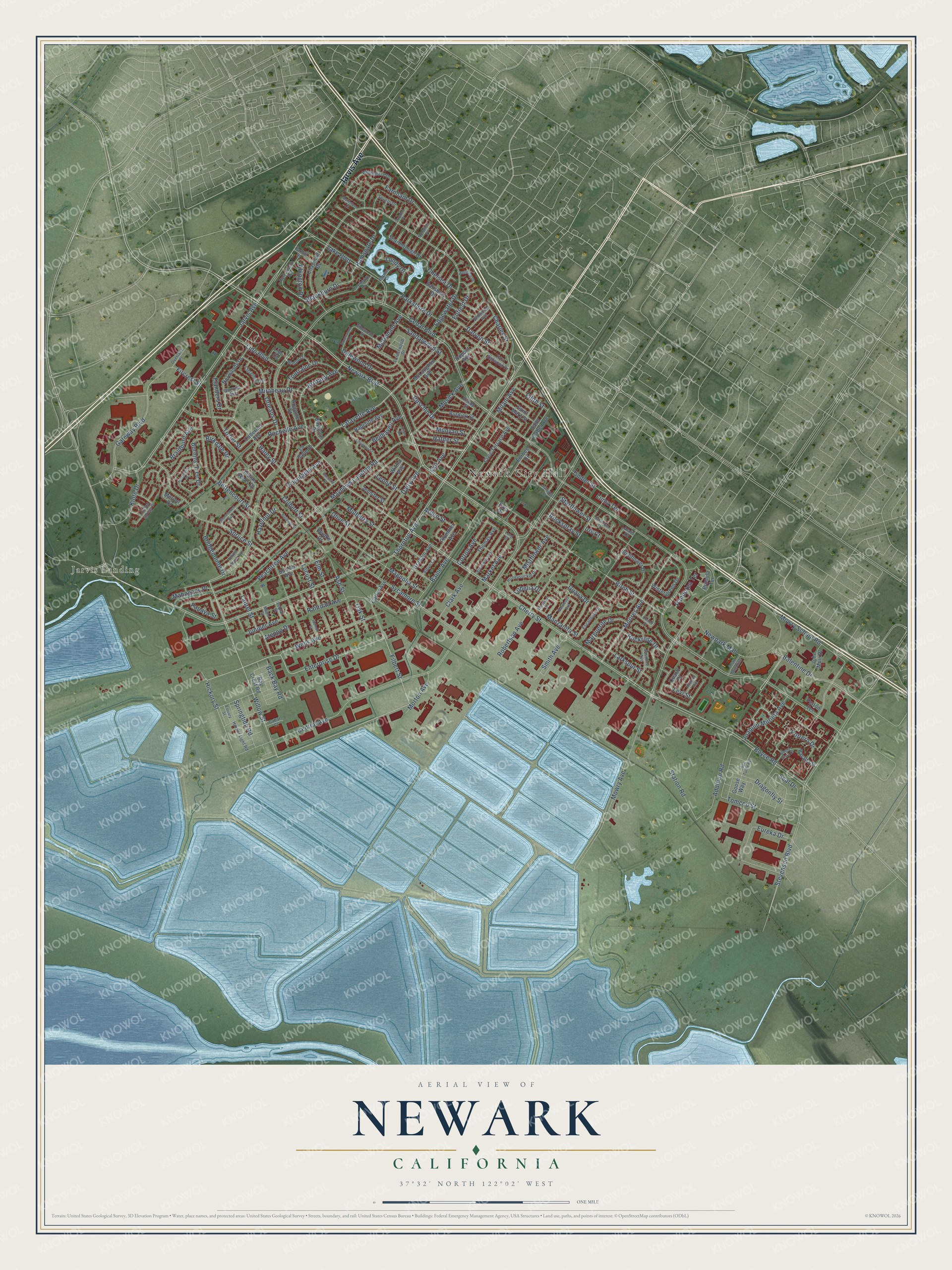
A new map of Newark, California, made in 2026 and printed to order on thick archival matte paper.
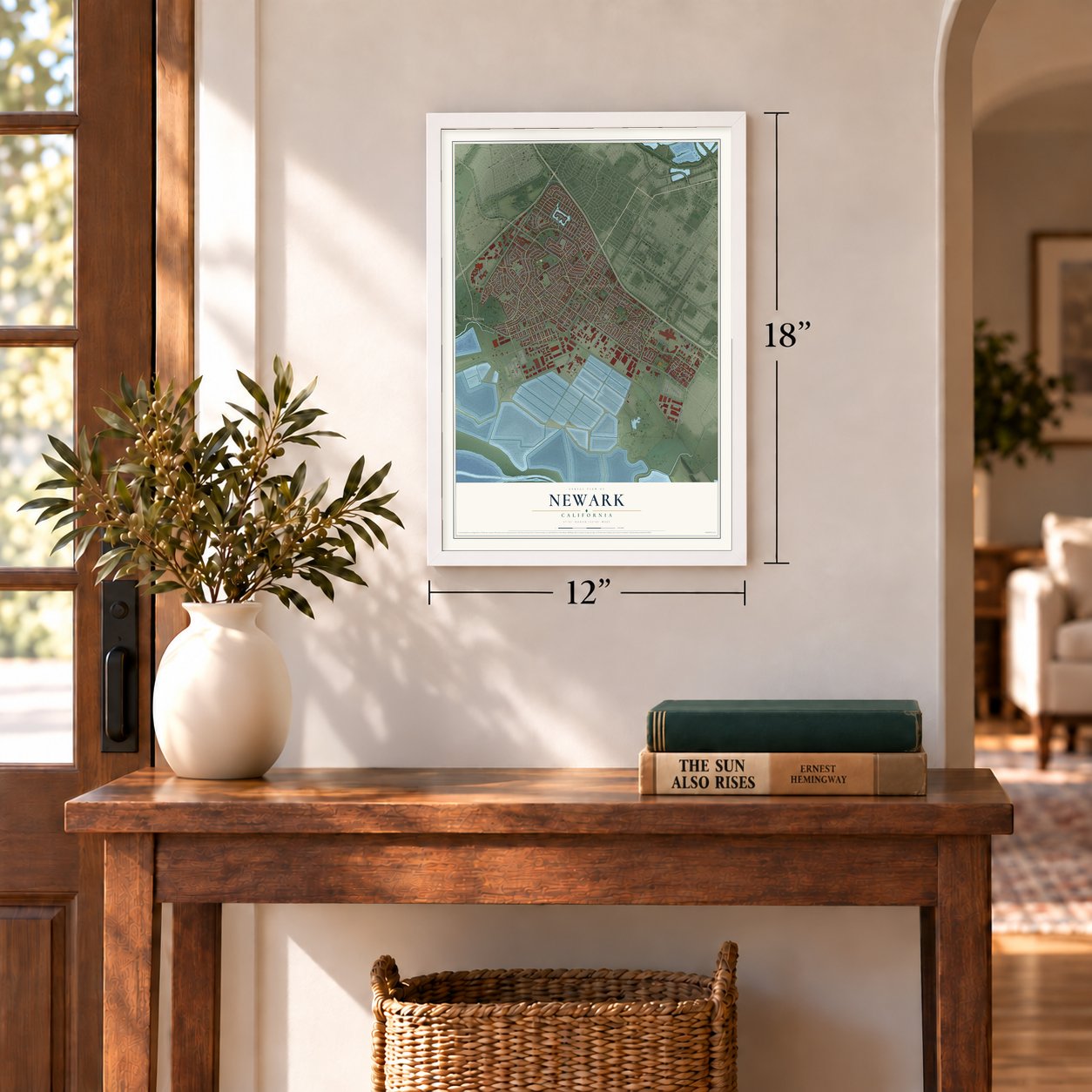
12" x 18" Archival Matte Print
A Map of Home. A Work of Art.
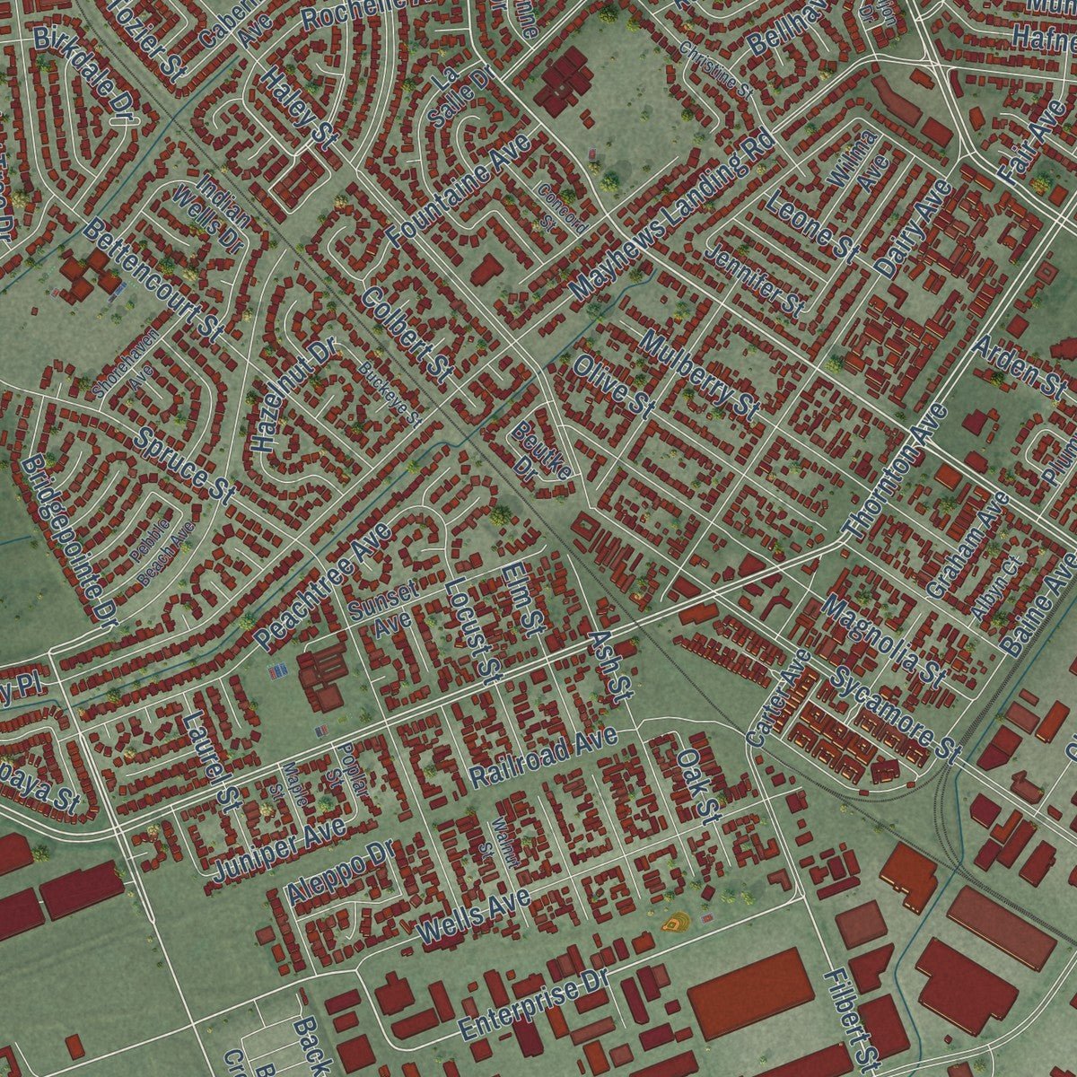
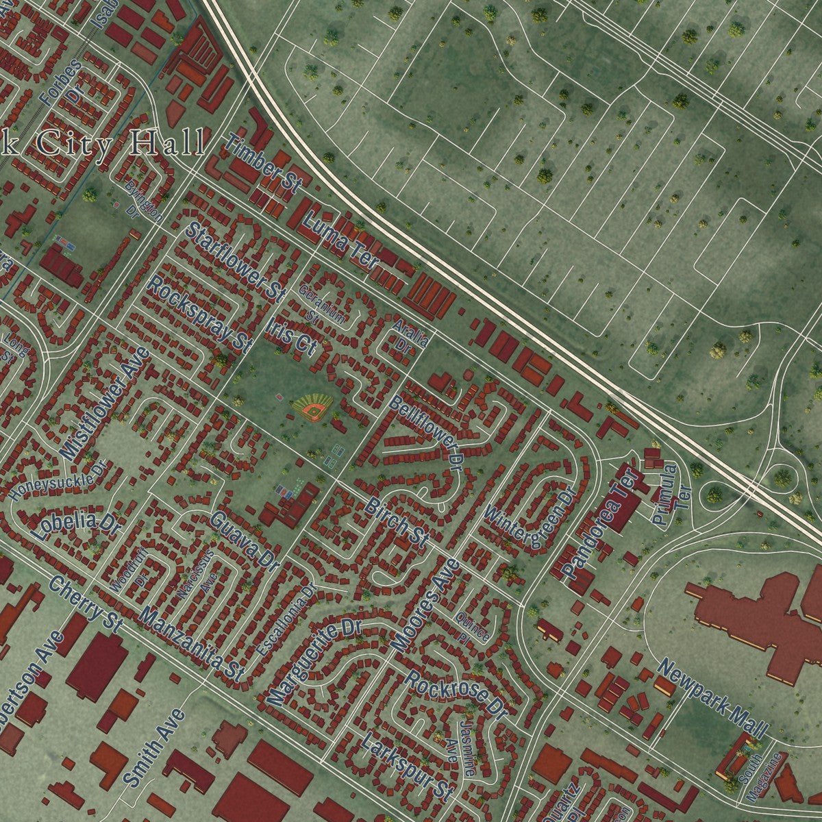
Explore Newark, California from a whole new perspective. Created using aerial imagery and detailed geographic data, this map captures Newark building by building, with labeled streets, familiar landmarks, and shaded topographical relief that highlights the natural contours of the landscape.
Combining modern data with the timeless character of a vintage atlas, this map is just as interesting up close as it is beautiful on the wall. Whether you grew up in Newark, spent memorable years there, or call it home today, this unique map is a great way to celebrate a place that means something to you. Zoom in on the preview to look for your street, and then order a print to put your memories on the wall.
Three ways to hang it
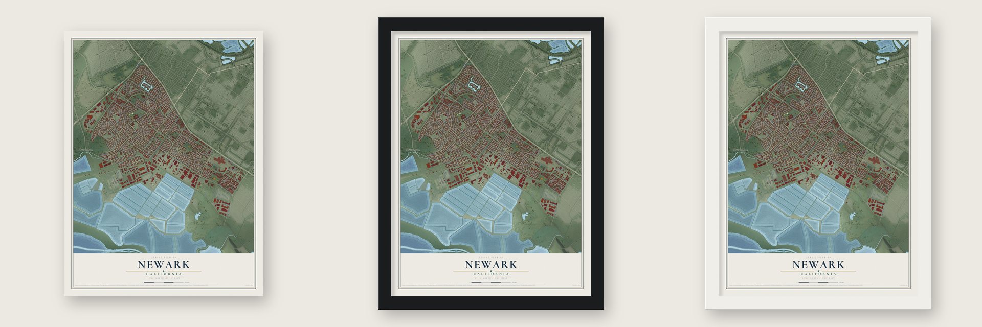
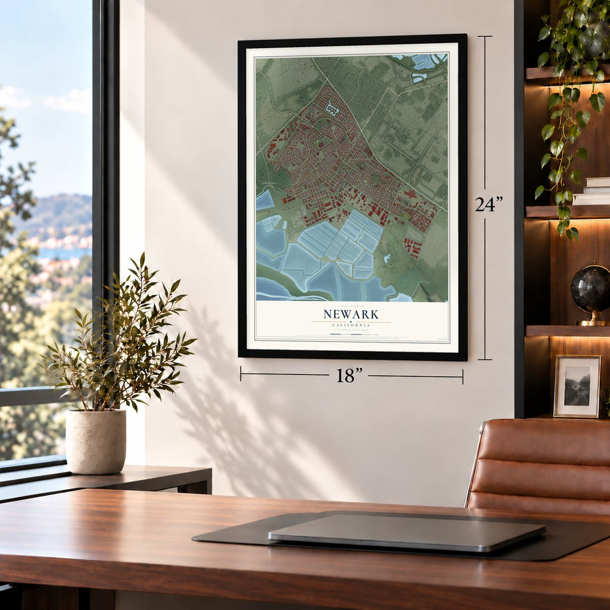
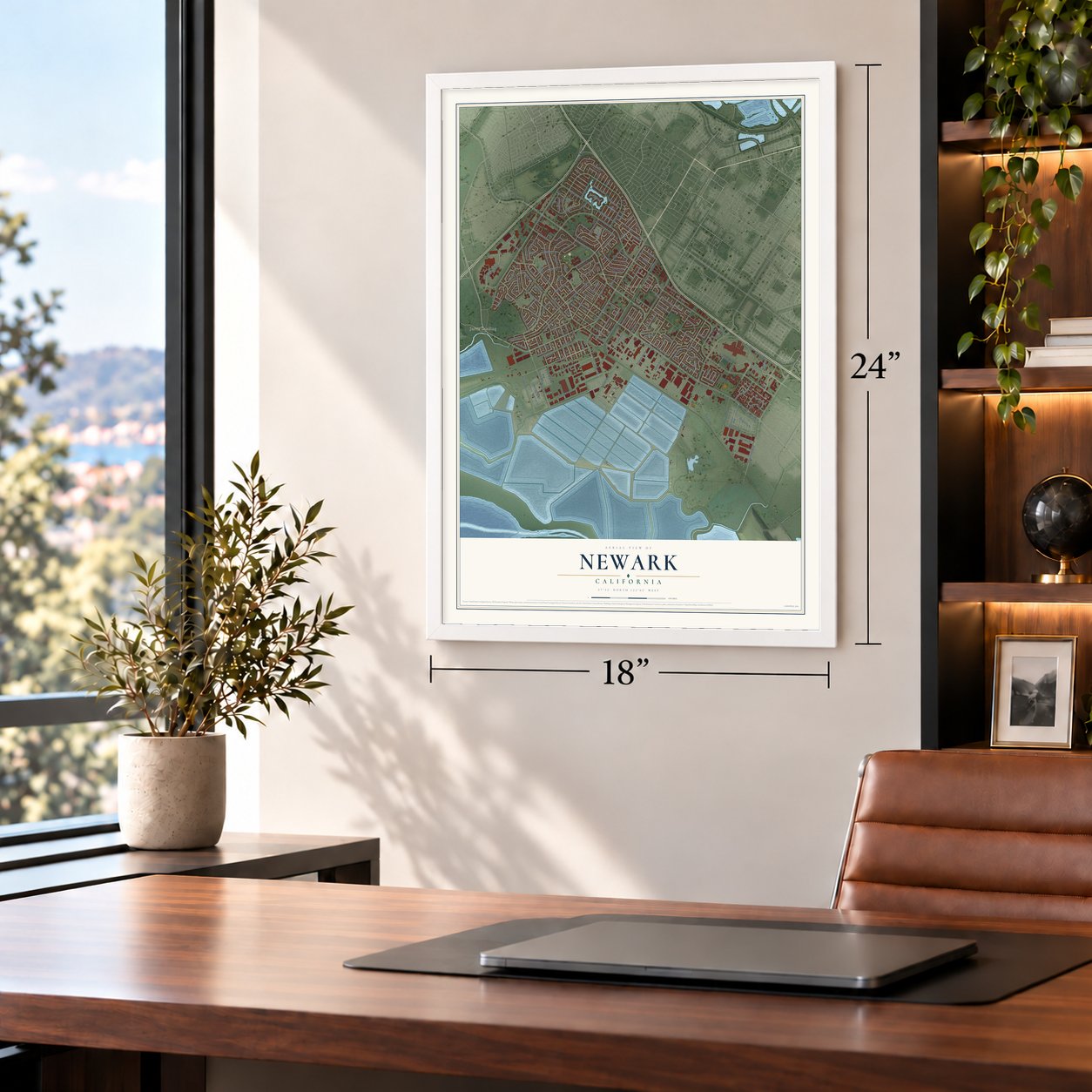
Unframed archival matte, a black wood frame or a white wood frame.
Up close
Geography Worth Displaying
This map was created using accurate cartographic data and authoritative geographic sources, including the U.S. Geological Survey and the Census Bureau. The map brings together terrain, waterways, roads, and building detail. The majority of the streets are labeled, houses are accurately depicted, and the topography is derived from government sources. Combining local data with carefully composed color and shading leads to this beautifully detailed Newark artwork for your wall.
Rather than simply showing street outlines, we’ve included as many of the street names as we could reasonably fit on the map while keeping their names legible. Zoom in on the high resolution preview to see exactly what’s on the map. We truly set out to create a statement piece for anyone who loves Newark. So whether it’s for you, or a gift for someone you love, we hope this map of Newark brings back fond memories.
Read the story behind this map of Newark, California from 2026.

About Newark, California
Newark is a city of 47,529 people in Alameda County, at the south end of San Francisco Bay, and Fremont surrounds it on every side. The Ohlone people lived here before Europeans arrived. The first European settlers were Spanish missionaries from Mission San José, whose lands took in most of what is now Newark, Fremont and Union City.
In the spring of 1877, backers won the right to build a railroad from Alameda to Newark, and work on the line began right away. The next year the Pacific Land Investment Company bought land in Washington Township and divided it into lots for the new town. J. Barr Robertson named it for Newark Castle at Port Glasgow, in Scotland.
- A city by September 1955In 1953, people in the towns around Newark feared that Hayward would annex them, so they made plans to join together as one city, which became Fremont. Newark worried that it would be pulled into that new city and that its zoning would change. It incorporated on its own in September 1955, before Fremont had finished becoming a city.
- Stoves, trucks and trailersFor much of the 20th century, Newark lived on manufacturing. Wedgewood stoves were made here from the 1910s to the 1940s. A.O. Smith Corporation, and later National Steel Corporation, built glass-lined water heaters from the 1950s to the 1970s. Peterbilt built trucks from the 1960s to the 1980s, and Trailmobile made semi-trailers from 1965 to 1975.
- Salt from the bayCargill Salt, once called Leslie Salt, runs a large refinery in Newark that cleans salt gathered in evaporation ponds on San Francisco Bay. Newark and Fremont each take in part of a wildlife refuge on the bay's shore, called Don Edwards San Francisco Bay National Wildlife Refuge.
- Newark Days every SeptemberEach September the city marks its founding with Newark Days, a four-day festival held on the MacGregor Soccer fields beside the community center on Cedar Boulevard.
Find your street
Names on the Newark map
Every name below is printed on this map. Look for your street, your school, the park where you played, or the pond down the road.
Places and landmarks2
- Newark City Hall
- Jarvis Landing
Streets and roads201
- Jarvis Avenue
- Cherry Street
- Central Avenue
- Newark Boulevard
- Balentine Drive
- Willow Street
- Enterprise Drive
- Filbert Street
- Brittany Avenue
- Thornton Avenue
- Cedar Boulevard
- Blackburn Drive
- Gateway Boulevard
- Hickory Street
- Ramsgate Drive
- Edgewater Drive
- Mowry Avenue
- Mayhews Landing Road
- Sycamore Street
- Birch Street
- Lafayette Avenue
- Stevenson Boulevard
- Moores Avenue
- Spruce Street
- Haley Street
- Newpark Mall
- Lake Boulevard
- Mowry School Road
- Smith Avenue
- Ruschin Drive
Show all 201 streets
- Robertson Avenue
- Bettencourt Street
- Peachtree Avenue
- Orleans Drive
- Baine Avenue
- Dairy Avenue
- Railroad Avenue
- Eureka Drive
- Olive Street
- Station Road
- Magnolia Street
- Wells Avenue
- Lido Boulevard
- Farnham Drive
- Darvon Street
- Kiote Drive
- Locust Street
- Mulberry Street
- Addition Road
- Manzanita Street
- Rockrose Drive
- Mirabeau Drive
- Musick Avenue
- Dragonfly Street
- Ash Street
- Elm Street
- Potrero Drive
- Flanders Drive
- Marguerite Drive
- Hafner Street
- Dalewood Drive
- Joaquin Murieta Avenue
- Tourraine Drive
- Rochelle Avenue
- Braidburn Avenue
- Tomcod Street
- Parkshore Drive
- Boyce Road
- Sandalwood Street
- Chelsea Drive
- Birkdale Drive
- Bridgepointe Drive
- Clark Avenue
- Hazelnut Drive
- Burning Tree Drive
- Seal Drive
- Fountaine Avenue
- Larkspur Street
- Charles Street
- Cotton Avenue
- Market Avenue
- Springtide Road
- Bellhaven Avenue
- Pandorea Terrace
- Starflower Street
- Morton Avenue
- Aleppo Drive
- Guava Drive
- Enfield Drive
- Munyan Street
- Papaya Street
- McDonald Avenue
- Mahogany Place
- Timber Street
- Fircrest Street
- Back Bay Road
- Laurel Street
- Mistflower Avenue
- Abington Drive
- Edith Street
- Juniper Avenue
- Tozier Street
- Luma Terrace
- Milani Avenue
- Rockspray Street
- Fair Avenue
- Arden Street
- Colbert Street
- Oak Street
- Leone Street
- Levi Street
- Lobelia Drive
- Lundy Drive
- Iris Court
- Forbes Drive
- Civic Terrace Avenue
- Chapman Drive
- Normandy Drive
- La Salle Drive
- Dupont Avenue
- Scarborough Drive
- Bellflower Drive
- Indian Wells Drive
- Sunset Avenue
- Wintergreen Drive
- Carter Avenue
- Graham Avenue
- Salisbury Drive
- Thomas Avenue
- Primula Terrace
- Radcliffe Avenue
- Cabernet Avenue
- McLaughlin Avenue
- Burdick Street
- Saint Isabel Avenue
- Argonne Street
- Merion Drive
- Beutke Drive
- Bay Crest Road
- Bayonne Drive
- Saint Mary Street
- John Muir Drive
- Plummer Avenue
- Jennifer Street
- Wilma Avenue
- Lido Court
- Parada Street
- Quartz Place
- Goose Way
- Ezra Drive
- Pelton Terrace
- Port Sailwood Drive
- Honeysuckle Drive
- Reymouth Drive
- Forestwood Drive
- Windemere Drive
- Escallonia Drive
- Severn Drive
- Harbor Light Road
- Jasmine Avenue
- Portsmouth Avenue
- Cleremont Drive
- Breton Drive
- Aralia Drive
- Vinewood Street
- Elmwood Avenue
- Bishop Street
- Cardiff Street
- Garrone Avenue
- Overlake Place
- Albyn Court
- Cabot Court
- Norwich Place
- Poplar Street
- Sea Turtle Avenue
- Walnut Street
- Christine Street
- Broadway Avenue
- Byington Drive
- Inverness Drive
- Woodruff Drive
- Crystal Springs Drive
- Narcissus Avenue
- Quince Place
- Shorehaven Avenue
- Dijon Drive
- Buena Vista Drive
- Worthing Drive
- Pebble Beach Avenue
- Buckeye Street
- Ravenwood Avenue
- Concord Street
- Rubicon Avenue
- Channel Drive
- South Magazine
- Geranium Street
- Maidstone Court
- Estuary Street
- Maple Street
- Croydon Place
- Long Street
Names are listed as they appear on the printed map. Zoom into the product photos to find them.
The art of mapping a place
How This Map Was Made
Real places. Remarkable detail. Discover the layers that turn geographic data into a map of home.

The view from above
Aerial imagery reveals the character of the land: woodland, open fields, and the patterns of a place.

The shape of the land
Elevation data brings hills, valleys, and subtle changes in the landscape into view.

The details of home
Roads, waterways, and building footprints come together to make the map feel unmistakably local.

Geography becomes art
Considered color, shading, and typography bring the layers together in a map made for your wall.


Process illustrated with Mendon, Massachusetts. Aerial imagery: USDA NAIP. Terrain: USGS 3D Elevation Program. Map details and finished artwork: KNOWOL.
The Details
About This Print
Choose an archival matte print, or a black or white Ayous wood frame. The archival matte print is unframed.
Select your size and finish above to see the matching product image and price.
Materials & Craftsmanship
A contemporary map with the character of a classic atlas, printed on archival matte paper. Optional frames are made from Ayous wood.
Your printed map does not include the watermark shown in the full-map preview.
Shipping & Delivery
Free shipping within the United States. Every print is made to order in the USA.
Buying a gift? Add a note in your cart and we'll include it. We never put prices in the package.
Prints ship within 2 to 3 business days. Allow 7 to 10 days total from ordering for delivery. Timing may vary during holidays or periods of high order volume.
Read our shipping policy.
Returns and damaged prints
Each print is made to order. Change-of-mind refunds are not available after production.
If your print arrives damaged, misprinted or incorrect, contact support@knowol.com within 30 days of receiving it. Include your order number, photos and a description of the issue.
Read our full refund and replacement policy. For questions about your order, email support@knowol.com.
Find your town
Looking for another city?
Find a map of home in our California collection, or any town in the country.
Nearby
Maps of towns near Newark
Know someone from one of these towns? Their map makes a great gift.
 Fremont
, California
From $39.99See the map
 East Palo Alto
, California
From $39.99See the map
 Menlo Park
, California
From $39.99See the map
More maps nearby: Union City, Mountain View, Sunnyvale, Milpitas and Stanford.