
Search for another town





Free U.S. delivery 7 to 10 days after you order
Mountain View, California Map Art
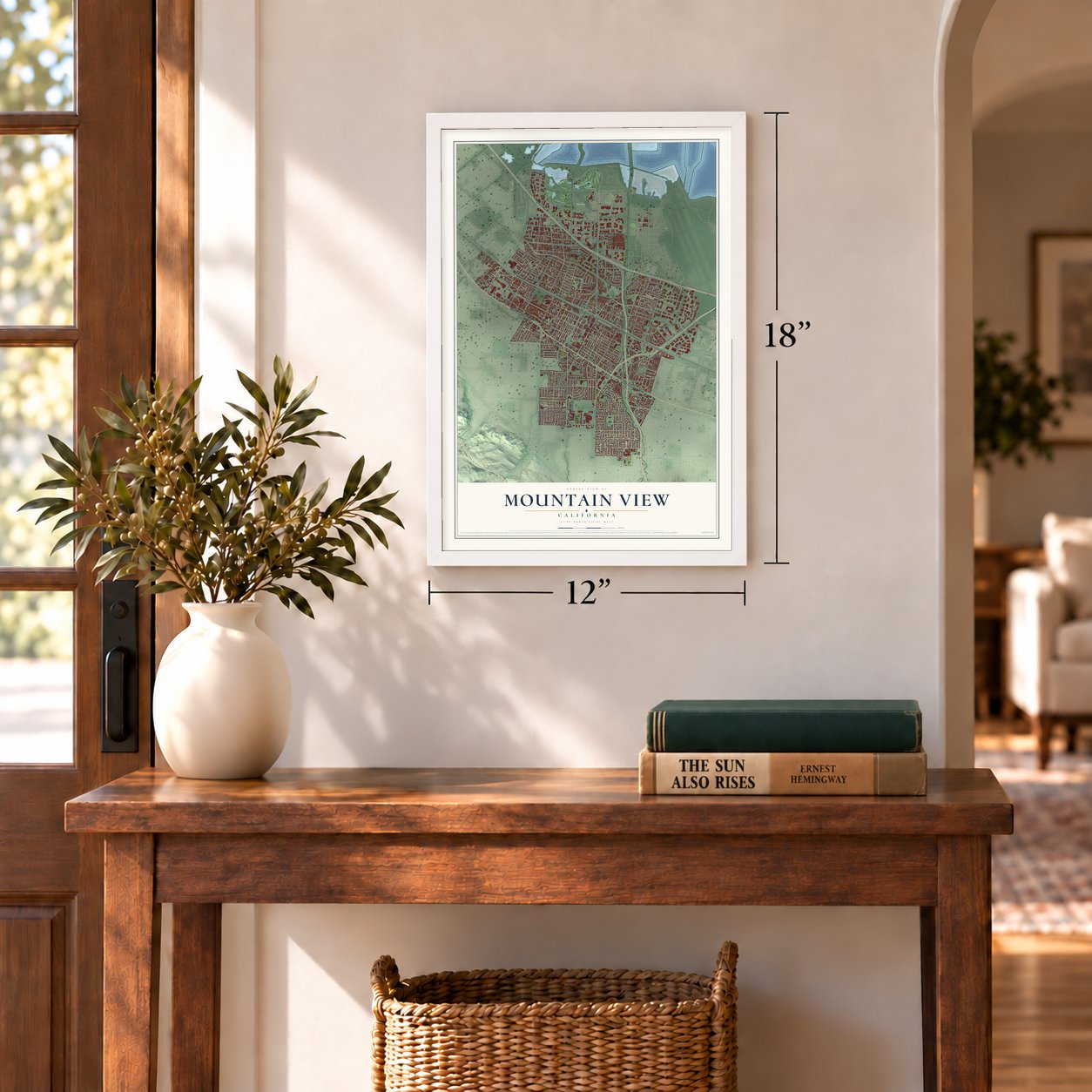
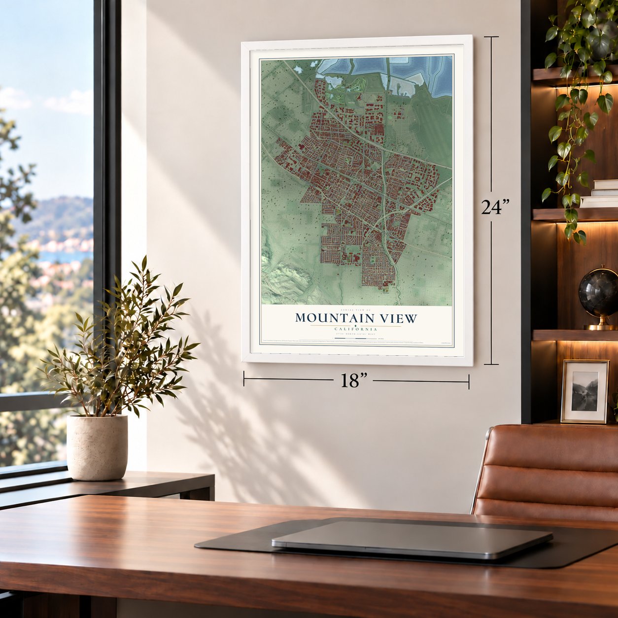
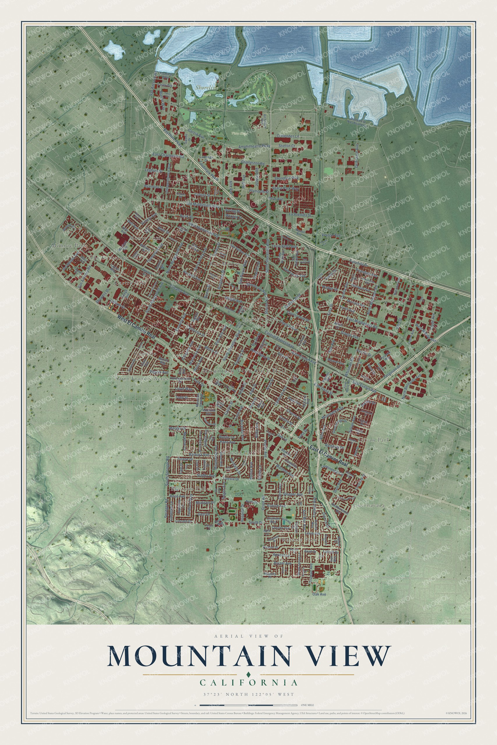
A new map of Mountain View, California, made in 2026 and printed to order on thick archival matte paper.
12" x 18" Archival Matte Print
A Map of Home. A Work of Art.
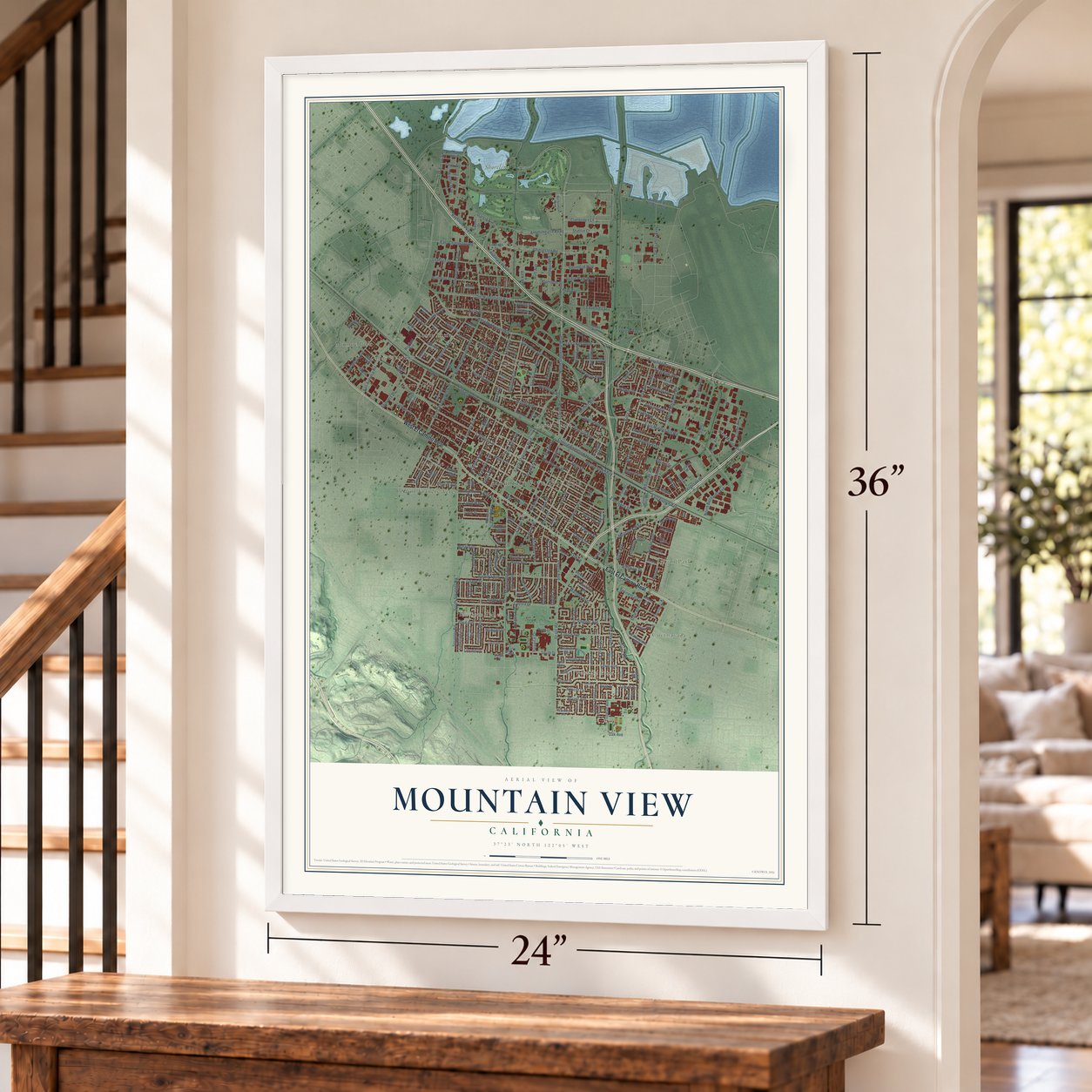
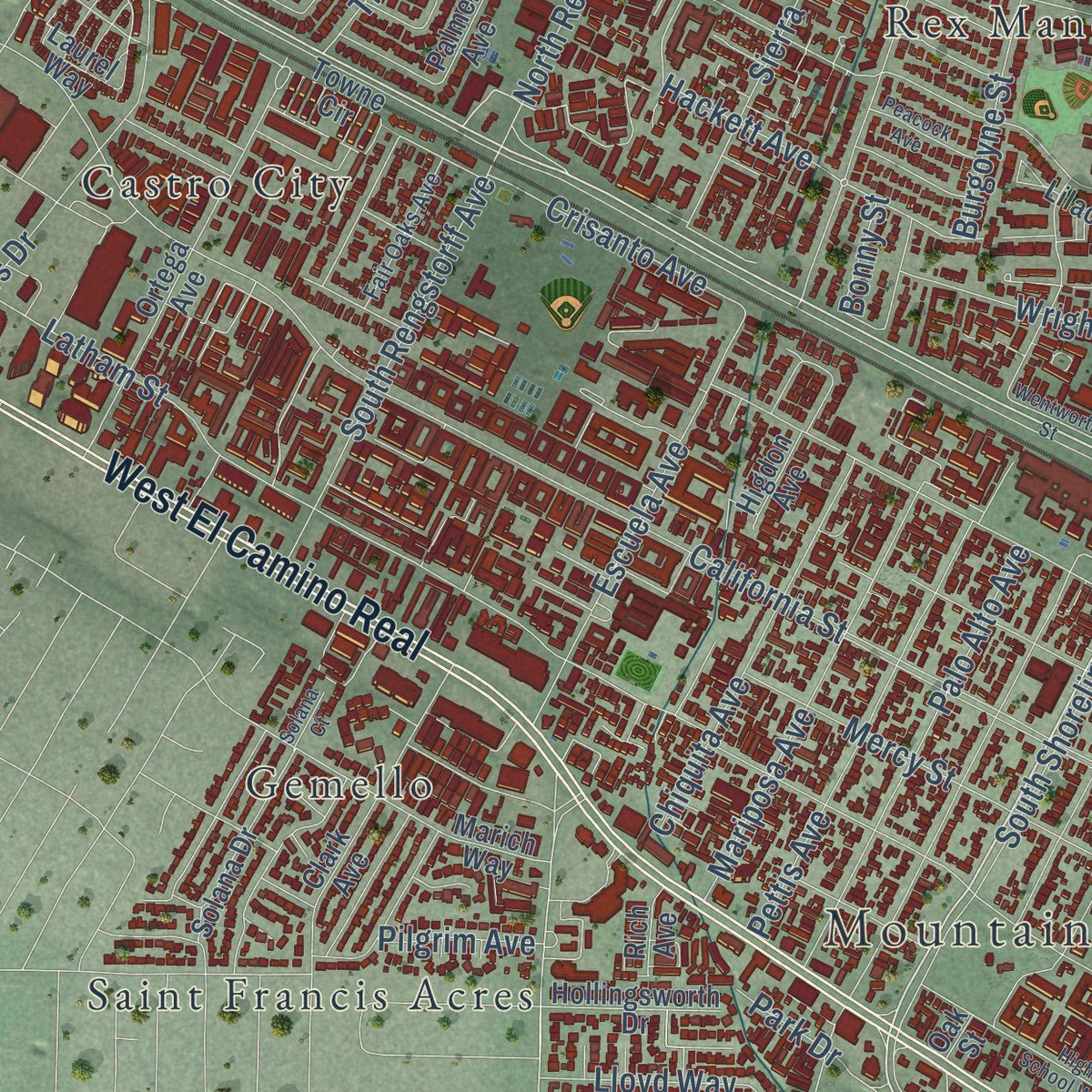
Explore Mountain View, California from a whole new perspective. Created using aerial imagery and detailed geographic data, this map captures Mountain View building by building, with labeled streets, familiar landmarks, and shaded topographical relief that highlights the natural contours of the landscape.
Combining modern data with the timeless character of a vintage atlas, this map is just as interesting up close as it is beautiful on the wall. Whether you grew up in Mountain View, spent memorable years there, or call it home today, this unique map is a great way to celebrate a place that means something to you. Zoom in on the preview to look for your street, and then order a print to put your memories on the wall.
Three ways to hang it
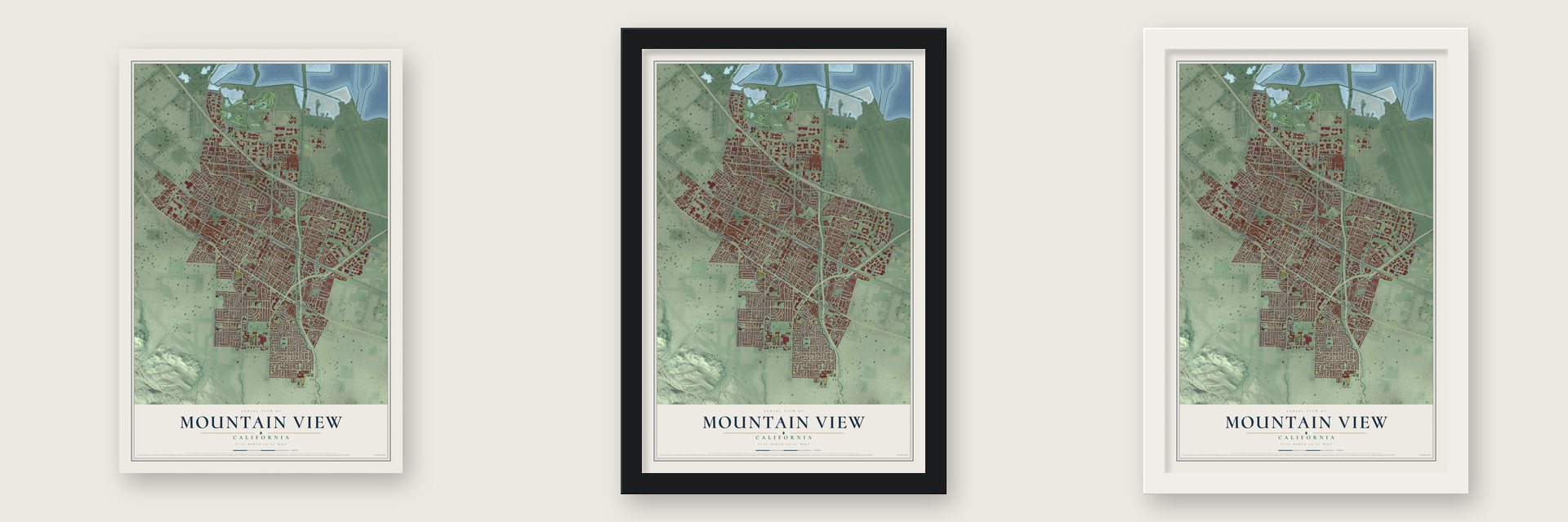
Unframed archival matte, a black wood frame or a white wood frame.
Up close
Geography Worth Displaying
This map was created using accurate cartographic data and authoritative geographic sources, including the U.S. Geological Survey and the Census Bureau. The map brings together terrain, waterways, roads, and building detail. The majority of the streets are labeled, houses are accurately depicted, and the topography is derived from government sources. Combining local data with carefully composed color and shading leads to this beautifully detailed Mountain View artwork for your wall.
Rather than simply showing street outlines, we’ve included as many of the street names as we could reasonably fit on the map while keeping their names legible. Zoom in on the high resolution preview to see exactly what’s on the map. We truly set out to create a statement piece for anyone who loves Mountain View. So whether it’s for you, or a gift for someone you love, we hope this map of Mountain View brings back fond memories.
Read the story behind this map of Mountain View, California from 2026.

About Mountain View, California
Mountain View is a city of 82,376 people in Santa Clara County, and it takes its name from its views of the Santa Cruz Mountains. Ohlone villages once stood on the fertile ground between those mountains and the bay, and Spanish missionaries later grazed sheep here. In 1842 Governor Juan Alvarado of Alta California granted Rancho Pastoria de las Borregas to Francisco Estrada. The grant passed to Mariano Castro, who sold half of it to Martin Murphy Jr., and the old rancho slowly became Mountain View and Sunnyvale.
After the United States took California, settlers started a stagecoach station here in 1852. That same year Seligman Weilheimer and his brother Samuel arrived from Dossenheim, in Germany, and in 1856 they opened the first big general store in the settlement. By the early 1900s the town shipped fruit and grain and was known for printing religious books. Its pioneers were buried in a cemetery off Castro Street, where the city library and Pioneer Park stand today.
- Moffett Field, 1929 to 1994Moffett Field Naval Air Station operated here from 1929 to 1994, and the Navy's 1,000-acre complex drew many workers to town. In 1940 the federal aeronautics research agency that later became NASA Ames Research Center made its home here. Aerospace and electronics jobs followed, and the population jumped from 6,563 in 1950 to 30,889 in 1960.
- Silicon arrives in 1956William Shockley opened Shockley Semiconductor Laboratory in Mountain View in 1956. It was the first company in Silicon Valley to develop silicon semiconductor devices. Today Google and Intuit both keep their headquarters in the city.
- St. Joseph's since 1905St. Joseph Parish was founded in 1905 and came through the 1906 San Francisco earthquake, but its church burned down in 1928. The parish built the present church in 1929. St. Joseph's Seminary also ran here from 1924 to 1991.
Find your street
Names on the Mountain View map
Every name below is printed on this map. Look for your street, your school, the park where you played, or the pond down the road.
Places and landmarks16
- Mountain View City Hall
- Waverly Park
- Cuernavaca
- Blossom Valley
- Sylvan Park
- Shoreline Park
- Vista Slope
- Castro City
- Cuesta Park
- Gemello
- Jackson Park
- Monroe Park
Show all 16 places
- Monta Loma
- Rex Manor
- Saint Francis Acres
- The Crossings
Streets and roads281
- West El Camino Real
- East El Camino Real
- North Shoreline Boulevard
- West Middlefield Road
- East Middlefield Road
- Castro Street
- Miramonte Avenue
- South Shoreline Boulevard
- Old Middlefield Way
- Marilyn Drive
- Moffett Boulevard
- San Antonio Road
- San Antonia Road
- Grant Road
- East Evelyn Avenue
- Spring Street
- Walker Drive
- Calderon Avenue
- San Pierre Way
- Whisman Road
- Phyllis Avenue
- Franklin Avenue
- Dorado Drive
- Central Expressway
- California Street
- North Rengstorff Avenue
- Cuesta Drive
- North Whisman Road
- Latham Street
- Mercy Street
Show all 281 streets
- Villa Street
- Sierra Vista Avenue
- West Dana Street
- Charleston Road
- Church Street
- Montecito Avenue
- Fordham Way
- Fairchild Drive
- Easy Street
- Springer Road
- West Evelyn Avenue
- Ellis Street
- Rock Street
- South Springer Road
- Barbara Avenue
- Bryant Avenue
- Showers Drive
- Terra Bella Avenue
- Tyrella Avenue
- Levin Avenue
- Bush Street
- Bayshore Parkway
- Bonita Avenue
- Independence Avenue
- View Street
- Hope Street
- Plymouth Street
- Wright Avenue
- Amphitheatre Parkway
- Farley Street
- Hospital Drive
- Franklin Street
- Moorpark Way
- Garcia Avenue
- Sylvan Avenue
- Leghorn Street
- Nilda Avenue
- Ferguson Drive
- Begen Avenue
- Tulane Drive
- Palo Alto Avenue
- Continental Circle
- Thompson Avenue
- Pettis Avenue
- Escuela Avenue
- East Dana Street
- Clyde Avenue
- Mariposa Avenue
- South Rengstorff Avenue
- Diericx Drive
- De France Avenue
- Sleeper Avenue
- Burgoyne Street
- Eunice Avenue
- Chiquita Avenue
- Central Avenue
- Sun Mor Avenue
- Stierlin Road
- La Avenida Street
- Rose Avenue
- Del Medio Avenue
- Hans Avenue
- Sladky Avenue
- Landmark Parkway
- Alvin Street
- Evandale Avenue
- Montalto Drive
- Shorebird Way
- Crittenden Lane
- Hackett Avenue
- Paul Avenue
- Park Drive
- Dale Avenue
- Space Park Way
- Martens Avenue
- Gladys Avenue
- Truman Avenue
- Bryant Street
- Gretel Lane
- East Charleston Road
- Centre Street
- Alice Avenue
- Boranda Avenue
- South Drive
- Crisanto Avenue
- West Maude Avenue
- Alta Avenue
- North Bernardo Avenue
- Ada Avenue
- Stierlin Court
- Dell Avenue
- Colony Street
- Todd Street
- Limetree Lane
- Marine Way
- Lloyd Way
- Flynn Avenue
- Meadow Lane
- Emily Drive
- Joaquin Road
- Huff Avenue
- Lubich Drive
- Anza Street
- San Lucas Avenue
- Morgan Street
- Victory Avenue
- Pear Avenue
- Vernon Avenue
- Yuba Drive
- Carol Avenue
- Rainbow Drive
- Madison Drive
- Apricot Lane
- Vaquero Drive
- Oak Lane
- Pilgrim Avenue
- Gest Drive
- Kent Drive
- Lincoln Drive
- Pacific Drive
- Lane Avenue
- Rustic Lane
- Yale Drive
- Oak Avenue
- Bonny Street
- Lee Drive
- Yucca Drive
- Heatherstone Way
- Shary Avenue
- Mountain View Avenue
- San Ramon Avenue
- San Luis Avenue
- Ortega Avenue
- Oak Street
- Wyandotte Street
- Chesley Avenue
- Clark Avenue
- Marich Way
- Preston Drive
- Blossom Lane
- Pioneer Way
- Linda Vista Avenue
- Logue Avenue
- Shady Spring Lane
- Carmelita Drive
- National Avenue
- Solana Drive
- Katrina Way
- Towne Circle
- Murlagan Avenue
- Macon Avenue
- Sherland Avenue
- North Drive
- Cypress Point Drive
- Alison Avenue
- Glenborough Drive
- Isabelle Avenue
- San Rafael Avenue
- Higdon Avenue
- Monroe Drive
- Brookdale Avenue
- Sonia Way
- Whitney Drive
- Moffett Fld Nas Boundary
- Hollingsworth Drive
- Kittoe Drive
- Appletree Lane
- Minaret Avenue
- Casey Avenue
- McCarty Avenue
- Crestview Drive
- Terminal Boulevard
- Mayfield Avenue
- Awalt Drive
- Pyramid Way
- Salado Drive
- Landings Drive
- Eichler Drive
- Bentley Square
- Nita Avenue
- Orchard Avenue
- Amalfi Way
- Waverly Place
- Palmer Avenue
- Valencia Avenue
- Muir Drive
- Chatham Way
- Lilac Lane
- Ivan Way
- Yorkton Drive
- Laurel Way
- Rich Avenue
- Cornell Drive
- Ramos Court
- April Lane
- Iris Drive
- Ferry Morse Way
- Devonshire Avenue
- Gemini Avenue
- Nicholas Drive
- Leona Lane
- Leong Drive
- Mansfield Drive
- Lola Lane
- Bill Graham Parkway
- San Pablo Drive
- Fayette Drive
- Miller Avenue
- Fair Oaks Avenue
- Wasatch Drive
- Piazza Drive
- Lacewood Drive
- Jane Lane
- Pamela Drive
- Reinert Road
- Lassen Avenue
- Sevely Drive
- Walkway
- Junction Avenue
- Devoto Street
- Yardis Court
- Pastel Lane
- Elka Avenue
- Front Lane
- Chetwood Drive
- Wentworth Street
- Cuernavaca Circulo
- San Leandro Avenue
- Mardell Way
- High School Way
- Vernon Circle
- Bruckner Circle
- Starr Way
- Varsity Court
- Williams Way
- Compass Way
- Bay Street
- Peacock Avenue
- Pacific Avenue
- Doane Avenue
- Doyle Place
- Waltham Street
- Churin Drive
- Amherst Way
- Coast Avenue
- Tryna Drive
- Solana Court
- Crane Avenue
- Clyde Court
- Dali Avenue
- Our Lane
Names are listed as they appear on the printed map. Zoom into the product photos to find them.
The art of mapping a place
How This Map Was Made
Real places. Remarkable detail. Discover the layers that turn geographic data into a map of home.

The view from above
Aerial imagery reveals the character of the land: woodland, open fields, and the patterns of a place.

The shape of the land
Elevation data brings hills, valleys, and subtle changes in the landscape into view.

The details of home
Roads, waterways, and building footprints come together to make the map feel unmistakably local.

Geography becomes art
Considered color, shading, and typography bring the layers together in a map made for your wall.


Process illustrated with Mendon, Massachusetts. Aerial imagery: USDA NAIP. Terrain: USGS 3D Elevation Program. Map details and finished artwork: KNOWOL.
The Details
About This Print
Choose an archival matte print, or a black or white Ayous wood frame. The archival matte print is unframed.
Select your size and finish above to see the matching product image and price.
Materials & Craftsmanship
A contemporary map with the character of a classic atlas, printed on archival matte paper. Optional frames are made from Ayous wood.
Your printed map does not include the watermark shown in the full-map preview.
Shipping & Delivery
Free shipping within the United States. Every print is made to order in the USA.
Buying a gift? Add a note in your cart and we'll include it. We never put prices in the package.
Prints ship within 2 to 3 business days. Allow 7 to 10 days total from ordering for delivery. Timing may vary during holidays or periods of high order volume.
Read our shipping policy.
Returns and damaged prints
Each print is made to order. Change-of-mind refunds are not available after production.
If your print arrives damaged, misprinted or incorrect, contact support@knowol.com within 30 days of receiving it. Include your order number, photos and a description of the issue.
Read our full refund and replacement policy. For questions about your order, email support@knowol.com.
Find your town
Looking for another city?
Find a map of home in our California collection, or any town in the country.
Nearby
Maps of towns near Mountain View
Know someone from one of these towns? Their map makes a great gift.
 Los Altos
, California
From $39.99See the map
 Sunnyvale
, California
From $39.99See the map
 Palo Alto
, California
From $39.99See the map
More maps nearby: Loyola, Los Altos Hills, Stanford, East Palo Alto and Cupertino.