


Search for another town


Free U.S. delivery 7 to 10 days after you order
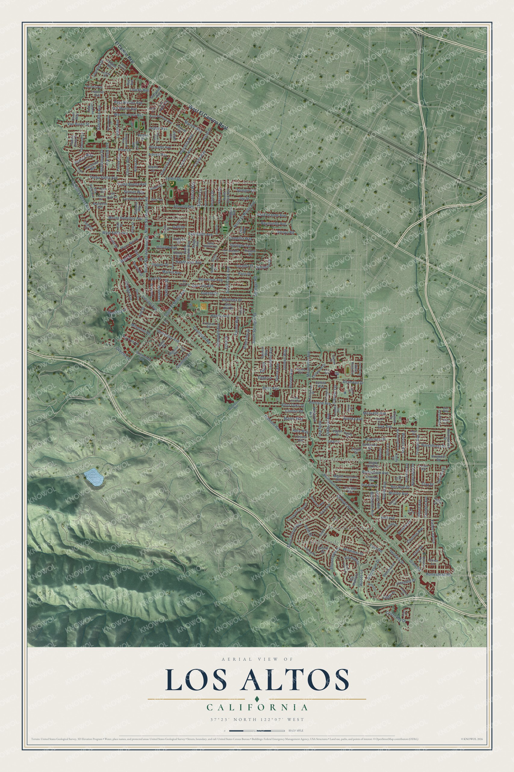
Los Altos, California Map Art
Building by building, with labeled streets and shaded relief.
12" x 18" Archival Matte Print
A Map of Home. A Work of Art.
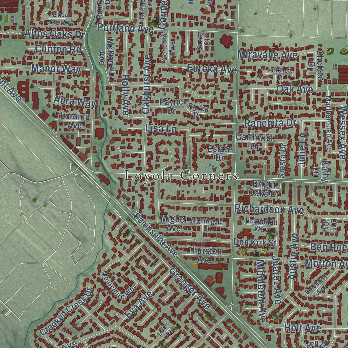
Explore Los Altos, California from a whole new perspective. Created using aerial imagery and detailed geographic data, this map captures Los Altos building by building, with labeled streets, familiar landmarks, and shaded topographical relief that highlights the natural contours of the landscape.
Combining modern data with the timeless character of a vintage atlas, this map is just as interesting up close as it is beautiful on the wall. Whether you grew up in Los Altos, spent memorable years there, or call it home today, this unique map is a great way to celebrate a place that means something to you. Zoom in on the preview to look for your street, and then order a print to put your memories on the wall.
Three ways to hang it
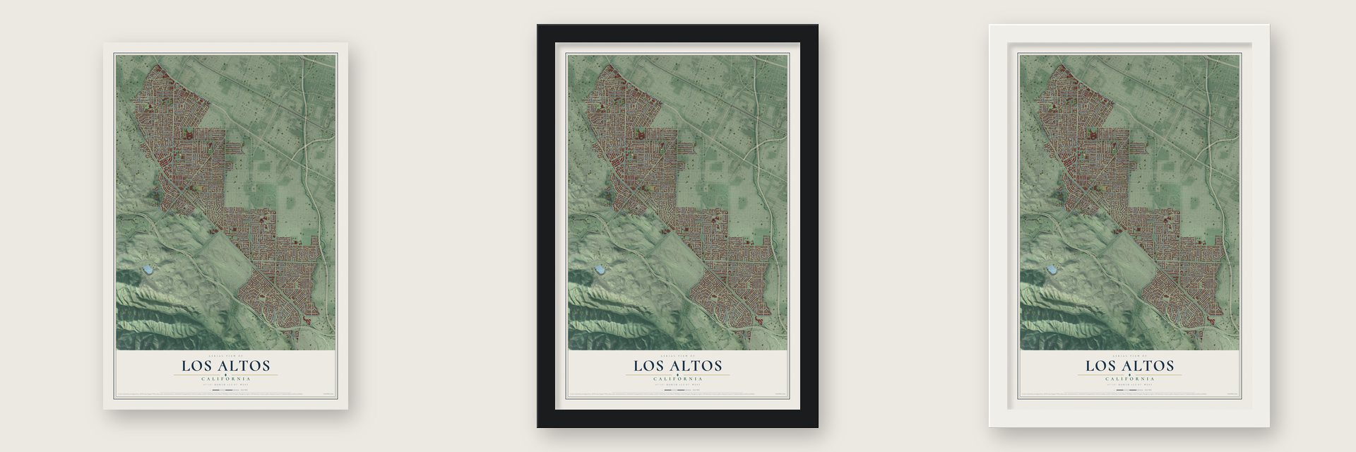
Unframed archival matte, a black wood frame or a white wood frame.
Up close
Geography Worth Displaying
This map was created using accurate cartographic data and authoritative geographic sources, including the U.S. Geological Survey and the Census Bureau. The map brings together terrain, waterways, roads, and building detail. The majority of the streets are labeled, houses are accurately depicted, and the topography is derived from government sources. Combining local data with carefully composed color and shading leads to this beautifully detailed Los Altos artwork for your wall.
Rather than simply showing street outlines, we’ve included as many of the street names as we could reasonably fit on the map while keeping their names legible. Zoom in on the high resolution preview to see exactly what’s on the map. We truly set out to create a statement piece for anyone who loves Los Altos. So whether it’s for you, or a gift for someone you love, we hope this map of Los Altos brings back fond memories.
Read the story behind this map of Los Altos, California from 2026.

Find your street
Names on the Los Altos map
Every name below is printed on this map. Look for your street, your school, the park where you played, or the pond down the road.
Places and landmarks5
- Los Altos City Hall
- Loyola Corners
- Saint Francis Acres
- The Highlands
- Woodland Acres
Streets and roads271
- West El Camino Real
- South El Monte Avenue
- North El Monte Avenue
- South Clark Avenue
- Main Street
- Covington Road
- Fremont Avenue
- West Edith Avenue
- North San Antonio Road
- Lincoln Avenue
- Rosita Avenue
- Lyell Street
- Los Altos Avenue
- West Portola Avenue
- Alvarado Avenue
- Altamead Drive
- Foothill Expressway
- Grant Road
- South Springer Road
- Fallen Leaf Lane
- University Avenue
- South San Antonio Road
- Deodara Drive
- Cuesta Drive
- Miramonte Avenue
- Springer Road
- Almond Avenue
- Saint Joseph Avenue
- Hawthorne Avenue
- Oak Avenue
Show all 271 streets
- Newcastle Drive
- Parma Way
- Benvenue Avenue
- Richardson Avenue
- Morton Avenue
- Campbell Avenue
- Pine Lane
- Berry Avenue
- Arboretum Drive
- First Street
- Farndon Avenue
- Granger Avenue
- Jardin Drive
- Arboleda Drive
- Holt Avenue
- Riverside Drive
- Casita Way
- Orange Avenue
- Yerba Buena Avenue
- Distel Drive
- Second Street
- Panchita Way
- Golden Way
- Portland Avenue
- Austin Avenue
- Oakhurst Avenue
- Valencia Drive
- Paco Drive
- Russell Avenue
- East Edith Avenue
- Cherry Avenue
- Sunkist Lane
- Woods Lane
- Alford Avenue
- Jordan Avenue
- Alicia Way
- Marich Way
- Ben Roe Drive
- Altos Oaks Drive
- Hillview Avenue
- Solana Drive
- Yerba Santa Avenue
- Loucks Avenue
- Kent Drive
- Truman Avenue
- Stonehaven Drive
- Holly Avenue
- Third Street
- Mount Hamilton Avenue
- Torwood Lane
- Echo Drive
- San Luis Avenue
- Sunshine Drive
- Cristo Rey Drive
- Arroyo Road
- Juarez Avenue
- Marvin Avenue
- Santa Rita Avenue
- Linden Avenue
- Pasa Robles Avenue
- Del Monte Avenue
- Ranchita Drive
- Van Buren Street
- Vineyard Drive
- Manor Way
- Wessex Avenue
- Lisa Lane
- Seena Avenue
- Alma Court
- Laureles Drive
- Vista Grande Avenue
- Crist Drive
- Okeefe Lane
- Via Huerta
- Homestead Road
- Jay Street
- Manresa Lane
- Raymundo Avenue
- Eureka Avenue
- Eva Avenue
- Miravalle Avenue
- Juanita Way
- Havenhurst Drive
- Plaza North
- Milverton Road
- Middleton Avenue
- Giralda Drive
- Churton Avenue
- Aura Way
- Verano Drive
- Springer Terrace
- Camellia Way
- Farm Road
- Pepper Drive
- Clay Drive
- Spargur Drive
- Windimer Drive
- Quinnhill Road
- Guadalupe Drive
- Gabilan Street
- Leonello Avenue
- Edge Lane
- Sylvian Way
- Lassen Street
- Julie Lane
- Cedar Place
- Clinton Road
- Filip Road
- Galli Drive
- Annette Lane
- Carmel Terrace
- Lee Street
- El Camino Real
- Summerhill Avenue
- Bay Tree Lane
- West Rose Circle
- Los Altos Square
- Los Ninos Way
- Brookmill Road
- South Gordon Way
- Colleen Drive
- McKenzie Avenue
- Payne Drive
- Beechwood Lane
- Patrick Way
- Nash Road
- Delphi Circle
- Arbuelo Way
- Coronado Avenue
- North Clark Avenue
- Hacienda Way
- Louise Lane
- Crooked Creek Drive
- Peninsular Avenue
- East Portola Avenue
- Tyndall Street
- Ravenswood Drive
- Parkhills Avenue
- Christina Drive
- Alta Vista Avenue
- Eastwood Drive
- El Sereno Avenue
- Thurston Avenue
- Higgins Avenue
- Oxford Drive
- Portola Court
- Dixon Way
- Sherwood Avenue
- Twelve Acres Drive
- Traverso Avenue
- Garthwick Drive
- Osage Avenue
- Laverne Way
- Miguel Avenue
- Harwalt Drive
- Suffolk Way
- Scott Lane
- Glen Alto Drive
- Garland Way
- Via Maderos
- Bright Oaks Court
- Don Kirk Street
- Sevilla Drive
- Chelsea Drive
- Belden Drive
- Mariposa Avenue
- Oak Street
- Langton Avenue
- View Street
- Cypress Drive
- Siesta Drive
- Loraine Avenue
- Live Oak Lane
- Spencer Way
- Valley Street
- Frances Drive
- Tomi Lea Street
- Stuart Court
- Dior Terrace
- Estate Drive
- Riviera Drive
- Kathy Lane
- Silvia Drive
- Lantis Lane
- Ray Avenue
- Otis Way
- Silvia Court
- Orr Court
- Magdalena Avenue
- Highlands Circle
- North Avalon Drive
- Montclaire Way
- Palm Avenue
- Madonna Way
- Doud Drive
- La Prenda Road
- Marlbarough Avenue
- Cielito Drive
- Vera Cruz Avenue
- Mundell Way
- Runnymead Drive
- Kingswood Way
- Westminster Lane
- Santa Barbara Drive
- Lunada Drive
- Friars Lane
- Concord Avenue
- Ensenada Way
- Stanley Avenue
- Lammy Place
- Stagi Lane
- Toyon Avenue
- Hayman Place
- Joel Way
- Stardust Lane
- De Anza Lane
- Patlen Drive
- Teresi Lane
- Selig Lane
- Carvo Court
- Awalt Court
- Eleanor Avenue
- Sierra Ventura Drive
- Redwood Drive
- Raquel Lane
- Chester Circle
- Dalehurst Avenue
- Candace Way
- Grant Park Lane
- Buckingham Drive
- Laver Court
- East Rose Circle
- Mimosa Court
- Nightingale Court
- Chamisal Avenue
- Linda Vista Way
- Pritchett Court
- Muir Way
- Santa Rita Court
- Clark Court
- Viola Place
Names are listed as they appear on the printed map. Zoom into the product photos to find them.
About Los Altos, California
Los Altos, whose name is Spanish for "The Heights," is a city of 31,625 people in Santa Clara County. The area was organized in 1853 as the Fremont Judicial Township, which people later called Banks and Braes. In 1906 the railroad man Paul Shoup and a group of friends started the Altos Land Company, and it bought 140 acres from Sarah Winchester. Shoup planned the new town as a commuter stop on the line between Palo Alto and Los Gatos.
Southern Pacific steam trains began running through on the new Mayfield Cutoff on April 19, 1908, five a day, and two freight cars served as the first depot. That same year Eschenbruecher's Hardware went up as the first commercial building downtown, and a craftsman-style station opened at 288 First Street in 1913. By 1949 residents disliked the county's zoning rules and feared that Palo Alto or Mountain View would annex them. They chose to incorporate, and on December 1, 1952, Los Altos was formed as the county's eleventh city.
- From rail line to expresswayTrains stopped running through Los Altos in January 1964, and the old track bed became Foothill Expressway. In 1970 the county tested different soundwall designs along the road. The wall it built lowered noise at nearby homes by seven to ten decibels, just as the study had predicted, and it may have been the first sound baffle designed by science.
- The Apple I, 1976Steve Jobs and Steve Wozniak, the founders of Apple, put together their first 50 Apple I computers in the garage of the Jobs family home in Los Altos in 1976.
- The founder's houseThe home of Paul Shoup, the Southern Pacific executive who started the Altos Land Company and set the town in motion, joined the National Register in 2011.
- Redwood Grove since 1974In 1974 the city bought Redwood Grove, a 5.9-acre preserve along Adobe Creek. The Halsey family had moved coast redwoods there from Summit Road in the Santa Cruz Mountains, where they took the place of native willows. Theodore and Emma Halsey built their Spanish Revival house on the grounds in the late 1920s, and the city made it a local landmark in 1981.
Keep exploring California
Los Altos is one of 1,990 California towns we've mapped. Every dot on the map is a print of its own.
The search covers every state, California first.
Near Los Altos
Order 2 or more town maps and save 10%. Shown in the size and finish you picked above, so they hang as a set.
- Loyola 12" x 18" / Archival Matte Print $39.99
- Los Altos Hills 12" x 18" / Archival Matte Print $39.99
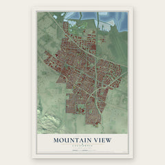
- Mountain View 12" x 18" / Archival Matte Print $39.99

More maps nearby: Palo Alto, Sunnyvale, Cupertino, College_Terrace and Stanford.
The art of mapping a place
How This Map Was Made
Real places. Remarkable detail. Discover the layers that turn geographic data into a map of home.

The view from above
Aerial imagery reveals the character of the land: woodland, open fields, and the patterns of a place.

The shape of the land
Elevation data brings hills, valleys, and subtle changes in the landscape into view.

The details of home
Roads, waterways, and building footprints come together to make the map feel unmistakably local.

Geography becomes art
Considered color, shading, and typography bring the layers together in a map made for your wall.


Process illustrated with Mendon, Massachusetts. Aerial imagery: USDA NAIP. Terrain: USGS 3D Elevation Program. Map details and finished artwork: KNOWOL.
The Details
About This Print
Choose an archival matte print, or a black or white Ayous wood frame. The archival matte print is unframed.
Select your size and finish above to see the matching product image and price.
Materials & Craftsmanship
A contemporary map with the character of a classic atlas, printed on archival matte paper. Optional frames are made from Ayous wood.
Your printed map does not include the watermark shown in the full-map preview.
Shipping & Delivery
Free shipping within the United States. Every print is made to order in the USA.
Buying a gift? Add a note in your cart and we'll include it. We never put prices in the package.
Prints ship within 2 to 3 business days. Allow 7 to 10 days total from ordering for delivery. Timing may vary during holidays or periods of high order volume.
Read our shipping policy.
Returns and damaged prints
Each print is made to order. Change-of-mind refunds are not available after production.
If your print arrives damaged, misprinted or incorrect, contact support@knowol.com within 30 days of receiving it. Include your order number, photos and a description of the issue.
Read our full refund and replacement policy. For questions about your order, email support@knowol.com.