


Search for another town


Free U.S. delivery 7 to 10 days after you order
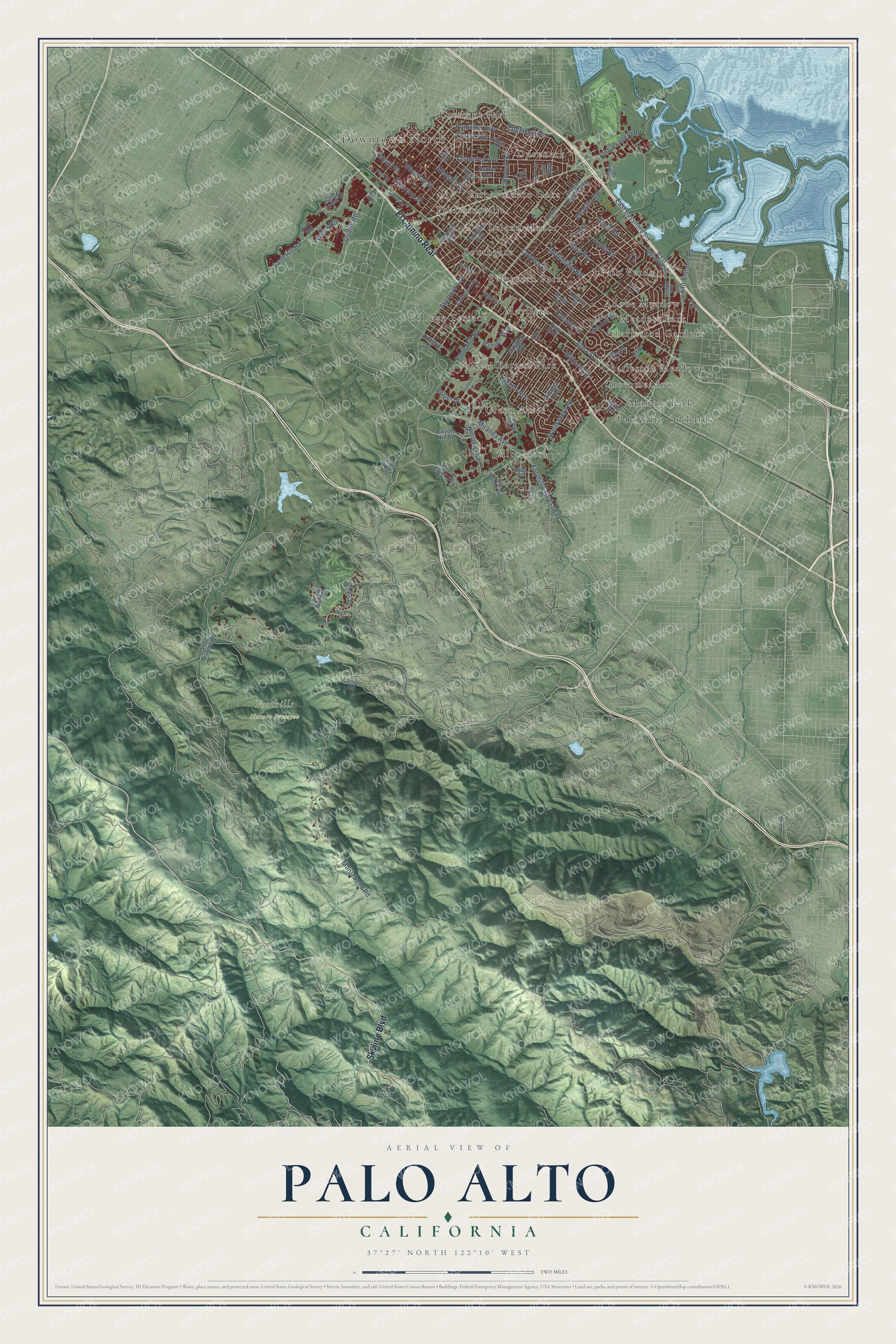
Palo Alto, California Map Art
Building by building, with labeled streets and shaded relief.
12" x 18" Archival Matte Print
A Map of Home. A Work of Art.
Explore Palo Alto, California from a whole new perspective. Created using aerial imagery and detailed geographic data, this map captures Palo Alto building by building, with labeled streets, familiar landmarks, and shaded topographical relief that highlights the natural contours of the landscape.
Combining modern data with the timeless character of a vintage atlas, this map is just as interesting up close as it is beautiful on the wall. Whether you grew up in Palo Alto, spent memorable years there, or call it home today, this unique map is a great way to celebrate a place that means something to you. Zoom in on the preview to look for your street, and then order a print to put your memories on the wall.
Three ways to hang it

Unframed archival matte, a black wood frame or a white wood frame.
Up close
Geography Worth Displaying
This map was created using accurate cartographic data and authoritative geographic sources, including the U.S. Geological Survey and the Census Bureau. The map brings together terrain, waterways, roads, and building detail. The majority of the streets are labeled, houses are accurately depicted, and the topography is derived from government sources. Combining local data with carefully composed color and shading leads to this beautifully detailed Palo Alto artwork for your wall.
Rather than simply showing street outlines, we’ve included as many of the street names as we could reasonably fit on the map while keeping their names legible. Zoom in on the high resolution preview to see exactly what’s on the map. We truly set out to create a statement piece for anyone who loves Palo Alto. So whether it’s for you, or a gift for someone you love, we hope this map of Palo Alto brings back fond memories.
Read the story behind this map of Palo Alto, California from 2026.

Find your street
Names on the Palo Alto map
Every name below is printed on this map. Look for your street, your school, the park where you played, or the pond down the road.
Places and landmarks24
- Downtown North
- Byxbee Park
- Foothills Nature Preserve
- Adobe Meadow
- Alta Mesa
- Barron Park
- Charleston Gardens
- Charleston Meadows
- College Terrace
- Crescent Park
- Duveneck
- Embarcadero Oaks
Show all 24 places
- Evergreen Park
- Green Acres
- Greenmeadow
- Leland Manor
- Mayfield
- Meadow Park
- Monroe Park
- Neal
- Palo Alto Orchards
- Palo Verde
- Professorville
- Southgate
Streets and roads86
- El Camino Real
- Skyline Boulevard
- Alma Street
- Embarcadero Road
- San Antonio Road
- Middlefield Road
- Greer Road
- Edgewood Drive
- Page Mill Road
- Foothill Expressway
- Waverley Street
- Arastradero Road
- Bryant Street
- Cowper Street
- Montebello Road
- Emerson Street
- East Bayshore Road
- Louis Road
- Ramona Street
- Hamilton Avenue
- Webster Street
- Channing Avenue
- Miranda Avenue
- Ross Road
- Sand Hill Road
- Forest Avenue
- Newell Road
- Hillview Avenue
- Stanford Avenue
- Quarry Road
Show all 86 streets
- Ash Street
- Wilkie Way
- Hansen Way
- Welch Road
- Amarillo Avenue
- Laguna Avenue
- Porter Drive
- Ely Place
- Park Boulevard
- Amherst Street
- Oregon Expressway
- West Bayshore Road
- South Court
- East Meadow Drive
- Oak Creek Drive
- Alexis Drive
- Kipling Street
- College Avenue
- Matadero Avenue
- Fulton Street
- Loop Road
- Los Trancos Road
- Churchill Avenue
- Georgia Avenue
- Tennyson Avenue
- Laurel Glen Drive
- Old Adobe Road
- Faber Place
- Coyote Hill Road
- Deer Creek Road
- Harker Avenue
- Iris Way
- Jarvis Way
- Lois Lane
- Canyon Road
- Miller Avenue
- Hanover Street
- High Street
- Homer Avenue
- Clark Way
- Birch Street
- Fabian Way
- Pitman Avenue
- Urban Lane
- Mesa Avenue
- Palo Road
- Oregon Avenue
- Manuela Avenue
- Transport Street
- Nelson Drive
- Heather Lane
- Wilton Avenue
- Sycamore Drive
- Arbutus Avenue
- Janice Way
- Bandera Drive
Names are listed as they appear on the printed map. Zoom into the product photos to find them.
About Palo Alto, California
Palo Alto is a city of 68,572 people in Santa Clara County, and its name is Spanish for "tall stick." The name comes from El Palo Alto, a coastal redwood in the San Francisquito Creek watershed where Gaspar de Portolá's expedition camped from November 6 to 11, 1769. The Puichon Ohlone lived on this land long before the Spanish came.
Leland and Jane Stanford's only child, Leland Stanford Jr., died of typhoid fever in 1884 at age 15, and the couple chose to found a university in his memory. In 1886 they offered to make nearby Mayfield its gateway if the town would ban alcohol, but Mayfield, with its 13 saloons, refused. Timothy Hopkins, a friend of theirs at the Southern Pacific Railroad, then bought 740 acres in 1887 for a new town where alcohol was forbidden. It was first called University Park, and it was incorporated as Palo Alto on April 16, 1894.
“We have watched Mayfield grow from a small hamlet, when Palo Alto was nothing more than a hayfield, to her present size”
- Mayfield joins Palo AltoMayfield grew up in 1855 around "Uncle Jim's Cabin," a stagecoach stop and saloon near El Camino Real and today's California Avenue. The railroad from San Francisco reached it in October 1863, and by 1869 it had a newspaper printed in English and Spanish. Palo Alto voters approved taking it in on July 2, 1925, and the two towns merged on July 6. That's why the city has two downtowns, on University Avenue and California Avenue.
- The first tube amplifierLee de Forest, who invented the three-element radio vacuum tube, worked at the Federal Telegraph laboratory at 218 Channing. There, starting in 1911, he built the first amplifier and oscillator made with vacuum tubes. The lab site is now a California Historical Landmark.
- The garage at 367 AddisonHewlett-Packard got its start in a garage behind a house at 367 Addison Avenue. The company later restored both the house and the garage, which are closed to the public and are listed on the National Register as the Hewlett-Packard House and Garage. HP still keeps its headquarters in Palo Alto.
- ProfessorvilleMany of Stanford University's first teachers built homes in the neighborhood that came to be called Professorville, between Kingsley, Lincoln and Addison Avenues and Ramona, Bryant and Waverley. Many of its houses from the 1890s still stand. Russell Varian, co-inventor of the klystron tube, lived at 1044 Bryant.
- A cannery of 1,000 workersThomas Foon Chew, whose father had founded the Bayside Canning Company in Alviso, opened a cannery in Mayfield, then still a separate town, in 1918 with 350 workers. In the 1920s Bayside became one of the largest canning companies in the world. By the time the plant closed in 1949, under Safeway's Sutter Packing Company, it was Palo Alto's largest employer, with about 1,000 workers. Fry's Electronics was among the businesses that later used the building.
Keep exploring California
Palo Alto is one of 1,990 California towns we've mapped. Every dot on the map is a print of its own.
The search covers every state, California first.
Near Palo Alto
Order 2 or more town maps and save 10%. Shown in the size and finish you picked above, so they hang as a set.
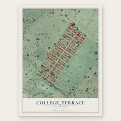
- College_Terrace 12" x 18" / Archival Matte Print $39.99
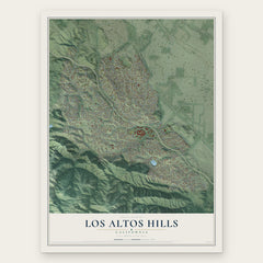
- Los Altos Hills 12" x 18" / Archival Matte Print $39.99
- Stanford 12" x 18" / Archival Matte Print $39.99

More maps nearby: Ladera, Los Altos, Mountain View, Loyola and West Menlo Park.
The art of mapping a place
How This Map Was Made
Real places. Remarkable detail. Discover the layers that turn geographic data into a map of home.

The view from above
Aerial imagery reveals the character of the land: woodland, open fields, and the patterns of a place.

The shape of the land
Elevation data brings hills, valleys, and subtle changes in the landscape into view.

The details of home
Roads, waterways, and building footprints come together to make the map feel unmistakably local.

Geography becomes art
Considered color, shading, and typography bring the layers together in a map made for your wall.


Process illustrated with Mendon, Massachusetts. Aerial imagery: USDA NAIP. Terrain: USGS 3D Elevation Program. Map details and finished artwork: KNOWOL.
The Details
About This Print
Choose an archival matte print, or a black or white Ayous wood frame. The archival matte print is unframed.
Select your size and finish above to see the matching product image and price.
Materials & Craftsmanship
A contemporary map with the character of a classic atlas, printed on archival matte paper. Optional frames are made from Ayous wood.
Your printed map does not include the watermark shown in the full-map preview.
Shipping & Delivery
Free shipping within the United States. Every print is made to order in the USA.
Buying a gift? Add a note in your cart and we'll include it. We never put prices in the package.
Prints ship within 2 to 3 business days. Allow 7 to 10 days total from ordering for delivery. Timing may vary during holidays or periods of high order volume.
Read our shipping policy.
Returns and damaged prints
Each print is made to order. Change-of-mind refunds are not available after production.
If your print arrives damaged, misprinted or incorrect, contact support@knowol.com within 30 days of receiving it. Include your order number, photos and a description of the issue.
Read our full refund and replacement policy. For questions about your order, email support@knowol.com.