
Search for another town





Free U.S. delivery 7 to 10 days after you order
Mount Dora, Florida Map Art
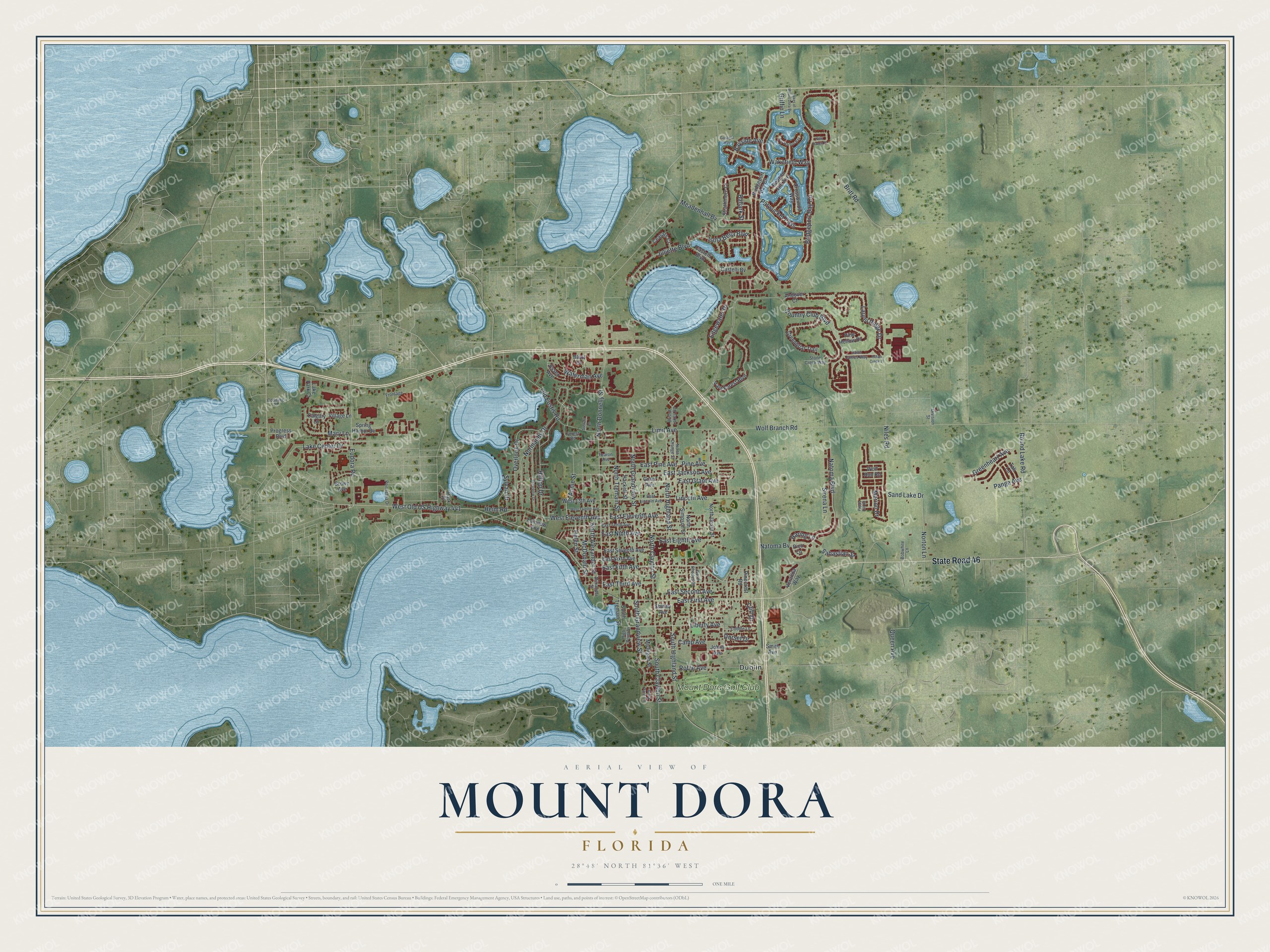
A new map of Mount Dora, Florida, made in 2026 and printed to order on thick archival matte paper.
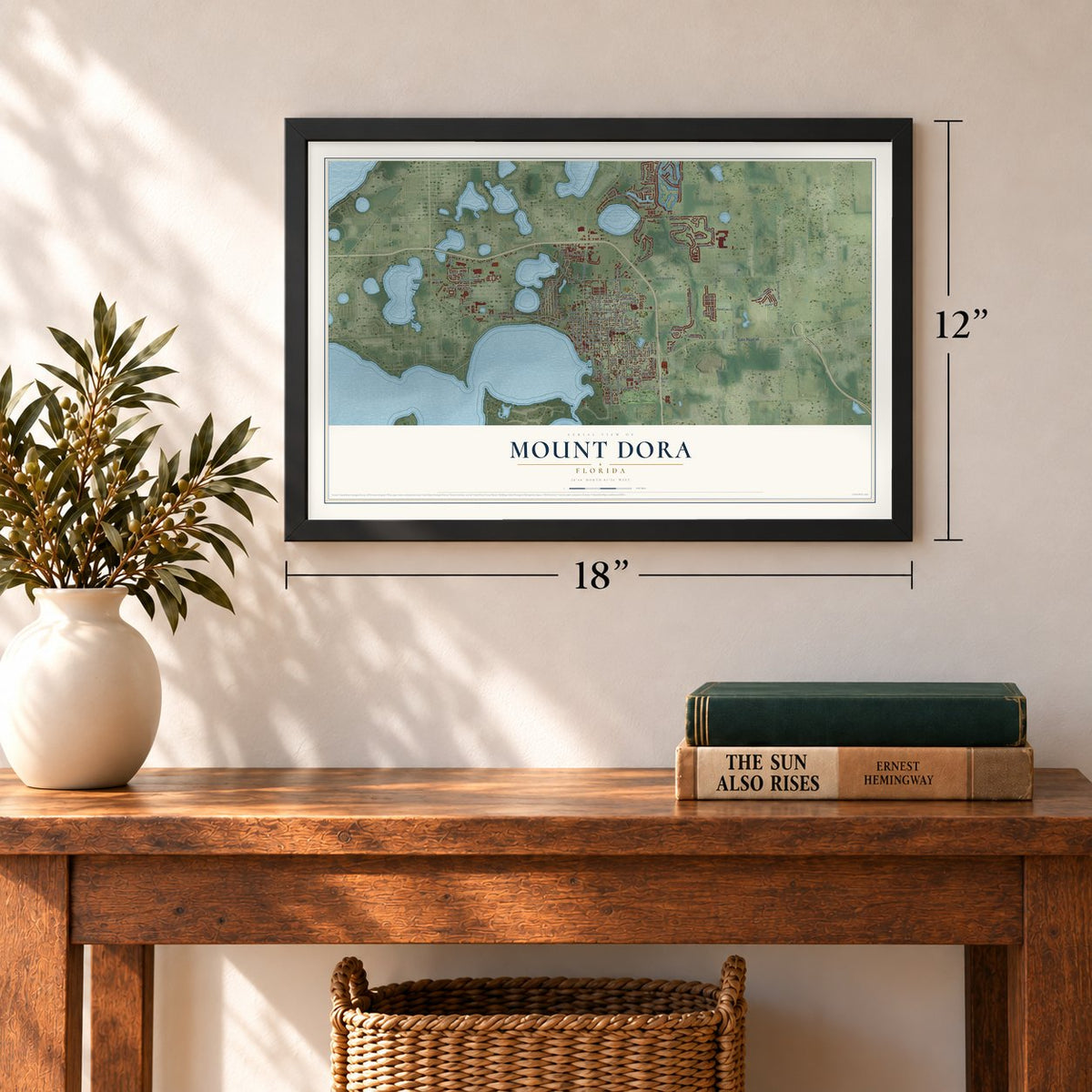
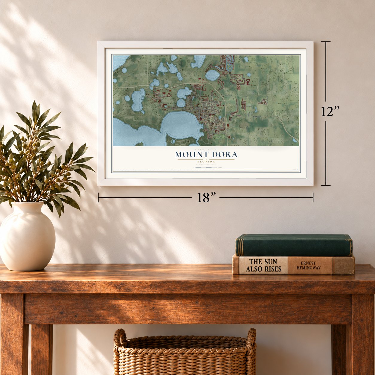
12" x 18" Archival Matte Print
A Map of Home. A Work of Art.
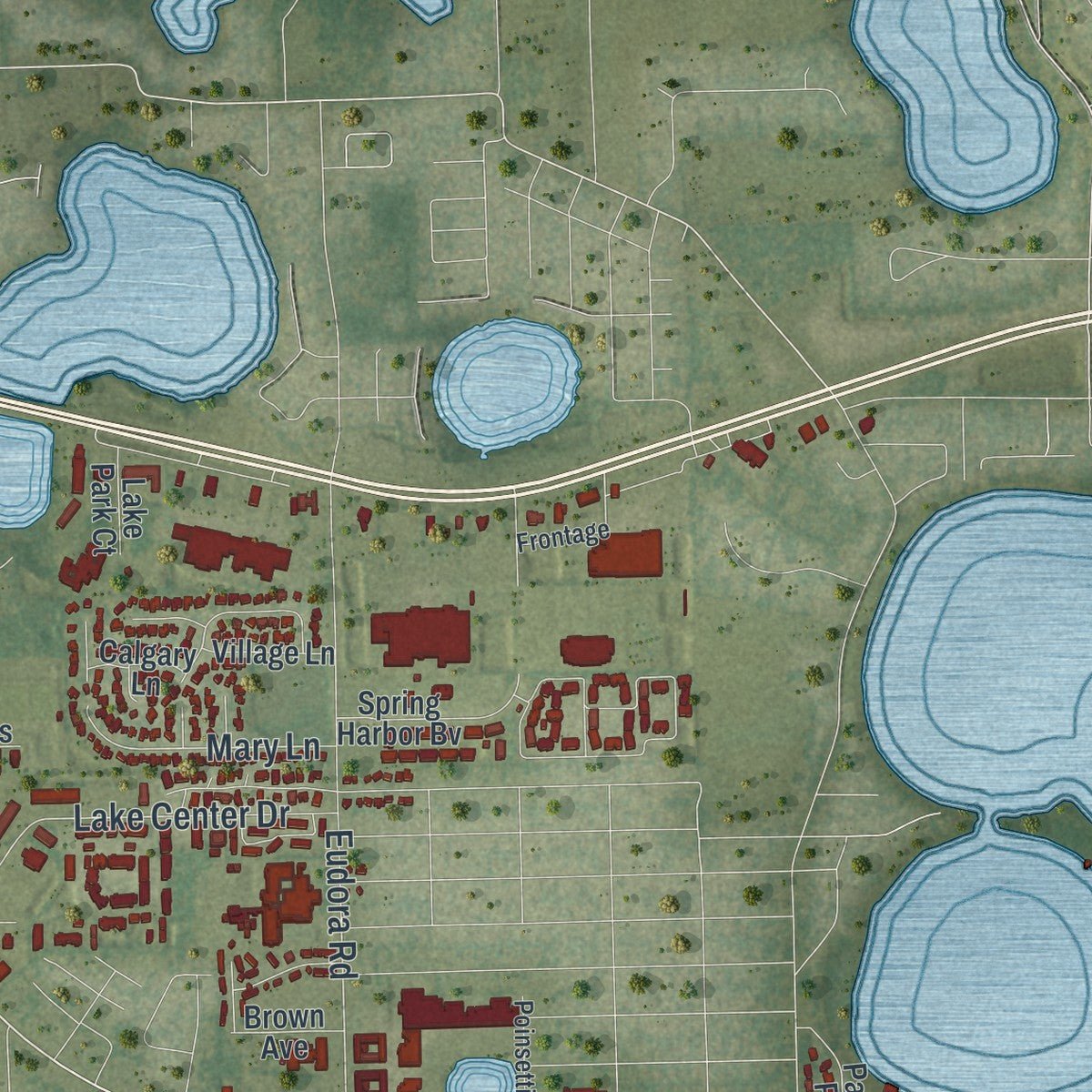
Explore Mount Dora, Florida from a whole new perspective. Created using aerial imagery and detailed geographic data, this map captures Mount Dora building by building, with labeled streets, familiar landmarks, and shaded topographical relief that highlights the natural contours of the landscape.
Combining modern data with the timeless character of a vintage atlas, this map is just as interesting up close as it is beautiful on the wall. Whether you grew up in Mount Dora, spent memorable years there, or call it home today, this unique map is a great way to celebrate a place that means something to you. Zoom in on the preview to look for your street, and then order a print to put your memories on the wall.
Three ways to hang it
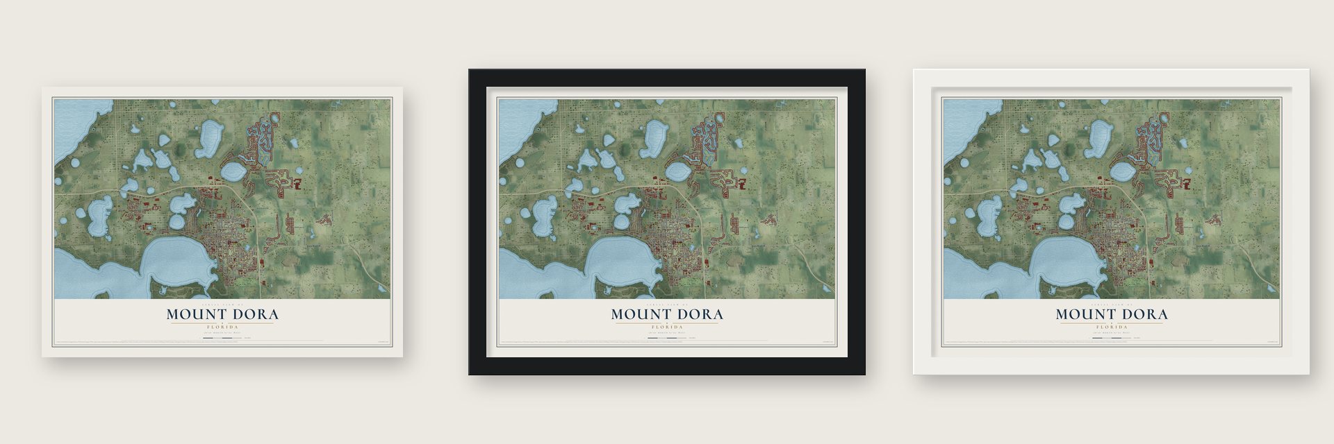
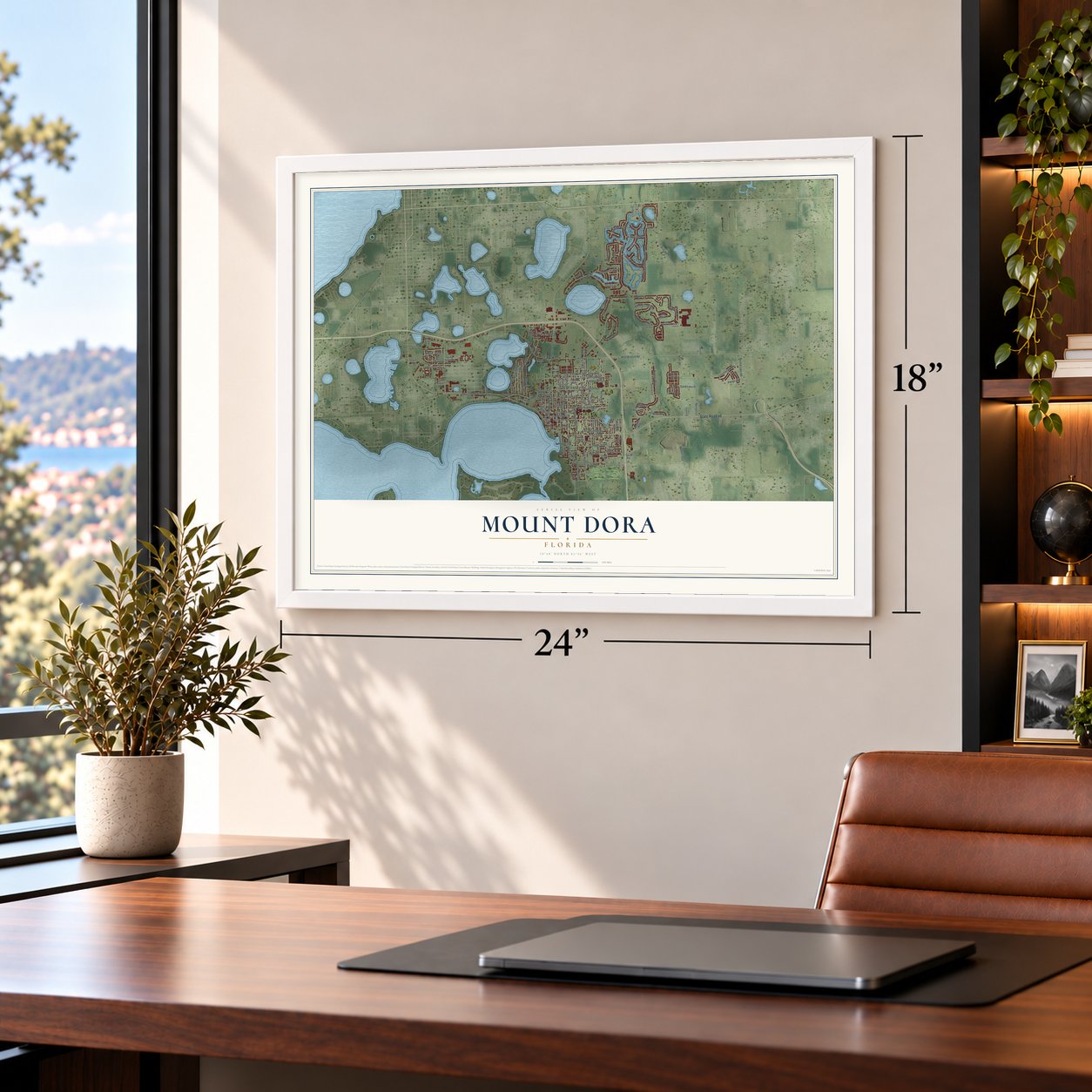
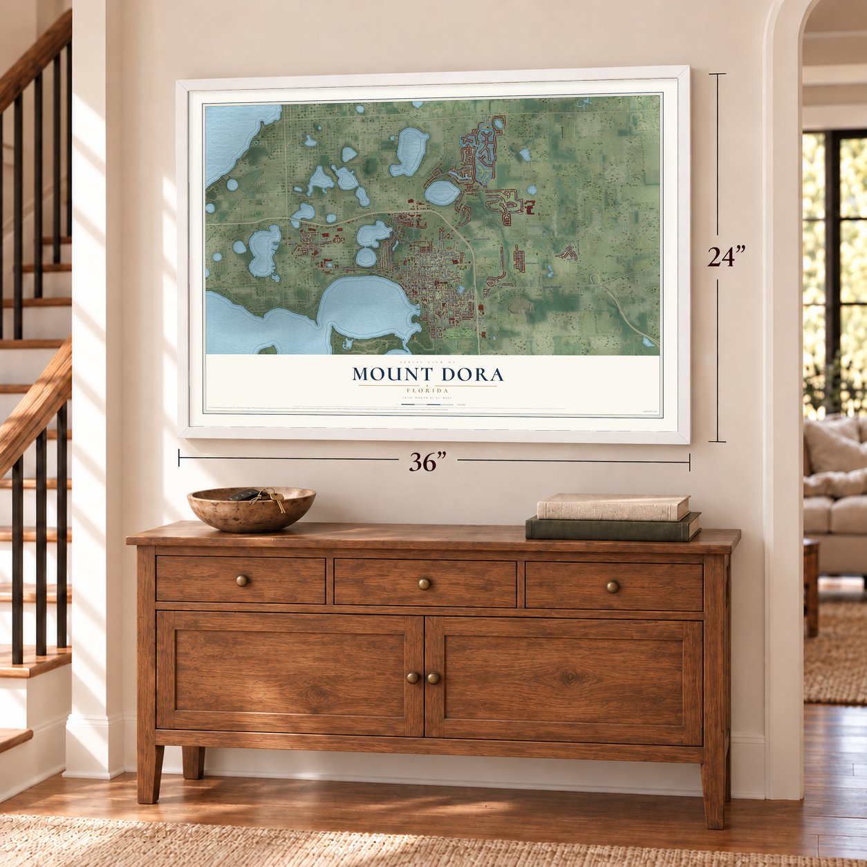
Unframed archival matte, a black wood frame or a white wood frame.
Up close
Geography Worth Displaying
This map was created using accurate cartographic data and authoritative geographic sources, including the U.S. Geological Survey (USGS) and FEMA. The map brings together terrain, waterways, roads, and building detail. The majority of the streets are labeled, houses are accurately depicted, and the topography is derived from government sources. Combining local data with carefully composed color and shading leads to this beautifully detailed Mount Dora artwork for your wall.
Rather than simply showing street outlines, we’ve included as many of the street names as we could reasonably fit on the map while keeping their names legible. Zoom in on the high resolution preview to see exactly what’s on the map. We truly set out to create a statement piece for anyone who loves Mount Dora. So whether it’s for you, or a gift for someone you love, we hope this map of Mount Dora brings back fond memories.
Explore the full map of Mount Dora, Florida and read about the local places it shows.

About Mount Dora, Florida
Mount Dora is a city of 16,341 people in Lake County, on high ground 184 feet above sea level beside Lakes Dora, Gertrude and Beauclair. In 1874 David Simpson, his wife and their two children made their home here. Ross C. Tremain took charge as the village's first postmaster in 1880 and called it Royellou, a name he built from those of his children, Roy, Ella and Louis.
That name did not stick. Surveyors had named the lake in 1846 for Dora Ann Drawdy, an early settler, so in 1883 the town took the lake's name and added "Mount" for its plateau. After a railroad reached town in 1887, new businesses followed: a packing house for oranges, a cannery and fertilizer factories. When Mount Dora received its charter in 1910 it had 371 residents, and its first mayor was John Philip Donnelly.
- A hotel open since 1883Hunters, fishermen and boaters came to Mount Dora for the winter, and in 1883 the Alexander House opened to serve them as a two-story hotel with ten rooms. It changed names several times and is now the Lakeside Inn on North Alexander Street. The inn calls itself the oldest hotel in Florida that has never stopped operating, and it joined the National Register in 1975.
- The 1915 depotThe Atlantic Coast Line built a new depot on North Alexander Street in 1915. Trains there carried citrus out and brought tourists in until passenger service stopped in 1949. In 1981 the Mount Dora Chamber of Commerce moved into the station, which is now on the National Register.
- A town built by its peopleMount Dora grew fast in the 1920s. The city put in streetlights, a water system, curbs and paved streets, and it opened its first two public parks. Residents raised most of the money for the Mount Dora Community Building, which has hosted the city's shows and meetings ever since. The first fire station and city jail, opened in 1923, now hold the Mount Dora History Museum.
- A lighthouse on Lake DoraA 35-foot lighthouse of stucco-covered brick was dedicated at Grantham Point Park on March 25, 1988. After dark its blue light guides boats on Lake Dora. Known as the Mount Dora Light, it is the one lighthouse in Florida that stands on fresh water away from the coast, and locals often call the spot "Lighthouse Park."
- Fort Repose and a pink downtownPat Frank based Fort Repose, the town in his 1959 novel Alas, Babylon, on Mount Dora. Later, filmmakers painted the downtown buildings pink for the movie Honky Tonk Freeway. The shoot brought money to local merchants, helped restore downtown and put Mount Dora in the national news.
Find your street
Names on the Mount Dora map
Every name below is printed on this map. Look for your street, your school, the park where you played, or the pond down the road.
Places and landmarks2
- Dublin
- Mount Dora Golf Club
Streets and roads135
- State Road 46
- West Old US Highway 441
- North Highland Street
- East Fifth Avenue
- Liberty Avenue
- South Highland Street
- South Clayton Street
- West Eleventh Avenue
- Bridgeport Bay Circle
- Country Club Boulevard
- Britt Road
- Wolf Branch Road
- North Donnelly Street
- Pine Avenue
- North Grandview Street
- Lincoln Avenue
- North Clayton Street
- Round Lake Road
- Robie Avenue
- East Eleventh Avenue
- Overlook Drive
- North Tremain Street
- Limit Avenue
- McDonald Street
- East Ninth Avenue
- Eudora Road
- East Pine Avenue
- East Jackson Avenue
- East First Avenue
- Laurel Ridge Drive
Show all 135 streets
- East Grant Avenue
- North Alexander Street
- East Eighth Avenue
- East Third Avenue
- Old Eustis Road
- Niles Road
- Normandy Drive
- Natoma Bv
- Lake Center Drive
- Sirena Lane
- Hilltop Drive
- Queen Avenue
- Juliette Boulevard
- Greenheart Avenue
- Natoma Boulevard
- Edgewater Drive
- Merion Drive
- Isola Bella Boulevard
- Sand Lake Drive
- Patwucket Pass
- South Grandview Street
- East Second Avenue
- Sabastian Street
- Camp Avenue
- Mary Lane
- Meadenhall Bv
- Waterman Avenue
- Griffin Lane
- Annie Street
- Wakefield Way
- Ballark Street
- Bayside Avenue
- Helen Street
- Heim Road
- Panga Avenue
- Sylvan Drive
- Norton Lane
- Dorset Drive
- Haring Lane
- Cliff Drive
- South Tremain Street
- Bridgeport Bay Cr
- North Simpson Street
- Strathmore Cr
- Grant Avenue
- Greenbriar Trail
- Park Forest Boulevard
- Pine Hollow Drive
- North Unser Street
- Veranda Way
- East Seventh Avenue
- Johns Avenue
- Spring Harbor Bv
- Castelli Bv
- Beacon Hill Avenue
- Castelli Boulevard
- Crosswinds Way
- West 13th Avenue
- East Sixth Avenue
- Ceasars Court
- Tali Lane
- Pinecrest Road
- Essex Avenue
- Michigan Street
- Park Place
- Wolf Run Road
- Progress Boulevard
- Blivit Court
- Hackett Street
- Calgary Lane
- Village Lane
- Fairview Avenue
- Lake Park Court
- Andover Court
- Brown Avenue
- Shirley Avenue
- Pico Lane
- Smith Avenue
- High Point Drive
- Alexander Street
- North Orange Street
- Bristol Lakes Road
- North Rhodes Street
- East Lincoln Avenue
- East Tenth Avenue
- Frontage
- Dora Parc Lane
- Saint James Way
- Fearon Avenue
- Division Street
- Cobble Lane
- Poinsettia Drive
- Stone Creek Way
- Bobwhite Lane
- Codding Place
- Forest Road
- Crestview Drive
- Gaslight Way
- New Haven Place
- West Twelfth Avenue
- Lakes of Mount Dora Bv
- Bar Harbor Bay
- Indian Creek Tl
- Poppy Hill Road
- Stewart Lane
Names are listed as they appear on the printed map. Zoom into the product photos to find them.
The art of mapping a place
How This Map Was Made
Real places. Remarkable detail. Discover the layers that turn geographic data into a map of home.

The view from above
Aerial imagery reveals the character of the land: woodland, open fields, and the patterns of a place.

The shape of the land
Elevation data brings hills, valleys, and subtle changes in the landscape into view.

The details of home
Roads, waterways, and building footprints come together to make the map feel unmistakably local.

Geography becomes art
Considered color, shading, and typography bring the layers together in a map made for your wall.


Process illustrated with Mendon, Massachusetts. Aerial imagery: USDA NAIP. Terrain: USGS 3D Elevation Program. Map details and finished artwork: KNOWOL.
The Details
About This Print
Choose an archival matte print, or a black or white Ayous wood frame. The archival matte print is unframed.
Select your size and finish above to see the matching product image and price.
Materials & Craftsmanship
A contemporary map with the character of a classic atlas, printed on archival matte paper. Optional frames are made from Ayous wood.
Your printed map does not include the watermark shown in the full-map preview.
Shipping & Delivery
Free shipping within the United States. Every print is made to order in the USA.
Buying a gift? Add a note in your cart and we'll include it. We never put prices in the package.
Prints ship within 2 to 3 business days. Allow 7 to 10 days total from ordering for delivery. Timing may vary during holidays or periods of high order volume.
Read our shipping policy.
Returns and damaged prints
Each print is made to order. Change-of-mind refunds are not available after production.
If your print arrives damaged, misprinted or incorrect, contact support@knowol.com within 30 days of receiving it. Include your order number, photos and a description of the issue.
Read our full refund and replacement policy. For questions about your order, email support@knowol.com.
Find your town
Looking for another city?
Find a map of home in our Florida collection, or any town in the country.
Nearby
Maps of towns near Mount Dora
Know someone from one of these towns? Their map makes a great gift.
 Tangerine
, Florida
From $39.99See the map
 Eustis
, Florida
From $39.99See the map
 Sorrento
, Florida
From $39.99See the map
More maps nearby: Mount Plymouth, Seminole Springs, Zellwood, Umatilla and Tavares.