
Search for another town





Free U.S. delivery 7 to 10 days after you order
Murfreesboro, Tennessee Map Art
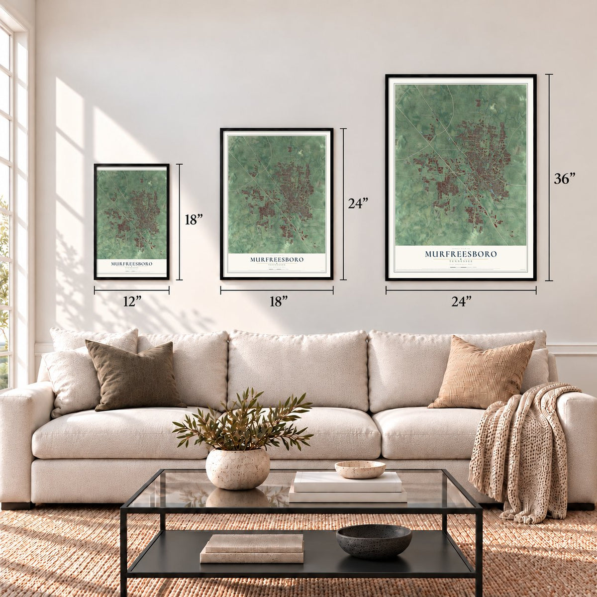
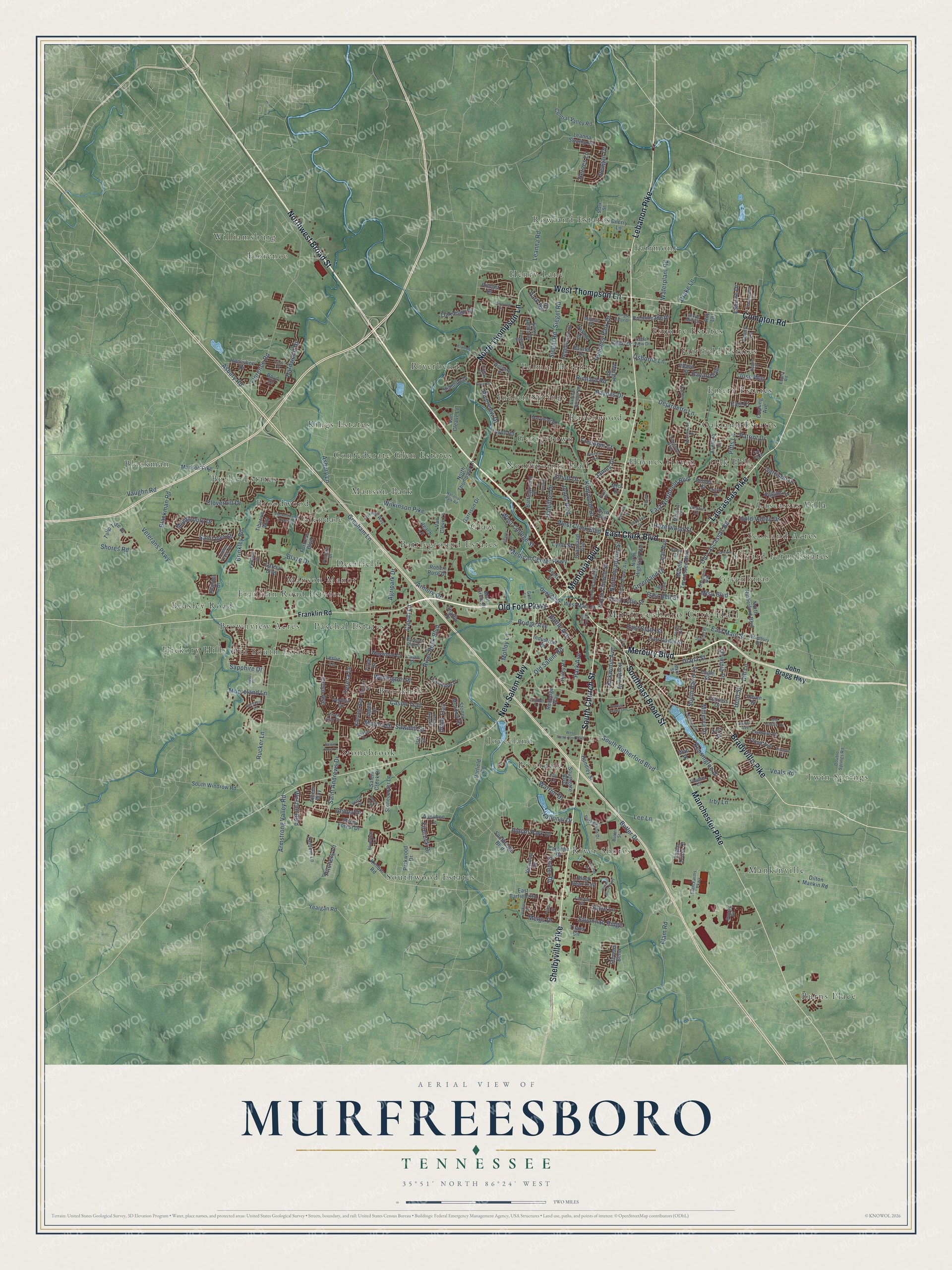
A new map of Murfreesboro, Tennessee, made in 2026 and printed to order on thick archival matte paper.
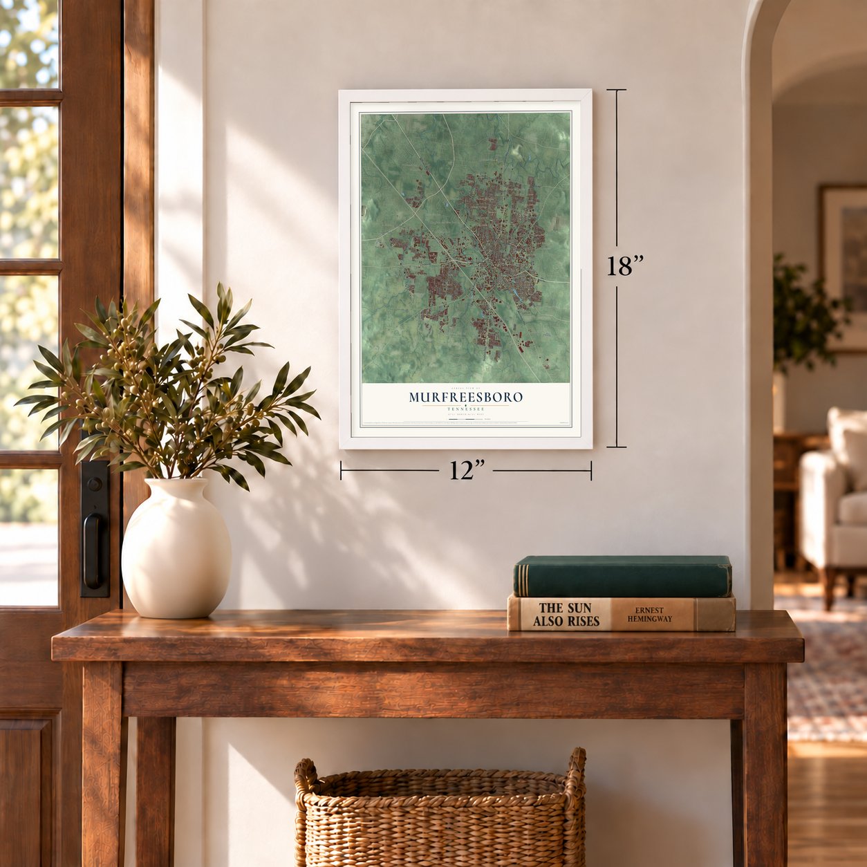
12" x 18" Archival Matte Print
A Map of Home. A Work of Art.
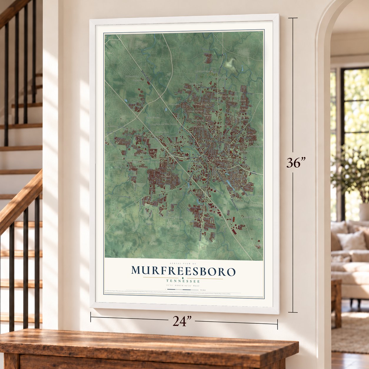
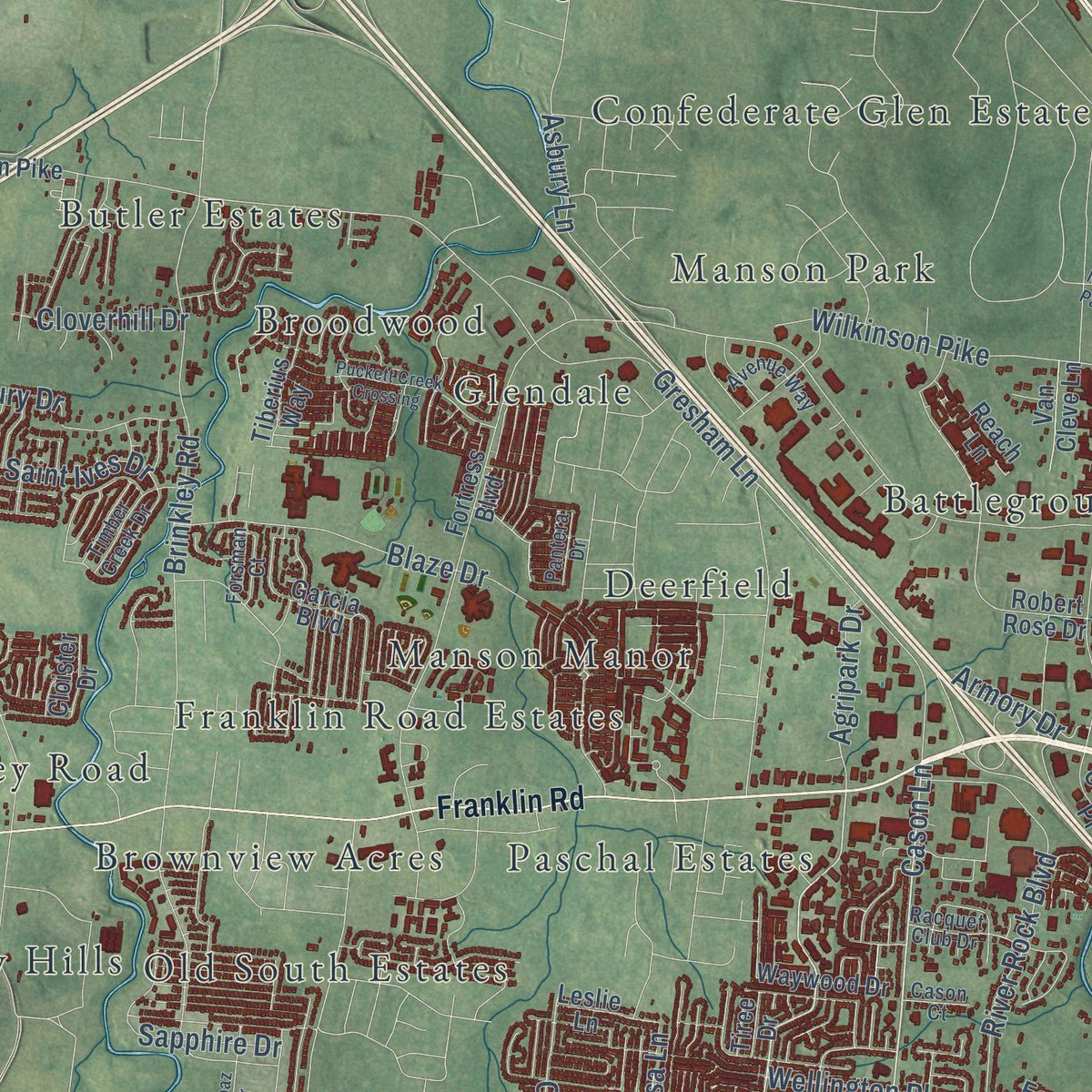
Explore Murfreesboro, Tennessee from a whole new perspective. Created using aerial imagery and detailed geographic data, this map captures Murfreesboro building by building, with labeled streets, familiar landmarks, and shaded topographical relief that highlights the natural contours of the landscape.
Combining modern data with the timeless character of a vintage atlas, this map is just as interesting up close as it is beautiful on the wall. Whether you grew up in Murfreesboro, spent memorable years there, or call it home today, this unique map is a great way to celebrate a place that means something to you. Zoom in on the preview to look for your street, and then order a print to put your memories on the wall.
Three ways to hang it
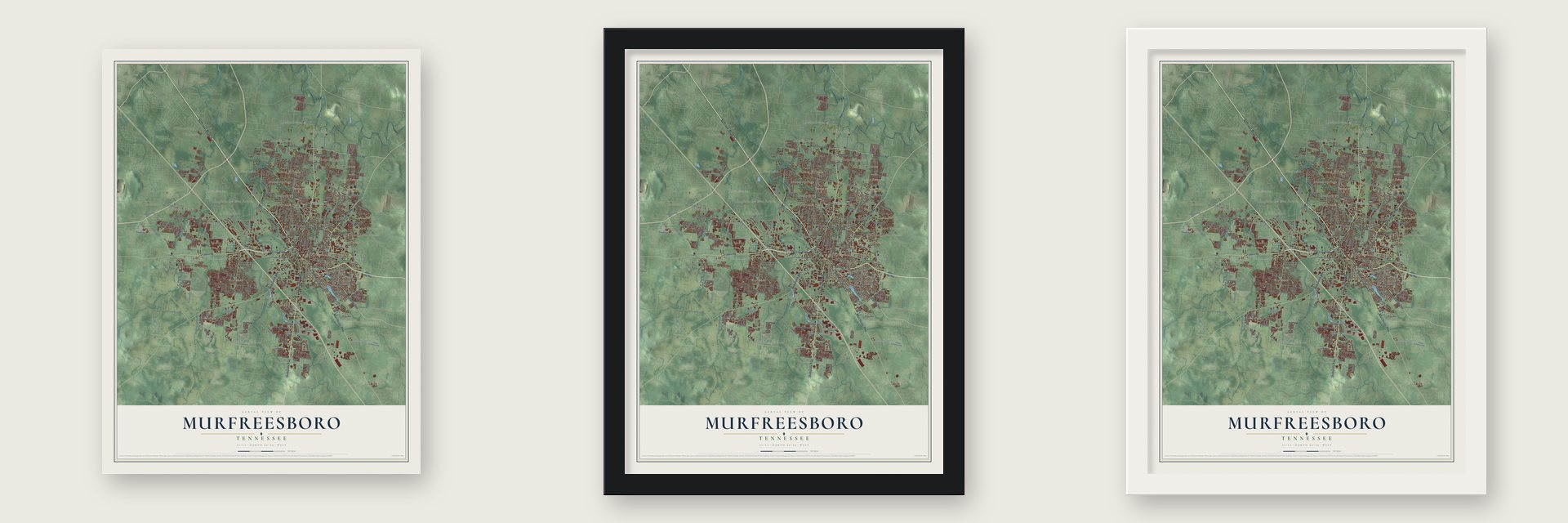
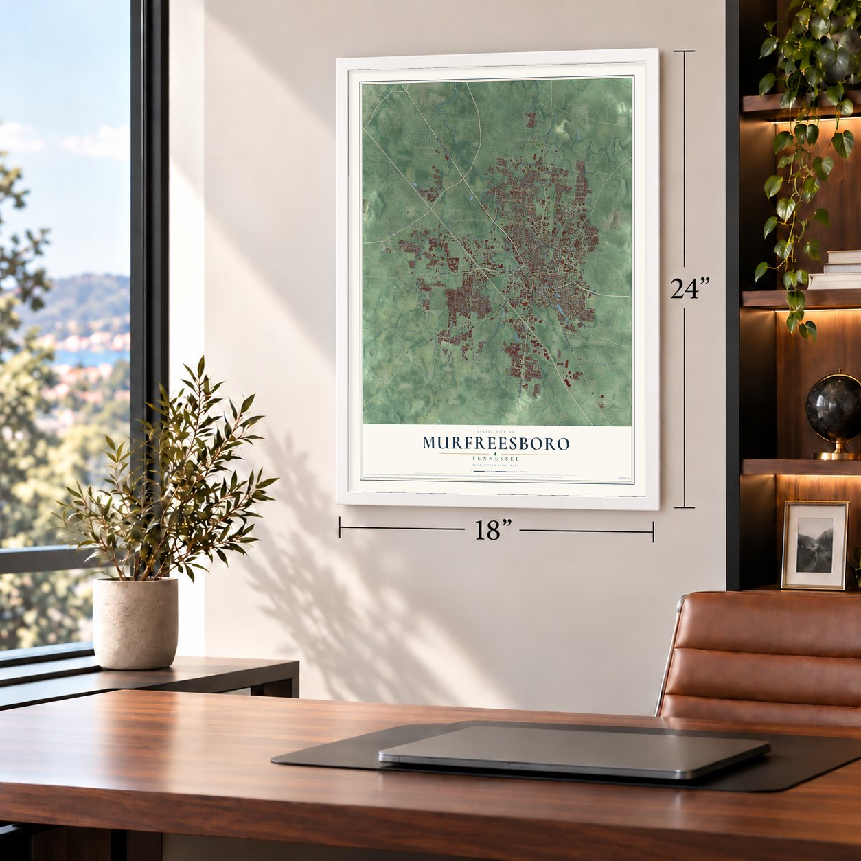
Unframed archival matte, a black wood frame or a white wood frame.
Up close
Geography Worth Displaying
This map was created using accurate cartographic data and authoritative geographic sources, including the U.S. Geological Survey and the Census Bureau. The map brings together terrain, waterways, roads, and building detail. The majority of the streets are labeled, houses are accurately depicted, and the topography is derived from government sources. Combining local data with carefully composed color and shading leads to this beautifully detailed Murfreesboro artwork for your wall.
Rather than simply showing street outlines, we’ve included as many of the street names as we could reasonably fit on the map while keeping their names legible. Zoom in on the high resolution preview to see exactly what’s on the map. We truly set out to create a statement piece for anyone who loves Murfreesboro. So whether it’s for you, or a gift for someone you love, we hope this map of Murfreesboro brings back fond memories.
Read the story behind this map of Murfreesboro, Tennessee from 2026.

About Murfreesboro, Tennessee
Murfreesboro is a city of 152,769 people and the seat of Rutherford County, 34 miles southeast of downtown Nashville. On October 27, 1811, state lawmakers picked this spot for a new county seat. They called it Cannonsburgh, for Newton Cannon, who stood for the area in the assembly. On November 29, 1811, William Lytle had it renamed for Colonel Hardy Murfree, a hero of the Revolution. The town got its charter in January 1812, and the name was cut to Murfreesboro.
As settlers moved west, Knoxville was too far away for most people to reach their capital. So in 1818 Murfreesboro became the capital of Tennessee, and its population boomed. Nashville took the job in 1826. The town began as a farm town, but by 1853 it had several colleges and academies.
- The Battle of Stones RiverFrom December 31, 1862, to January 2, 1863, Union troops of the Army of the Cumberland fought Confederates of the Army of Tennessee near the town. The two sides lost 23,515 men killed, hurt or missing. By share of losses, no battle of the war was bloodier. Neither side won outright. But General Braxton Bragg then led his Confederates 36 miles south to Tullahoma, so most count it a Union win.
- Fortress RosecransAfter the battle, General William Rosecrans made Murfreesboro his supply base. Brigadier General James St. Clair Morton built Fortress Rosecrans about 2 miles northwest of town. Its eight lunettes and four redoubts covered about 225 acres, the war's largest earthworks, and its 2,000 men ran sawmills, warehouses and ammunition magazines. Finished in June 1863, it was never attacked, partly because Union cannon were aimed at the courthouse. Much of it survives at Stones River National Battlefield.
- A teachers school in 1911In 1911 the state legislature founded Middle Tennessee State Normal School, a two-year school for training teachers. Before long it joined with the Tennessee College for Women. It became a four-year college in 1925. In 1965 it added graduate programs and took the name Middle Tennessee State University. Today no school in the state has more undergraduates.
- Bradley AcademyBradley Academy was the first school in Rutherford County. Later it became Murfreesboro's only school for African American students, and it stayed open until 1955. The building joined the National Register in 1990 and is now a museum.
- Uncle Dave Macon DaysEvery July for more than 30 years, the city has honored the music of Uncle Dave Macon. The festival holds national contests in old-time music and dancing.
Find your street
Names on the Murfreesboro map
Every name below is printed on this map. Look for your street, your school, the park where you played, or the pond down the road.
Places and landmarks48
- Murfreesboro City Hall
- Battleground Estates
- Beasley Road
- Blackman
- Broodwood
- Brookhill
- Brownview Acres
- Burns Place
- Butler Estates
- Confederate Glen Estates
- Deerfield
- Emery Estates
Show all 48 places
- Esquire Estates
- Fairfield Estates
- Fairmont
- Florence
- Franklin Road Estates
- Georgetown
- Glaze
- Glendale
- Greenbriar
- Haynes Haven
- Henry Lane
- Hickory Hills
- Indian Springs
- Joyceland
- Kings Estates
- Lascassas Villa
- Lillard Farm Estates
- Mankinville
- Manson Manor
- Manson Park
- Northpointe Hall
- Oak Hill
- Oakland Estates
- Old South Estates
- Palmer Heights
- Paschal Estates
- Ravenwood
- River Shores
- Riverbend
- Riverdale
- Rowland Estates
- Scotland Acres
- Southwood Estates
- Stonebrook
- Twin Springs
- Williamsburg
Streets and roads293
- Northwest Broad Street
- Old Fort Parkway
- Memorial Boulevard
- South Church Street
- Southeast Broad Street
- Lascassas Pike
- Lebanon Pike
- East Clark Boulevard
- New Salem Highway
- Mercury Boulevard
- Bradyville Pike
- Manchester Pike
- North Thompson Lane
- Shelbyville Pike
- Compton Road
- West Thompson Lane
- Cason Lane
- Saint Andrews Drive
- East Main Street
- North Church Street
- Savannah Ridge
- East State Street
- Garrison Cv
- Veterans Parkway
- South Rutherford Boulevard
- Medical Center Parkway
- Florence Road
- River Rock Boulevard
- Elam Road
- Haynes Drive
Show all 293 streets
- Old Salem Road
- Butler Drive
- Cason Trail
- Warrior Drive
- Osborne Lane
- Jones Boulevard
- Dejarnette Lane
- Rucker Lane
- West College Street
- East Northfield Boulevard
- Blaze Drive
- Indian Park Drive
- Gresham Lane
- Greenland Drive
- Blackman Road
- Regency Park Drive
- Riverview Drive
- Minerva Drive
- Bridge Avenue
- Wellington Place
- Mooreland Lane
- Brinkley Road
- Old Lascassas Road
- Hamilton Drive
- Kensington Drive
- Gold Valley Drive
- Asbury Lane
- Pitts Lane
- Wilkinson Pike
- Saint Ives Drive
- South Baird Lane
- Veals Road
- Asbury Road
- Olympia Place
- Molloy Lane
- West Clark Boulevard
- Armstrong Valley Road
- East Lytle Street
- East Bell Street
- Siegal Road
- Siegel Road
- Leaf Avenue
- North Academy Street
- Hazelwood Street
- Shores Road
- Hardwood Drive
- Firerock Drive
- Vaughn Road
- Diana Street
- Mtsu Boulevard
- Sayre Lane
- Colyn Avenue
- Sapphire Drive
- Park Avenue
- Kingwood Drive
- Irby Lane
- Dodd Trail
- Kirkwood Avenue
- Leanna Road
- Genoa Drive
- Elliott Drive
- National Drive
- Patriot Drive
- Agripark Drive
- Waterplant Road
- Dill Lane
- Middlebury Drive
- Cloverhill Drive
- Battle Avenue
- Freedom Court
- Weston Boulevard
- Lynn Street
- Park Hill Drive
- Armory Drive
- Richard Road
- Oakleigh Drive
- Sawmill Street
- Bayard Avenue
- Lee Lane
- Teresa Lane
- Jose Way
- Esquire Drive
- Pitchers Lane
- Meigs Drive
- James Drive
- Maylon Drive
- Comer Drive
- Reagan Drive
- Heroes Lane
- Drake Lane
- Hunt Street
- Earl Court
- Franklin Road
- John Bragg Highway
- Middle Tennessee Boulevard
- Kimbro Road
- Shady Forest Drive
- Mall Circle Drive
- North Rutherford Boulevard
- Manson Pike
- Battleground Drive
- Fortress Boulevard
- North Highland Avenue
- Central Valley Road
- East Castle Street
- West Main Street
- Cherry Lane
- Robert Rose Drive
- Dilton Mankin Road
- Regal Drive
- Stoney Meadow Drive
- Van Cleave Lane
- Regenwood Drive
- Avellino Circle
- Avon Road
- Garcia Boulevard
- Shannon Drive
- Higgins Lane
- Vicwood Drive
- Parkwood Drive
- South Windrow Road
- Stonecenter Lane
- Eagle Street
- Titans Circle
- Saint Johns Drive
- Waywood Drive
- Cypress Drive
- Barfield Road
- Haley Road
- Southgate Boulevard
- Penny Lane
- Tulip Tree Drive
- Cushing Avenue
- Overall Street
- Houston Drive
- East Barfield Road
- Banner Drive
- Brentmeade Drive
- Honeybee Drive
- Leanna Swamp Road
- Boyd Drive
- Throne Street
- Cloister Drive
- Garrison Drive
- Perlino Drive
- Morgan Road
- Rift Lane
- Ithaca Street
- Floyd Avenue
- Grantland Avenue
- Kinsale Avenue
- Eastview Drive
- Audubon Lane
- Yeargan Road
- Joben Drive
- Industrial Drive
- Handley Street
- Tiberius Way
- Lantern Lane
- Salem Creek Drive
- Lismore Drive
- Southridge Boulevard
- Van Cleve Lane
- Stevens Bend
- Rutledge Way
- Haven Drive
- Black Bear Trail
- Leslie Lane
- Chaffin Place
- Benley Street
- Caroline Drive
- Bridget Drive
- Athem Way
- Apple Cross Court
- Scott Street
- Byrd Avenue
- Wall Street
- Mtcs Drive
- Reach Lane
- Fern Drive
- Tiree Drive
- Isis Court
- Old Castle Drive
- Sulphur Springs Road
- Alexander Boulevard
- Wiltshire Drive
- Racquet Club Drive
- North Maney Avenue
- Majesty Drive
- North Walnut Street
- Stephenson Drive
- Maymont Drive
- Stone Mill Circle
- Lilly Lane
- Wenlon Drive
- Sunray Drive
- Timber Creek Drive
- Marymont Drive
- Shafer Drive
- Double Springs Road
- Elam Farms Parkway
- Forsman Court
- Avenue Way
- Champion Way
- Forsyth Street
- Sloan Street
- Butler Street
- Jupiter Place
- Slater Drive
- Golf Lane
- Bluestem Lane
- Cedar View Drive
- Esther Lane
- Woodbury Road
- Risen Star Drive
- Carrick Drive
- Longford Drive
- East Street
- Aspen Avenue
- Colfax Drive
- Pantera Drive
- Thomas Court
- Cason Court
- Emery Road
- Stark Street
- Mars Street
- First Place
- South Front Street
- Meadowhill Drive
- Fairhaven Lane
- Lakeshore Drive
- Puckett Creek Crossing
- Eventide Drive
- Council Bluff Parkway
- Kedzie Drive
- Calumet Trce
- Oak Hill Drive
- Pecan Ridge Drive
- Fourth Avenue
- Northwoods Drive
- West Rutherford Boulevard
- Satinwood Drive
- Chariot Drive
- Tricia Place
- Peacock Avenue
- Forrest Pointe Drive
- Blanton Drive
- Jenkins Drive
- Lincoya Drive
- Kings Ridge Drive
- Shelley Street
- Topaz Drive
- Hanover Street
- Prater Court
- Parklawn Drive
- Searcy Street
- Franklin Lane
- Janell Trail
- Herald Lane
- Salem Cove Lane
- Royal Drive
- National Park Road
- Ash Street
Names are listed as they appear on the printed map. Zoom into the product photos to find them.
The art of mapping a place
How This Map Was Made
Real places. Remarkable detail. Discover the layers that turn geographic data into a map of home.

The view from above
Aerial imagery reveals the character of the land: woodland, open fields, and the patterns of a place.

The shape of the land
Elevation data brings hills, valleys, and subtle changes in the landscape into view.

The details of home
Roads, waterways, and building footprints come together to make the map feel unmistakably local.

Geography becomes art
Considered color, shading, and typography bring the layers together in a map made for your wall.


Process illustrated with Mendon, Massachusetts. Aerial imagery: USDA NAIP. Terrain: USGS 3D Elevation Program. Map details and finished artwork: KNOWOL.
The Details
About This Print
Choose an archival matte print, or a black or white Ayous wood frame. The archival matte print is unframed.
Select your size and finish above to see the matching product image and price.
Materials & Craftsmanship
A contemporary map with the character of a classic atlas, printed on archival matte paper. Optional frames are made from Ayous wood.
Your printed map does not include the watermark shown in the full-map preview.
Shipping & Delivery
Free shipping within the United States. Every print is made to order in the USA.
Buying a gift? Add a note in your cart and we'll include it. We never put prices in the package.
Prints ship within 2 to 3 business days. Allow 7 to 10 days total from ordering for delivery. Timing may vary during holidays or periods of high order volume.
Read our shipping policy.
Returns and damaged prints
Each print is made to order. Change-of-mind refunds are not available after production.
If your print arrives damaged, misprinted or incorrect, contact support@knowol.com within 30 days of receiving it. Include your order number, photos and a description of the issue.
Read our full refund and replacement policy. For questions about your order, email support@knowol.com.
Find your town
Looking for another city?
Find a map of home in our Tennessee collection, or any town in the country.
Nearby
Maps of towns near Murfreesboro
Know someone from one of these towns? Their map makes a great gift.
 Walterhill
, Tennessee
From $39.99See the map
 Rockvale
, Tennessee
From $39.99See the map
 Christiana
, Tennessee
From $39.99See the map
More maps nearby: Smyrna, La Vergne, Eagleville, Nolensville and Greenvale.