
Search for another town





Free U.S. delivery 7 to 10 days after you order
Naples, Florida Map Art
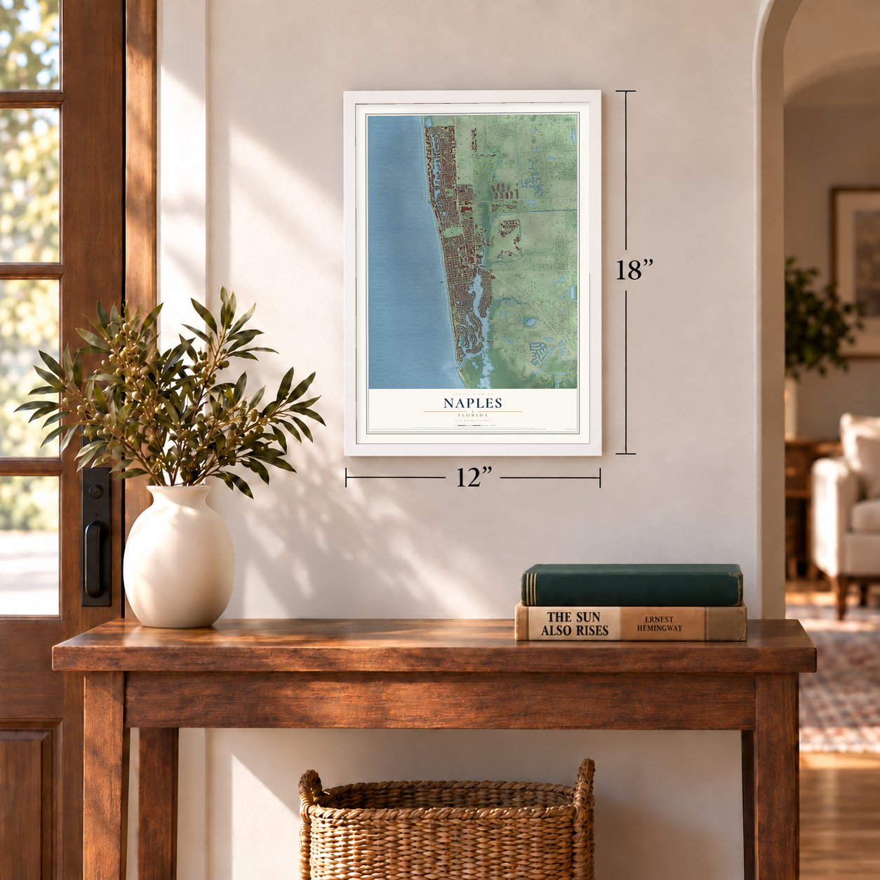
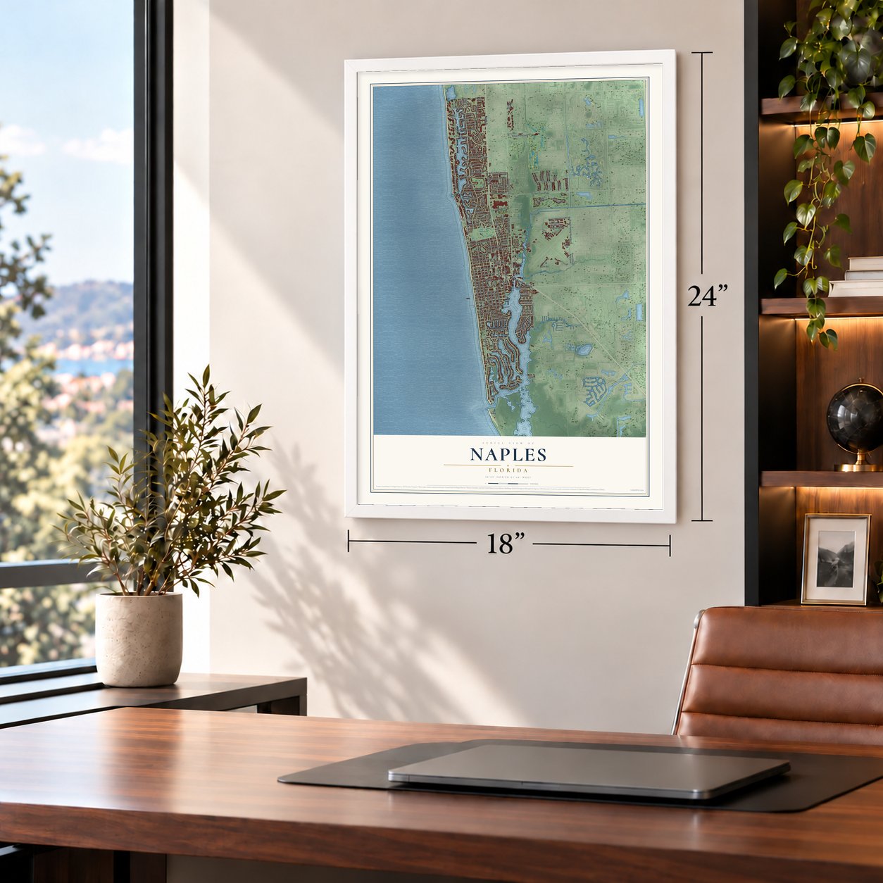
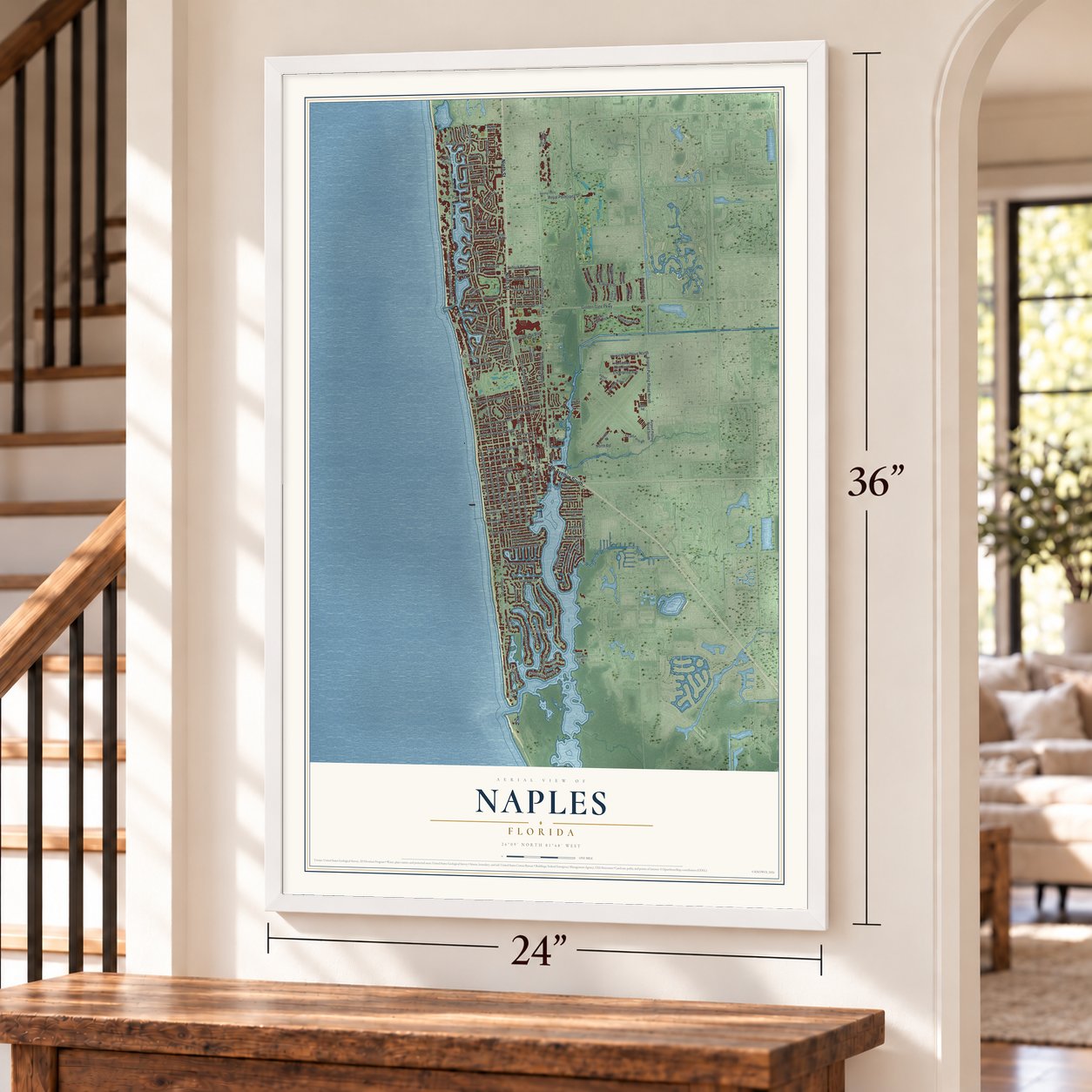
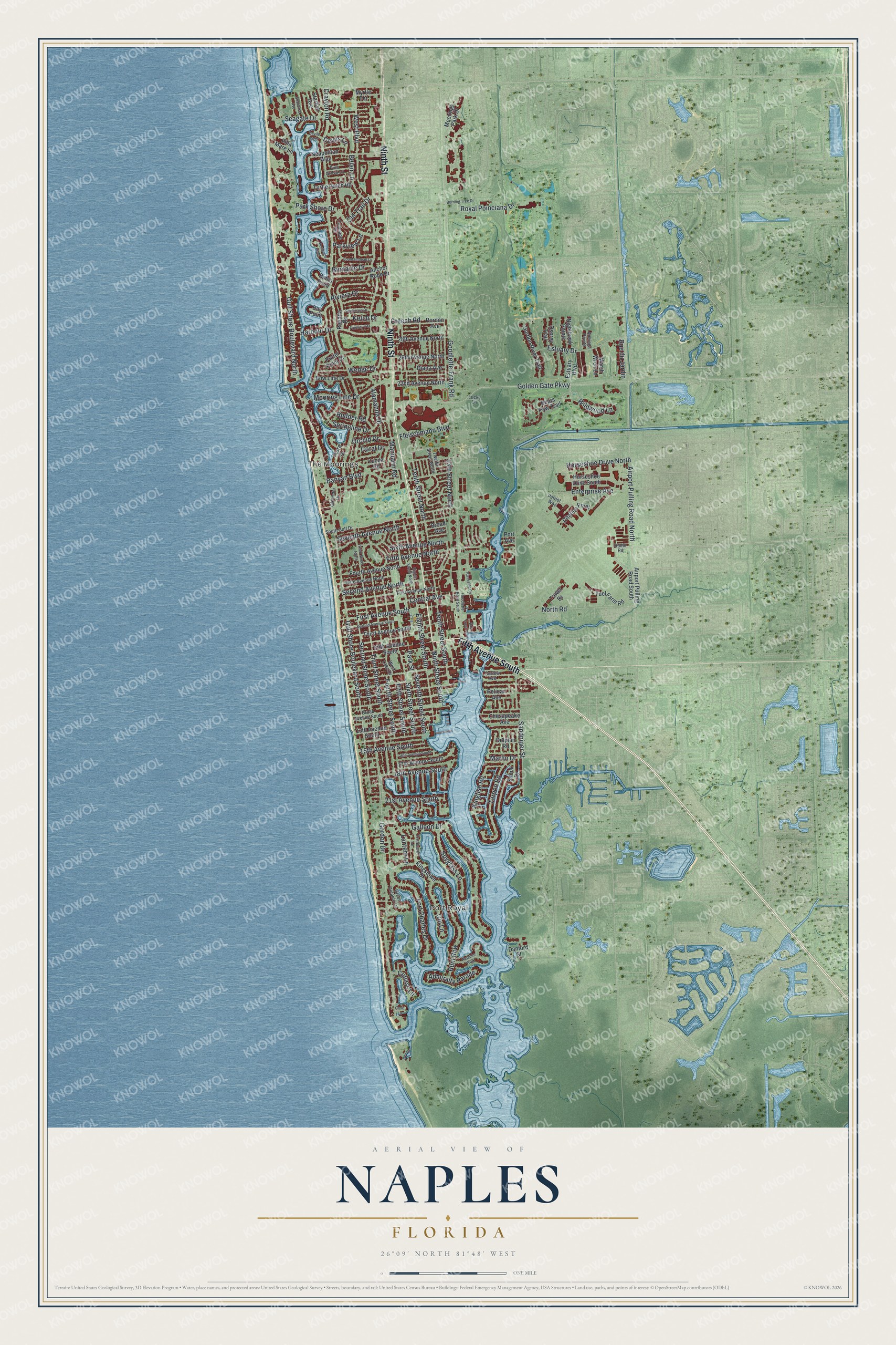
A new map of Naples, Florida, made in 2026 and printed to order on thick archival matte paper.
12" x 18" Archival Matte Print
A Map of Home. A Work of Art.
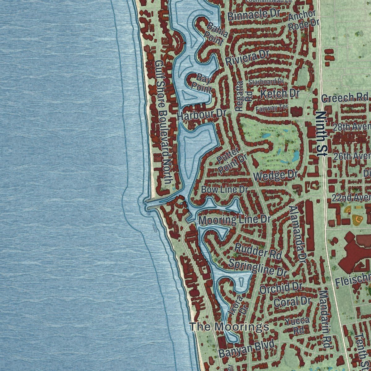
Explore Naples, Florida from a whole new perspective. Created using aerial imagery and detailed geographic data, this map captures Naples building by building, with labeled streets, familiar landmarks, and shaded topographical relief that highlights the natural contours of the landscape.
Combining modern data with the timeless character of a vintage atlas, this map is just as interesting up close as it is beautiful on the wall. Whether you grew up in Naples, spent memorable years there, or call it home today, this unique map is a great way to celebrate a place that means something to you. Zoom in on the preview to look for your street, and then order a print to put your memories on the wall.
Three ways to hang it
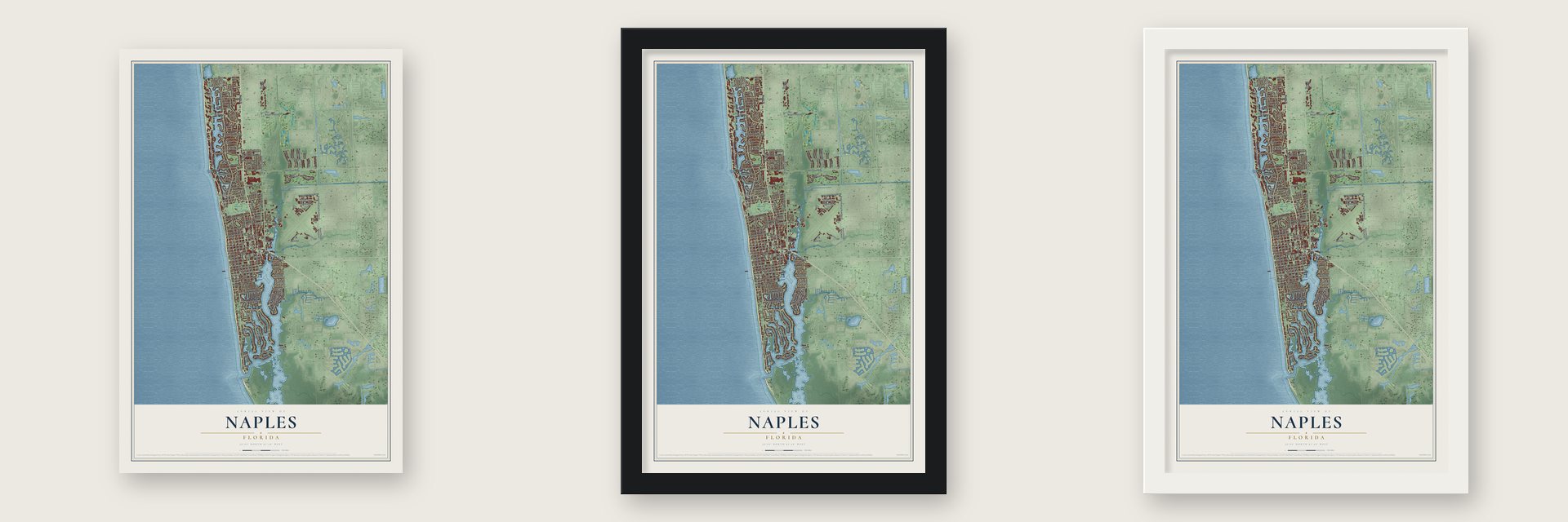
Unframed archival matte, a black wood frame or a white wood frame.
Up close
Geography Worth Displaying
This map was created using accurate cartographic data and authoritative geographic sources, including the U.S. Geological Survey (USGS) and FEMA. The map brings together terrain, waterways, roads, and building detail. The majority of the streets are labeled, houses are accurately depicted, and the topography is derived from government sources. Combining local data with carefully composed color and shading leads to this beautifully detailed Naples artwork for your wall.
Rather than simply showing street outlines, we’ve included as many of the street names as we could reasonably fit on the map while keeping their names legible. Zoom in on the high resolution preview to see exactly what’s on the map. We truly set out to create a statement piece for anyone who loves Naples. So whether it’s for you, or a gift for someone you love, we hope this map of Naples brings back fond memories.
Explore the full map of Naples, Florida and read about the local places it shows.

About Naples, Florida
Naples is a city of 19,115 people in Collier County, along southwest Florida's Gulf of Mexico coast. The Calusa lived on this coast for thousands of years, and when Juan Ponce de León came through in 1513 they fought off Spain's first efforts to plant a colony. In 1886 John Stuart Williams, a former Confederate general who had served Kentucky as a U.S. senator, founded the town with Walter N. Haldeman, publisher of the Louisville Courier-Journal. Writers had spent the 1870s and 1880s praising the warm winters and good fishing, and promoters sold the name by saying this bay outdid the one at Naples, Italy.
By 1888 about 80 people lived here, and that year the pier opened. Collier County was created in 1923, trains arrived in 1927, and the Tamiami Trail reached Miami in 1928, yet the expected boom held off through the 1929 crash, the Depression and World War II. Naples finally incorporated as a city in 1949, the same year its first bank opened on 5th Avenue.
- Port Royal's pirate streetsJohn Glenn Sample, a Chicago radio advertising pioneer, arrived in 1938 and bought mostly marshy land south of 5th Avenue and beside Naples Bay. In the early 1950s he dredged canals and peninsulas so every lot met the water, and named it for 17th-century Port Royal, Jamaica. Its streets have pirate names including Galleon Drive, Treasure Lane, Rum Row and Gin Lane. His work led to the Moorings, Park Shore and Aqualane Shores in the 1960s and 1970s.
- A seashell house from 1895Walter N. Haldeman, one of the founders, built Palm Cottage in 1895 as his summer home. Its two stories are made of tabby, a mortar mixed from sand, shells and water, and it is the oldest house in Naples. Palm Cottage joined the National Register on May 24, 1982, and the Naples Historical Society now runs it as a house museum beside the Norris Gardens, at 12th Avenue South and Gulf Shore Boulevard.
- Swamp buggies since 1949Ed Frank invented the swamp buggy in Naples, and the machines did hard work opening up the Everglades in the 1930s and 1940s. In 1949 a parade through town ended with the drivers plunging their buggies into the mud as the crowd looked on, and that was the first race. The races still run three times a year at the Florida Sports Park.
- The last train in 1971The Seaboard Air Line Railroad extended its tracks to Naples in 1927. Amtrak ended passenger trains to the city in May 1971, and three years later the station, the Seaboard Coast Line Railroad Depot, was placed on the National Register. It is now the Naples Depot Museum.
- From garden to zooThe botanist Henry Nehrling began planting the grounds in 1919. In 1954 Julius Fleischmann Jr. opened them to the public under the name Caribbean Gardens. Jungle Larry and Safari Jane, the couple Larry and Nancy Jane Tetzlaff, brought their animals here on September 1, 1969, and turned it into a zoo. When the land went up for sale, voters chose to buy it in 2004, with 73 percent voting yes.
Find your street
Names on the Naples map
Every name below is printed on this map. Look for your street, your school, the park where you played, or the pond down the road.
Places and landmarks3
- Port Royal
- The Moorings
- Baker Park
Streets and roads145
- Ninth Street
- Fifth Avenue South
- Gulf Shore Boulevard North
- Gulf Shore Boulevard South
- Marlin Drive
- Horseshoe Drive North
- Gordon Drive
- Crayton Road
- Goodlette-Frank Road
- Tenth Street North
- Golden Gate Parkway
- Galleon Drive
- North Road
- Third Street South
- Seagate Drive
- Eighth Street South
- Fourth Street South
- First Avenue South
- Seventh Avenue North
- 13th Street North
- Central Avenue
- Fifth Avenue North
- Belair Lane
- Sixth Street South
- Fifth Street South
- Rum Row
- Binnacle Drive
- Tarpon Road
- Second Street South
- Fort Charles Drive
Show all 145 streets
- Second Avenue North
- Park Shore Drive
- Wedge Drive
- Seventh Street South
- Harbour Drive
- Riviera Drive
- Estuary Drive
- Spyglass Lane
- Tenth Street South
- Sandpiper Street
- 18th Avenue South
- Airport Pulling Road North
- Enterprise Avenue
- Mooring Line Drive
- Banyan Boulevard
- Sixth Avenue North
- Royal Poinciana Drive
- Kingfish Road
- 21st Avenue South
- Springline Drive
- Mandarin Road
- Lantern Lane
- West Boulevard
- 15th Avenue South
- Wildwood Lane
- Rudder Road
- Ninth Street South
- Creech Road
- Rue du Jardin
- Fleischmann Boulevard
- Gin Lane
- Alamanda Drive
- Admiralty Parade
- Old Trail Drive
- Orchid Drive
- Ketch Drive
- Coral Drive
- Cutlass Lane
- Parkview Lane
- Devils Lane
- Park Street
- Bears Paw Trail
- Third Avenue South
- Fourth Avenue North
- Neapolitan Way
- Moorings Park Drive
- Regatta Road
- Fuel Farm Road
- Citation Point
- 17th Avenue South
- 13th Avenue South
- Yucca Road
- Snook Drive
- Bow Line Drive
- Horseshoe Drive South
- 28th Avenue North
- 26th Avenue North
- Kingstown Drive
- 22nd Avenue North
- Airport Pulling Road South
- Anchor Rode Drive
- Diana Avenue
- Gordon River Trail
- Rordon Avenue
- Turtle Hatch Road
- Chesapeake Avenue
- Villa Mare Lane
- Estuary Boulevard
- Nighthawk Pointe
- Ixora Drive
- Pelican Avenue
- Osprey Trail
- Danford Street
- Marsh Wren Lane
- Dolphin Road
- Tower Drive
- Starfish Avenue
- Putter Point Drive
- Myrtle Terrace
- Broad Avenue
- Bahia Point
- Bay Point
- Port Avenue
- Radio Road
- Twelfth Street North
- First Avenue North
- Third Avenue North
- South Golf Drive
- Broad Avenue South
- Colonade Circle
- Treasure Lane
- Patriot Way
- Green Dolphin Lane
- Curlew Avenue
- West Lake Drive
- Pine Grove Lane
- Oleander Drive
- Anhinga Pointe
- Lucky Lane
- Second Avenue South
- Third Street North
- Eighth Street North
- Goodlette Road South
- 16th Avenue South
- Fountainhead Lane
- Nelsons Walk
- Riverside Circle
- Burning Tree Drive
- Starboard Drive
- Mermaids Bight
- Devils Bight
- Fairway Terrace
- Seahorse Avenue
- Bay Front Place
- Cove Lane
Names are listed as they appear on the printed map. Zoom into the product photos to find them.
The art of mapping a place
How This Map Was Made
Real places. Remarkable detail. Discover the layers that turn geographic data into a map of home.

The view from above
Aerial imagery reveals the character of the land: woodland, open fields, and the patterns of a place.

The shape of the land
Elevation data brings hills, valleys, and subtle changes in the landscape into view.

The details of home
Roads, waterways, and building footprints come together to make the map feel unmistakably local.

Geography becomes art
Considered color, shading, and typography bring the layers together in a map made for your wall.


Process illustrated with Mendon, Massachusetts. Aerial imagery: USDA NAIP. Terrain: USGS 3D Elevation Program. Map details and finished artwork: KNOWOL.
The Details
About This Print
Choose an archival matte print, or a black or white Ayous wood frame. The archival matte print is unframed.
Select your size and finish above to see the matching product image and price.
Materials & Craftsmanship
A contemporary map with the character of a classic atlas, printed on archival matte paper. Optional frames are made from Ayous wood.
Your printed map does not include the watermark shown in the full-map preview.
Shipping & Delivery
Free shipping within the United States. Every print is made to order in the USA.
Buying a gift? Add a note in your cart and we'll include it. We never put prices in the package.
Prints ship within 2 to 3 business days. Allow 7 to 10 days total from ordering for delivery. Timing may vary during holidays or periods of high order volume.
Read our shipping policy.
Returns and damaged prints
Each print is made to order. Change-of-mind refunds are not available after production.
If your print arrives damaged, misprinted or incorrect, contact support@knowol.com within 30 days of receiving it. Include your order number, photos and a description of the issue.
Read our full refund and replacement policy. For questions about your order, email support@knowol.com.
Find your town
Looking for another city?
Find a map of home in our Florida collection, or any town in the country.
Nearby
Maps of towns near Naples
Know someone from one of these towns? Their map makes a great gift.
 East Naples
, Florida
From $39.99See the map
 Berkshire Lakes
, Florida
From $39.99See the map
 Lely
Lely, Florida
From $39.99See the map
More maps nearby: Pine Ridge, Pelican Bay, Naples Manor, Golden Gate and Lely Resort.