
Search for another town




Free U.S. delivery 7 to 10 days after you order
Navarre, Florida Map Art
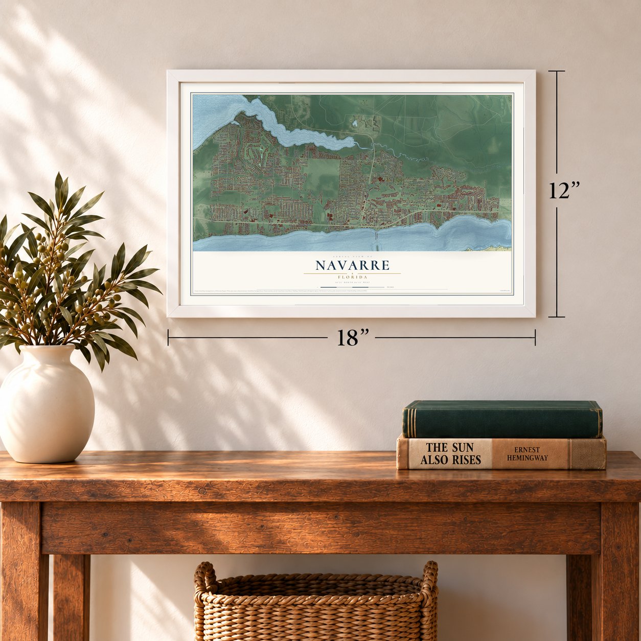
A new map of Navarre, Florida, made in 2026 and printed to order on thick archival matte paper.
12" x 18" Archival Matte Print
A Map of Home. A Work of Art.
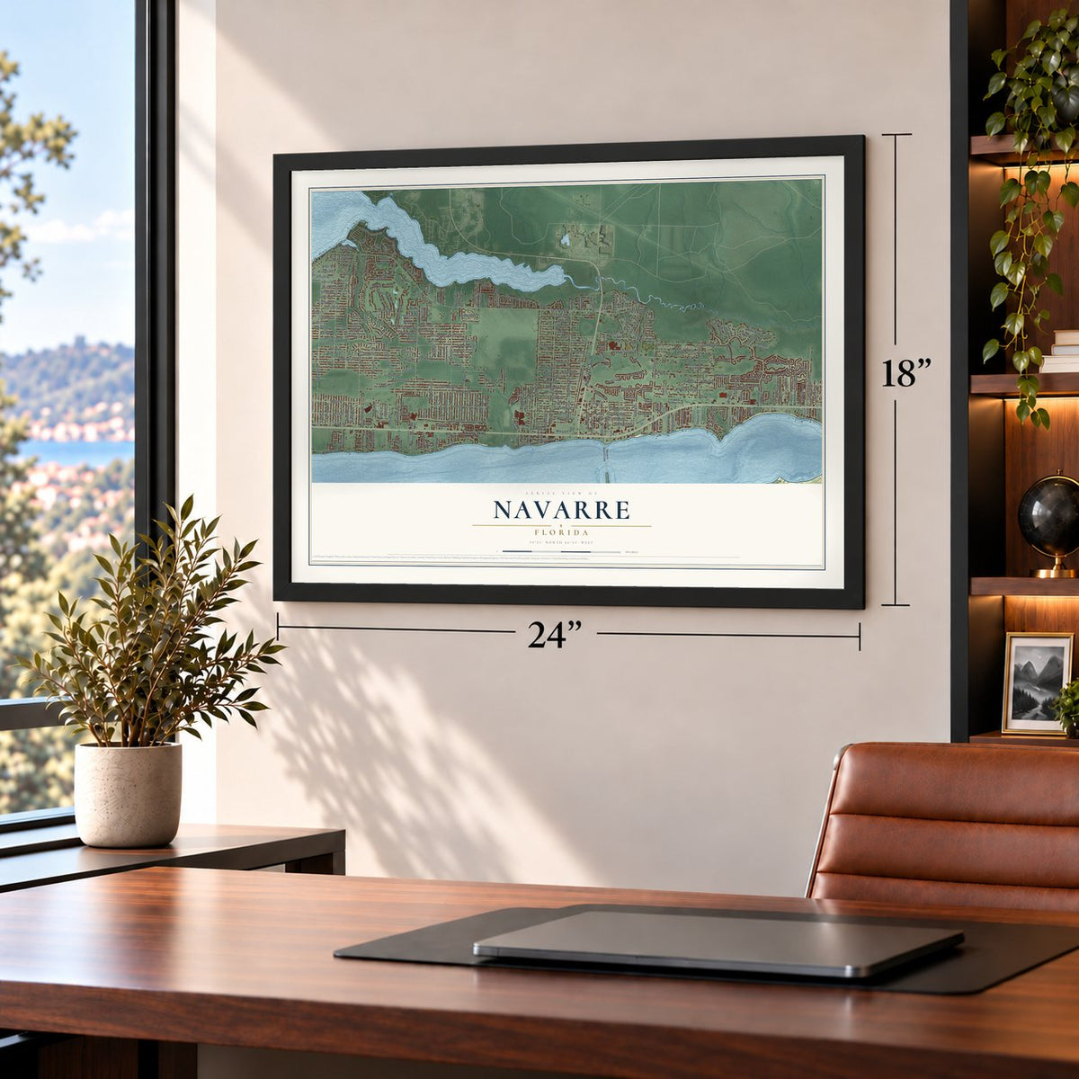
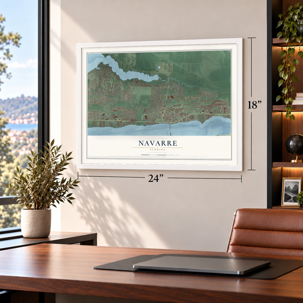
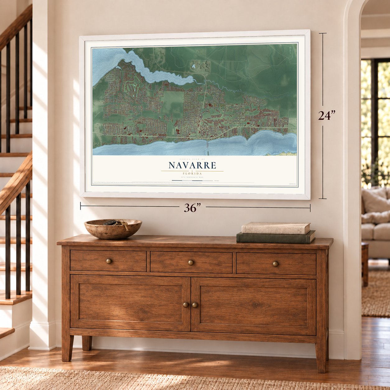
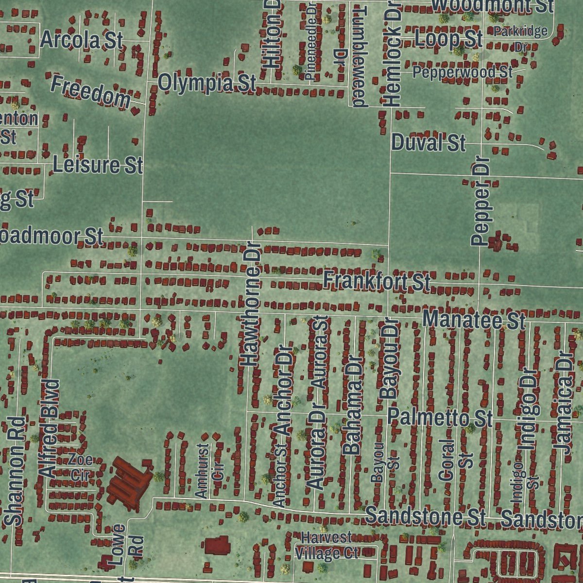
Explore Navarre, Florida from a whole new perspective. Created using aerial imagery and detailed geographic data, this map captures Navarre building by building, with labeled streets, familiar landmarks, and shaded topographical relief that highlights the natural contours of the landscape.
Combining modern data with the timeless character of a vintage atlas, this map is just as interesting up close as it is beautiful on the wall. Whether you grew up in Navarre, spent memorable years there, or call it home today, this unique map is a great way to celebrate a place that means something to you. Zoom in on the preview to look for your street, and then order a print to put your memories on the wall.

Three ways to hang it
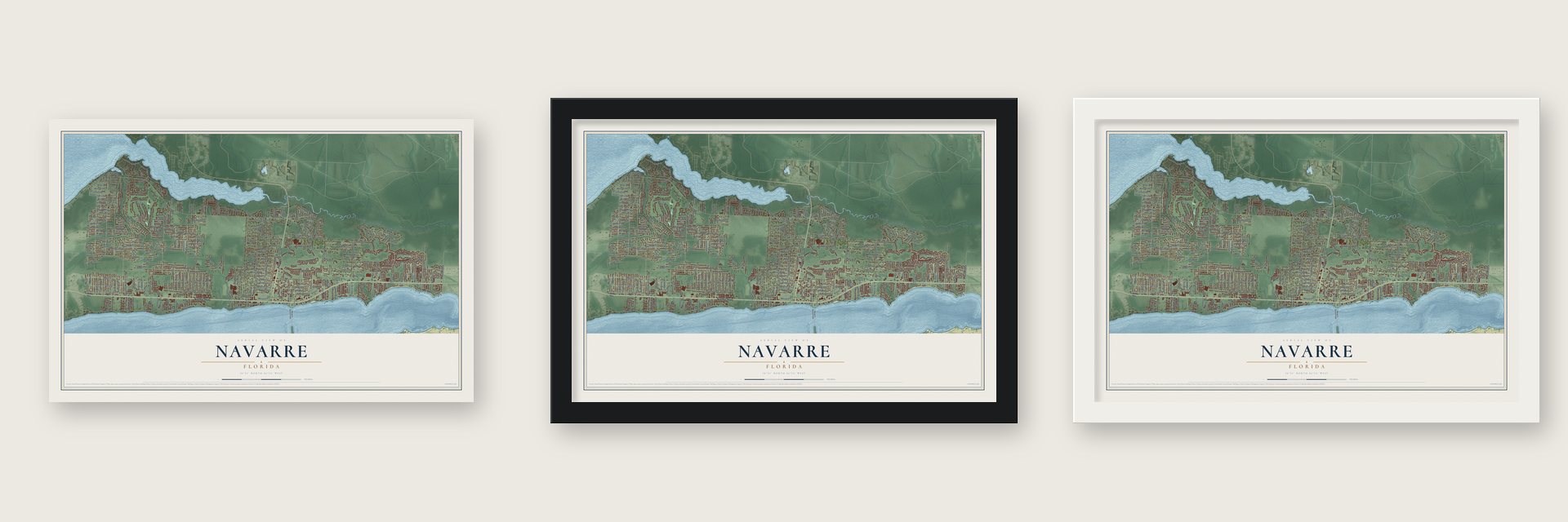
Unframed archival matte, a black wood frame or a white wood frame.
Up close
Geography Worth Displaying
This map was created using accurate cartographic data and authoritative geographic sources, including the U.S. Geological Survey (USGS) and FEMA. The map brings together terrain, waterways, roads, and building detail. The majority of the streets are labeled, houses are accurately depicted, and the topography is derived from government sources. Combining local data with carefully composed color and shading leads to this beautifully detailed Navarre artwork for your wall.
Rather than simply showing street outlines, we’ve included as many of the street names as we could reasonably fit on the map while keeping their names legible. Zoom in on the high resolution preview to see exactly what’s on the map. We truly set out to create a statement piece for anyone who loves Navarre. So whether it’s for you, or a gift for someone you love, we hope this map of Navarre brings back fond memories.
Explore the full map of Navarre, Florida and read about the local places it shows.

About Navarre, Florida
Navarre is an unincorporated community of 40,817 people in Santa Rosa County, in the Florida Panhandle, set between Santa Rosa Sound and the East Bay River. In April 1693 Admiral Andrés de Pez and Carlos de Sigüenza y Góngora led a Spanish expedition up the East Bay River, and they became the first Europeans on record here. They found a camp the Native people had just fled, with buffalo meat still on the fire and a dog standing guard. The Spanish named the spot El Robledal for its many oaks.
Before going on upriver, the Spanish raised a wooden cross and left presents. When they returned, the presents were gone, and the Native people had put up a cross of their own and left a buffalo hide as a sign of peace. Spanish maps from 1698 still marked the area as Robledal, and neighborhoods there carry the name today.
- The Axelson Point shipyardAround 1856 the Axelson family settled on a little point of land jutting into East Bay, and they are often counted as Navarre's first settlers. On the point that now bears their name, they ran a shipyard that repaired vessels from the ports of Pensacola and Milton and built big ships of their own. During the Civil War, records suggest the yard stayed busy working for the Union navy while the blockade ruined other local businesses. It closed around 1890.
- The lost town of EaganAbout 40 families lived in Eagan, a settlement on Santa Rosa Sound named for John Eagan, a Pensacola lawyer and politician. Its post office opened in 1874, run by Patrick Shea, an Irish-born American, and it closed on September 11, 1884. Families stayed on, the town still showed up on maps into the 1890s, and its land later became part of Navarre.
- Named by a French nurseDuring World War I, U.S. Army colonel Guy Wyman met Noelle, a French nurse. Immigration rules barred her as his fiancée or wife but allowed a child, so Wyman adopted her, brought her to the Panhandle and bought much land there. Noelle named it Navarre, after the Spanish province near France, and Wyman platted the town in 1925. In the Depression the Wymans fell behind on taxes and sold off land; Navarre Park sits on part of it.
- Jaws 2 in 1977In 1977 the crew of Jaws 2 shot most of the movie on the water and shore around Navarre and its beach. Hiring local boaters, extras and stand-ins, the production gave the town's economy a boost.
- The longest pier on the GulfThe Navarre Beach Fishing Pier, on the barrier island of Santa Rosa Island, runs 1,545 feet out from the shore. No other fishing pier on the Gulf of Mexico or anywhere in Florida is longer.
Find your street
Names on the Navarre map
Every name below is printed on this map. Look for your street, your school, the park where you played, or the pond down the road.
Streets and roads355
- Navarre Parkway
- Highway 87 South
- Avenue de Galvez
- Sandstone Street
- Misty Meadow Lane
- Rosewood Drive
- Frontera Street
- Elkhart Drive
- Winfield Drive
- Summit Drive
- East Bay Boulevard
- Edgewood Drive
- Leisure Street
- Manatee Street
- Andorra Street
- Avenue de Sol
- Salamanca Street
- Frankfort Street
- Sherwood Drive
- Citrus Drive
- Laredo Street
- East River Drive
- Flintwood Street
- Sunrise Drive
- Pga Boulevard
- Camden Drive
- Crescent Road
- Ortega Street
- Liberty Street
- Valley Road
Show all 355 streets
- Sandstone Road
- Pepper Drive
- Hemlock Drive
- Broadmoor Street
- Cove Road
- Codell Street
- High School Boulevard
- Bone Bluff Drive
- Parker Lake Circle
- Panhandle Trail
- Turkey Bluff Road
- Woodmont Street
- Eagle Nest Drive
- Quail Roost Drive
- Sunset Drive
- Crescent Wood Road
- Timber Lane
- Deer Lane
- Avenue de Soto
- Palmetto Street
- Beleza Street
- Sevilla Street
- Segura Street
- Hartington Drive
- Alfred Boulevard
- Rexford Street
- Marlin Street
- Escola Street
- Blackjack Circle
- Pawnee Drive
- Nevada Street
- Yorkwood Street
- Fourth Street
- Treasure Road
- Treasure Street
- Entrance Road
- Basswood Drive
- Loysburg Street
- Brevard Road
- Brevard Street
- Perch Street
- Lucena Street
- Brewster Street
- Tortuga Street
- Verano Street
- Presidio Street
- Sierra Street
- Tavira Street
- Mirado
- Miranda Drive
- Heritage Circle
- Mercado Street
- Tidewater Drive
- Sleepy Bay Boulevard
- Water Street
- Verdura Street
- Jasper Street
- Bay River Road
- Vizcaya Drive
- El Paseo Street
- Menorca Street
- Hawthorne Drive
- Las Vegas Trail
- Torres Street
- Fortworth Street
- Cll Mio
- Masters Boulevard
- Bellingham Street
- Kempton Street
- Molina Street
- Toledo Street
- Redfield Street
- Pamplona Street
- Sunnybrook Drive
- Desoto Street
- Sundown Drive
- Pouder Lane
- Sand Pine Drive
- Fairmont Street
- Turkey Creek Drive
- Newport Street
- Shannon Road
- Hartland Street
- Shoni Drive
- Seagrape Drive
- Bay Club Drive
- Orion Lake Drive
- Hilton Drive
- Granada Street
- Via Conquistadores
- Castlewood Street
- Lincoln Road
- Cll de Hidalgo
- Tom Street
- Constitution Drive
- Banyan Drive
- Janet Street
- Esplanade Street
- Ridge Drive
- Ridge Road
- Lola Circle
- Pebble Beach Drive
- Joybrook Road
- Olympia Street
- Eagle Lane
- Fern Road
- Bahama Drive
- Bayou Drive
- Jamaica Drive
- Aurora Drive
- Indigo Drive
- Cardinal Lane
- Cosica Boulevard
- Anchor Drive
- Fox Den Drive
- Glassport Street
- Indian Street
- Flamingo Lane
- Montalban Street
- Seahawk Lane
- Bryant Road
- Prado Street
- Britt Road
- Rio Vista Drive
- Olivera Street
- Estrada Street
- Reef Road
- Reef Street
- Casa de Oro
- Sparrow Lane
- Resort Street
- Palo Alto Street
- Paloma Street
- Fenwick Street
- Sawfish Street
- Penn Street
- Brentwood Boulevard
- Serosa Drive
- Teepee Road
- Duval Street
- Sound Haven Court
- Mikajack Avenue
- Pirates Way
- Ferris Drive
- Colonial Avenue
- Paso de Vivaz
- Medlin Court
- Sea Lark Lane
- Pompano Street
- Rosemont Drive
- Reagan Road
- Riverview Street
- Augustus Road
- Shellfish Drive
- Ericksen Road
- Moray Drive
- Siesta Street
- Bob White Circle
- Kit Lane
- Federal Street
- Bluefish Road
- Sardinia Court
- Calle Lane
- Abaco Drive
- Island Drive
- Arcola Street
- Morella Street
- Revere Street
- Truman Court
- Freedom
- Brand Court
- Loop Street
- Angle Road
- Cagle Drive
- Sweet Street
- Onich Drive
- Gandy Drive
- Australian Road
- Whispering Pines Boulevard
- Coral Street
- Winners Circle Drive
- Biscayne Boulevard
- Fernandina Road
- Jessica Way
- Prytania Circle
- Estate Circle
- North Shores Drive
- Creets Landing Drive
- Navarre Beach Causeway
- Stormy Circle
- Orlando Avenue
- Aurora Street
- Jeannie Street
- Hartman Court
- Iris Lane
- Hidden Creek Drive
- Bushton Street
- Bryant Street
- Admiral Road
- Britt Street
- Military Trail
- Alhambra Street
- Hidden Estates Circle
- Catline Circle
- Cll de Lago
- Skyview Boulevard
- Nautilus Drive
- Crittenden Drive
- Tumbleweed Drive
- Ivalea Circle
- Brooke Beach Drive
- Sound Retreat Drive
- Briza del Mar Drive
- Williams Creek Drive
- Brinkley Street
- Leewood Lane
- Koppel Drive
- Branston Drive
- Larker Woods Drive
- Costa Verde Court
- Yellow Pine Road
- Villa Vizcaya Drive
- Ola Broxson Road
- Blue Tip Drive
- Cypress Circle
- Orion Parker Boulevard
- Tupelo Drive
- Grand Bay Court
- Tom King Bayou Road
- Arch Road
- Joe Pruitt Road
- Mar Mar Lane
- Lowe Road
- Wilburn Cv
- Riverside Landing Drive
- Albatros Drive
- Fountian View Drive
- Menton Street
- Pro Am Court
- Pine Lilly Court
- Elbing Street
- Mission Drive
- Deena Lane
- Mooring Drive
- River Run Road
- Health Care Drive
- Plank Road
- Faye Court
- Tiffany Lane
- Lilge Circle
- Snug Waters Road
- Cll de Castelar
- Bayou Street
- Indigo Street
- Anchor Street
- Admiral Street
- Vandivere Drive
- Harvest Village Court
- Pritchard Point Drive
- Country Bay Boulevard
- Turnberry Circle
- Duncan Ridge Drive
- Thunderbolt Street
- Muirfield Drive
- Pepperwood Street
- Robar Tesora
- Captain's Cv
- Holley Club Drive
- Cll de Cortez
- Pebble Brook Drive
- Corbin Court
- Blue Jack Drive
- Sawgrass Way
- Mary Anne Drive
- Knollwood Drive
- Palmetto Ridge Court
- Thesher Drive
- Sumac Court
- Pinosa Street
- Via Grande
- Rynes Circle
- Kubota Lane
- Kingsley Place
- Misty Ridge Lane
- Alpine Avenue
- Elks Way
- Amhurst Circle
- First Court
- Clarke Street
- Ranch Drive
- Pullam Street
- Falcon Hurst
- Zoe Circle
- Kiwi Place
- Holly Place
- Villa Court
- Gulf Breeze Parkway
- Barefoot Creek Circle
- Weeping Willow Lane
- Pelican Lane
- Luneta Street
- Majestic Boulevard
- Smallwood Drive
- Parkridge Drive
- Turkey Oak Drive
- Wilsons Plover Circle
- Lansford Street
- Pine Ranch Drive
- Meadow Wood Lane
- Fontainebleau Court
- Raider Lane
- Kerra Lane
- Magnolia Harbor Drive
- Tampa Boulevard
- Lovewood Drive
- Pineneedle Drive
- Gable Lake Road
- Acorn Lane
- Fulva Drive
- Durell Lane
- Concord Court
- Barco de Villa
- Water Oak Circle
- Cotton Boll Lane
- Clay Court
Names are listed as they appear on the printed map. Zoom into the product photos to find them.
The art of mapping a place
How This Map Was Made
Real places. Remarkable detail. Discover the layers that turn geographic data into a map of home.

The view from above
Aerial imagery reveals the character of the land: woodland, open fields, and the patterns of a place.

The shape of the land
Elevation data brings hills, valleys, and subtle changes in the landscape into view.

The details of home
Roads, waterways, and building footprints come together to make the map feel unmistakably local.

Geography becomes art
Considered color, shading, and typography bring the layers together in a map made for your wall.


Process illustrated with Mendon, Massachusetts. Aerial imagery: USDA NAIP. Terrain: USGS 3D Elevation Program. Map details and finished artwork: KNOWOL.
The Details
About This Print
Choose an archival matte print, or a black or white Ayous wood frame. The archival matte print is unframed.
Select your size and finish above to see the matching product image and price.
Materials & Craftsmanship
A contemporary map with the character of a classic atlas, printed on archival matte paper. Optional frames are made from Ayous wood.
Your printed map does not include the watermark shown in the full-map preview.
Shipping & Delivery
Free shipping within the United States. Every print is made to order in the USA.
Buying a gift? Add a note in your cart and we'll include it. We never put prices in the package.
Prints ship within 2 to 3 business days. Allow 7 to 10 days total from ordering for delivery. Timing may vary during holidays or periods of high order volume.
Read our shipping policy.
Returns and damaged prints
Each print is made to order. Change-of-mind refunds are not available after production.
If your print arrives damaged, misprinted or incorrect, contact support@knowol.com within 30 days of receiving it. Include your order number, photos and a description of the issue.
Read our full refund and replacement policy. For questions about your order, email support@knowol.com.
Find your town
Looking for another city?
Find a map of home in our Florida collection, or any town in the country.
Nearby
Maps of towns near Navarre
Know someone from one of these towns? Their map makes a great gift.
 Holley
, Florida
From $39.99See the map
 Navarre Beach
, Florida
From $39.99See the map
 Woodlawn Beach
, Florida
From $39.99See the map
More maps nearby: Tiger Point, Hurlburt Field, Dickerson City, Garcon Point and Oriole Beach.