
Search for another town


Free U.S. delivery 7 to 10 days after you order
New Haven, Connecticut Map Art
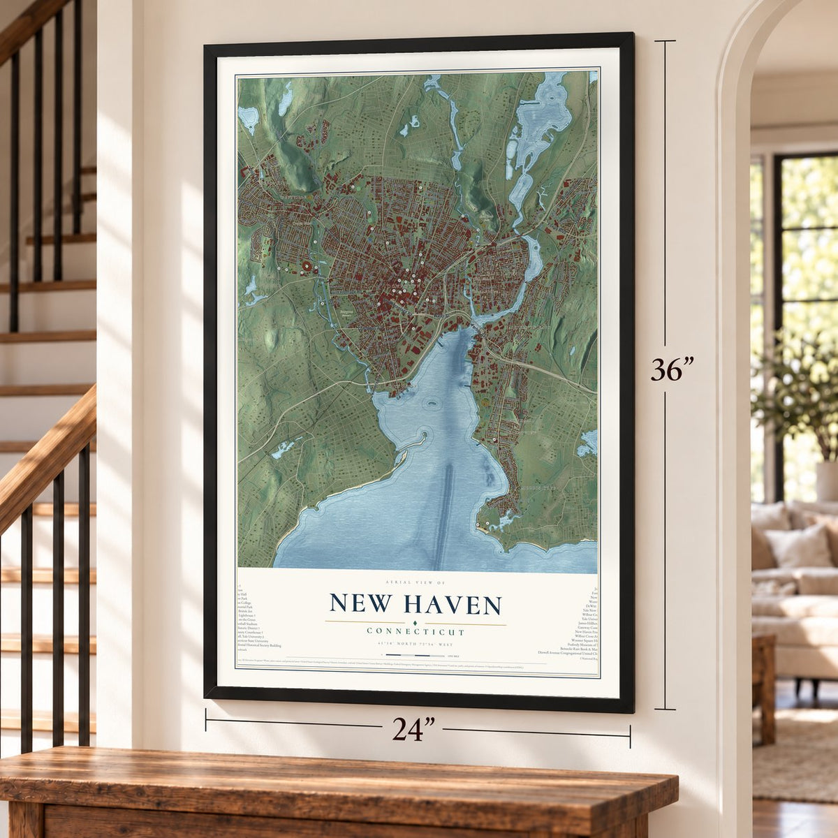
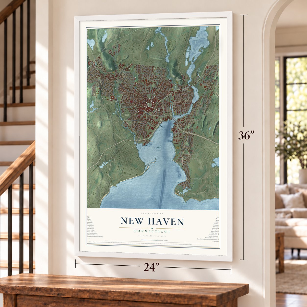
Building by building, with labeled streets and shaded relief.
12" x 18" Archival Matte Print
A Map of Home. A Work of Art.
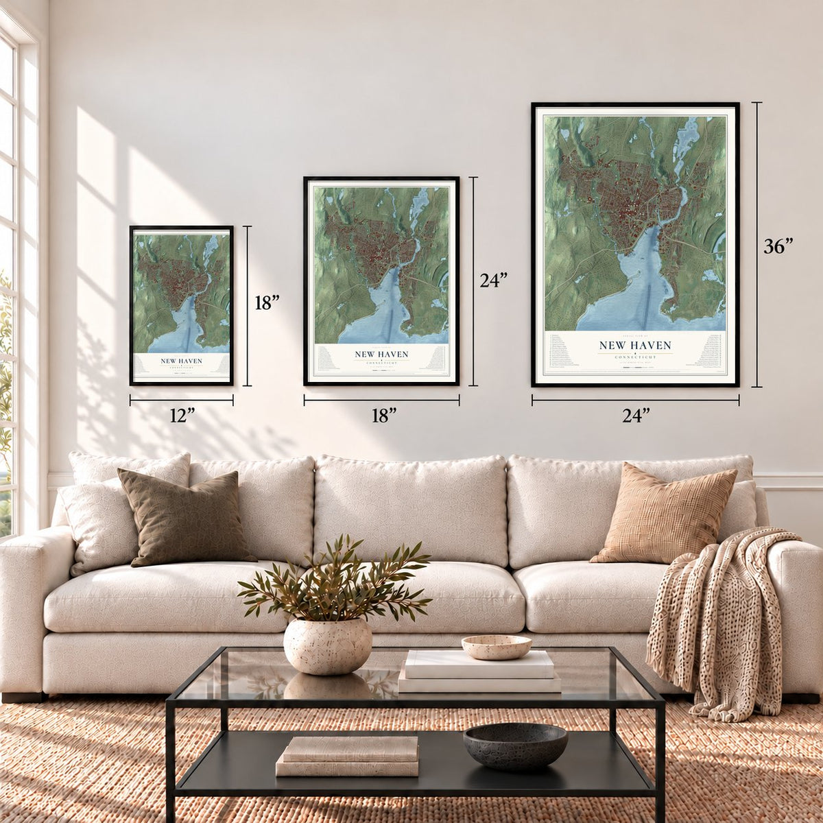
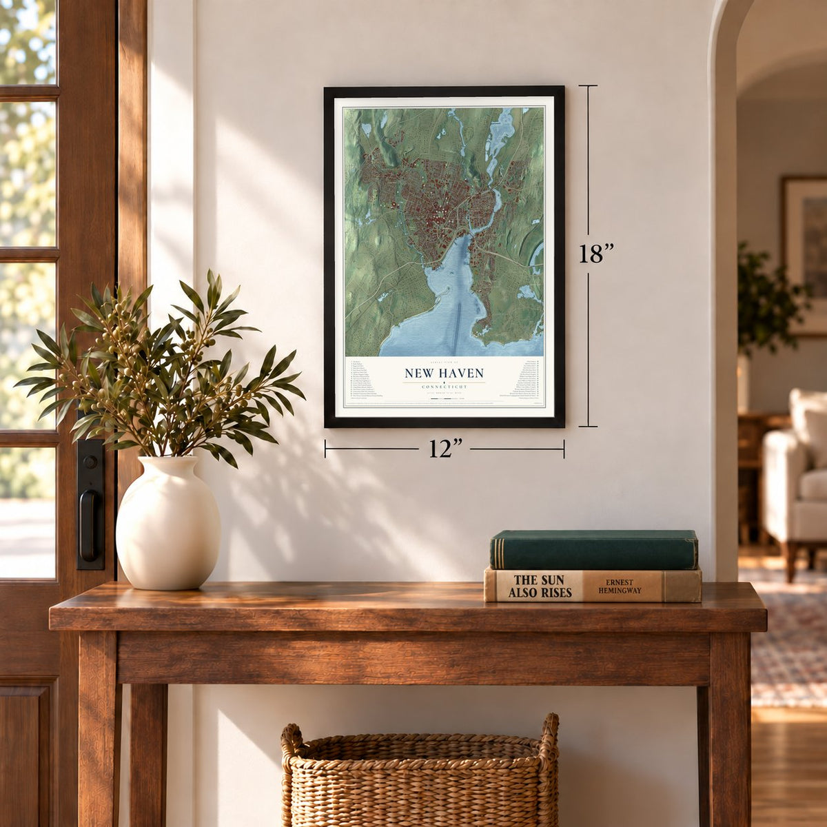
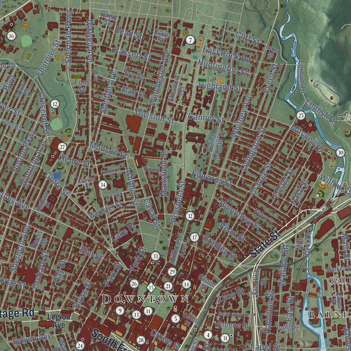
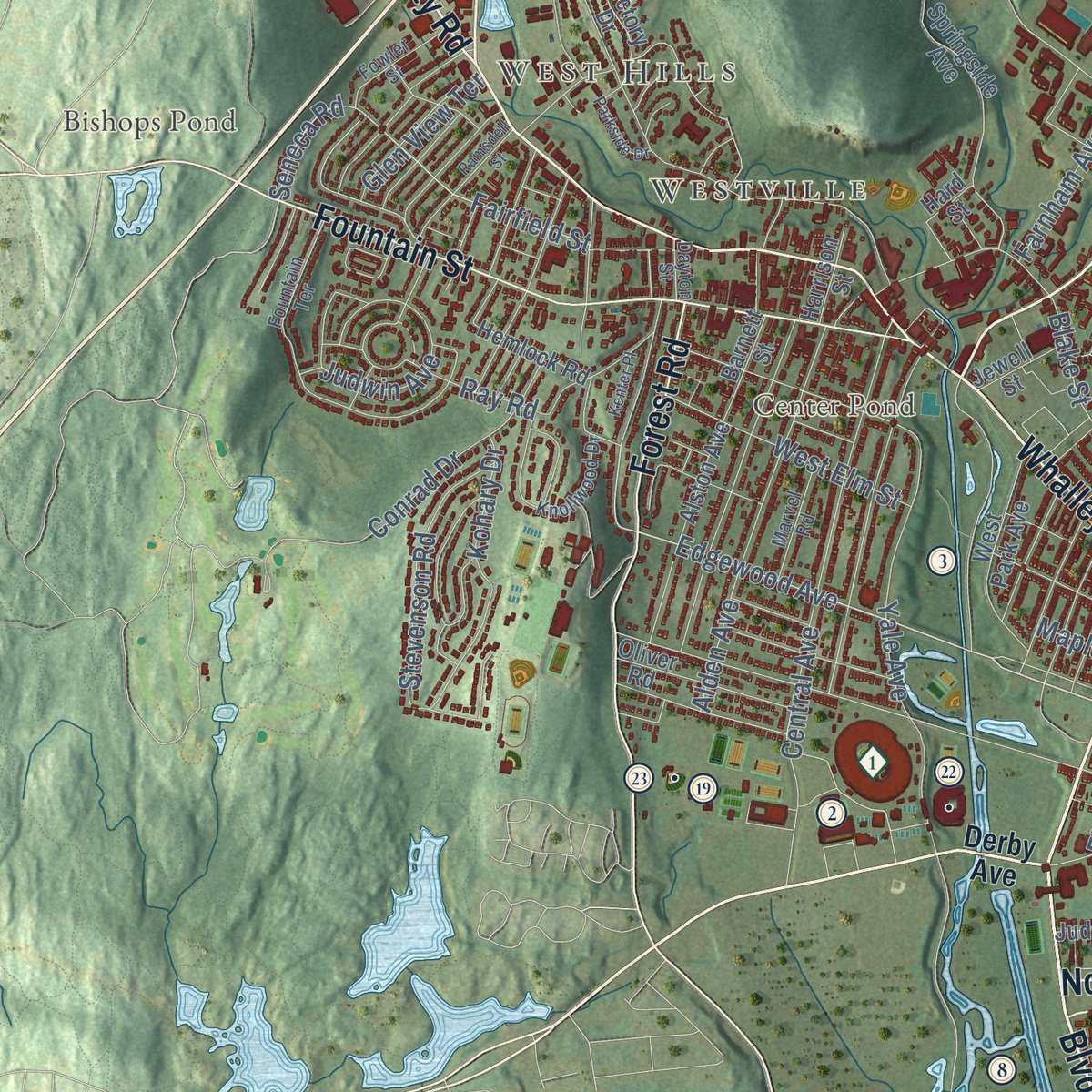
Explore New Haven, Connecticut from a whole new perspective. Created using aerial imagery and detailed geographic data, this map captures New Haven building by building, with labeled streets, familiar landmarks, and shaded topographical relief that highlights the natural contours of the landscape.
Combining modern data with the timeless character of a vintage atlas, this map is just as interesting up close as it is beautiful on the wall. Whether you grew up in New Haven, spent memorable years there, or call it home today, this unique map is a great way to celebrate a place that means something to you. Zoom in on the preview to look for your street, and then order a print to put your memories on the wall.

Three ways to hang it
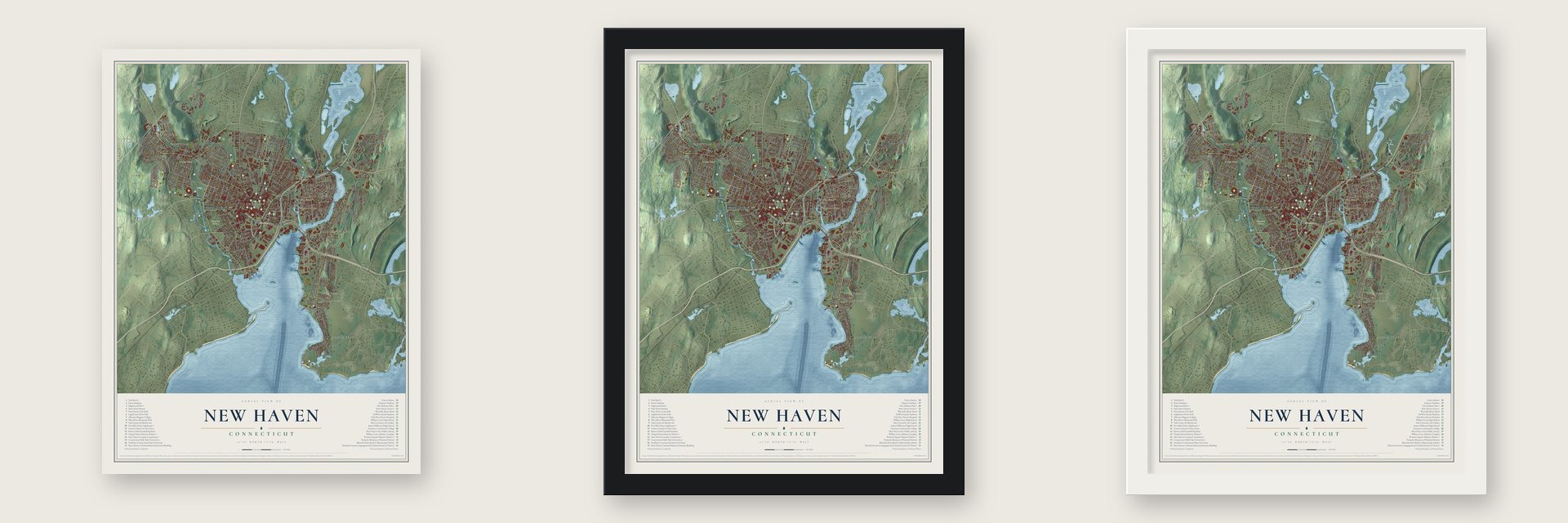
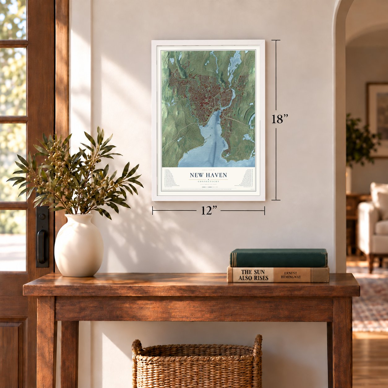
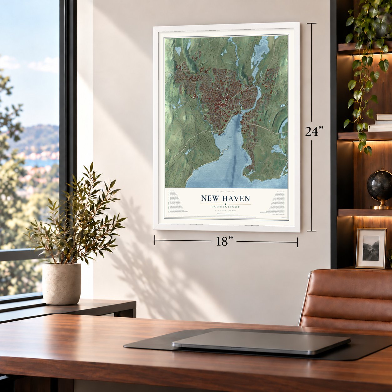
Unframed archival matte, a black wood frame or a white wood frame.
Up close
Geography Worth Displaying
This map was created using accurate cartographic data and authoritative geographic sources, including the U.S. Geological Survey (USGS) and FEMA. The map brings together terrain, waterways, roads, and building detail. The majority of the streets are labeled, houses are accurately depicted, and the topography is derived from government sources. Combining local data with carefully composed color and shading leads to this beautifully detailed New Haven artwork for your wall.
Rather than simply showing street outlines, we’ve included as many of the street names as we could reasonably fit on the map while keeping their names legible. Zoom in on the high resolution preview to see exactly what’s on the map. We truly set out to create a statement piece for anyone who loves New Haven. So whether it’s for you, or a gift for someone you love, we hope this map of New Haven brings back fond memories.
Explore the full map of New Haven, Connecticut and read about the local places it shows.

Find your street
Names on the New Haven map
Every name below is printed on this map. Look for your street, your school, the park where you played, or the pond down the road.
Places and landmarks17
- Downtown
- West Hills
- Westville
- Allington Hill
- Ball Island
- Beacon Hill
- Bishops Pond
- Center Pond
- East Rock Park
- Evergreen Cemetery
- Morris Cove
- Raynham
Show all 17 places
- City Point
- Fair Haven
- Fair Haven East
- Brightview
- Barnesville
Streets and roads267
- State Street
- Boulevard
- North Frontage Road
- Columbus Avenue
- Amity Road
- Whalley Avenue
- Fitch Street
- Townsend Avenue
- Fountain Street
- Forbes Avenue
- Quinnipiac Avenue
- Forest Road
- Middletown Avenue
- Water Street
- Foxon Boulevard
- South Frontage Road
- Edgewood Avenue
- Winthrop Avenue
- Dixwell Avenue
- Church Street
- Washington Avenue
- Munson Street
- Howe Street
- Goffe Street
- Fairfield Street
- Congress Avenue
- Seneca Road
- Sherman Avenue
- Spring Avenue
- Stiles Street
Show all 267 streets
- Main Street
- Chapel Street
- Sherman Parkway
- Elm Street
- Woodward Avenue
- Orange Street
- Howard Avenue
- Grand Avenue
- Whitney Avenue
- Russell Street
- Prospect Street
- Orchard Street
- Wintergreen Avenue
- George Street
- Ferry Street
- Ellsworth Avenue
- Winchester Avenue
- Front Street
- Long Wharf Drive
- East Street
- Valley Street
- Norton Parkway
- Norton Street
- Eastern Street
- Sargent Drive
- Blatchley Avenue
- Central Avenue
- James Street
- Crescent Street
- Yale Avenue
- Blake Street
- Mansfield Street
- Lighthouse Road
- Willow Street
- Lexington Avenue
- Humphrey Street
- Huntington Street
- Poplar Street
- Shelton Avenue
- Lombard Street
- Stevenson Road
- Livingston Street
- Burr Street
- Alden Avenue
- Canner Street
- Concord Street
- Peck Street
- Wilmont Road
- York Street
- Davenport Avenue
- Edwards Street
- Crown Street
- Lenox Street
- Bassett Street
- Hamilton Street
- Dean Street
- Pine Street
- Conrad Drive
- Kneeland Road
- East Rock Road
- Division Street
- Lloyd Street
- Dyer Street
- Ashmun Street
- Canal Street
- Highland Street
- Judwin Avenue
- Maple Street
- Olive Street
- Park Street
- West Elm Street
- Goffe Terrace
- Lamberton Street
- English Drive
- Summit Street
- Kohary Drive
- Foster Street
- Everit Street
- Henry Street
- Fillmore Street
- Wallace Street
- Augustine Street
- Ivy Street
- Fulton Street
- Frank Street
- Glen Haven Road
- Bradley Street
- Burwell Street
- Sylvan Avenue
- Mitchell Drive
- Fournier Street
- Farnham Avenue
- Beacon Avenue
- Upson Terrace
- South End Road
- Hall Street
- Glen View Terrace
- Read Street
- Kenny Drive
- Putnam Street
- Nash Street
- Smith Avenue
- Day Street
- Ray Road
- Cliff Street
- Pearl Street
- First Avenue
- Girard Avenue
- Dover Street
- Dump Road
- Welton Street
- Rock Street
- Lyon Street
- Lake Place
- Dell Drive
- Derby Avenue
- Kimberly Avenue
- Grove Street
- Clinton Avenue
- Cedar Street
- Springside Avenue
- Baldwin Drive
- Saint Ronan Street
- East Grand Avenue
- Waterfront Street
- Fairmont Avenue
- Starr Street
- Barnes Avenue
- Alston Avenue
- West Park Avenue
- Downing Street
- Webster Street
- Osborn Avenue
- East Pearl Street
- Ward Street
- Oliver Road
- Franklin Street
- Roger White Drive
- Huntington Avenue
- Hillhouse Avenue
- Rosewood Avenue
- Woolsey Street
- Morris Avenue
- Victory Drive
- Portsea Street
- Button Street
- Essex Street
- Fort Hale Park Road
- Kendall Street
- Farnum Drive
- Foxon Hill Road
- Beers Street
- Oakley Street
- Hemlock Road
- Sheldon Terrace
- Judson Avenue
- Barnett Street
- Greene Street
- Uriah Street
- Union Street
- Ives Place
- Mill River Street
- Jewell Street
- Elaine Terrace
- Harrison Street
- Morse Place
- Printers Lane
- Park Drive
- Warren Place
- Level Street
- Tuttle Street
- Cart Road
- Tuttle Drive
- Tyler Street
- Aner Street
- Daisy Street
- Hard Street
- Ford Street
- Cave Street
- Allen Place
- Legion Avenue
- Wheeler Street
- Hallock Avenue
- Colony Road
- Glen Road
- Knollwood Drive
- Farren Avenue
- Cove Street
- Catherine Way
- Monroe Street
- Wooster Street
- Fountain Terrace
- Adeline Street
- Haven Street
- Harper Avenue
- Court Street
- South Water Street
- Fowler Street
- Brewery Street
- Connecticut Avenue
- Market Street
- Marvel Road
- Hudson Street
- Judith Terrace
- Oak Ridge Drive
- Pine Rock Avenue
- Grant Street
- Boston Avenue
- Dayton Street
- Flint Street
- Clifton Street
- Bishop Street
- River Street
- West Street
- Hazel Street
- Grafton Street
- Ramsdell Street
- Rock View Circle
- Foote Street
- Bailey Street
- Myron Street
- Perkins Street
- Elliott Street
- Ashland Place
- Stevens Street
- Parkside Drive
- Saint John Street
- Admiral Street
- Laura Lane
- Highview Lane
- Mead Street
- Charles Street
- Sunset Ridge
- Kenter Place
- Tilton Street
- Burns Street
- Fox Street
Names are listed as they appear on the printed map. Zoom into the product photos to find them.
About New Haven, Connecticut
New Haven is a city of 134,023 people in New Haven County, on New Haven Harbor at the northern edge of Long Island Sound. Around five hundred Puritans sailed in during April 1638, led by the minister John Davenport and Theophilus Eaton, a London merchant, and they hoped to build a town where church and government worked hand in hand. The Quinnipiac, then under attack by the Pequots, sold them land for a promise of protection, and by 1640 the settlement had its grid of nine squares and the name New Haven.
The town led a colony of its own until 1664, when pressure from England folded it into Connecticut, and New Haven and Hartford took turns as capital from 1701 until 1873. The Collegiate School moved here from Old Saybrook in 1716, and it took the name Yale College in 1718, when the merchant Elihu Yale gave it a large donation. New Haven became a city in 1784, and its first mayor was Roger Sherman, who had signed the Constitution.
“The skilful precision with which New Haven was laid out around its central market-place elicited at that time universal admiration.”
- The judges on West RockIn 1661 King Charles II was hunting the judges who had condemned his father. Two of them, Edward Whalley and William Goffe, fled here, where John Davenport helped keep them hidden, and on May 15 they settled among huge stone pillars high on West Rock. A farmer, Richard Sperry, had his boys leave food on a stump. After a panther poked its head in one night, they left the cave, and neither was ever returned to England.
- Spared in 1779On July 5, 1779, General William Tryon came ashore with 2,600 loyalists and British regulars and attacked New Haven, then home to 3,500 people. Yale students formed a militia and stood ready, and the raiders burned ships at Long Wharf. But they did not set the town on fire, as they did Fairfield and Norwalk a week later, so many of New Haven's colonial buildings still stand.
- Who planted the Elm CityJames Hillhouse did the planting between 1787 and 1796, bringing young trees from his farm out toward Meriden and lining the streets and the Green with rows of them. In a 1911 account, a boy held the saplings or drove stakes while Hillhouse filled in the dirt. That boy, Jeremiah Day, later became president of Yale, and the elms gave New Haven its nickname.
- Oysters by the schooner loadBy about 1823 Fair Haven oystermen were already sailing down to the Chesapeake. In 1834 the schooner Mary and Martha planted 1,600 bushels of oysters in Morris Cove, and Fair Haven grew into a great oyster shipping center. Ten years earlier the steamboat United States had begun regular runs to New York, firing a cannon from the bow as it came into port so the Hartford and Boston stagecoaches would be waiting.
- The Amistad trial of 1839In 1839 the Mende Africans who had risen up aboard the Spanish slave ship Amistad were tried in New Haven's federal court, an early landmark of the antislavery movement. Members of the Dixwell Avenue church, founded by free African Americans in 1820, spoke up for them. A memorial put up in 1992 stands in front of New Haven City Hall, where the jail that held them once stood.
Keep exploring Connecticut
New Haven is one of 382 Connecticut towns we've mapped. Every dot on the map is a print of its own.
The search covers every state, Connecticut first.
Near New Haven
Order 2 or more town maps and save 10%. Shown in the size and finish you picked above, so they hang as a set.
- Wooster Square 12" x 18" / Archival Matte Print $39.99
- Dixwell 12" x 18" / Archival Matte Print $39.99
- Dwight 12" x 18" / Archival Matte Print $39.99


More maps nearby: Prospect Hill, East Rock, West River, Newhallville and The Hill.
The art of mapping a place
How This Map Was Made
Real places. Remarkable detail. Discover the layers that turn geographic data into a map of home.

The view from above
Aerial imagery reveals the character of the land: woodland, open fields, and the patterns of a place.

The shape of the land
Elevation data brings hills, valleys, and subtle changes in the landscape into view.

The details of home
Roads, waterways, and building footprints come together to make the map feel unmistakably local.

Geography becomes art
Considered color, shading, and typography bring the layers together in a map made for your wall.


Process illustrated with Mendon, Massachusetts. Aerial imagery: USDA NAIP. Terrain: USGS 3D Elevation Program. Map details and finished artwork: KNOWOL.
The Details
About This Print
Choose an archival matte print, or a black or white Ayous wood frame. The archival matte print is unframed.
Select your size and finish above to see the matching product image and price.
Materials & Craftsmanship
A contemporary map with the character of a classic atlas, printed on archival matte paper. Optional frames are made from Ayous wood.
Your printed map does not include the watermark shown in the full-map preview.
Shipping & Delivery
Free shipping within the United States. Every print is made to order in the USA.
Buying a gift? Add a note in your cart and we'll include it. We never put prices in the package.
Prints ship within 2 to 3 business days. Allow 7 to 10 days total from ordering for delivery. Timing may vary during holidays or periods of high order volume.
Read our shipping policy.
Returns and damaged prints
Each print is made to order. Change-of-mind refunds are not available after production.
If your print arrives damaged, misprinted or incorrect, contact support@knowol.com within 30 days of receiving it. Include your order number, photos and a description of the issue.
Read our full refund and replacement policy. For questions about your order, email support@knowol.com.