
Search for another town





Free U.S. delivery 7 to 10 days after you order
Newark, Ohio Map Art
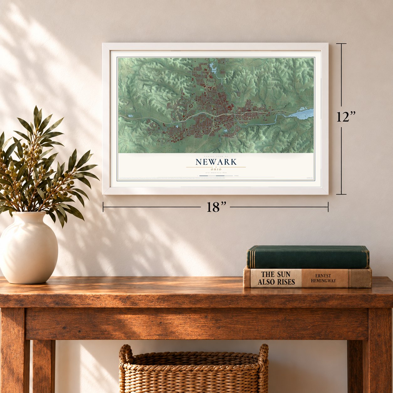
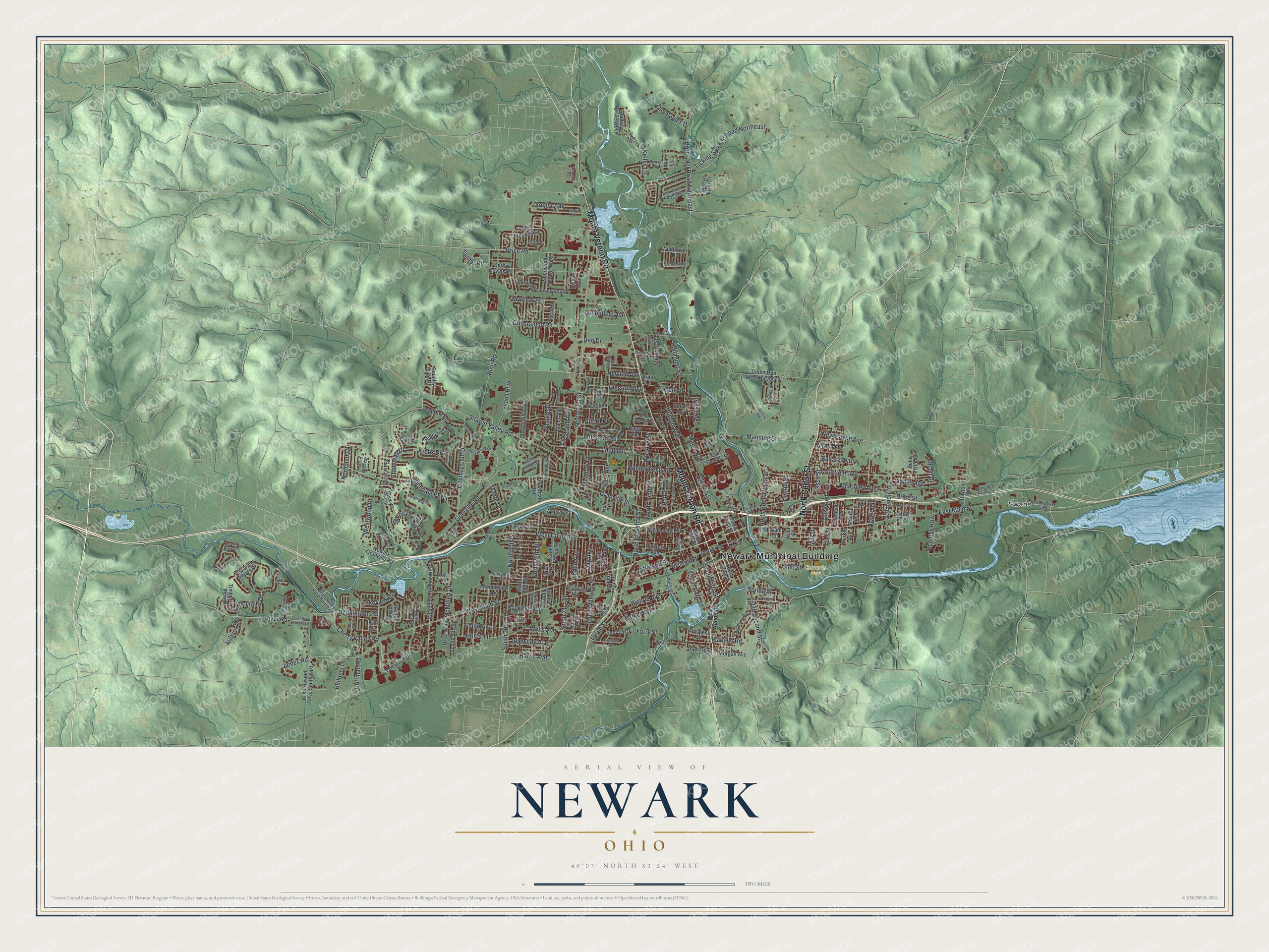
A new map of Newark, Ohio, made in 2026 and printed to order on thick archival matte paper.
12" x 18" Archival Matte Print
A Map of Home. A Work of Art.
If you grew up in Newark, walked downtown along West Main Street, or still have family off Mount Vernon Road, this map gives you plenty to find. It's a modern aerial view of Newark in Licking County, Ohio, made from modern data with a vintage artistic feel. Zoom in on the preview and look for your block.
Three ways to hang it
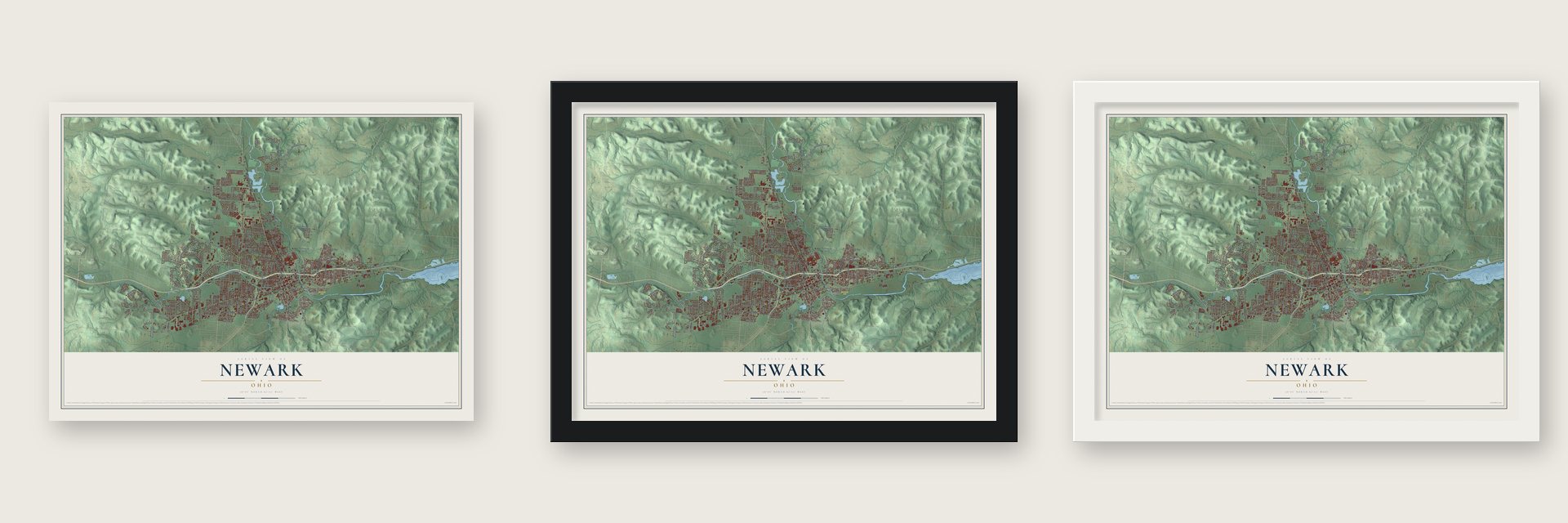
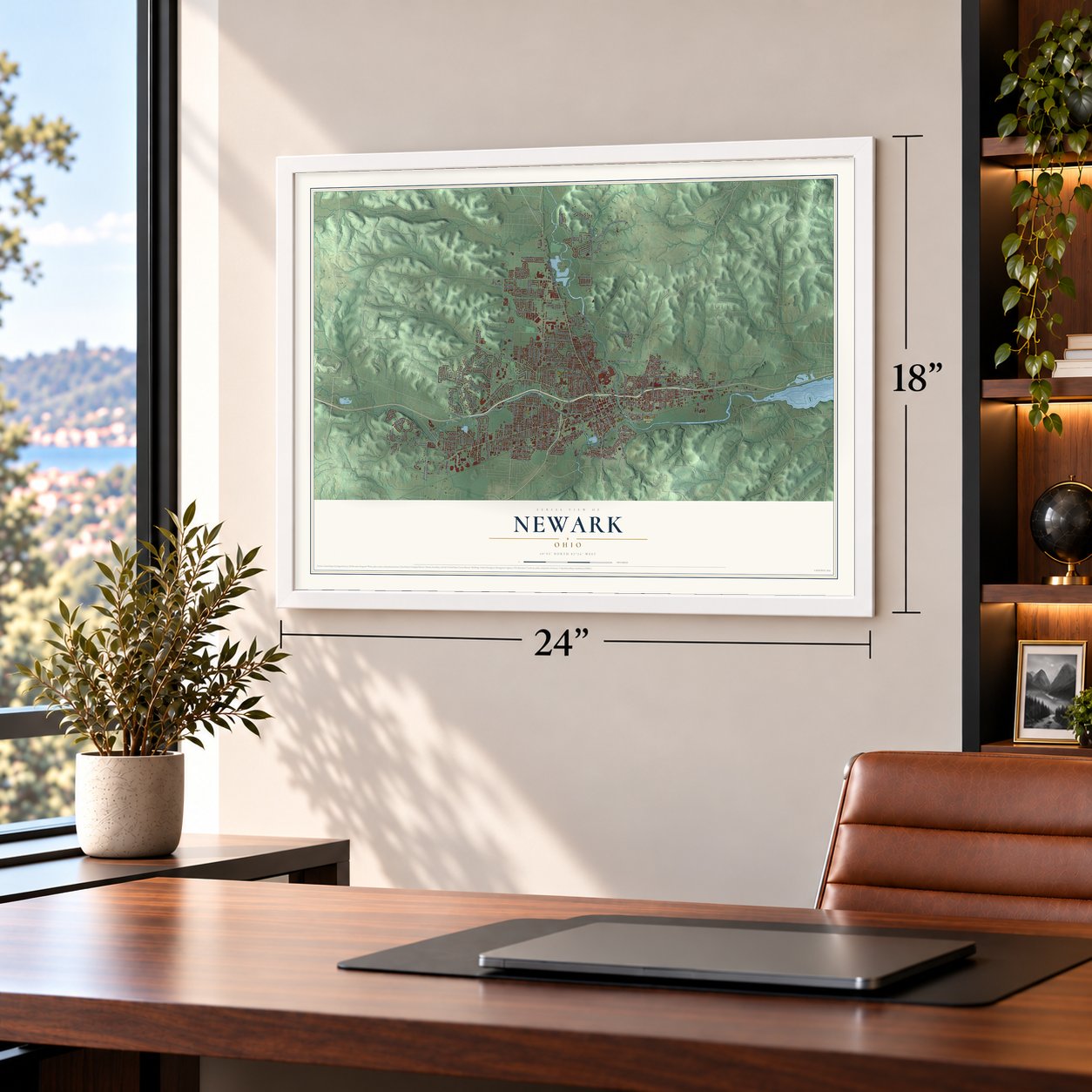
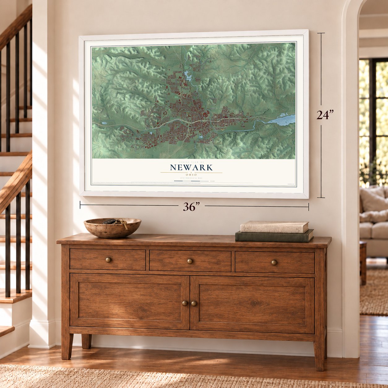
Unframed archival matte, a black wood frame or a white wood frame.
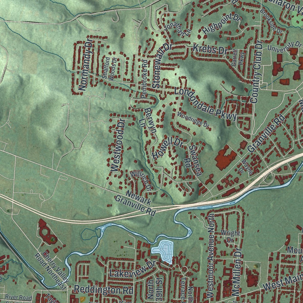
Up close
Real geography. Art worth displaying.
This map was created using accurate cartographic data and authoritative geographic sources, including the U.S. Geological Survey and the Census Bureau. The map brings together terrain, waterways, roads, and building detail. The majority of the streets are labeled, houses are accurately depicted, and the topography is derived from government sources. Combining local data with carefully composed color and shading leads to this beautifully detailed Newark artwork for your wall.
Rather than simply showing street outlines, we’ve included as many of the street names as we could reasonably fit on the map while keeping their names legible. Zoom in on the high resolution preview to see exactly what’s on the map. We truly set out to create a statement piece for anyone who loves Newark. So whether it’s for you, or a gift for someone you love, we hope this map of Newark brings back fond memories.

About Newark, Ohio
Within Licking County in Ohio, Newark is classified as a city. Its population stood at 49,934 in the 2020 census, a present-day measure of the place formed by local streets, public buildings and familiar gathering points. This is the community its residents know as home.
- 49,934 residentsThat was the population reported for the community by the 2020 census.
- Licking County cityOfficial records place this city within Licking County.
- A National Register siteThe National Register includes Bryn Mawr, recorded as a building.
- A National Register siteThe National Register includes West Side Planing Mill (rear), recorded as a building.
- A National Register siteThe National Register includes McNamar-McLure-Miller Residence, recorded as a building.
Find your street
Names on the Newark map
Every name below is printed on this map. Look for your street, your school, the park where you played, or the pond down the road.
Places and landmarks3
- Newark Municipal Building
- Swans
- Edwards Field
Streets and roads235
- Mount Vernon Road
- North Cedar Street
- Price Road
- Cherry Valley Road
- West Main Street
- Manor Drive
- East Main Street
- Hudson Avenue
- Reddington Road
- James Road
- McMillen Drive
- North 21st Street
- West Church Street
- Horns Hill Road Northeast
- Granville Road
- Sharon Valley Road
- King Road
- North Buena Vista Street
- Moull Street
- South Second Street
- Manning Street
- Londondale Parkway
- Garfield Avenue
- Granville Street
- Country Club Drive
- Howell Drive
- Union Street
- West Shields Street
- North Eleventh Street
- Oakwood Avenue
Show all 235 streets
- Licking Springs Road Northeast
- King Avenue
- River Road
- Jefferson Road
- Hollander Street
- North Tenth Street
- Wilson Street
- Maple Avenue
- North 26th Street
- South 21st Street
- Kelley Lane
- Woods Avenue
- North 30th Street
- Ohio Street
- Goosepond Road
- South Williams Street
- Hollar Lane
- O'Bannon Avenue
- Wehrle Avenue
- South Sixth Street
- Myrtle Avenue
- McKinley Avenue
- Forry Street
- Central Avenue
- Wells Avenue
- Buckeye Avenue
- Clinton Street
- Empire Drive
- South Fifth Street
- New Haven Avenue
- Pierson Boulevard
- Jefferson Street
- Westwood Drive
- South 30th Street
- Gregory Drive
- Idlewilde Avenue
- Essex Street
- Normandy Drive
- Evans Boulevard
- Deo Drive
- Krebs Drive
- Harris Avenue
- Linden Avenue
- Jones Avenue
- Stonewall Drive
- Ecology Row
- Meadow Drive
- Park Trails Drive
- Ballard Avenue
- Shide Avenue
- Brice Street
- Greenfield Avenue
- Cleveland Avenue
- Auburn Drive
- Lakeview Drive
- Gleneagles Drive
- Day Avenue
- Daniel Avenue
- Coffman Road
- Newton Avenue
- Isabelle Road
- Builders Drive
- Turner Road
- Alcon Drive
- Stewart Street
- Hunter Street
- Alford Drive
- Spring Street
- Kreig Street
- Priest Street
- Roe Avenue
- Mill Street
- Westmoor Avenue North
- Tamarack Road
- Newark Granville Road
- South Third Street
- North First Street
- West Hunters Drive
- Thornwood Drive Southwest
- West Locust Street
- Derby Downs Road
- Berwyn Lane
- Cedar Run Road Northeast
- Sherwood Downs South
- Stare Road
- Decrow Avenue
- North Fifth Street
- Orchard Street
- Timberland View Drive
- East Sheilds Street
- South 24th Street
- Grant Street
- Market Street
- Davis Avenue
- South 36th Street
- Seneca Drive
- Highpoint Drive
- Morgan Avenue
- Sherwood Downs West
- Sharon Glyn Drive
- Belle Vista Avenue
- Audrey Drive West
- Madison Avenue
- Rugg Avenue
- Sheryl Lynn Drive
- Adams Avenue
- Country Side Drive
- North 39th Street
- Deer Run Road
- Moundview Avenue
- South Pine Street
- Western Avenue
- Catalina Drive
- Allston Avenue
- Bolton Avenue
- Cambria Street
- Crestview Woods Drive
- North Fulton Avenue
- Green Wave Drive
- Wildflower Drive
- Monroe Avenue
- Riverdale Road
- Walker Street
- Swansea Road
- Shaw Drive
- Dayton Road
- Prospect Street
- North 28th Street
- Allen Street
- Scioto Way
- Hull Street
- Parker Avenue
- Ava Lane
- Arbor Court
- Webb Street
- Race Street
- Kim Avenue
- West National Drive
- Cherry Valley Road Northeast
- East Canal Street
- County Highway 585
- Everett Avenue
- Eddy Street
- Jonathan Lane
- University Drive
- Edgemont Road
- Summit Street
- North 29th Street
- Pembroke Road
- Redwood Drive
- Messimer Drive
- North Terrace Avenue
- Earl Drive Northeast
- Euclid Avenue
- Larkspur Drive
- East Main Parkway
- Lee Avenue
- Vine Street
- Kenarbre Drive
- Audrey Drive
- Log Pond Drive
- Willrich Drive
- Smithfield Drive
- North Village Drive
- Raccoon Drive
- Parkview Road
- John Street
- Wright Drive
- Dumont Street
- Broad Street
- Taylor Lane
- Vista Court
- Bow Street
- Brooke Way
- River Road Southeast
- Waterworks Road
- Greenwood Loop
- Grafton Road
- Brenton Drive
- Buckingham Street
- Meadowbrook Drive
- Swans Road Northeast
- Ridgefield Road
- Stratford Woods Drive
- Riverview Drive
- Meadowland Drive
- Russell Avenue
- South 26th Street
- Emerson Street
- North Sixth Street
- Griffith Road
- Pierson Drive
- Woodridge Drive
- Riverside Drive
- Brookside Drive
- Sunrise Drive
- North Quentin Road
- Taylor Avenue
- Upland View Court
- Steele Avenue
- Evans Street
- Mallard Drive
- Crosley Street
- Wayne Drive
- Garrett Parkway
Names are listed as they appear on the printed map. Zoom into the product photos to find them.
The art of mapping a place
How This Map Was Made
Real places. Remarkable detail. Discover the layers that turn geographic data into a map of home.

The view from above
Aerial imagery reveals the character of the land: woodland, open fields, and the patterns of a place.

The shape of the land
Elevation data brings hills, valleys, and subtle changes in the landscape into view.

The details of home
Roads, waterways, and building footprints come together to make the map feel unmistakably local.

Geography becomes art
Considered color, shading, and typography bring the layers together in a map made for your wall.


Process illustrated with Mendon, Massachusetts. Aerial imagery: USDA NAIP. Terrain: USGS 3D Elevation Program. Map details and finished artwork: KNOWOL.
The Details
About This Print
Choose an archival matte print, or a black or white Ayous wood frame. The archival matte print is unframed.
Select your size and finish above to see the matching product image and price.
Materials & Craftsmanship
A contemporary map with the character of a classic atlas, printed on archival matte paper. Optional frames are made from Ayous wood.
Your printed map does not include the watermark shown in the full-map preview.
Shipping & Delivery
Free shipping within the United States. Every print is made to order in the USA.
Buying a gift? Add a note in your cart and we'll include it. We never put prices in the package.
Prints ship within 2 to 3 business days. Allow 7 to 10 days total from ordering for delivery. Timing may vary during holidays or periods of high order volume.
Read our shipping policy.
Returns and damaged prints
Each print is made to order. Change-of-mind refunds are not available after production.
If your print arrives damaged, misprinted or incorrect, contact support@knowol.com within 30 days of receiving it. Include your order number, photos and a description of the issue.
Read our full refund and replacement policy. For questions about your order, email support@knowol.com.
Find your town
Looking for another city?
Find a map of home in our Ohio collection.
Nearby
Maps of towns near Newark
Know someone from one of these towns? Their map makes a great gift.


