
Search for another town





Free U.S. delivery 7 to 10 days after you order
Norristown, Pennsylvania Map Art
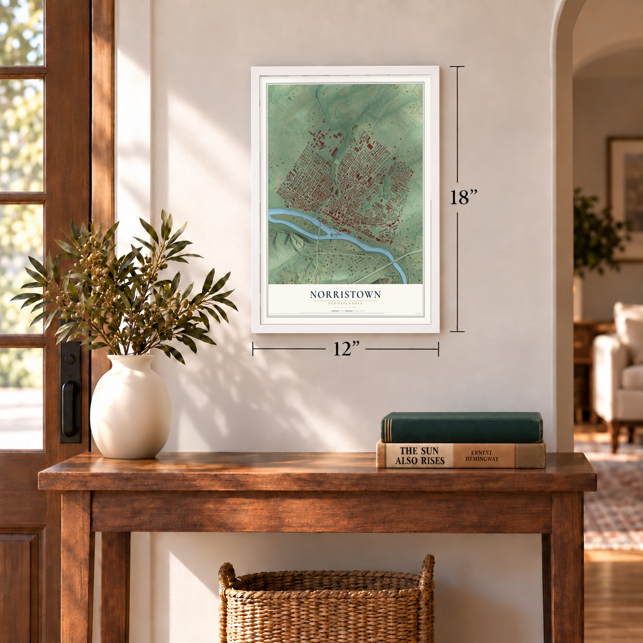
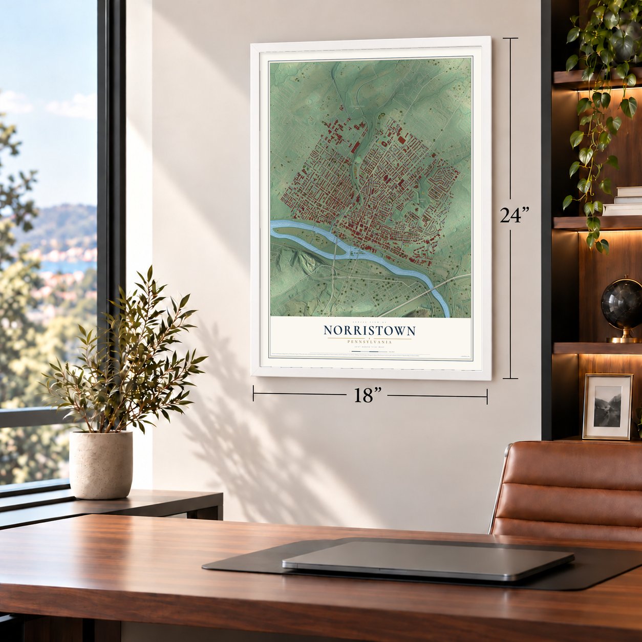
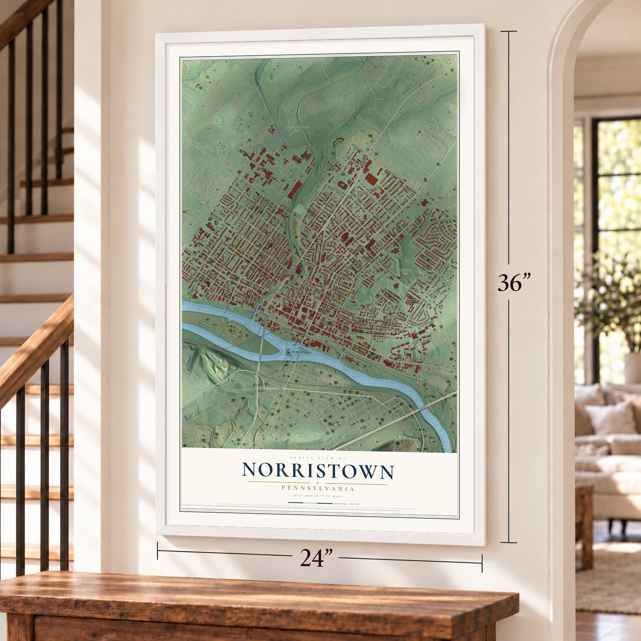
A new map of Norristown, Pennsylvania, made in 2026 and printed to order on thick archival matte paper.
12" x 18" Archival Matte Print
A Map of Home. A Work of Art.
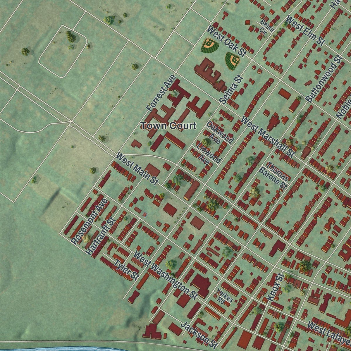
Explore Norristown, Pennsylvania from a whole new perspective. Created using aerial imagery and detailed geographic data, this map captures Norristown building by building, with labeled streets, familiar landmarks, and shaded topographical relief that highlights the natural contours of the landscape.
Combining modern data with the timeless character of a vintage atlas, this map is just as interesting up close as it is beautiful on the wall. Whether you grew up in Norristown, spent memorable years there, or call it home today, this unique map is a great way to celebrate a place that means something to you. Zoom in on the preview to look for your street, and then order a print to put your memories on the wall.

Three ways to hang it
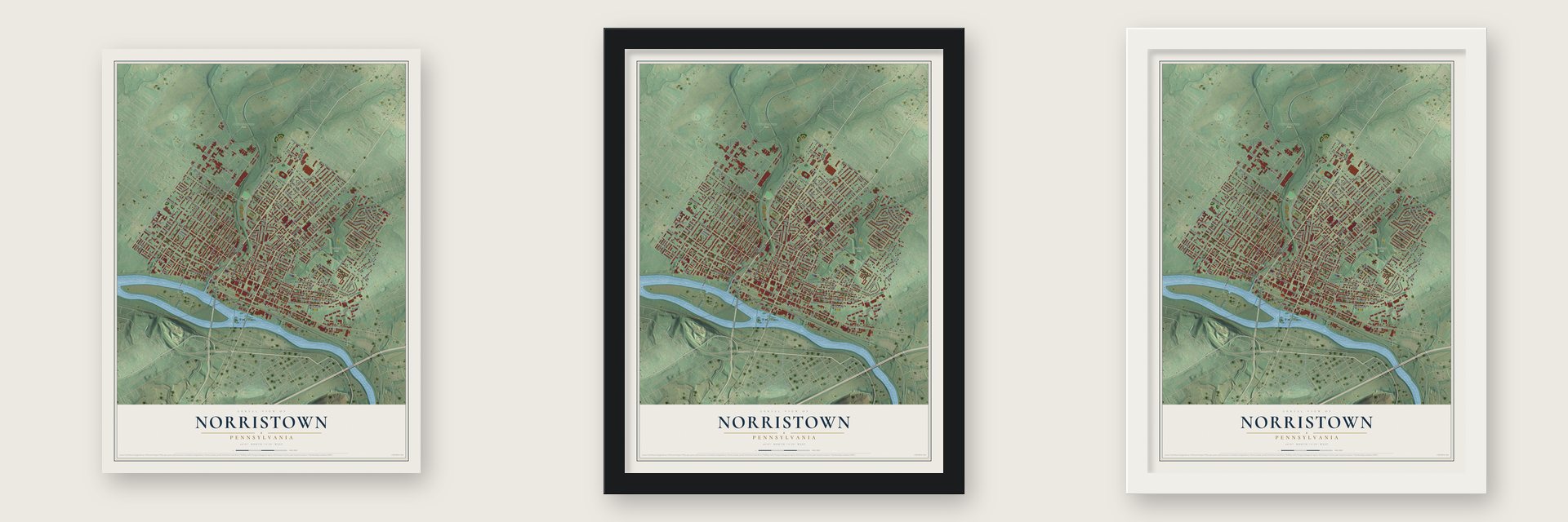
Unframed archival matte, a black wood frame or a white wood frame.
Up close
Geography Worth Displaying
This map was created using accurate cartographic data and authoritative geographic sources, including the U.S. Geological Survey and the Census Bureau. The map brings together terrain, waterways, roads, and building detail. The majority of the streets are labeled, houses are accurately depicted, and the topography is derived from government sources. Combining local data with carefully composed color and shading leads to this beautifully detailed Norristown artwork for your wall.
Rather than simply showing street outlines, we’ve included as many of the street names as we could reasonably fit on the map while keeping their names legible. Zoom in on the high resolution preview to see exactly what’s on the map. We truly set out to create a statement piece for anyone who loves Norristown. So whether it’s for you, or a gift for someone you love, we hope this map of Norristown brings back fond memories.
Read the story behind this map of Norristown, Pennsylvania from 2026.
About Norristown, Pennsylvania
Norristown is a borough of 35,748 people on the Schuylkill River, and it is the county seat of Montgomery County. Isaac Norris and William Trent bought this land together on October 7, 1704, paying 50¢ an acre. In 1712 Norris bought out Trent's share and built a gristmill at the bottom of what is now Water Street. When Montgomery County was formed in 1784, the settlement, then called the Town of Norris, became its seat.
Norristown was incorporated as a borough in 1812 with about 500 residents, and its borders grew in 1853. After the Civil War it boomed, as breweries, cigar factories, textile mills, foundries and rolling mills hired skilled workers. Irish families came in large numbers from the mid-1800s, and Italians followed around 1900. The borough had 22,265 people by 1900 and 38,181 by 1940, more than any other borough in Pennsylvania. After World War II, new malls in King of Prussia and Plymouth Meeting pulled shoppers away from downtown, and many factories closed or moved to industrial parks elsewhere in the county.
- A newspaper since 1799The Times Herald was founded on June 15, 1799, years before Norristown became a borough. It is still the town's daily paper, published seven days a week for readers across most of Montgomery County, and its staff still works in the borough.
- The Porter family homeA state historical marker notes the home of Andrew Porter, a general in the Revolution, where his sons were born. David R. Porter became governor of Pennsylvania in 1839, James M. Porter was Secretary of War in 1843, and George B. Porter governed Michigan Territory starting in 1831.
Find your street
Names on the Norristown map
Every name below is printed on this map. Look for your street, your school, the park where you played, or the pond down the road.
Places and landmarks6
- Norristown Municipal Hall
- Bartash Park
- Elmwood Park
- Norristown Farm Park
- Town Court
- Treemont Terrace
Streets and roads178
- Markley Street
- Dekalb Street
- Harding Boulevard
- Powell Street
- West Johnson Highway
- Johnson Highway
- East Johnson Highway
- East Elm Street
- West Spruce Street
- East Airy Street
- East Marshall Street
- West Wood Street
- East Fornance Street
- East Lafayette Street
- Wood Street
- East Main Street
- West Poplar Street
- Ford Street
- Stanbridge Street
- Arch Street
- West Lafayette Street
- West Main Street
- Locust Street
- West Airy Street
- Green Street
- Willow Street
- West Marshall Street
- Buttonwood Street
- West Washington Street
- West Elm Street
Show all 178 streets
- Forrest Avenue
- Noble Street
- New Hope Street
- Circle Drive
- Hamilton Street
- Haws Avenue
- West Oak Street
- Swede Street
- Astor Street
- Sterigere Street
- East Oak Street
- Chain Street
- Pine Street
- Selma Street
- Sandy Street
- East Washington Street
- Cherry Street
- West Sterigere Street
- East Basin Street
- Old Arch Road
- Tremont Avenue
- High Street
- East Moore Street
- Walnut Street
- Bringhurst Alley
- Maple Alley
- George Street
- Lower Farm Road
- East Roberts Street
- Beech Street
- West James Street
- Kohn Street
- Kelly Drive
- West Freedley Street
- West Fornance Street
- Green Valley Road
- Juniper Street
- Land Alley
- Violet Street
- Grady Alley
- East Chestnut Street
- Park Alley
- East Penn Street
- Barbadoes Street
- Cedar Street
- Calamia Drive
- East Wood Street
- East Jacoby Street
- Laurel Drive
- Oak Drive
- North Hills Drive
- West Logan Street
- East Freedley Street
- Dogwood Drive
- Glen Valley Drive
- Church Street
- East Brown Street
- East Spruce Street
- Regatta Circle
- West Penn Street
- Linda Lane
- Polk Alley
- Jackson Street
- Boyer Boulevard
- West Basin Street
- Hartranft Street
- Sandy Hill Road
- Dartmouth Drive
- Coolidge Boulevard
- Cooke Lane
- West Warren Street
- Natalie Lane
- Stony Creek Road
- View Drive
- Summit Street
- Zoo Drive
- Ross Alley
- Corson Street
- Bailey Alley
- Caroline Drive
- Franklin Alley
- Knox Street
- Gary Lane
- Schuylkill Avenue
- Janeway Drive
- James Street
- Thomas Street
- Rosemont Avenue
- Old Airy Street
- Pearl Street
- Budd Alley
- Kendrick Lane
- Boyer Place
- Water Street
- Tyler Street
- Eva Lane
- Birch Drive
- Maris Street
- Market Street
- Smith Street
- Piazza Street
- Ellis Street
- Lowerfarm Road
- Irons Alley
- East Logan Street
- West Brown Street
- Clay Alley
- Poplar Street
- Heavner Alley
- Northview Boulevard
- The Oval
- Spruce Street
- Norma Lane
- Thomas Barone Street
- Chestnut Alley
- Plymouth Boulevard
- West Egbert Alley
- Roosevelt Avenue
- Nassau Place
- Zummo Way
- Carmen Drive
- Linwood Avenue
- Oakwood Avenue
- Joseph Drive
- Brown Street
- Faircourt Avenue
- Lincoln Avenue
- Franklin Street
- Wayne Avenue
- Hart Alley
- Mill Street
- Gay Street
- New Street
- Luxor Lane
- Laura Lane
- Ann Street
- Hayden Alley
- Maple Street
- Russwood Drive
- Roberts Circle
- East Scott Alley
- Yerkes Road
- Willow Drive
- Belair Circle
- Redwood Lane
- Stauffer Alley
- Hickey Street
- Ross Street
Names are listed as they appear on the printed map. Zoom into the product photos to find them.
The art of mapping a place
How This Map Was Made
Real places. Remarkable detail. Discover the layers that turn geographic data into a map of home.

The view from above
Aerial imagery reveals the character of the land: woodland, open fields, and the patterns of a place.

The shape of the land
Elevation data brings hills, valleys, and subtle changes in the landscape into view.

The details of home
Roads, waterways, and building footprints come together to make the map feel unmistakably local.

Geography becomes art
Considered color, shading, and typography bring the layers together in a map made for your wall.


Process illustrated with Mendon, Massachusetts. Aerial imagery: USDA NAIP. Terrain: USGS 3D Elevation Program. Map details and finished artwork: KNOWOL.
The Details
About This Print
Choose an archival matte print, or a black or white Ayous wood frame. The archival matte print is unframed.
Select your size and finish above to see the matching product image and price.
Materials & Craftsmanship
A contemporary map with the character of a classic atlas, printed on archival matte paper. Optional frames are made from Ayous wood.
Your printed map does not include the watermark shown in the full-map preview.
Shipping & Delivery
Free shipping within the United States. Every print is made to order in the USA.
Buying a gift? Add a note in your cart and we'll include it. We never put prices in the package.
Prints ship within 2 to 3 business days. Allow 7 to 10 days total from ordering for delivery. Timing may vary during holidays or periods of high order volume.
Read our shipping policy.
Returns and damaged prints
Each print is made to order. Change-of-mind refunds are not available after production.
If your print arrives damaged, misprinted or incorrect, contact support@knowol.com within 30 days of receiving it. Include your order number, photos and a description of the issue.
Read our full refund and replacement policy. For questions about your order, email support@knowol.com.
Find your town
Looking for another city?
Find a map of home in our Pennsylvania collection, or any town in the country.
Nearby
Maps of towns near Norristown
Know someone from one of these towns? Their map makes a great gift.
 Bridgeport
, Pennsylvania
From $39.99See the map
 Swedesburg
, Pennsylvania
From $39.99See the map
 West Norriton
, Pennsylvania
From $39.99See the map
More maps nearby: East Norriton, Swedeland, Plymouth, King of Prussia and Upper Merion.