
Search for another town





Free U.S. delivery 7 to 10 days after you order
King of Prussia, Pennsylvania Map Art
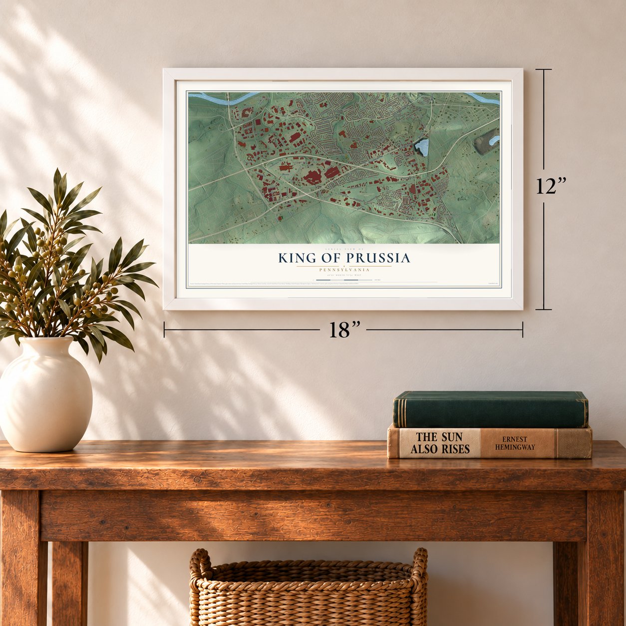
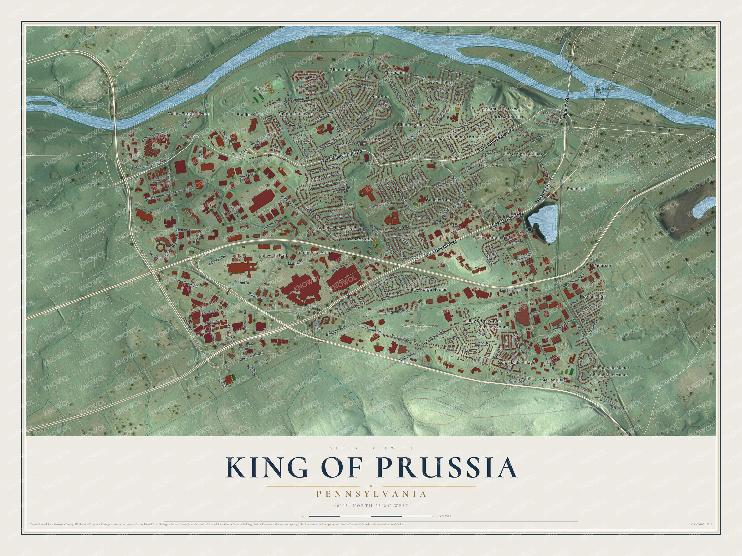
A new map of King of Prussia, Pennsylvania, made in 2026 and printed to order on thick archival matte paper.
12" x 18" Archival Matte Print
A Map of Home. A Work of Art.
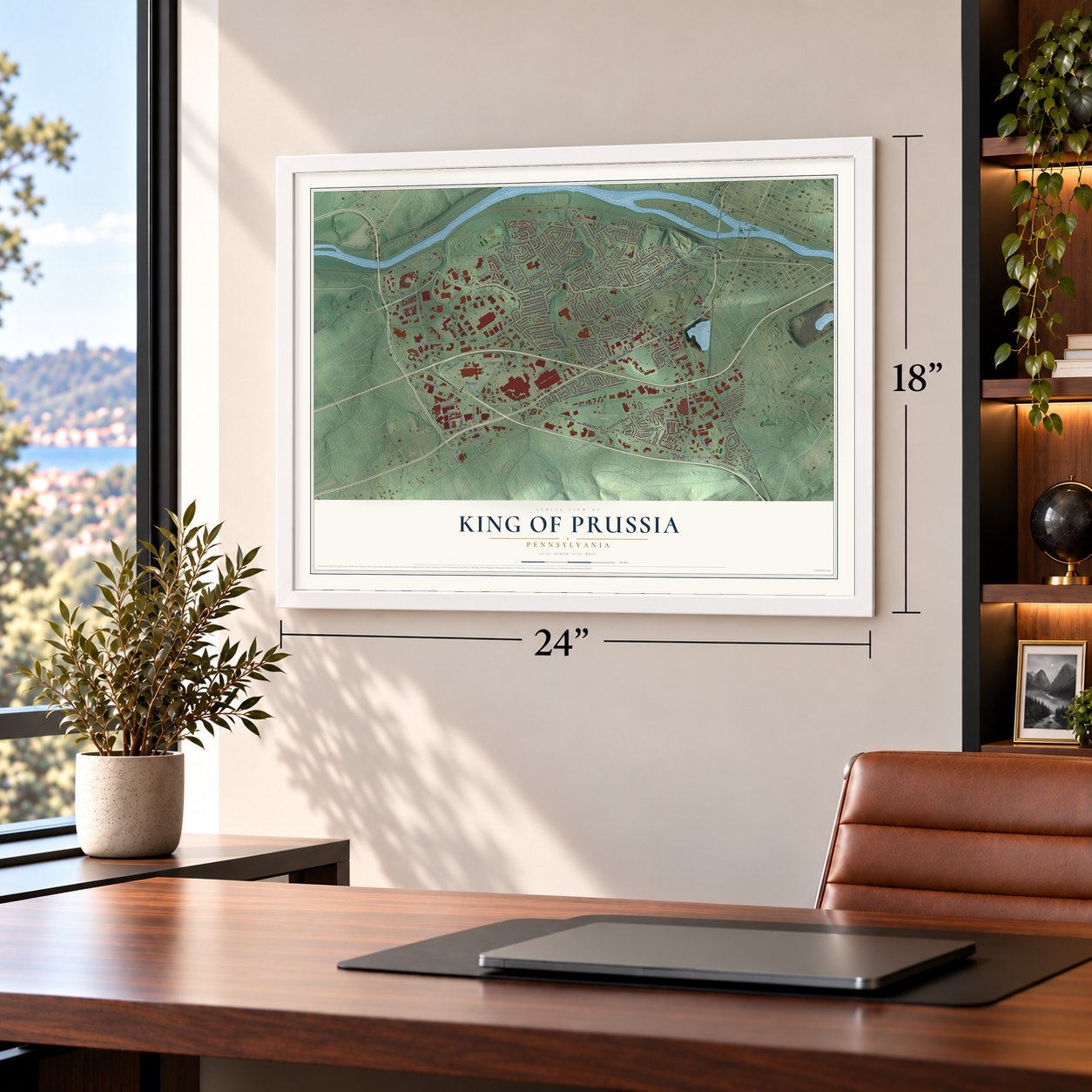
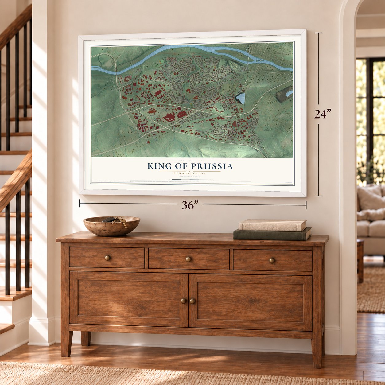
Explore King of Prussia, Pennsylvania from a whole new perspective. Created using aerial imagery and detailed geographic data, this map captures King of Prussia building by building, with labeled streets, familiar landmarks, and shaded topographical relief that highlights the natural contours of the landscape.
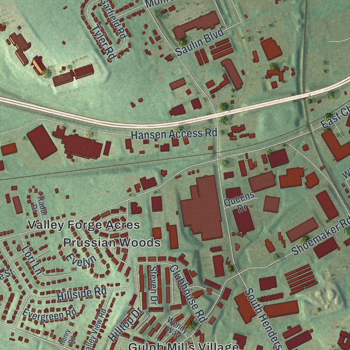
Combining modern data with the timeless character of a vintage atlas, this map is just as interesting up close as it is beautiful on the wall. Whether you grew up in King of Prussia, spent memorable years there, or call it home today, this unique map is a great way to celebrate a place that means something to you. Zoom in on the preview to look for your street, and then order a print to put your memories on the wall.
Three ways to hang it
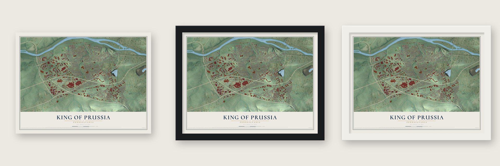
Unframed archival matte, a black wood frame or a white wood frame.
Up close
Geography Worth Displaying
This map was created using accurate cartographic data and authoritative geographic sources, including the U.S. Geological Survey and the Census Bureau. The map brings together terrain, waterways, roads, and building detail. The majority of the streets are labeled, houses are accurately depicted, and the topography is derived from government sources. Combining local data with carefully composed color and shading leads to this beautifully detailed King of Prussia artwork for your wall.
Rather than simply showing street outlines, we’ve included as many of the street names as we could reasonably fit on the map while keeping their names legible. Zoom in on the high resolution preview to see exactly what’s on the map. We truly set out to create a statement piece for anyone who loves King of Prussia. So whether it’s for you, or a gift for someone you love, we hope this map of King of Prussia brings back fond memories.
Read the story behind this map of King of Prussia, Pennsylvania from 2026.

About King of Prussia, Pennsylvania
King of Prussia is a community of 24,695 people in Upper Merion Township, Montgomery County. It grew up where Swedesford Road crossed Gulph Road, and it was first called Reesville, after William and Janet Rees. These Welsh Quakers built a cottage at the crossroads in 1719. In 1769 the cottage became an inn, a day's ride on horseback from Philadelphia, and settlers bound for Ohio often spent their first night there.
In 1774 the Rees family put James Berry in charge of the inn, and people called it Berry's Tavern. George Washington first stopped there on Thanksgiving Day in 1777, a few weeks before his army made camp at Valley Forge. A local petition of 1786 used the name King of Prussia, which honors Frederick the Great. The post office has carried that name since 1837.
- An inn saved twiceSwedesford Road became part of U.S. Route 202 in 1935. In 1952 the state highway department planned to widen it to four lanes and tear down the King of Prussia Inn. Preservationists talked the state into building the lanes on either side of it instead. The inn then sat sealed and fenced on a median island for years. A new widening was proposed in 1997, so the building was moved to a nearby site in 2000.
- A Welsh school about 1740The Welsh settlers of the township built their first schoolhouse around 1740. It stood in Matthew Roberts' woods, beside what the county history of 1884 called the State road, less than half a mile east of the old inn.
- Anna Morris HolsteinAnna Morris Holstein lived at 211 South Henderson Road, where a state historical marker now stands. She worked as a Civil War nurse and hospital matron at Gettysburg and in Virginia and Maryland, and she helped save Mount Vernon. She also led the effort to buy, preserve and restore Washington's Headquarters at Valley Forge. Those grounds became Pennsylvania's first state park and are now a national historical park.
- Plowshares in 1980Daniel and Philip Berrigan launched the Plowshares Movement in 1980 with a protest at a General Electric plant in King of Prussia that made weapons. Emile de Antonio retold the protest and the trial of the Plowshares Eight in his 1983 film, In the King of Prussia.
- One mall from two in 2016The Pennsylvania Turnpike and the Schuylkill Expressway were built near the old crossroads in the late 1950s, and a building boom followed. The King of Prussia mall grew up in that boom as two separate sections, The Plaza and The Court. A new corridor joined them into a single mall in 2016.
Find your street
Names on the King of Prussia map
Every name below is printed on this map. Look for your street, your school, the park where you played, or the pond down the road.
Places and landmarks34
- School Side Manor
- Schoolside Manor
- Heuser Park
- Valley Forge Memorial Gardens
- Abrahams
- Beidler Knoll
- Belmont Terrace
- Brandywine Village
- Candle Brook
- Cannon Run
- Cannon Run West
- Cinnamon Hill
Show all 34 places
- Continental Arms
- Crestwyck
- Dartmouth Hills
- Eastburn Terrace
- Forge Spring Village
- Glenn Rose
- Gulph Mills Village
- Henderson
- Henderson Park
- Hidden Valley
- Hughes Park
- Lafayette Park
- Lowell Hills
- Merion Hills
- Merion View
- Prussian Woods
- Shainline
- Sweet Briar
- Valley Forge Acres
- Valley Forge Homes
- Valley Forge Towers
- Washington Park
Streets and roads187
- West Dekalb Pike
- West Valley Forge Road
- East Valley Forge Road
- East Dekalb Pike
- Markley Street
- Henderson Road
- North Gulph Road
- North Henderson Road
- South Gulph Road
- Moore Road
- Old Valley Forge Road
- Montgomery Avenue
- Market Street
- Crooked Lane
- Valley Forge Circle
- Mall Boulevard
- West Beidler Road
- Allendale Road
- South Henderson Road
- First Avenue
- Crossfield Road
- Bill Smith Boulevard
- Prince Frederick Street
- West Church Road
- Kingwood Road
- Hansen Access Road
- Goddard Boulevard
- Keebler Road
- Ross Road
- Old Fort Road
Show all 187 streets
- Anderson Road
- Billsmith Boulevard
- Abrams Mill Road
- Shoemaker Road
- Guthrie Road
- Conrad Drive
- Anthony Road
- East Church Road
- Saulin Boulevard
- Penn Circle
- Covered Bridge Road
- Devon Park Drive
- Yerkes Road
- Caley Road
- General Armstrong Road
- Powderhorn Road
- Freedom Business Center Drive
- Riverview Road
- Glenn Rose Circle
- Hillside Road
- Hidden Valley Road
- Cambridge Road
- Village Drive
- Boro Line Road
- School Line Drive
- Hillview Road
- Jasper Road
- Walker Lane
- Deer Creek Drive
- Abrams Road
- Hansen Road
- Clubhouse Road
- Croton Road
- American Avenue
- Pulaski Drive
- Saratoga Road
- Long Road
- Fifth Avenue
- Chelsea Drive
- Bernard Drive
- Sweetbriar Road
- Tyler Road
- Monroe Boulevard
- Susan Drive
- Rees Drive
- Redwood Road
- Beidler Road
- General Learned Road
- Wills Road
- North Charles Drive
- Foulkrod Boulevard
- Hilltop Drive
- Nancy Lane
- George Drive
- Regimental Road
- West Eighth Avenue
- Maiden Lane
- Dorothy Drive
- Suellen Drive
- Lori Lane
- Third Avenue
- Clark Avenue
- Somerset Place
- Weadley Road
- Kirk Avenue
- Bryce Lane
- Rebel Road
- Arnold Road
- Jean Drive
- Meyers Road
- Lincoln Road
- Park Avenue
- Wilson Road
- Evelyn
- County Line Road
- Shaffer Road
- North Crossfield Road
- Brownlie Road
- Hampton Road
- Sweetbriar Circle
- Geerdes Boulevard
- East Signal Hill Road
- Champlain Drive
- South Warner Road
- Mancill Mill Road
- Thomas Drive
- White Avenue
- General Muhlenberg Road
- Jamie Circle
- Springdell Road
- Heritage Lane
- Candlebrook Road
- Pinecrest Drive
- Vandenburg Boulevard
- Hawthorn Road
- Spring Lane
- Green Hill Road
- Crestwyck Drive
- Town Center Road
- Fawn Circle
- Old Route 202
- North Warner Road
- Independence Road
- Evergreen Road
- East Eighth Avenue
- Garfield Road
- West Ninth Avenue
- Deep Hollow Road
- Ivy Lane
- Flintlock Road
- Bluebuff Road
- Continental Road
- Norwyck Drive
- Tulip Lane
- Crockett Road
- James Street
- Rosehill Drive
- Steven Drive
- Lowell Terrace
- Grove Street
- Gypsy Lane
- Queens Drive
- Sharon Court
- Petty Lane
- Park Lane
- Lower East Valley Forge Road
- Justus Barber Drive
- Elliott Drive
- Hunters Run Road
- Concord Circle
- Valley View Road
- Belmont Road
- Hamlet Drive
- Jonathan Drive
- North Colmar Drive
- Traymore Avenue
- Lewis Road
- Forge Road
- Mark Lane
- Musket Road
- King of Prussia Road
- Radar Drive
- Wendy Way
- Avon Road
- Glennrose Circle
- East Swedesford Road
- Dartmouth Drive
- Springhouse Road
- Britton Drive
- Edgewood Road
- Strawberry Lane
- Forge Springs Lane
- Glen Arbor Court
- Adams Road
- Nantucket Circle
- Leonard Drive
- Henry Road
Names are listed as they appear on the printed map. Zoom into the product photos to find them.
The art of mapping a place
How This Map Was Made
Real places. Remarkable detail. Discover the layers that turn geographic data into a map of home.

The view from above
Aerial imagery reveals the character of the land: woodland, open fields, and the patterns of a place.

The shape of the land
Elevation data brings hills, valleys, and subtle changes in the landscape into view.

The details of home
Roads, waterways, and building footprints come together to make the map feel unmistakably local.

Geography becomes art
Considered color, shading, and typography bring the layers together in a map made for your wall.


Process illustrated with Mendon, Massachusetts. Aerial imagery: USDA NAIP. Terrain: USGS 3D Elevation Program. Map details and finished artwork: KNOWOL.
The Details
About This Print
Choose an archival matte print, or a black or white Ayous wood frame. The archival matte print is unframed.
Select your size and finish above to see the matching product image and price.
Materials & Craftsmanship
A contemporary map with the character of a classic atlas, printed on archival matte paper. Optional frames are made from Ayous wood.
Your printed map does not include the watermark shown in the full-map preview.
Shipping & Delivery
Free shipping within the United States. Every print is made to order in the USA.
Buying a gift? Add a note in your cart and we'll include it. We never put prices in the package.
Prints ship within 2 to 3 business days. Allow 7 to 10 days total from ordering for delivery. Timing may vary during holidays or periods of high order volume.
Read our shipping policy.
Returns and damaged prints
Each print is made to order. Change-of-mind refunds are not available after production.
If your print arrives damaged, misprinted or incorrect, contact support@knowol.com within 30 days of receiving it. Include your order number, photos and a description of the issue.
Read our full refund and replacement policy. For questions about your order, email support@knowol.com.
Find your town
Looking for another city?
Find a map of home in our Pennsylvania collection, or any town in the country.
Nearby
Maps of towns near King of Prussia
Know someone from one of these towns? Their map makes a great gift.
 Upper Merion
, Pennsylvania
From $39.99See the map
 Bridgeport
, Pennsylvania
From $39.99See the map
 West Norriton
, Pennsylvania
From $39.99See the map
More maps nearby: Swedeland, Swedesburg, Norristown, Audubon and West Conshohocken.