


Search for another town





Free U.S. delivery 7 to 10 days after you order
North Canaan, Connecticut Map Art
Building by building, with labeled streets and shaded relief.
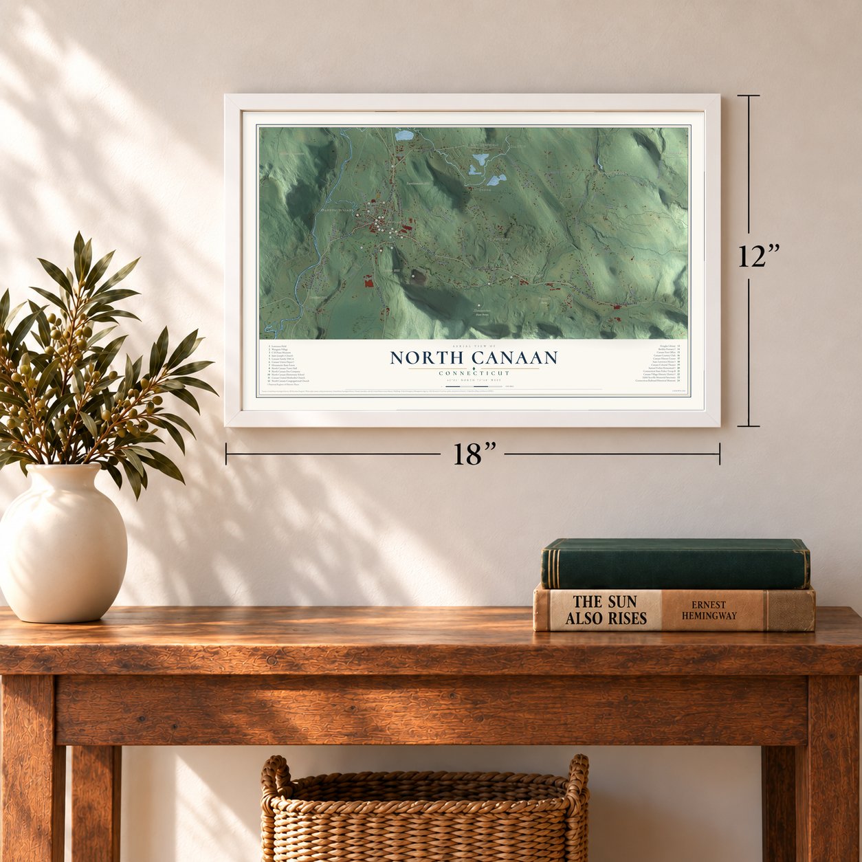
12" x 18" Archival Matte Print
A Map of Home. A Work of Art.
Explore North Canaan, Connecticut from a whole new perspective. Created using aerial imagery and detailed geographic data, this map captures North Canaan building by building, with labeled streets, familiar landmarks, and shaded topographical relief that highlights the natural contours of the landscape.
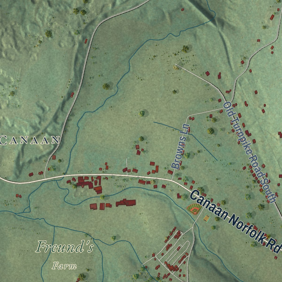
Combining modern data with the timeless character of a vintage atlas, this map is just as interesting up close as it is beautiful on the wall. Whether you grew up in North Canaan, spent memorable years there, or call it home today, this unique map is a great way to celebrate a place that means something to you. Zoom in on the preview to look for your street, and then order a print to put your memories on the wall.

Three ways to hang it
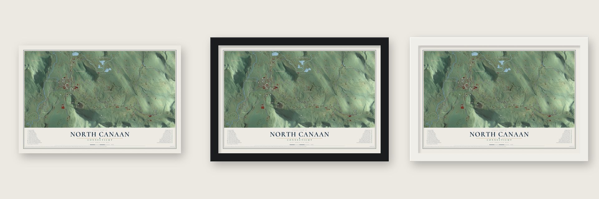
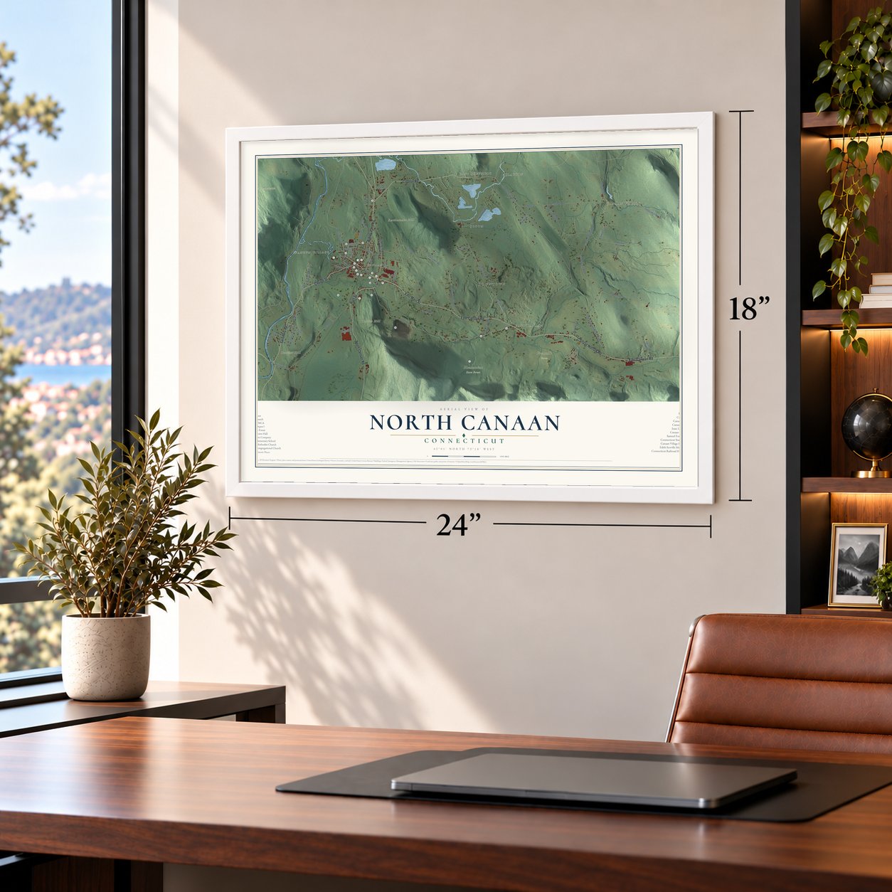
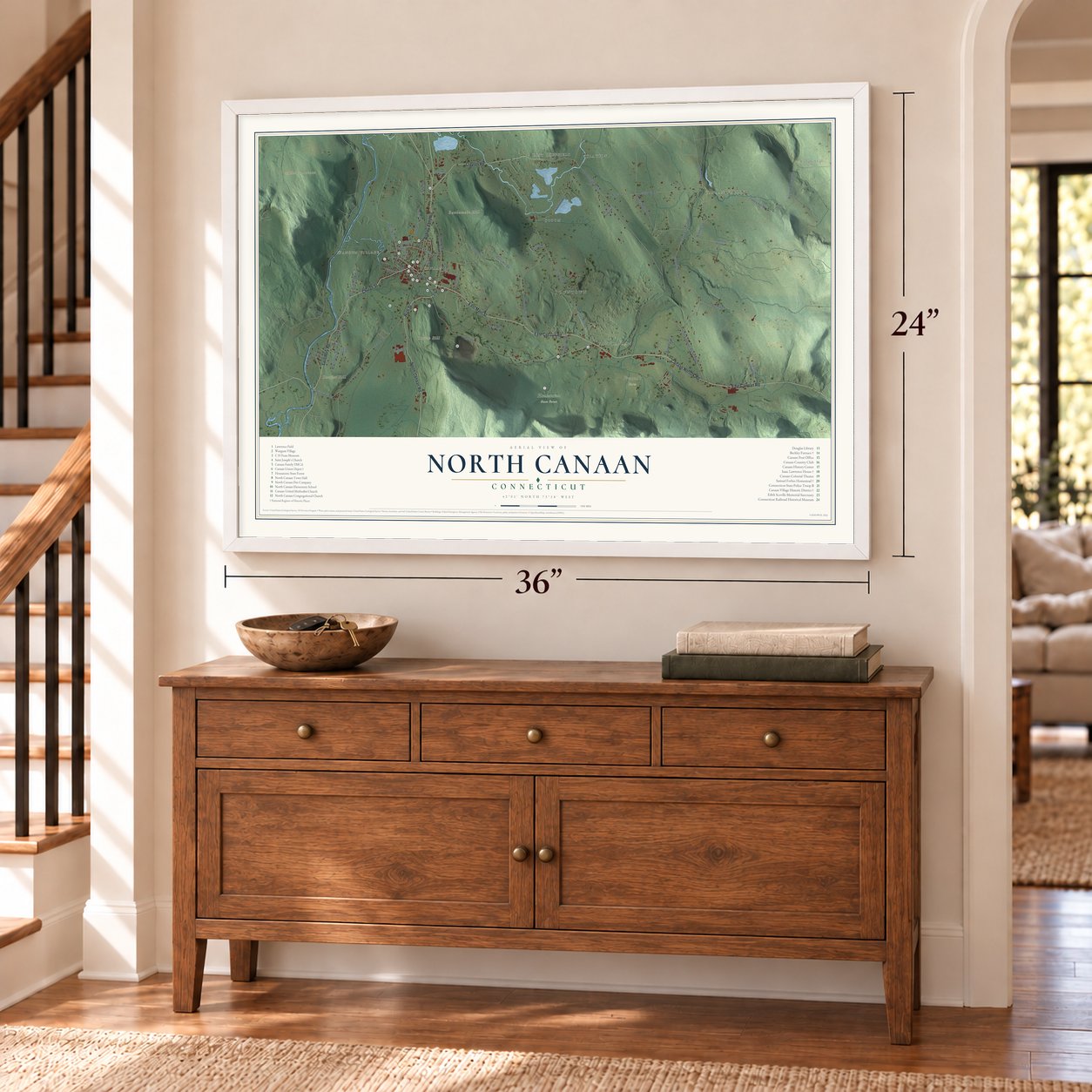
Unframed archival matte, a black wood frame or a white wood frame.
Up close
Geography Worth Displaying
This map was created using accurate cartographic data and authoritative geographic sources, including the U.S. Geological Survey (USGS) and FEMA. The map brings together terrain, waterways, roads, and building detail. The majority of the streets are labeled, houses are accurately depicted, and the topography is derived from government sources. Combining local data with carefully composed color and shading leads to this beautifully detailed North Canaan artwork for your wall.
Rather than simply showing street outlines, we’ve included as many of the street names as we could reasonably fit on the map while keeping their names legible. Zoom in on the high resolution preview to see exactly what’s on the map. We truly set out to create a statement piece for anyone who loves North Canaan. So whether it’s for you, or a gift for someone you love, we hope this map of North Canaan brings back fond memories.
Explore the full map of North Canaan, Connecticut and read about the local places it shows.

Find your street
Names on the North Canaan map
Every name below is printed on this map. Look for your street, your school, the park where you played, or the pond down the road.
Places and landmarks16
- Downtown
- Canaan Valley
- Wangum Village
- Church Hill
- Dutcher Hill
- Miles Mountain
- Rattlesnake Hill
- Campbell Falls
- Case Pond
- Freund's Farm
- Housatonic State Forest
- East Sheffield
Show all 16 places
- Sodom
- Clayton
- East Canaan
- Canaan
Streets and roads64
- East Main Street
- Church Street
- East Canaan Road
- High Street
- Salisbury Road
- Ashley Falls Road
- Canaan Norfolk Road
- South Canaan Road
- Clayton Road
- Lower Road
- West Main Street
- Tone Drive
- Canaan Valley Road
- Allyndale Road
- College Hill Road
- Old Turnpike North
- Sand Road
- Daisy Hill Road
- Tobey Hill Road
- Moses Mead Road
- Trescott Hill Road
- Old Turnpike Road South
- Sodom Road
- North Elm Street
- Carlson Road
- Emmons Lane
- Granger Lane
- Greene Avenue
- Casey Hill Road
- New Street
Show all 64 streets
- Browns Lane
- Boinay Hill Road
- Bragg Street
- Norfolk No Canaan
- Burton Lane
- Housatonic Avenue
- Deely Road
- Highland Avenue
- Orchard Road
- Whiting Drive
- Hadsell Street
- Reed Street
- Barlow Street
- Marilyn Drive
- Hollow Brook Lane
- Locust Hill Way
- Raymond Avenue
- Pease Street
- Barracks Road
- Furnace Hill Road
- Lime Kiln Road
- Cemetery Road
- Birch Lane
- Grace Way
- Mountain View Lane
- Patty Lane
- Ryan Avenue
- Main Street
- Honey Hill Road
- Granite Avenue
- Prospect Street
- Quinn Street
- Elm Street
- New High Street
Names are listed as they appear on the printed map. Zoom into the product photos to find them.
About North Canaan, Connecticut
North Canaan is a town of 3,211 people in Litchfield County, on the Massachusetts line. In 1738 the township of Canaan, which then included this land, was sold at auction in New London, and two years later Daniel and Isaac Lawrence brought their families to look it over. In 1769 eleven members of Canaan's First Church broke away to form their own church in the northern society, and in 1858 that northern half was incorporated as North Canaan. Its village center kept the old name, Canaan.
Iron came first here. Blacksmiths hammered anchors on the Blackberry River, and later furnaces in East Canaan turned out pig iron. By 1887 the town had 1,803 people who lived by farming, pig iron and lime. Lime outlasted iron: in 1895 five firms were burning it, and the Canfield brothers by themselves sent out over thirty thousand barrels each year.
“Canaan does not forget that the marble with which it is built came from one of her inexhaustible quarries.”
- Anchors hauled to BostonBlacksmith Samuel Forbes built his first forge on "the island" just east of his house on the Blackberry River. There men with sledges of up to 56 pounds hammered ship anchors weighing as much as two tons, and ox teams hauled them to Boston on trips of a month to six weeks. In 1762 Forbes joined Ethan Allen to open a Lakeville blast furnace, which the state had him run during the Revolution to arm the Continental Army.
- The doorstep at the tavernIsaac Lawrence, an early settler, built his Elm Street house in 1751. It was a stagecoach tavern on the roads to Hartford, Poughkeepsie and Albany, and its trade grew after the Hartford-Albany Turnpike opened in 1800. Its stone doorstep named Captain Lawrence, his wife and their eleven children, and in 1838 Nathaniel Hawthorne found it odd to put a family record underfoot. Lawrence's family still owned it when the Isaac Lawrence House joined the National Register in 1983.
- Beckley Furnace, 1847In 1847 John Adam Beckley built a 40-foot stone blast furnace on the Blackberry River to produce pig iron. Barnum, Richardson and Company bought it in 1858, just as North Canaan became its own town, and it kept running until it made its last iron in 1919. The state turned the site into a park in 1946, the Beckley Furnace was named to the National Register in 1978, and in 1999 the stack was restored.
- Where two railroads crossedThe Union Depot went up in 1872 where the Housatonic line crossed the Connecticut Western, and the junction made Canaan a market town for the region. Its three-story tower held the telegraph operator, and a large restaurant fed travelers before dining cars. Passenger service ended in 1971, and arson burned more than half the station in 2001. The Connecticut Railroad Historical Association rebuilt the rest, and an accordion museum holding over 400 instruments opened there in 2021.
Keep exploring Connecticut
North Canaan is one of 382 Connecticut towns we've mapped. Every dot on the map is a print of its own.
The search covers every state, Connecticut first.
Near North Canaan
Order 2 or more town maps and save 10%. Shown in the size and finish you picked above, so they hang as a set.
- Canaan 12" x 18" / Archival Matte Print $39.99
- Falls Village 12" x 18" / Archival Matte Print $39.99
- Norfolk 12" x 18" / Archival Matte Print $39.99


More maps nearby: Salisbury, Lakeville, West Cornwall, Winchester and Colebrook.
The art of mapping a place
How This Map Was Made
Real places. Remarkable detail. Discover the layers that turn geographic data into a map of home.

The view from above
Aerial imagery reveals the character of the land: woodland, open fields, and the patterns of a place.

The shape of the land
Elevation data brings hills, valleys, and subtle changes in the landscape into view.

The details of home
Roads, waterways, and building footprints come together to make the map feel unmistakably local.

Geography becomes art
Considered color, shading, and typography bring the layers together in a map made for your wall.


Process illustrated with Mendon, Massachusetts. Aerial imagery: USDA NAIP. Terrain: USGS 3D Elevation Program. Map details and finished artwork: KNOWOL.
The Details
About This Print
Choose an archival matte print, or a black or white Ayous wood frame. The archival matte print is unframed.
Select your size and finish above to see the matching product image and price.
Materials & Craftsmanship
A contemporary map with the character of a classic atlas, printed on archival matte paper. Optional frames are made from Ayous wood.
Your printed map does not include the watermark shown in the full-map preview.
Shipping & Delivery
Free shipping within the United States. Every print is made to order in the USA.
Buying a gift? Add a note in your cart and we'll include it. We never put prices in the package.
Prints ship within 2 to 3 business days. Allow 7 to 10 days total from ordering for delivery. Timing may vary during holidays or periods of high order volume.
Read our shipping policy.
Returns and damaged prints
Each print is made to order. Change-of-mind refunds are not available after production.
If your print arrives damaged, misprinted or incorrect, contact support@knowol.com within 30 days of receiving it. Include your order number, photos and a description of the issue.
Read our full refund and replacement policy. For questions about your order, email support@knowol.com.