
Search for another town





Free U.S. delivery 7 to 10 days after you order
North Canton, Ohio Map Art
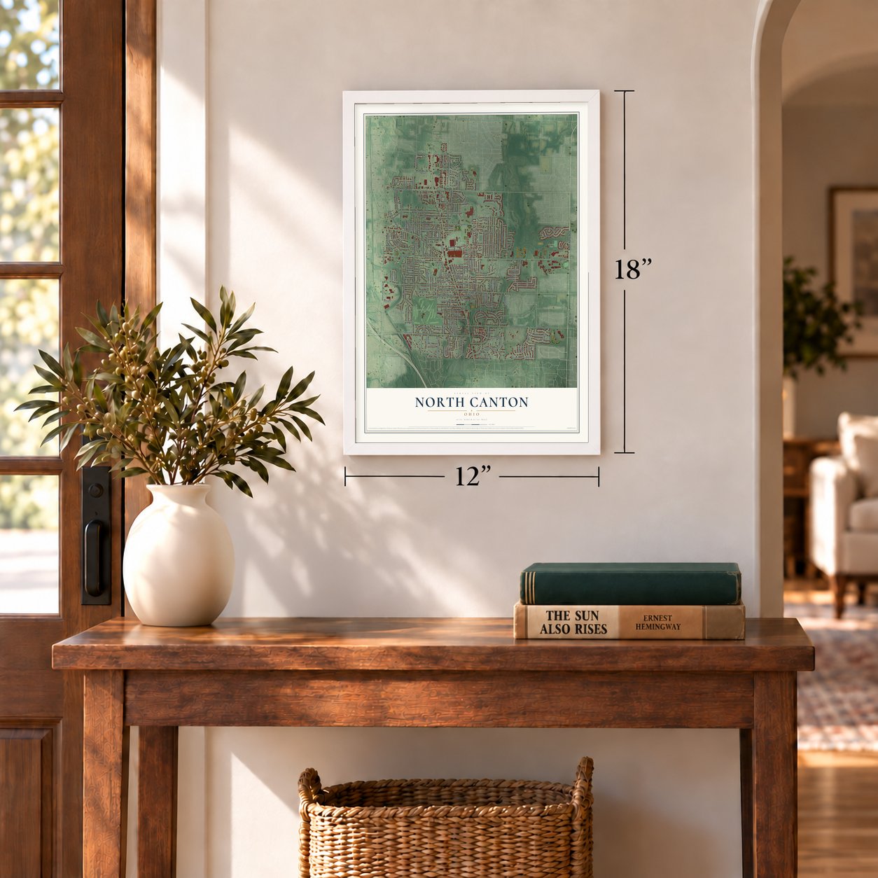
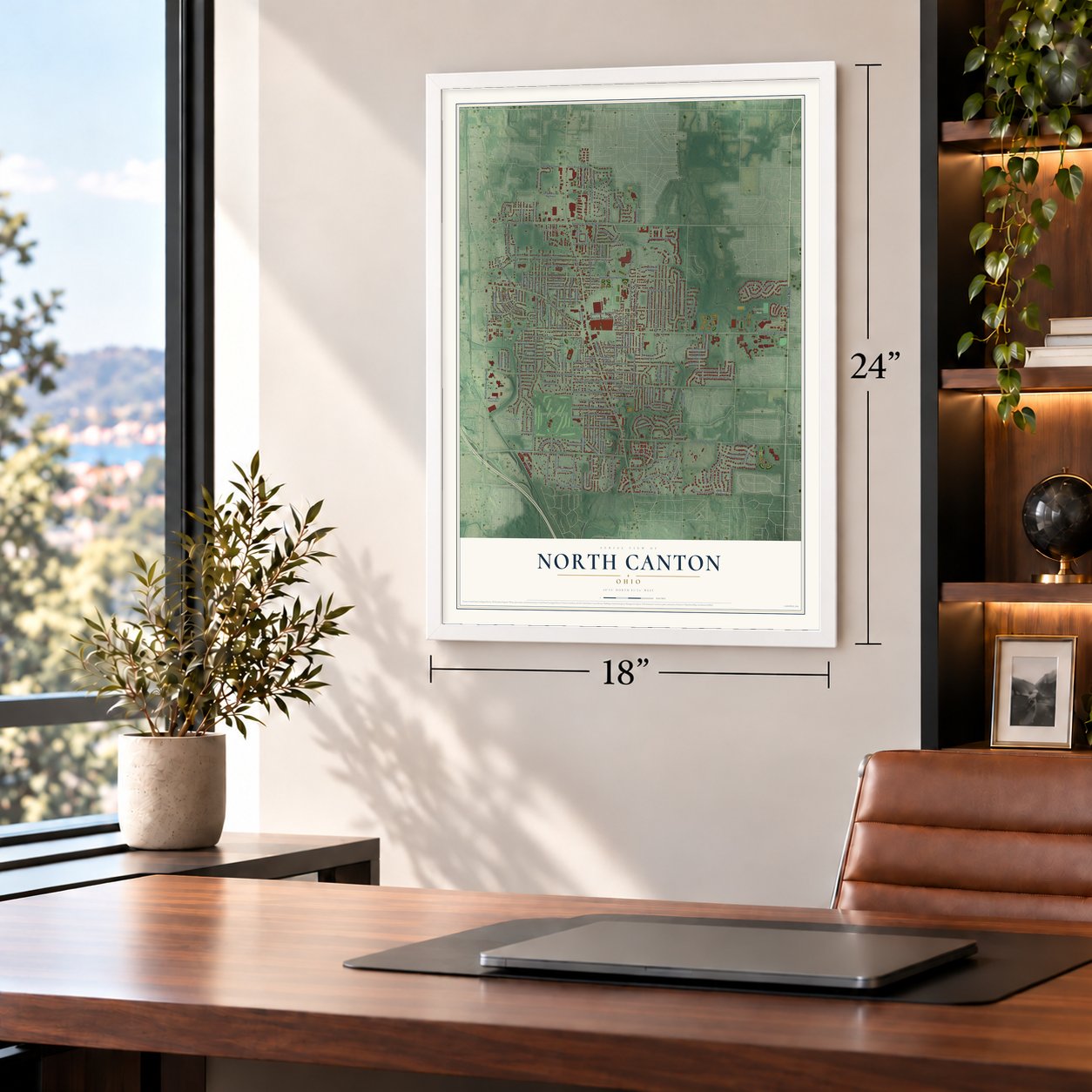
A new map of North Canton, Ohio, made in 2026 and printed to order on thick archival matte paper.
12" x 18" Archival Matte Print
A Map of Home. A Work of Art.
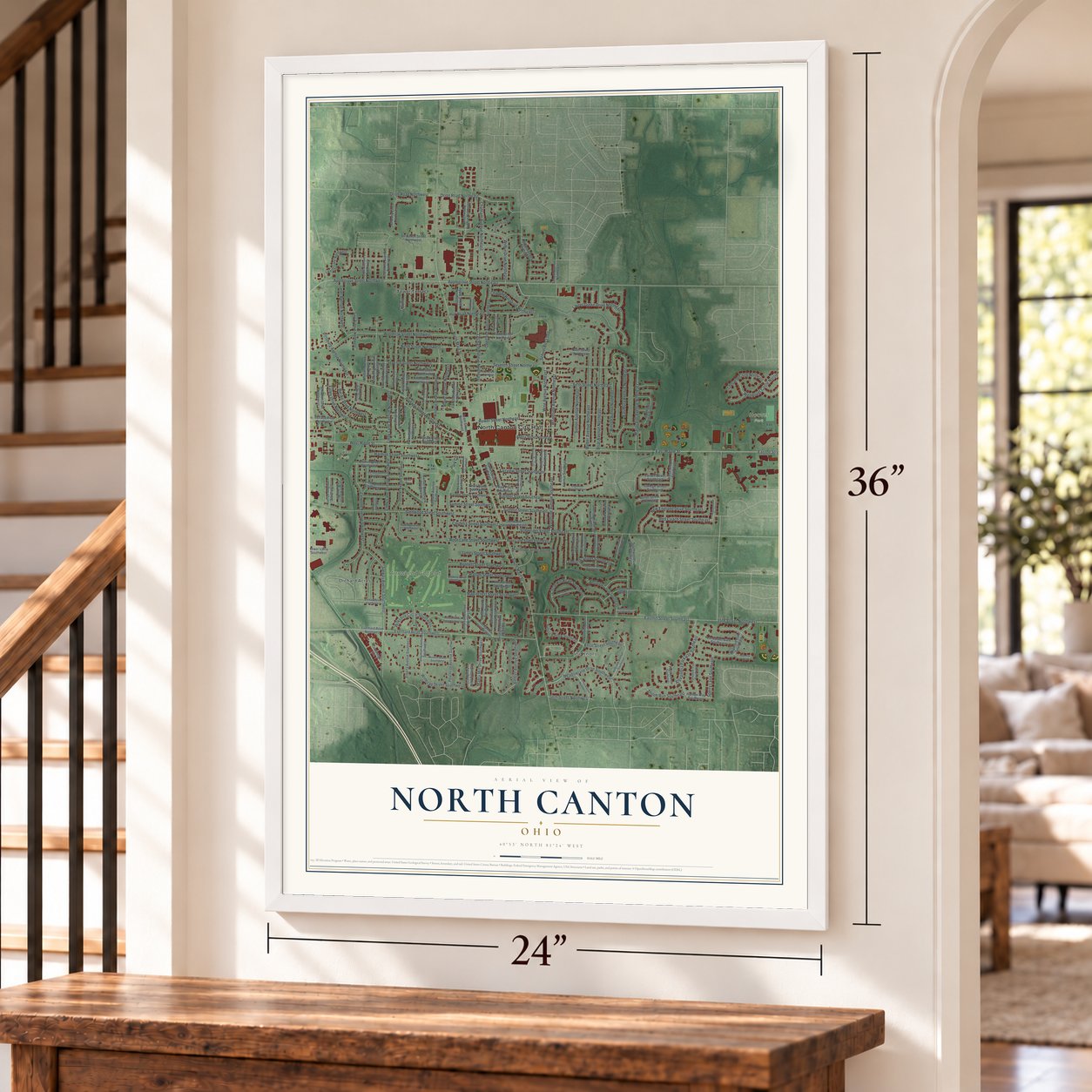
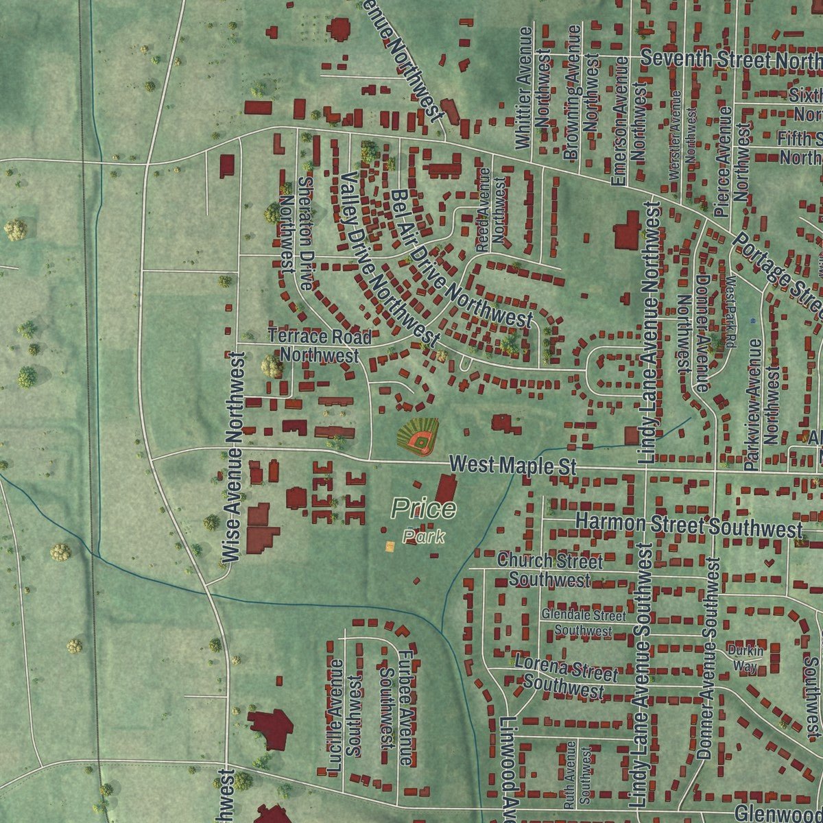
Explore North Canton, Ohio from a whole new perspective. Created using aerial imagery and detailed geographic data, this map captures North Canton building by building, with labeled streets, familiar landmarks, and shaded topographical relief that highlights the natural contours of the landscape.
Combining modern data with the timeless character of a vintage atlas, this map is just as interesting up close as it is beautiful on the wall. Whether you grew up in North Canton, spent memorable years there, or call it home today, this unique map is a great way to celebrate a place that means something to you. Zoom in on the preview to look for your street, and then order a print to put your memories on the wall.

Three ways to hang it
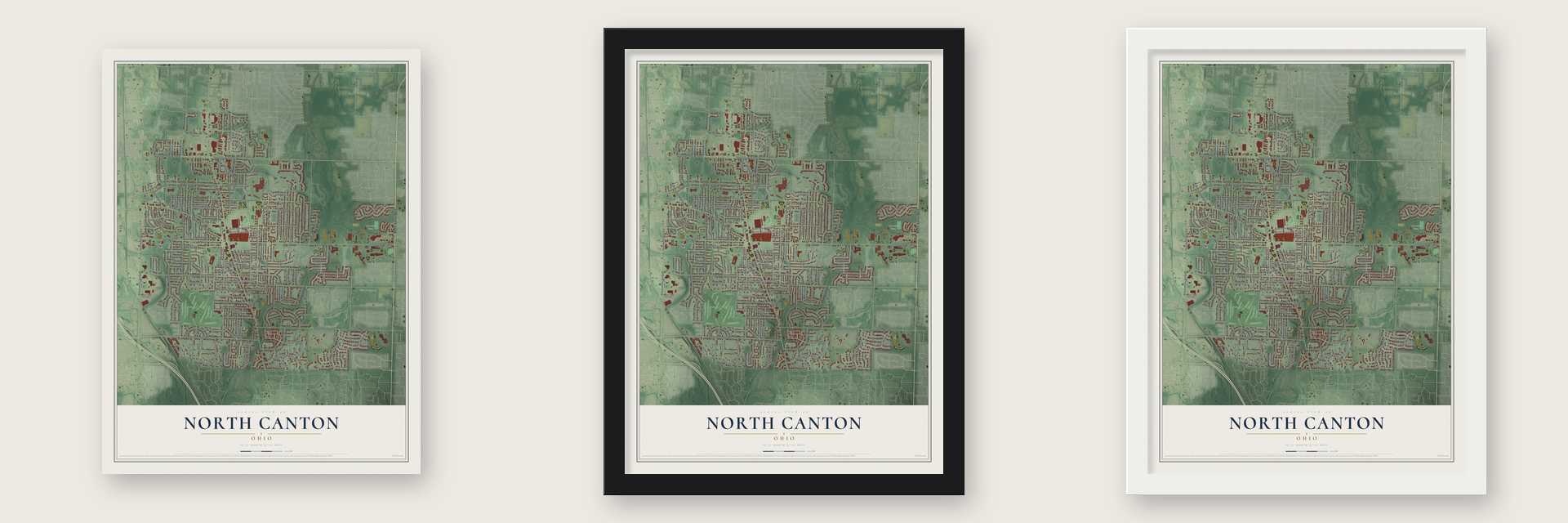
Unframed archival matte, a black wood frame or a white wood frame.
Up close
Geography Worth Displaying
This map was created using accurate cartographic data and authoritative geographic sources, including the U.S. Geological Survey and the Census Bureau. The map brings together terrain, waterways, roads, and building detail. The majority of the streets are labeled, houses are accurately depicted, and the topography is derived from government sources. Combining local data with carefully composed color and shading leads to this beautifully detailed North Canton artwork for your wall.
Rather than simply showing street outlines, we’ve included as many of the street names as we could reasonably fit on the map while keeping their names legible. Zoom in on the high resolution preview to see exactly what’s on the map. We truly set out to create a statement piece for anyone who loves North Canton. So whether it’s for you, or a gift for someone you love, we hope this map of North Canton brings back fond memories.
Read the story behind this map of North Canton, Ohio from 2026.

About North Canton, Ohio
North Canton is a city in Stark County with a 2020 population of 17,842. Established as New Berlin in 1831, the community took its present name in 1918. Its history is closely associated with the Hoover Company, while institutions such as Walsh University continue to shape local life.
- New Berlin OriginsGerman settlers established New Berlin on February 19, 1831, and the community changed its name to North Canton in 1918.
- Vacuum Cleaner LegacyJames M. Spangler invented the first upright vacuum cleaner locally in June 1908, and William H. Hoover later purchased the patent.
- Walsh UniversityWalsh University is a private Catholic institution offering undergraduate and graduate degrees to about 2,500 students.
- Local WaterwayThe West Branch of Nimishillen Creek flows through North Canton.
Find your street
Names on the North Canton map
Every name below is printed on this map. Look for your street, your school, the park where you played, or the pond down the road.
Places and landmarks7
- North Canton City Hall
- The Knolls
- Hoover Park
- Price Park
- Orchard Acres
- Tower Terrace
- Arrowhead Golf Club
Streets and roads186
- Market Avenue North
- East Maple Street
- North Main Street
- Applegrove Street Northwest
- Whipple Avenue Northwest
- Woodside Avenue Southeast
- Applegrove Street Northeast
- Orion Road Northeast
- South Main Street
- West Maple Street
- Valley Drive Northwest
- Overland Avenue Northeast
- Rose Lane Street Southwest
- 55th Street Northwest
- Bonnett Street Southwest
- Seventh Street Northeast
- Glenwood Street Southwest
- Easthill Street Southeast
- Portage Street Northwest
- Everhard Road Southwest
- Hower Street Northeast
- Salway Avenue Southwest
- Schneider Street Southeast
- Woodrow Street Northwest
- Bachtel Street Southeast
- Easton Street Northwest
- Linwood Avenue Southwest
- Orchard Avenue Northeast
- Harmon Street Southwest
- Lindy Lane Avenue Southwest
Show all 186 streets
- Wilbur Drive Northeast
- Briar Avenue Northeast
- Weber Avenue Northeast
- Seventh Street Northwest
- Woodside Avenue Northeast
- Laurel Green Drive Northeast
- Holl Road Northeast
- Chatham Avenue Northeast
- Alexandria Parkway Southeast
- School Bus Loop
- Eastbury Avenue Northeast
- Wise Avenue Northeast
- Marquardt Avenue Northeast
- Orion Road Northwest
- New England Drive Southeast
- Fifth Street Northeast
- Meadowlane Drive Southwest
- Red Coach Street Southeast
- Pittsburg Avenue Northwest
- Summit Street Southwest
- Summit Street Southeast
- Knoll Street Southeast
- Circle Hill Road Southeast
- Fairview Street Southeast
- Wendover Circle Northeast
- Royer Avenue Northwest
- Sutton Avenue Northeast
- Ambler Avenue Southwest
- Wise Avenue Northwest
- Ninth Street Northwest
- Bel Air Drive Northwest
- Maplecrest Street Southwest
- Wilkshire Circle Southwest
- Janet Avenue Northwest
- Mabry Mill Drive Southwest
- Lindy Lane Avenue Northwest
- Cordelia Street Southwest
- Hallum Street Southwest
- Chapple Hill Drive Northeast
- James Street Southwest
- Winesap Street Southwest
- Lynbrook Street Southeast
- Shiloh Run Southeast
- Sperry Lane Southeast
- Park Circle
- 50th Street Northwest
- Rose Lane Street Southeast
- Everhard Road Northwest
- Auburn Avenue Southeast
- Tenth Street Northeast
- Ninth Street Northeast
- Clearmount Avenue Southeast
- Westfield Avenue Southwest
- Church Street Southwest
- Hillcrest Avenue Northwest
- Beechwood Avenue Northeast
- Hillcrest Avenue Southwest
- Sunset Boulevard Southwest
- Pierce Avenue Northwest
- Lorena Street Southwest
- Chadford Gate Southeast
- Sheraton Drive Northwest
- Donner Avenue Southwest
- Terrace Road Northwest
- Westview Circle Southeast
- Baker Court Southeast
- Lancaster Gate Southeast
- Fifth Street Northwest
- Jonathan Avenue Southwest
- Winston Avenue Northeast
- Radford Street Northeast
- Browning Avenue Northwest
- Wise Avenue Southeast
- Castlewood Avenue Southwest
- Donner Avenue Northwest
- Peachtree Avenue Southwest
- Lipton Avenue Southwest
- Elberta Avenue Southwest
- Lois Avenue Northwest
- Fair Oaks Avenue Northwest
- Whittier Avenue Northwest
- Emerson Avenue Northwest
- Cheswold Circle Northeast
- Mississippi Street Southeast
- Bachtel Street Southwest
- Parkview Avenue Northwest
- Halifax Way Southeast
- Liberty Lane Northwest
- Stayman Avenue Southwest
- Adena Street Northeast
- Walsh Avenue Southeast
- Stratavon Street Northwest
- Ream Street Northwest
- Overridge Avenue Northwest
- Pineview Avenue Northwest
- Apple Street Northeast
- Lupe Avenue Northwest
- Lucille Avenue Southwest
- Ellesmere Avenue Northwest
- Glenwood Street Southeast
- Furbee Avenue Southwest
- School Avenue Northeast
- Sixth Street Northwest
- Pearl Place Southeast
- Southwoods Lane Southeast
- Clinton Avenue Southeast
- Farrell Street Southeast
- Allison Place Northwest
- College Street Southeast
- Arnesby Circle Northwest
- Hines Street Southwest
- Harmony Lane Southwest
- Heiser's Way Southwest
- Butler Street Southeast
- Cambridge Avenue
- Pearl Place Southwest
- Northfield Avenue Southeast
- Foster Avenue Southeast
- Pasadena Boulevard
- Park Avenue Northeast
- Oakridge Street Southwest
- Hillbrook Avenue Southeast
- Yorkshire Trce Southeast
- Orchard Hill Drive Southwest
- Sunford Avenue Southeast
- Watkins Street Southwest
- Vincent Road Southeast
- Oakwood Street Southeast
- Morello Street Southwest
- Creekside Circle Northeast
- Ford Avenue Southwest
- Linda Street Southwest
- Reed Avenue Northwest
- Cole Avenue Southwest
- Pilgrims Knob Southeast
- Pershing Avenue Southeast
- Edgewood Street Southeast
- Werstler Avenue Northwest
- Willaman Avenue Northwest
- Wynstone Circle Northeast
- Penny Street Southeast
- Sixth Street Northeast
- Glendale Street Southwest
- Heatherwood Street Southwest
- West Park Road
- Sunnyfield Road Northeast
- Carlton Avenue Northwest
- Overridge Avenue Southeast
- Rogwin Circle
- Pleasantview Avenue Southeast
- Arbury Avenue Southeast
- Rosewood Circle Southeast
- Glenmar Oval
- Ruth Avenue Southwest
- Pear Street Northeast
- Durkin Way
Names are listed as they appear on the printed map. Zoom into the product photos to find them.
The art of mapping a place
How This Map Was Made
Real places. Remarkable detail. Discover the layers that turn geographic data into a map of home.

The view from above
Aerial imagery reveals the character of the land: woodland, open fields, and the patterns of a place.

The shape of the land
Elevation data brings hills, valleys, and subtle changes in the landscape into view.

The details of home
Roads, waterways, and building footprints come together to make the map feel unmistakably local.

Geography becomes art
Considered color, shading, and typography bring the layers together in a map made for your wall.


Process illustrated with Mendon, Massachusetts. Aerial imagery: USDA NAIP. Terrain: USGS 3D Elevation Program. Map details and finished artwork: KNOWOL.
The Details
About This Print
Choose an archival matte print, or a black or white Ayous wood frame. The archival matte print is unframed.
Select your size and finish above to see the matching product image and price.
Materials & Craftsmanship
A contemporary map with the character of a classic atlas, printed on archival matte paper. Optional frames are made from Ayous wood.
Your printed map does not include the watermark shown in the full-map preview.
Shipping & Delivery
Free shipping within the United States. Every print is made to order in the USA.
Buying a gift? Add a note in your cart and we'll include it. We never put prices in the package.
Prints ship within 2 to 3 business days. Allow 7 to 10 days total from ordering for delivery. Timing may vary during holidays or periods of high order volume.
Read our shipping policy.
Returns and damaged prints
Each print is made to order. Change-of-mind refunds are not available after production.
If your print arrives damaged, misprinted or incorrect, contact support@knowol.com within 30 days of receiving it. Include your order number, photos and a description of the issue.
Read our full refund and replacement policy. For questions about your order, email support@knowol.com.
Find your town
Looking for another city?
Find a map of home in our Ohio collection, or any town in the country.
Nearby
Maps of towns near North Canton
Know someone from one of these towns? Their map makes a great gift.
 Greentown
, Ohio
From $39.99See the map
 Middlebranch
, Ohio
From $39.99See the map
 Hills and Dales
, Ohio
From $39.99See the map
More maps nearby: Meyers Lake, Canton, Reedurban, Uniontown and Perry Heights.