
Search for another town




Free U.S. delivery 7 to 10 days after you order
Oak Harbor, Washington Map Art
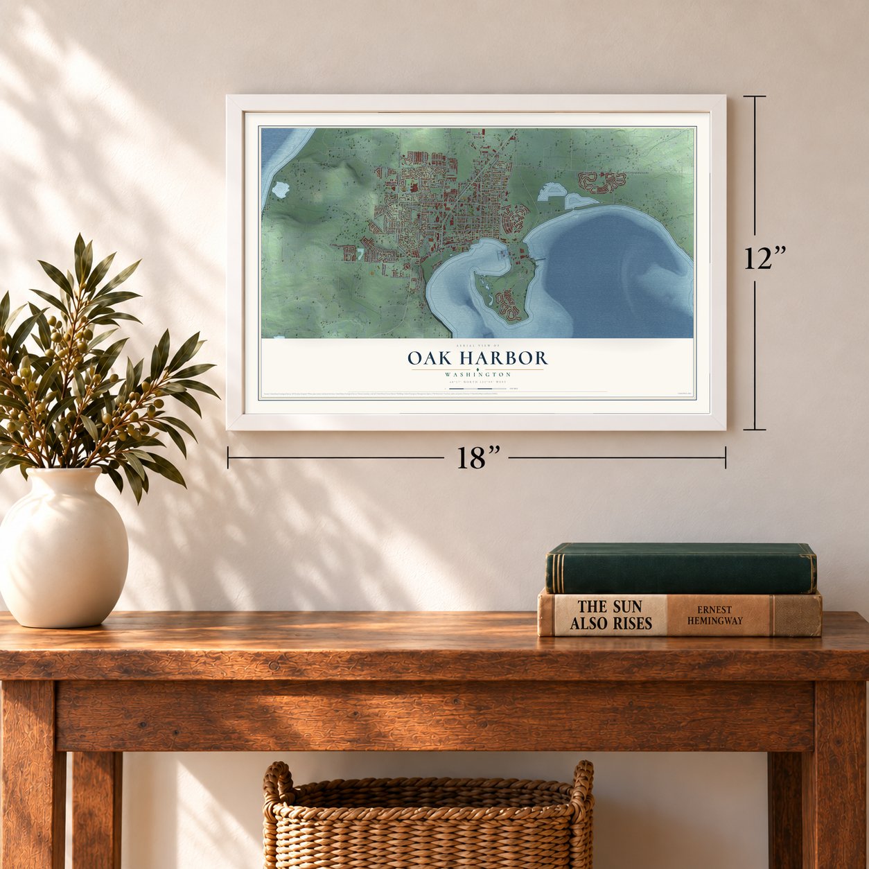
A new map of Oak Harbor, Washington, made in 2026 and printed to order on thick archival matte paper.
12" x 18" Archival Matte Print
A Map of Home. A Work of Art.
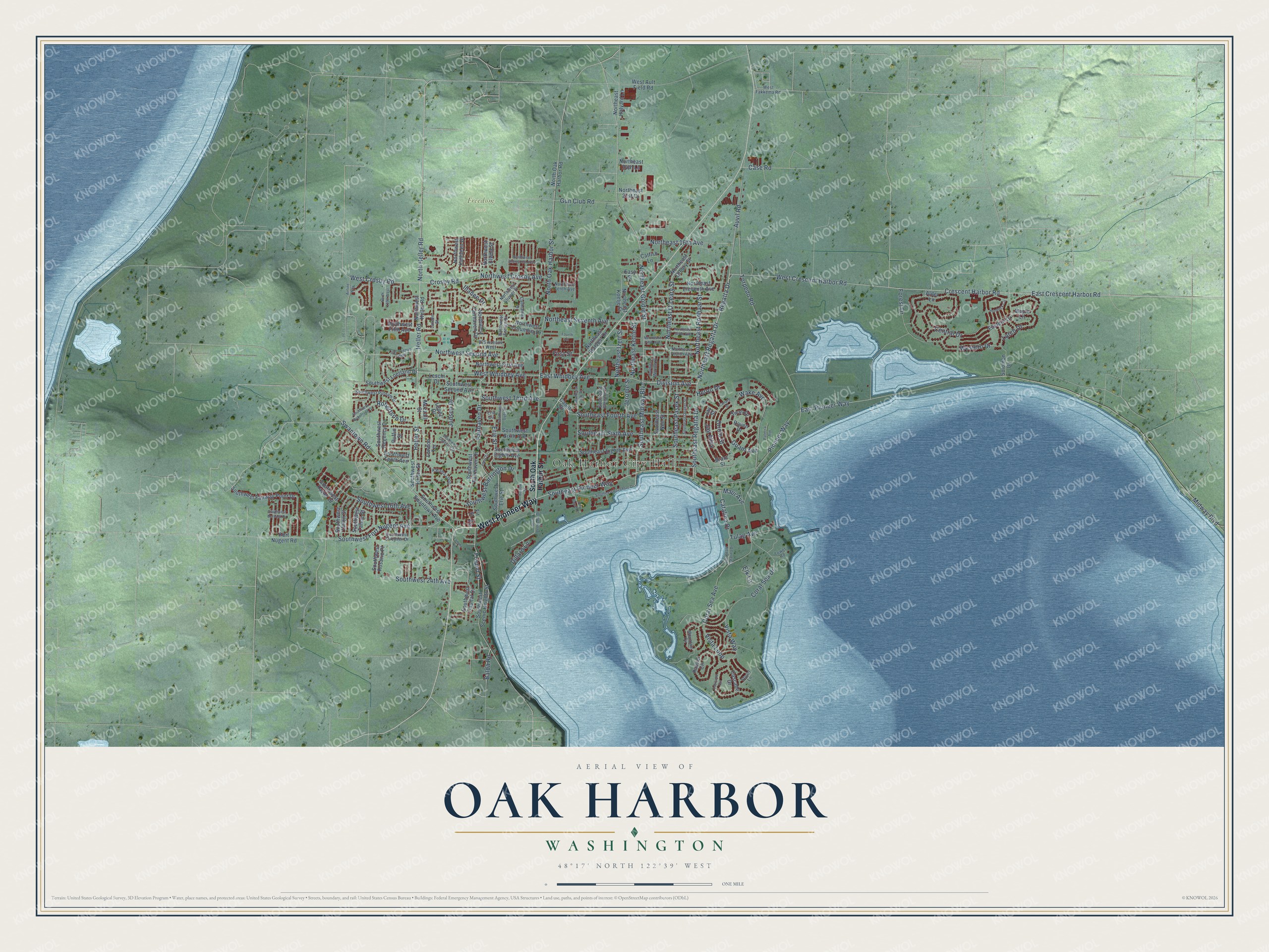
Explore Oak Harbor, Washington from a whole new perspective. Created using aerial imagery and detailed geographic data, this map captures Oak Harbor building by building, with labeled streets, familiar landmarks, and shaded topographical relief that highlights the natural contours of the landscape.
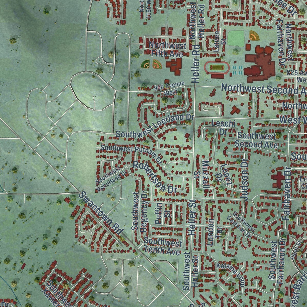
Combining modern data with the timeless character of a vintage atlas, this map is just as interesting up close as it is beautiful on the wall. Whether you grew up in Oak Harbor, spent memorable years there, or call it home today, this unique map is a great way to celebrate a place that means something to you. Zoom in on the preview to look for your street, and then order a print to put your memories on the wall.
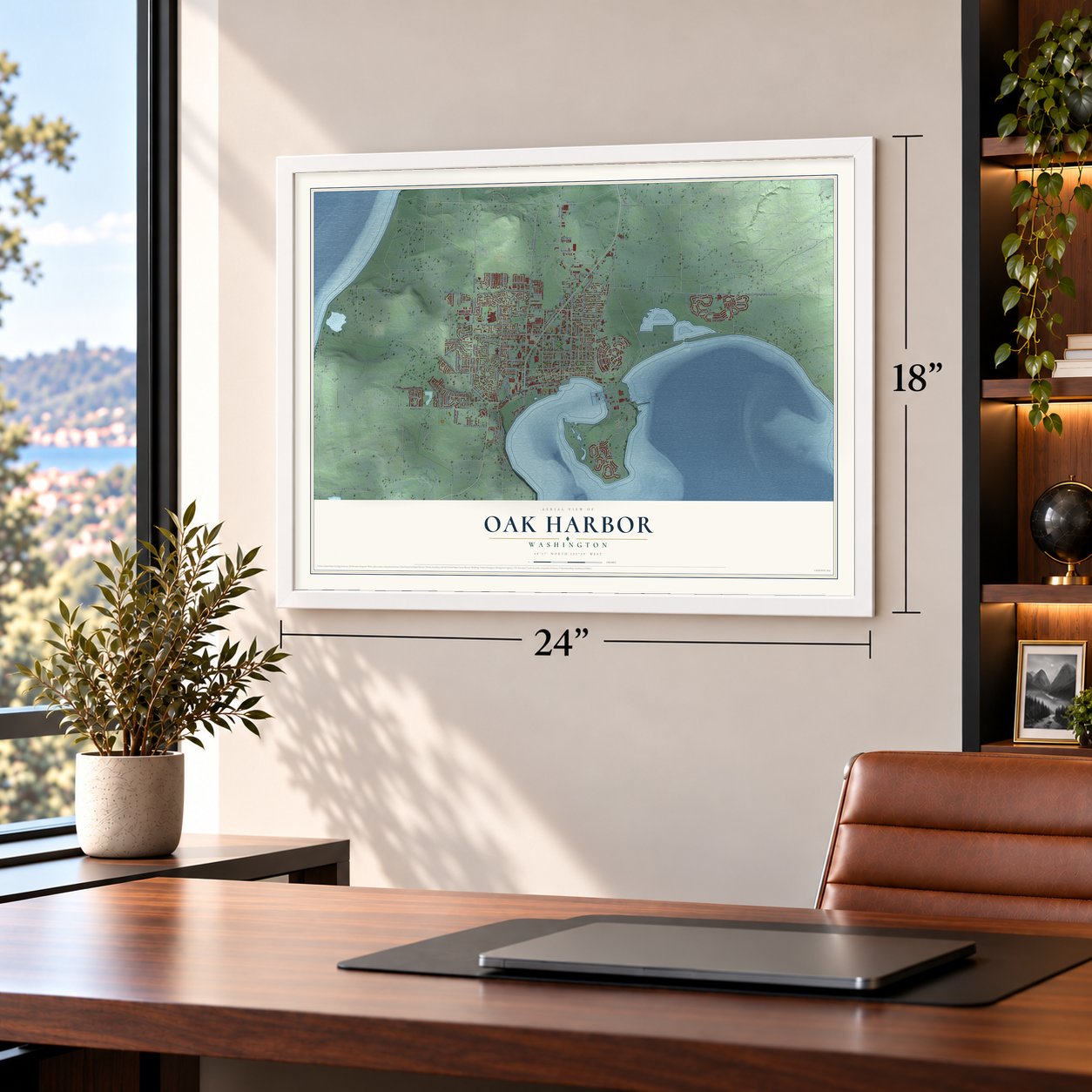
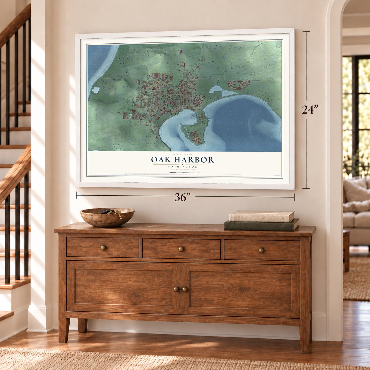
Three ways to hang it
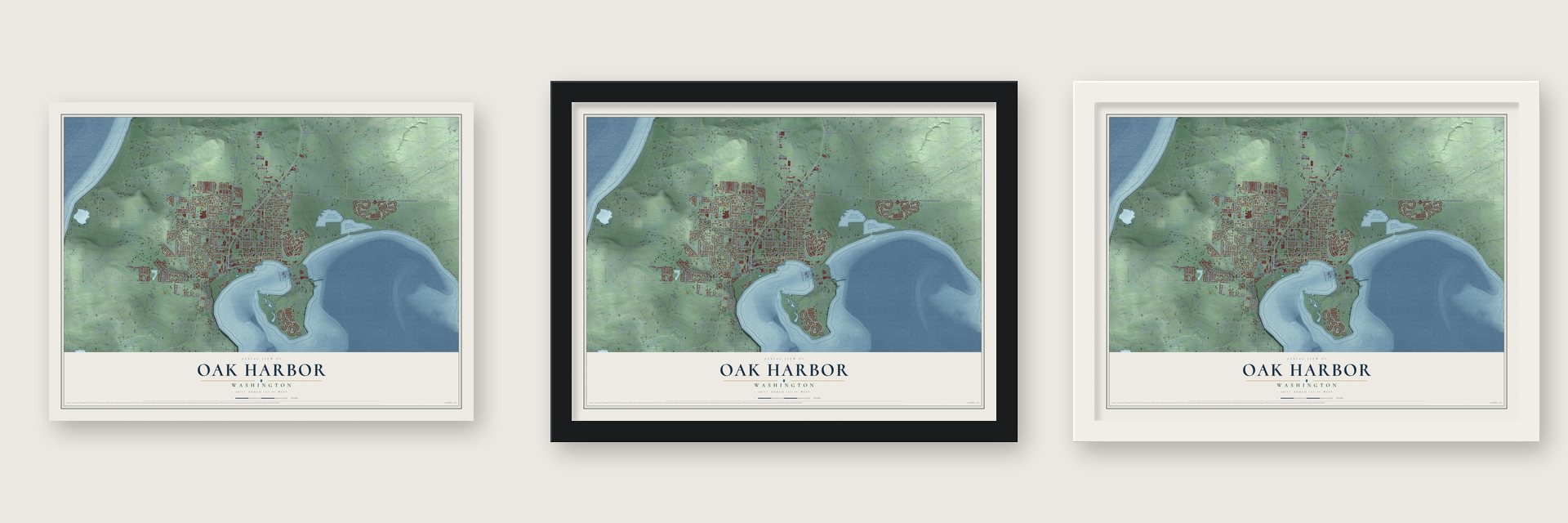
Unframed archival matte, a black wood frame or a white wood frame.
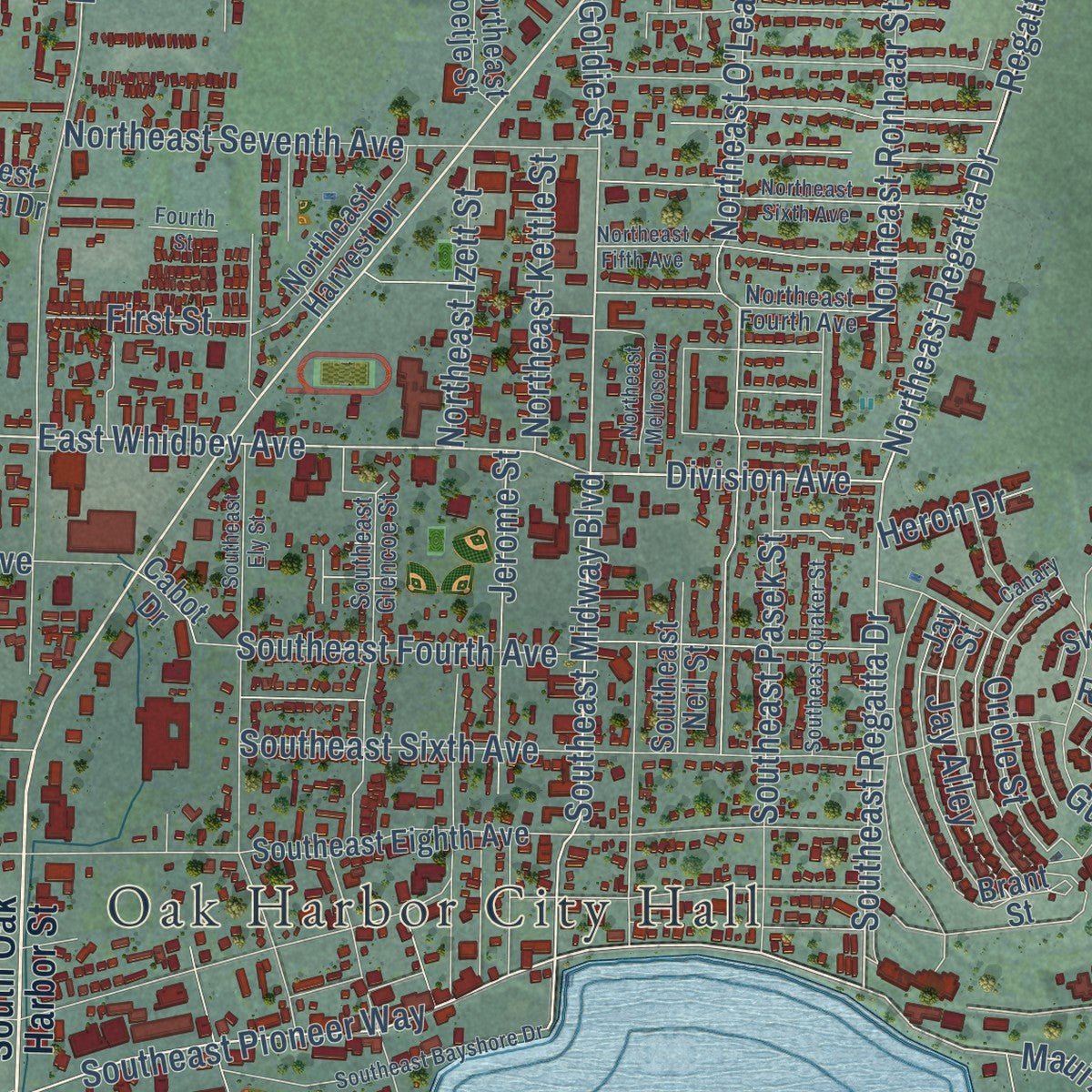
Up close
Geography Worth Displaying
This map was created using accurate cartographic data and authoritative geographic sources, including the U.S. Geological Survey and the Census Bureau. The map brings together terrain, waterways, roads, and building detail. The majority of the streets are labeled, houses are accurately depicted, and the topography is derived from government sources. Combining local data with carefully composed color and shading leads to this beautifully detailed Oak Harbor artwork for your wall.
Rather than simply showing street outlines, we’ve included as many of the street names as we could reasonably fit on the map while keeping their names legible. Zoom in on the high resolution preview to see exactly what’s on the map. We truly set out to create a statement piece for anyone who loves Oak Harbor. So whether it’s for you, or a gift for someone you love, we hope this map of Oak Harbor brings back fond memories.
Read the story behind this map of Oak Harbor, Washington from 2026.

About Oak Harbor, Washington
Oak Harbor is a city of 24,622 people in Island County, on the north end of Whidbey Island. The Skagits lived here long before settlers came and called the harbor Kla-tole-tsche. In 1850 Congress passed the Oregon Donation Land Law, which let a settler claim 320 acres. That year three men who had found no fortune in the California gold fields sailed north: Zakarias Martin Toftezen, a Norwegian shoemaker; Ulrich Freund, from Switzerland; and Clement W. "Charlie" Sumner, from New England. Land records date their claims on the open prairie to January 4, 1851.
For decades the settlers reached the outside world by canoe and later by steamer. Oak Harbor was incorporated on May 14, 1915, with 401 people. The Civilian Conservation Corps built the Deception Pass Bridge as a Public Works Administration project, and when it opened on July 31, 1935, the island had its first road to the mainland. Naval Air Station Whidbey Island followed on September 21, 1942, and the city grew up around the base.
“Because the Tulalips and Skagits were having a war that day, the Indian canoers would not enter Oak Harbor.”
- Named by a claim jumperWhen Toftezen got back from a canoe trip to Olympia for salt pork and nails, a Dr. Lansdale was trying to take over his claim. Toftezen talked the doctor out of it, and Lansdale moved on to Penn's Cove. Before leaving, he named Oak Harbor for its Garry oaks and Crescent Harbor for its curved shape.
- The red-haired traderIn the early 1850s, Charlie Phillips and sea captain Edward Barrington set up a store for trade here, so Barrington would not have to paddle two days to Olympia for supplies. Local legend says that when Northern raiders arrived, the big red-bearded captain smashed a Skagit burial canoe, set a skull on a stick, danced, and then charged at them. The raiders fled, and they never troubled Oak Harbor again.
- Hollanders from MichiganIn 1894 John "R.E." Werkman, selling land for a land company, went to Holland, Michigan, ran ads in Dutch and showed farmers foot-long potatoes. On March 17, 1895, the steamer Idaho landed 18 Hollanders and a cheesemaker from the Netherlands at San de Fuca on Penn's Cove. Within two years 200 Hollanders lived on north Whidbey, where they started dairy farms and planted orchards.
- The best schoolhouse in 1870Island County School District Number Three opened in the fall of 1859, and twenty pupils came on the first day. In 1864 Oak Harbor parents asked for a district of their own, Number Six. By 1870 the county's superintendent of schools called the Oak Harbor schoolhouse the best in the county, with 36 pupils attending.
Find your street
Names on the Oak Harbor map
Every name below is printed on this map. Look for your street, your school, the park where you played, or the pond down the road.
Places and landmarks2
- Oak Harbor City Hall
- Freedom Park
Streets and roads168
- West Pioneer Way
- East Pioneer Way
- East Crescent Harbor Road
- Northeast Regatta Drive
- East Whidbey Avenue
- Heller Road
- West Whidbey Avenue
- West Crescent Harbor Road
- Regatta Drive
- Southeast Regatta Drive
- Division Avenue
- North Heller Road
- Northeast Goldie Street
- Midway Boulevard
- Southeast Midway Boulevard
- West Crosby Road
- Auvil Road
- Crescent Harbor Road
- Southeast Pioneer Way
- Swantown Road
- Heller Street
- Maui Avenue
- Southwest Fort Nugent Avenue
- North Oak Harbor Street
- Oriole Street
- Torpedo Road
- Wake Avenue
- Southwest Third Avenue
- Fairhaven Drive
- Vista Way
Show all 168 streets
- Northwest Second Avenue
- Northwest Crosby Avenue
- Southwest Barrington Drive
- Coral Sea Avenue
- Central Drive
- Coral Sea Drive
- Western Drive
- Northeast O'Leary Street
- Crosby Road
- Southeast Fourth Avenue
- Pioneer Way
- Northeast Seventh Avenue
- Southeast Sixth Avenue
- Larch Drive
- Erie Street
- Southeast Pasek Street
- Elk Lane
- Southwest 16th Avenue
- Robertson Drive
- Northeast 16th Avenue
- Catalina Drive
- Northeast Ronhaar Street
- Southwest 24th Avenue
- Forest Drive
- Jerome Street
- Gun Club Road
- Guam Avenue
- Jay Alley
- Northeast Kettle Street
- Judson Drive
- Northeast Izett Street
- Vista Loop
- Tulag Avenue
- Freund Street
- First Street
- Illahee Drive
- Balda Road
- Heron Drive
- Dillard Lane
- Case Road
- Fir
- South Oak Harbor Street
- Northwest Heller Road
- Southwest Loerland Drive
- Southwest Swantown Avenue
- Southwest Heller Street
- Eastern Drive
- Southwest Scenic Heights Street
- Southwest Tenth Avenue
- Northeast Halyard Lane
- Cabot Drive
- Southeast Eighth Avenue
- Southwest Fairhaven Drive
- Northeast Oleary Street
- Southwest Sixth Avenue
- Southwest Fairway Point Drive
- Southwest Erie Street
- Southwest Eighth Avenue
- Brant Street
- Northwest Fairhaven Drive
- Rainier Circle
- Cascade Drive
- Northwest Columbia Drive
- Northeast Eleventh Avenue
- Northwest Kathleen Drive
- Northwest Fifth Avenue
- Jay Street
- Southwest Regency Drive
- Northwest First Avenue
- Northwest Elwha Street
- Southwest Second Avenue
- North Oak Harbor Road
- Northeast Harvest Drive
- Southwest Union Street
- Southwest Xavier Drive
- Northeast Koetje Street
- Southwest Capital Drive
- West Ault Field Road
- Leschi Drive
- Fort Nugent Road
- Swan Drive
- Raven Drive
- Muzzall Street
- Southwest Rosario Place
- Southwest Tahoe Street
- Southeast Neil Street
- Northeast 21st Court
- Lopez Drive
- Northeast 24th Lane
- Solomon Drive
- London Terrace
- Alder Lane
- Easy Street
- Catfish Lane
- Maple Lane
- Fir Street
- Puffin Street
- Southwest Stremler Drive
- Southeast Glencoe Street
- Northeast Tenth Avenue
- Southwest Putnam Drive
- Mountain Circle
- Northeast Fourth Avenue
- Cathlamet Drive
- Northwest Clipper Drive
- Kalama Loop
- Northwest Ensign Drive
- West Fakkema Road
- 825 Avenue West
- Erie Circle
- Stuart Lane
- Tower Road
- Lateen Street
- South Beeksma Drive
- 800 Avenue West
- Southeast Ely Street
- Cascade Circle
- Southwest Robertson Drive
- Southeast Bayshore Drive
- Southeast Catalina Drive
- Northeast Sixth Avenue
- Northeast Fifth Avenue
- Northwest Cherry Hill Loop
- Hemlock Circle
- City Beach Street
- Canary Street
- Southwest Castilian Drive
- Southwest Berwick Drive
- Southeast Quaker Street
- Southwest Dyer Street
- Fleet Street
- Palmira Avenue
- Northeast Melrose Drive
- North 1190 West
- Barlow Street
- Airline Way
- Fourth Street
- Lamms Lane
Names are listed as they appear on the printed map. Zoom into the product photos to find them.
The art of mapping a place
How This Map Was Made
Real places. Remarkable detail. Discover the layers that turn geographic data into a map of home.

The view from above
Aerial imagery reveals the character of the land: woodland, open fields, and the patterns of a place.

The shape of the land
Elevation data brings hills, valleys, and subtle changes in the landscape into view.

The details of home
Roads, waterways, and building footprints come together to make the map feel unmistakably local.

Geography becomes art
Considered color, shading, and typography bring the layers together in a map made for your wall.


Process illustrated with Mendon, Massachusetts. Aerial imagery: USDA NAIP. Terrain: USGS 3D Elevation Program. Map details and finished artwork: KNOWOL.
The Details
About This Print
Choose an archival matte print, or a black or white Ayous wood frame. The archival matte print is unframed.
Select your size and finish above to see the matching product image and price.
Materials & Craftsmanship
A contemporary map with the character of a classic atlas, printed on archival matte paper. Optional frames are made from Ayous wood.
Your printed map does not include the watermark shown in the full-map preview.
Shipping & Delivery
Free shipping within the United States. Every print is made to order in the USA.
Buying a gift? Add a note in your cart and we'll include it. We never put prices in the package.
Prints ship within 2 to 3 business days. Allow 7 to 10 days total from ordering for delivery. Timing may vary during holidays or periods of high order volume.
Read our shipping policy.
Returns and damaged prints
Each print is made to order. Change-of-mind refunds are not available after production.
If your print arrives damaged, misprinted or incorrect, contact support@knowol.com within 30 days of receiving it. Include your order number, photos and a description of the issue.
Read our full refund and replacement policy. For questions about your order, email support@knowol.com.
Find your town
Looking for another city?
Find a map of home in our Washington collection, or any town in the country.
Nearby
Maps of towns near Oak Harbor
Know someone from one of these towns? Their map makes a great gift.
 Whidbey Island Station
, Washington
From $39.99See the map
 Coupeville
, Washington
From $39.99See the map
 La Conner
, Washington
From $39.99See the map
More maps nearby: Camano, Lake Ketchum, Northwest Stanwood, Conway and Anacortes.