
Search for another town






Free U.S. delivery 7 to 10 days after you order
Pike Road, Alabama Map Art
Building by building, with labeled streets and shaded relief.
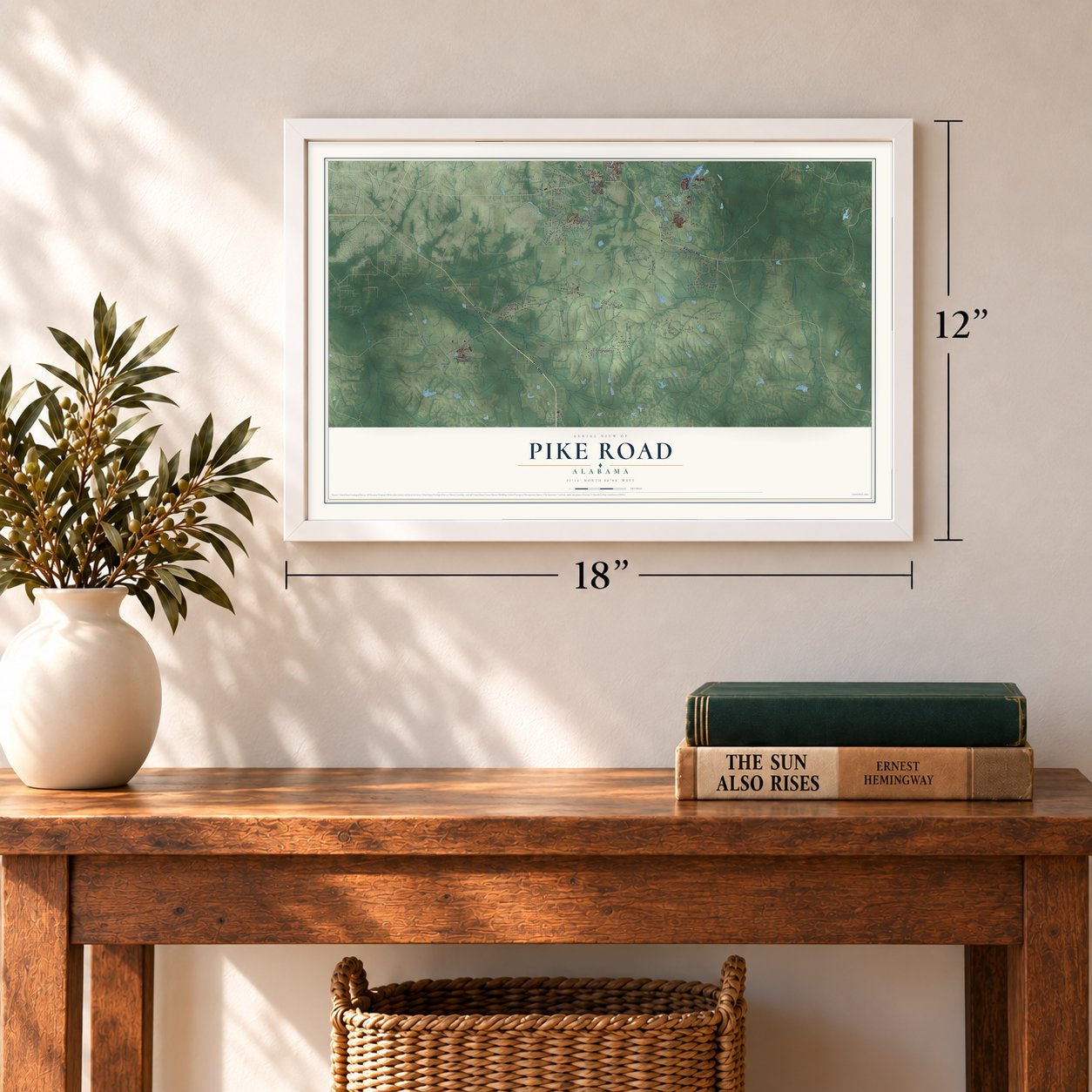
12" x 18" Archival Matte Print
A Map of Home. A Work of Art.
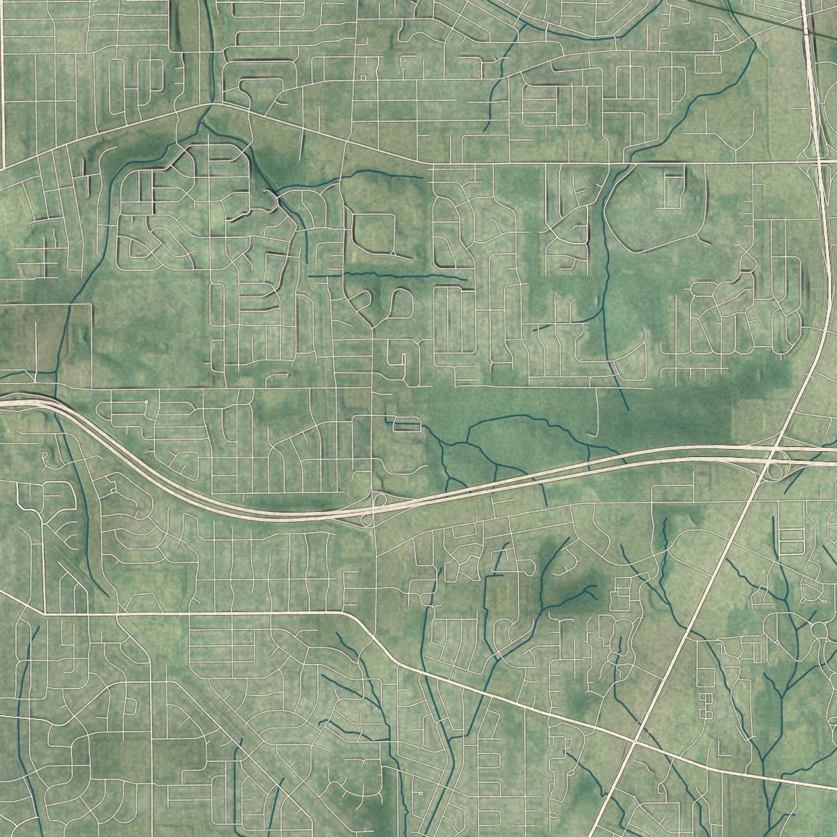
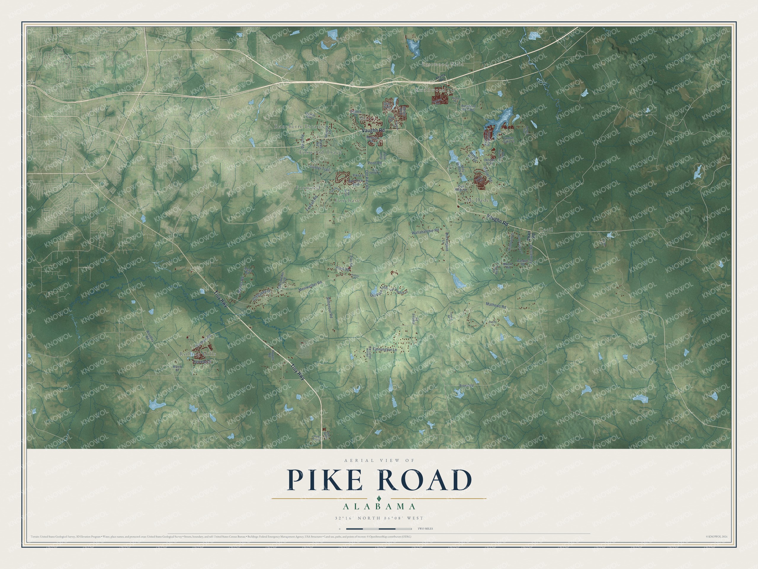
Explore Pike Road, Alabama from a whole new perspective. Created using aerial imagery and detailed geographic data, this map captures Pike Road building by building, with labeled streets, familiar landmarks, and shaded topographical relief that highlights the natural contours of the landscape.
Combining modern data with the timeless character of a vintage atlas, this map is just as interesting up close as it is beautiful on the wall. Whether you grew up in Pike Road, spent memorable years there, or call it home today, this unique map is a great way to celebrate a place that means something to you. Zoom in on the preview to look for your street, and then order a print to put your memories on the wall.
Three ways to hang it
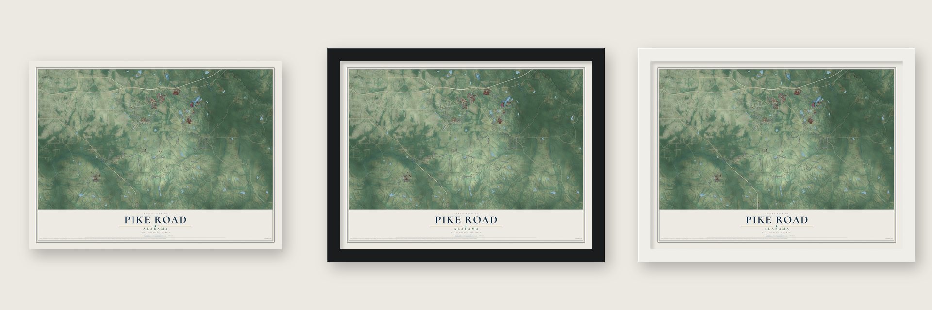
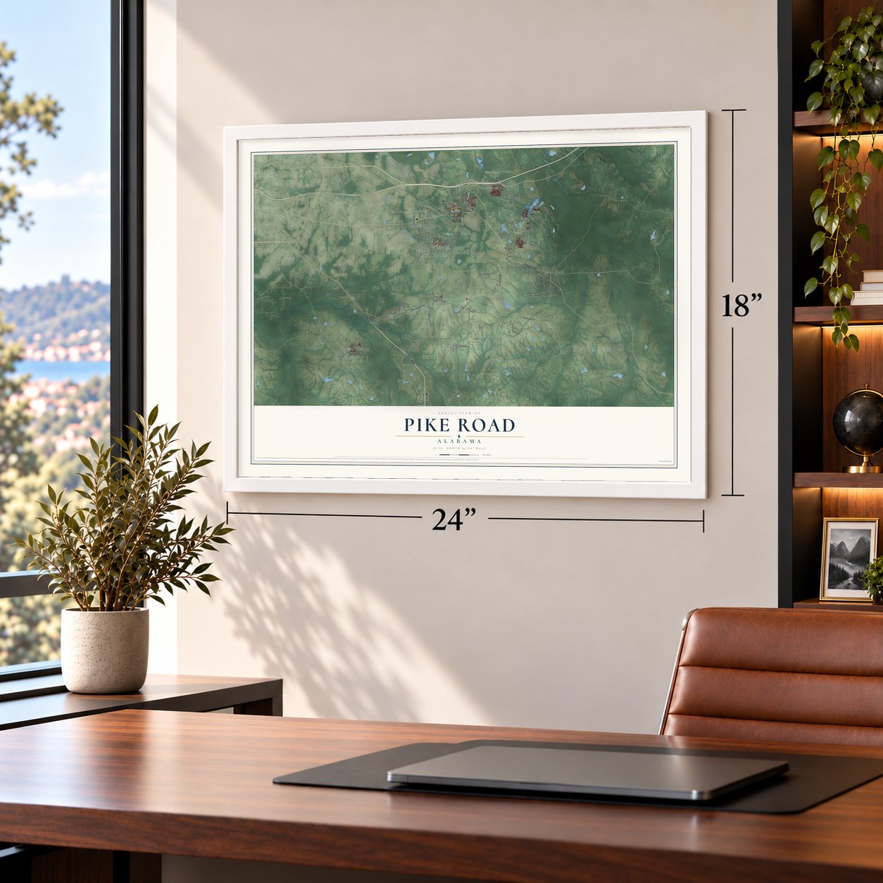
Unframed archival matte, a black wood frame or a white wood frame.
Up close
Geography Worth Displaying
This map was created using accurate cartographic data and authoritative geographic sources, including the U.S. Geological Survey and the Census Bureau. The map brings together terrain, waterways, roads, and building detail. The majority of the streets are labeled, houses are accurately depicted, and the topography is derived from government sources. Combining local data with carefully composed color and shading leads to this beautifully detailed Pike Road artwork for your wall.
Rather than simply showing street outlines, we’ve included as many of the street names as we could reasonably fit on the map while keeping their names legible. Zoom in on the high resolution preview to see exactly what’s on the map. We truly set out to create a statement piece for anyone who loves Pike Road. So whether it’s for you, or a gift for someone you love, we hope this map of Pike Road brings back fond memories.
Read the story behind this map of Pike Road, Alabama from 2026.

Find your street
Names on the Pike Road map
Every name below is printed on this map. Look for your street, your school, the park where you played, or the pond down the road.
Places and landmarks10
- Eastwood Villa
- Knollwood
- Cecil
- Foxchase
- Foxwood
- Foxwood Trace
- McDade
- Merry
- Ranchette Estates
- Rolling Hills
Streets and roads71
- Vaughn Road
- Troy Highway
- Meriwether Road
- Marler Road
- Old Pike Road
- Wallahatchie Road
- Mathews Road
- Foxhall Road
- Trotman Road
- Rittenour Road
- Farmington Lane
- Flowers Road
- Barnes Road
- Old Pike Trce
- Glynlakes Drive
- Hunter Trail
- Flinn Road
- Ryan Road
- Fairway Drive
- Penn Road
- Pharr Road
- Antioch Lane
- Bon Terre Boulevard
- Howell Road
- Avenue of the Waters
- Woodley Road
- Milly Branch Road
- Wildwood Drive
- Melison Drive
- Avenue of the Oaks
Show all 71 streets
- Mockingbird Lane
- Okfuski Trail
- Twelve Oaks Lane
- Meriwether Trce
- Oak Ridge Drive
- Mizell Drive
- Moore Road
- Pike Road
- Parks Road
- Randall Road
- Pike Lane
- Brown Road
- Belser Boulevard
- Mason Mill Road
- Sequoia Lane
- Doe Run Court
- Jaybird Lane
- Penn Loop
- York Street
- Bean Road
- Deer Path
- Honeysuckle Lane
- Fair Meadow Lane
- Oak View Drive
- Old Carter Hill Road
- Split Bark Drive
- Pine Acres
- Chantilly Parkway
- Deer Ridge
- Setter Trail
- Cantera Way
- Atlanta Highway
- Foxchase Drive
- Pike Springs Lane
- Kingman Drive
- Dansby Court
- Rising Fawn Drive
- London Road
- Hudson Road
- Goude Lane
- Wright Road
Names are listed as they appear on the printed map. Zoom into the product photos to find them.
About Pike Road, Alabama
Pike Road is a town of 9,439 people in Montgomery County, just south of the city of Montgomery, the state capital. Settlers arrived around 1815, and a farming community had formed by the mid-nineteenth century where Pike Road crossed Meriwether Road. Travelers once paid a toll, or "pike," to use the first of those roads, and the community took its name from it.
Businesses opened at the crossroads to serve the farms around them. For years residents argued over whether to incorporate, and in 1997 voters in four communities, Glynlakes, Bean, Barnes and Meriwether Road, finally settled it, with 97 percent choosing to become the town of Pike Road. The new town opened a town hall in 2010, settled a boundary dispute with Montgomery that same year, and started its own school system in 2015.
- The Marks House, about 1825William Matthews Marks came from Georgia and built the house on land he bought from the U.S. land office in Cahaba for $1.25 an acre. In the 1920s the Churchill Marks family added a kitchen, baths, a rose garden and a pavilion for dancing. In 1967 the film of Truman Capote's "Thanksgiving Visitor" was shot inside. A fire badly damaged the house on August 28, 1997, and the community restored it.
- A November fair since 1966The Pike Road Arts and Crafts Fair has met on the Marks House grounds every year since 1966, always on the first Saturday in November, and the Pike Road Community Club has made the house its headquarters since 1968. The Civic Club and the Community Club sponsor the fair, which brings in more than 250 artists and craft vendors and as many as 10,000 visitors.
- The county's first consolidated schoolPike Road School opened on November 11, 1918, as Montgomery County's first school to gather children from rural one-room schoolhouses into grades one through twelve. Families from nearby settlements loaned and donated the $40,000 it cost to build on 30 acres. Once the school appeared in Alabama's display at Philadelphia's 1926 Sesquicentennial International Exposition, educators came from Europe and South America to study it.
- Pilots trained in 1917Taylor Field, Montgomery's first military flying installation, opened in November 1917. It honored Captain Ralph L. Taylor, killed in a New York crash that August. Its school had 16 hangars and nearly 200 JN-4 and DH-4 airplanes on 800 acres. One hundred and thirty-nine pilots finished the eight-week course, and a few later went to France.
Keep exploring Alabama
Pike Road is one of 662 Alabama towns we've mapped. Every dot on the map is a print of its own.
The search covers every state, Alabama first.
Near Pike Road
Order 2 or more town maps and save 10%. Shown in the size and finish you picked above, so they hang as a set.
- Montgomery 12" x 18" / Archival Matte Print $39.99
- Emerald Mountain 12" x 18" / Archival Matte Print $39.99
- Shorter 12" x 18" / Archival Matte Print $39.99


More maps nearby: Pintlala, Redland, Fitzpatrick, Blue Ridge and Catoma.
The art of mapping a place
How This Map Was Made
Real places. Remarkable detail. Discover the layers that turn geographic data into a map of home.

The view from above
Aerial imagery reveals the character of the land: woodland, open fields, and the patterns of a place.

The shape of the land
Elevation data brings hills, valleys, and subtle changes in the landscape into view.

The details of home
Roads, waterways, and building footprints come together to make the map feel unmistakably local.

Geography becomes art
Considered color, shading, and typography bring the layers together in a map made for your wall.


Process illustrated with Mendon, Massachusetts. Aerial imagery: USDA NAIP. Terrain: USGS 3D Elevation Program. Map details and finished artwork: KNOWOL.
The Details
About This Print
Choose an archival matte print, or a black or white Ayous wood frame. The archival matte print is unframed.
Select your size and finish above to see the matching product image and price.
Materials & Craftsmanship
A contemporary map with the character of a classic atlas, printed on archival matte paper. Optional frames are made from Ayous wood.
Your printed map does not include the watermark shown in the full-map preview.
Shipping & Delivery
Free shipping within the United States. Every print is made to order in the USA.
Buying a gift? Add a note in your cart and we'll include it. We never put prices in the package.
Prints ship within 2 to 3 business days. Allow 7 to 10 days total from ordering for delivery. Timing may vary during holidays or periods of high order volume.
Read our shipping policy.
Returns and damaged prints
Each print is made to order. Change-of-mind refunds are not available after production.
If your print arrives damaged, misprinted or incorrect, contact support@knowol.com within 30 days of receiving it. Include your order number, photos and a description of the issue.
Read our full refund and replacement policy. For questions about your order, email support@knowol.com.