
Search for another town




Free U.S. delivery 7 to 10 days after you order
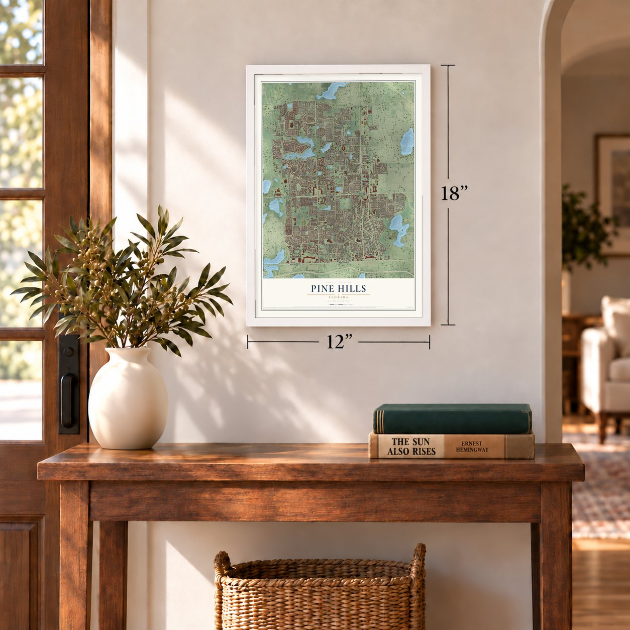
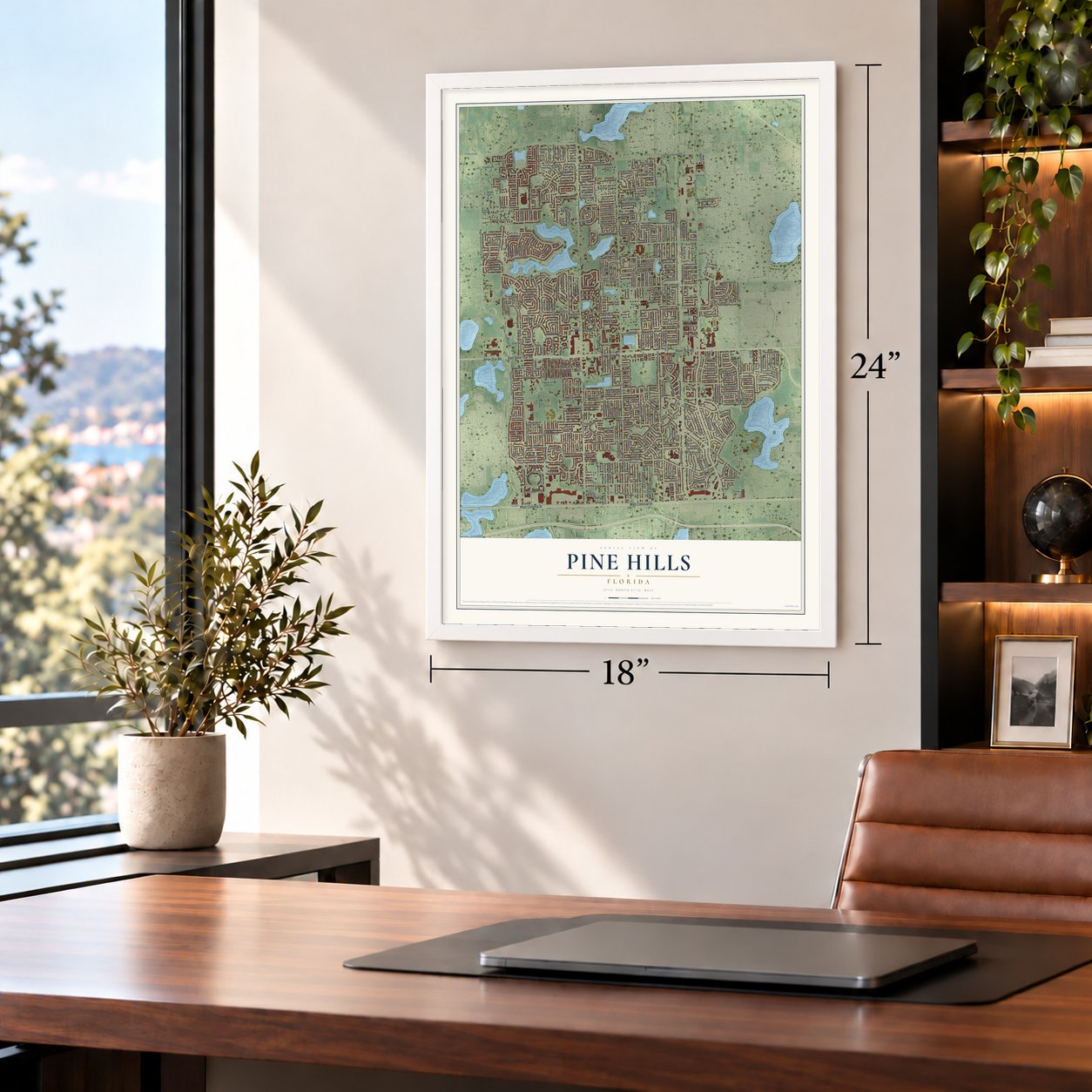
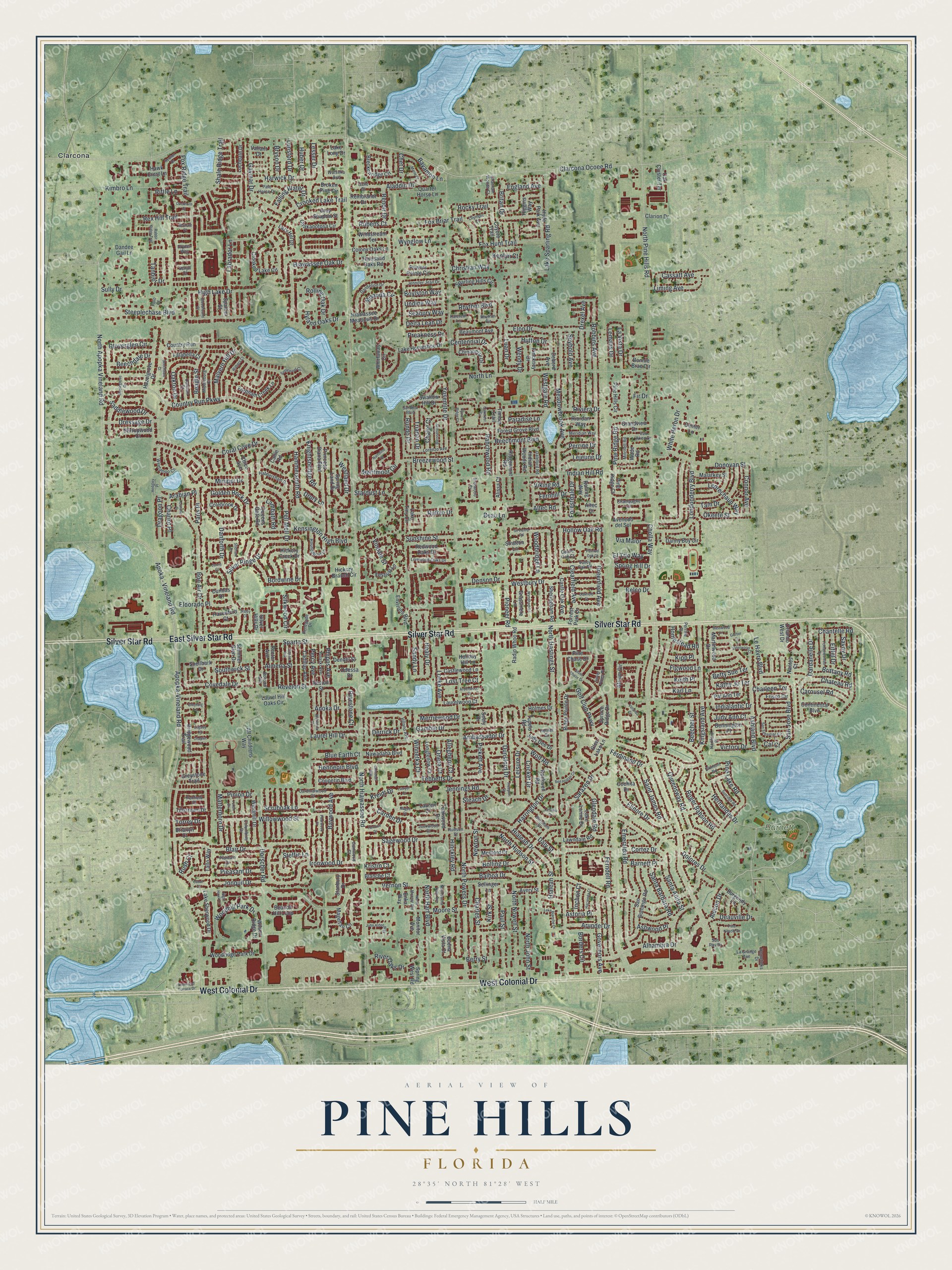
Pine Hills, Florida Map Art
Building by building, with labeled streets and shaded relief.
12" x 18" Archival Matte Print
A Map of Home. A Work of Art.
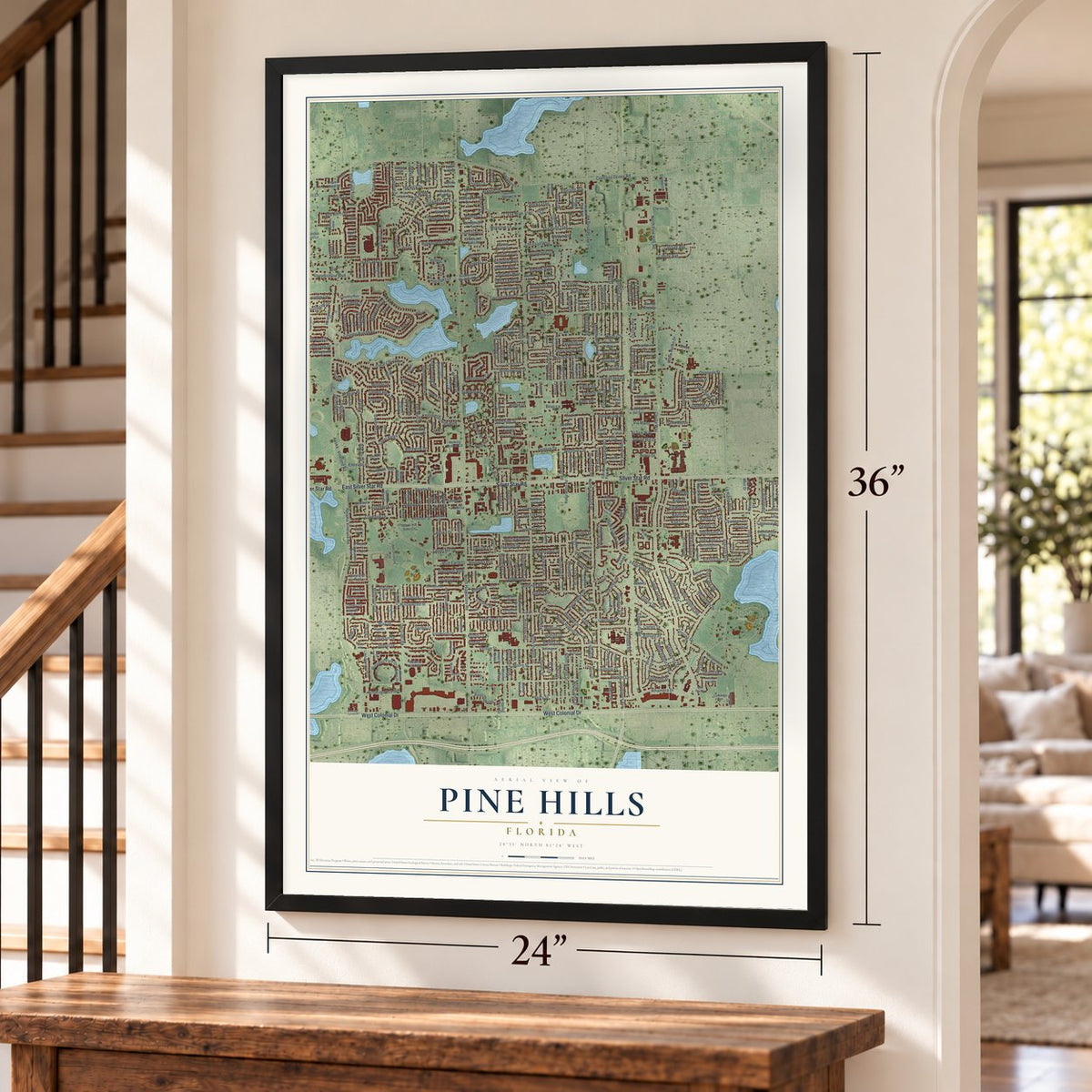
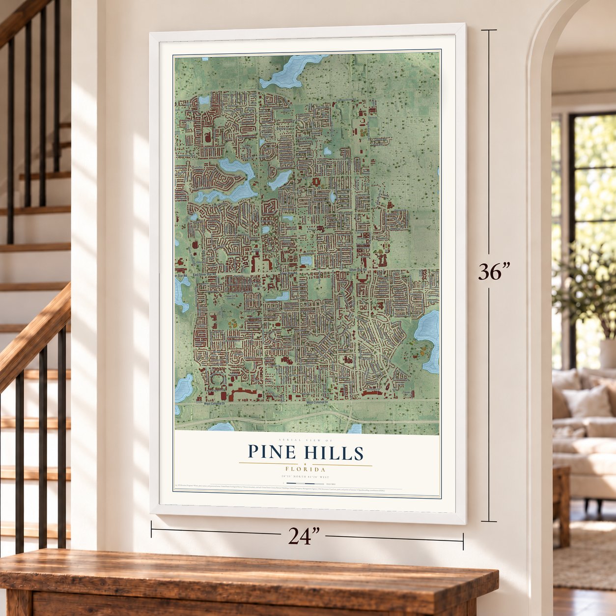
Explore Pine Hills, Florida from a whole new perspective. Created using aerial imagery and detailed geographic data, this map captures Pine Hills building by building, with labeled streets, familiar landmarks, and shaded topographical relief that highlights the natural contours of the landscape.
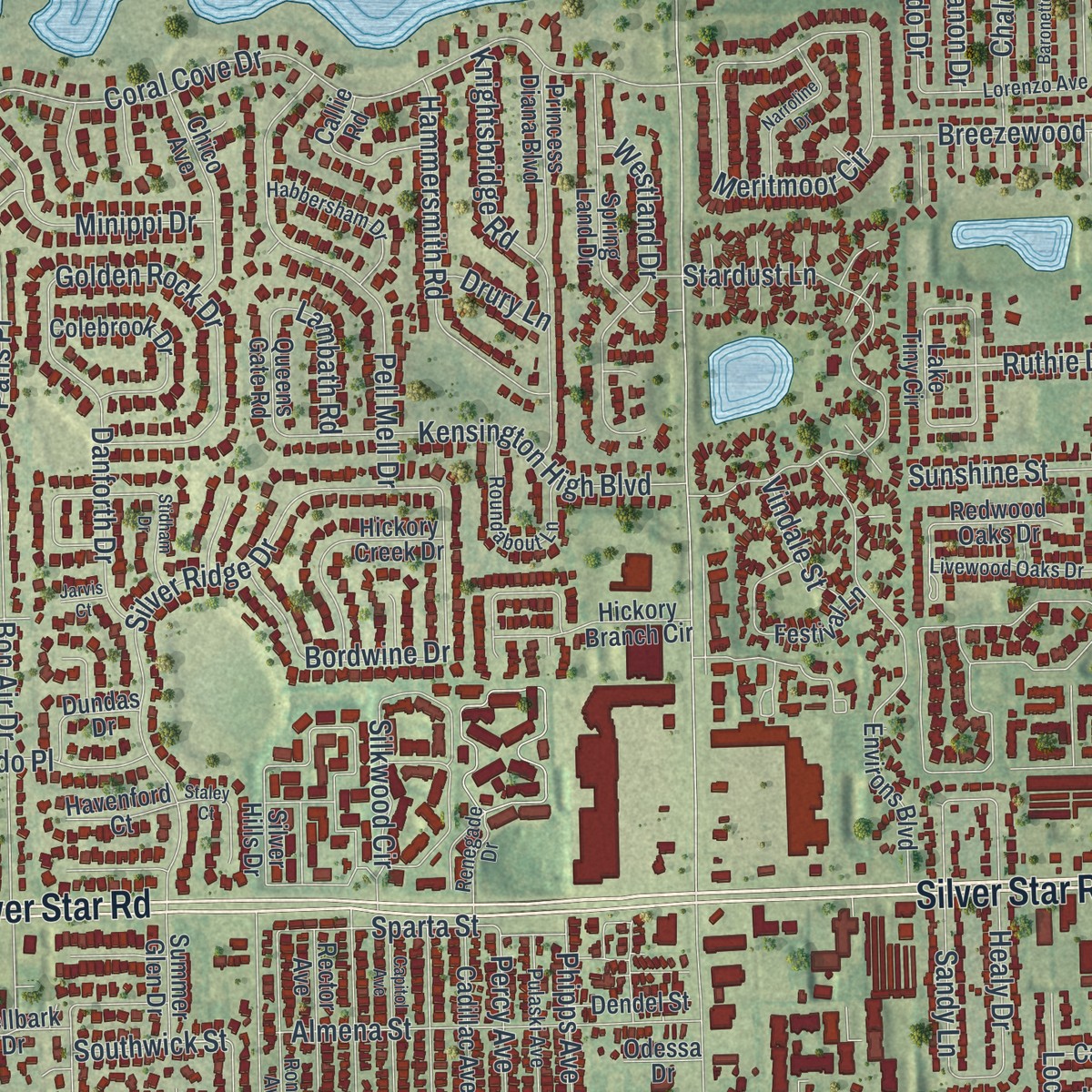
Combining modern data with the timeless character of a vintage atlas, this map is just as interesting up close as it is beautiful on the wall. Whether you grew up in Pine Hills, spent memorable years there, or call it home today, this unique map is a great way to celebrate a place that means something to you. Zoom in on the preview to look for your street, and then order a print to put your memories on the wall.
Three ways to hang it
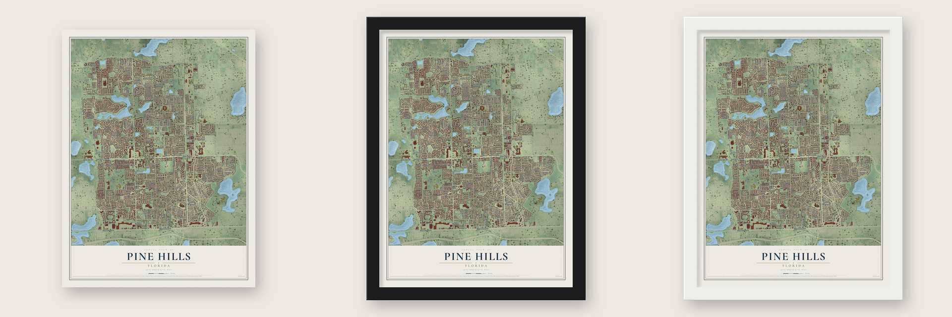
Unframed archival matte, a black wood frame or a white wood frame.
Up close
Geography Worth Displaying
This map was created using accurate cartographic data and authoritative geographic sources, including the U.S. Geological Survey and the Census Bureau. The map brings together terrain, waterways, roads, and building detail. The majority of the streets are labeled, houses are accurately depicted, and the topography is derived from government sources. Combining local data with carefully composed color and shading leads to this beautifully detailed Pine Hills artwork for your wall.
Rather than simply showing street outlines, we’ve included as many of the street names as we could reasonably fit on the map while keeping their names legible. Zoom in on the high resolution preview to see exactly what’s on the map. We truly set out to create a statement piece for anyone who loves Pine Hills. So whether it’s for you, or a gift for someone you love, we hope this map of Pine Hills brings back fond memories.
Read the story behind this map of Pine Hills, Florida from 2026.

Find your street
Names on the Pine Hills map
Every name below is printed on this map. Look for your street, your school, the park where you played, or the pond down the road.
Places and landmarks2
- Barnett Park
- Clarcona
Streets and roads494
- Silver Star Road
- West Colonial Drive
- East Silver Star Road
- North Apopka Vineland Road
- Clarcona Ocoee Road
- Apopka-Vineland Road
- Brittany Road
- Vernon Street
- Cholla Way
- North Hiawassee Road
- North Pine Hills Road
- North Powers Drive
- Balboa Drive
- North Hastings Street
- Country Run Parkway
- Golf Club Parkway
- Coral Cove Drive
- High Lake Drive
- Emeralda Road
- Blair Drive
- Rex Hill Trail
- Dorscher Road
- North Lane
- Indian Hill Road
- Laurel Hill Drive
- Lake Sparling Road
- Arundel Drive
- Shale Ridge Trail
- Indialantic Drive
- Hernandes Drive
Show all 494 streets
- Robbins Avenue
- Cortez Drive
- Meadowbrook Avenue
- Bon Air Drive
- Silver Ridge Drive
- Willowwood Street
- North Hudson Street
- Ambassador Drive
- Apoka - Vineland Road
- Queensway Road
- Gamble Drive
- Santa Anita Street
- Hialeah Drive
- Hialeah Street
- Ferndell Road
- Ironwood Drive
- Ashland Boulevard
- Kingsland Avenue
- Dardanelle Drive
- Stardust Lane
- Meritmoor Circle
- Alhambra Drive
- Moore Street
- River Oaks Drive
- Torrey Drive
- Bolling Drive
- Cloverglen Circle
- Minippi Drive
- Deauville Drive
- Silkwood Circle
- Pell Mell Drive
- Pioneer Road
- Londonderry Boulevard
- Drexel Avenue
- Westgate Road
- Hiawassee Oak Drive
- Riviera Drive
- North Nowell Street
- Tanbier Drive
- Borders Circle
- Greenfield Avenue
- Almena Street
- Sarazen Drive
- Knightsbridge Road
- Westbury Drive
- Miranda Circle
- Charles Street
- Gaymar Drive
- North Hart Boulevard
- Kensington High Boulevard
- Perrine Drive
- Bordwine Drive
- Paul Street
- Chateau Road
- Crooked Lake Trail
- White Heron Drive
- Golden Rock Drive
- Figwood Lane
- North John Street
- Fox Briar Trail
- Beagle Street
- Berry Street
- Elon Drive
- Beechmont Boulevard
- Hinckley Road
- Anoka Drive
- Danforth Drive
- Hammersmith Road
- Hennepin Boulevard
- Jennings Road
- San Jose Boulevard
- Donovan Street
- Governors Avenue
- Tam Drive
- Sagewood Drive
- Roger Babson Road
- Steeplechase Boulevard
- Merriewood Drive
- Woodbridge Lane
- Kirk Street
- Wolf Road
- Covedale Drive
- Seybold Avenue
- Dunsford Drive
- Woodhill Park Drive
- Westland Drive
- Beechdale Drive
- Chalet Court
- Dressage Drive
- Healy Drive
- Rubens Court
- Sandy Lane
- Dolores Drive
- Elinore Drive
- Centennial Drive
- Labrador Lane
- Fox Hunt Trail
- Baywood Avenue
- Britan Drive
- Sunshine Street
- Tebbetts Drive
- Sparta Street
- Saddlewood Drive
- Belco Drive
- Le Havre Boulevard
- Revelon Street
- Winnetka Court
- Leisure Drive
- Kreidt Drive
- Yosemite Drive
- Cassatt Avenue
- Aladdin Drive
- Saint James Road
- Kimbro Lane
- Harwick Drive
- Santa Barbara Road
- Leprechaun Way
- Oakton Drive
- Liming Avenue
- Hyland Oaks Drive
- Fox Ridge Trail
- Preakness Drive
- Eldorado Place
- Harrington Drive
- Okeefe Street
- Spring Hill Drive
- Breezewood Street
- Malvern Hill Drive
- Daly Street
- Newton Street
- Lemans Drive
- Riffle Lane
- Christian Way
- Boylston Way
- Falling Water Drive
- Luan Drive
- Matterhorn Drive
- Glendale Road
- Rolling Oak Drive
- Carousel Road
- Connor Avenue
- Denson Drive
- Wynglow Lane
- Renoir Drive
- Rhythm Boulevard
- England Avenue
- Kenlyn Court
- Steffie Lane
- Betty Sue Terrace
- Arabian Place
- Carden Drive
- Cricket Drive
- Beecher Street
- Sully Drive
- Ferdinand Drive
- Forestdale Drive
- La Vista Drive
- Seabury Way
- Pine Ridge Road
- Ruthie Drive
- Phipps Avenue
- Locke Avenue
- Lejeune Drive
- Hutton Drive
- Ranchwood Road
- Homestead Road
- Blue Earth Court
- Chantelle Road
- Dragoon Place
- Hollow Oak Road
- Jonquil Drive
- Scruboak Lane
- Percy Avenue
- Via Maior
- Rocky Trail
- Pipestone Court
- Bryson Drive
- Keith Place
- Clearfield Avenue
- Trianon Drive
- Chariot Place
- Rundo Drive
- Karl Lane
- Barnett Place
- Pleasant Drive
- Allegheny Court
- Oneta Court
- Lunsford Drive
- Lost Tree Court
- Paris Place
- El Trio Way
- Pickett Avenue
- Huber Drive
- Judy Ann Court
- Lesser Drive
- Fernhill Drive
- Eiffel Drive
- Undine Way
- Victory Drive
- Kathy Jo Terrace
- Savoy Drive
- Delta Leah Drive
- Charleen Terrace
- Ashwood Place
- Southwick Street
- Lambath Road
- Pine Lake Road
- Alecon Drive
- Vindale Street
- Kipp Place
- Bayamon Lane
- Wendy Drive
- Pinion Drive
- Astoria Place
- Paradise Lane
- Rush Court
- Derrick Drive
- Altec Road
- Steach Drive
- Inchon Court
- Drury Lane
- Viking Road
- Kristin Court
- Chet Drive
- Beau Lane
- Cal Court
- Fir Drive
- Chinaberry Drive
- Avenedo del Sol
- Beaumont Avenue
- Continental Boulevard
- Silver Hills Drive
- All Childrens Way
- Environs Boulevard
- Tillstream Drive
- Pine Chase Drive
- Powers Pointe Circle
- Greystone Trail
- Crooked Lake Circle
- Pine Hills Circle
- Bridgewood Trail
- Atrium Circle
- Beacon Hill Loop
- Sparling Hills Circle
- Woodridge Park Drive
- San Domingo Road
- Whirlaway Circle
- Sheringham Road
- Hickory Branch Circle
- Forest Grove Boulevard
- Lake Tiny Circle
- Spruce Ridge Drive
- Lazy Hill Drive
- Castle Oak Avenue
- Broken Pine Circle
- Danny Boy Circle
- Magellan Circle
- Laurel Hill Oaks Circle
- Revlon Street
- Breckenridge Circle
- Hiawassee Meadows Drive
- Timber Trail
- Frisco Circle
- Hazelgrove Drive
- Ridgemont Road
- Redwood Oaks Drive
- Spring Land Drive
- Chakanotosa Circle
- Hyde Park Avenue
- Hickory Creek Drive
- Colebrook Drive
- Lochdale Drive
- Ridge Pointe Drive
- Festival Lane
- Clarion Drive
- Chico Avenue
- Coyote Trail
- Bonnie Brae Circle
- Lake Horseshoe Drive
- Lake Lorine Drive
- Windmill Drive
- Shellbark Drive
- Dandee Gail Lane
- Princess Diana Boulevard
- Tallo Way
- Rector Avenue
- Cadillac Avenue
- Quarter Horse Lane
- Lake Sherwood Drive
- Fordham Creek Lane
- Nawadaha Boulevard
- Debord Avenue
- Pat Ann Terrace
- Medford Drive
- Colony Oaks Lane
- Longfellow Court
- Laurelwood Court
- Castlewood Lane
- Grassmere Lane
- Valiant Court
- Hawk Crest Lane
- Gray Shadow Street
- Pinckney Drive
- Callie Road
- Rembrandt Drive
- Couperin Boulevard
- Rockwell Road
- Radio Whoo Road
- Grandview Drive
- Malarkey Street
- Indian Woods Road
- Stanbury Drive
- Higgins Way
- Martinwood Drive
- Wilson Ridge Drive
- Riordan Way
- Burgundy Lane
- Thousand Oaks Road
- Country Run
- Swallow Hill Drive
- Windstream Terrace
- Lawndale Road
- Judy Dee Drive
- Stirrupwood Court
- Teakwood Drive
- Summer Glen Drive
- Queens Gate Road
- Oak Cluster Terrace
- Pine Ridge Court
- Dundas Drive
- Falabella Court
- Dendel Street
- Bennington Place
- Rolling Way
- Holmes Drive
- Havenford Court
- Blanche Court
- Glen Lake Lane
- Spaniel Street
- Tupelo Road
- Orlando West Drive
- Monitor Avenue
- Enka Way
- Sellinger Lane
- Avery Street
- Center Lane
- Lauren Court
- Spring West Road
- Forrest Park Drive
- Briarlyn Court
- Alissa Court
- Buena Vista Court
- Holiday Hill Lane
- Lake Long Drive
- Stratton Lane
- Cochita Drive
- Odessa Drive
- Nantes Court
- Altec Court
- Wade Road
- Seely Drive
- Renegade Drive
- Champagne Circle
- Weetamoo Circle
- Cardinalwood Court
- Pale Horse Drive
- Dandelion Drive
- Livewood Oaks Drive
- Roundabout Lane
- Ronson Avenue
- Habbersham Drive
- Pulaski Avenue
- Rhythm Circle
- Lorenzo Avenue
- Jennifer Jean Drive
- Valley Oak Road
- Plantain Drive
- Middleburg Court
- Meridian Way
- Sardina Boulevard
- Burnham Street
- Van Aken Drive
- Oakham Court
- Elkmont Road
- Mitchell Road
- Villano Avenue
- Daleford Road
- Jackwood Court
- Hornet Drive
- Homefolks Drive
- Hudson Street
- Hartford Place
- La Grange Avenue
- Columbine Drive
- Perrine Place
- Gumwood Court
- Bretwood Drive
- Kaieteur Lane
- Penfield Court
- Watseka Avenue
- Chatham Woods Court
- Silver Pines Place
- Olympic Court
- Polo Court
- Galle Court
- Senjill Court
- Dryden Way
- Castle Oak Court
- Sun Ray Drive
- Beechdale Court
- Pine Needle Drive
- San Sebastian Circle
- Maplegrove Drive
- Veranda Circle
- Sherwood Terrace Drive
- Settlement Circle
- North Buena Vista Avenue
- Stidham Drive
- Capitol Avenue
- Oakcrest Circle
- Wautoma Place
- Narroline Drive
- Lake Blanche Drive
- Newlan Drive
- Fontainebleau Drive
- Sunridge Road
- Baronette Drive
- Elderwood Court
- Laconia Drive
- Sir Henry Road
- Rabbit Ridge Trail
- Henrich Drive
- Powers Ridge Court
- Ben Hogan Circle
- Bloodhound Street
- John Alden Way
- Wyndham Lane
- Silver Chase Drive
- Oakfield Street
- Hacienda Court
- Staley Court
- North Monitor Avenue
- Night Hawk Lane
- Marie Court
- Chaplin Lane
- Legacy Lane
- Duckhorn Court
- Ardenwood Court
- Basswood Lane
- Gerber Court
- Canute Place
- Withers Court
- Chicotah Way
- Pearwood Court
- Yukon Drive
- Greytwig Lane
- Beridale Court
- Lawyer Court
- Freeport Street
- Hedgley Place
- Painted Oak Court
- Cabor Court
- Magee Court
- Jarvis Court
Names are listed as they appear on the printed map. Zoom into the product photos to find them.
About Pine Hills, Florida
Pine Hills is a community of 66,111 people in Orange County, just west of Orlando. Building started in 1953, when the Robinswood and Pine Ridge Estates subdivisions went up beside the new Pine Hills Road, north of Colonial Drive. They were among Orlando's first suburbs, and they filled with families of people who worked at Martin Marietta, the company now called Lockheed Martin. In those years it was an upper-middle class place with its own country club, Silver Pines.
Through the 1960s and 1970s the community spread north toward Silver Star Road and east toward Indian Hill Road. Residents built their own fire department, a branch post office and several schools. In the 1970s Orange County took the Pine Hills fire engine to bring fire service under one county system. Local leaders then pushed to make Pine Hills a city, but they later dropped the plan. When Orlando began annexing pieces of the community in the 1980s, residents turned down more of it, because they feared higher taxes and too little say in city government.
- Graceland in 1981A near-copy of Elvis Presley's Graceland mansion was built in 1981 in the Hyland Oaks subdivision, just off North Hiawassee Road.
- A first for Evans HighIn 2010 the University of Central Florida, Orange County Public Schools and the Children's Home Society of Florida joined forces at Maynard Evans High School, making it Florida's first UCF-Certified Community Partnership School. Its graduation rate stood at 64 percent when the effort started and reached 87 percent by the 2016-2017 school year. Its main campus on Silver Star Road was rebuilt in 2012.
Keep exploring Florida
Pine Hills is one of 1,049 Florida towns we've mapped. Every dot on the map is a print of its own.
The search covers every state, Florida first.
Near Pine Hills
Order 2 or more town maps and save 10%. Shown in the size and finish you picked above, so they hang as a set.
- Orlovista 12" x 18" / Archival Matte Print $39.99
- Lockhart 12" x 18" / Archival Matte Print $39.99
- Ocoee 12" x 18" / Archival Matte Print $39.99


More maps nearby: Clarcona, Gotha, Fairview Shores, Eatonville and Paradise Heights.
The art of mapping a place
How This Map Was Made
Real places. Remarkable detail. Discover the layers that turn geographic data into a map of home.

The view from above
Aerial imagery reveals the character of the land: woodland, open fields, and the patterns of a place.

The shape of the land
Elevation data brings hills, valleys, and subtle changes in the landscape into view.

The details of home
Roads, waterways, and building footprints come together to make the map feel unmistakably local.

Geography becomes art
Considered color, shading, and typography bring the layers together in a map made for your wall.


Process illustrated with Mendon, Massachusetts. Aerial imagery: USDA NAIP. Terrain: USGS 3D Elevation Program. Map details and finished artwork: KNOWOL.
The Details
About This Print
Choose an archival matte print, or a black or white Ayous wood frame. The archival matte print is unframed.
Select your size and finish above to see the matching product image and price.
Materials & Craftsmanship
A contemporary map with the character of a classic atlas, printed on archival matte paper. Optional frames are made from Ayous wood.
Your printed map does not include the watermark shown in the full-map preview.
Shipping & Delivery
Free shipping within the United States. Every print is made to order in the USA.
Buying a gift? Add a note in your cart and we'll include it. We never put prices in the package.
Prints ship within 2 to 3 business days. Allow 7 to 10 days total from ordering for delivery. Timing may vary during holidays or periods of high order volume.
Read our shipping policy.
Returns and damaged prints
Each print is made to order. Change-of-mind refunds are not available after production.
If your print arrives damaged, misprinted or incorrect, contact support@knowol.com within 30 days of receiving it. Include your order number, photos and a description of the issue.
Read our full refund and replacement policy. For questions about your order, email support@knowol.com.