


Search for another town





Free U.S. delivery 7 to 10 days after you order
Pine Run, Bucks County, Pennsylvania Map Art
Building by building, with labeled streets and shaded relief.
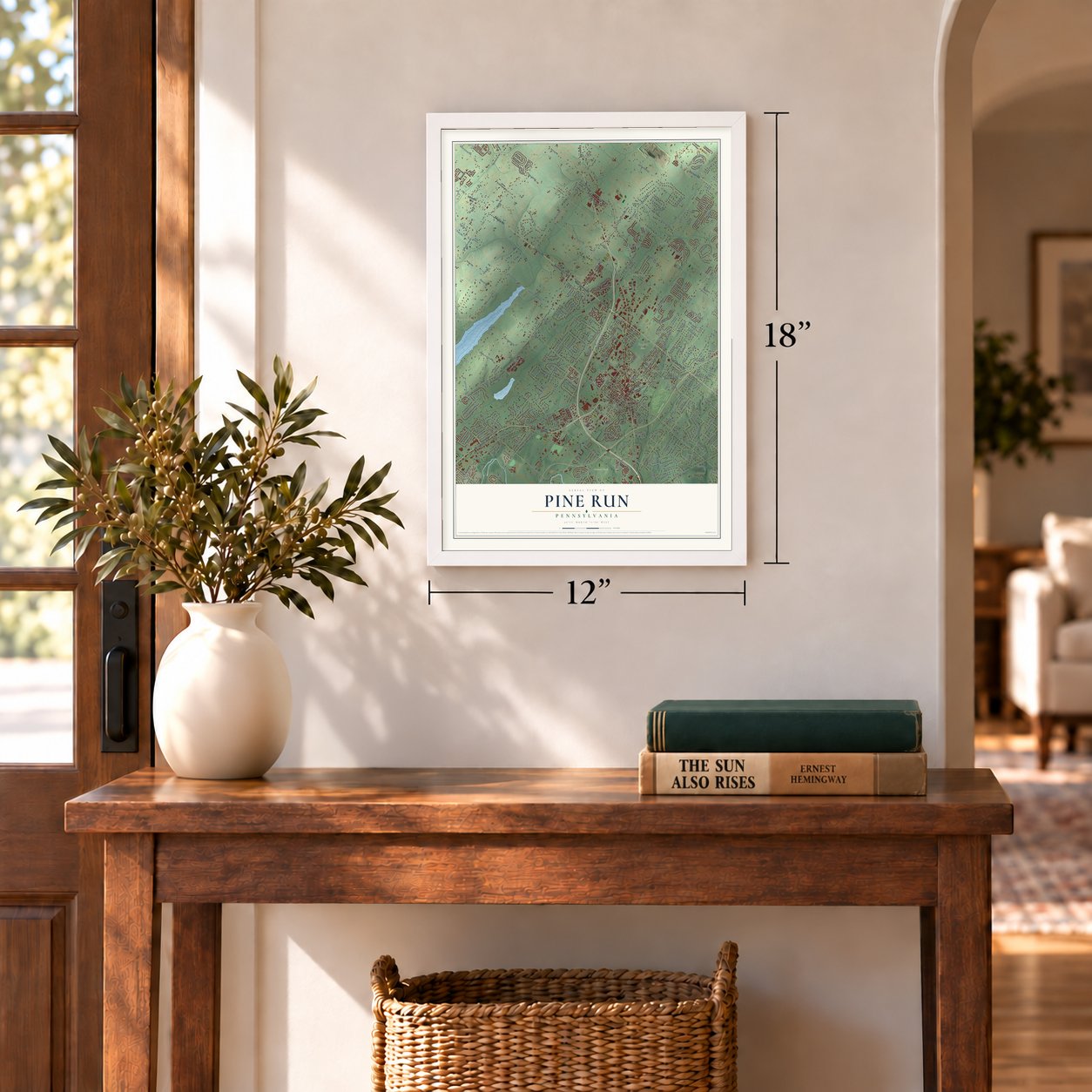
12" x 18" Archival Matte Print
A Map of Home. A Work of Art.
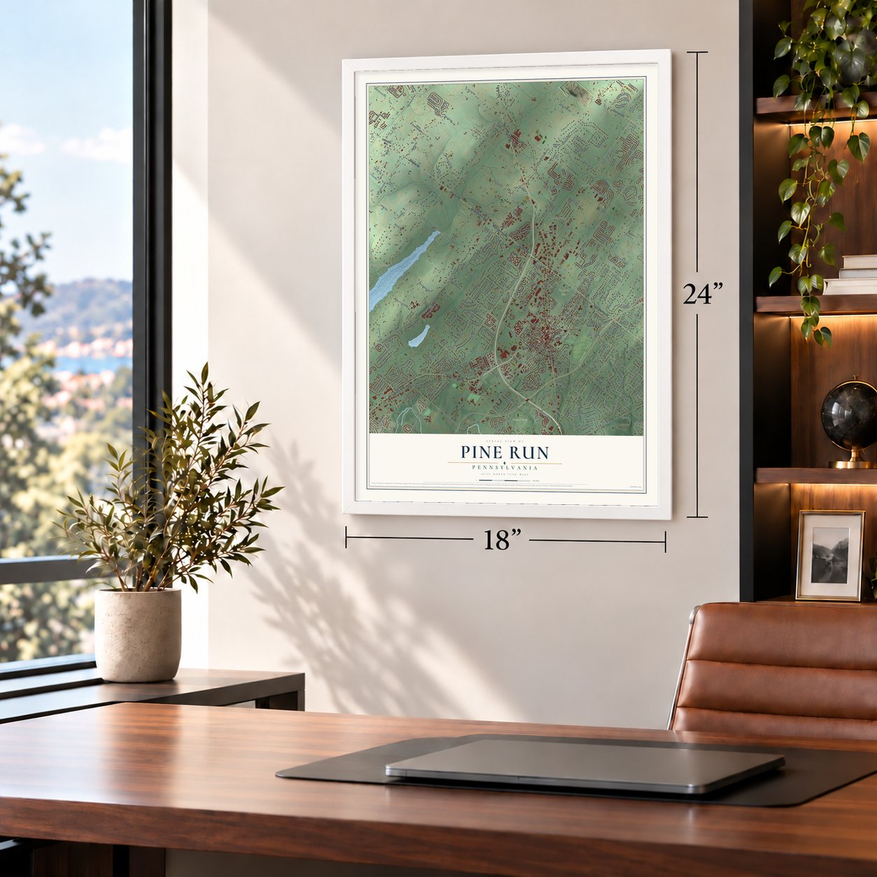
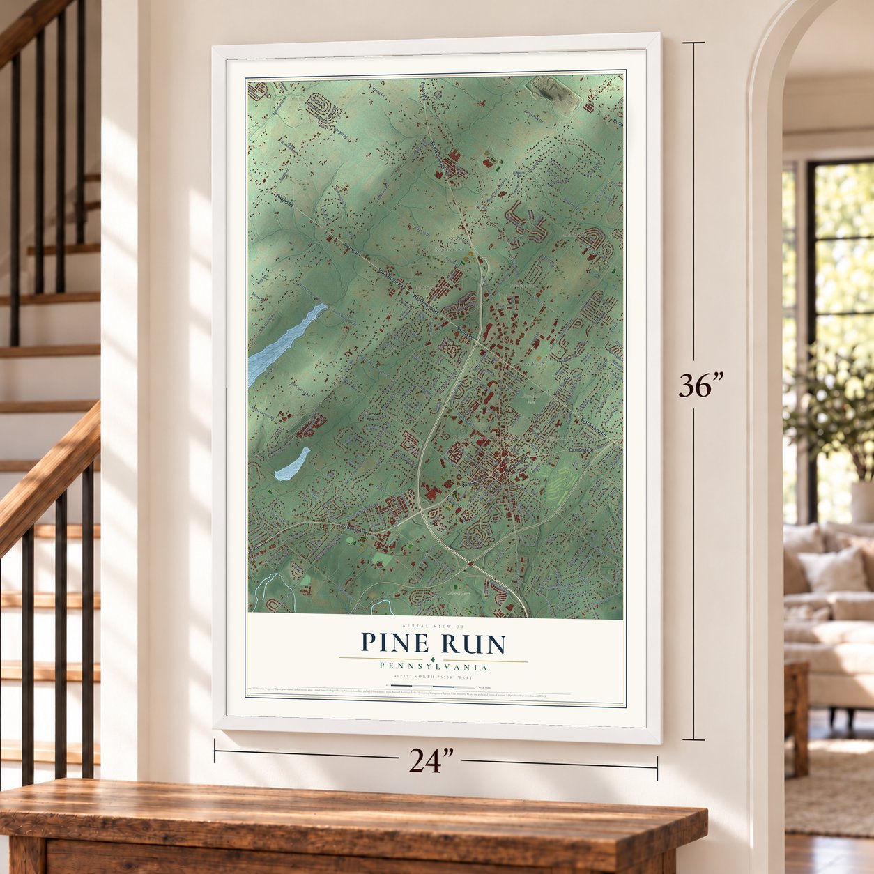
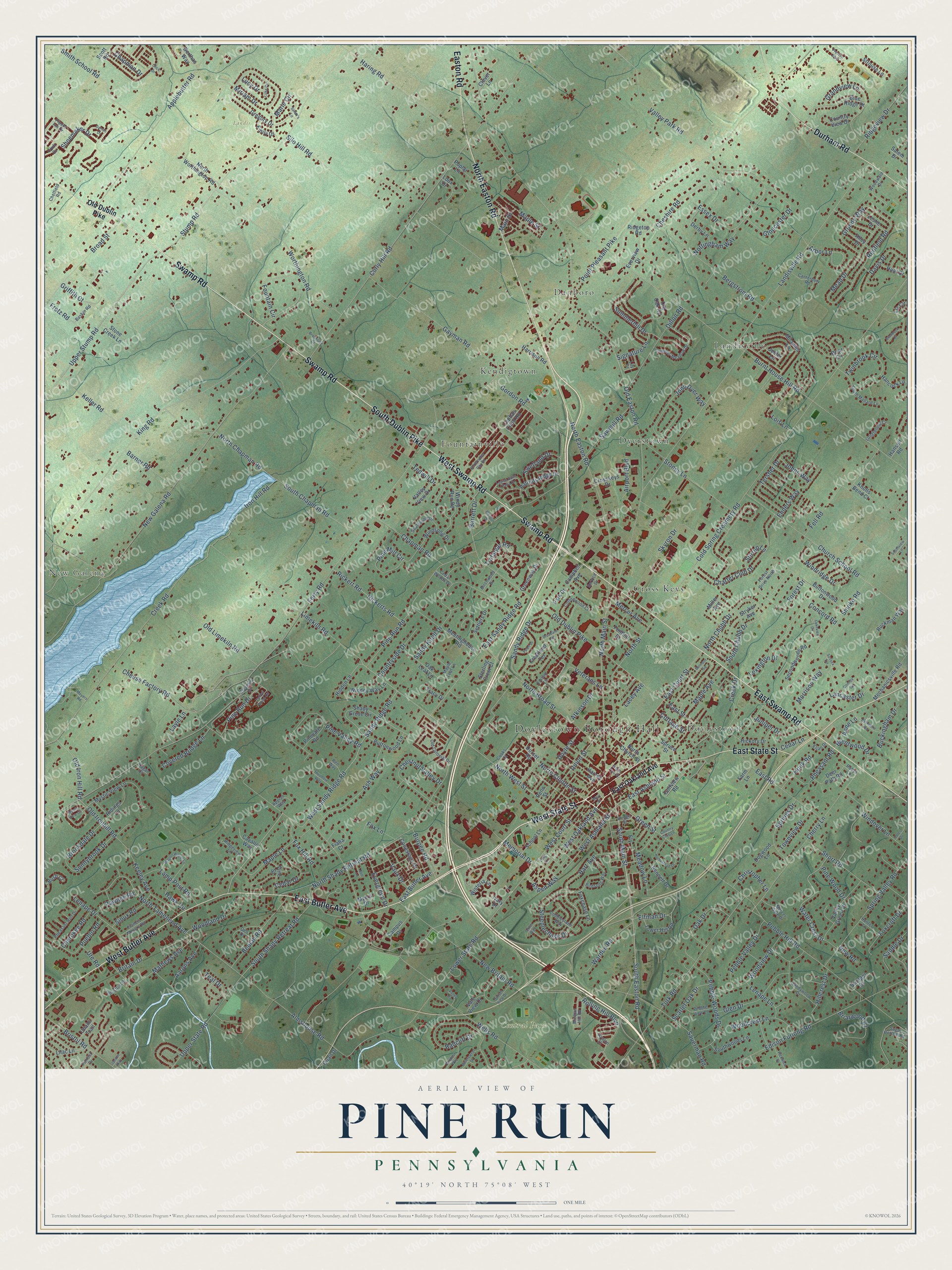
Explore Pine Run, Pennsylvania from a whole new perspective. Created using aerial imagery and detailed geographic data, this map captures Pine Run building by building, with labeled streets, familiar landmarks, and shaded topographical relief that highlights the natural contours of the landscape.
Combining modern data with the timeless character of a vintage atlas, this map is just as interesting up close as it is beautiful on the wall. Whether you grew up in Pine Run, spent memorable years there, or call it home today, this unique map is a great way to celebrate a place that means something to you. Zoom in on the preview to look for your street, and then order a print to put your memories on the wall.
Three ways to hang it
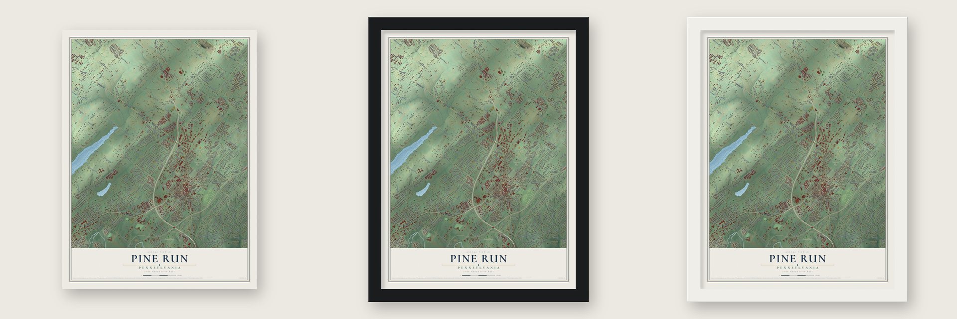
Unframed archival matte, a black wood frame or a white wood frame.
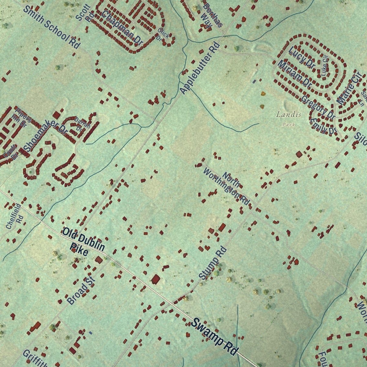
Up close
Geography Worth Displaying
This map was created using accurate cartographic data and authoritative geographic sources, including the U.S. Geological Survey and the Census Bureau. The map brings together terrain, waterways, roads, and building detail. The majority of the streets are labeled, houses are accurately depicted, and the topography is derived from government sources. Combining local data with carefully composed color and shading leads to this beautifully detailed Pine Run artwork for your wall.
Rather than simply showing street outlines, we’ve included as many of the street names as we could reasonably fit on the map while keeping their names legible. Zoom in on the high resolution preview to see exactly what’s on the map. We truly set out to create a statement piece for anyone who loves Pine Run. So whether it’s for you, or a gift for someone you love, we hope this map of Pine Run brings back fond memories.
Read the story behind this map: Detailed Map of Pine Run, Bucks County, Pennsylvania.

Find your street
Names on the Pine Run map
Every name below is printed on this map. Look for your street, your school, the park where you played, or the pond down the road.
Places and landmarks12
- Doylestown Borough Hall
- New Galena
- Central Park
- Fonthill Park
- Landis Park
- Dyerstown
- Fountainville
- Landisville
- Danboro
- Kendigtown
- Doylestown
- Cross Keys
Streets and roads379
- West State Street
- Swamp Road
- West Swamp Road
- East Swamp Road
- North Easton Road
- East Butler Avenue
- South Dublin Pike
- East State Street
- Durham Road
- West Butler Avenue
- Easton Road
- South Main Street
- South Easton Road
- North Clinton Street
- Pine Run Drive
- Upper State Road
- North Main Street
- North West Street
- Limekiln Road
- Main Street
- North Tamenend Avenue
- North Street
- Concord Road
- Water Crest Drive
- Brentwood Drive
- Ferry Road
- Old Easton Road
- Cold Spring Creamery Road
- Iron Hill Road
- Point Pleasant Pike
Show all 379 streets
- Landisville Road
- Burnt House Hill Road
- Curly Hill Road
- New Galena Road
- Creek Road
- Silo Hill Road
- Pebble Hill Road
- Lower State Road
- King Road
- Pine Run Road
- North Shady Retreat Road
- New Britain Road
- Stump Road
- West Sandy Ridge Road
- Sandy Ridge Road
- Old Dublin Pike
- Applebutter Road
- Turk Road
- Edison Furlong Road
- Almshouse Road
- Church School Road
- Old Limekiln Road
- Steeplechase Drive
- Essex Drive
- Upper Stump Road
- Worthington Road
- Cherry Lane
- North Broad Street
- Chapman Road
- Gayman Road
- Sandy Knoll Drive
- East Street
- Sawmill Road
- Smith School Road
- Miriam Drive
- Bergstrom Road
- East Court Street
- Haring Road
- Valley Park Road
- East Sandy Ridge Road
- Smoke Road
- Old Ironhill Road
- John Dyer Way
- Gordon Road
- Fountain Circle
- Spring Valley Road
- Wells Road
- Glen Drive
- Forest Drive
- Charter Club Drive
- Pine Valley Road
- Broad Street
- Hart Avenue
- Fell Road
- Redfield Road
- South Shady Retreat Road
- Maple Avenue
- Radcliff Drive
- Ash Way
- Evergreen Drive
- West Court Street
- Grandview Lane
- Stoney Lane
- Doyle Street
- East Road
- Pebble Woods Drive
- Morrison Way
- Dillon Road
- Chestnut Valley Drive
- Lancaster Drive
- Windover Lane
- Pine Mill Circle
- South Chapman Road
- Rolling Hill Boulevard
- Gloucester Drive
- Woodview Drive
- Keller Road
- Union Street
- Mead Drive
- Foxcroft Drive
- Beulah Road
- Summerhill Drive
- Short Road
- Grundy Way
- Oak Drive
- Twinbrook Circle
- Maple Lane
- Cheese Factory Road
- Bristol Road
- Green Street
- Tersher Drive
- Rickert Road
- Rickerts Road
- North Chubb Drive
- Ridgeview Drive
- East Ashland Street
- Windridge Drive
- Hillcrest Drive
- Cheshire Road
- West Ashland Street
- Sandy Ridge Drive
- Veterans Lane
- Pueblo Road
- Pebble Valley Drive
- West Oakland Avenue
- Sauerman Road
- Davis Drive
- Mathews Avenue
- South Chubb Drive
- Meadow Lane
- Lenape Drive
- Springs Drive
- Skyron Drive
- Keeley Avenue
- Briarwood Court
- Woodland Drive
- Lamp Post Road
- Woodcrest Lane
- Cedar Drive
- Warden Road
- Vaux Drive
- Arbor Lane
- Lois Lane
- Aspen Way
- Old Iron Hill Road
- Trafalgar Road
- Enders Way
- Covered Bridge Lane
- Pheasant Road
- Countryside Drive
- Barner Road
- Sunnybrook Drive
- Brookdale Drive
- North Chapman Road
- Fretz Road
- Elfman Drive
- Nottingham Way
- Barrett Drive
- Swetland Drive
- Burpee Road
- Saddle Drive
- Maple Street
- Scarlet Oak Drive
- Townview Drive
- Lexington Drive
- Juniper Drive
- Memorial Drive
- Aarons Avenue
- Sioux Road
- Christopher Lane
- Shoemaker Drive
- Fox Hill Road
- Griffith Court
- Lenape Lane
- Lacey Avenue
- Buckingham Drive
- Atkinson Drive
- Mercer Avenue
- Pawnee Road
- Cherokee Road
- Fox Lane
- Signature Lane
- Houk Road
- Chapman Drive
- Hawk Circle
- Creek Drive
- Airport Boulevard
- Pine Wood Drive
- Teal Drive
- Layle Lane
- Stirrup Lane
- Cottage Street
- Johns Way
- New Road
- Tedwill Drive
- Cedar Lane
- Britain Drive
- Marie Circle
- Anne Lane
- Ute Road
- Lucy Drive
- East Oakland Avenue
- Dorset Road
- Conestoga Drive
- Shady Grove Circle
- North Church Street
- Spruce Street
- Miladies Lane
- Ruckman Way
- Gregory Drive
- Mystic View Lane
- Meetinghouse Road
- Windy Run Road
- Old Oak Road
- Valley Green Drive
- Buttonwood Drive
- Cephas Child Road
- Wisteria Lane
- Oak Leaf Lane
- Patriots Ridge Drive
- Ridgetop Road
- Hancock Lane
- Hickory Drive
- Mechanicsville Road
- Tower Hill Road
- Blue Ridge Drive
- Park Drive
- Scott Road
- Settlers Drive
- Harvey Avenue
- Strouse Lane
- Secondwoods Road
- Buttonwood Lane
- Farm Lane
- Derby Lane
- Ridings Lane
- Lilac Lane
- Stryker Avenue
- Myers Drive
- North Worthington Road
- Southwoods Lane
- Windsong Drive
- Dogwood Lane
- Deer Path Road
- School Lane
- Everview Drive
- Windey Way Lane
- Fonthill Drive
- Poplar Lane
- Golfview Road
- Sterling Crest Court
- Crosskeys Drive
- Foxchase Lane
- Leslie Drive
- Valley View Drive
- Alley Drive
- Greenway Drive
- Campbell Avenue
- Hunt Drive
- Pinevale Road
- Stone Creek Lane
- Country View Drive
- Vine Street
- Harrison Road
- Berthas Way
- Loux Drive
- Cavallo Way
- Crestland Terrace
- Bennett Drive
- Hansell Road
- Hidden Lane
- Unami Trail
- Emily Drive
- Fiaba Court
- Knolls Bend Court
- Quail Drive
- Vale View Drive
- Miller Avenue
- Liz Circle
- Stringer Drive
- Campus Drive
- Bush Court
- Salem Drive
- Tracy Drive
- Briar Circle
- Jester Lane
- Clover Lane
- Penn Street
- Ivary Drive
- Ely
- Cooks Court
- Summer Meadow Drive
- Cobblestone Way
- Pipers Inn Drive
- South Mallard Lane
- Sandywood Drive
- Old Colonial Drive
- Cottonwood Court
- Birdsong Way
- Pheasant Run Drive
- Francis Meyers Road
- Woodward Drive
- Avalon Court
- Forest Drive North
- Southwind Drive
- Pebble View Lane
- Crescent Drive
- Ridgeview Lane
- Canterbury Road
- Longfellow Court
- Mercer Gate Drive
- Chelfield Road
- Morgan Hill Road
- Industrial Drive
- Baskin Road
- Bridge Street
- Hunter Lane
- Birchwood Drive
- Sugar Bottom Road
- Cedar Woods Drive
- Appian Way
- Edison Lane
- Forrest Drive
- Robyn Lane
- Ren Way
- Croft Drive
- Dell Drive
- Service Drive
- Eljan Drive
- Maple Leaf Lane
- Hagan Court
- Lily Drive
- Yellow Wood Circle
- Christopher Day Road
- Louise Saint Claire Drive
- Belmont Square
- Windsor Way
- Bittersweet Drive
- Sunset View Drive
- Homestead Drive
- Lakeview Circle
- Mystic View Circle
- Wagon Wheel Lane
- Mary Street
- Berkshire Road
- Pearl Drive
- Preston Way
- Pickwick Drive
- Broadale Road
- Theodore Way
- Coles Drive
- Tether Way
- Southview Lane
- Long Lane
- Darrah Drive
- Sarah's Lane
- Comley Circle
- Sussex Terrace
- Braddock Court
- Brookside Court
- Valley Circle
- Luke Circle
- Weldon Drive
- Bell Lane
- Country Club Lane
- Janton Way
- North Pine Street
- Meyers Road
- Glick Drive
Names are listed as they appear on the printed map. Zoom into the product photos to find them.
About Pine Run, Bucks County, Pennsylvania
Thomas Holcomb built the Pine Run mill in 1746. He was the son of Jacob Holcomb of Buckingham. Jacob Stout bought the mill in 1767. For many years after that, it belonged to his son-in-law, Gabriel Swartzlander.
Pine Run got its own creamery in August 1880. By 1883 Bucks County had at least sixteen creameries. Farmers who once kept six or eight cows could now keep eighteen or twenty. Their butter was shipped to New York and Philadelphia.
- An early tractor farmIn 1918 Frederick Blair Jaekel owned and used a tractor plow on the Glen Echo Farm at Pine Run. Since then, many tractors have come into use in Bucks County.
Keep exploring Pennsylvania
Pine Run is one of 3,725 Pennsylvania towns we've mapped. Every dot on the map is a print of its own.
The search covers every state, Pennsylvania first.
Near Pine Run
Order 2 or more town maps and save 10%. Shown in the size and finish you picked above, so they hang as a set.
- Doylestown Borough 12" x 18" / Archival Matte Print $39.99
- Doylestown Township 12" x 18" / Archival Matte Print $39.99
- New Britain Borough 12" x 18" / Archival Matte Print $39.99

More maps nearby: New Britain Township, Plumsteadville, Plumstead, Buckingham and Chalfont.
The art of mapping a place
How This Map Was Made
Real places. Remarkable detail. Discover the layers that turn geographic data into a map of home.

The view from above
Aerial imagery reveals the character of the land: woodland, open fields, and the patterns of a place.

The shape of the land
Elevation data brings hills, valleys, and subtle changes in the landscape into view.

The details of home
Roads, waterways, and building footprints come together to make the map feel unmistakably local.

Geography becomes art
Considered color, shading, and typography bring the layers together in a map made for your wall.


Process illustrated with Mendon, Massachusetts. Aerial imagery: USDA NAIP. Terrain: USGS 3D Elevation Program. Map details and finished artwork: KNOWOL.
The Details
About This Print
Choose an archival matte print, or a black or white Ayous wood frame. The archival matte print is unframed.
Select your size and finish above to see the matching product image and price.
Materials & Craftsmanship
A contemporary map with the character of a classic atlas, printed on archival matte paper. Optional frames are made from Ayous wood.
Your printed map does not include the watermark shown in the full-map preview.
Shipping & Delivery
Free shipping within the United States. Every print is made to order in the USA.
Buying a gift? Add a note in your cart and we'll include it. We never put prices in the package.
Prints ship within 2 to 3 business days. Allow 7 to 10 days total from ordering for delivery. Timing may vary during holidays or periods of high order volume.
Read our shipping policy.
Returns and damaged prints
Each print is made to order. Change-of-mind refunds are not available after production.
If your print arrives damaged, misprinted or incorrect, contact support@knowol.com within 30 days of receiving it. Include your order number, photos and a description of the issue.
Read our full refund and replacement policy. For questions about your order, email support@knowol.com.