
Search for another town


Free U.S. delivery 7 to 10 days after you order
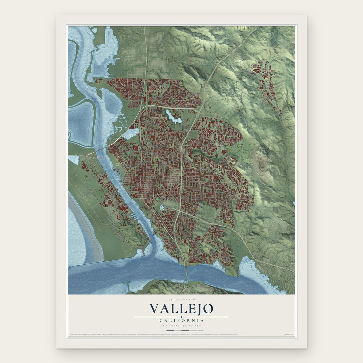
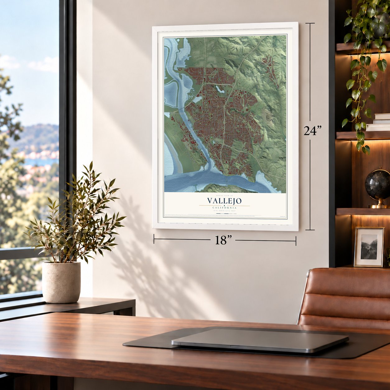
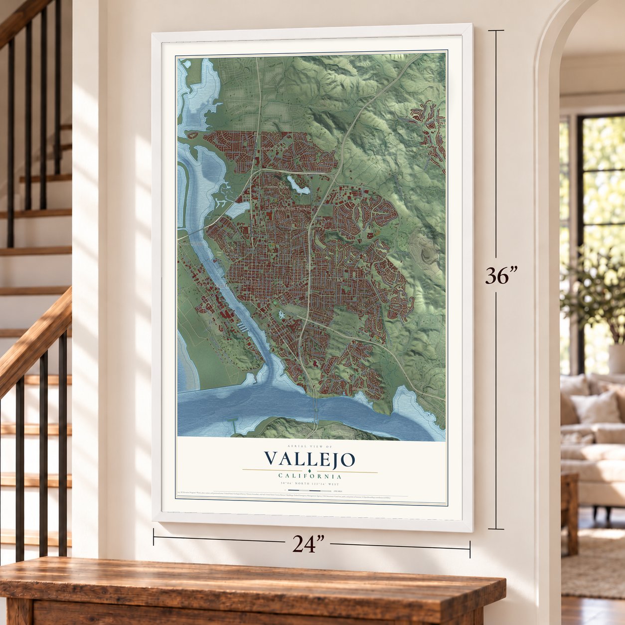
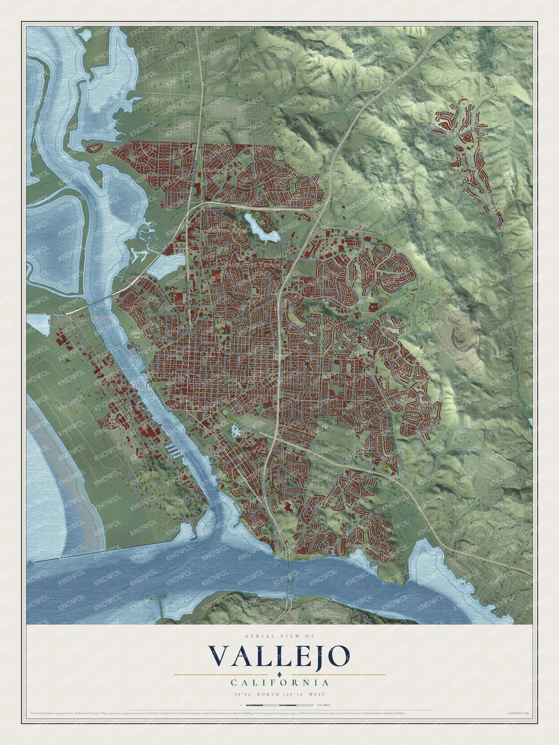
Vallejo, California Map Art
Building by building, with labeled streets and shaded relief.
12" x 18" Archival Matte Print
A Map of Home. A Work of Art.
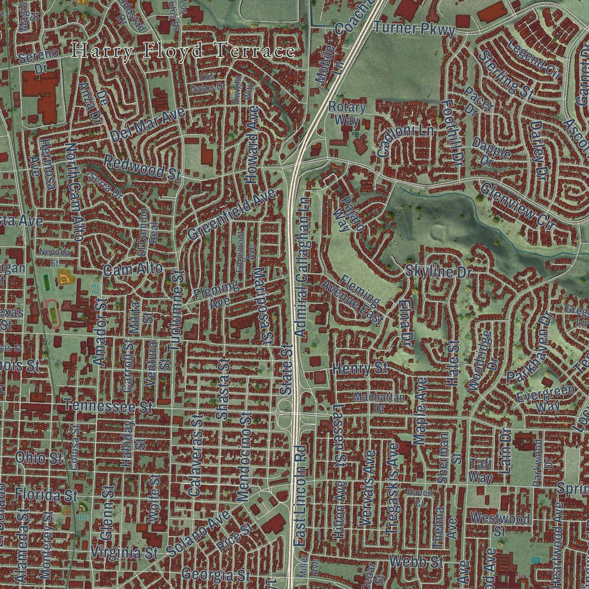
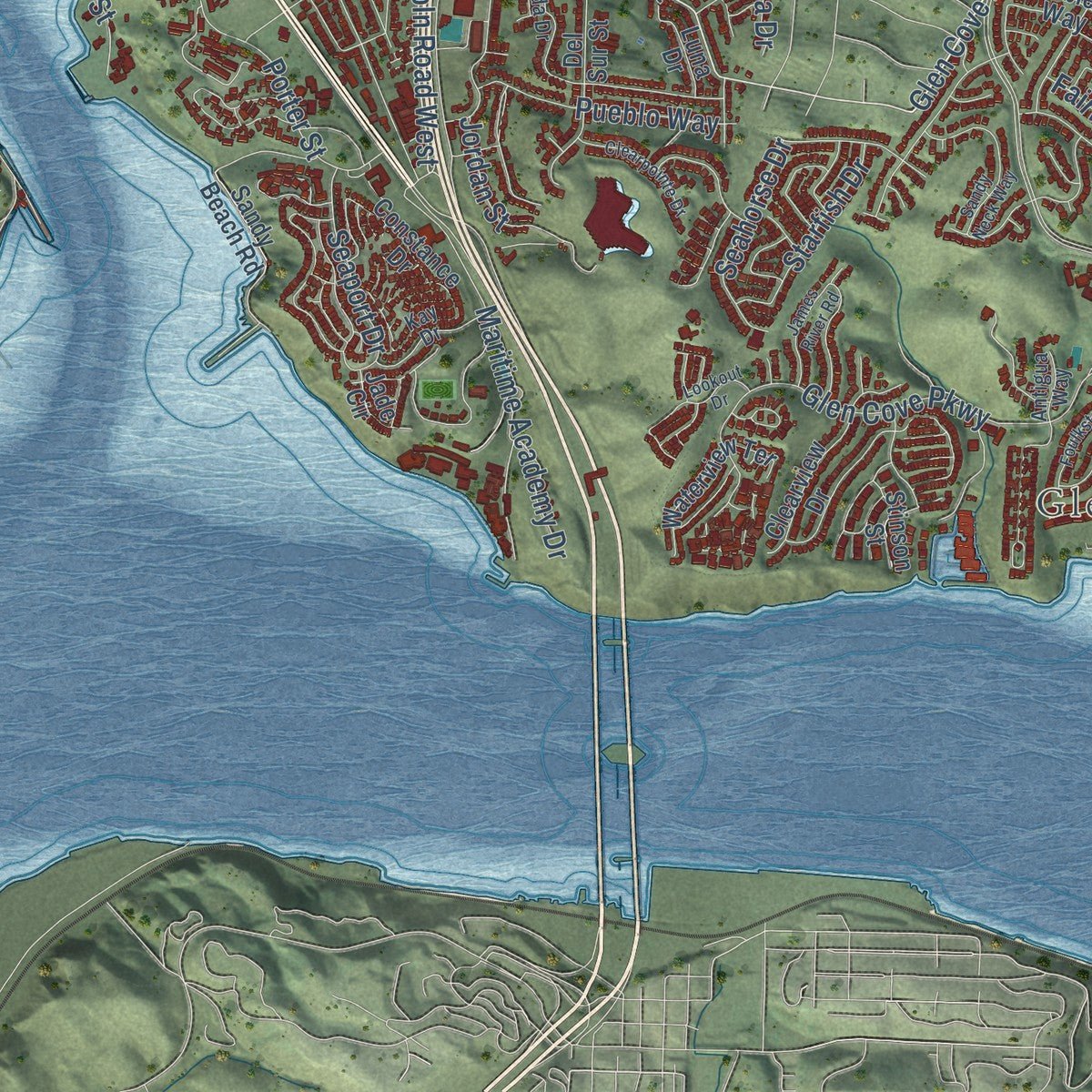
Explore Vallejo, California from a whole new perspective. Created using aerial imagery and detailed geographic data, this map captures Vallejo building by building, with labeled streets, familiar landmarks, and shaded topographical relief that highlights the natural contours of the landscape.
Combining modern data with the timeless character of a vintage atlas, this map is just as interesting up close as it is beautiful on the wall. Whether you grew up in Vallejo, spent memorable years there, or call it home today, this unique map is a great way to celebrate a place that means something to you. Zoom in on the preview to look for your street, and then order a print to put your memories on the wall.
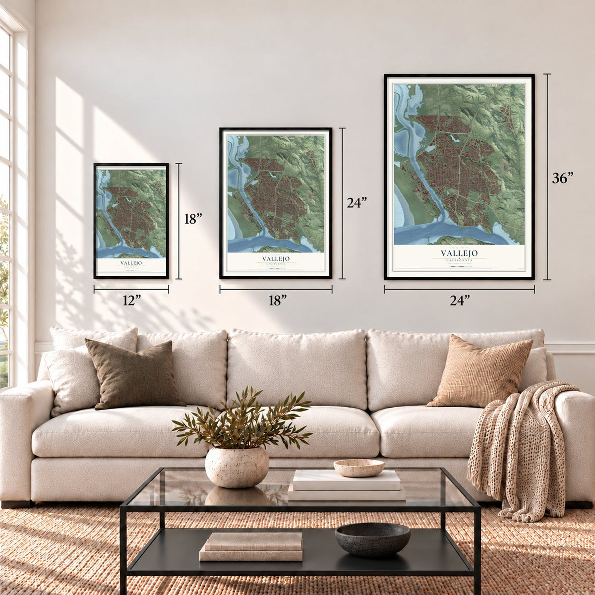
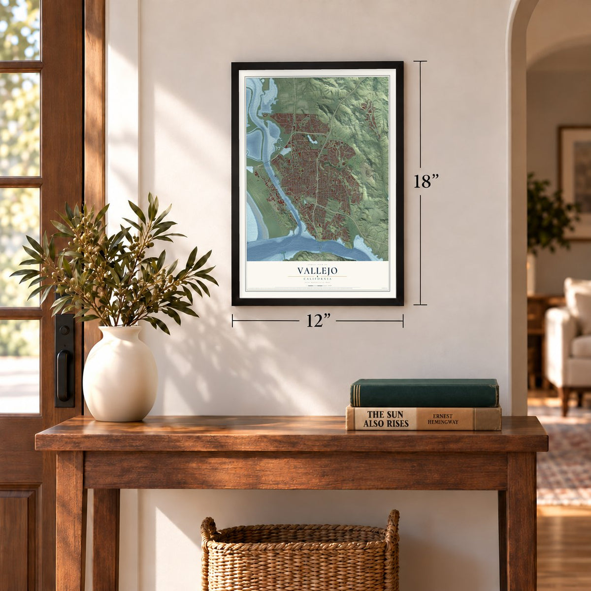
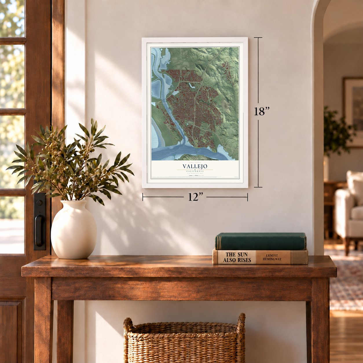
Three ways to hang it
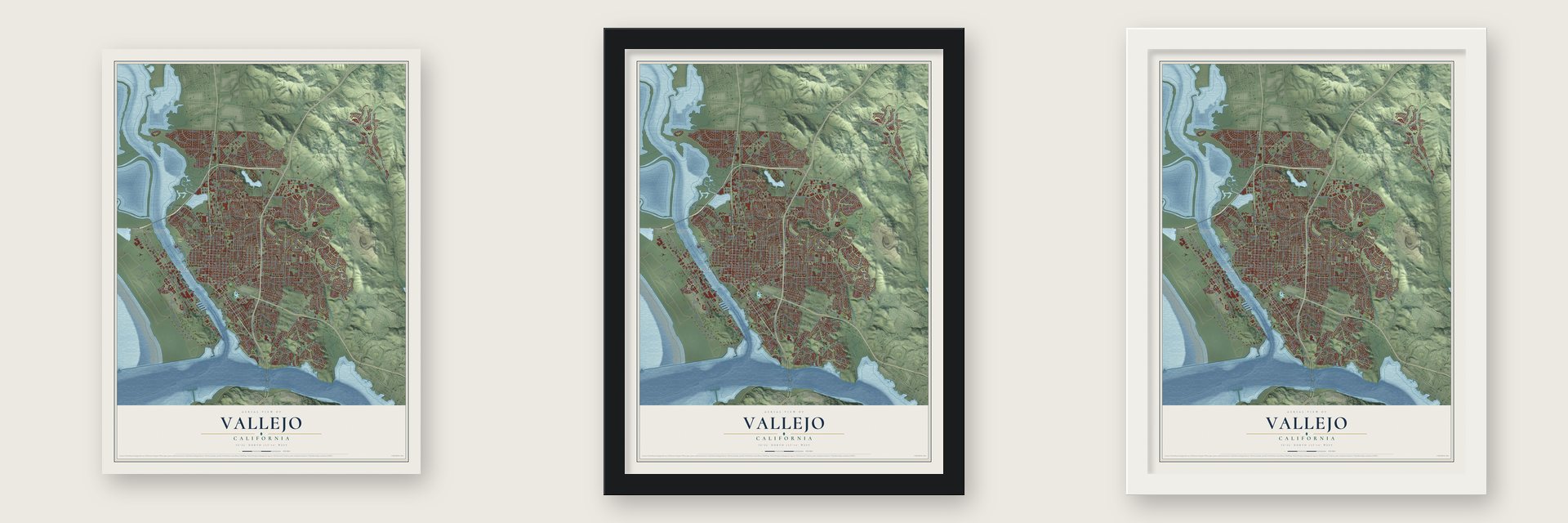
Unframed archival matte, a black wood frame or a white wood frame.
Up close
Geography Worth Displaying
This map was created using accurate cartographic data and authoritative geographic sources, including the U.S. Geological Survey and the Census Bureau. The map brings together terrain, waterways, roads, and building detail. The majority of the streets are labeled, houses are accurately depicted, and the topography is derived from government sources. Combining local data with carefully composed color and shading leads to this beautifully detailed Vallejo artwork for your wall.
Rather than simply showing street outlines, we’ve included as many of the street names as we could reasonably fit on the map while keeping their names legible. Zoom in on the high resolution preview to see exactly what’s on the map. We truly set out to create a statement piece for anyone who loves Vallejo. So whether it’s for you, or a gift for someone you love, we hope this map of Vallejo brings back fond memories.
Read the story behind this map of Vallejo, California from 2026.

Find your street
Names on the Vallejo map
Every name below is printed on this map. Look for your street, your school, the park where you played, or the pond down the road.
Places and landmarks7
- Vallejo City Hall
- Glencove
- Chabot Terrace
- River Park
- Flosden Acres
- Guadalcanal Village
- Harry Floyd Terrace
Streets and roads366
- Sonoma Boulevard
- Railroad Avenue
- Wilson Avenue
- Magazine Street
- Lincoln Road West
- Lawes Street
- Columbus Parkway
- Walnut Avenue
- Glen Cove Road
- Kentucky Street
- Curtola Parkway
- Hiddenbrooke Parkway
- Sixth Street
- Elliott Drive
- Ribeiro Road
- Bennington Drive
- Winchester Street
- Meginniss Road
- Taper Avenue
- Dump Road
- Tennessee Street
- Azuar Drive
- Amador Street
- Maine Street
- Cedar Avenue
- Mariposa Street
- Greenmont Drive
- Sterling Street
- Broadway Street
- Ascot Parkway
Show all 366 streets
- Georgia Street
- Redwood Parkway
- Admiral Callaghan Lane
- Tuolumne Street
- Glen Cove Parkway
- Fairgrounds Drive
- Mini Drive
- Springs Road
- Valle Vista Avenue
- Saint Johns Mine Road
- Sacramento Street
- Lewis Brown Drive
- Flagship Drive
- Florida Street
- Benicia Road
- Redwood Street
- Louisiana Street
- Couch Street
- Ohio Street
- Alabama Street
- Oakwood Avenue
- Solano Avenue
- Turner Parkway
- Landmark Drive
- Fifth Street
- North Cam Alto
- Maple Avenue
- Nimitz Avenue
- Nebraska Street
- Meadows Drive
- Carolina Street
- Napa Street
- Rollingwood Drive
- Borges Lane
- Marin Street
- Sutter Street
- Alameda Street
- Illinois Street
- Vervais Avenue
- North Regatta Drive
- El Dorado
- Corcoran Avenue
- Laurel Street
- Severus Drive
- Virginia Street
- Skyline Drive
- Griffin Drive
- Locust Drive
- Del Mar Avenue
- Tyler Road
- 14th Street
- Indiana Street
- Pueblo Way
- Porter Street
- 13th Street
- Maritime Academy Drive
- Granada Street
- Brunswick Drive
- Shasta Street
- Lemon Street
- Grant Street
- Gateway Drive
- York Street
- Pebble Beach Drive
- Steffan Street
- Roleen Drive
- Weyraugh Road
- Falcon Drive
- Ninth Street
- Jordan Street
- Catalina Circle
- Wallace Avenue
- Daniels Avenue
- Basalt Drive
- Lexington Drive
- Southport Way
- Annette Avenue
- Temple Way
- Glenn Street
- Overlook Drive
- Calaveras Street
- Chenin Blanc Place
- Eagle Ridge Drive
- Foothill Drive
- Sage Street
- Keats Drive
- Catalina Way
- Webb Street
- Stanford Drive
- Windsor Way
- Darley Drive
- Henry Street
- Whitney Avenue
- Idora Avenue
- Ryder Street
- East Lincoln Road
- Britannia Drive
- Hichborn Street
- Lassen Street
- Parkhaven Drive
- Hale Street
- Tobin Drive
- Alhambra Avenue
- Mendocino Street
- Rosewood Avenue
- Greenfield Avenue
- Pepper Drive
- Ladera Drive
- Blake Avenue
- Seahorse Drive
- Starfish Drive
- Howard Avenue
- Sawyer Street
- Highgate Road
- Seaport Drive
- Lighthouse Drive
- Garnet Drive
- Reis Avenue
- Butte Street
- Penny Lane
- Sandhurst Drive
- Auburn Drive
- Newcastle Drive
- Holly Street
- Everett Place
- Cadloni Lane
- Haviture Way
- Tregaskis Avenue
- Derr Street
- Turnberry Way
- Quartz Lane
- Baywood Drive
- Fairhaven Way
- Cabernet Drive
- Glenview Circle
- Harbor Way
- Hilary Way
- Mississippi Street
- Cam Alto
- Brookside Drive
- Farragut Avenue
- Coach Lane
- Oak Avenue
- Radcliffe Drive
- Carousel Drive
- Shady Lane
- Redwing Street
- Irwin Street
- Fleet Street
- Carter Street
- Lain Drive
- Lofas Place
- Dryden Drive
- Ash Street
- State Street
- Elna Drive
- Yolano Drive
- Mare Island Way
- Grove Avenue
- Lake Herman Road
- Plaza Drive
- Jade Circle
- Sereno Drive
- Waterfront Avenue
- Santa Clara Street
- Monterey Street
- Jack London Drive
- Capitol Street
- North Ascot Parkway
- South Regatta Drive
- Evelyn Circle
- Sandy Beach Road
- Topsail Drive
- Legend Circle
- Delwood Avenue
- Rice Street
- Benson Avenue
- Del Sur Street
- Hermosa Avenue
- Wilshire Avenue
- Marshfield Road
- Devlin Drive
- Sunrise Way
- Fleming Avenue
- Waterview Terrace
- Edgewater Place
- Donner Pass Road
- Heartwood Avenue
- Robles Way
- Central Avenue
- Olympic Drive
- Eighth Street
- De Anza Drive
- Fortune Street
- Fleming Avenue East
- Aragon Street
- Alder Creek Road
- Diana Drive
- Clearview Drive
- Gary Circle
- Mesa Road
- Corkwood Street
- Stinson Street
- Woodridge Drive
- Mark Avenue
- Campbell Avenue
- Constance Drive
- Rotary Way
- Dapple Drive
- Sawgrass Lane
- Baxter Street
- Johnson Lane
- Amber Avenue
- Mobile Lane
- Avian Drive
- Warren Avenue
- Carroll Street
- Ventura Street
- Evergreen Way
- Westwood Street
- Spyglass Parkway
- Imhoff Road
- Halliday Street
- Home Acres Avenue
- Thelma Avenue
- Staghorn Drive
- Wildwing Lane
- Hilton Avenue
- Lorenzo Drive
- Michigan Street
- Newhaven Lane
- McLane Street
- Abbey Drive
- Linfield Drive
- Trinity Street
- Pacer Drive
- Sherman Street
- Beston Way
- Luna Drive
- Palm Drive
- Hobbs Avenue
- Cypress Avenue
- Wolfe Street
- Mica Drive
- Oscar Lane
- Crisp Avenue
- Milita Street
- Delta Circle
- Texas Street
- Pajaro Way
- Erin Drive
- Taft Way
- Ken Court
- Echo Summit Road
- El Camino Real
- Cedar Street
- Branciforte Street
- Newport Way
- La Canyada Drive
- Pine Street
- Colusa Street
- Longridge Drive
- Headwater Drive
- Candy Drive
- Bluebell Place
- Birkdale Drive
- Molina Street
- San Miguel Road
- Vanessa Street
- Carlingford Lane
- Lansdowne Place
- Second Street
- Jennings Road
- Gregory Lane
- Manhattan Drive
- Bidwell Way
- Kay Drive
- Parrott Street
- Princeton Avenue
- Parkwood Drive
- Oddstad Drive
- Ifland Way
- Hillview Drive
- Acacia Way
- Donegal Drive
- Magill Street
- Serra Drive
- Pike Street
- Price Way
- Hickory Street
- Moises Way
- Antigua Way
- Plov Way
- Fern Place
- Jersey Street
- Hargus Avenue
- Reis Street
- Coral Road
- Sears Point Road
- Arkansas Street
- Los Cerritos Drive
- Wellfleet Drive
- Phoenix Circle
- Buss Avenue
- Cottonwood Drive
- Knights Circle
- Bergwall Way
- Sandy Neck Way
- Miller Avenue
- Angelina Way
- Zinfandel Lane
- Foulkstone Way
- Cobb Avenue
- Devonshire Street
- Clearpointe Drive
- James River Road
- Frisbie Street
- Edgemont Avenue
- Hayman Avenue
- Chestnut Street
- Pope Drive
- Berkshire Lane
- East Street
- Spruce Street
- Malaga Street
- Dwight Way
- Lookout Drive
- Nevada Street
- Los Gatos Drive
- Doyle Drive
- Sala Street
- Sims Avenue
- Alden Street
- Haven Court
- Apollo Court
- Cadiz Court
Names are listed as they appear on the printed map. Zoom into the product photos to find them.
About Vallejo, California
Vallejo is a city of 126,090 people in Solano County, on San Pablo Bay where the Napa River turns into the Mare Island Strait. In 1843 Governor Manuel Micheltorena granted the 84,000-acre Rancho Suscol to Gen. Mariano Guadalupe Vallejo. The city was founded on that land in 1851 to be the state capital.
The legislature first met here in 1852, but Vallejo never put up a capitol building for it. When lawmakers came back in 1853, they stayed only long enough to move the capital to Benicia, which they did on February 4, 1853. The federal government then opened a naval shipyard on Mare Island in 1854. It carried the city's economy for more than a century, until it closed in 1996.
“Mare Island had the Navy's first shipyard, ammunition depot, hospital, Marine barracks, cemetery, chapel, and radio station in the Pacific.”
- Laid out by John B. FrisbieGeneral Vallejo gave John B. Frisbie power of attorney over the land grant even before Frisbie married his daughter Epifania, and Frisbie is regarded as the city's true founder. He hired E. H. Rowe to plan the town. Rowe gave the east-west streets the names of states and the north-south streets the names of California counties.
- Submarines in World War IIMare Island was a key submarine yard during World War II, where crews both built and overhauled the boats. The shipyard also drew Filipino immigrants to Vallejo in the first decades of the twentieth century.
- The nation's first budget voteIn a vote on April 17, 2012, the council created the first citywide participatory budgeting process in the country, setting aside $3.4 million for residents to spend. They narrowed more than 800 ideas down to 36 ballot projects, and anyone 14 or older could vote in May 2013.
Keep exploring California
Vallejo is one of 1,914 California towns we've mapped. Every dot on the map is a print of its own.
The search covers every state, California first.
Near Vallejo
Order 2 or more town maps and save 10%. Shown in the size and finish you picked above, so they hang as a set.
- Crockett 12" x 18" / Archival Matte Print $39.99
- Rodeo 12" x 18" / Archival Matte Print $39.99
- American Canyon 12" x 18" / Archival Matte Print $39.99

More maps nearby: Napa Junction, Port Costa, Hercules, Benicia and Bayview.
The art of mapping a place
How This Map Was Made
Real places. Remarkable detail. Discover the layers that turn geographic data into a map of home.

The view from above
Aerial imagery reveals the character of the land: woodland, open fields, and the patterns of a place.

The shape of the land
Elevation data brings hills, valleys, and subtle changes in the landscape into view.

The details of home
Roads, waterways, and building footprints come together to make the map feel unmistakably local.

Geography becomes art
Considered color, shading, and typography bring the layers together in a map made for your wall.


Process illustrated with Mendon, Massachusetts. Aerial imagery: USDA NAIP. Terrain: USGS 3D Elevation Program. Map details and finished artwork: KNOWOL.
The Details
About This Print
Choose an archival matte print, or a black or white Ayous wood frame. The archival matte print is unframed.
Select your size and finish above to see the matching product image and price.
Materials & Craftsmanship
A contemporary map with the character of a classic atlas, printed on archival matte paper. Optional frames are made from Ayous wood.
Your printed map does not include the watermark shown in the full-map preview.
Shipping & Delivery
Free shipping within the United States. Every print is made to order in the USA.
Buying a gift? Add a note in your cart and we'll include it. We never put prices in the package.
Prints ship within 2 to 3 business days. Allow 7 to 10 days total from ordering for delivery. Timing may vary during holidays or periods of high order volume.
Read our shipping policy.
Returns and damaged prints
Each print is made to order. Change-of-mind refunds are not available after production.
If your print arrives damaged, misprinted or incorrect, contact support@knowol.com within 30 days of receiving it. Include your order number, photos and a description of the issue.
Read our full refund and replacement policy. For questions about your order, email support@knowol.com.