


Search for another town



Free U.S. delivery 7 to 10 days after you order
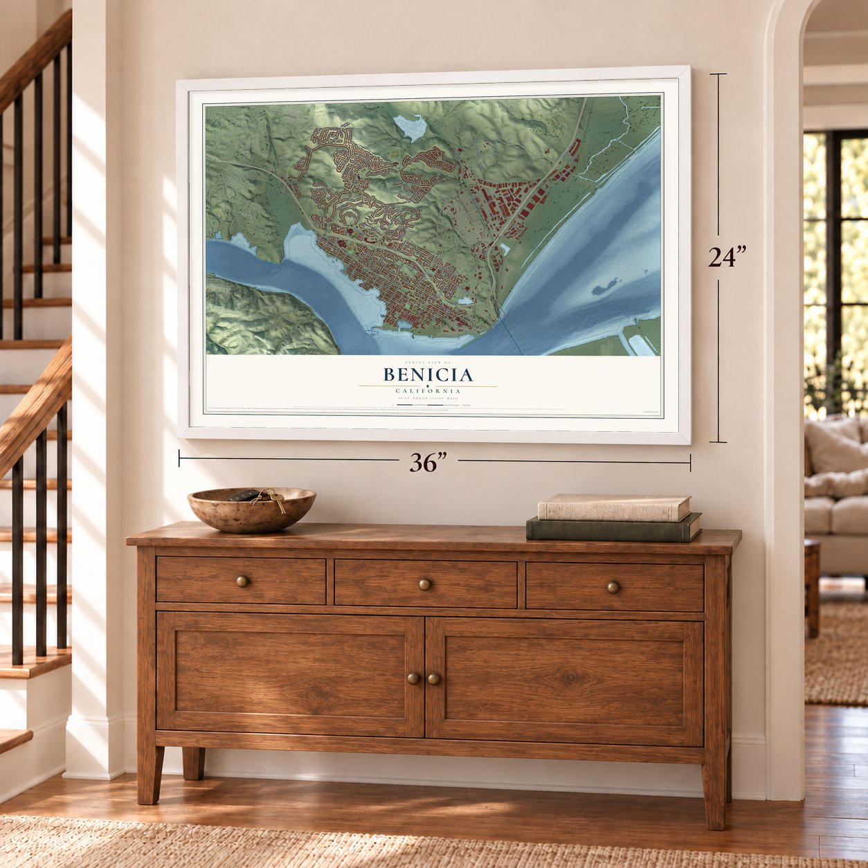
Benicia, California Map Art
Building by building, with labeled streets and shaded relief.
12" x 18" Archival Matte Print
A Map of Home. A Work of Art.
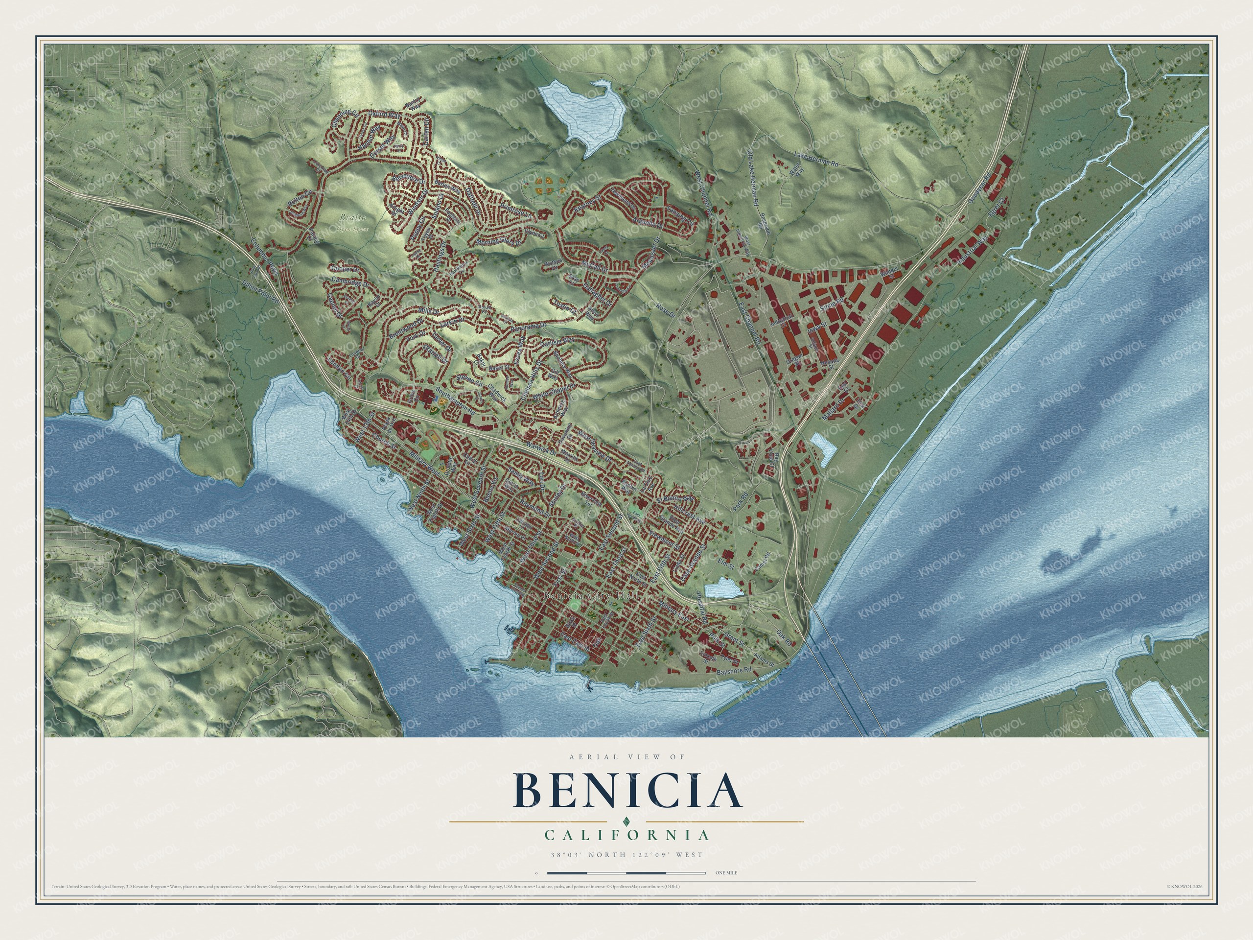
Explore Benicia, California from a whole new perspective. Created using aerial imagery and detailed geographic data, this map captures Benicia building by building, with labeled streets, familiar landmarks, and shaded topographical relief that highlights the natural contours of the landscape.
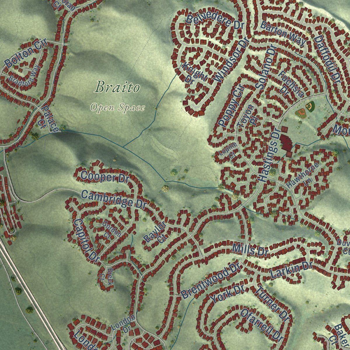
Combining modern data with the timeless character of a vintage atlas, this map is just as interesting up close as it is beautiful on the wall. Whether you grew up in Benicia, spent memorable years there, or call it home today, this unique map is a great way to celebrate a place that means something to you. Zoom in on the preview to look for your street, and then order a print to put your memories on the wall.
Three ways to hang it
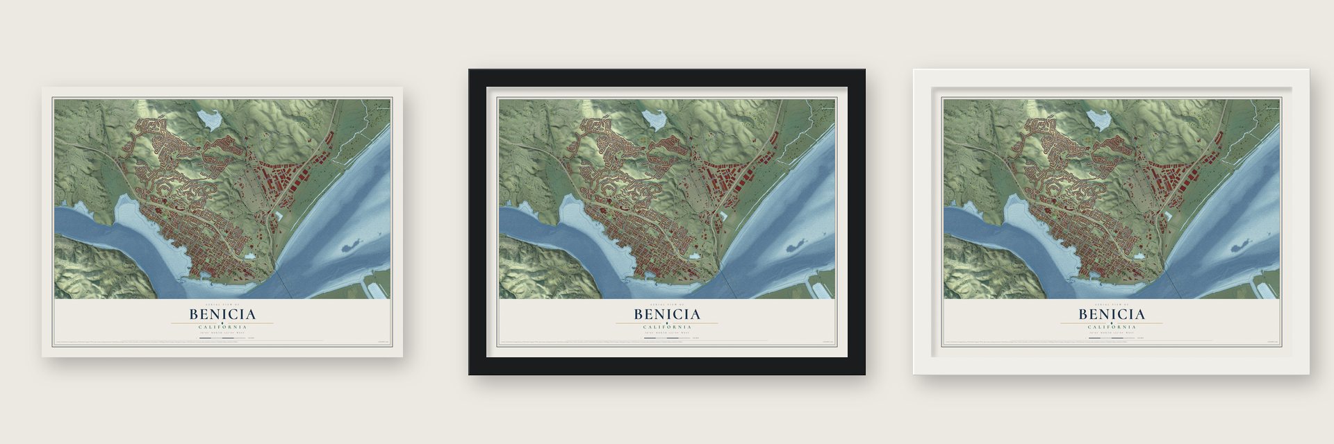
Unframed archival matte, a black wood frame or a white wood frame.
Up close
Geography Worth Displaying
This map was created using accurate cartographic data and authoritative geographic sources, including the U.S. Geological Survey and the Census Bureau. The map brings together terrain, waterways, roads, and building detail. The majority of the streets are labeled, houses are accurately depicted, and the topography is derived from government sources. Combining local data with carefully composed color and shading leads to this beautifully detailed Benicia artwork for your wall.
Rather than simply showing street outlines, we’ve included as many of the street names as we could reasonably fit on the map while keeping their names legible. Zoom in on the high resolution preview to see exactly what’s on the map. We truly set out to create a statement piece for anyone who loves Benicia. So whether it’s for you, or a gift for someone you love, we hope this map of Benicia brings back fond memories.
Read the story behind this map of Benicia, California from 2026.

Find your street
Names on the Benicia map
Every name below is printed on this map. Look for your street, your school, the park where you played, or the pond down the road.
Places and landmarks2
- Benicia City Hall
- Braito Open Space
Streets and roads163
- Military East
- Polk Street
- Military West
- Grant Street
- West Third Street
- East Second Street
- First Street
- Shirley Drive
- Industrial Way
- Lansing Circle
- Rose Drive
- Lake Herman Road
- Park Road
- Bayshore Road
- Dillon Point Road
- Panorama Drive
- Hastings Drive
- Southampton Road
- East Fifth Street
- West Channel Road
- Carlisle Way
- Solano Drive
- Cambridge Drive
- McAllister Drive
- Oxford Way
- Kearney Street
- Old Lake Herman Road
- Mills Drive
- Chelsea Hills Drive
- Primrose Lane
Show all 163 streets
- East Third Street
- Warwick Drive
- Stone Road
- East Channel Road
- Hillcrest Avenue
- McCall Drive
- Lori Drive
- Goodyear Road
- Daffodil Drive
- Larkin Drive
- West Second Street
- Belvedere Drive
- Cooper Drive
- Viewmont Street
- Capitol Drive
- Ofarrell Drive
- East Sixth Street
- Raymond Drive
- Brentwood Drive
- Bolton Circle
- Turner Drive
- West Seventh Street
- Buena Vis
- Oak Road
- Arguello Drive
- Hospital Road
- Morning Glory Drive
- West Seaview Drive
- Casa Grande Street
- East East Street
- Columbus Parkway
- Essex Way
- White Chapel Drive
- Channing Circle
- London Circle
- West Fifth Street
- El Bonito Way
- Dorset Way
- Windsor Drive
- York Drive
- Steven Circle
- Egret Court
- Gallagher Drive
- Poppy Circle
- West Sixth Street
- West Ninth Street
- Elm Street
- Carten Circle
- Hanlon Way
- Sandy Way
- Church Street
- West 13th Street
- Mallard Drive
- Tustin Court
- Iowa Street
- Oak
- Lincoln Street
- Warrick Drive
- Reservoir Road
- East North Street
- Ardmore Way
- Adams Street
- Barton Way
- Bay Vista Court
- Drolette Way
- Camel Road
- Grove Circle
- Banbury Way
- La Cruz Avenue
- Lindo Street
- Chadwick Way
- Townsend Drive
- Allen Way
- Marina Place
- West Eighth Street
- Knight Drive
- Gill Way
- Vista Grande Avenue
- Havenhill Drive
- West Fourth Street
- Riverview Terrace
- Nevada Street
- Water Way
- Bantry Way
- Wanger Street
- Baker Street
- Cheryl Drive
- Teal Court
- Industrial Court
- Fuchsia Drive
- Teal Drive
- Oregon Street
- Palace Court
- Clyne Court
- Toyon Place
- Rankin Way
- Tyler Street
- Baker Court
- Watson Court
- Birch Street
- Gloria Way
- Gray Court
- West 14th Street
- Baylor Court
- Plaza de Oro
- Indiana Street
- East Fourth Street
- West North Street
- London Drive
- West Industrial Way
- Labrador Lane
- Hawthorne Lane
- East Tennys Drive
- Corcoran Court
- Mayo Court
- Duvall Court
- Incline Place
- East South Street
- Columbia Circle
- Dundee Way
- State Park Road
- Bradford Way
- Dover Circle
- Stuart Court
- Durham Court
- Semple Crossing
- Kerry Court
- Gordon Court
- James Court
- Violet Court
- Lupine Court
- Casey Court
- Breck Court
Names are listed as they appear on the printed map. Zoom into the product photos to find them.
About Benicia, California
Benicia is a city of 27,131 people in Solano County, on the north shore of the Carquinez Strait. Dr. Robert Semple, Thomas O. Larkin and General Mariano Guadalupe Vallejo founded it on May 19, 1847, on land Vallejo had given them the December before. Vallejo meant to name it Francisca for his wife, Francisca Benicia Carillo de Vallejo. When Yerba Buena renamed itself San Francisco, the founders used her middle name instead.
In February 1848 news of gold at Sutter's Mill first slipped out in a Benicia tavern, and the town became a stop for miners bound for the Sierras. Benicia was incorporated in March 1850, a month after Sacramento. It was the first seat of Solano County until 1858, when the seat moved to Fairfield. Its new city hall became the state capitol on February 11, 1853, and held that role until February 25, 1854, when the legislature moved to Sacramento for good.
“the best natural site for a commercial city”
- The last early capitolThe old city hall is the only one of California's capitols before Sacramento still standing, and it joined the National Register in 1971 as Benicia Capitol State Historic Park. On March 22, 1945, a fire burned half a block of businesses nearby, including the Solano Hotel and the old brewery, and caught the capitol's roof. Crews put it out quickly, and the building came through with little damage.
- Trains on a ferryOn December 1, 1879, the Central Pacific moved its Sacramento to Oakland line through Benicia. The Solano, then the world's largest ferry, carried whole trains across the strait to Port Costa, and the even bigger Contra Costa joined it later. That crossing lasted until October 15, 1930, when the Southern Pacific's new railroad bridge to Martinez took over. The town then declined until World War II doubled its population to about 7,000.
- The Arsenal and the bridgeBenicia Arsenal began as an Army ordnance depot in August 1851, set up by 21 enlisted men led by Stone. The Army closed it in the early 1960s, and the city turned its land into an industrial park that in time brought in more money than the Army had. The Benicia-Martinez Bridge opened in 1962, and from 1970 to 1995 the city grew by about 1,000 people a year, from 7,000 to 27,000.
- Mills College began hereThe Young Ladies Seminary opened in Benicia in 1852 on West I Street. No college for women anywhere west of the Rocky Mountains came before it, and in 1871 it moved to Oakland as the start of Mills College.
- Jack London and the Benicia BoyJack London worked in the local fishing trade and began writing while he lived in Benicia. The architect Addison Mizner and the playwright Wilson Mizner were born here, and the boxer John C. Heenan was known as "The Benicia Boy." On June 5, 1889, James J. Corbett and Joe Choynski fought 28 rounds on a barge offshore, and a plaque near Southampton Bay marks the match.
Keep exploring California
Benicia is one of 1,990 California towns we've mapped. Every dot on the map is a print of its own.
The search covers every state, California first.
Near Benicia
Order 2 or more town maps and save 10%. Shown in the size and finish you picked above, so they hang as a set.
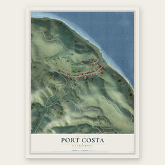
- Port Costa 12" x 18" / Archival Matte Print $39.99
- Crockett 12" x 18" / Archival Matte Print $39.99
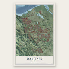
- Martinez 12" x 18" / Archival Matte Print $39.99

More maps nearby: Vine Hill, Rodeo, Vallejo, Alhambra Valley and Pacheco.
The art of mapping a place
How This Map Was Made
Real places. Remarkable detail. Discover the layers that turn geographic data into a map of home.

The view from above
Aerial imagery reveals the character of the land: woodland, open fields, and the patterns of a place.

The shape of the land
Elevation data brings hills, valleys, and subtle changes in the landscape into view.

The details of home
Roads, waterways, and building footprints come together to make the map feel unmistakably local.

Geography becomes art
Considered color, shading, and typography bring the layers together in a map made for your wall.


Process illustrated with Mendon, Massachusetts. Aerial imagery: USDA NAIP. Terrain: USGS 3D Elevation Program. Map details and finished artwork: KNOWOL.
The Details
About This Print
Choose an archival matte print, or a black or white Ayous wood frame. The archival matte print is unframed.
Select your size and finish above to see the matching product image and price.
Materials & Craftsmanship
A contemporary map with the character of a classic atlas, printed on archival matte paper. Optional frames are made from Ayous wood.
Your printed map does not include the watermark shown in the full-map preview.
Shipping & Delivery
Free shipping within the United States. Every print is made to order in the USA.
Buying a gift? Add a note in your cart and we'll include it. We never put prices in the package.
Prints ship within 2 to 3 business days. Allow 7 to 10 days total from ordering for delivery. Timing may vary during holidays or periods of high order volume.
Read our shipping policy.
Returns and damaged prints
Each print is made to order. Change-of-mind refunds are not available after production.
If your print arrives damaged, misprinted or incorrect, contact support@knowol.com within 30 days of receiving it. Include your order number, photos and a description of the issue.
Read our full refund and replacement policy. For questions about your order, email support@knowol.com.