
Search for another town



Free U.S. delivery 7 to 10 days after you order
Pittsford, Vermont Map Art
Building by building, with labeled streets and shaded relief.
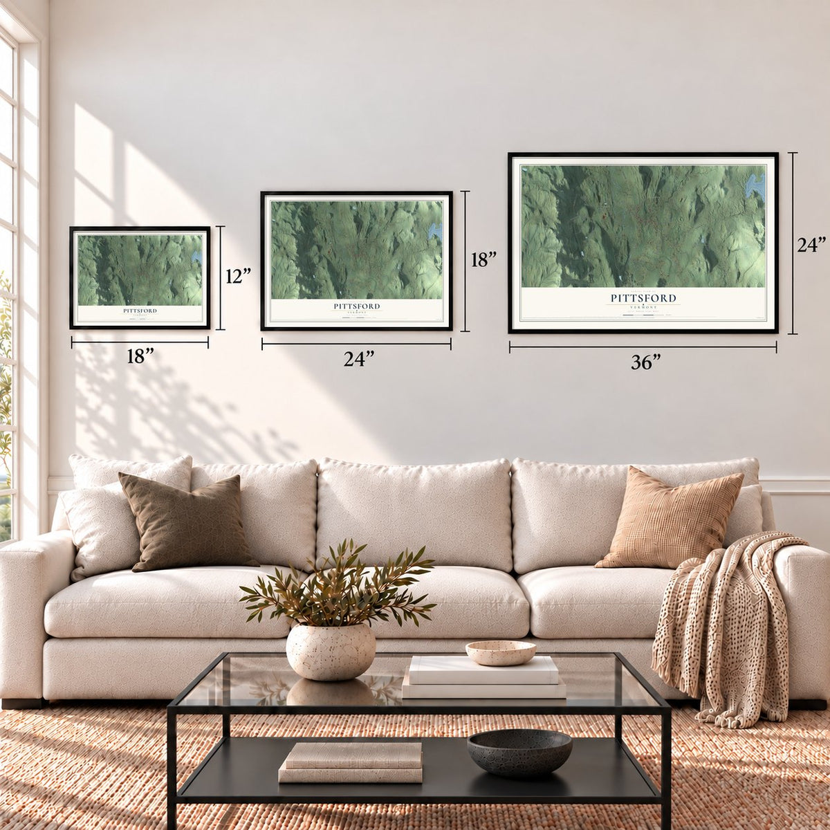
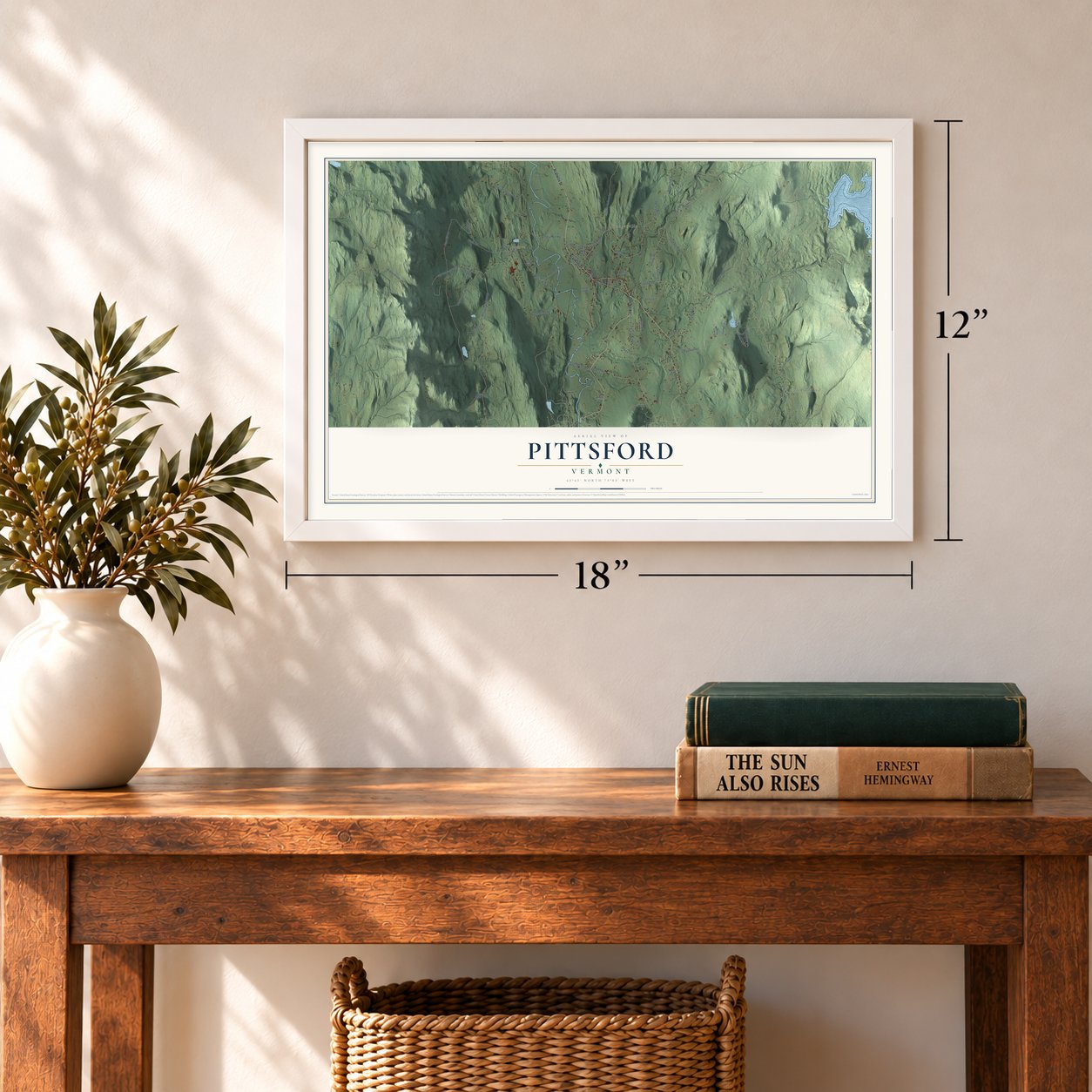
12" x 18" Archival Matte Print
A Map of Home. A Work of Art.
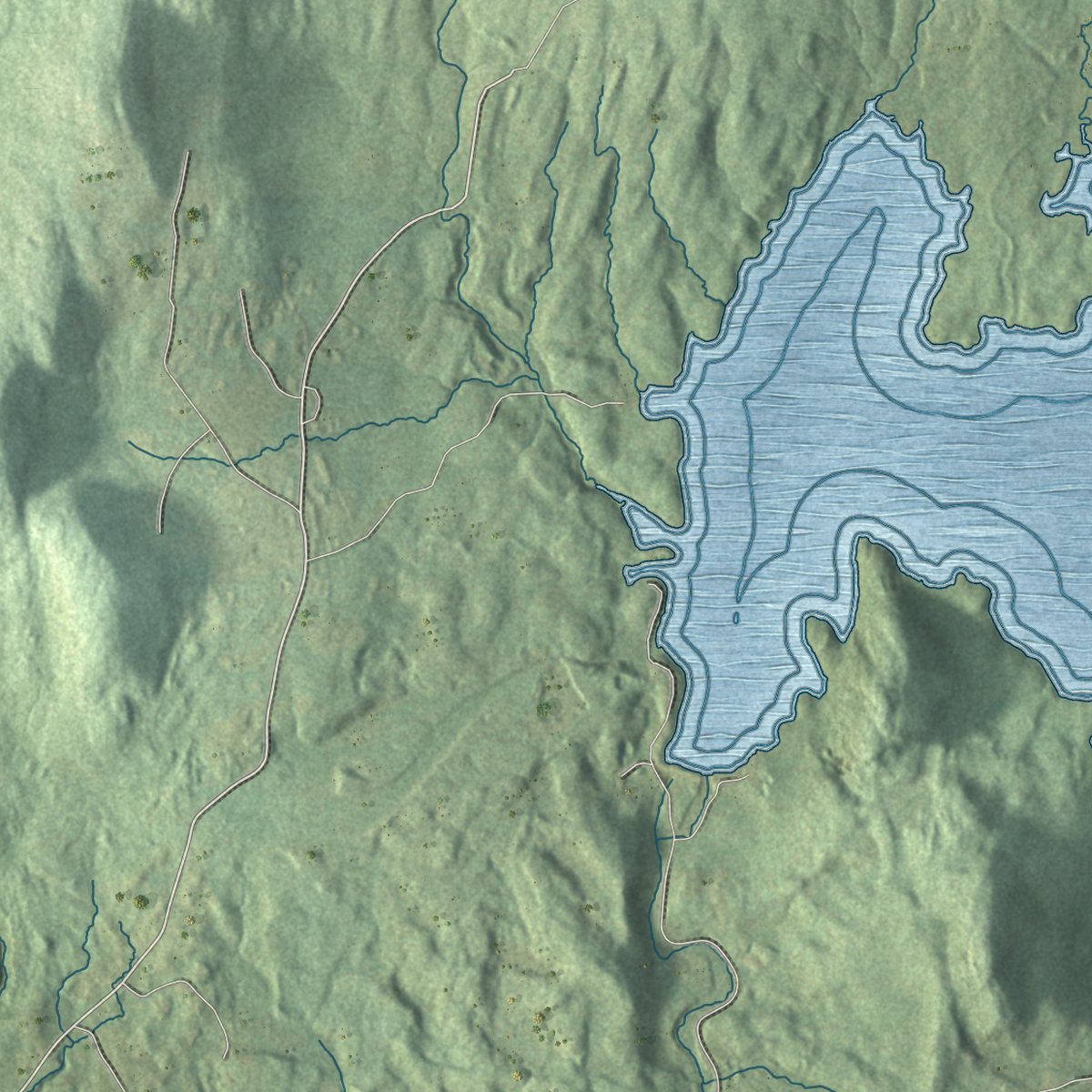
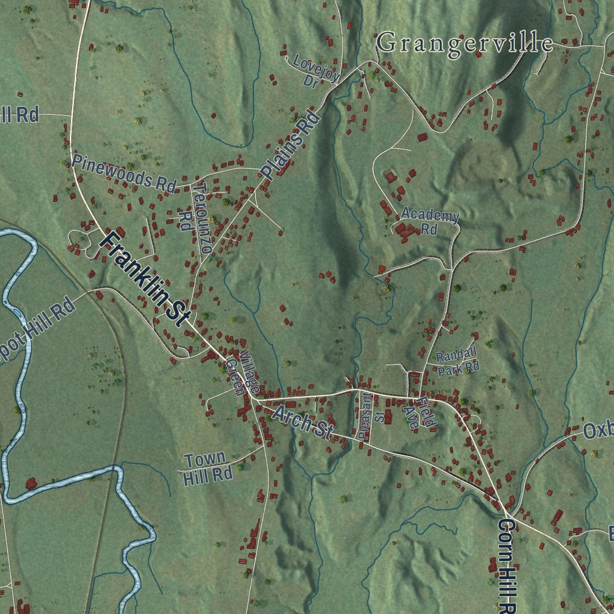
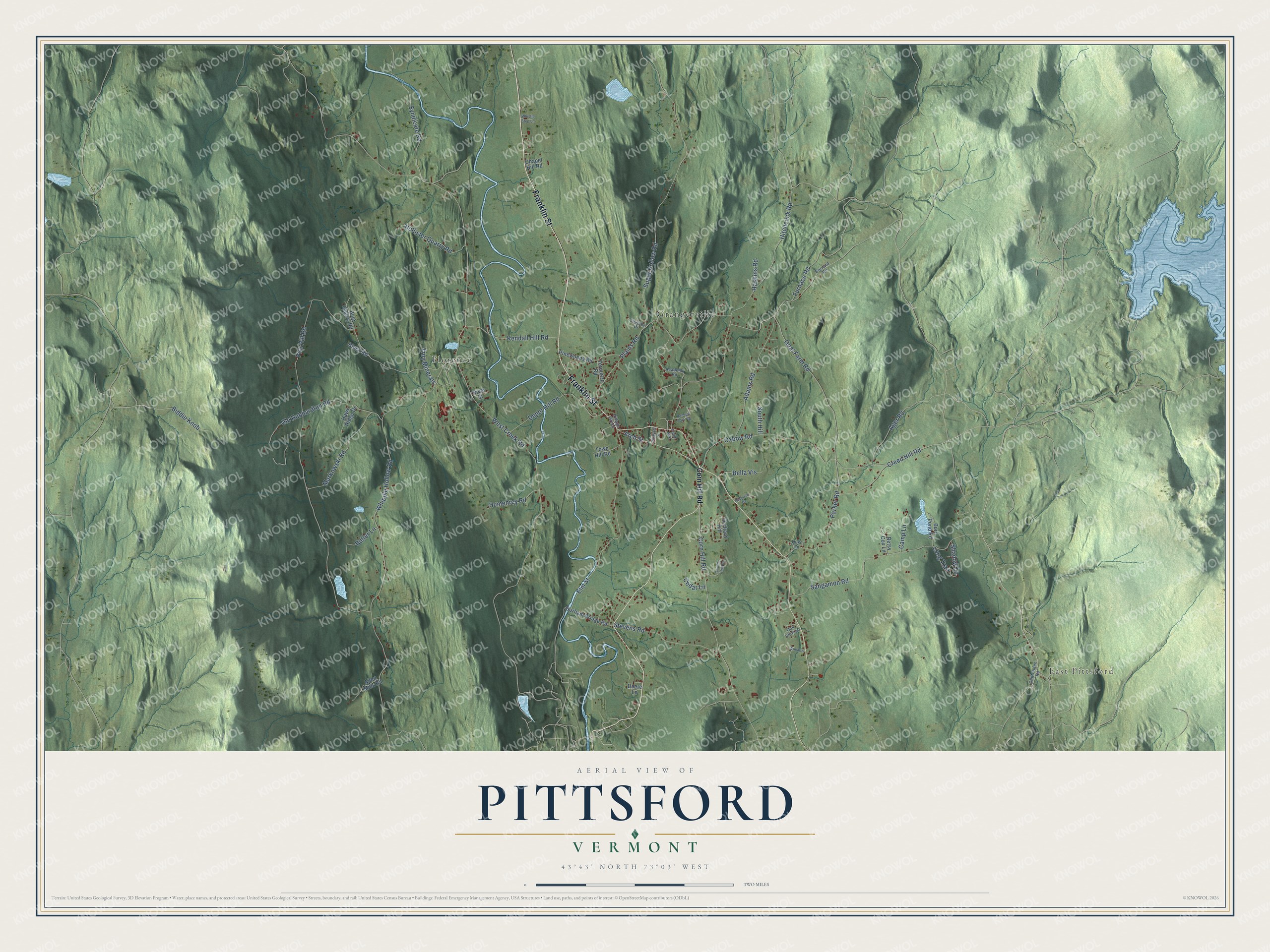
Explore Pittsford, Vermont from a whole new perspective. Created using aerial imagery and detailed geographic data, this map captures Pittsford building by building, with labeled streets, familiar landmarks, and shaded topographical relief that highlights the natural contours of the landscape.
Combining modern data with the timeless character of a vintage atlas, this map is just as interesting up close as it is beautiful on the wall. Whether you grew up in Pittsford, spent memorable years there, or call it home today, this unique map is a great way to celebrate a place that means something to you. Zoom in on the preview to look for your street, and then order a print to put your memories on the wall.
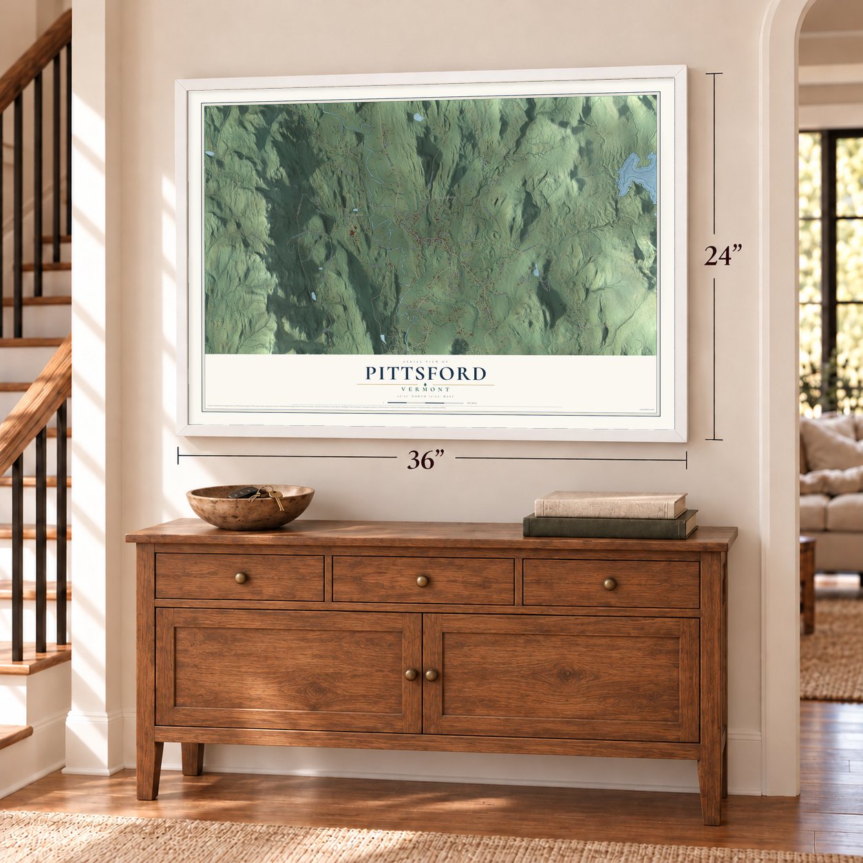
Three ways to hang it
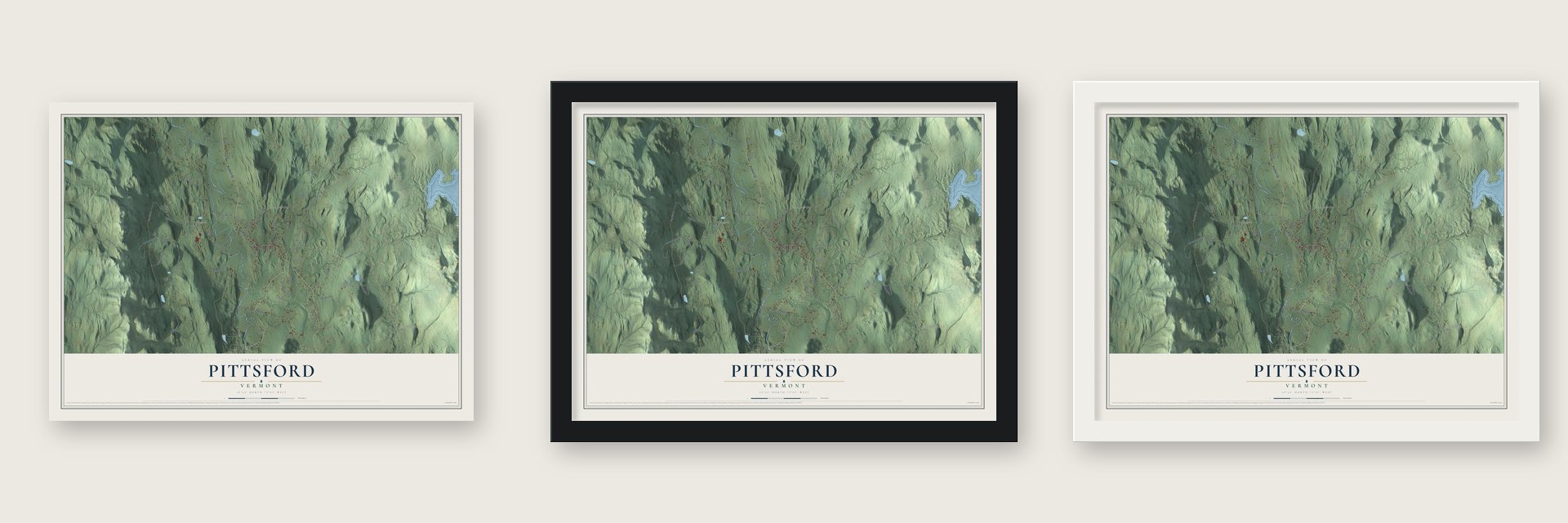
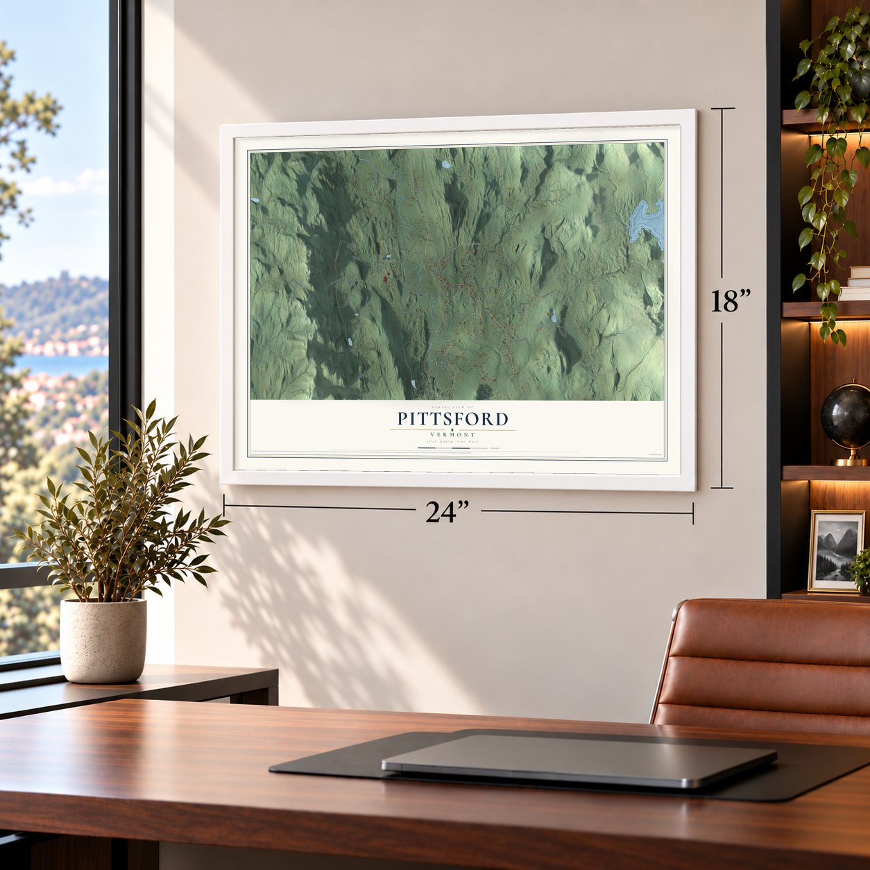
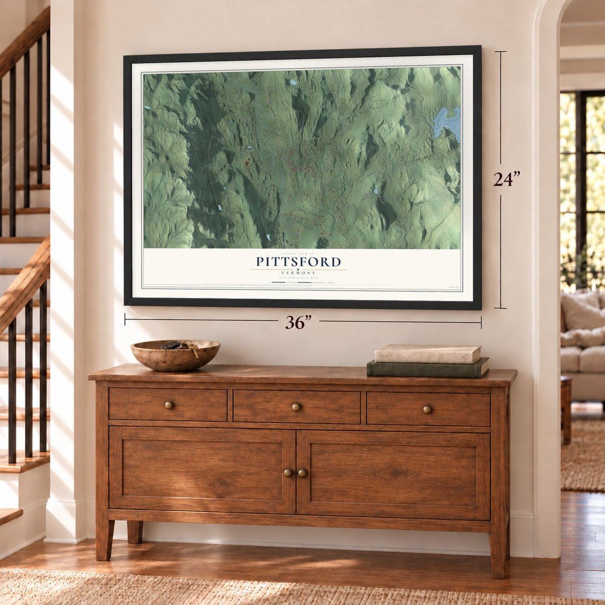
Unframed archival matte, a black wood frame or a white wood frame.
Up close
Geography Worth Displaying
This map was created using accurate cartographic data and authoritative geographic sources, including the U.S. Geological Survey (USGS) and FEMA. The map brings together terrain, waterways, roads, and building detail. The majority of the streets are labeled, houses are accurately depicted, and the topography is derived from government sources. Combining local data with carefully composed color and shading leads to this beautifully detailed Pittsford artwork for your wall.
Rather than simply showing street outlines, we’ve included as many of the street names as we could reasonably fit on the map while keeping their names legible. Zoom in on the high resolution preview to see exactly what’s on the map. We truly set out to create a statement piece for anyone who loves Pittsford. So whether it’s for you, or a gift for someone you love, we hope this map of Pittsford brings back fond memories.
Explore the full map of Pittsford, Vermont and read about the local places it shows.
Find your street
Names on the Pittsford map
Every name below is printed on this map. Look for your street, your school, the park where you played, or the pond down the road.
Places and landmarks3
- East Pittsford
- Florence
- Grangerville
Streets and roads64
- Franklin Street
- Goat Farm Road
- Corn Hill Road
- West Creek Road
- Fire Hill Road
- Whipple Hollow Road
- Furnace Road
- Sugar Hollow Road
- Oxbow Road
- Sangamon Road
- Plains Road
- Elm Street
- Hitchcock Road
- Parker Road
- Adams Road
- Markowski Road
- Depot Hill Road
- Stevens Road
- Creed Hill Road
- Syndicate Road
- Kendall Hill Road
- Old Hubbardton Road
- Arch Street
- Hollister Quarry Road
- Ager Road
- Humphrey Road
- Bella Vis
- Butler Lane
- Biddie Knob
- Long Trail
Show all 64 streets
- Troy Minerals
- Shadow Lane
- Camp Lane
- South Hill
- Cedar Lane
- Haskins Road
- Orchard Hill
- Pinewoods Road
- Gorham Bridge Road
- Allen Mills Road
- Burr Pond Road
- Blue Quarry Road
- Hawk Ridge Drive
- Town Hill Road
- Terounzo Road
- Block Road
- Betsy Cox Lane
- Chapel Hill Road
- River Street
- Deere Lane
- Chittenden Road
- Barnard Road
- Academy Road
- Duke Lane
- Oak View Lane
- Lovejoy Drive
- Village Green
- Field Avenue
- Country Club Drive
- Whistle Stop Lane
- Gloriosa Drive
- Randall Park Road
- Pleasant Street
- Winslow
Names are listed as they appear on the printed map. Zoom into the product photos to find them.
About Pittsford, Vermont
Pittsford is a town of 2,862 people in Rutland County, on Otter Creek. It was named for William Pitt when New Hampshire granted it on October 12, 1761, but no one settled for good until 1769, when the half-brothers Benjamin and Gideon Cooley arrived. Benjamin soon joined the Green Mountain Boys under Ethan Allen and Benedict Arnold, and they took Fort Ticonderoga from the British on May 10, 1775.
The war then came to the town itself. Settlers fled their homes in the days before the Battle of Hubbardton, fought on July 7, 1777, and those who returned built Fort Mott, a picket fort beside Otter Creek. In 1780 Major Ebenezer Allen raised Fort Vengeance about a mile farther north and held it with 150 men, naming it for a soldier killed nearby. A marble obelisk set up in 1873 beside Route 7, near the Brandon line, still marks where it stood.
- A village on the stage roadThe village center took shape in about 1795. A tavern opened then, Israel Keith set up an iron foundry, and Jeremiah Sheldon began cutting marble across Otter Creek. Stagecoaches between Rutland and Vergennes stopped here on the road that is now Route 7. The Congregational Church rose at the north end of the green in 1837, and the brick Maclure Library followed in 1894 and 1895. By 1900 most local industry had faded, but the marble quarries kept working.
- A voyage downstream in 1927Asa Nourse built the Hammond Covered Bridge over Otter Creek in 1842. In the flood of 1927 the water lifted it off its footings and carried it 1.5 miles downstream, yet it held together, and crews floated it back home on barrels. The state owns it today, and cars can no longer cross it.
- Nicholas Powers's Cooley BridgeNicholas M. Powers grew up on a farm near Furnace Brook and became Vermont's best-known covered bridge builder. In 1849 he built the Cooley Covered Bridge over that brook, about a mile south of the village, and it still carries Elm Street. The Depot Covered Bridge, from about 1840, crosses Otter Creek west of the village.
- A stone arch from 1899Anne Wagner Boardman gave the town the Colburn Bridge, a stone arch built in 1899 over the gorge of Sugar Hollow Brook on Route 7, east of the village. When it joined the National Register in 1990, Vermont had only seventeen documented masonry arch bridges.
- A Scottish schoolmanThomas H. Palmer, an educator who came from Scotland, became Pittsford's school superintendent in 1828 and made his home in a brick house of 1832 south of the village. His changes to the town's schools were noticed all over Vermont, and in the 1840s he helped lead the work of raising the state's education standards.
Keep exploring Vermont
Pittsford is one of 333 Vermont towns we've mapped. Every dot on the map is a print of its own.
The search covers every state, Vermont first.
Near Pittsford
Order 2 or more town maps and save 10%. Shown in the size and finish you picked above, so they hang as a set.
- Proctor 12" x 18" / Archival Matte Print $39.99
- Hubbardton 12" x 18" / Archival Matte Print $39.99
- Brandon 12" x 18" / Archival Matte Print $39.99


More maps nearby: West Rutland, Chittenden, Rutland City, Castleton and Sudbury.
The art of mapping a place
How This Map Was Made
Real places. Remarkable detail. Discover the layers that turn geographic data into a map of home.

The view from above
Aerial imagery reveals the character of the land: woodland, open fields, and the patterns of a place.

The shape of the land
Elevation data brings hills, valleys, and subtle changes in the landscape into view.

The details of home
Roads, waterways, and building footprints come together to make the map feel unmistakably local.

Geography becomes art
Considered color, shading, and typography bring the layers together in a map made for your wall.


Process illustrated with Mendon, Massachusetts. Aerial imagery: USDA NAIP. Terrain: USGS 3D Elevation Program. Map details and finished artwork: KNOWOL.
The Details
About This Print
Choose an archival matte print, or a black or white Ayous wood frame. The archival matte print is unframed.
Select your size and finish above to see the matching product image and price.
Materials & Craftsmanship
A contemporary map with the character of a classic atlas, printed on archival matte paper. Optional frames are made from Ayous wood.
Your printed map does not include the watermark shown in the full-map preview.
Shipping & Delivery
Free shipping within the United States. Every print is made to order in the USA.
Buying a gift? Add a note in your cart and we'll include it. We never put prices in the package.
Prints ship within 2 to 3 business days. Allow 7 to 10 days total from ordering for delivery. Timing may vary during holidays or periods of high order volume.
Read our shipping policy.
Returns and damaged prints
Each print is made to order. Change-of-mind refunds are not available after production.
If your print arrives damaged, misprinted or incorrect, contact support@knowol.com within 30 days of receiving it. Include your order number, photos and a description of the issue.
Read our full refund and replacement policy. For questions about your order, email support@knowol.com.