
Search for another town





Free U.S. delivery 7 to 10 days after you order
Pontotoc, Mississippi Map Art
A new map of Pontotoc, Mississippi, made in 2026 and printed to order on thick archival matte paper.
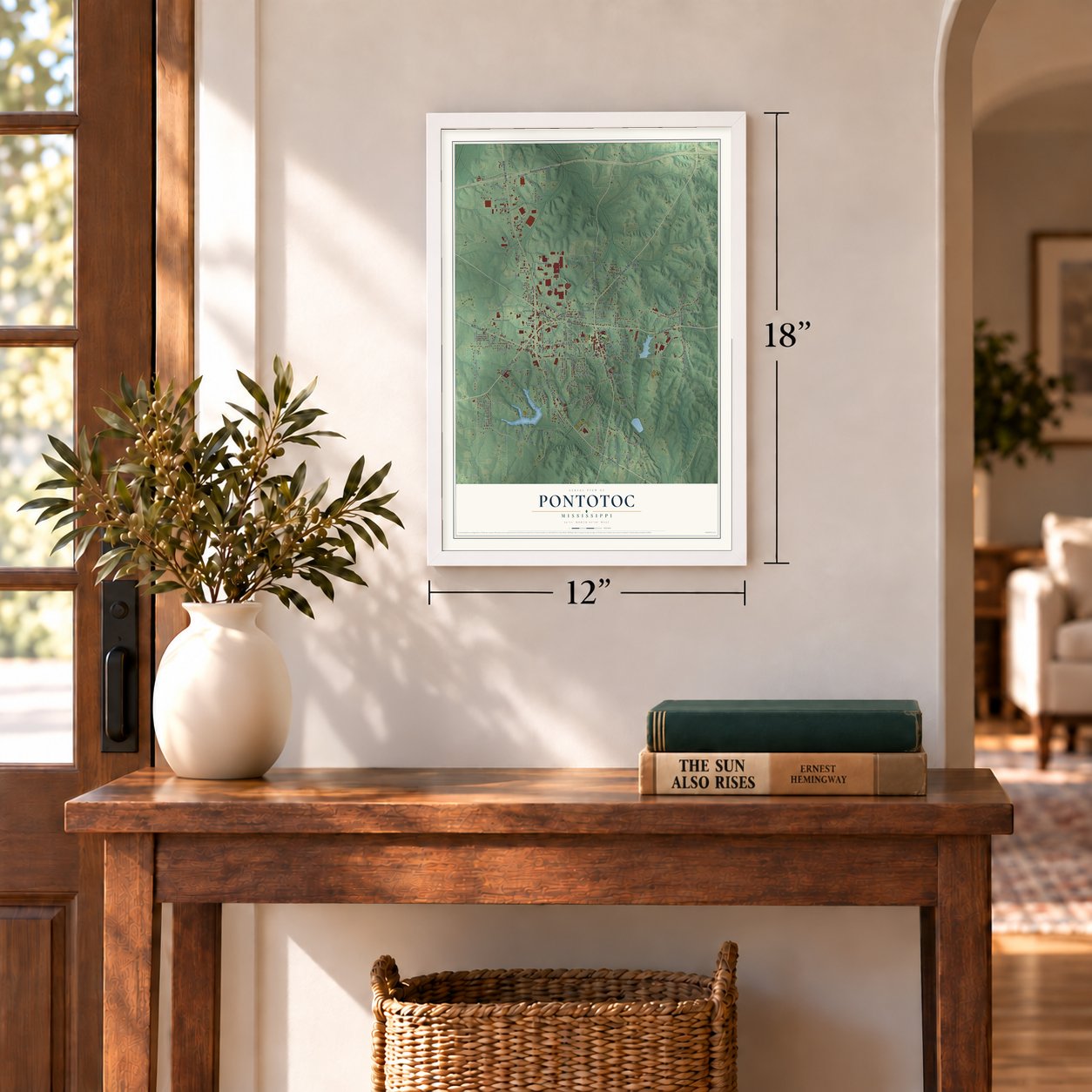
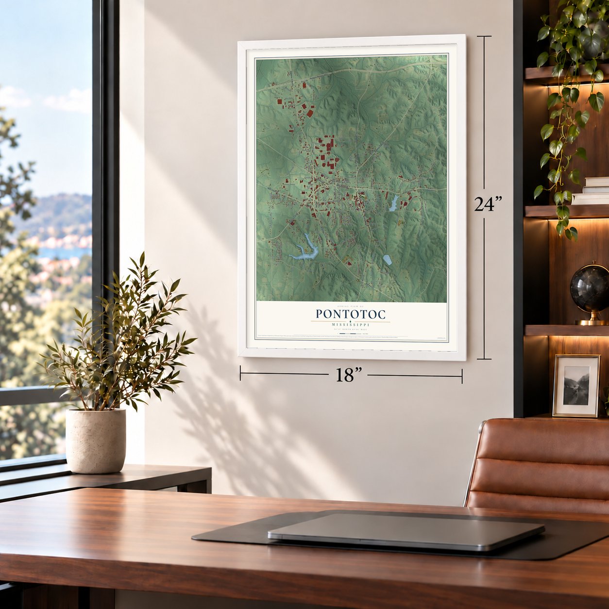
12" x 18" Archival Matte Print
A Map of Home. A Work of Art.
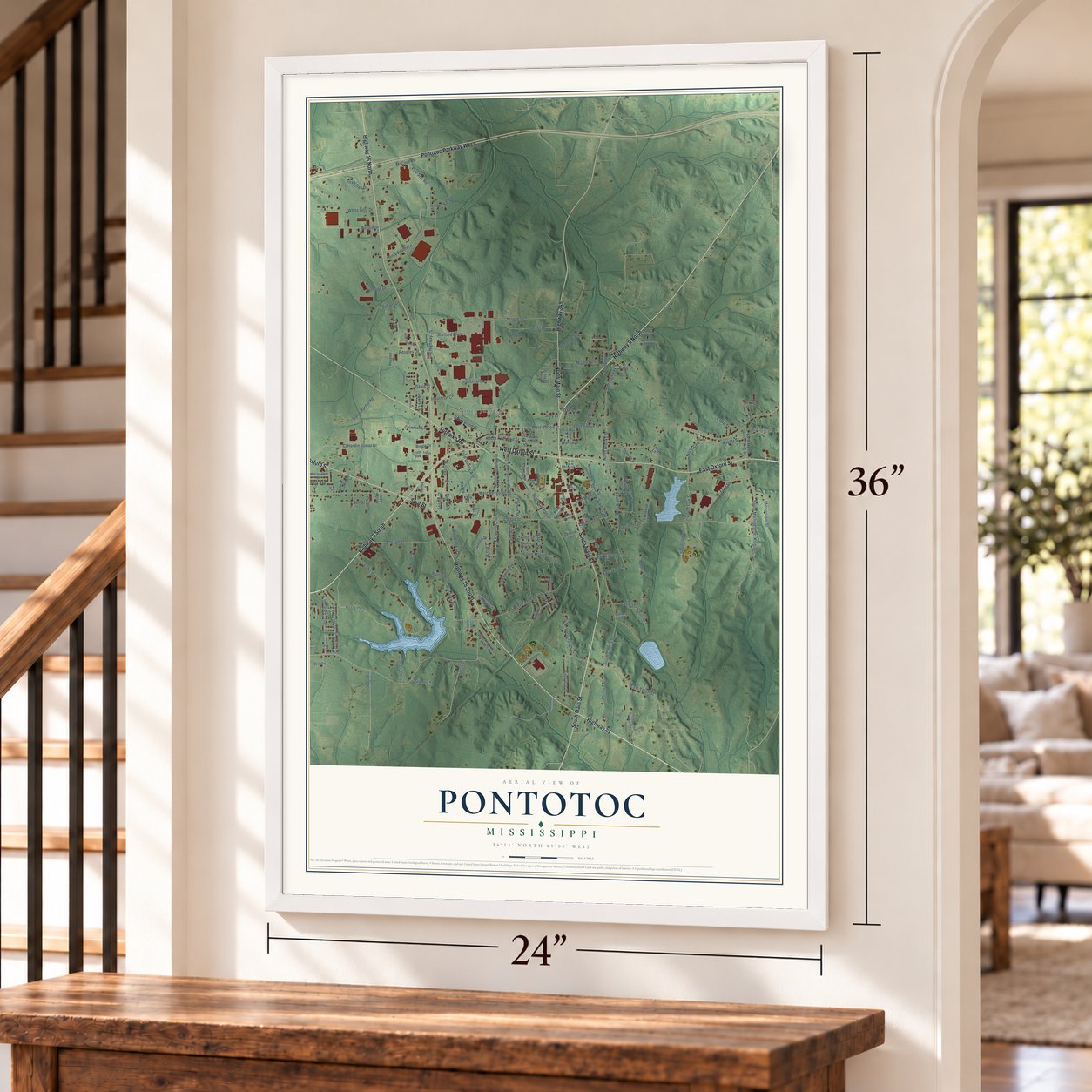
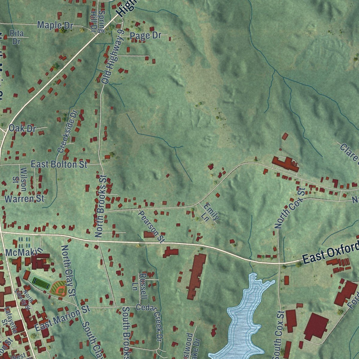
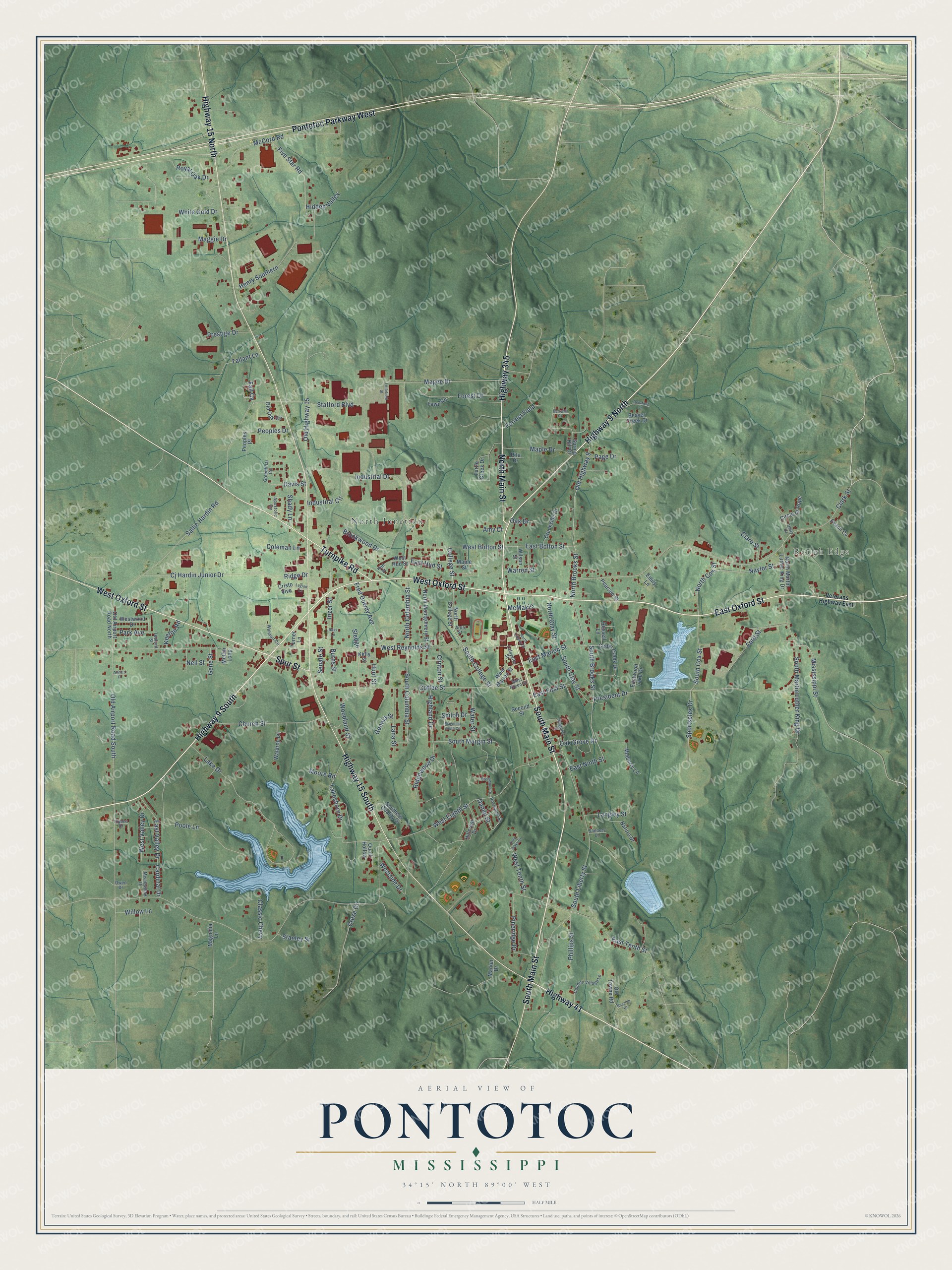
Explore Pontotoc, Mississippi from a whole new perspective. Created using aerial imagery and detailed geographic data, this map captures Pontotoc building by building, with labeled streets, familiar landmarks, and shaded topographical relief that highlights the natural contours of the landscape.
Combining modern data with the timeless character of a vintage atlas, this map is just as interesting up close as it is beautiful on the wall. Whether you grew up in Pontotoc, spent memorable years there, or call it home today, this unique map is a great way to celebrate a place that means something to you. Zoom in on the preview to look for your street, and then order a print to put your memories on the wall.
Three ways to hang it
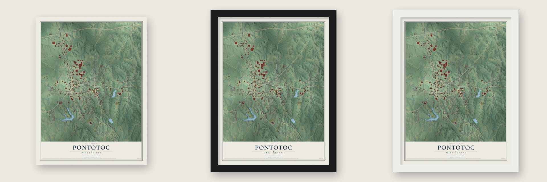
Unframed archival matte, a black wood frame or a white wood frame.
Up close
Geography Worth Displaying
This map was created using accurate cartographic data and authoritative geographic sources, including the U.S. Geological Survey and the Census Bureau. The map brings together terrain, waterways, roads, and building detail. The majority of the streets are labeled, houses are accurately depicted, and the topography is derived from government sources. Combining local data with carefully composed color and shading leads to this beautifully detailed Pontotoc artwork for your wall.
Rather than simply showing street outlines, we’ve included as many of the street names as we could reasonably fit on the map while keeping their names legible. Zoom in on the high resolution preview to see exactly what’s on the map. We truly set out to create a statement piece for anyone who loves Pontotoc. So whether it’s for you, or a gift for someone you love, we hope this map of Pontotoc brings back fond memories.
Read the story behind this map of Pontotoc, Mississippi from 2026.

About Pontotoc, Mississippi
Pontotoc is a city of 5,640 people and the seat of Pontotoc County, west of Tupelo in northeastern Mississippi. For generations the Chickasaw made this ground a center of their life, and their main settlements lay a few miles east of the present town. In 1832 the Treaty of Pontotoc Creek, part of President Andrew Jackson's Indian Removal policy, gave up millions of acres of Chickasaw land, and the Chickasaw were forced west of the Mississippi River.
White settlers and the people they enslaved then moved into the area. Pontotoc was incorporated in 1837, the year the county was founded, and for a number of years it held the United States land office and the Chickasaw Land Bank, while the federal District Court also sat here. The town counted 1,010 people in 1900, nearly twice as many as ten years before, and by 1906 its population was estimated at 1,600.
- A Chickasaw namePontotoc is a Chickasaw word usually translated as "Land of Hanging Grapes." An early county history gave a different story, saying the town was named for a Chickasaw chief and that the word meant "weed prairie."
- Two banks, two newspapersThe Bank of Pontotoc opened in 1889, and the Merchants & Farmers Bank followed in 1900. A. F. Herman owned and edited the Sentinel, a Democratic weekly started in 1893, and E. T. Winston launched the Advance, an independent weekly, in 1900. The growing trade town also had the Chickasaw Female College, a cotton seed oil mill and gin, a brick plant and an electric light plant.
- The post office muralThe post office near the courthouse went up in 1937 as a Works Progress Administration project, and it still handles mail while housing the Town Square Museum. In 1939 Joseph Pollet, a German-born artist, painted its lobby mural, The Wedding of Ortez and SaOwana. It shows a feast Hernando de Soto supposedly held at Christmas 1540 for the first recorded Christian wedding in North America, though little proof of that wedding has been found.
- The Bodock FestivalEach year in the last week of September, Pontotoc holds the Bodock Festival on the Town Square. It celebrates a local Osage orange tree, also called bois d'arc or bowdock, which stands beside a historic mansion. The tree and the house both made it through a massive tornado in 2001.
- Ruby Elzy, born 1908The opera singer Ruby Elzy was born in Pontotoc in 1908. She became well known for her performances in Porgy and Bess.
Find your street
Names on the Pontotoc map
Every name below is printed on this map. Look for your street, your school, the park where you played, or the pond down the road.
Places and landmarks2
- Rough Edge
- North Junction
Streets and roads179
- East Oxford Street
- Highway 9 North
- Highway 9 South
- West Oxford Street
- North Main Street
- Highway 15 North
- Pontotoc Parkway West
- Highway 15 South
- South Main Street
- Turnpike Road
- Highway 345
- Highway 41
- Spur Street
- South College Street
- South Brooks Street
- South Columbia Street
- North Columbia Street
- McCord Road
- West Eighth Street
- West Reynolds Street
- Clark Street
- South Liberty Street
- Old Airport Road South
- Sallie Hardin Road
- President Drive
- North Brooks Street
- Coffee Street
- Old Highway 9
- Industrial Drive
- Stafford Boulevard
Show all 179 streets
- South Martin Luther King Drive
- Magee Drive
- Poole Lane
- Old Highway 15
- Royal Oak Drive
- Maggie Drive
- Cj Hardin Junior Drive
- Brookwood Drive
- Naylor Street
- Lake Drive
- Church Street
- East Tenth Street
- Ridgewood Drive
- Woodland Street
- Industrial Circle
- Ford Street
- Inzer Street
- West Bolton Street
- Pineridge Drive
- Five Star Road
- Forest Drive
- South Cox Street
- Oak Grove Drive
- East Marion Street
- Henry Southern
- Maple Drive
- East Bolton Street
- South Clay Street
- Fred Dowdy Avenue
- South Margin Street
- East Valley Drive
- Lana Street
- West Tenth Street
- North Cox Street
- Mississippi Street
- Lakeshore Drive
- Ridge Drive
- Westside Drive
- Page Drive
- Sportsplex Drive
- Highland Drive
- West Valley Drive
- Langley Street
- Peoples Drive
- Water Street
- Phillips Street
- North Clay Street
- Forrest Field
- Nell Street
- White Gold Drive
- Prestige Drive
- Shady Lane
- East First Street
- Coleman Lane
- Classic Chevy
- Clare Street
- Clinton Street
- Hunt Street
- Hidden Valley
- College Street
- Willow Lane
- Park Avenue
- Senate Street
- East Ninth Street
- Davis Street
- Shiloh Drive
- McMakin
- East Hud Street
- Stanley Street
- Keeton Road
- Warren Street
- Cardinal Drive
- Daniel Street
- Tallant Lane
- Cruse Drive
- Moore Road
- Genola Street
- Oak Drive
- Gene Street
- Burns Street
- Amy Court
- Fall Cv
- Sledge
- North College Street
- Turtle Creek Drive
- Cedar Creek Drive
- Spring Hill Drive
- North Montgomery Street
- Old Airport Road North
- North Martin Luther King Drive
- Beaver Creek Drive
- Nature Drive
- West Marion Street
- Creekside Drive
- McGar Loop
- Hillcrest Drive
- Southern Quality Drive
- Mulberry Lane
- Westwood Drive
- Circle of Hope
- Eastwood Lake Drive
- Old Towne Road
- Fawn Circle
- Old Oak Circle
- Pearson Street
- Second Street
- Waldrop Lane
- Magnolia Lane
- West Hud Street
- Peoples Place
- Wilson Street
- Russell Lane
- Evann Cv
- Maple Street
- Turner Lane
- Cristo Vive
- Rita Drive
- Market Drive
- Emily Lane
- Quail Hollow
- Kelly Street
- Veterans Highway East
- Walmart Circle
- Greenbriar Circle
- Apostolic Circle
- Country Village Lane
- Hospital Drive
- Roseanne Street
- West Green Street
- Meadowlark Drive
- Lafayette Street
- Unity Drive
- Hud Street
- Sanders Lane
- Tedford Street
- Illyana Drive
- Owen Drive
- Aron Street
- Magnolia South Circle
- Brentwood Drive
- Deerfield Lane
- Twin Oaks Drive
- Legion Lane
- North Liberty Street
- Rosalee Drive
- Littlefield Street
- Berryhill Cv
- Anita's Place
- Ross Lane
Names are listed as they appear on the printed map. Zoom into the product photos to find them.
The art of mapping a place
How This Map Was Made
Real places. Remarkable detail. Discover the layers that turn geographic data into a map of home.

The view from above
Aerial imagery reveals the character of the land: woodland, open fields, and the patterns of a place.

The shape of the land
Elevation data brings hills, valleys, and subtle changes in the landscape into view.

The details of home
Roads, waterways, and building footprints come together to make the map feel unmistakably local.

Geography becomes art
Considered color, shading, and typography bring the layers together in a map made for your wall.


Process illustrated with Mendon, Massachusetts. Aerial imagery: USDA NAIP. Terrain: USGS 3D Elevation Program. Map details and finished artwork: KNOWOL.
The Details
About This Print
Choose an archival matte print, or a black or white Ayous wood frame. The archival matte print is unframed.
Select your size and finish above to see the matching product image and price.
Materials & Craftsmanship
A contemporary map with the character of a classic atlas, printed on archival matte paper. Optional frames are made from Ayous wood.
Your printed map does not include the watermark shown in the full-map preview.
Shipping & Delivery
Free shipping within the United States. Every print is made to order in the USA.
Buying a gift? Add a note in your cart and we'll include it. We never put prices in the package.
Prints ship within 2 to 3 business days. Allow 7 to 10 days total from ordering for delivery. Timing may vary during holidays or periods of high order volume.
Read our shipping policy.
Returns and damaged prints
Each print is made to order. Change-of-mind refunds are not available after production.
If your print arrives damaged, misprinted or incorrect, contact support@knowol.com within 30 days of receiving it. Include your order number, photos and a description of the issue.
Read our full refund and replacement policy. For questions about your order, email support@knowol.com.
Find your town
Looking for another city?
Find a map of home in our Mississippi collection, or any town in the country.
Nearby
Maps of towns near Pontotoc
Know someone from one of these towns? Their map makes a great gift.
 Algoma
, Mississippi
From $39.99See the map
 Ecru
Ecru, Mississippi
From $39.99See the map
 Randolph
, Mississippi
From $39.99See the map
More maps nearby: Thaxton, Blue Springs, Toccopola, Sherman and New Houlka.