
Search for another town





Free U.S. delivery 7 to 10 days after you order
Port St. Lucie, Florida Map Art
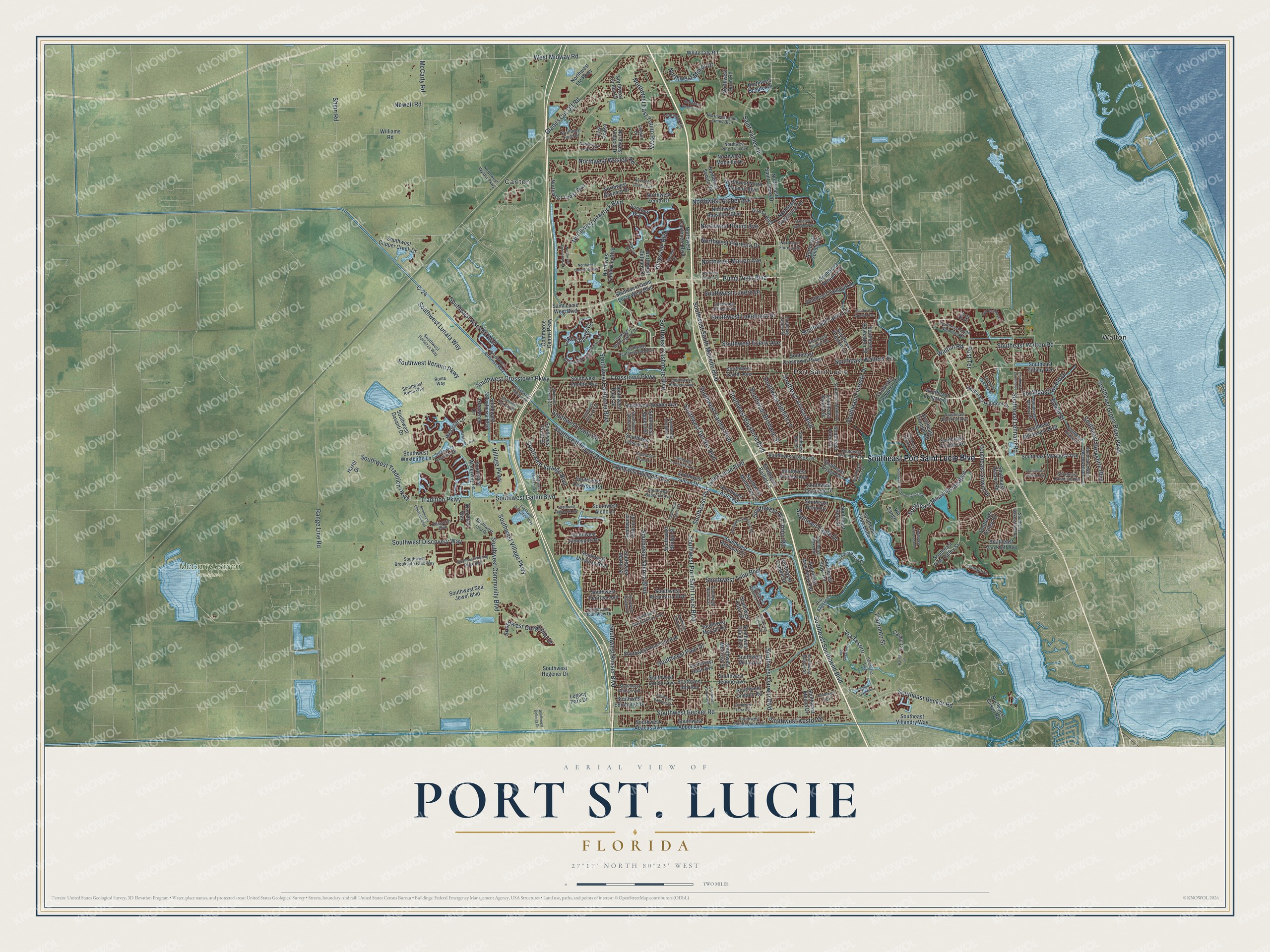
A new map of Port St. Lucie, Florida, made in 2026 and printed to order on thick archival matte paper.
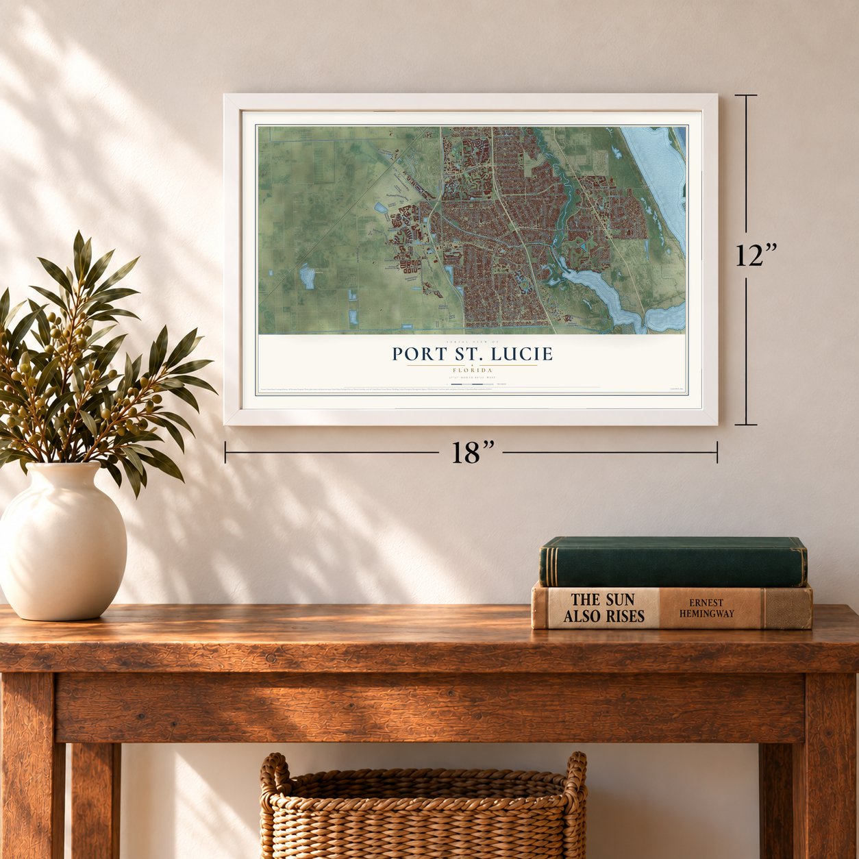
12" x 18" Archival Matte Print
A Map of Home. A Work of Art.
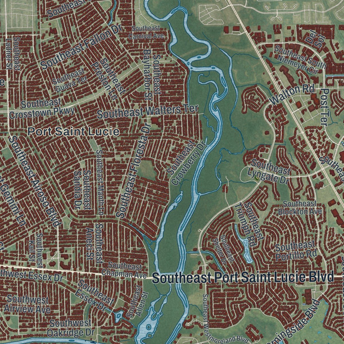
Explore Port St. Lucie, Florida from a whole new perspective. Created using aerial imagery and detailed geographic data, this map captures Port St. Lucie building by building, with labeled streets, familiar landmarks, and shaded topographical relief that highlights the natural contours of the landscape.
Combining modern data with the timeless character of a vintage atlas, this map is just as interesting up close as it is beautiful on the wall. Whether you grew up in Port St. Lucie, spent memorable years there, or call it home today, this unique map is a great way to celebrate a place that means something to you. Zoom in on the preview to look for your street, and then order a print to put your memories on the wall.
Three ways to hang it
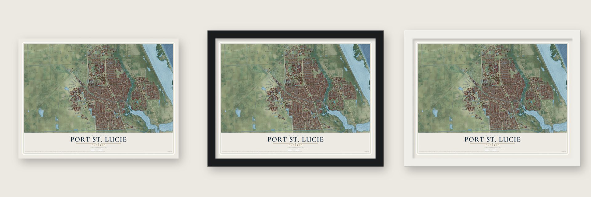
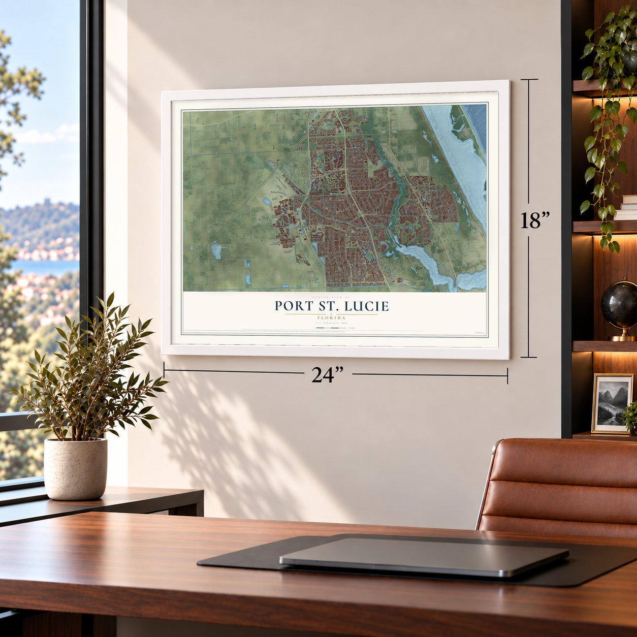
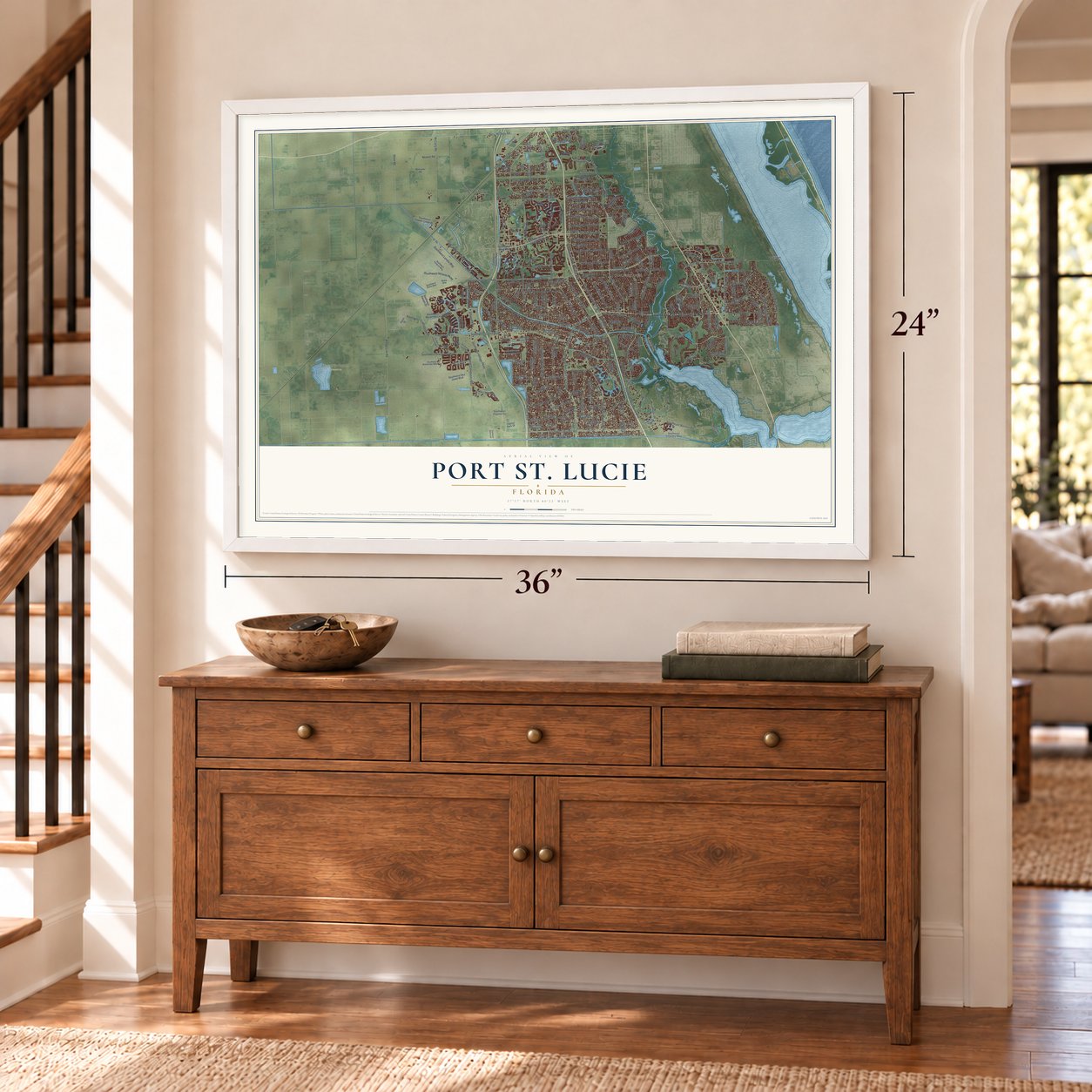
Unframed archival matte, a black wood frame or a white wood frame.
Up close
Geography Worth Displaying
This map was created using accurate cartographic data and authoritative geographic sources, including the U.S. Geological Survey (USGS) and FEMA. The map brings together terrain, waterways, roads, and building detail. The majority of the streets are labeled, houses are accurately depicted, and the topography is derived from government sources. Combining local data with carefully composed color and shading leads to this beautifully detailed Port St. Lucie artwork for your wall.
Rather than simply showing street outlines, we’ve included as many of the street names as we could reasonably fit on the map while keeping their names legible. Zoom in on the high resolution preview to see exactly what’s on the map. We truly set out to create a statement piece for anyone who loves Port St. Lucie. So whether it’s for you, or a gift for someone you love, we hope this map of Port St. Lucie brings back fond memories.
Explore the full map of Port St. Lucie, Florida and read about the local places it shows.
About Port St. Lucie, Florida
Port St. Lucie is a city of 204,851 people in St. Lucie County. It is the largest city in the county and the sixth largest in Florida. In the 1950s the ground here was nearly empty land south of White City. It held a handful of farms and shops along U.S. 1 and a river fishing camp called Burt Pruitt's Fishin' Farm.
In 1958 the General Development Corporation, working with a $50 million budget, purchased 40,000 acres along the river's North Fork, along with the River Park development. Its first bridge over the river opened in 1959, so cars could drive directly in, and by February 25, 1961, the new community had 250 homes. State Representative Rupert Smith proposed House Bill No. 953, Governor C. Farris Bryant approved it, and on April 27, 1961, Port St. Lucie became a city. River Park's residents asked to stay out, and they did.
- A name from 1566St. Lucia's Day in 1566 saw the founding of a settlement near Jupiter Inlet, and the name St. Lucie comes from it. After a string of mistakes the name drifted north to what is now St. Lucie Village. Only La Florida and St. Augustine are older European place names still used in the United States.
- Spruce Bluff in the 1890sIn the early 1890s several pioneer families lived at Spruce Bluff on the St. Lucie River. They had a school and a post office, worked a pineapple plantation and ran a sawmill. The site is now the Spruce Bluff Preserve, where an old cemetery survives along with a prehistoric Ais Indian mound at its south end.
- St. Lucie West and TraditionCore Communities started planning St. Lucie West in the early 1990s as about 14,000 homes on 7 square miles. The company soon added business districts and places for entertainment, which brought 7,000 jobs and fed the city's boom in the early 2000s. In 2006 it began Tradition, west of I-95 at Gatlin Boulevard, on land that had been a large cattle ranch, and designed it to feel like a 1950s town.
- Mets spring training since 1988Clover Park, home of the New York Mets each spring, first hosted games in the 1988 season. Its field was laid out with the same dimensions as the old Shea Stadium, and the St. Lucie Mets of the Florida State League play their games there too.
Find your street
Names on the Port St. Lucie map
Every name below is printed on this map. Look for your street, your school, the park where you played, or the pond down the road.
Places and landmarks4
- McCarty Ranch Preserve
- Carlton
- Port Saint Lucie
- Walton
Streets and roads274
- Southeast Port Saint Lucie Boulevard
- Southeast Airoso Boulevard
- Prima Vista Boulevard
- Post Terrace
- Southeast Morningside Boulevard
- Lake Charles Circle
- Southeast Lennard Road
- Crosstown Parkway
- Southwest Crosstown Parkway
- Southwest Bayshore Boulevard
- Southeast Fallon Drive
- Shinn Road
- Southwest Village Parkway
- Southwest Becker Road
- Southwest Gatlin Boulevard
- West Midway Road
- Range Line Road
- Southwest Port Saint Lucie Boulevard
- Southwest Savona Boulevard
- Southwest Community Boulevard
- Glades Cut Off Road
- Southwest Paar Drive
- Southwest California Boulevard
- Southeast Floresta Drive
- Northwest Peacock Boulevard
- Southwest Del Rio Boulevard
- Village Parkway
- Southeast Southbend Boulevard
- Southwest Rosser Boulevard
- Southwest Darwin Boulevard
Show all 274 streets
- Northwest East Torino Parkway
- Southwest Tulip Boulevard
- Southeast Becker Road
- Southwest Import Drive
- Tradition Parkway
- Southwest South Macedo Boulevard
- Southwest Cashmere Boulevard
- Southwest Cameo Boulevard
- Southeast Green River Parkway
- Southwest Kestor Drive
- Southeast Walton Road
- Southwest Discovery Way
- Southeast Berkshire Boulevard
- Southwest Visconti Way
- Southeast Grand Drive
- Southwest Savage Boulevard
- Southeast Eagle Drive
- Southeast Walters Terrace
- Saint James Drive
- Southwest Gingerline Drive
- Tramonto Street
- Via Tesoro
- Southwest Ann Arbor Road
- Kings Isle Boulevard
- McCarty Road
- Southwest Lakehurst Drive
- Southwest Lunata Way
- Southwest Verano Parkway
- Northwest Floresta Drive
- Southwest Tradition Parkway
- Southwest Gemini Lane
- Southwest Eyerly Avenue
- Southwest Brisbane Street
- Southwest Lucero Drive
- Northwest Archer Avenue
- Northwest Milner Drive
- Northwest Marion Avenue
- Southeast Gowin Drive
- Northwest Wesley Road
- Southwest Leafy Road
- Northwest Placid Avenue
- Newell Road
- Walton Road
- Bowie Street
- C-24
- Southeast Tiffany Avenue
- Saint Lucie West Boulevard
- Southwest Saint Lucie West Boulevard
- Southeast Lyngate Drive
- Northwest Bethany Drive
- Northeast Sagamore Terrace
- Southeast Crosstown Parkway
- Northwest Selvitz Road
- Southeast Sandia Drive
- Southwest Vittorio Street
- Southwest Penrose Avenue
- Southeast Pine Valley Street
- Northwest North Macedo Boulevard
- Southwest Janette Avenue
- Southwest Monterrey Lane
- Northwest California Boulevard
- Northwest Bayshore Boulevard
- Northwest Cashmere Boulevard
- Southeast Melaleuca Boulevard
- Southwest Abingdon Avenue
- Commerce Centre Parkway
- Southeast Preston Lane
- Southwest Belmont Circle
- Northwest Topaz Way
- Northwest Zenith Drive
- Westcliff Lane
- Southeast Crowberry Drive
- Southeast Nome Drive
- Southwest Edinburgh Drive
- Southeast Aneci Street
- Southwest Carter Avenue
- Southwest Sultan Drive
- Southwest Hunnicut Avenue
- Southeast Mariposa Avenue
- Northeast Solida Circle
- Southwest Copper Creek Drive
- Southeast West Snow Road
- Northwest Ltc Parkway
- Southwest Idol Avenue
- Southwest Salvatierra Boulevard
- Southeast Calmoso Drive
- Northwest Volucia Drive
- Southeast Hillmoor Drive
- Southwest Sudder Avenue
- Southwest Dreyfuss Boulevard
- Northeast Saint James Drive
- Southwest Millard Drive
- Southwest McCall Road
- Southwest Jeanne Avenue
- Southwest Undallo Road
- Southwest Essex Drive
- Northwest Manville Drive
- Southwest Aster Road
- Southeast Verada Avenue
- Southeast Villandry Way
- Southwest Sea Jewel Boulevard
- Southwest Waterway Lane
- Southwest Athena Drive
- Southeast Farley Road
- Southeast Essex Drive
- Northwest Conley Drive
- Southwest Alcantarra Boulevard
- Southwest Jamesport Drive
- Southwest Oakridge Drive
- Southeast Delano Road
- Southwest McCrory Street
- Southwest Abacus Avenue
- Southwest Hegener Drive
- Glenbrook Drive
- Southeast Stow Terrace
- Southwest Westcliffe Lane
- Southwest Aledo Lane
- Via Sangro
- Calmo Circle
- Southwest Martin Street
- Southeast Peru Street
- Southwest Leisure Lane
- Southeast Portillo Road
- Southwest Jericho Avenue
- Southeast Van Kleff Avenue
- Southwest Barber Lane
- Northwest Baynard Drive
- Northwest Scepter Drive
- Southwest Airview Avenue
- Southwest Haas Avenue
- White City Road
- Southwest Davis Street
- Southeast Bayharbor Street
- Southeast Fiore Bello
- Southwest Catskill Drive
- Southwest Hainlin Street
- Southwest Oakwood Road
- Southeast Triumph Road
- Northwest Dunn Road
- Southwest Kasin Street
- Northwest Gilson Road
- Airoso Boulevard
- Sunview Way
- Southwest Davanti Drive
- Southwest Pruitt Street
- Wyndham Way
- Southwest Abbot Avenue
- Southwest Bridge Street
- Southwest Aguero Street
- Hazel Drive
- Legacy Park Drive
- Williams Road
- East Coosa
- Del Sol
- Southwest Lake Charles Circle
- Northeast Floresta Drive
- Tuscany Drive
- Southeast Blockton Avenue
- Southwest Bellevue Avenue
- Southeast Manth Lane
- Northwest Saint James Boulevard
- Southwest Heatherwood Boulevard
- Northwest Hann Drive
- Southwest Ambrose Way
- Southwest Lyra Drive
- Southwest Brookside Falls Way
- Southwest Aventino Drive
- Leonardo Circle
- Southwest South Quick Circle
- Southeast Ladner Street
- Southeast West Blackwell Drive
- Southwest Mockingbird Drive
- Ballantrae Court
- Northwest Wylder Parkway
- Bay Saint Lucie Drive
- Southwest Panther Trce
- Southeast South Niemeyer Circle
- Southwest Glastonberry Avenue
- Southwest Fortezza Way
- Southeast Wake Road
- Southeast Bowie Street
- Southeast Bakersfield Street
- Southeast Chapman Avenue
- Northwest Pine Trail Avenue
- Southeast Mantua Street
- Southwest Sunglow Street
- Southeast Caladium Avenue
- Southwest Colleen Avenue
- Southwest Gadsan Avenue
- Southwest Babcock Avenue
- Southwest Open View Drive
- Southwest Rivera Street
- Southwest Beard Street
- Southeast Allen Street
- Northwest Leah Drive
- Lawton Road
- Roma Way
- Southeast Guava Terrace
- Ellsworth Boulevard
- Southwest Muncie Street
- Southwest Kail Street
- Southwest Roma Way
- Rio Angelica
- Cleburn Drive
- Northeast Surfside Avenue
- Southwest Provincetown Lane
- Southwest Hayworth Avenue
- Southeast Westmoreland Boulevard
- Southbend Boulevard
- Northwest Enterprise Drive
- Southwest Cherryhill Road
- Southwest Innovation Way
- Southwest Winding Ridge Boulevard
- East Caribbean
- Southeast Shelter Drive
- Northwest Billiar Avenue
- Southwest Halissee Street
- Southwest Mackenzie Street
- Newberry Avenue
- Southwest Haines Street
- Southwest Log Drive
- Northwest Stratford Lane
- Northwest Culebra Avenue
- Rio Casarano
- Southwest Ellsworth Boulevard
- Southwest Fair Isle Road
- Northwest University Boulevard
- Southeast Carnival Avenue
- Southwest Kakopo Street
- Southwest Kalevala Drive
- Southwest Galiano Road
- Southeast Overbrook Drive
- Southwest Vicuna Lane
- Southwest Hickock Terrace
- Southwest Yamada Drive
- Southeast Lorraine Street
- Southwest Belterra Drive
- Southeast Cascella Court
- Southwest Margela Street
- Southeast Gillette Avenue
- Southwest Tarra Avenue
- Southwest Dinner Street
- Santa Gardenia
- Palma Street
Names are listed as they appear on the printed map. Zoom into the product photos to find them.
The art of mapping a place
How This Map Was Made
Real places. Remarkable detail. Discover the layers that turn geographic data into a map of home.

The view from above
Aerial imagery reveals the character of the land: woodland, open fields, and the patterns of a place.

The shape of the land
Elevation data brings hills, valleys, and subtle changes in the landscape into view.

The details of home
Roads, waterways, and building footprints come together to make the map feel unmistakably local.

Geography becomes art
Considered color, shading, and typography bring the layers together in a map made for your wall.


Process illustrated with Mendon, Massachusetts. Aerial imagery: USDA NAIP. Terrain: USGS 3D Elevation Program. Map details and finished artwork: KNOWOL.
The Details
About This Print
Choose an archival matte print, or a black or white Ayous wood frame. The archival matte print is unframed.
Select your size and finish above to see the matching product image and price.
Materials & Craftsmanship
A contemporary map with the character of a classic atlas, printed on archival matte paper. Optional frames are made from Ayous wood.
Your printed map does not include the watermark shown in the full-map preview.
Shipping & Delivery
Free shipping within the United States. Every print is made to order in the USA.
Buying a gift? Add a note in your cart and we'll include it. We never put prices in the package.
Prints ship within 2 to 3 business days. Allow 7 to 10 days total from ordering for delivery. Timing may vary during holidays or periods of high order volume.
Read our shipping policy.
Returns and damaged prints
Each print is made to order. Change-of-mind refunds are not available after production.
If your print arrives damaged, misprinted or incorrect, contact support@knowol.com within 30 days of receiving it. Include your order number, photos and a description of the issue.
Read our full refund and replacement policy. For questions about your order, email support@knowol.com.
Find your town
Looking for another city?
Find a map of home in our Florida collection, or any town in the country.
Nearby
Maps of towns near Port St. Lucie
Know someone from one of these towns? Their map makes a great gift.
 River Park
, Florida
From $39.99See the map
 White City
, Florida
From $39.99See the map
 Indian River Estates
, Florida
From $39.99See the map
More maps nearby: North River Shores, Fort Pierce South, Jensen Beach, Palm City and Rio.