
Search for another town

Free U.S. delivery 7 to 10 days after you order
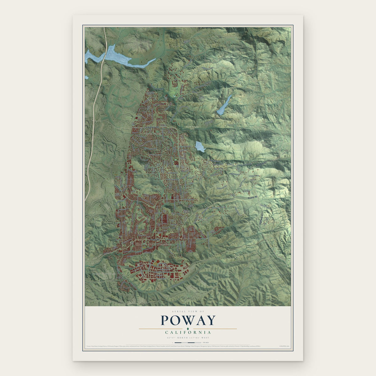
Poway, California Map Art
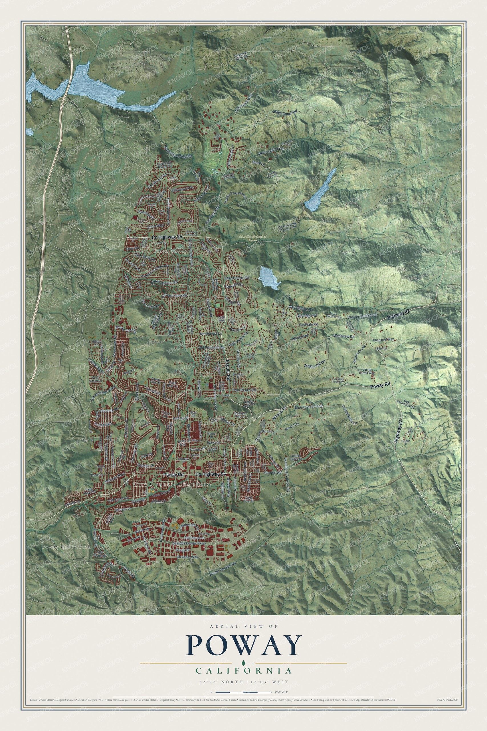
Building by building, with labeled streets and shaded relief.
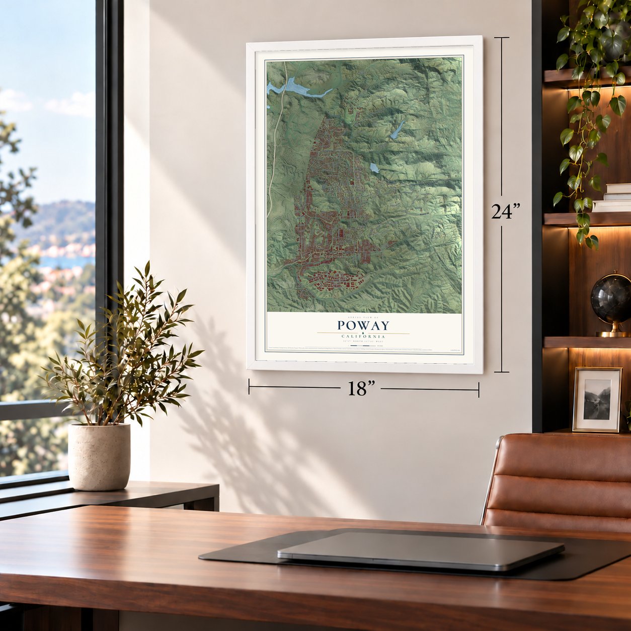
12" x 18" Archival Matte Print
A Map of Home. A Work of Art.
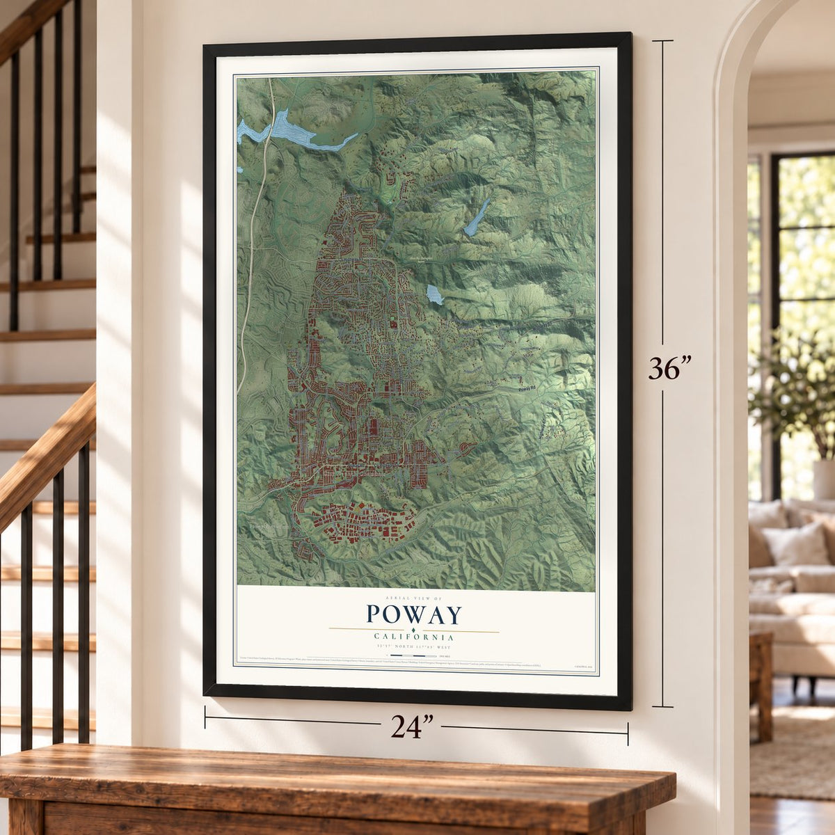
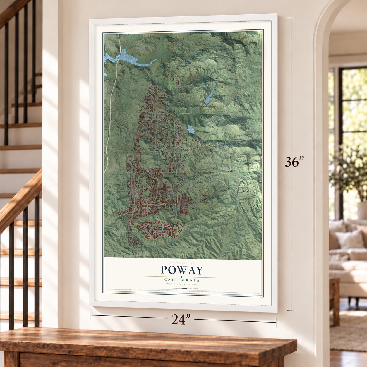
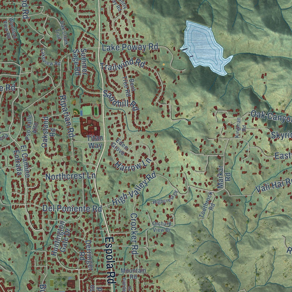
Explore Poway, California from a whole new perspective. Created using aerial imagery and detailed geographic data, this map captures Poway building by building, with labeled streets, familiar landmarks, and shaded topographical relief that highlights the natural contours of the landscape.
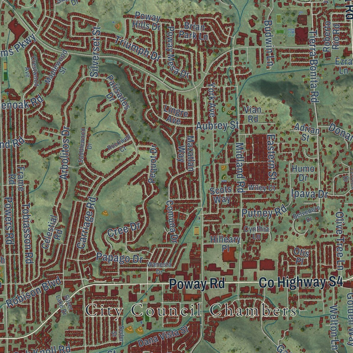
Combining modern data with the timeless character of a vintage atlas, this map is just as interesting up close as it is beautiful on the wall. Whether you grew up in Poway, spent memorable years there, or call it home today, this unique map is a great way to celebrate a place that means something to you. Zoom in on the preview to look for your street, and then order a print to put your memories on the wall.
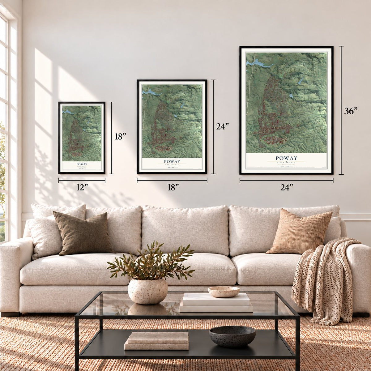
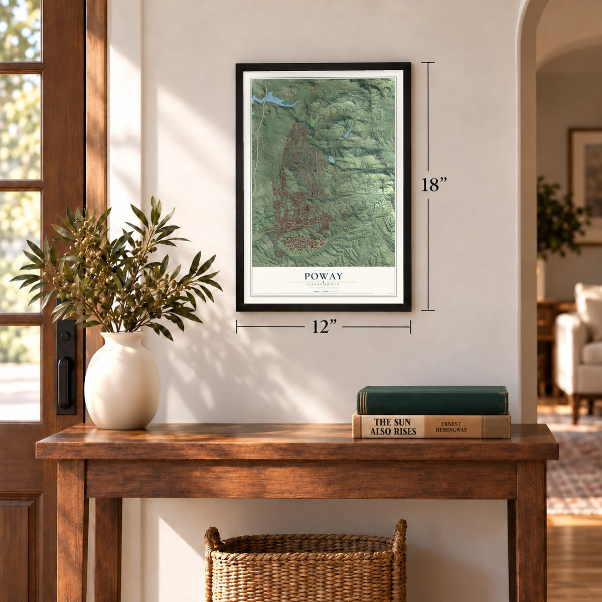
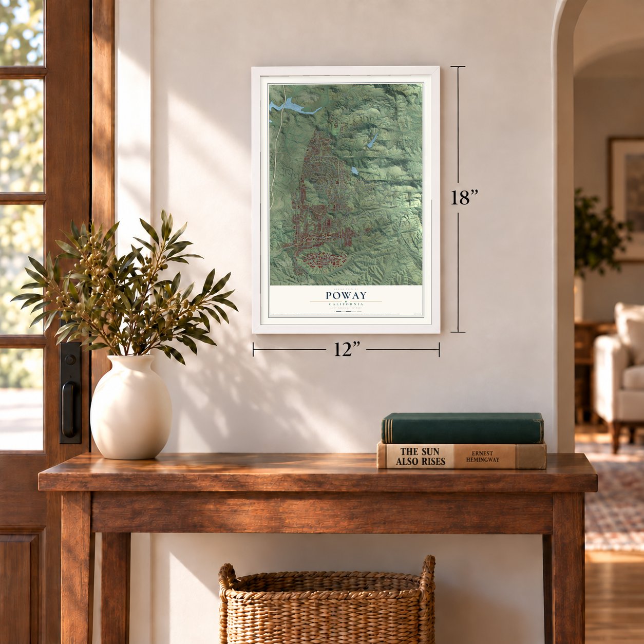
Three ways to hang it
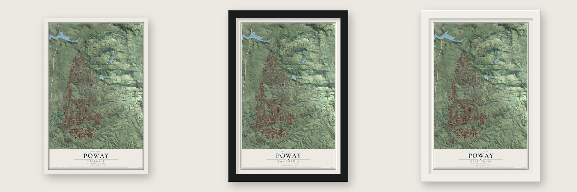
Unframed archival matte, a black wood frame or a white wood frame.
Up close
Geography Worth Displaying
This map was created using accurate cartographic data and authoritative geographic sources, including the U.S. Geological Survey and the Census Bureau. The map brings together terrain, waterways, roads, and building detail. The majority of the streets are labeled, houses are accurately depicted, and the topography is derived from government sources. Combining local data with carefully composed color and shading leads to this beautifully detailed Poway artwork for your wall.
Rather than simply showing street outlines, we’ve included as many of the street names as we could reasonably fit on the map while keeping their names legible. Zoom in on the high resolution preview to see exactly what’s on the map. We truly set out to create a statement piece for anyone who loves Poway. So whether it’s for you, or a gift for someone you love, we hope this map of Poway brings back fond memories.
Read the story behind this map of Poway, California from 2026.

Find your street
Names on the Poway map
Every name below is printed on this map. Look for your street, your school, the park where you played, or the pond down the road.
Places and landmarks4
- City Council Chambers
- Poway Grove Park
- Green Valley
- Blue Sky Ecological Reserve
Streets and roads227
- County Highway S4
- Poway Road
- County Highway S5
- Espola Road
- Highway 67
- Del Poniente Road
- Tierra Bonita Road
- High Valley Road
- Tobiasson Road
- Northcrest Lane
- Orchard Gate Road
- Holland Road
- Midland Road
- Old Coach Road
- Pomerado Road
- Scripps Poway Parkway
- Twin Peaks Road
- Community Road
- Beeler Canyon Road
- Stowe Drive
- Lake Poway Road
- Stage Coach Road
- Kirkham Way
- Old Coach Way
- Garden Road
- Danielson Street
- Saint Andrews Drive
- Carriage Road
- Stone Canyon Road
- Crystal View Lane
Show all 227 streets
- Westview Road
- Metate Lane
- Sycamore Canyon Road
- Powers Road
- Coyote Creek Trail
- Avenue la Valencia
- Oak Knoll Road
- Ridgecrest Road
- Arbolitos Drive
- Ipava Drive
- Blue Crystal Trail
- Eastvale Road
- Oak Canyon Road
- Gate Drive
- Orchard Bend Road
- Deer Valley Ests
- Cam del Valle
- Old Winery Road
- Trailwind Road
- Aubrey Street
- Kirkham Road
- Budwin Lane
- Neddick Avenue
- Harrow Lane
- Treadwell Drive
- Old Coach Drive
- Welton Lane
- Skyridge Road
- Triumph Drive
- La Manda Drive
- Sycamore Creek Road
- Crocker Road
- Via del Toro
- Standish Drive
- Vali Hai Road
- Crosthwaite Circle
- Ted Williams Parkway
- Acton Avenue
- Edina Way
- Putney Road
- Villamoura Drive
- Claire Drive
- Gregg Street
- Sandhill Road
- Alpine Drive
- Papago Drive
- Millards Road
- Riparian Road
- Amso Street
- Robison Boulevard
- Monte Vista Road
- Golden Way
- Creek Road
- Olive Tree Lane
- Soule Street
- Solera Way
- Buds Lane
- Del Norte
- Cree Drive
- Jenell Street
- Donart Drive
- Silverset Street
- Glenoak Road
- Eastern Street
- Rios Road
- Markar Road
- Huntington Gate Drive
- El Camino Entrada
- Lime Grove Road
- Green Valley Truck Trail
- Valle Verde Road
- Martincoit Road
- Mina de Oro Road
- Summer Sage Road
- Frame Road
- Butterfield Trail
- Hiddden Valley Ranch
- Pequot Drive
- Old Pomerado Road
- Sagewood Drive
- Glen Circle Road
- York Avenue
- Millards Ranch Lane
- Lucidi Farms Way
- Hidden Valley Drive
- Boulder Mountain Road
- Palisades Drive
- Murel Trail
- Chaparral Way
- Hilltop Circle
- Dana Vista Street
- Dos Hermanos Road
- Range Park Road
- Highlands Ranch Road
- Poway Mesa Drive
- Highland Valley Road
- Adrian Street
- Oakstand Road
- Whitewater Drive
- Cam del Norte
- Southern Hills Lane
- Sage View Road
- Old Stone Road
- Derringer Road
- Del Paso Drive
- Kerran Street
- High Pine Street
- Celestial Road
- Mazatlan Way
- Arabian Way
- Allbrook Drive
- Comuna Drive
- Poway Hills Drive
- Roberto Rio Road
- Brian Park Lane
- Titan Way
- Leona Lane
- Hilleary Place
- Kozy Crest Lane
- Rock Road
- Scots Way
- Lingre Avenue
- El Mar Avenue
- Ellie Lane
- Ninth Street
- Sutter Mill Road
- Vian Road
- Humo Drive
- Otis Place
- Ezra Lane
- Sunset Point Road
- Avenue Florencia
- Cll Colina
- Running Deer Trail
- Cloudcroft Drive
- Lomas Verdes Drive
- Pso Valle Alto
- Big Bucks Trail
- Cascade Crossing
- Eisenhower Avenue
- Quail Mountain Road
- Bridlewood Road
- Sagecrest Drive
- Bent Tree Road
- Maplewood Street
- Mountain Road
- Decant Drive
- Stonemill Drive
- Toothrock Road
- Tarzana Road
- Floral Avenue
- Eden Grove
- Cll Ana
- Wiley Court
- Kaitz Street
- Heath Drive
- Cynthia Lane
- Via Serena
- Erin Lane
- Crestwood Avenue
- Silver Lake Drive
- Country Day Road
- Wanesta Drive
- Orchard View Drive
- Saddlewood Drive
- Belvedere Drive
- Oak Creek Trail
- Crestline Drive
- Pomard Way
- Ash Hollow Crossing Road
- Platinum Place
- Silver Ridge Road
- Crossrock Road
- Highcrest Court
- Lakeview Road
- Sunrise Canyon Road
- Eucalyptus Heights Road
- Kalapana Street
- Seiler Street
- Blaisdell Place
- Kirkham Court
- Canyon Pass
- Cedar Ridge Court
- Bronco Lane
- Rockwell Court
- Country Squire Drive
- Kittery Street
- Pinefield Road
- Woodson View Road
- Kingman Road
- Gem Court
- Terrilee Drive
- Dorset Way
- Buxton Avenue
- Bryce Point
- Benny Lee Drive
- Joyas Court
Names are listed as they appear on the printed map. Zoom into the product photos to find them.
About Poway, California
Poway is a city of 48,841 people in San Diego County, part of the region known as North County. The Kumeyaay lived here for centuries. They left arrowheads, grinding stones and pottery along Poway Creek, and they painted on boulders as early as the 16th century or before. Mission San Diego de Alcalá grazed cattle in the valley in the late 18th century, and its records called the place Paguay by 1828. The name probably comes from a Kumeyaay word for arrowhead or watering hole.
Americans began farming the valley before the Civil War, and about 800 people lived here in 1887. Good soil was not enough without water, so the town stayed small until 1954. That year voters formed the Poway Municipal Water District by a vote of 210 to 32, joined the San Diego County Water Authority and approved $600,000 in bonds. The first water reached Gordon's Grocery on Garden Road that July. The first subdivision homes sold in 1959, and Poway became a city on December 1, 1980.
“The peach is a good article, and Poway produces it to perfection.”
- Peaches, grapes and honeyPoway's first homesteaders grew peaches, Muscat grapes, apricots, pears, hay and alfalfa, and some caught swarms of wild bees to make honey. The crops sold across the San Diego area, but each harvest depended on that winter's rain. Once water arrived in 1954, farmers turned mainly to avocados and citrus.
- A church since 1887Poway's first church, the Community Church of Poway, has held services since 1887. No other congregation in San Diego County has met for as long without a break.
- The stage to EscondidoIn 1888 a stagecoach began running between San Diego and Escondido, with one stop in Poway at the post office. Farmers waited by the road for mail, and men jogged beside the coach to collect their letters without stopping it. The three-day trip cost $1.00, or $1.50 round trip, and mountain trails sometimes tipped the coach over. San Diego ended the line in 1912, once automobiles could carry the mail faster.
- A one-room school in 1885Poway formed its school district in 1871 but had no schoolhouse until 1885, when a one-room school went up on Midland Road. Children in the first through eighth grades shared one classroom and wrote on slates. High school meant a trip to Escondido, and only three Poway students graduated in 1909. The site is still an elementary school, rebuilt in 1945.
- Where Blink-182 beganSeveral pop-punk acts were formed in Poway, among them Blink-182, Unwritten Law, Pivit and the Frights.
Keep exploring California
Poway is one of 1,914 California towns we've mapped. Every dot on the map is a print of its own.
The search covers every state, California first.
Near Poway
Order 2 or more town maps and save 10%. Shown in the size and finish you picked above, so they hang as a set.
- Carmel Mountain Ranch 12" x 18" / Archival Matte Print $39.99
- Rancho Encantada 12" x 18" / Archival Matte Print $39.99
- Rancho Bernardo 12" x 18" / Archival Matte Print $39.99



More maps nearby: Sabre Springs, Miramar Ranch North, Rancho Penasquitos, Scripps Miramar Ranch and Black Mountain Ranch.
The art of mapping a place
How This Map Was Made
Real places. Remarkable detail. Discover the layers that turn geographic data into a map of home.

The view from above
Aerial imagery reveals the character of the land: woodland, open fields, and the patterns of a place.

The shape of the land
Elevation data brings hills, valleys, and subtle changes in the landscape into view.

The details of home
Roads, waterways, and building footprints come together to make the map feel unmistakably local.

Geography becomes art
Considered color, shading, and typography bring the layers together in a map made for your wall.


Process illustrated with Mendon, Massachusetts. Aerial imagery: USDA NAIP. Terrain: USGS 3D Elevation Program. Map details and finished artwork: KNOWOL.
The Details
About This Print
Choose an archival matte print, or a black or white Ayous wood frame. The archival matte print is unframed.
Select your size and finish above to see the matching product image and price.
Materials & Craftsmanship
A contemporary map with the character of a classic atlas, printed on archival matte paper. Optional frames are made from Ayous wood.
Your printed map does not include the watermark shown in the full-map preview.
Shipping & Delivery
Free shipping within the United States. Every print is made to order in the USA.
Buying a gift? Add a note in your cart and we'll include it. We never put prices in the package.
Prints ship within 2 to 3 business days. Allow 7 to 10 days total from ordering for delivery. Timing may vary during holidays or periods of high order volume.
Read our shipping policy.
Returns and damaged prints
Each print is made to order. Change-of-mind refunds are not available after production.
If your print arrives damaged, misprinted or incorrect, contact support@knowol.com within 30 days of receiving it. Include your order number, photos and a description of the issue.
Read our full refund and replacement policy. For questions about your order, email support@knowol.com.