
Search for another town





Free U.S. delivery 7 to 10 days after you order
Quincy, Illinois Map Art
A new map of Quincy, Illinois, made in 2026 and printed to order on thick archival matte paper.
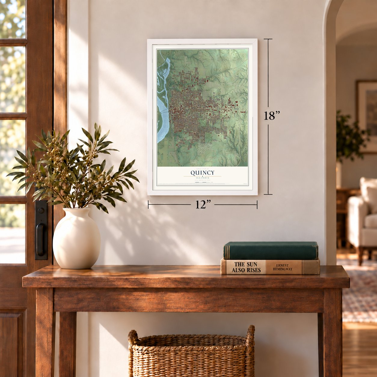
12" x 18" Archival Matte Print
A Map of Home. A Work of Art.
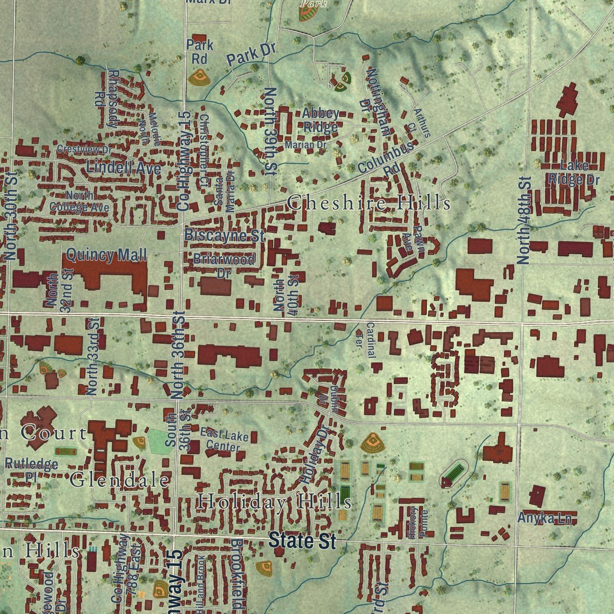
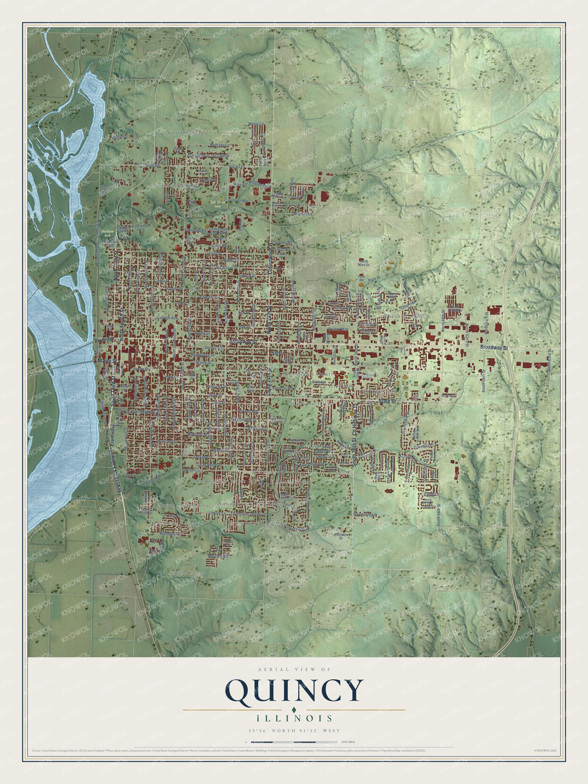
Explore Quincy, Illinois from a whole new perspective. Created using aerial imagery and detailed geographic data, this map captures Quincy building by building, with labeled streets, familiar landmarks, and shaded topographical relief that highlights the natural contours of the landscape.
Combining modern data with the timeless character of a vintage atlas, this map is just as interesting up close as it is beautiful on the wall. Whether you grew up in Quincy, spent memorable years there, or call it home today, this unique map is a great way to celebrate a place that means something to you. Zoom in on the preview to look for your street, and then order a print to put your memories on the wall.
Three ways to hang it
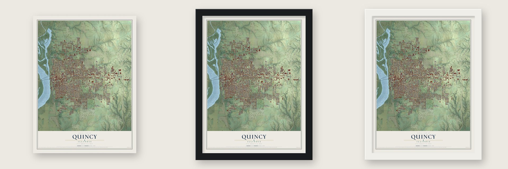
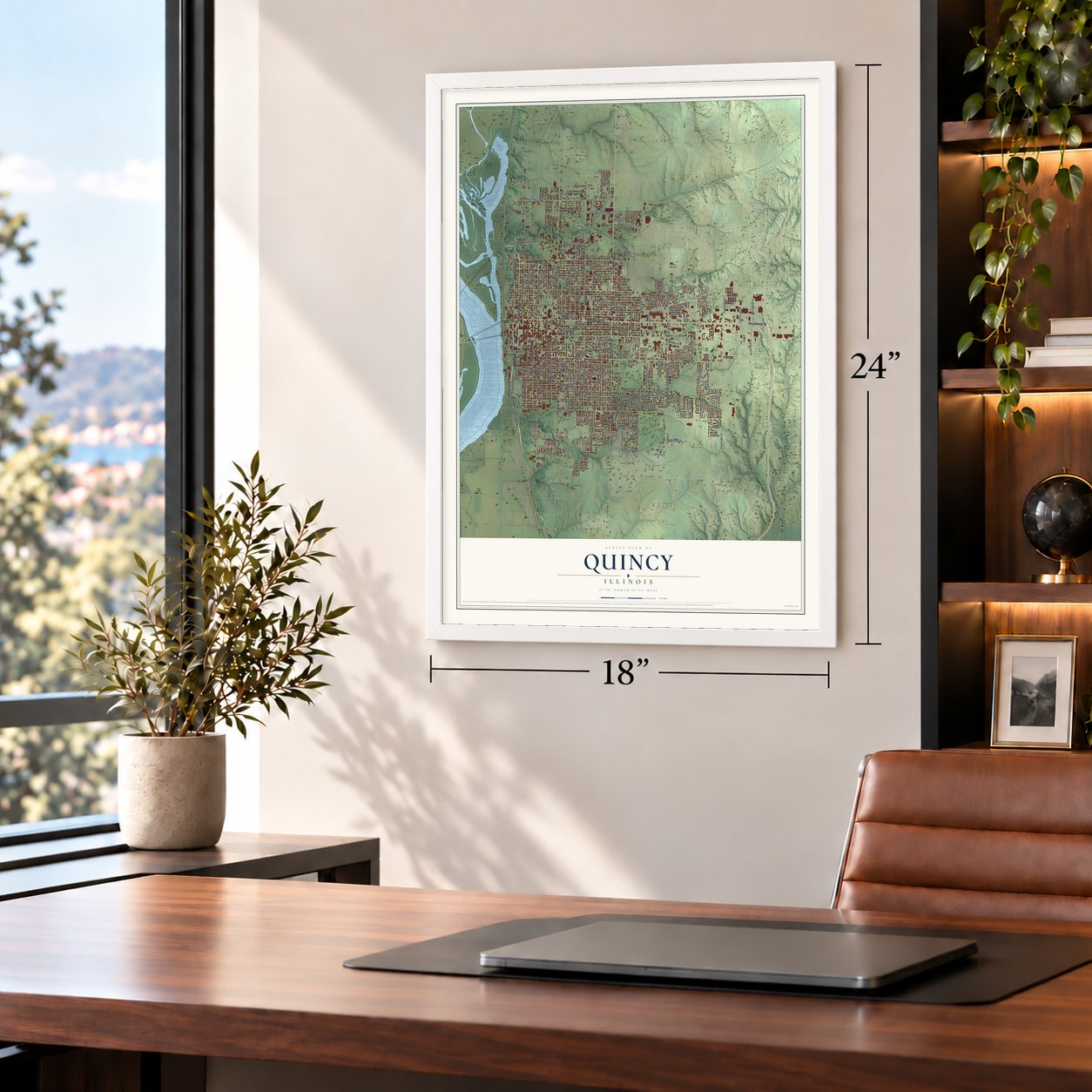
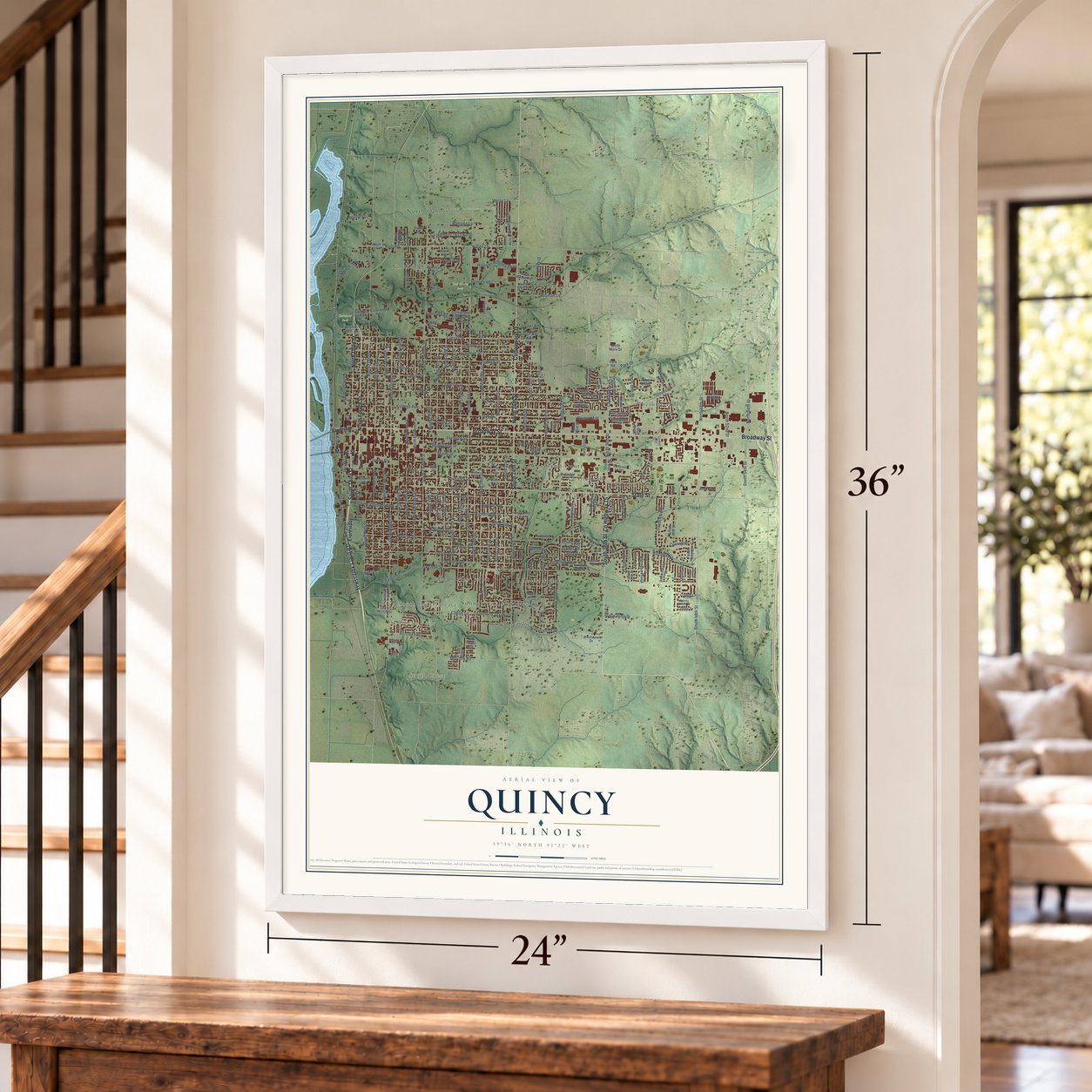
Unframed archival matte, a black wood frame or a white wood frame.
Up close
Geography Worth Displaying
This map was created using accurate cartographic data and authoritative geographic sources, including the U.S. Geological Survey and the Census Bureau. The map brings together terrain, waterways, roads, and building detail. The majority of the streets are labeled, houses are accurately depicted, and the topography is derived from government sources. Combining local data with carefully composed color and shading leads to this beautifully detailed Quincy artwork for your wall.
Rather than simply showing street outlines, we’ve included as many of the street names as we could reasonably fit on the map while keeping their names legible. Zoom in on the high resolution preview to see exactly what’s on the map. We truly set out to create a statement piece for anyone who loves Quincy. So whether it’s for you, or a gift for someone you love, we hope this map of Quincy brings back fond memories.
Read the story behind this map of Quincy, Illinois from 2026.
About Quincy, Illinois
Quincy is a city of 39,463 people on the Mississippi River and the county seat of Adams County. After the War of 1812, the government gave western land to veterans, and in 1819 Peter Flinn got a tract from veteran Mark McGowan. Flinn sold 160 acres to John Wood of Moravia, New York, for $60, and Wood started a settlement called Bluffs. In 1825 the town took the name Quincy, and the county became Adams, both for President John Quincy Adams.
Quincy was incorporated as a town in June 1834 and as a city in 1840, when Ebenezer Moore became its first mayor. Steamboats and trains made it a stop for immigrants heading west, and Germans began settling on its south side in the 1840s. The Chicago, Burlington and Quincy Railroad was founded in 1855, and the city grew from just under 7,000 people in 1850 to 24,000 by 1870. That put Quincy ahead of Peoria as the second-largest city in Illinois.
“Quincy begins at the Mississippi, hurdles steep bluffs, levels out on the uplands, and trails off into woods and farmlands.”
- 12,000 at the 1858 debateQuincy sits across the river from Missouri, then a slave state, and slavery split the town. In 1858 it hosted the sixth debate between Senator Stephen A. Douglas and Abraham Lincoln, his challenger. A crowd of 12,000 came, and Quincy was the largest town where the two men debated.
- A refuge from MissouriAfter Missouri Executive Order 44 forced the Mormons out of that state, large numbers of Latter-day Saints crossed the river to Quincy. There were far more refugees than townspeople, yet the town fed and housed them. Joseph Smith later took them 40 miles upriver to Nauvoo. Quincy also gave shelter in 1838 to the Potawatomi, who were being forced from Indiana to Kansas.
- An Underground Railroad stopRichard Eells, a firm abolitionist, built his house in Quincy in 1835. He hid people who had escaped slavery on their way to Chicago, and the house became one of the Underground Railroad's major stops.
- The governor stayed homeJohn Wood was lieutenant governor when Governor William H. Bissell died in office in 1860, so the founder of Quincy became governor. Wood was busy with his business and with building his mansion, and the legislature let him govern from Quincy. The John Wood Mansion joined the National Register in 1970.
- Tornado of April 12, 1945Hours after word of President Roosevelt's death reached Quincy on April 12, 1945, a tornado tore through downtown and blew the roof off the courthouse, ruining it. Some residents joked that FDR and God were fighting over the power. A new courthouse took five years to finish.
Find your street
Names on the Quincy map
Every name below is printed on this map. Look for your street, your school, the park where you played, or the pond down the road.
Places and landmarks19
- South Crest
- Southern View
- Northridge
- South Park Terrace
- Bob Mays Park
- Gardner Park
- Moorman Park
- Cherry Lane Estates
- Cheshire Hills
- Glendale
- Grandview Acres
- Hillside Manor
Show all 19 places
- Holiday Hills
- Lincoln Hills
- Melrose
- North Quincy
- Northbrook
- Sunnybrook Meadows
- Woodlawn Court
Streets and roads240
- Gardner Expressway
- South 36th Street
- Maine Street
- South Third Street
- North Fourth Street
- State Street
- Broadway Street
- North 24th Street
- Cottonwood Is
- North Third Street
- County Highway 15
- South 24th Street
- South 48th Street
- South Fifth Street
- North 30th Street
- Weiss Lane
- Cherry Lane
- North Fifth Street
- South Twelfth Street
- North Twelfth Street
- Bluff Road
- Bonansinga Drive
- Harrison Street
- North 36th Street
- North 48th Street
- Kochs Lane
- North Second Street
- South Ninth Street
- North 13th Street
- College Avenue
Show all 240 streets
- Chestnut Street
- Oak Street
- North 18th Street
- Vermont Street
- Hampshire Street
- Lind Street
- Elm Street
- South Eighth Street
- Locust Street
- Spring Street
- Spruce Street
- Payson Avenue
- Cherry Street
- Cedar Street
- Monroe Street
- Jefferson Street
- Jersey Street
- Jackson Street
- North 16th Street
- Ohio Street
- Washington Street
- Sycamore Street
- Madison Street
- Maple Street
- Kentucky Street
- Adams Street
- South 18th Street
- North Sixth Street
- South 23rd Street
- North 22nd Street
- South 30th Street
- South Sixth Street
- Van Buren Street
- North 14th Street
- North 17th Street
- North Eighth Street
- North Ninth Street
- North Seventh Street
- North Tenth Street
- North 20th Street
- South 20th Street
- South 16th Street
- South Seventh Street
- York Street
- South Eleventh Street
- North Eleventh Street
- South Tenth Street
- South 14th Street
- North 15th Street
- South 22nd Street
- South 15th Street
- North 27th Street
- South 21st Street
- North 28th Street
- North 25th Street
- North 54th Street
- South 19th Street
- South 17th Street
- Rj Peters Drive
- South Front Street
- County Highway 7
- Fasthoff Alley
- North 52nd Street
- Seminary Road
- North 26th Street
- Lindell Avenue
- South 28th Street
- South 46th Street
- South Fourth Street
- South 43rd Street
- Cabot Road
- Wisman Lane
- Hollister Whitney Parkway
- Park Drive
- County Highway 1412 North
- Klondike Road
- Hampton Lane
- South 38th Street
- Genevieve Drive
- North 39th Street
- Winsor Drive
- South 13th Street
- Covington Lane
- Quincy Mall
- South 54th Street
- Hamann Lane
- Harrison Plaza
- Kingsridge Drive
- Drake Drive
- Morton Drive
- Melview Road
- Larch Road
- East Avenue
- Lantern Lane
- Brookfield Road
- North 63rd Street
- Biscayne Street
- Turner Road
- Caleb Lane
- High Street
- Bay Bridge
- Gardner Expresspay
- Grant Drive
- County Highway 1000 North
- Ridgewood Drive
- South Second Street
- Columbus Road
- Abbey Ridge
- Holiday Drive
- Curtis Creek Road
- Valley View Road
- Wilmar Drive
- County Highway 1326 North
- North 33rd Street
- Curved Creek Road
- Parkwood Drive
- Maiden Lane
- Manor Hill Drive
- Mohrman Drive
- Eaton Lane
- Nottingham Drive
- South 45th Street
- Kentucky Road
- Park Place
- Breckenridge Drive
- Prairie Ridge Drive
- Hilltop Drive
- Park Road
- Quintron Way
- County Highway 788 East
- Aldo Boulevard
- Riverview Avenue
- Rutledge Place
- Peach Tree Lane
- Melrose Drive
- Briarwood Drive
- Koch's Lane
- Cortez Drive
- Westview Drive
- South Hilltop Drive
- Bluff Ridge Drive
- Acadia Way
- North 32nd Street
- Fox Run East
- Bredeweg Road
- Rhapsody Road
- North Marx Drive
- Anyka Lane
- Jennifer Lane
- Wells Avenue
- North Brook Road
- Gardner Park Drive
- Lake Ridge Drive
- Ken Ray Drive
- North 40th Street
- Diana Drive
- Merle Street
- Lexi Lane
- Watts Lane
- Park Plaza
- April Avenue
- Amber Avenue
- Vail Drive
- Pine Street
- North Front Street
- Northridge Drive
- Pawn Avenue
- Cadbury Ridge
- Grove Avenue
- Frese Drive
- Edinburgh Drive
- Cambridge Ests
- North College Avenue
- Callaway Drive
- Katherine Road
- Christopher Court
- Trinity Lakes Drive
- East Lake Center
- Riverside Terrace
- South 39th Street
- Carnoustie Lane
- Center Avenue
- North 23rd Street
- South Brook Road
- North 29th Street
- Scotia Trail
- Santa Maria Drive
- Donlee Street
- Clayton Road
- North Avenue
- Quail Creek Drive
- Josephine Drive
- Crestview Drive
- Cheswick Road
- Arthurs Court
- Marian Drive
- Madonna Drive
- Stone Crest Drive
- Hill and Brook
- North Country Club Drive
- Liebig Alley
- Valley Vw West
- Sharon Drive
- Scenic Drive
- Joshua Street
- Dublin Drive
- Cardinal Terrace
- Emerald Drive
- Melodie North
- Hickory Pointe
Names are listed as they appear on the printed map. Zoom into the product photos to find them.
The art of mapping a place
How This Map Was Made
Real places. Remarkable detail. Discover the layers that turn geographic data into a map of home.

The view from above
Aerial imagery reveals the character of the land: woodland, open fields, and the patterns of a place.

The shape of the land
Elevation data brings hills, valleys, and subtle changes in the landscape into view.

The details of home
Roads, waterways, and building footprints come together to make the map feel unmistakably local.

Geography becomes art
Considered color, shading, and typography bring the layers together in a map made for your wall.


Process illustrated with Mendon, Massachusetts. Aerial imagery: USDA NAIP. Terrain: USGS 3D Elevation Program. Map details and finished artwork: KNOWOL.
The Details
About This Print
Choose an archival matte print, or a black or white Ayous wood frame. The archival matte print is unframed.
Select your size and finish above to see the matching product image and price.
Materials & Craftsmanship
A contemporary map with the character of a classic atlas, printed on archival matte paper. Optional frames are made from Ayous wood.
Your printed map does not include the watermark shown in the full-map preview.
Shipping & Delivery
Free shipping within the United States. Every print is made to order in the USA.
Buying a gift? Add a note in your cart and we'll include it. We never put prices in the package.
Prints ship within 2 to 3 business days. Allow 7 to 10 days total from ordering for delivery. Timing may vary during holidays or periods of high order volume.
Read our shipping policy.
Returns and damaged prints
Each print is made to order. Change-of-mind refunds are not available after production.
If your print arrives damaged, misprinted or incorrect, contact support@knowol.com within 30 days of receiving it. Include your order number, photos and a description of the issue.
Read our full refund and replacement policy. For questions about your order, email support@knowol.com.
Find your town
Looking for another city?
Find a map of home in our Illinois collection, or any town in the country.
Nearby
Maps of towns near Quincy
Know someone from one of these towns? Their map makes a great gift.
 Bloomfield
, Illinois
From $39.99See the map
 Burton
, Illinois
From $39.99See the map
 Fowler
, Illinois
From $39.99See the map
More maps nearby: Ursa, Adams, Payson, Fall Creek and Paloma.