
Search for another town





Free U.S. delivery 7 to 10 days after you order
Rayne, Louisiana Map Art
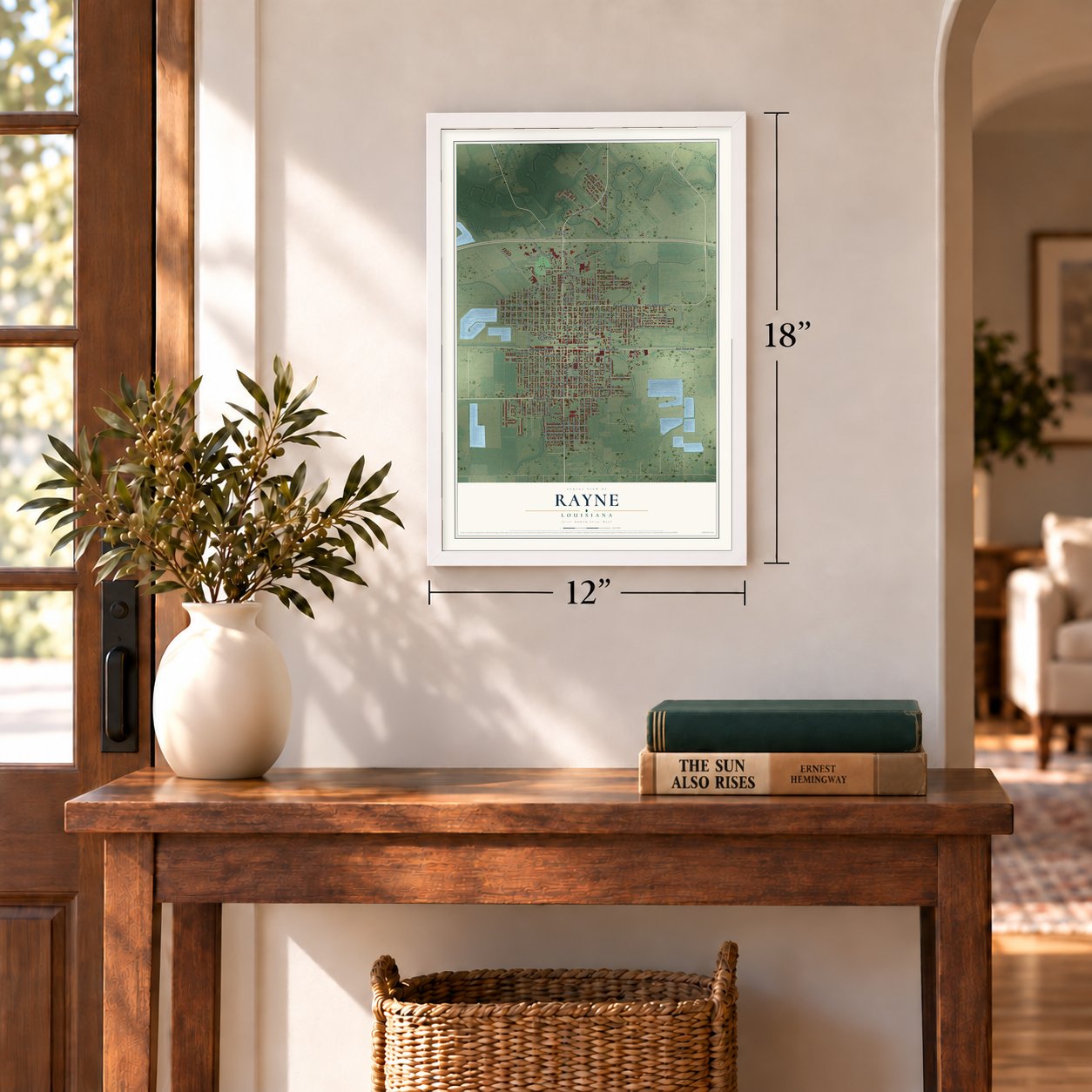
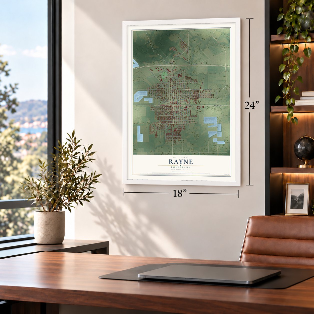
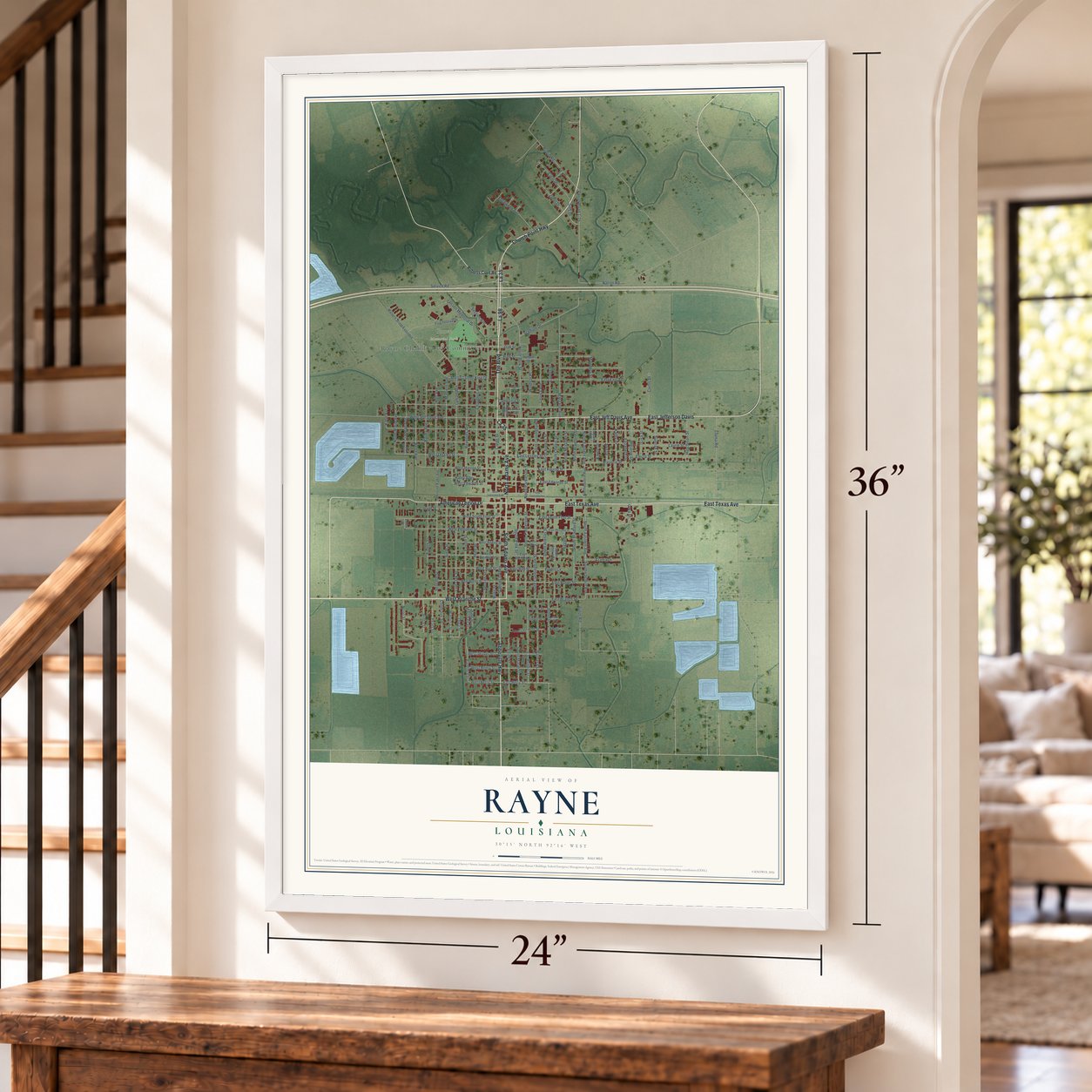
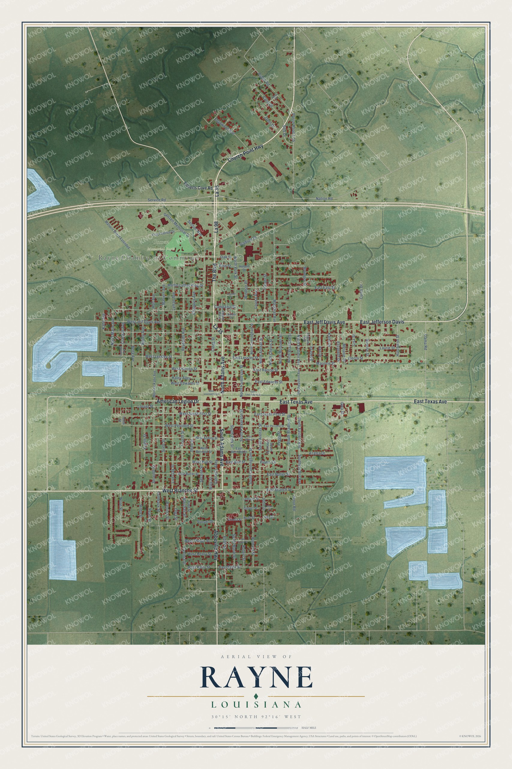
A new map of Rayne, Louisiana, made in 2026 and printed to order on thick archival matte paper.
12" x 18" Archival Matte Print
A Map of Home. A Work of Art.
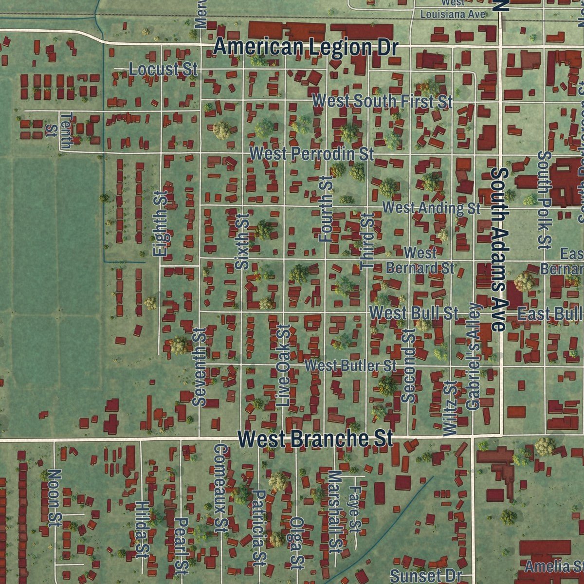
Explore Rayne, Louisiana from a whole new perspective. Created using aerial imagery and detailed geographic data, this map captures Rayne building by building, with labeled streets, familiar landmarks, and shaded topographical relief that highlights the natural contours of the landscape.
Combining modern data with the timeless character of a vintage atlas, this map is just as interesting up close as it is beautiful on the wall. Whether you grew up in Rayne, spent memorable years there, or call it home today, this unique map is a great way to celebrate a place that means something to you. Zoom in on the preview to look for your street, and then order a print to put your memories on the wall.
Three ways to hang it
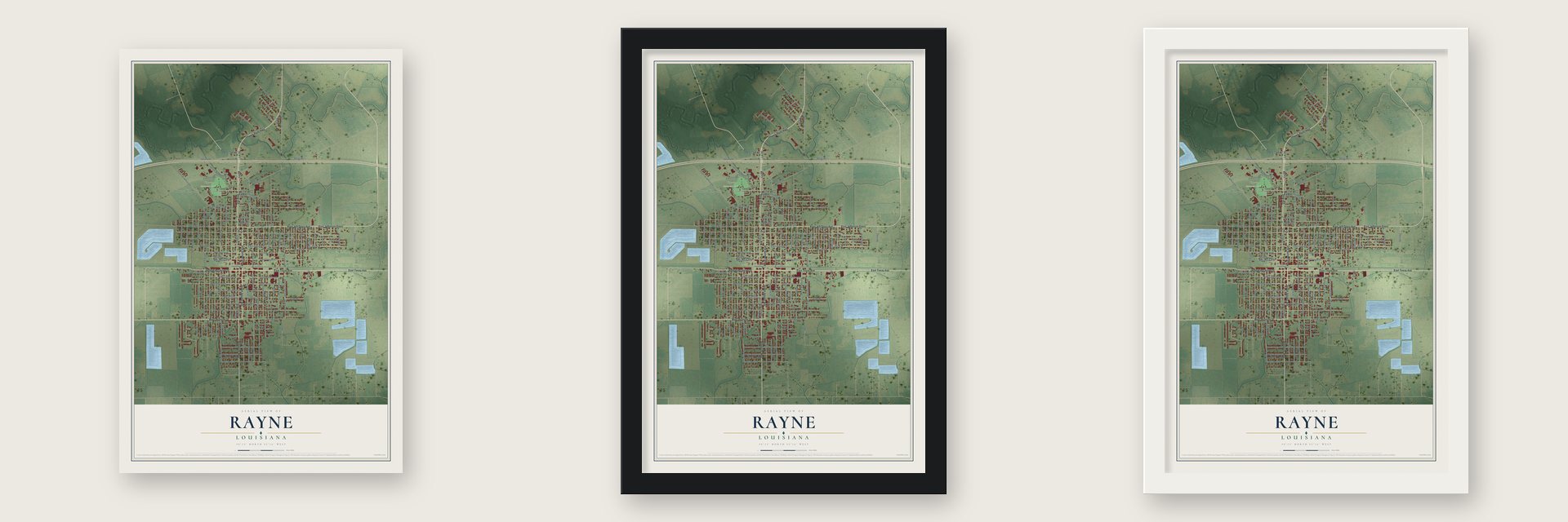
Unframed archival matte, a black wood frame or a white wood frame.
Up close
Geography Worth Displaying
This map was created using accurate cartographic data and authoritative geographic sources, including the U.S. Geological Survey and the Census Bureau. The map brings together terrain, waterways, roads, and building detail. The majority of the streets are labeled, houses are accurately depicted, and the topography is derived from government sources. Combining local data with carefully composed color and shading leads to this beautifully detailed Rayne artwork for your wall.
Rather than simply showing street outlines, we’ve included as many of the street names as we could reasonably fit on the map while keeping their names legible. Zoom in on the high resolution preview to see exactly what’s on the map. We truly set out to create a statement piece for anyone who loves Rayne. So whether it’s for you, or a gift for someone you love, we hope this map of Rayne brings back fond memories.
Read the story behind this map of Rayne, Louisiana from 2026.

About Rayne, Louisiana
Rayne is a city of 7,236 people in Acadia Parish, in the farm country of Acadiana where rice and sugarcane have long been grown. The town began in the late nineteenth century as a prairie stop on the Louisiana Western Railroad. It was first called Pouppeville, but it was soon renamed for Rayne Grey, a Southern Pacific engineer who helped bring the railroad there, and its first depot was Rayne Station.
Merchants moved in, and within a few years the depot was crowded with trade. A Daily Picayune reporter who came in 1887 wrote about one big shipper who had traveled twenty-five miles from the south with a load of bullfrogs. Frogs soon became the town's best known export, and by the middle of the twentieth century Rayne was called the Frog Capital of the World.
“witnessed such bustle and confusion as is only equaled by the French Market of New Orleans on Sunday mornings.”
- Frogs from a saloonDonat Pucheu, a newcomer from France, ran a saloon called the Rayne Drop Inn. On the side he sold wild game from the nearby prairies and waters: ducks, quail and bullfrogs, which Cajun French speakers call ouaouaron. Frogs were hard to find elsewhere in Louisiana, so he packed them in ice and sent them to New Orleans, where restaurant chefs cooked the legs in butter and garlic.
- The Weil brothers, 1899In 1899 the Weils, another French family, joined the trade. Jacques Maurice Weil, born in Paris, ran the store of Boudreaux, Leger, and Weil on Polk Street with his brothers Edmond and Gontran, right across from Pucheu's bar. Weil became the town's leading frog dealer. He built a caged pen that held fifteen thousand frogs, sold goods made of frog leather and shipped to Chicago, Los Angeles and, by one account, Paris.
- Two frogs in orbitThe Louisiana Frog Company started in Mermentau in 1931 and moved to Rayne in 1933. It grew into the biggest frog shipper in the world, sending out half a million frogs four years later. It also canned frog à la sauce piquante, packed frogs for school dissection and gave NASA two frogs, Pierre and Tee-Nom, that circled the earth in 1970. Its shipments ended in 1973, and three years after that the business sold off what it owned.
- Frog Festival since 1973As foreign frogs cut into its trade, Rayne held its first Frog Festival in 1973. It grew out of the Frog Derby, where frogs race dressed as jockeys, first run at Crowley's International Rice Festival in 1946. Held on the second weekend of May, the festival has a Frog Derby Queen, frog kissing, frog jumping and plates of frog legs. Frog murals around town earned Rayne a second nickname, the City of Murals.
Find your street
Names on the Rayne map
Every name below is printed on this map. Look for your street, your school, the park where you played, or the pond down the road.
Places and landmarks2
- Rayne Chamber of Commerce
- Gossen Memorial Park
Streets and roads150
- La 35
- Church Point Highway
- The Boulevard
- North Adams Avenue
- South Adams Avenue
- West Branche Street
- East Texas Avenue
- Abbeville Highway
- East Jefferson Davis
- American Legion Drive
- La 98
- East Jeff Davis Avenue
- Gabriel's Alley
- Parish Road 1-15
- Crandall Avenue
- Gina Street
- East Bull Street
- Sills Drive
- Hutchison Street
- West Perrodin Street
- West Lessley Street
- West Harrop Street
- North Marie Avenue
- North Polk Street
- Section Avenue
- Nation Road
- West Jeff Davis Avenue
- Service Road
- Lyman Avenue
- East Branch Street
Show all 150 streets
- Reynolds Avenue
- East Edwards Street
- West South First Street
- East East Street
- East Butler Street
- East Harrop Street
- Second Street
- Margaret Avenue
- South Polk Street
- South Parkerson Street
- South Arenas Street
- Seventh Street
- South Eastern Avenue
- Southeastern Avenue
- Sixth Street
- Live Oak Street
- Fourth Street
- Third Street
- Wiltz Street
- South Cunningham Street
- Malvern Avenue
- Chappuis Avenue
- Holt Avenue
- Noon Street
- Robert Street
- Barbara Street
- Bailey Avenue
- East Lessley Street
- North Arenas Street
- North Parkerson Street
- Locust Street
- South Bradford Street
- Gossen Memorial Drive
- North Eastern Avenue
- Kathy Drive
- Eighth Street
- Bella Avenue
- West Bull Street
- East South First Street
- Stadium Drive
- Clegg Street
- Ann Drive
- Edgewood Avenue
- North McGown Street
- North Chevis Street
- Public Road
- Edith Street
- Electa Street
- North Bradford Street
- West Edwards Street
- Oak Street
- Carol Drive
- East Betty Street
- Carver Street
- Janet Drive
- Melanie Street
- Laurie Street
- Llama Road
- Karen Drive
- Cynthia Street
- Marjorie Street
- Martin Luther King Drive
- Elizabeth Drive
- Haley Alley
- South Marie Street
- Louisa Avenue
- Curtis Drive
- Lisa Street
- Sunrise Street
- Olga Street
- John Drive
- West Henry Street
- West Thayer Street
- West Betty Street
- Azalea Drive
- Pearl Street
- Comeaux Street
- Hilda Street
- Patricia Street
- Junot Road
- Marshall Street
- Windsor Place
- Mounger Street
- Peggy Street
- Campania Street
- Pine Street
- Sunset Drive
- Kahn Avenue
- Pipers Cv
- Huff Street
- Ike Street
- Roberts Cove Road
- Malvern Street Extended
- West Bernard Street
- Northeastern Avenue
- North Cunningham Street
- West Butler Street
- West Anding Street
- Frog Festival Drive
- East Bernard Street
- South Chevis Street
- Mervine Kahn Avenue
- Leblanc Street
- Adams Alley
- Leblanc Avenue
- Amelia Street
- Gilbert Street
- Faye Street
- Louisa Street
- Hebert Drive
- Tenth Street
- East Perrodin Street
- Crandle Avenue
- Anna Street
- Irene Street
- East Anding Street
- East Thayer Street
- East Louisiana Avenue
- West Louisiana Avenue
- Bowden Street
Names are listed as they appear on the printed map. Zoom into the product photos to find them.
The art of mapping a place
How This Map Was Made
Real places. Remarkable detail. Discover the layers that turn geographic data into a map of home.

The view from above
Aerial imagery reveals the character of the land: woodland, open fields, and the patterns of a place.

The shape of the land
Elevation data brings hills, valleys, and subtle changes in the landscape into view.

The details of home
Roads, waterways, and building footprints come together to make the map feel unmistakably local.

Geography becomes art
Considered color, shading, and typography bring the layers together in a map made for your wall.


Process illustrated with Mendon, Massachusetts. Aerial imagery: USDA NAIP. Terrain: USGS 3D Elevation Program. Map details and finished artwork: KNOWOL.
The Details
About This Print
Choose an archival matte print, or a black or white Ayous wood frame. The archival matte print is unframed.
Select your size and finish above to see the matching product image and price.
Materials & Craftsmanship
A contemporary map with the character of a classic atlas, printed on archival matte paper. Optional frames are made from Ayous wood.
Your printed map does not include the watermark shown in the full-map preview.
Shipping & Delivery
Free shipping within the United States. Every print is made to order in the USA.
Buying a gift? Add a note in your cart and we'll include it. We never put prices in the package.
Prints ship within 2 to 3 business days. Allow 7 to 10 days total from ordering for delivery. Timing may vary during holidays or periods of high order volume.
Read our shipping policy.
Returns and damaged prints
Each print is made to order. Change-of-mind refunds are not available after production.
If your print arrives damaged, misprinted or incorrect, contact support@knowol.com within 30 days of receiving it. Include your order number, photos and a description of the issue.
Read our full refund and replacement policy. For questions about your order, email support@knowol.com.
Find your town
Looking for another city?
Find a map of home in our Louisiana collection, or any town in the country.
Nearby
Maps of towns near Rayne
Know someone from one of these towns? Their map makes a great gift.
 Duson
Duson, Louisiana
From $39.99See the map
 Crowley
, Louisiana
From $39.99See the map
 Branch
, Louisiana
From $39.99See the map
More maps nearby: Ossun, Scott, Church Point, Cankton and Estherwood.