
Search for another town




Free U.S. delivery 7 to 10 days after you order
Redding, California Map Art
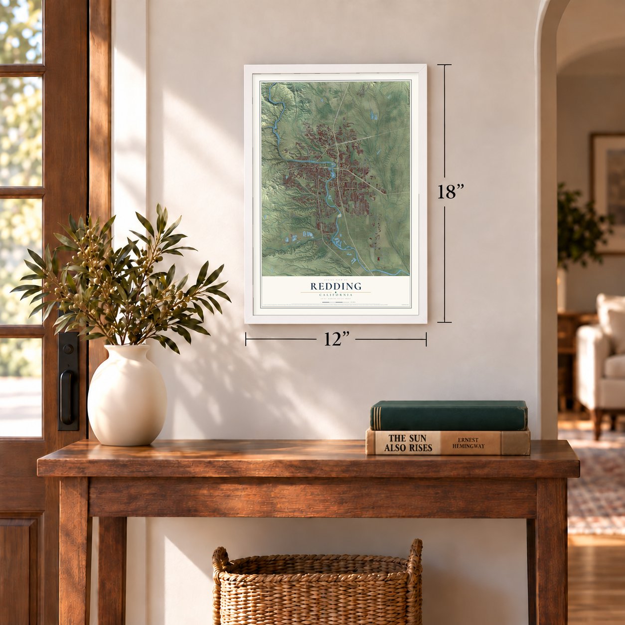
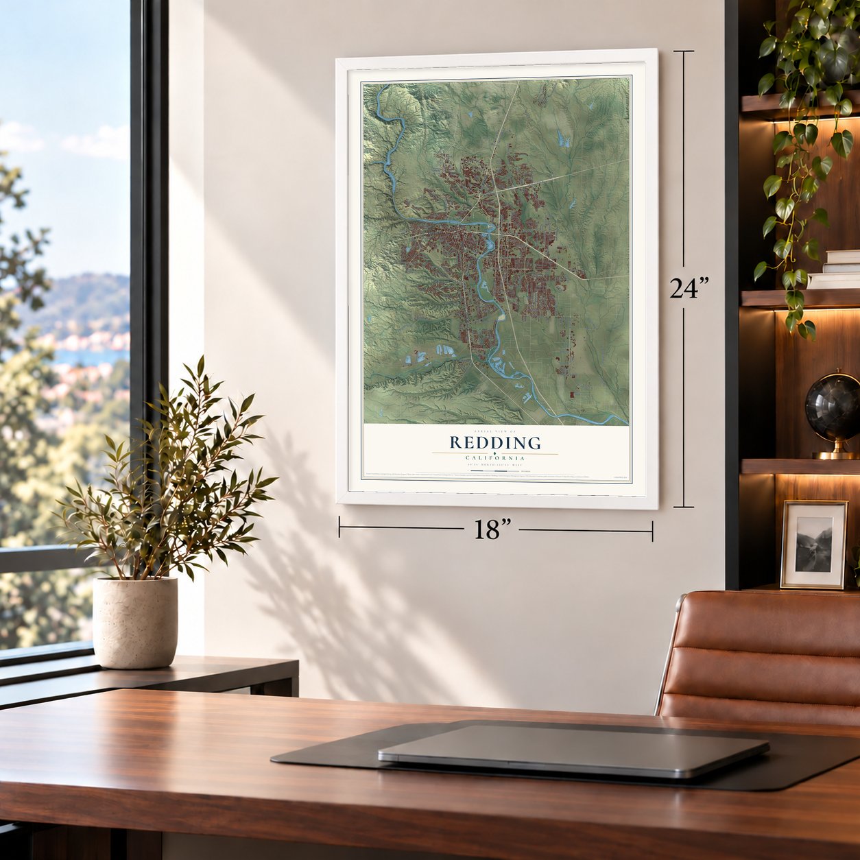
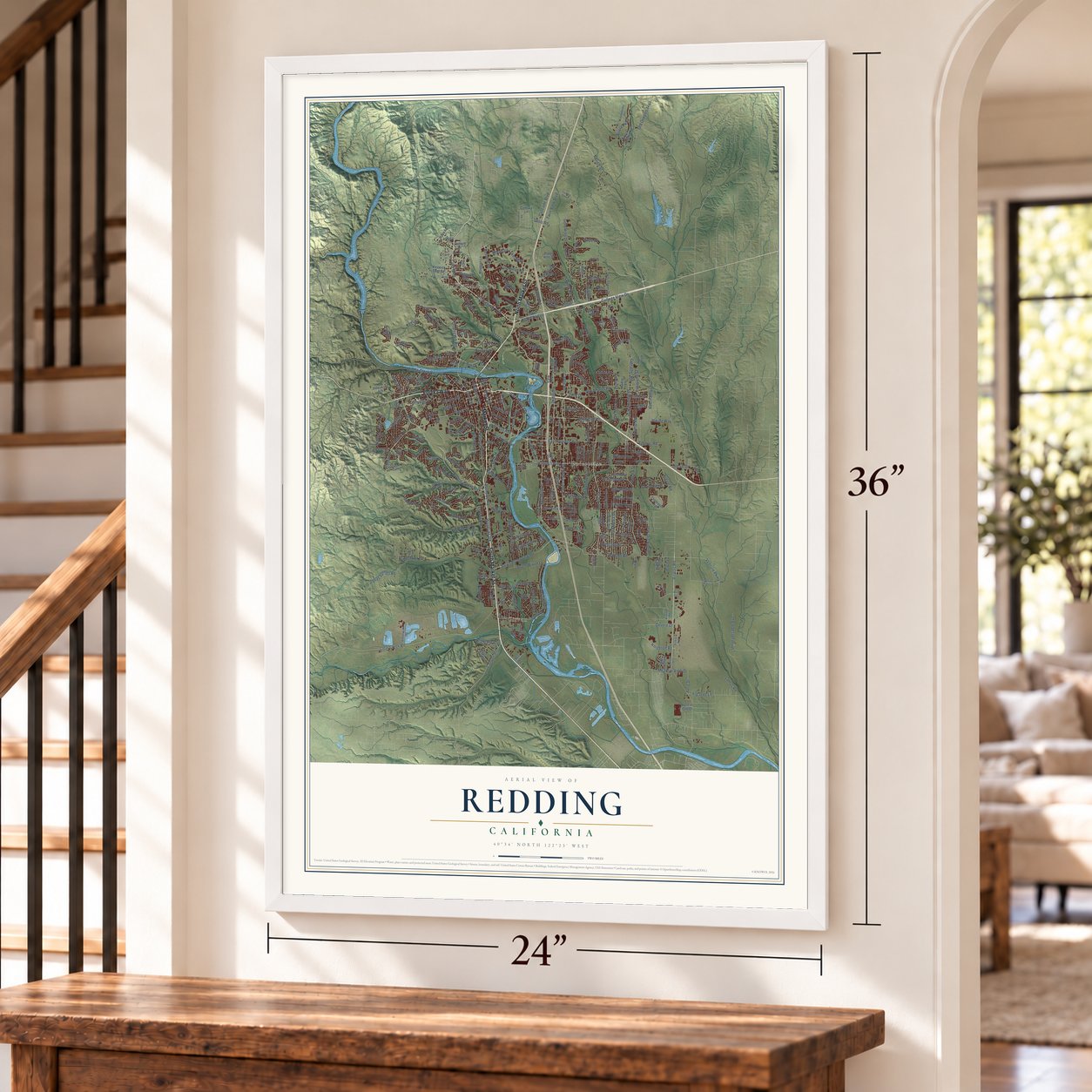
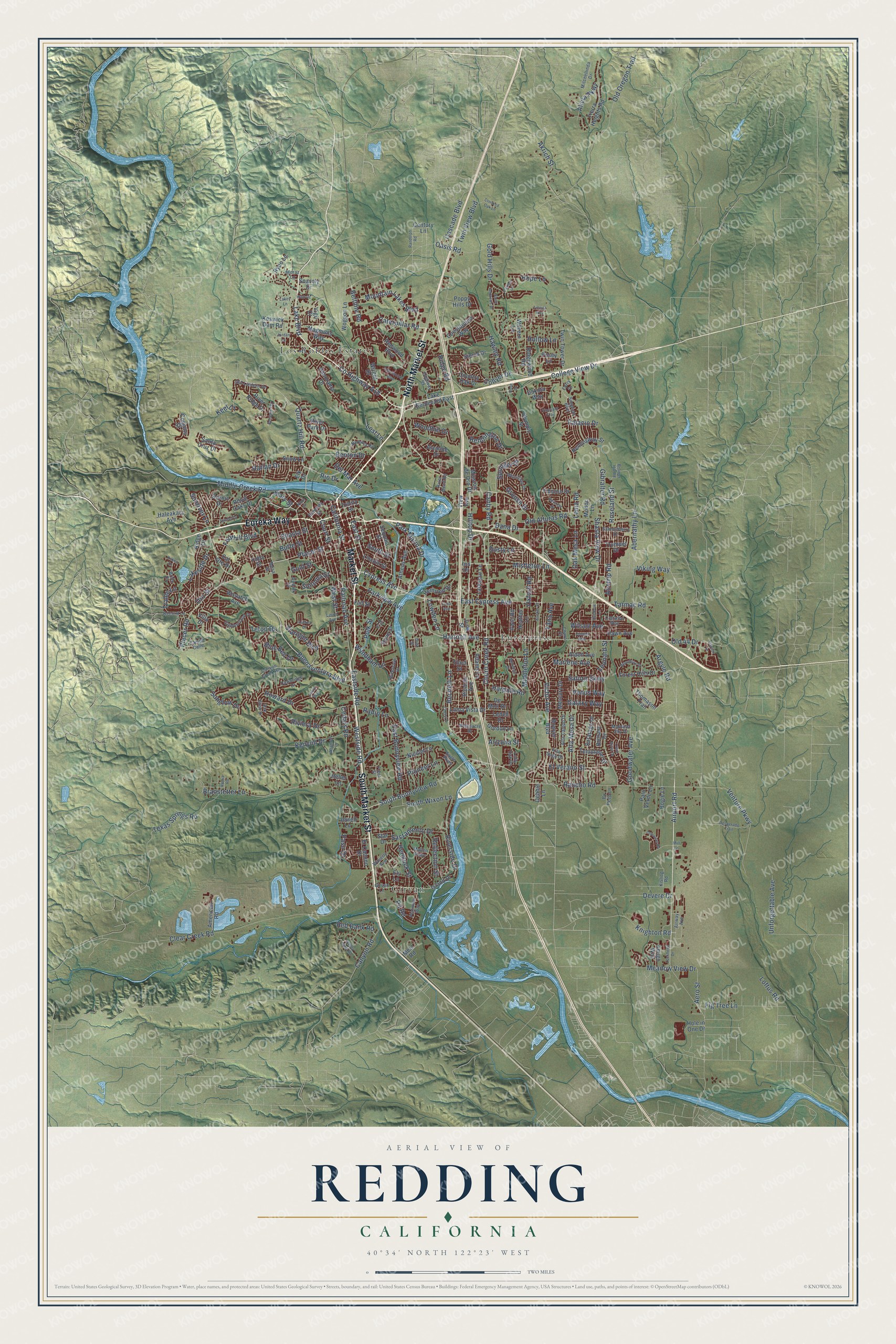
A new map of Redding, California, made in 2026 and printed to order on thick archival matte paper.
12" x 18" Archival Matte Print
A Map of Home. A Work of Art.
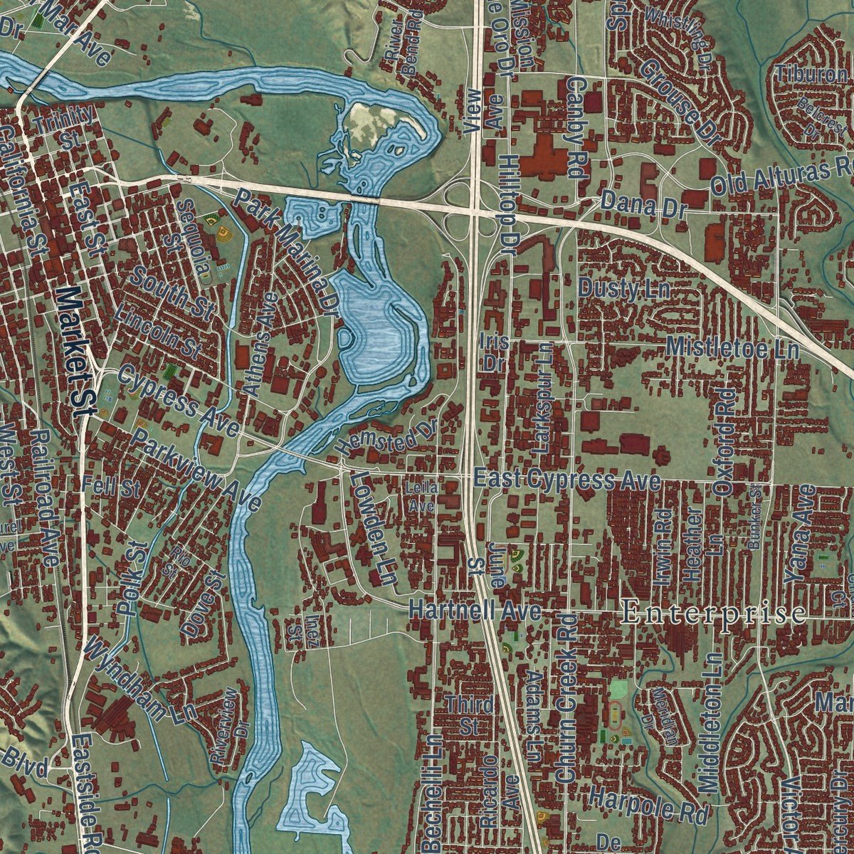
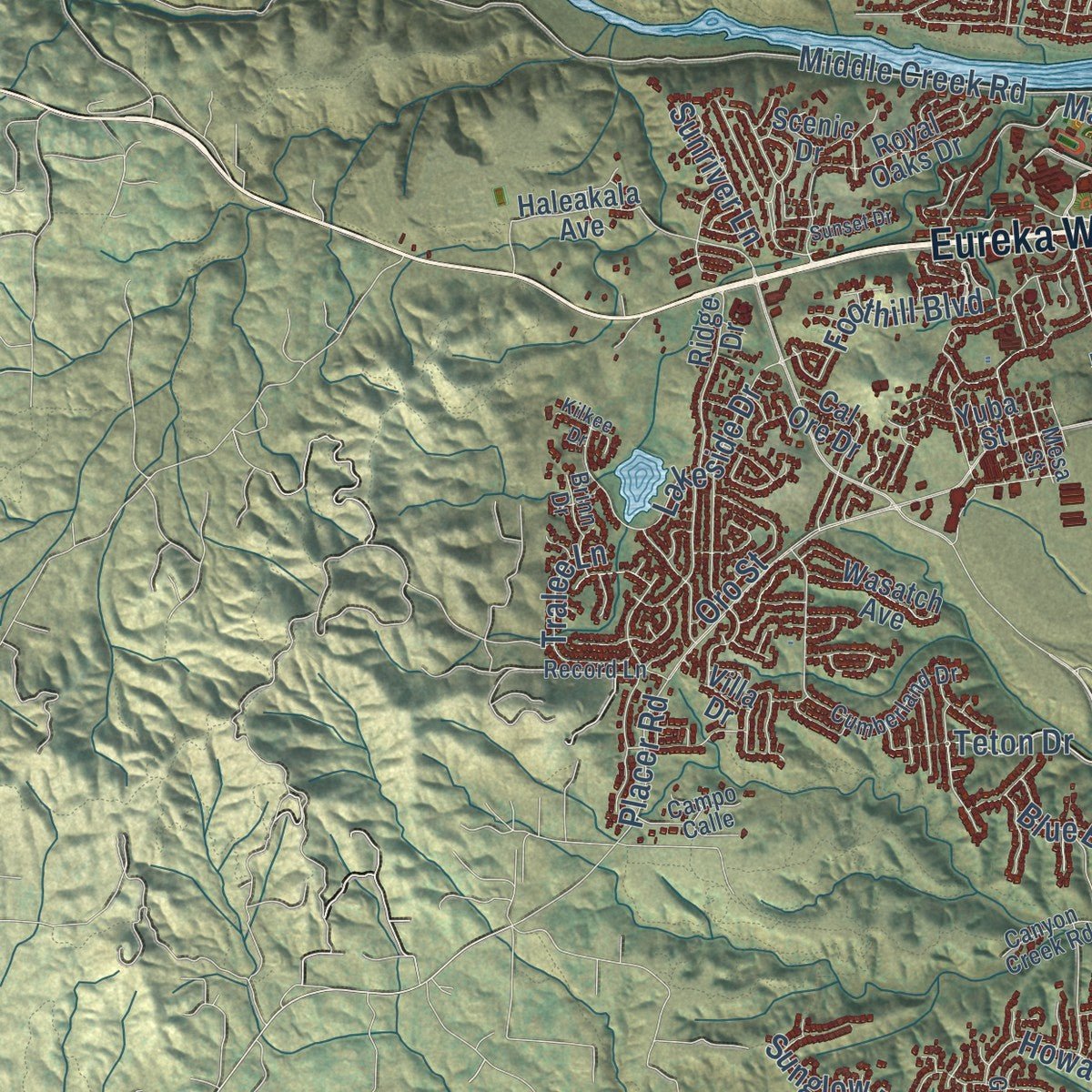
Explore Redding, California from a whole new perspective. Created using aerial imagery and detailed geographic data, this map captures Redding building by building, with labeled streets, familiar landmarks, and shaded topographical relief that highlights the natural contours of the landscape.
Combining modern data with the timeless character of a vintage atlas, this map is just as interesting up close as it is beautiful on the wall. Whether you grew up in Redding, spent memorable years there, or call it home today, this unique map is a great way to celebrate a place that means something to you. Zoom in on the preview to look for your street, and then order a print to put your memories on the wall.
Three ways to hang it
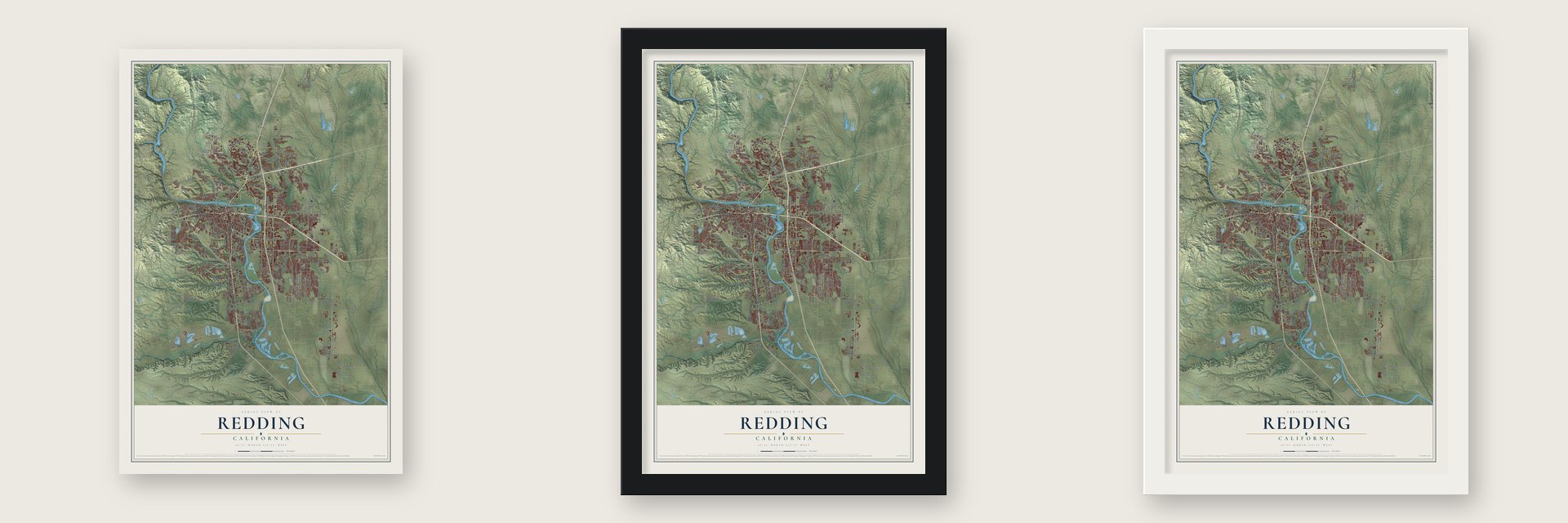
Unframed archival matte, a black wood frame or a white wood frame.
Up close
Geography Worth Displaying
This map was created using accurate cartographic data and authoritative geographic sources, including the U.S. Geological Survey and the Census Bureau. The map brings together terrain, waterways, roads, and building detail. The majority of the streets are labeled, houses are accurately depicted, and the topography is derived from government sources. Combining local data with carefully composed color and shading leads to this beautifully detailed Redding artwork for your wall.
Rather than simply showing street outlines, we’ve included as many of the street names as we could reasonably fit on the map while keeping their names legible. Zoom in on the high resolution preview to see exactly what’s on the map. We truly set out to create a statement piece for anyone who loves Redding. So whether it’s for you, or a gift for someone you love, we hope this map of Redding brings back fond memories.
Read the story behind this map of Redding, California from 2026.
About Redding, California
Redding is a city of 93,611 people and the county seat of Shasta County, on the Sacramento River. During the Gold Rush, miners struck gold on creeks to the north and south, but this ground held so little placer gold that people called it Poverty Flats. In 1868 Benjamin B. Redding, a former Sacramento politician and the Central Pacific Railroad's first land agent, bought land here where the railroad planned to end its northern line.
The tracks reached Poverty Flats in 1872, and the railroad built a town beside its terminus and named it for Redding. In 1874 local legislators renamed it Reading to honor the pioneer Pierson B. Reading, but the old spelling was back by 1880. The city incorporated on October 4, 1887, and the following year it won the county seat away from Shasta.
“Bell's Mansion, erected in 1859 on Clear Creek, was a favorite stopping place for miners on their way to the Shasta, Trinity, and Siskiyou gold fields.”
- Reading's rancho, 1844Long before the railroad, the Wintu lived here, with as many as 239 villages across the Shasta County area. In 1844 Pierson B. Reading started the first European settlement on Rancho Buena Ventura, a Mexican land grant of 26,632 acres that now holds Redding and Cottonwood. No other settlers from outside lived farther north in California then.
- The dam that doubled the townCopper and iron mines nearby fed Redding's early growth, but the industry faded and the town was struggling by 1920. Work on Shasta Dam, northwest of town, brought it back in the thirties. When the dam was finished in 1945, Redding's population had nearly doubled, and the Whiskeytown and Keswick dams, lumber and tourism kept it growing through the 1950s.
- Enterprise joins for cheap powerIn the 1960s and 1970s Redding annexed land east of the Sacramento River, including the community of Enterprise. Its residents voted for the move mostly to get cheaper electricity from Redding's own city utility, which draws power from Shasta Dam.
- A downtown made overA downtown plan adopted in January 2001 brought the historic Cascade Theatre back to life, and the theatre joined the National Register in 2002. The same plan took the roof off the Midtown Mall, turning it into an open air street for people on foot, and finished a Health Sciences and University Center built in partnership with Shasta College.
Find your street
Names on the Redding map
Every name below is printed on this map. Look for your street, your school, the park where you played, or the pond down the road.
Places and landmarks3
- Enterprise
- Girvan
- Los Robles Estates
Streets and roads292
- South Market Street
- Eureka Way
- North Market Street
- Market Street
- Airport Road
- County Highway A18
- Lake Boulevard
- Caterpillar Road
- East Street
- Shasta Street
- Cypress Avenue
- Churn Creek Road
- Hartnell Avenue
- Quartz Hill Road
- East Cypress Avenue
- Hilltop Drive
- South Bonnyview Road
- Old Oregon Trail
- Oasis Road
- Park Marina Drive
- Teton Drive
- Parkview Avenue
- Butte Street
- Del Mar Avenue
- Aero Street
- Shasta View Drive
- Buenaventura Boulevard
- Victor Avenue
- Bechelli Lane
- Placer Street
Show all 292 streets
- Eastside Road
- West Street
- Twin View Boulevard
- Westside Road
- Clear Creek Road
- Old Alturas Road
- Rancho Road
- South Street
- Railroad Avenue
- Branstetter Lane
- Goodwater Avenue
- California Street
- Middle Creek Road
- Court Street
- Dana Drive
- College View Drive
- Mountain Lakes Boulevard
- Alta Mesa Drive
- Collyer Drive
- Benton Drive
- Abernathy Lane
- Canby Road
- Sacramento Drive
- Gold Street
- Placer Road
- Mistletoe Lane
- Cedars Road
- Tarmac Road
- Riverside Drive
- Texas Springs Road
- Lakeside Drive
- Hawley Road
- Venture Parkway
- Howard Drive
- Riviera Drive
- East Bonnyview Road
- Gold Hills Drive
- Hollow Lane
- Kenyon Drive
- Beltline Road
- Akrich Street
- Galaxy Way
- Springer Drive
- Harlan Drive
- Palacio Drive
- Hope Lane
- Sonoma Street
- Grouse Drive
- Argyle Road
- Marlene Avenue
- Old 44 Drive
- Sunglow Drive
- Foothill Boulevard
- South Wixon Lane
- Wilson Avenue
- Starlight Boulevard
- Pit Road
- Unforgettable Avenue
- Venus Way
- El Verano Street
- Meadow View Drive
- Airstrip Road
- Viking Way
- Hemlock Street
- Knighton Road
- Wyndham Lane
- Fig Tree Lane
- Oak Mesa Lane
- Pioneer Lane
- Lema Road
- Middleton Lane
- Cascade Boulevard
- Gibralter Road
- Oxford Road
- Alicia Parkway
- Reddington Drive
- Tralee Lane
- Lowden Lane
- Roseland Street
- Red Bank Road
- Rio Drive
- Saturn Skwy
- Devere Drive
- Oro Street
- Harpole Road
- Canyon Road
- Woodhill Drive
- Reflection Street
- Leonard Street
- Yana Avenue
- Blue Bell Drive
- Sunriver Lane
- Loftus Road
- Dusty Lane
- Polk Street
- Arizona Street
- Radio Lane
- Ridge Road
- Lost Lane
- Paso Drive
- Mary Street
- Keel Court
- Lake Boulevard East
- Yuba Street
- River Park Drive
- Redwood Boulevard
- Loma Vista Drive
- Panorama Drive
- Tierra Heights Road
- Saratoga Drive
- Larkspur Lane
- Athens Avenue
- Sequoia Street
- Hawn Avenue
- Trinity Street
- Ridgewood Road
- Thomason Trail
- Woggon Lane
- Keswick Dam Road
- Royal Oaks Drive
- Trumpet Drive
- Mission de Oro Drive
- Brittany Drive
- Constitution Way
- Santa Cruz Drive
- Forest Hills Drive
- Templeton Drive
- Lincoln Street
- River Ridge Drive
- Nicolet Lane
- Twin Tower Drive
- Magnums Way
- Ridge Drive
- Hemingway Street
- Irwin Road
- Sierra Drive
- Hemsted Drive
- Heather Lane
- American Road
- Amigo Way
- Alden Avenue
- Mercury Drive
- Gordon Lane
- Bowyer Boulevard
- Scenic Drive
- Hole in One Drive
- Country Oak Drive
- Jewell Lane
- Wasatch Avenue
- Coggins Street
- El Camino Drive
- Tiburon Drive
- Ricardo Avenue
- Poppy Hills Drive
- Alamine Drive
- De Moll Drive
- Palo Verde Lane
- Island Drive
- Haleakala Avenue
- Modoc Lane
- Wright Drive
- Snow Lane
- Wilvern Lane
- Adams Lane
- Cal Ore Drive
- Ryan Lane
- Dove Street
- Ledell Drive
- Century Lane
- Dakota Way
- Bogie Lane
- Olympic Street
- Posey Lane
- Snavely Drive
- Star Drive
- Debbie Lane
- Fell Street
- Metz Road
- Heller Lane
- View Avenue
- Third Street
- Ely Lane
- June Street
- Elk Drive
- Vigil Court
- Iris Drive
- Villa Drive
- Cumberland Drive
- Airpark Drive
- Girvan Lane
- Canyon Creek Road
- Riverview Drive
- Whistling Drive
- Barbara Road
- Simpson Boulevard
- Mullen Parkway
- Alta Saga Drive
- Eagle Parkway
- Platinum Way
- Alta Campo Drive
- Old Lantern Drive
- Record Lane
- Entry Drive
- River Bend Road
- Salmonberry Drive
- Dawnridge Drive
- Mitchellinda Drive
- Woodacre Drive
- Campo Calle
- Highway 99
- Montana Sky Drive
- Camulos Way
- Oak Glen Drive
- Mesa Street
- Eleventh Street
- Bo Peep Lane
- Waverly Avenue
- Kisling Road
- Lofty Oak Drive
- Airway Avenue
- Churn Court
- Inez Street
- Brinn Drive
- Meraz Lane
- Fleet Street
- Lockheed Drive
- Cheryl Drive
- Valley View Road
- Vineyard Trail
- Woodbury Drive
- Desperado Trail
- Saint Andrews Drive
- Hardwood Boulevard
- Randolph Road
- Lemurian Road
- Auburn Drive
- Sunset Drive
- Crooked Oak Lane
- Clark River Drive
- Bellagio Terrace
- Bunker Street
- Belcrest Drive
- Jonquil Way
- Leila Avenue
- Laurel Avenue
- Hiatt Drive
- Ninth Street
- Altamont Lane
- Meridian Drive
- Rainbow Lane
- Carmel Drive
- Kiowa Road
- Boomer Hill Road
- Carson Drive
- Jordan Lane
- Rose Lane
- Titleist Way
- Lakey Lane
- Kilkee Drive
- Rio Street
- Emily Way
- Mill Lane
Names are listed as they appear on the printed map. Zoom into the product photos to find them.
The art of mapping a place
How This Map Was Made
Real places. Remarkable detail. Discover the layers that turn geographic data into a map of home.

The view from above
Aerial imagery reveals the character of the land: woodland, open fields, and the patterns of a place.

The shape of the land
Elevation data brings hills, valleys, and subtle changes in the landscape into view.

The details of home
Roads, waterways, and building footprints come together to make the map feel unmistakably local.

Geography becomes art
Considered color, shading, and typography bring the layers together in a map made for your wall.


Process illustrated with Mendon, Massachusetts. Aerial imagery: USDA NAIP. Terrain: USGS 3D Elevation Program. Map details and finished artwork: KNOWOL.
The Details
About This Print
Choose an archival matte print, or a black or white Ayous wood frame. The archival matte print is unframed.
Select your size and finish above to see the matching product image and price.
Materials & Craftsmanship
A contemporary map with the character of a classic atlas, printed on archival matte paper. Optional frames are made from Ayous wood.
Your printed map does not include the watermark shown in the full-map preview.
Shipping & Delivery
Free shipping within the United States. Every print is made to order in the USA.
Buying a gift? Add a note in your cart and we'll include it. We never put prices in the package.
Prints ship within 2 to 3 business days. Allow 7 to 10 days total from ordering for delivery. Timing may vary during holidays or periods of high order volume.
Read our shipping policy.
Returns and damaged prints
Each print is made to order. Change-of-mind refunds are not available after production.
If your print arrives damaged, misprinted or incorrect, contact support@knowol.com within 30 days of receiving it. Include your order number, photos and a description of the issue.
Read our full refund and replacement policy. For questions about your order, email support@knowol.com.
Find your town
Looking for another city?
Find a map of home in our California collection, or any town in the country.
Nearby
Maps of towns near Redding
Know someone from one of these towns? Their map makes a great gift.
 Centerville
, Shasta County, California
From $39.99See the map
 Shasta
, California
From $39.99See the map
 Keswick
, California
From $39.99See the map
More maps nearby: Palo Cedro, Shasta Lake, Happy Valley, Bella Vista and Anderson.