
Search for another town





Free U.S. delivery 7 to 10 days after you order
Shasta Lake, California Map Art
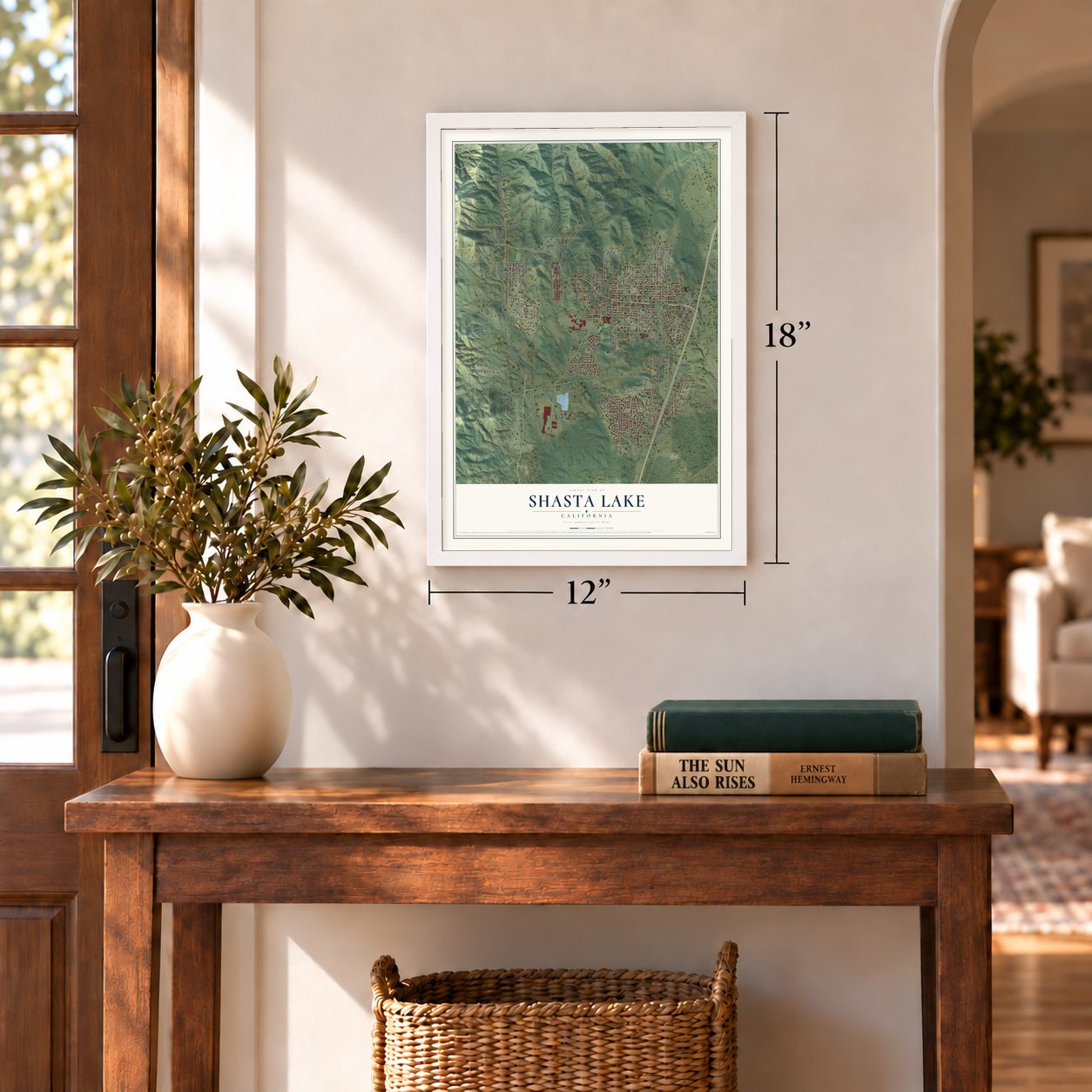
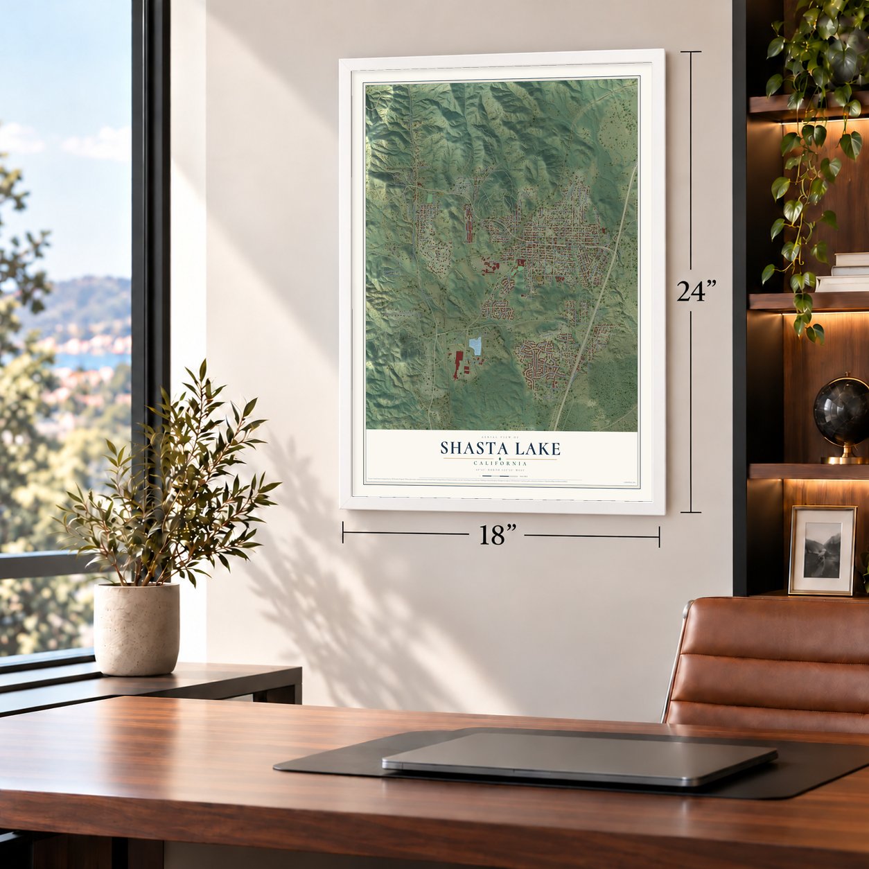
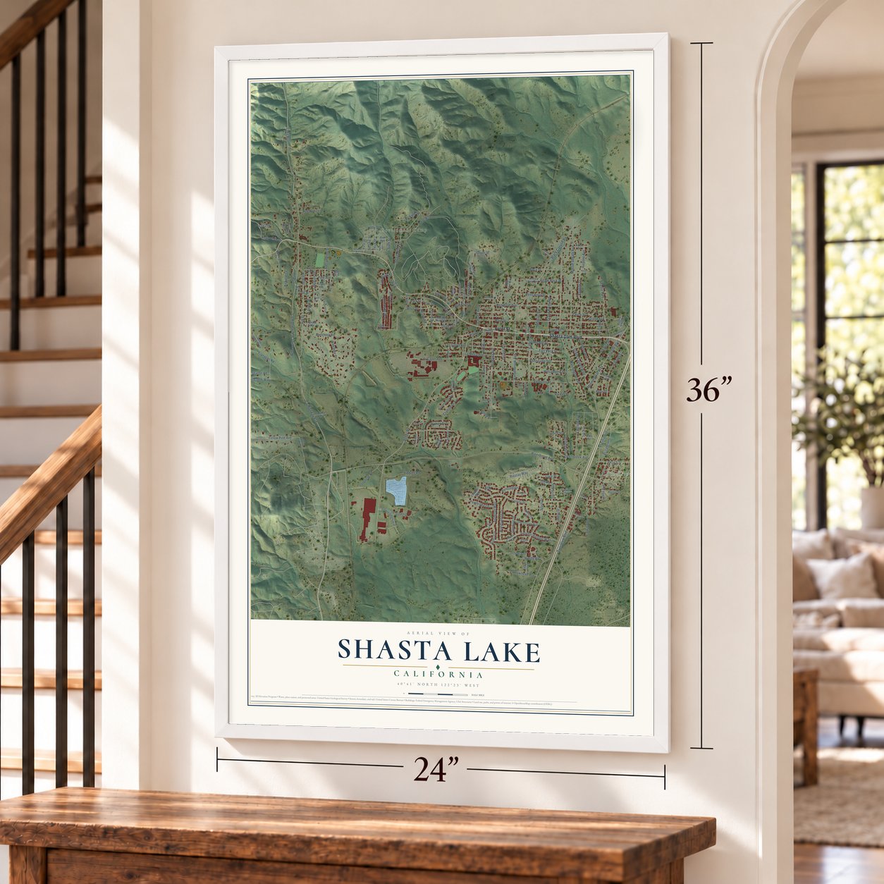
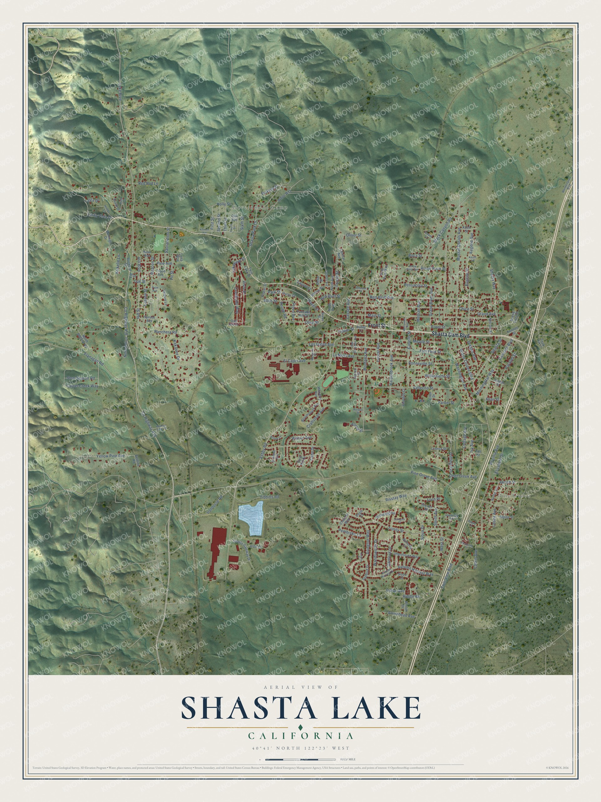
A new map of Shasta Lake, California, made in 2026 and printed to order on thick archival matte paper.
12" x 18" Archival Matte Print
A Map of Home. A Work of Art.
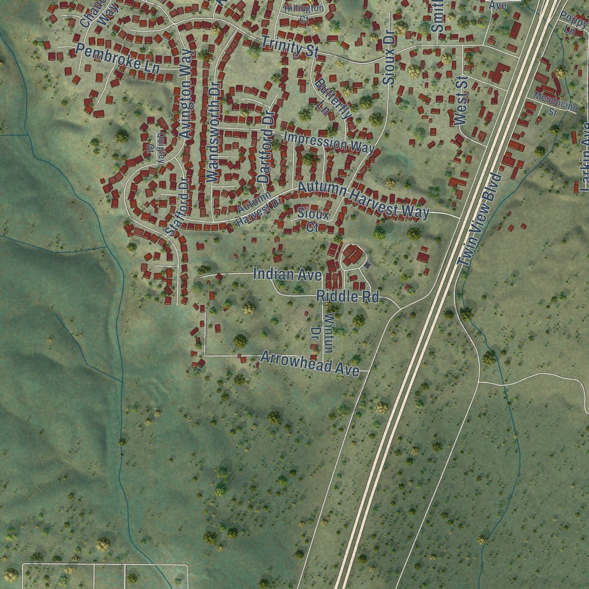
Explore Shasta Lake, California from a whole new perspective. Created using aerial imagery and detailed geographic data, this map captures Shasta Lake building by building, with labeled streets, familiar landmarks, and shaded topographical relief that highlights the natural contours of the landscape.
Combining modern data with the timeless character of a vintage atlas, this map is just as interesting up close as it is beautiful on the wall. Whether you grew up in Shasta Lake, spent memorable years there, or call it home today, this unique map is a great way to celebrate a place that means something to you. Zoom in on the preview to look for your street, and then order a print to put your memories on the wall.
Three ways to hang it
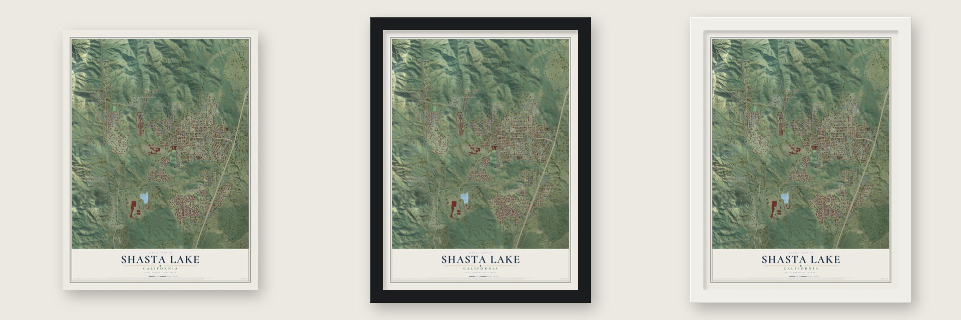
Unframed archival matte, a black wood frame or a white wood frame.
Up close
Geography Worth Displaying
This map was created using accurate cartographic data and authoritative geographic sources, including the U.S. Geological Survey and the Census Bureau. The map brings together terrain, waterways, roads, and building detail. The majority of the streets are labeled, houses are accurately depicted, and the topography is derived from government sources. Combining local data with carefully composed color and shading leads to this beautifully detailed Shasta Lake artwork for your wall.
Rather than simply showing street outlines, we’ve included as many of the street names as we could reasonably fit on the map while keeping their names legible. Zoom in on the high resolution preview to see exactly what’s on the map. We truly set out to create a statement piece for anyone who loves Shasta Lake. So whether it’s for you, or a gift for someone you love, we hope this map of Shasta Lake brings back fond memories.
Read the story behind this map of Shasta Lake, California from 2026.
About Shasta Lake, California
Shasta Lake is a city of 10,371 people in Shasta County, and it is the closest town to Shasta Dam. It grew from five small settlements that sprang up when work on the dam started in 1938: Summit City, Pine Grove, Project City, Toyon and Central Valley. Dam workers settled here because the land was cheap and their families needed housing they could afford, although the first wells gave only a little water.
Central Valley grew into the shopping center for the dam workers, and people long called the whole area Central Valley, or CV. In 1980 Central Valley had 3,424 people, Project City had 1,659 and Summit City had 1,139. Talk of joining them spread in the early 1990s, and on July 2, 1993, 60% of voters chose to incorporate, which made the three communities one city named Shasta Lake.
- Toyon, the government townThe Bureau of Reclamation built Toyon, which was first known as Government Camp, on 41 acres of the old Seaman Ranch, and every resident worked for the bureau. At first two big dormitories housed single workers. By 1950 the town had two tennis courts, a basketball court, a community center, lawns and sidewalks, power from Shasta Dam, and its own sewage plant and landfill.
- From Job Corps camp to ruinsBy the end of 1964 bureau families had to leave, and Toyon became a Job Corps work camp under Lyndon Johnson's Great Society until 1972. Local Native Americans then moved in, hoping for recognition as tribal land, which never came. Water and power were cut over an unpaid $28,000 bill, and many homes burned during clashes with law enforcement, along with the Seaman Ranch Community House and the bureau headquarters. Only a metal storage building and the flagpole remain.
- Central Valley High since 1956Toyon School in Summit City was the area's first elementary school, and Project City and Central Valley elementary schools came after it. Central Valley High School opened in 1956. The old Toyon School has since closed, and its building now houses Mountain Lakes High School.
Find your street
Names on the Shasta Lake map
Every name below is printed on this map. Look for your street, your school, the park where you played, or the pond down the road.
Places and landmarks2
- Pine Grove
- Government Camp
Streets and roads190
- Front Street
- Shasta Dam Boulevard
- Ashby Road
- Flower Street
- Vista Drive
- County Highway A18
- Eugene Street
- Shasta Park Drive
- Smith Avenue
- Ostling Avenue
- Allred Street
- Red Bluff Avenue
- Lake Boulevard
- Cascade Boulevard
- County Highway 418
- Pine Grove Avenue
- Washington Avenue
- Ranchera Road
- Montana Avenue
- Fort Peck Street
- Main Street
- Mussel Shoals Avenue
- Shasta Street
- Hardenbrook Avenue
- Twin View Boulevard
- Chico Street
- Virginia Avenue
- Black Canyon Road
- Hill Boulevard
- Avington Way
Show all 190 streets
- Vallecito Street
- Trinity Street
- La Mesa Avenue
- Meade Street
- Bonneville Street
- Locust Avenue
- Grand Coulee Boulevard
- Linda Vista Drive
- Autumn Harvest Way
- Flanagan Road
- Yellow Pine Avenue
- Williamette Street
- Lassen Street
- Oregon Avenue
- Eugene Avenue
- Shasta Way
- Rouge Road
- El Cajon Avenue
- Forest Street
- Pensacola Street
- Akrich Street
- Risstay Way
- Elizabeth Street
- Sioux Drive
- Deer Creek Avenue
- Walton Avenue
- Beacon Street
- Cabello Street
- Holly Street
- Wandsworth Drive
- Cottage Avenue
- Ivy Avenue
- Arrow Rock Street
- Red Bluff Street
- Tibbitts Road
- Leona Avenue
- Kokanee Drive
- Grand River Avenue
- Sacramento Street
- Arrowhead Avenue
- Grand Avenue
- Creekside Way
- Hazel Street
- Third Street
- Ironhorse Road
- Second Street
- Lassen Avenue
- Craftsman Avenue
- Larkin Avenue
- Hill Street
- Riddle Road
- Parker Street
- Red Bud Lane
- Kirkelie Lane
- Pickard Street
- Olive Street
- Boca Street
- Lakeview Street
- Altus Street
- Oliver Street
- Pembroke Lane
- Parallel Street
- Median Avenue
- Indian Avenue
- Pine Avenue
- Carpet Creek Way
- Slow Season Road
- Morningstar Way
- Dartford Drive
- Los Gatos Avenue
- First Street
- Pit Street
- Oak Street
- Kensington
- West Street
- Provo Avenue
- Cana Drive
- Loch Place
- Park Street
- Iron Court
- Targa Drive
- Laurel Street
- Sixth Street
- Allan Street
- Twin Lake Drive
- White Way
- Buckeye Street
- Shasta Gateway Drive
- North Avenue
- North Boulevard
- Central Avenue
- Impression Way
- Rose Avenue
- Pancake Hill Drive
- Toyon Avenue
- Duval Drive
- North Beltline Road
- Oak Avenue
- Willow Street
- Bloomsbury Avenue
- Chaucer Way
- Vallecito Court
- Nellie Bell Lane
- Butterfly Lane
- Woodley Avenue
- Wintun Drive
- Orkney Place
- Leisure Lane
- Stafford Drive
- Gray Pine Way
- Nell Orr Street
- Lennox Street
- Farm Hill Drive
- Spruce Avenue
- Alpine Street
- Ashby Court
- D'Alene Avenue
- Poplar Street
- Joseph Street
- Kennett Street
- Ouray Street
- Montego Drive
- Ellen Drive
- Oak Hill Drive
- Buena Vista Street
- Givan Street
- Cedar Street
- Fig Street
- Koch Street
- Doyle Court
- Beltline Road
- Durrett Street
- Fell Street
- Sioux Court
- Lena Way
- Autumn Harvest Drive
- Arrow Rock Avenue
- McConnel Avenue
- San Gorgonio Avenue
- Homer Lane
- Marilyn Avenue
- Wonderland Boulevard
- Cypress Avenue
- Mesquite Street
- Fourth Street
- Walker Lane
- Arlene Court
- Humboldt Avenue
- Johnson Street
- Bursell Street
- Tibark Oak Lane
- Poppy Lane
- Kevin Lane
- Palm Avenue
- Ruby Lane
- Kenneth Avenue
- Hillington Court
- Buckeye Dump Road
- Mendocino Street
- Quigley Court
Names are listed as they appear on the printed map. Zoom into the product photos to find them.
The art of mapping a place
How This Map Was Made
Real places. Remarkable detail. Discover the layers that turn geographic data into a map of home.

The view from above
Aerial imagery reveals the character of the land: woodland, open fields, and the patterns of a place.

The shape of the land
Elevation data brings hills, valleys, and subtle changes in the landscape into view.

The details of home
Roads, waterways, and building footprints come together to make the map feel unmistakably local.

Geography becomes art
Considered color, shading, and typography bring the layers together in a map made for your wall.


Process illustrated with Mendon, Massachusetts. Aerial imagery: USDA NAIP. Terrain: USGS 3D Elevation Program. Map details and finished artwork: KNOWOL.
The Details
About This Print
Choose an archival matte print, or a black or white Ayous wood frame. The archival matte print is unframed.
Select your size and finish above to see the matching product image and price.
Materials & Craftsmanship
A contemporary map with the character of a classic atlas, printed on archival matte paper. Optional frames are made from Ayous wood.
Your printed map does not include the watermark shown in the full-map preview.
Shipping & Delivery
Free shipping within the United States. Every print is made to order in the USA.
Buying a gift? Add a note in your cart and we'll include it. We never put prices in the package.
Prints ship within 2 to 3 business days. Allow 7 to 10 days total from ordering for delivery. Timing may vary during holidays or periods of high order volume.
Read our shipping policy.
Returns and damaged prints
Each print is made to order. Change-of-mind refunds are not available after production.
If your print arrives damaged, misprinted or incorrect, contact support@knowol.com within 30 days of receiving it. Include your order number, photos and a description of the issue.
Read our full refund and replacement policy. For questions about your order, email support@knowol.com.
Find your town
Looking for another city?
Find a map of home in our California collection, or any town in the country.
Nearby
Maps of towns near Shasta Lake
Know someone from one of these towns? Their map makes a great gift.
 Mountain Gate
, California
From $39.99See the map
 Keswick
, California
From $39.99See the map
 Bella Vista
, California
From $39.99See the map
More maps nearby: Redding, Jones Valley, Shasta, Centerville and Palo Cedro.