
Search for another town





Free U.S. delivery 7 to 10 days after you order
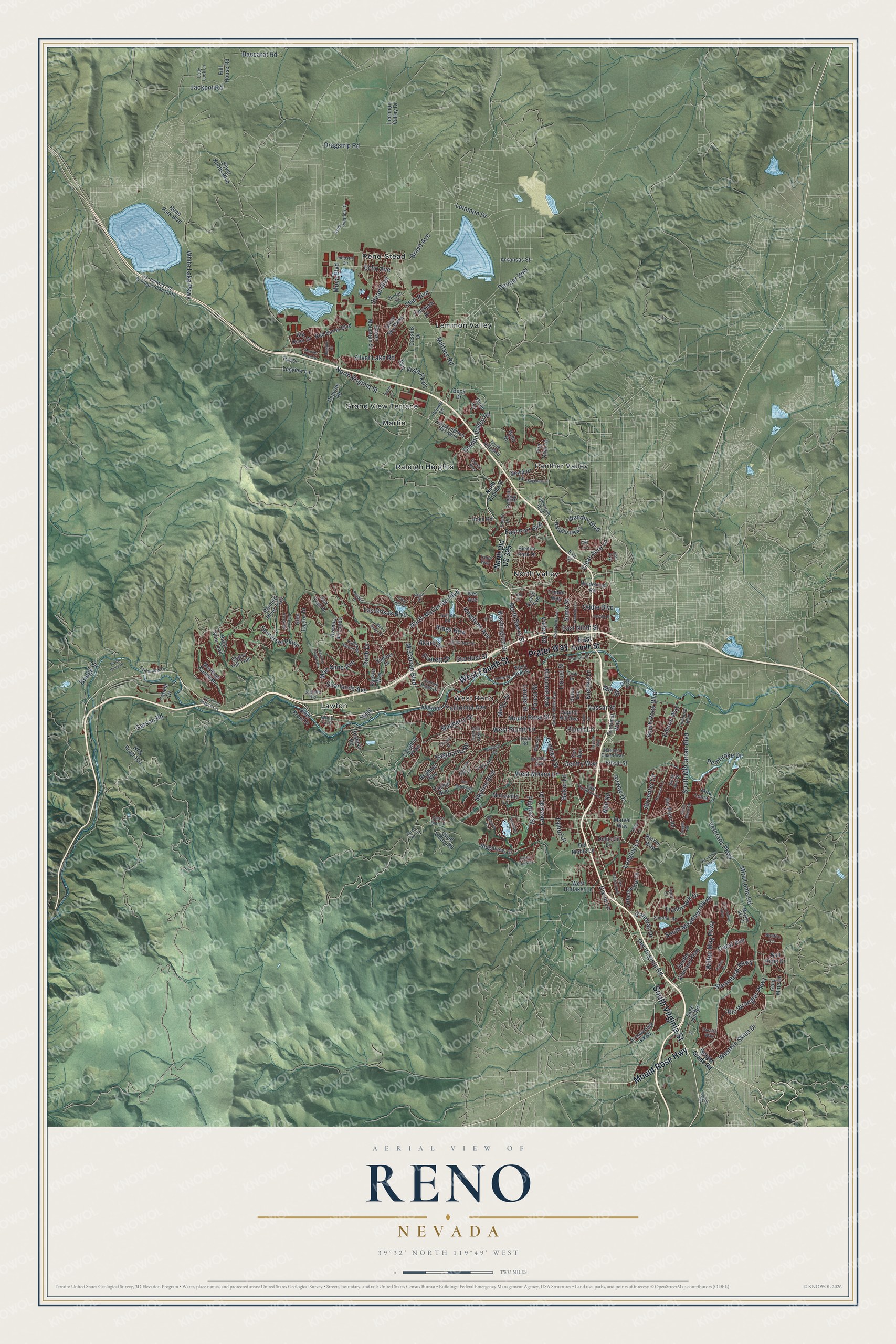
Reno, Nevada Map Art
Building by building, with labeled streets and shaded relief.
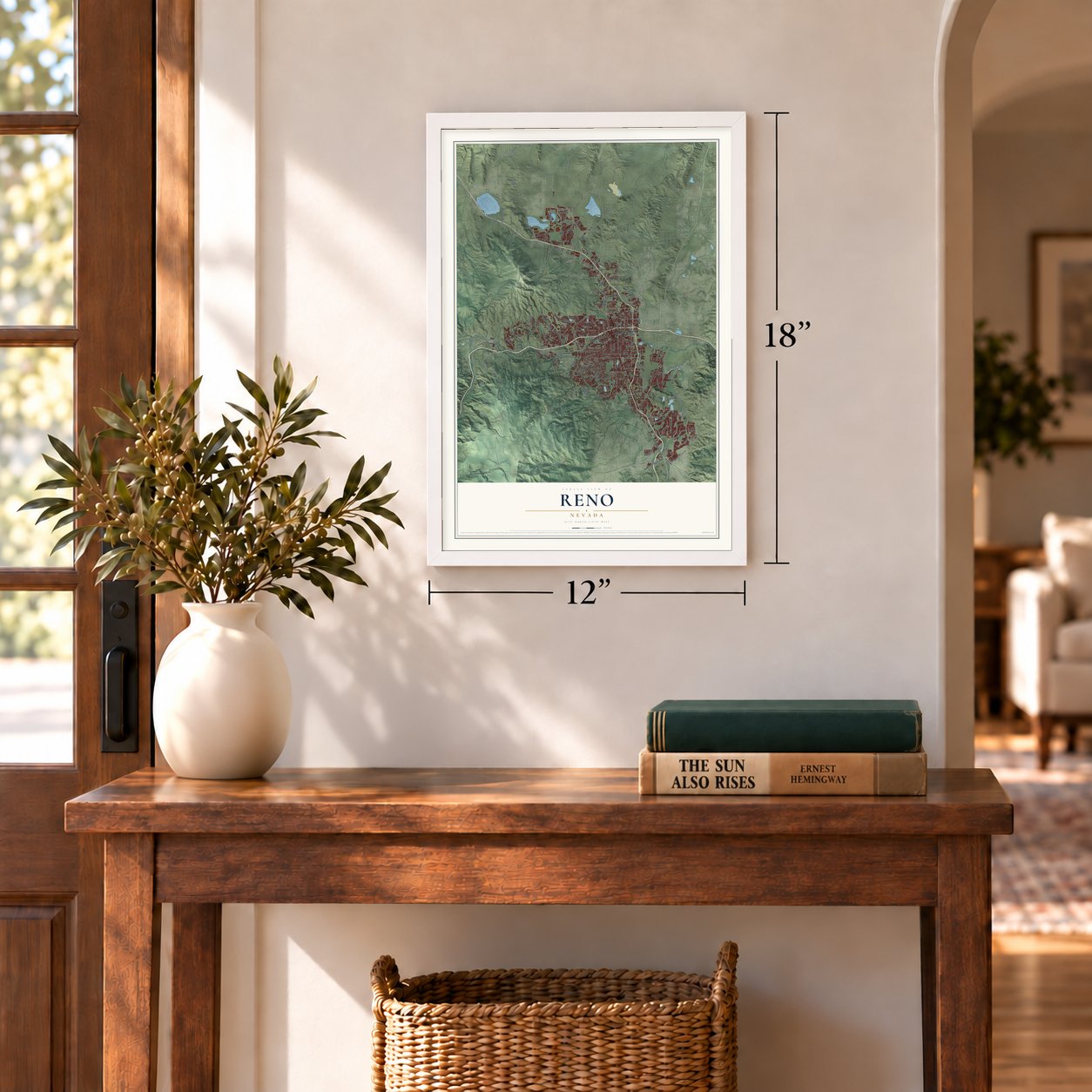
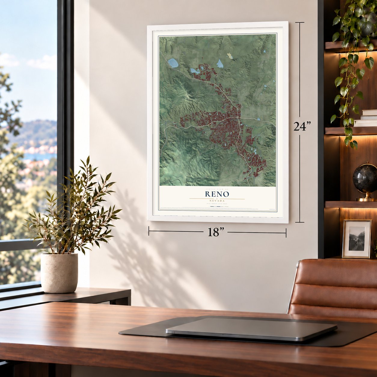
12" x 18" Archival Matte Print
A Map of Home. A Work of Art.
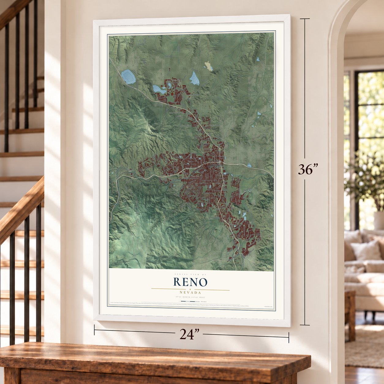
Explore Reno, Nevada from a whole new perspective. Created using aerial imagery and detailed geographic data, this map captures Reno building by building, with labeled streets, familiar landmarks, and shaded topographical relief that highlights the natural contours of the landscape.
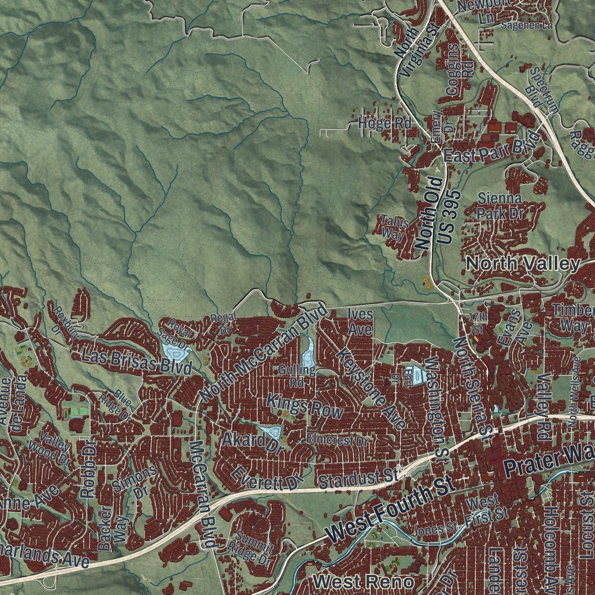
Combining modern data with the timeless character of a vintage atlas, this map is just as interesting up close as it is beautiful on the wall. Whether you grew up in Reno, spent memorable years there, or call it home today, this unique map is a great way to celebrate a place that means something to you. Zoom in on the preview to look for your street, and then order a print to put your memories on the wall.
Three ways to hang it
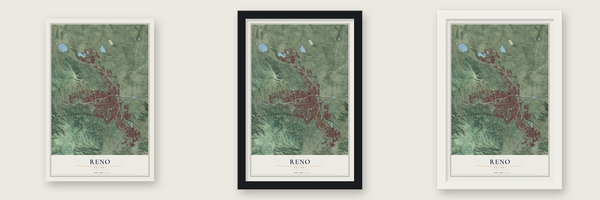
Unframed archival matte, a black wood frame or a white wood frame.
Up close
Geography Worth Displaying
This map was created using accurate cartographic data and authoritative geographic sources, including the U.S. Geological Survey and the Census Bureau. The map brings together terrain, waterways, roads, and building detail. The majority of the streets are labeled, houses are accurately depicted, and the topography is derived from government sources. Combining local data with carefully composed color and shading leads to this beautifully detailed Reno artwork for your wall.
Rather than simply showing street outlines, we’ve included as many of the street names as we could reasonably fit on the map while keeping their names legible. Zoom in on the high resolution preview to see exactly what’s on the map. We truly set out to create a statement piece for anyone who loves Reno. So whether it’s for you, or a gift for someone you love, we hope this map of Reno brings back fond memories.

Find your street
Names on the Reno map
Every name below is printed on this map. Look for your street, your school, the park where you played, or the pond down the road.
Places and landmarks9
- Grand View Terrace
- Lawton
- Lemmon Valley
- Martin
- North Valley
- Panther Valley
- Raleigh Heights
- Reno-Stead
- West Reno
Streets and roads234
- West Fourth Street
- Prater Way
- South Virginia Street
- Mount Rose Highway
- North Virginia Street
- West Plumb Lane
- Airway Drive
- Clear Acre Lane
- Dandini Boulevard
- Garson Road
- Plumb Lane
- East Parr Boulevard
- Stardust Street
- West Moana Lane
- Steamboat Parkway
- South McCarran Boulevard
- Veterans Parkway
- Lemmon Drive
- North McCarran Boulevard
- Kietzke Lane
- Longley Lane
- Keystone Avenue
- Mira Loma Road
- White Lake Parkway
- Mill Street
- Plumas Street
- Robb Drive
- Sky Vista Parkway
- South Meadows Parkway
- Somerset Parkway
Show all 234 streets
- Lakeside Drive
- Silver Lake Road
- McCarran Boulevard
- Lear Boulevard
- Mae Anne Avenue
- Old Virginia Road
- Mayberry Drive
- Kings Row
- Stead Boulevard
- Rio Wrangler Parkway
- Military Road
- Moya Boulevard
- Skyline Boulevard
- California Avenue
- Western Skies Drive
- Wilbur May Parkway
- Sutro Street
- Neil Road
- Golden Valley Road
- South Rock Boulevard
- Locust Street
- North Sierra Street
- Echo Avenue
- Vassar Street
- Las Brisas Boulevard
- Carat Avenue
- Bravo Avenue
- East Ninth Street
- Washington Street
- Dragstrip Road
- Valley Road
- Mount Rose Street
- Holcomb Avenue
- Gentry Way
- Jackpot Road
- Baccarat Road
- Pembroke Drive
- Oddie Boulevard
- Lander Street
- Aircenter Circle
- Trademark Drive
- Everett Drive
- Sharlands Avenue
- Deodar Way
- Edison Way
- Lymbery Street
- Gateway Drive
- Sagittarius Drive
- Talbot Lane
- Bridge Street
- Manor Drive
- Forest Street
- Akard Drive
- Baker Lane
- Dixon Lane
- North Old US 395
- East Fourth Street
- Sage Hill Road
- Silver Knolls Boulevard
- Arrowcreek Parkway
- Caughlin Parkway
- NFS Road 100
- Reno Park Boulevard
- Double Diamond Parkway
- Avenue de Landa
- Manzanita Lane
- Ridgeview Drive
- Yori Avenue
- Idlewild Drive
- Mira Loma Drive
- Evans Avenue
- Red Baron Boulevard
- Edsall Street
- Terminal Way
- Cashill Boulevard
- Wedekind Road
- Peavine Road
- Rio Poco Road
- Simons Drive
- Raggio Parkway
- Painted River Trail
- Silver Sky Parkway
- Lemmon Valley Drive
- Back Nine Trail
- West First Street
- Offenhauser Drive
- Del Monte Lane
- West Huffaker Lane
- Quail Valley Road
- Green Mountain Street
- Gold Mine Drive
- Meridian Ranch Drive
- Plateau Road
- Newport Lane
- Full House Road
- Capitol Hill Avenue
- Logview Lane
- Exit 70
- Fire Opal Lane
- Arkansas Street
- Barron Way
- Bull Rider Drive
- Gypsy Hill Trail
- Backer Way
- Big River Drive
- Brighton Way
- Delucchi Lane
- Finnsech Drive
- River Front Drive
- Glen Eagles Drive
- Hoge Road
- Fox Trail Drive
- Cassilis Drive
- Ives Avenue
- Timber Way
- Sienna Park Drive
- Marvel Way
- Coggins Road
- Cory Drive
- Buck Drive
- Cabela Drive
- Quill Drive
- Stagg Lane
- Bates Avenue
- Gold Drive
- Geiger Grade Road
- Sierra Pine Drive
- North Hills Boulevard
- East Peckham Lane
- US Highway 395 Frontage Road North
- South Wells Avenue
- Hunter Lake Drive
- Army Aviation Drive
- Old US Highway 395 North
- Watt Street
- Summit Ridge Drive
- Kuenzli Street
- Norton Drive
- Brinkby Avenue
- Sandhill Road
- Valley Wood Drive
- Talus Way
- Fenhollow Drive
- White Fir Street
- Elmcrest Drive
- Industry Circle
- Gulling Road
- National Guard Way
- Santa Ana Drive
- Lady Luck Lane
- Financial Boulevard
- Spectrum Boulevard
- Jones Street
- Majave Sky Drive
- Hard Drive
- Greg Street
- Trail Drive
- Bonfire Lane
- La Salle Heights
- Heindel Road
- Pesaro Way
- Emery Drive
- Essex Way
- Urban Road
- Curti Drive
- Epic Avenue
- Lane
- Hunter Lake Road
- Harvard Way
- Alexander Lake Road
- Somersett Ridge Parkway
- Belford Road
- North Wells Avenue
- Carville Drive
- Montello Street
- Boynton Lane
- Evans Creek Drive
- Echo Valley Parkway
- Peavine Creek Road
- Sierra Madre Drive
- East Patriot Boulevard
- River Pines Drive
- Sagehen Lane
- Spinnaker Drive
- San Mateo Avenue
- Bagpipe Circle
- Reggie Road
- Saturno Heights Drive
- Roxbury Drive
- Driscoll Drive
- Marthiam Avenue
- Mariner Cove Drive
- Royal Sage Drive
- 17th Street
- Blue Ridge Drive
- Regal Drive
- Belsera Court
- Louie Lane
- Towne Drive
- Rollins Drive
- Webb Circle
- Laiolo Drive
- Earl Drive
- Loki Court
Names are listed as they appear on the printed map. Zoom into the product photos to find them.
About Reno, Nevada
Reno is a city of 264,165 people and the county seat of Washoe County, on the Truckee River. Washoe and Paiute peoples lived along the river when Euro-American travelers began passing through in the 1840s. Gold seekers bound for California rested their animals on the grass of the Truckee Meadows, but the river was hard to cross. In 1857 Charles Gates and John Stone built a bridge, and spring floods swept it away. Charles Fuller then built a log toll bridge upstream, and the spot became Fuller's Crossing.
Two years later Myron C. Lake bought the bridge. He added a grist mill, a kiln and a livery stable to the hotel and eating house, and the place became Lake's Crossing. Lake gave land to the Central Pacific Railroad in return for a depot, and when the station opened, Reno was founded on May 9, 1868. Charles Crocker, the railroad's construction boss, named it for Major General Jesse Lee Reno, a Union general who died at South Mountain. Reno took the county seat from Washoe City in 1871, became a town in 1879 and a city in 1903.
“All the people you saw on the streets in Reno were obviously there to get divorces.”
- The Biggest Little CityThe Reno Arch went up over Virginia Street in 1926 to advertise the Transcontinental Highways Exposition of 1927. The city council kept it afterward as a downtown gateway, and Mayor E.E. Roberts asked residents for a slogan to put on it. No good one came until the city offered a $100 prize. On March 14, 1929, G.A. Burns of Sacramento won it by praising Reno as the Biggest Little City in the World.
- The six-week cureA Nevada law passed in 1931 cut the residency needed for a divorce from six months to six weeks, and Reno called itself the Divorce Capital of the World. From the 1930s through the 1960s, thousands of people came each year and waited out their six weeks in hotels, boardinghouses and ranches. The El Cortez Hotel was built partly for the wealthier guests. The trade faded after the 1970s, once California and other states eased their own divorce laws.
- Legal gambling in 1931Nevada legalized open gambling on March 19, 1931, in a campaign led by Bill Graham, who owned the Bank Club on Center Street. No other state had legal casinos then. Within a few years the Bank Club, run by Graham, George Wingfield and Jim McKay, was the largest employer in Nevada and the biggest casino in the world. As divorce work declined, gambling became Reno's main business.
- Explosions on Sierra StreetAt 1:03 pm on February 5, 1957, natural gas that had leaked into the pipes and ditches under downtown blew up twice. The blasts and the fire that followed destroyed five buildings near Sierra and First Streets along the Truckee River, killing two people and injuring 49.
- A mansion on the moveIn 1971 a new bank was about to go up where the Lake Mansion stood, so the house was moved to South Virginia Street, close to the Convention Center, instead of being torn down. The Lake Mansion joined the National Register in 1972.
Keep exploring Nevada
Reno is one of 152 Nevada towns we've mapped. Every dot on the map is a print of its own.
The search covers every state, Nevada first.
Near Reno
Order 2 or more town maps and save 10%. Shown in the size and finish you picked above, so they hang as a set.
- Mogul 12" x 18" / Archival Matte Print $39.99
- Golden Valley 12" x 18" / Archival Matte Print $39.99
- Sun Valley 12" x 18" / Archival Matte Print $39.99

More maps nearby: Hidden Valley, Sparks, Verdi, Lemmon Valley and Cold Springs.
The art of mapping a place
How This Map Was Made
Real places. Remarkable detail. Discover the layers that turn geographic data into a map of home.

The view from above
Aerial imagery reveals the character of the land: woodland, open fields, and the patterns of a place.

The shape of the land
Elevation data brings hills, valleys, and subtle changes in the landscape into view.

The details of home
Roads, waterways, and building footprints come together to make the map feel unmistakably local.

Geography becomes art
Considered color, shading, and typography bring the layers together in a map made for your wall.


Process illustrated with Mendon, Massachusetts. Aerial imagery: USDA NAIP. Terrain: USGS 3D Elevation Program. Map details and finished artwork: KNOWOL.
The Details
About This Print
Choose an archival matte print, or a black or white Ayous wood frame. The archival matte print is unframed.
Select your size and finish above to see the matching product image and price.
Materials & Craftsmanship
A contemporary map with the character of a classic atlas, printed on archival matte paper. Optional frames are made from Ayous wood.
Your printed map does not include the watermark shown in the full-map preview.
Shipping & Delivery
Free shipping within the United States. Every print is made to order in the USA.
Buying a gift? Add a note in your cart and we'll include it. We never put prices in the package.
Prints ship within 2 to 3 business days. Allow 7 to 10 days total from ordering for delivery. Timing may vary during holidays or periods of high order volume.
Read our shipping policy.
Returns and damaged prints
Each print is made to order. Change-of-mind refunds are not available after production.
If your print arrives damaged, misprinted or incorrect, contact support@knowol.com within 30 days of receiving it. Include your order number, photos and a description of the issue.
Read our full refund and replacement policy. For questions about your order, email support@knowol.com.