
Search for another town


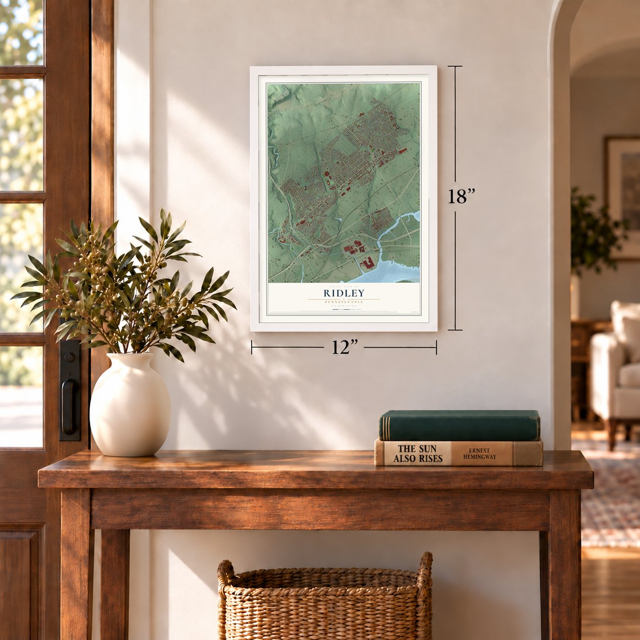

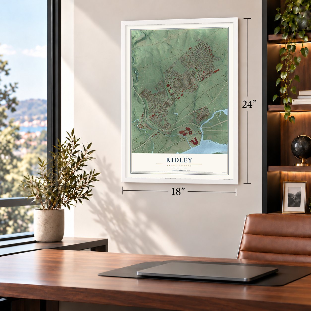

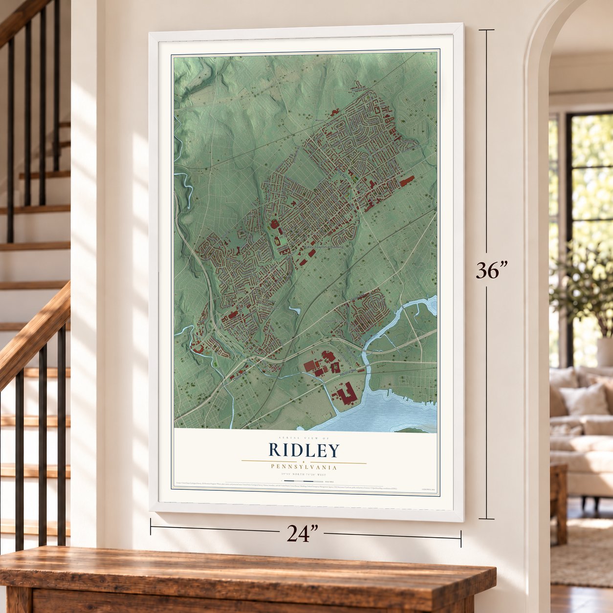

Free U.S. delivery 7 to 10 days after you order
Ridley, Pennsylvania Map Art
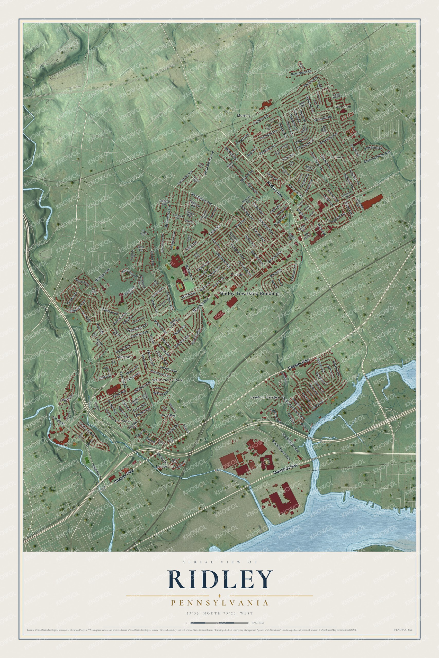
A new map of Ridley, Pennsylvania, made in 2026 and printed to order on thick archival matte paper.
12" x 18" Archival Matte Print
A Map of Home. A Work of Art.
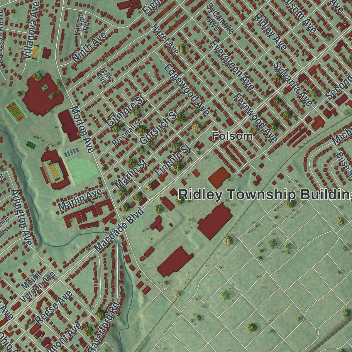
If you grew up in Folsom, Woodlyn or Holmes, or you still drive Macdade Boulevard most days, you'll find plenty to recognize on this map. It's a modern aerial view of Ridley Township in Delaware County, Pennsylvania, made from modern data and given a vintage artistic feel. Zoom in on the preview and look for your block.
Three ways to hang it
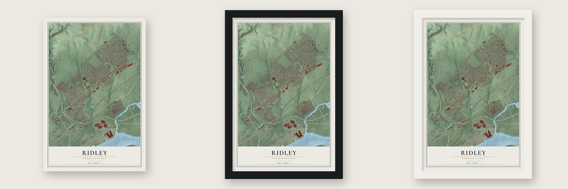
Unframed archival matte, a black wood frame or a white wood frame.
Up close
Real geography. Art worth displaying.
This map was created using accurate cartographic data and authoritative geographic sources, including the U.S. Geological Survey and the Census Bureau. The map brings together terrain, waterways, roads, and building detail. The majority of the streets are labeled, houses are accurately depicted, and the topography is derived from government sources. Combining local data with carefully composed color and shading leads to this beautifully detailed Ridley artwork for your wall.
Rather than simply showing street outlines, we’ve included as many of the street names as we could reasonably fit on the map while keeping their names legible. Zoom in on the high resolution preview to see exactly what’s on the map. We truly set out to create a statement piece for anyone who loves Ridley. So whether it’s for you, or a gift for someone you love, we hope this map of Ridley brings back fond memories.
Read the story behind this map of Ridley, Pennsylvania from 2026.

About Ridley, Pennsylvania
Ridley is a township in Delaware County, with 31,053 residents recorded in 2020. The 2020 census recorded 31,053 residents, placing a clear count beside the community's legal identity and its place within Pennsylvania today.
- 2020 populationThe Census Bureau recorded 31,053 residents in Ridley.
- A townshipRidley is identified as a township in Delaware County.
- Delaware CountyThe source material places Ridley within Delaware County.
Find your street
Names on the Ridley map
Every name below is printed on this map. Look for your street, your school, the park where you played, or the pond down the road.
Places and landmarks11
- Ridley Township Building
- Wyndom
- Fairview
- Folsom
- Holmes
- Leedom Estates
- Leiperville
- Milmont
- Morton
- West Ridley Park
- Woodlyn
Streets and roads211
- Kedron Avenue
- Chester Pike
- Industrial Highway
- Macdade Boulevard
- Bullens Lane
- Swarthmore Avenue
- South Morton Avenue
- Morton Avenue
- Eighth Avenue
- Jefferson Avenue
- Irvings Road
- Fairview Road
- Seventh Avenue
- Amosland Road
- Sixth Avenue
- Michigan Avenue
- Franklin Avenue
- Milmont Avenue
- South Academy Avenue
- Haverford Road
- Armstrong Avenue
- Fifth Avenue
- Wyndom Terrace
- Sylvania Avenue
- South Avenue
- Holmes Road
- Belmont Avenue
- Fourth Avenue
- Villanova Avenue
- Second Avenue
Show all 211 streets
- Evergreen Avenue
- Brighton Terrace
- Grand Avenue
- Edgewood Avenue
- Springfield Avenue
- Rutledge Avenue
- Folsom Avenue
- Lawnton Terrace
- Parklane Road
- South Swarthmore Avenue
- Mitchell Avenue
- Tasker Avenue
- South Sellers Avenue
- South Stewart Avenue
- Highland Terrace
- Morris Avenue
- Quaint Street
- Ridley Avenue
- Arlington Avenue
- Secane Avenue
- Michell Street
- Blackrock Road
- Hutchinson Terrace
- Braxton Road
- Agnes Avenue
- Pershing Avenue
- Grant Avenue
- Vauclain Avenue
- Quince Lane
- Youngs Avenue
- Kelly Avenue
- Darby Road
- Clymer Lane
- Fernwood Avenue
- Forrest Avenue
- Acres Drive
- Reese Avenue
- Cedar Avenue
- Liberty Road
- Kossuth Avenue
- Eisenhower Avenue
- Elder Avenue
- Muhlenberg Avenue
- Girard Avenue
- Lincoln Street
- Crum Creek Drive
- Marlin Street
- Rodney Road
- Holland Street
- Essex Avenue
- Gorsuch Street
- Hood Road
- Ohio Avenue
- Springhill Road
- Valley Road
- Brooke Avenue
- Ninth Avenue
- Lakeview Drive
- Gilmore Street
- Haller Road
- University Avenue
- Manor Circle
- Wakefield Drive
- Chipmunk Lane
- Cedar Lane
- Highland Avenue
- Haig Avenue
- Grace Road
- Providence Road
- Cricket Road
- Stockton Lane
- Maple Avenue
- Harper Avenue
- Jackson Avenue
- Ladomus Avenue
- Smiley Street
- Yates Avenue
- Forrester Avenue
- Bobwhite Lane
- Conway Drive
- Chester Avenue
- Waverly Terrace
- Wilson Avenue
- Colson Road
- Mildred Avenue
- Marlin Avenue
- Price Avenue
- Acer Avenue
- Clayton Road
- Forest Avenue
- Green Avenue
- West Road
- Hazel Avenue
- Sutton Avenue
- Sycamore Avenue
- Colwell Road
- Melrose Terrace
- Mount Vernon Avenue
- Hannum Avenue
- Taylor Avenue
- Randall Avenue
- Washington Avenue
- Amherst Avenue
- Mole Road
- Dale Road
- Stonyhill Road
- Willow Bend Drive
- Georgetown Road
- Ridley Circle
- Harding Avenue
- Stockton Circle
- Donna Avenue
- Willard Drive
- Hickory Road
- Parker Avenue
- Wood Road
- Unity Terrace
- Orchard Avenue
- Eleventh Avenue
- Adams Street
- Meadow Road
- Lukens Avenue
- Raymond Circle
- Brookside Avenue
- Randall Street
- Glenside Avenue
- Redwood Avenue
- Buse Street
- North Lane
- Woodland Avenue
- Cherry Lane
- Tenth Avenue
- Sherman Avenue
- Toth Drive
- Oak Leaf Lane
- Emlen Street
- Sloan Street
- Penn Avenue
- Park Avenue
- Willow Way
- Lee Terrace
- Nall Lane
- Stanbridge Road
- Broomall Street
- Buchanan Avenue
- Balignac Avenue
- Pearl Avenue
- Lynn Road
- Brooke Circle
- Rose Avenue
- Catherine Avenue
- Miller Street
- Tyler Avenue
- Stoneybrook Lane
- Village Road
- Locust Road
- Elmwood Avenue
- Perry Street
- Dougherty Drive
- Overbrook Avenue
- Cornell Avenue
- Howard Road
- Copper Beach Lane
- Hunter Lane
- Jenks Avenue
- Constitution Avenue
- Woodlyn Circle
- Hollis Avenue
- McKinley Avenue
- Ardsley Road
- Greenhouse Lane
- Dorrett Street
- Chestnut Street
- Walnut Street
- Spruce Street
- Stewart Place
- Theresa Avenue
- Sylvan Avenue
- Fizzano Avenue
- Morris Circle
- Arbor Road
Names are listed as they appear on the printed map. Zoom into the product photos to find them.
The art of mapping a place
How This Map Was Made
Real places. Remarkable detail. Discover the layers that turn geographic data into a map of home.

The view from above
Aerial imagery reveals the character of the land: woodland, open fields, and the patterns of a place.

The shape of the land
Elevation data brings hills, valleys, and subtle changes in the landscape into view.

The details of home
Roads, waterways, and building footprints come together to make the map feel unmistakably local.

Geography becomes art
Considered color, shading, and typography bring the layers together in a map made for your wall.


Process illustrated with Mendon, Massachusetts. Aerial imagery: USDA NAIP. Terrain: USGS 3D Elevation Program. Map details and finished artwork: KNOWOL.
The Details
About This Print
Choose an archival matte print, or a black or white Ayous wood frame. The archival matte print is unframed.
Select your size and finish above to see the matching product image and price.
Materials & Craftsmanship
A contemporary map with the character of a classic atlas, printed on archival matte paper. Optional frames are made from Ayous wood.
Your printed map does not include the watermark shown in the full-map preview.
Shipping & Delivery
Free shipping within the United States. Every print is made to order in the USA.
Buying a gift? Add a note in your cart and we'll include it. We never put prices in the package.
Prints ship within 2 to 3 business days. Allow 7 to 10 days total from ordering for delivery. Timing may vary during holidays or periods of high order volume.
Read our shipping policy.
Returns and damaged prints
Each print is made to order. Change-of-mind refunds are not available after production.
If your print arrives damaged, misprinted or incorrect, contact support@knowol.com within 30 days of receiving it. Include your order number, photos and a description of the issue.
Read our full refund and replacement policy. For questions about your order, email support@knowol.com.
Find your town
Looking for another city?
Find a map of home in our Pennsylvania collection.
Nearby
Maps of towns near Ridley
Know someone from one of these towns? Their map makes a great gift.
 Folsom
, Pennsylvania
From $39.99See the map
 Ridley Park
, Pennsylvania
From $39.99See the map
 Rutledge
, Pennsylvania
From $39.99See the map
More maps nearby: Prospect Park, Woodlyn, Norwood, Swarthmore and Morton.