


Search for another town


Free U.S. delivery 7 to 10 days after you order
Rio Grande, New Jersey Map Art
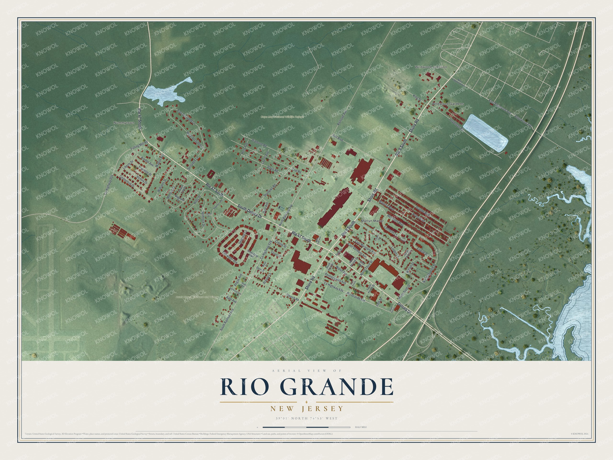
Building by building, with labeled streets and shaded relief.
12" x 18" Archival Matte Print
A Map of Home. A Work of Art.
Explore Rio Grande, New Jersey from a whole new perspective. Created using aerial imagery and detailed geographic data, this map captures Rio Grande building by building, with labeled streets, familiar landmarks, and shaded topographical relief that highlights the natural contours of the landscape.
Combining modern data with the timeless character of a vintage atlas, this map is just as interesting up close as it is beautiful on the wall. Whether you grew up in Rio Grande, spent memorable years there, or call it home today, this unique map is a great way to celebrate a place that means something to you. Zoom in on the preview to look for your street, and then order a print to put your memories on the wall.
Three ways to hang it

Unframed archival matte, a black wood frame or a white wood frame.
Up close
Geography Worth Displaying
This map was created using accurate cartographic data and authoritative geographic sources, including the U.S. Geological Survey and the Census Bureau. The map brings together terrain, waterways, roads, and building detail. The majority of the streets are labeled, houses are accurately depicted, and the topography is derived from government sources. Combining local data with carefully composed color and shading leads to this beautifully detailed Rio Grande artwork for your wall.
Rather than simply showing street outlines, we’ve included as many of the street names as we could reasonably fit on the map while keeping their names legible. Zoom in on the high resolution preview to see exactly what’s on the map. We truly set out to create a statement piece for anyone who loves Rio Grande. So whether it’s for you, or a gift for someone you love, we hope this map of Rio Grande brings back fond memories.
Read the story behind this map of Rio Grande, New Jersey from 2026.

Find your street
Names on the Rio Grande map
Every name below is printed on this map. Look for your street, your school, the park where you played, or the pond down the road.
Places and landmarks6
- Wildwood Junction
- Nummytown
- Cape May National Wildlife Refuge
- Hawk Haven Vineward and Winery
- Marlyn Manor
- Wildwood Gardens
Streets and roads83
- Route 9 South
- Route 47 South
- South Delsea Drive
- Shore Road
- Delsea Drive
- East Edgewood Avenue
- North Railroad Avenue
- Edgewood Avenue
- South Railroad Avenue
- County Highway 634
- Rio Grande Avenue
- North Seventh Street
- County Highway 626
- Maurice Boulevard
- Holly Drive
- Jorgensen Road
- Aberdeen Way
- Tidewater Avenue
- East Maryland Avenue
- Shunpike Road
- Priest Boulevard
- Mimosa Drive
- County Highway 654
- Fulling Mill Road
- Teal Road
- Grande Boulevard
- Diamond Road
- Linden Lane
- Davis Road
- Satt Boulevard
Show all 83 streets
- Church Road
- East Secluded Lane
- School Lane
- Kimble Avenue
- North Third Street
- West Secluded Lane
- Hemlock Drive
- Pennsylvania Avenue
- Railroad Avenue
- Centennial Drive
- Williams Street
- Lochalsh Lane
- East Vermont Avenue
- Falkirk Drive
- Walsh Avenue
- Marlyn Drive
- Seacrest Lane
- First Street
- North Sixth Street
- Liberty Drive
- Victory Drive
- Secluded Lane
- Angus Avenue
- Laurel Avenue
- King Street
- Freedom Drive
- Oslo Avenue
- Holly Avenue
- Walton Avenue
- Cresse Street
- Fifth Street
- Bate Avenue
- North Second Street
- Hirst Avenue
- South First Street
- South Fourth Street
- Corson Street
- Greenbriar Boulevard
- Magnolia Drive
- Peach Tree Drive
- North Fourth Street
- Denn Street
- Hawthorne Drive
- West Edgewood Avenue
- Anderson Avenue
- Marye Street
- New York Avenue
- Linden Circle
- South Sixth Street
- Riegel Avenue
- Cypress Drive
- Glen Cove Court
- South Third Street
Names are listed as they appear on the printed map. Zoom into the product photos to find them.
About Rio Grande, New Jersey
Rio Grande is a community of 3,610 people in Cape May County, spread across Middle Township and Lower Township. In colonial times Aaron Leaming and the Hildreth and Cresse families kept plantations here. A stagecoach terminal went up where the King's Highway met the road from Dennisville and Goshen, and that crossroads became the place where nearby farm families came to trade.
People first called the place Leamings, after the big landholders, or Hildreth, after the family that ran the country store. The historian Jeffrey M. Dorwart traces the community to the mid-nineteenth century, when it grew up around that Hildreth store, which is why Hildreth was its first name.
“The name, Rio Grande, was suggested by the seventh Aaron Leaming who thought this southern United States river had an attractive sound.”
- A post office in 1856Jeremiah Hand became postmaster when Rio Grande got a post office of its own on September 6, 1856. Only fourteen others had been set up in Cape May County before it, so it was the fifteenth.
- The sugar house of 1881In 1881 the New Jersey Legislature passed an act to encourage sugar making. Mr. Hilgert, of the Philadelphia refining firm J. Hilgert's Sons, then spent at least $60,000 building and fitting out a big sugar house at Rio Grande. Its first fall it pressed sorghum cane grown on about 700 acres, though local growers came away disappointed, having hoped for thirty bushels of seed and ten tons of cane.
- Good crops, poor pricesThe Rio Grande Sugar Company took over from the Hilgerts. Drawn by state bounties, it put large sums into the business and bought land to raise its own cane. The fields did well and the plant turned out plenty of sugar, but prices fell so low that no profit was left, and the company shut down its work in 1886.
- Separate schoolsIn the years of legal school segregation, white children in Rio Grande attended a local school for grades 1-6, while Black children traveled to Whitesboro for grades 1-8. For grades 7-12, white students from Rio Grande went on to the schools of the West Cape May district.
Keep exploring New Jersey
Rio Grande is one of 990 New Jersey towns we've mapped. Every dot on the map is a print of its own.
The search covers every state, New Jersey first.
Near Rio Grande
Order 2 or more town maps and save 10%. Shown in the size and finish you picked above, so they hang as a set.
- Erma 12" x 18" / Archival Matte Print $39.99
- Whitesboro 12" x 18" / Archival Matte Print $39.99
- Burleigh 12" x 18" / Archival Matte Print $39.99
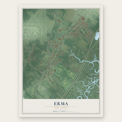
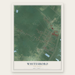

More maps nearby: Lower, Villas, West Wildwood, Wildwood and Wildwood Crest.
The art of mapping a place
How This Map Was Made
Real places. Remarkable detail. Discover the layers that turn geographic data into a map of home.

The view from above
Aerial imagery reveals the character of the land: woodland, open fields, and the patterns of a place.

The shape of the land
Elevation data brings hills, valleys, and subtle changes in the landscape into view.

The details of home
Roads, waterways, and building footprints come together to make the map feel unmistakably local.

Geography becomes art
Considered color, shading, and typography bring the layers together in a map made for your wall.


Process illustrated with Mendon, Massachusetts. Aerial imagery: USDA NAIP. Terrain: USGS 3D Elevation Program. Map details and finished artwork: KNOWOL.
The Details
About This Print
Choose an archival matte print, or a black or white Ayous wood frame. The archival matte print is unframed.
Select your size and finish above to see the matching product image and price.
Materials & Craftsmanship
A contemporary map with the character of a classic atlas, printed on archival matte paper. Optional frames are made from Ayous wood.
Your printed map does not include the watermark shown in the full-map preview.
Shipping & Delivery
Free shipping within the United States. Every print is made to order in the USA.
Buying a gift? Add a note in your cart and we'll include it. We never put prices in the package.
Prints ship within 2 to 3 business days. Allow 7 to 10 days total from ordering for delivery. Timing may vary during holidays or periods of high order volume.
Read our shipping policy.
Returns and damaged prints
Each print is made to order. Change-of-mind refunds are not available after production.
If your print arrives damaged, misprinted or incorrect, contact support@knowol.com within 30 days of receiving it. Include your order number, photos and a description of the issue.
Read our full refund and replacement policy. For questions about your order, email support@knowol.com.